May 25, 2020 – Pound Ridge, NY
Difficulty: Moderate
Length: Approximately 6 miles
Max elevation: 579 ft. – total elevation gain: approximately 600 ft.
Route type: Circuit
Maps: Westchester Wilderness Walk – Zofnass Family Preserve Trail Map
Trailhead parking: Upper Shad Rd, Pound Ridge, NY 10576
Preserve Overview:
Westchester Wilderness Walk – Zofnass Family Preserve is the largest of Westchester Land Trust’s preserves. Its 150-acres encompasses rocky woods, hillside streams, lakes and wetlands. The preserve is shoehorned between residential lots in Pound Ridge, a mile from the Connecticut border, but rarely will you catch a glimpse of a house, road or car. Although it is dwarfed by the Ward Pound Ridge Reservation a few miles to the north, it has a similar look and feel. The large rock formations and glacial erratics that are predominant in this section of Westchester, forms a rugged and picturesque landscape. The Westchester Wilderness Walk – Zofnass Family Preserve is owned and maintained by the Westchester Land Trust.
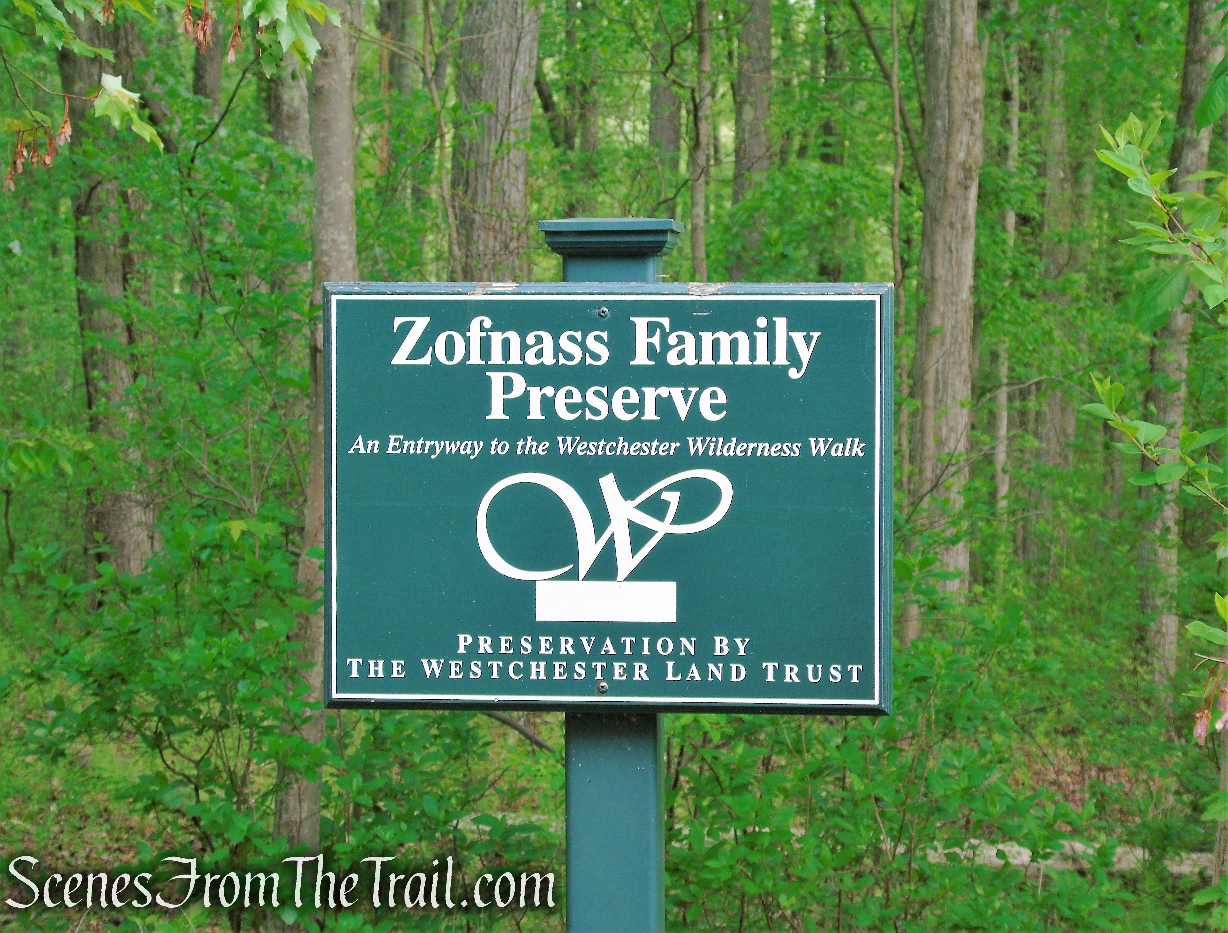
Westchester Wilderness Walk – Zofnass Family Preserve
The Westchester Wilderness Walk might not fit the dictionary definition of “wilderness.” The area is criss-crossed with stone walls, remnants of the early settlements in the area, and houses may occasionally be seen from the trails. But remarkably, for nearly the entire hike, one is entirely removed from the surrounding civilization of Westchester County.
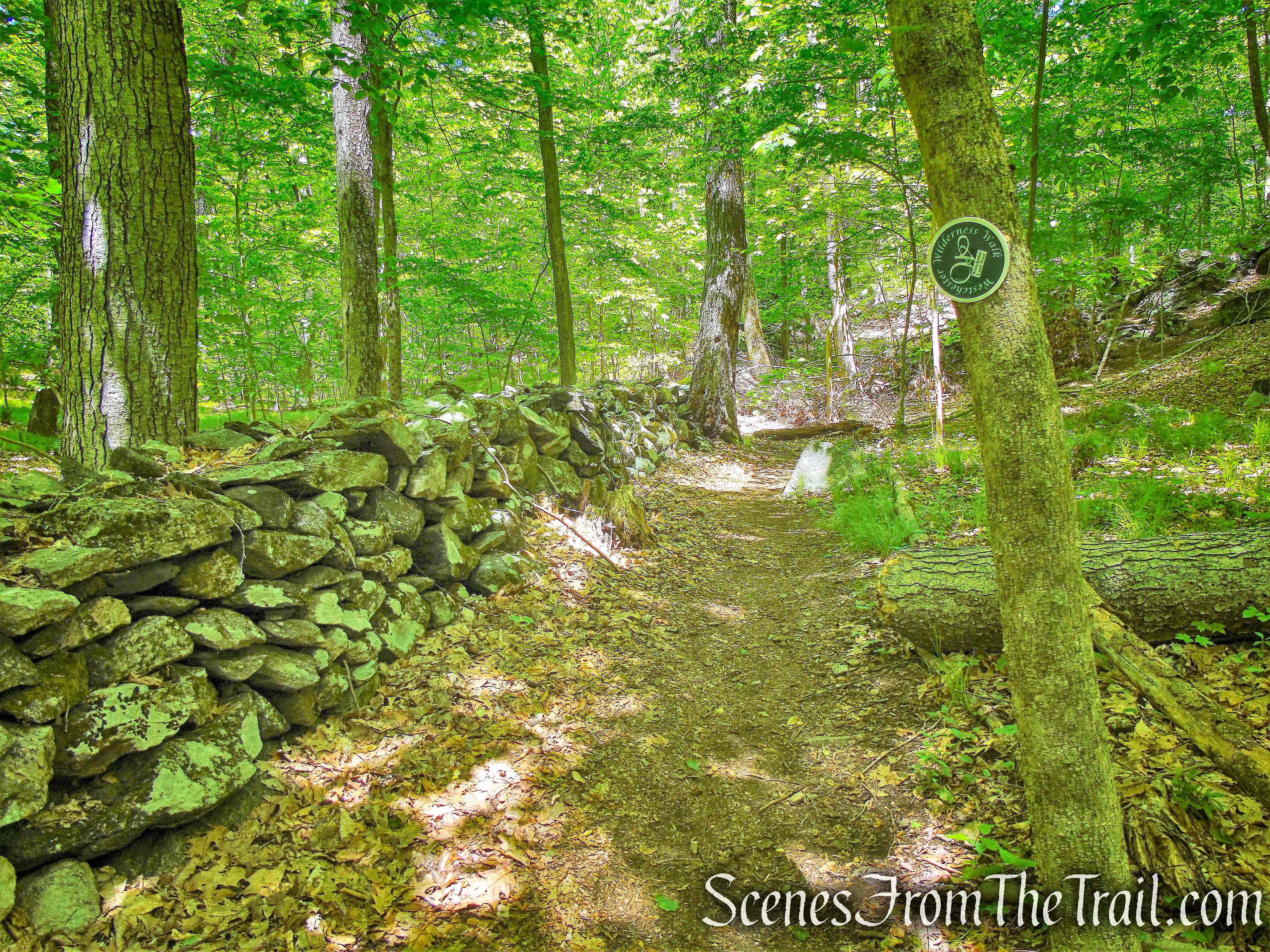
Northern Loop – Westchester Wilderness Walk
ATTENTION: The Westchester Wilderness Walk – Zofnass Family Preserve has two parking lots. One lot is on Upper Shad Road, about a quarter mile from Long Ridge Road. The lot can be muddy after rain and there are a few extra spots on the road shoulder.
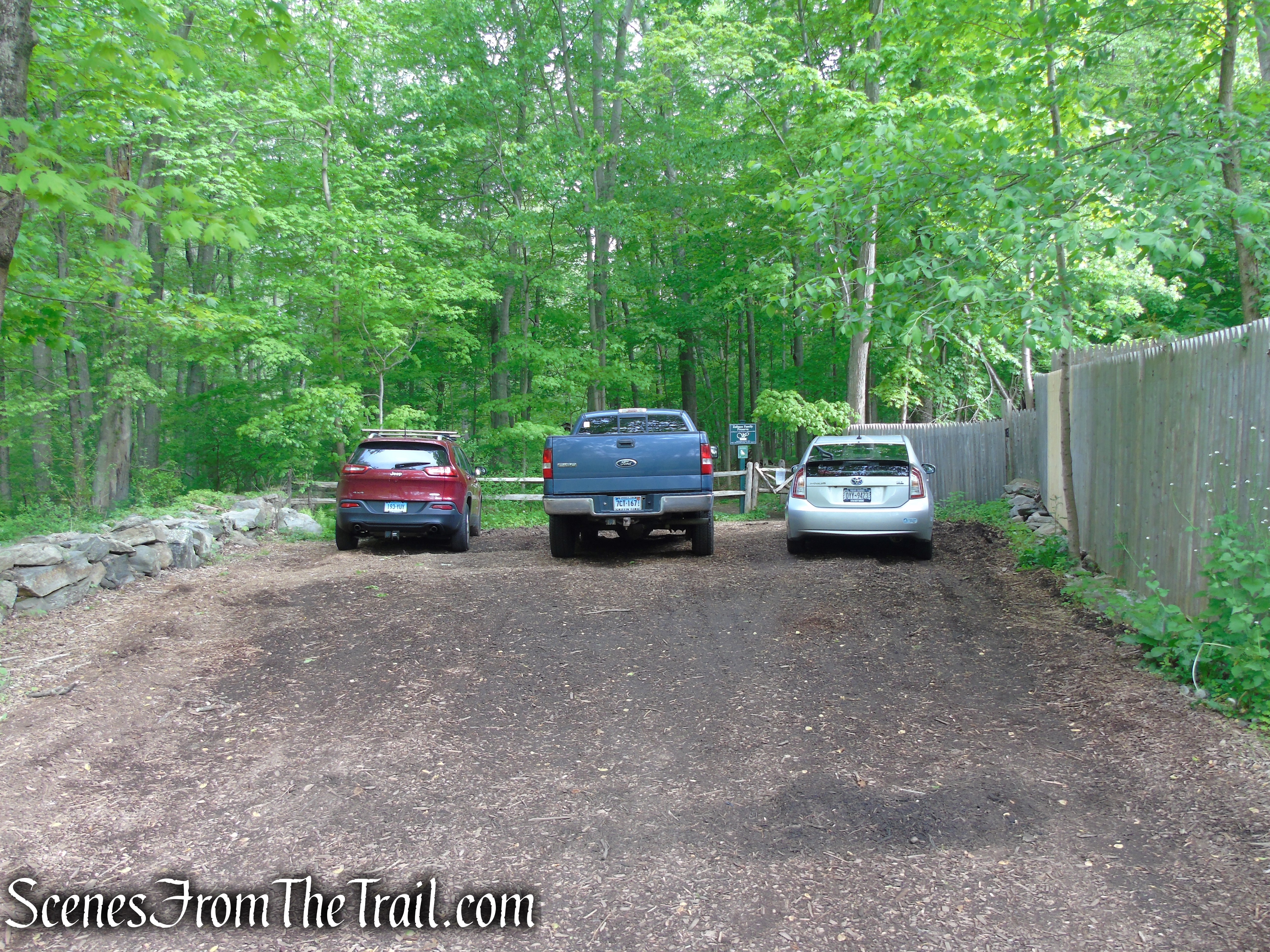
Upper Shad Road parking lot
The second lot is a five-car gravel lot on Joshua Hobby Lane, just off Upper Shad Road. Visitors must follow parking regulations. Signs have been installed by the Pound Ridge Police Department. If the lots are full, please come back another time or visit a different trail. Vehicles that ignore the signs will be ticketed or towed.
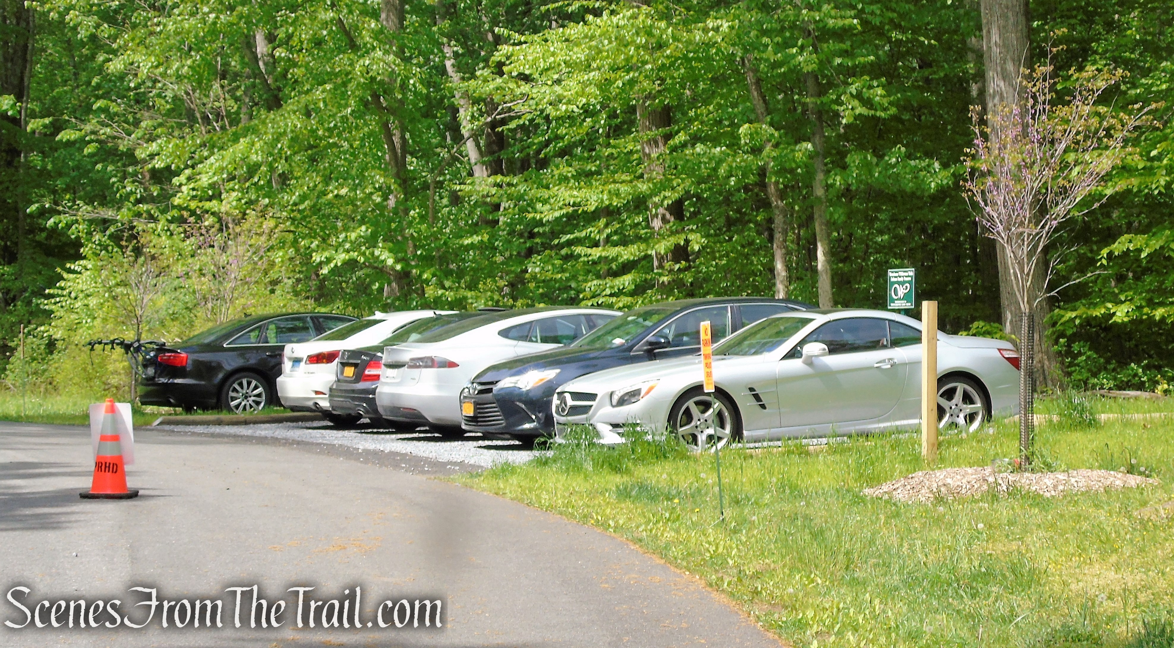
Joshua Hobby Road parking lot
FYI: When we returned to our cars at the conclusion of the hike, there was a police officer that drove by us, turned around and parked a short distance from us, watching us like a hawk. We were parked legally along the very narrow shoulder and the tires may have been partially on the road surface. Not sure what the issue was, but be forewarned that there is police presence in the area and given all the “No Parking” signs, they will most likely either ticket or tow your vehicle if you choose to park illegally.
History:
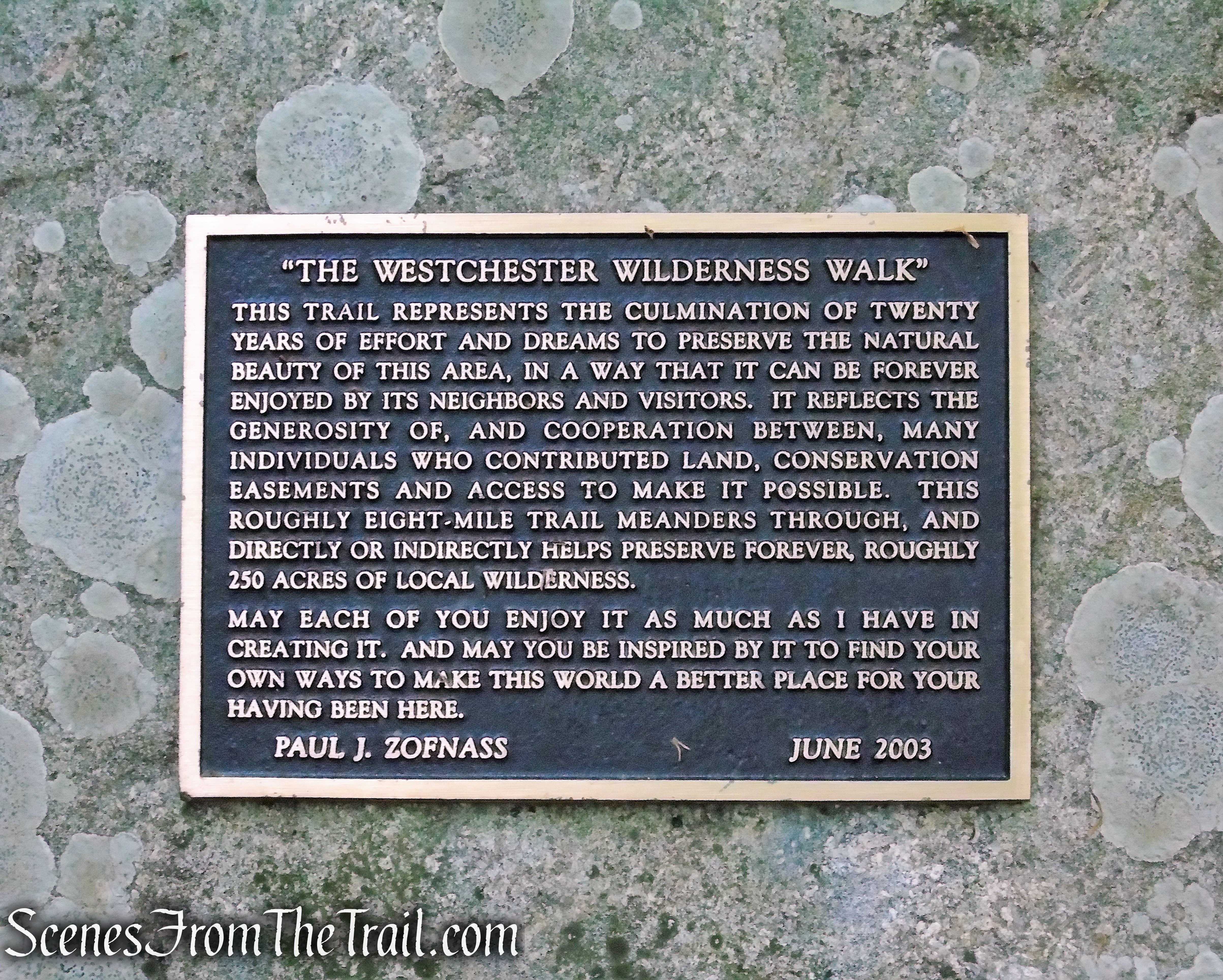
Paul Zofnass, a Manhattan investment banker, Pound Ridge resident and a member of the Westchester Land Trust’s Board of Directors, first conceived the idea of creating a trail preserve here and worked for over 10 years to put the project together. Paul and his family donated land, persuaded their neighbors to donate land, and created the impressive trail system.
Mr. Zofnass, who bought his six-acre place in 1982, would walk through the woods behind the house on weekends and began seeing surveyors’ markers in the trees. He and a neighbor bought several small parcels from a developer in order to preserve the land. Mr. Zofnass did not stop there, in the following years he hammered together a patchwork of property fragments trimmed from the abutting ends of neighboring lots, some donated through easements, some sold or given away.
Paul Gallay, executive director (Feb 2000 – Jun 2008) of the Westchester Land Trust, which was founded in 1988 and which now owns or holds easements on 8,600 acres across the county, said this project which received no county or state assistance, was “one of the most complex and rewarding” the trust had ever tackled.
In October 2019 with funding from the Land Trust Alliance/New York State Conservation Partnership Program, a five-car gravel parking opened on Joshua Hobby Road providing access to the Eastern Loop section.
In December 2019 Westchester Land Trust announced the acquisition of a 3-acre parcel adjacent to Westchester Wilderness Walk – Zofnass Family Preserve. The new acquisition features an arboretum established by Zofnass over the past 10 years. It includes roughly 250 different species of trees, plants and grasses, all identified, along a winding foot path which will become part of the Southern Loop Trail.
Trails Overview:
The trails have been routed, often quite circuitously, to pass many unusual and interesting natural features, resulting in a hike that will probably seem longer than the map appears to indicate. There are a number of named natural features along the trail, many of which are marked by signs.
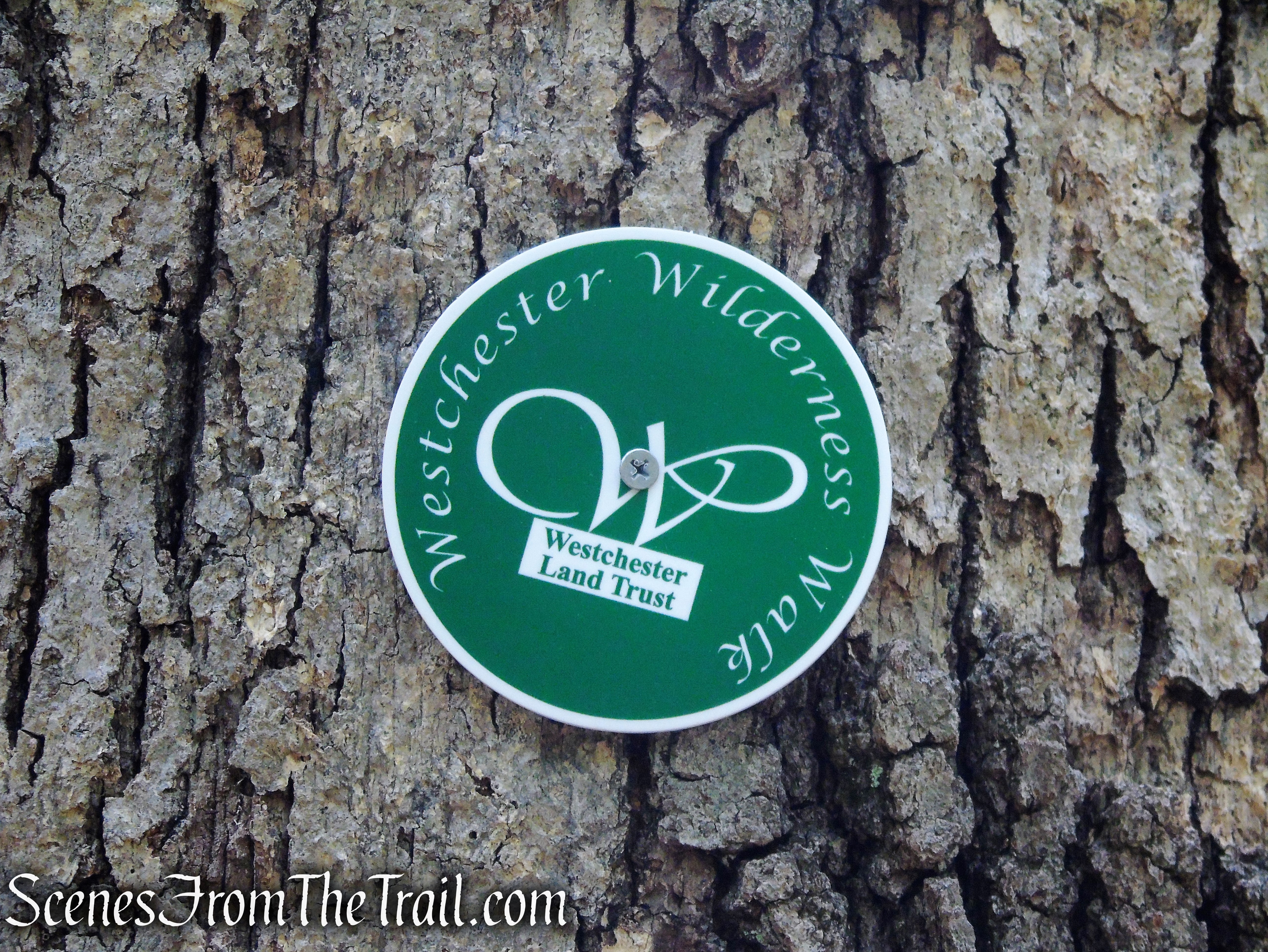
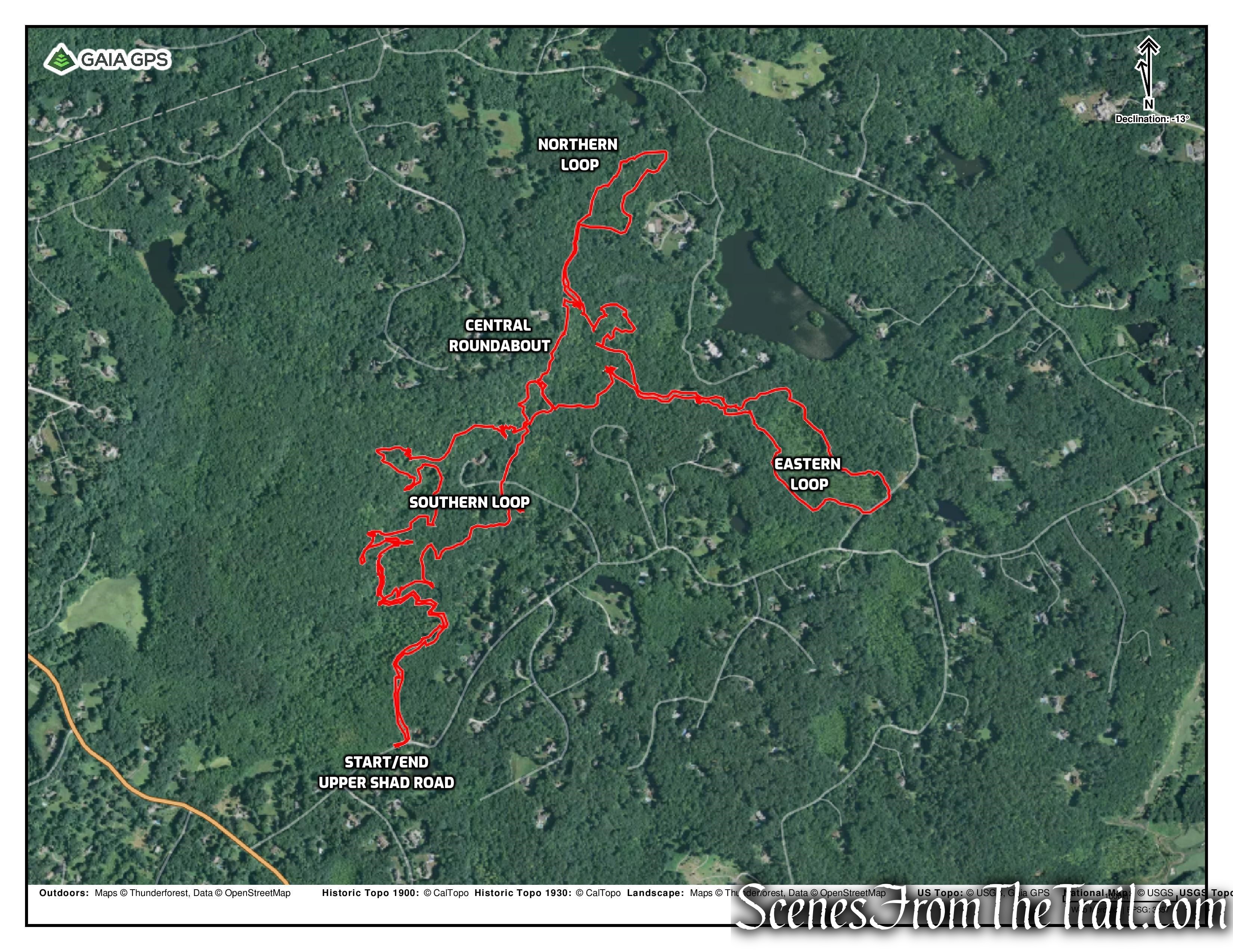
Total walking distance in the preserve is listed as 10 miles. The trails in the preserve form five loops and are shown on the map in various colors, but the entire trail system is blazed with the same green Westchester Land Trust markers and some blue paint blazes on rocks.
Westchester Wilderness Walk – Zofnass Family Preserve
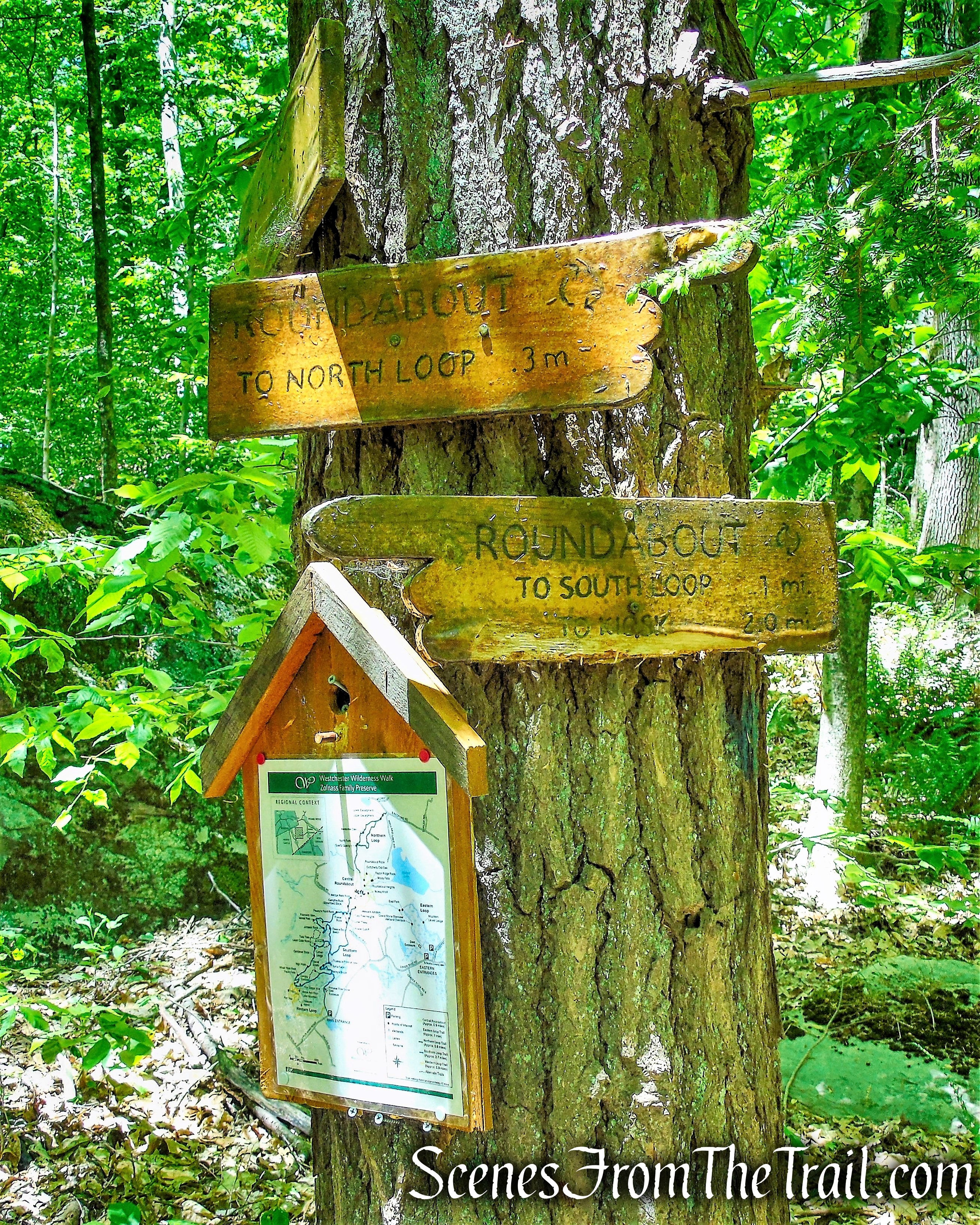
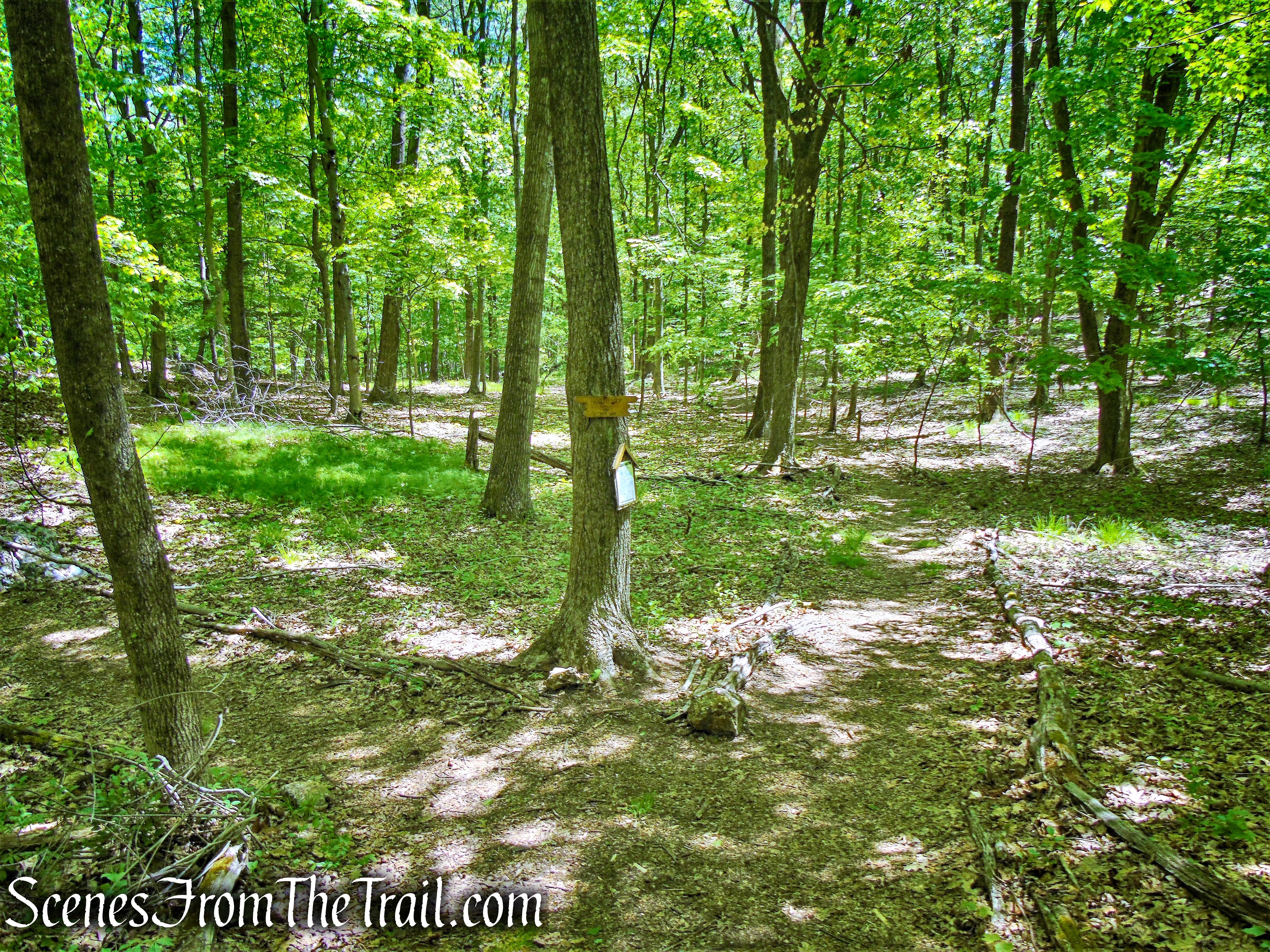
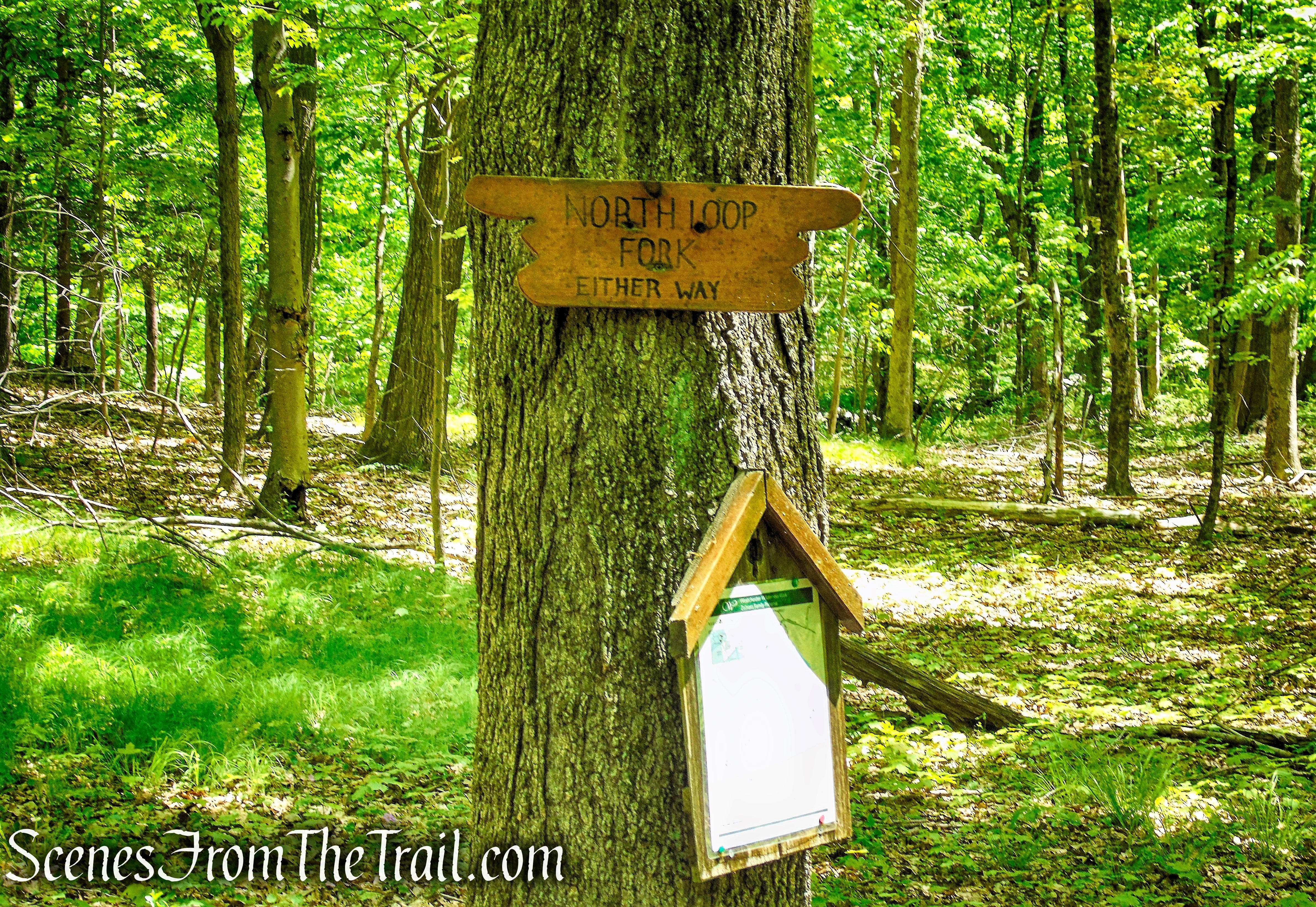
The junctions are clearly marked with wooden signs that correspond with those on the map, along with a copy of the trail map with a “You Are Here” written on it.
Westchester Wilderness Walk – Zofnass Family Preserve
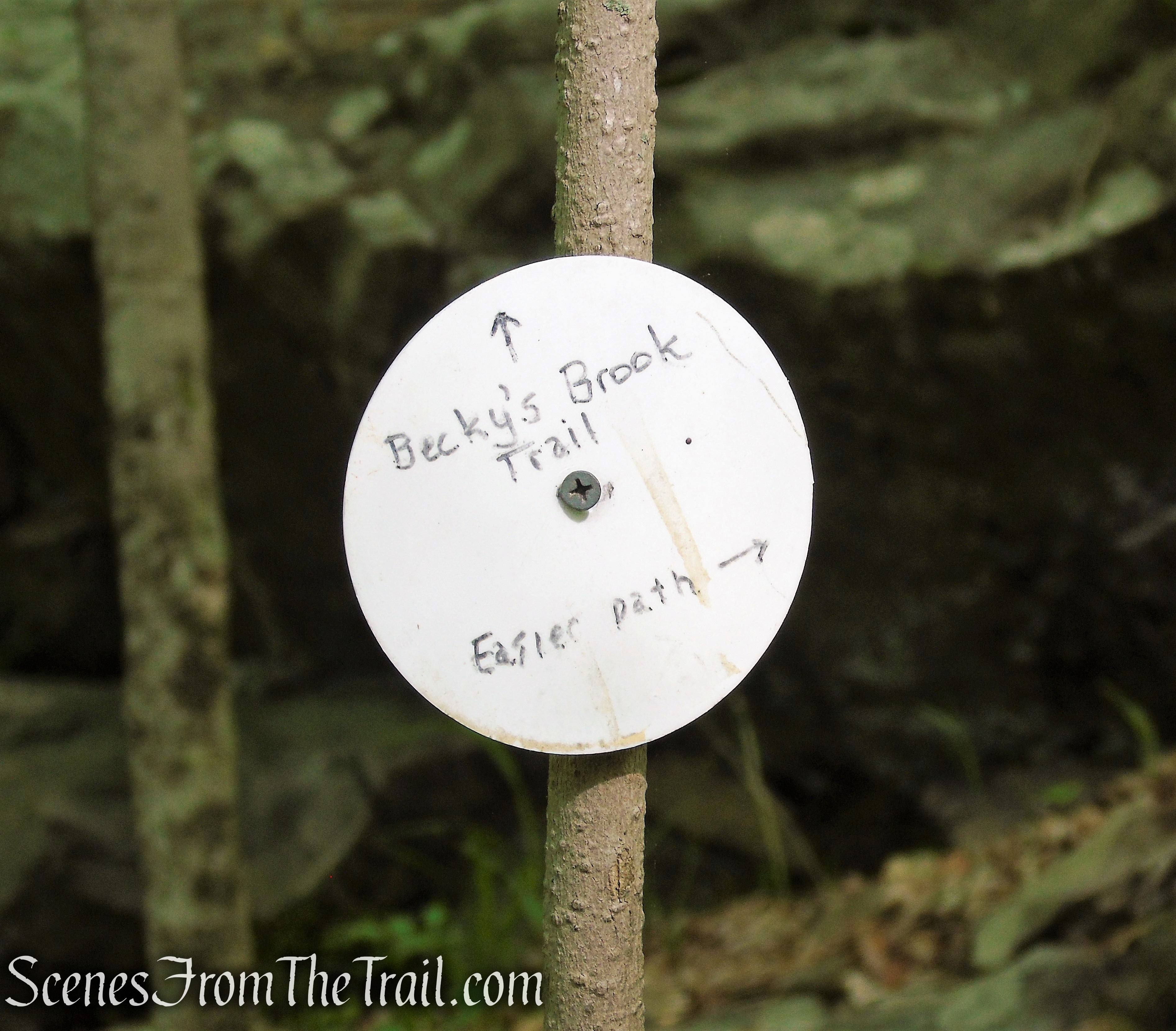
There are white circular markers throughout the preserve. These are not trail markers, they are used to provide information about certain points of interest or a helpful hint about the trail, such as an alternate route, if available.
Westchester Wilderness Walk – Zofnass Family Preserve
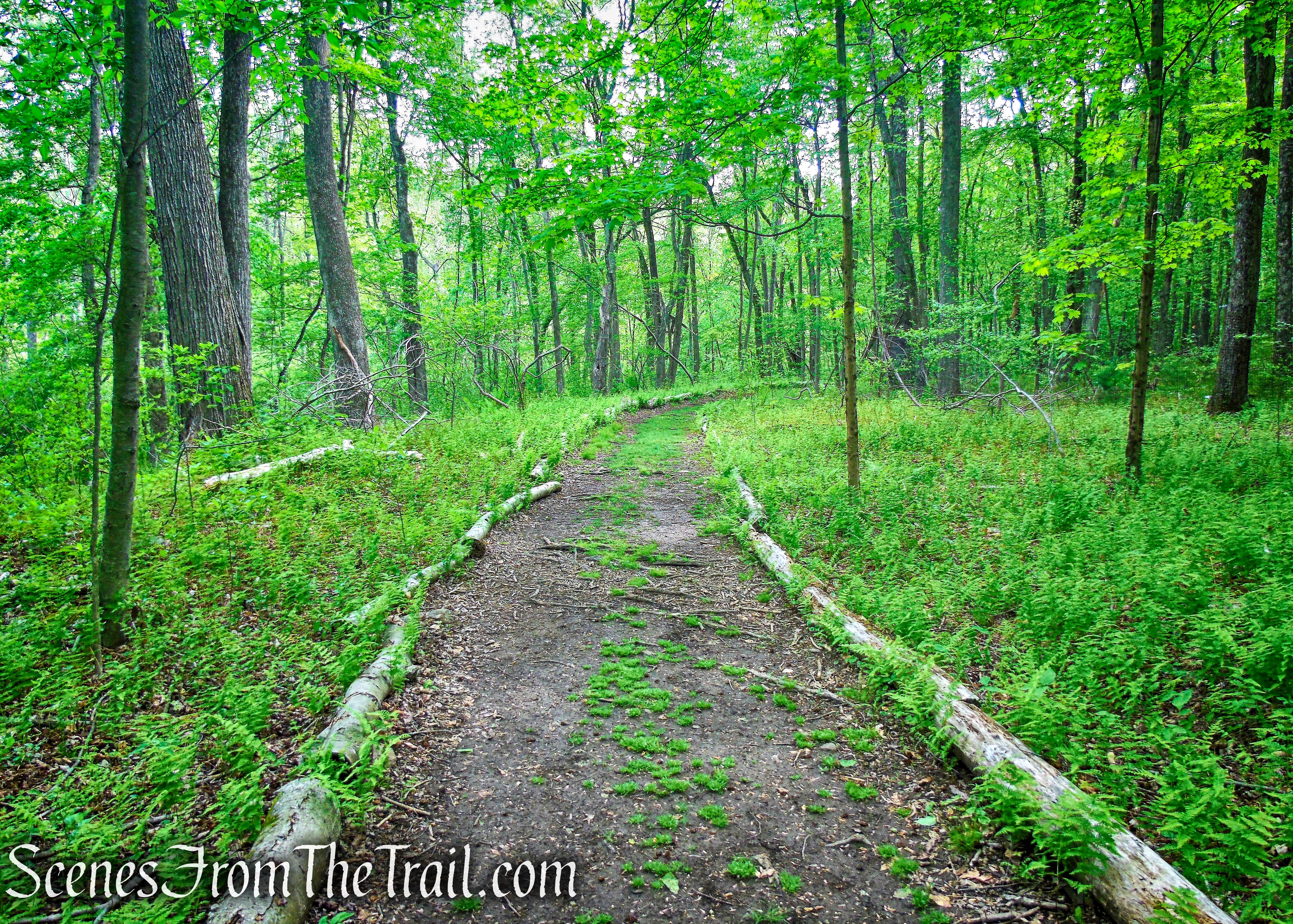
Many of the trails are bordered by logs. However, the hiker should be alert for sharp turns, some of which are easily missed, especially if the ground is covered with snow.
Westchester Wilderness Walk – Zofnass Family Preserve
Even in places that the trail travels over rocks, such as the “streambed steps,” it is bordered by logs. This is good to know as it took us several wrong turns to figure this out. There are a lot of unmarked trails throughout the preserve, but the main trails are well blazed. If you don’t see a green marker or logs bordering the trail, there is a good chance that you have strayed from the main trail.
Streambed Steps – Southern Loop
Hike Overview:
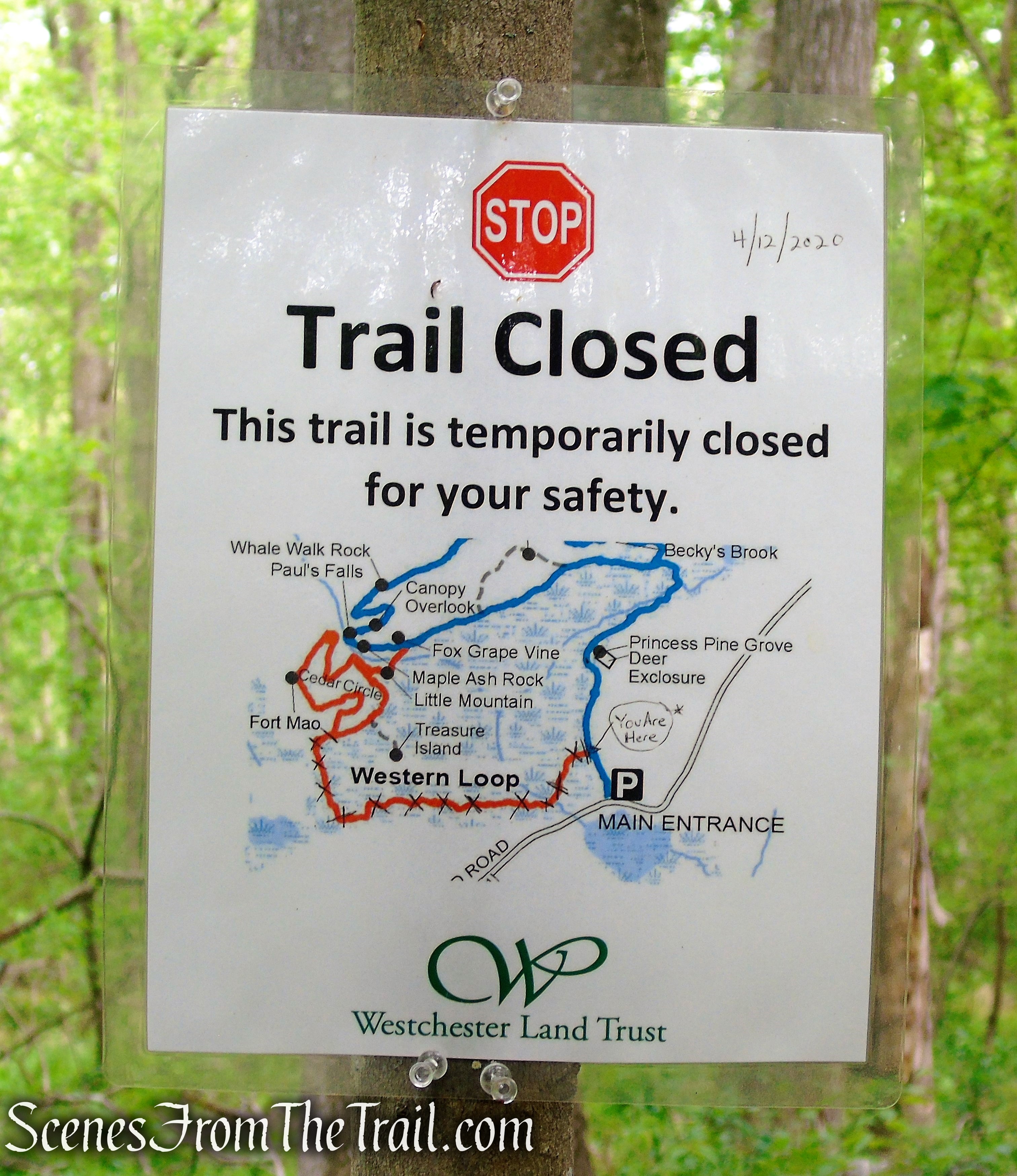
The goal was to hike all of the main trails, but unfortunately, a section of the Western Loop was closed on our visit, so we skipped that entire trail.
Westchester Wilderness Walk – Zofnass Family Preserve
Nevertheless, the remaining trails were enough and we were exhausted afterwards. The terrain is rugged enough for even the more seasoned hiker and the way the loops are designed, make it easy to do shorter hikes if so desired. With the limited parking, don’t expect to see crowds swarming the trails like at Ward Pound Ridge Reservation.
We started out at the parking area on Upper Shad Road and took the west leg of the Southern Loop (blue on map) to the Central Roundabout (yellow on map). We intended to take the eastern leg of the Southern Loop, but after crossing “Becky’s Brook,” we lost the main trail (which climbs over rocks) and took an unmarked trail instead. That was before we figured out the log border system. We turned right on the Central Roundabout (yellow on map) and then right on the Eastern Loop (purple on map) going counter clockwise. After returning to the Central Roundabout and turning right, we turned right again onto the Northern Loop (green on map) going counter clockwise, then returned to the Central Roundabout, turned right and proceeded past the first junction with the Southern Loop (that’s the way we came up) and turned right at “Jessica’s Junction” and onto the east leg of the Southern Loop and back to Upper Shad Road, where the hike began.
Westchester Wilderness Walk – Zofnass Family Preserve
There are a lot of rocks, roots, wet and/or muddy areas, uneven stone stairs and stepping stones on this hike. A good pair of boots is highly recommended. There are also numerous points of interest on this hike, some of which we missed. As this hike can be a little difficult to guide someone through, I will highlight some of the scenes and points of interest that we encountered on our hike. For a detailed description (The one that I partially followed) click HERE.
The Hike:
A brief description of the various loops and some of the more interesting sights along the various trails.
- Southern Loop ~ 2.7 miles
The trail begins at a kiosk just beyond the parking area, where a map of the preserve is posted. It continues along a woods road, with a wetland on the left, soon passing the start of the West Loop. A short distance beyond, a sign on the right (behind a deer exclosure) marks the Princess Pine Grove – named for the tiny club moss found in the area. This is the first of a number of named natural features along the trail, many of which are marked by signs.

Southern Loop Trailhead – Upper Shad Road

Southern Loop Trailhead – Upper Shad Road
Southern Loop – Westchester Wilderness Walk
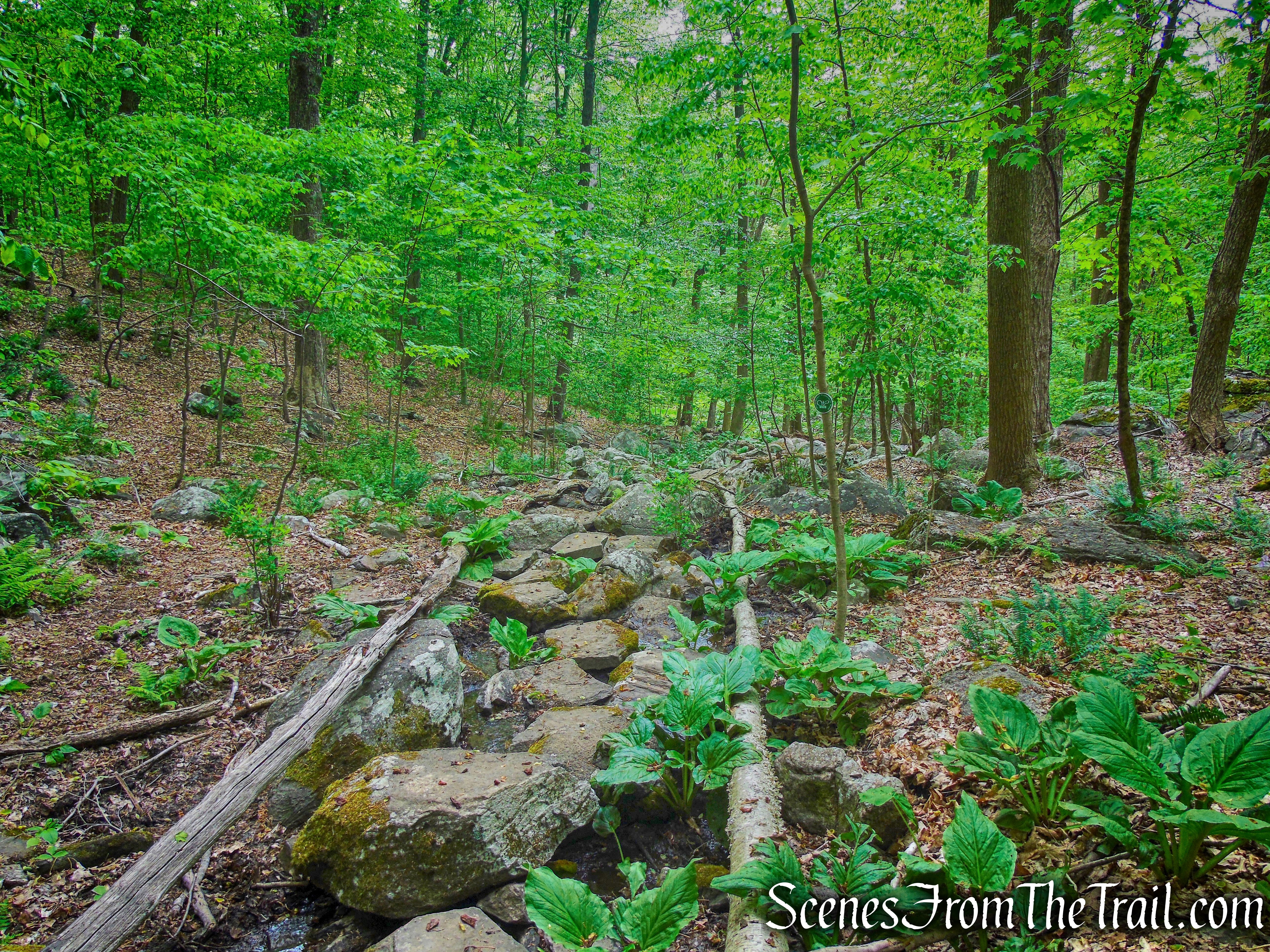
Soon, the trail narrows to a footpath and crosses several streams on rocks. When you reach a T-intersection, with a wooden bridge on the right, turn left and cross a rock causeway, with a wooden handrail, over a stream.

Southern Loop – Westchester Wilderness Walk
Southern Loop – Westchester Wilderness Walk

Southern Loop – Westchester Wilderness Walk
Just beyond, you’ll come to a junction, where the South Loop begins. You can go either way here, to either follow the loop clockwise or in a counter-clockwise direction. The suggested route is counter-clockwise, but we lost the trail after Becky’s Brook, and ended up on an unmarked trail. We ended up catching the main trail up by Lichen Ledge and proceeded clockwise. I will just show some of the points of interest in this area.
Southern Loop – Westchester Wilderness Walk
Southern Loop – Westchester Wilderness Walk
Southern Loop – Westchester Wilderness Walk

Lichen Ledge – Southern Loop

Layer Cake Rock – Westchester Wilderness Walk
The trail runs near the edge of an escarpment, with views over a wetland below, passes Jurassic Rock, Pauley’s Point Rock and Fowler Rock then descends rock steps.
Southern Loop – Westchester Wilderness Walk

Southern Loop – Westchester Wilderness Walk
Jurassic Rock – Southern Loop
Fowler Rock – Southern Loop
Fowler Rock – Southern Loop
This section of the trail is called the Streambed Steps and is marked with blue paint blazes.
Streambed Steps – Southern Loop
Campfire Rock – Southern Loop
The trail goes through Wedge Walk Rock, a narrow passage between two boulders.
Wedge Walk Rock – Southern Loop
After descending through Wedge Walk Rock, the western leg of the Southern Loop Trail ends at the Central Roundabout. Turn right and walk about 300 feet to Jessica’s Junction and turn right again to resume the Southern Loop.
Central Roundabout – Westchester Wilderness Walk
Jessica’s Junction – Westchester Wilderness Walk
Crossing a wet area on rocks.
Southern Loop – Westchester Wilderness Walk
The arboretum, a new addition to the Southern Loop Trail.

arboretum – Southern Loop

arboretum – Southern Loop
A short distance beyond, you’ll ascend a small hill, reach Trudeau’s Point of View and descend rock steps in a narrow passage between two rocks.
Trudeau’s Point of View – Southern Loop

Trudeau’s Point of View – Southern Loop
Southern Loop – Westchester Wilderness Walk
Southern Loop – Westchester Wilderness Walk
The ruins of Tom’s Cabin.

Tom’s Cabin – Southern Loop
Southern Loop – Westchester Wilderness Walk

Southern Loop – Westchester Wilderness Walk
- Central Roundabout ~ 1 mile
Forming a hub, the Central Roundabout connects the Southern, Eastern and Northern Loops. Beginning at a junction with the Southern Loop called Jessica’s Junction, follow the Roundabout in a counter-clockwise direction. The trail heads uphill, climbs a knoll with a stone bench and at 0.2 mile, passes through a stone wall and reaches the junction of the Eastern Loop. Turning left to continue on the Central Roundabout, the trail heads downhill, paralleling a stone wall.
Jessica’s Junction – Westchester Wilderness Walk
Central Roundabout – Westchester Wilderness Walk
Central Roundabout – Westchester Wilderness Walk
Central Roundabout – Westchester Wilderness Walk

Mossy Knoll – Central Roundabout
Central Roundabout – Westchester Wilderness Walk
The trail descends to cross a stream on large rocks. A short distance beyond, it climbs to Over the Top (a rock outcrop to the left of the trail) and descends to Moss Falls, a huge boulder covered with moss. It then climbs to Razor Ridge Rock.

stream crossing – Central Roundabout
Over the Top – Central Roundabout

Over the Top – Central Roundabout
Over the Top – Central Roundabout

Moss Falls – Central Roundabout

Moss Falls – Central Roundabout
Central Roundabout – Westchester Wilderness Walk
Razor Ridge Rock – Central Roundabout
After paralleling a stone wall, the trail turns left, making a sharp U-turn, and descends. The trail circles the interesting Roundabout Rock and soon arrives at another junction, the start of the Northern Loop. Turning left, immediately, you’ll cross a stream on rocks. After briefly paralleling the stream, the trail bears left and begins to head south. The trail comes to another junction, the western leg of the Southern Loop at Wedge Walk Rock then continues southwest on stepping stones. At approximately 1 mile, it closes the loop at Jessica’s Junction.

Roundabout Rock – Central Roundabout
Central Roundabout – Westchester Wilderness Walk
- Eastern Loop ~ 1 mile
Beginning from the Central Roundabout, this is the “lollipop stick” of the Eastern Loop. After a relatively level section, the trail crosses through a stone wall and reaches the top of the Grand Stone Staircase. Two routes are provided to descend this interesting feature, with the left route designated as “easier” and the right route “harder.” Neither route is particularly difficult, but you will be returning this way, so you may wish to select the “harder” route for the descent and the “easier” route for the ascent on the return.

Eastern Loop – Westchester Wilderness Walk
Eastern Loop – Westchester Wilderness Walk

Eastern Loop – Westchester Wilderness Walk

approach to the Grand Stone Staircase
Grand Stone Staircase – Eastern Loop

Grand Stone Staircase – Eastern Loop
After a short descent, you’ll reach an intersection where the Eastern Loop proper begins. Bear right to follow the loop in a counter-clockwise direction. Cross a wet area on large rocks, climb a little, then turn left onto a woods road, with a large wetland to the left. When you reach a sign “Out to Upper Shad .1 mile,” turn left to continue along the trail. At the end of the wetland, you’ll come to another paved private road. Turn left and follow the road for 250 feet, crossing the outlet of the wetland on the road bridge, then turn left, cross a small stream on a rock bridge, and reenter the woods.

Eastern Loop – Westchester Wilderness Walk
wetland – Eastern Loop
The trail now follows a rather rugged footpath along the northeast shore of the wetland, with several cliffs looming above to the right. We saw two hawks in this area. They were making quite a racket as they soared just above the treeline, landed on a tree briefly, then flew off.
Eastern Loop – Westchester Wilderness Walk
wetland – Eastern Loop
Eastern Loop – Westchester Wilderness Walk

Eastern Loop – Westchester Wilderness Walk
Eastern Loop – Westchester Wilderness Walk
When you reach the end of the loop at the northwest corner of the wetland, turn right, following the sign for the Central Roundabout. You’re now retracing your steps along the “lollipop stick” of the loop, going back up the Grand Stone Staircase and continuing to the junction with the Roundabout.

Grand Stone Staircase – Eastern Loop
Grand Stone Staircase – Eastern Loop
Eastern Loop – Westchester Wilderness Walk
- Northern Loop ~ 1 mile
From the northwest portion of the Central Roundabout, the Northern Loop heads uphill along a stone wall, crosses through another stone wall and descends. It reaches the loop portion of the Northern Loop at 0.2 mile. Continuing to the right, the trail is on easy terrain and reaches the far end of the loop at 0.4 mile. Descending, the Northern Loop reaches the corner of Bedford and Mallard Lake Roads at 0.5 mile (no parking).
Northern Loop – Westchester Wilderness Walk
Northern Loop – Westchester Wilderness Walk
Northern Loop – Westchester Wilderness Walk
Northern Loop – Westchester Wilderness Walk
Northern Loop – Westchester Wilderness Walk

Northern Loop – Westchester Wilderness Walk

Northern Loop – Westchester Wilderness Walk
On the return trip, turning right at the trail junction, the Northern Loop passes the Awesome Oak and the south end of the loop to arrive at the junction that leads back to the Central Roundabout. The trip out and back to the Central Roundabout is about 1 mile.

Awesome Oak – Northern Loop
Review:
This is a great hike through very scenic woods and the forest canopy offers lots of shade on a hot day. The varied terrain keeps you on your toes and at becomes a little challenging the longer you hike. The trails are well thought out and pass by or very near many points of interest. In this hiker’s opinion, the best trails are the Southern Loop, Central Roundabout and Eastern Loop in that order. The Northern Loop was my least favorite, but was done to tack on mileage. The stick portion of the Western Loop was closed so we did not hike that trail. With limited parking, we only ran into several small groups, mostly going in the opposite direction. For the most part, we had the woods to ourselves. If you like the rocky landscape of Ward Pound Ridge Reservation, you’ll like this place.
P.S. Bring bug spray.
Pros:
Well marked junctions, scenic landscape, quiet place to hike, well laid out trails.
Cons:
No hilltop views, buggy in the wetlands areas.
Take a hike!

Westchester Wilderness Walk – Zofnass Family Preserve
Sources:
- New York-New Jersey Trail Conference
- Walkable Westchester: A Walking Guide to Westchester County, NY – by Jane and Walt Daniels
- Westchester Land Trust

One of Paul Zofnass’ neighbors is Jane Pauley, hence ‘Pauley’s Point’ and ‘Trudeau’s Point of View’ named after her husband, cartoonist Garry Trudeau. They gave their land to the trust without question.
LikeLiked by 1 person