March 16, 2020 – Hamden, Connecticut
Difficulty: Strenuous
Length: Approximately 4 miles
Max elevation: 713 ft.– total elevation gain approximately 904 ft.
Route type: Circuit
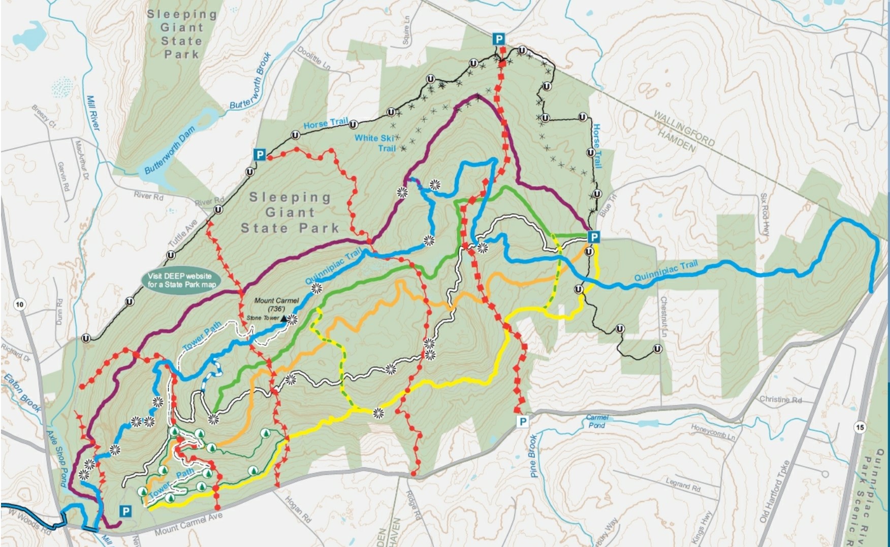
Maps: Sleeping Giant State Park Maps & Guides – Sleeping Giant State Park DEEP Map
Trailhead parking: Mt Carmel Ave – Hamden, CT 06518
Park Overview:
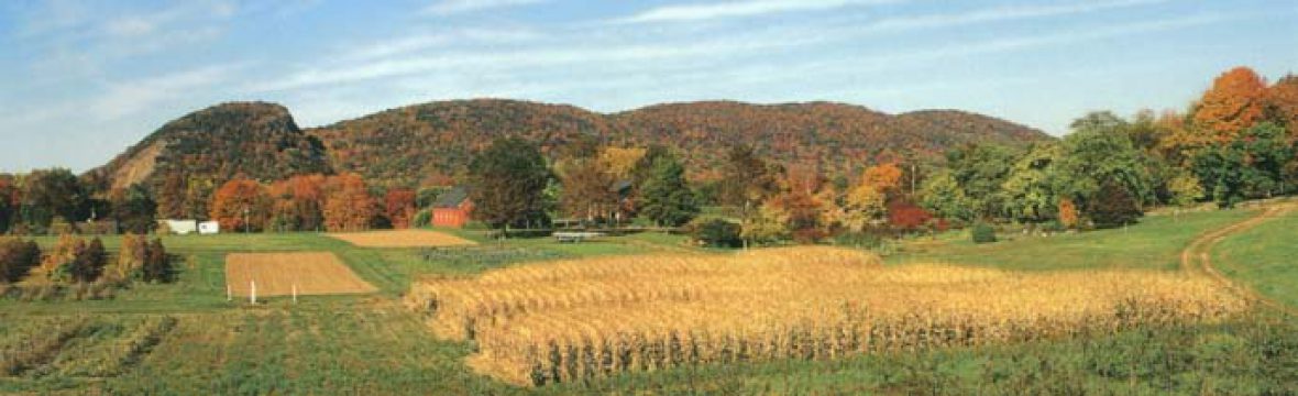
Sleeping Giant (also known as Mount Carmel) is a rugged traprock mountain with a high point of 739 feet, located in northern Hamden, Connecticut. A prominent landscape feature visible for miles, the Sleeping Giant receives its name from its resemblance to a slumbering human figure as seen from either the north or south. The Giant is known for its expansive clifftop vistas, rugged topography, and microclimate ecosystems. Most of the Giant is located within Sleeping Giant State Park with approximately 1,650-acres. The mountain is a popular recreation site with over 30 miles of hiking trails that traverse it, including 5 miles of the 23-mile Quinnipiac Trail.
Sleeping Giant State Park
The Sleeping Giant, 2.75 miles long by 1.75 miles wide, is located in Hamden with its eastern edge falling into Wallingford. The Giant’s profile features distinct “head,” “chin,” “chest,” “hip,” “knee,” and “feet” sections topographically represented by traprock outcrops and ridge crests. The highest point is the Left Hip at 739 ft. above sea level, where there is a stone observation tower that offers 360° views of the surrounding Mill and Quinnipiac River valleys. It is part of the narrow, linear Metacomet Ridge that extends from Long Island Sound north through the Connecticut River Valley of Massachusetts to the Vermont border.

observation tower – Sleeping Giant State Park
History:
Conservation of the Giant began in 1924 with the creation of the Sleeping Giant Park Association (SGPA) by a group of local residents concerned with ongoing traprock quarrying on the Giant’s head. The property was purchased by the SGPA in 1933, during the Great Depression, for $30,000; the money was raised through private donations and the property became the Sleeping Giant State Park.
Sleeping Giant received its name thanks to local Native American creation stories, which are part of a complex belief system about the beginnings of the cosmos and human beings. The giant rock formation embodied Hobbomock, an evil spirit who became angry at the neglect of his people. In his rage, Hobbomock stamped his foot near the current location of Middletown, which caused the course of the Connecticut River to change. A good spirit named Keihtan is said to have cast a spell on Hobbomock that caused him to sleep forever, preventing any further damage to the area.
During the mid-1800’s, as New Englanders took to the mountains searching for a respite from the era of industrialization, many cottages appeared on the ridges of Sleeping Giant. Judge Willis Cook built one of these cottages on a part of the ridge known as the giant’s “head.” By 1911, however, vandals had become such a problem that Cook decided to lease the land to the Mount Carmel Traprock Company for quarrying.
Local residents objected to the continuous blasting and the damage that quarrying did to the area. In 1924, they formed the Sleeping Giant Park Association in order to acquire, preserve, and maintain the land around Sleeping Giant. The organization raised tens of thousands of dollars and eventually bought the rights to land, ending quarrying there by 1933.
In subsequent decades, the Association managed to halt plans for an oil pipeline across Sleeping Giant and defeated proposals for the installment of nearby television and telephone antennas. Today, Sleeping Giant State Park affords visitors in an otherwise urban area a natural refuge that offers miles of hiking trails and spectacular views of Long Island Sound and the New Haven area.
Trails Overview:
The Sleeping Giant Park Association maintains the extensive trail system within the park. The trails offer distant views from rocky crags, remote quiet woods, pleasant pine groves, and mountain brooks with mossy cascades. The trail map makes note of at least 28 different viewpoints.
The 5-mile section of the blue-blazed Quinnipiac Trail in Sleeping Giant State Park is crisscrossed by myriad color-coded park trails.
Six east/west trails traverse the park, with the White Trail and blue-blazed Quinnipiac Trail being the most strenuous.
Five north/south trails connect Mount Carmel Avenue on the south with Tuttle Avenue or Mansion Road on the north, crossing all the east/west trails. These five red-blazed trails are frequently used as feeders or crossovers to other trails.
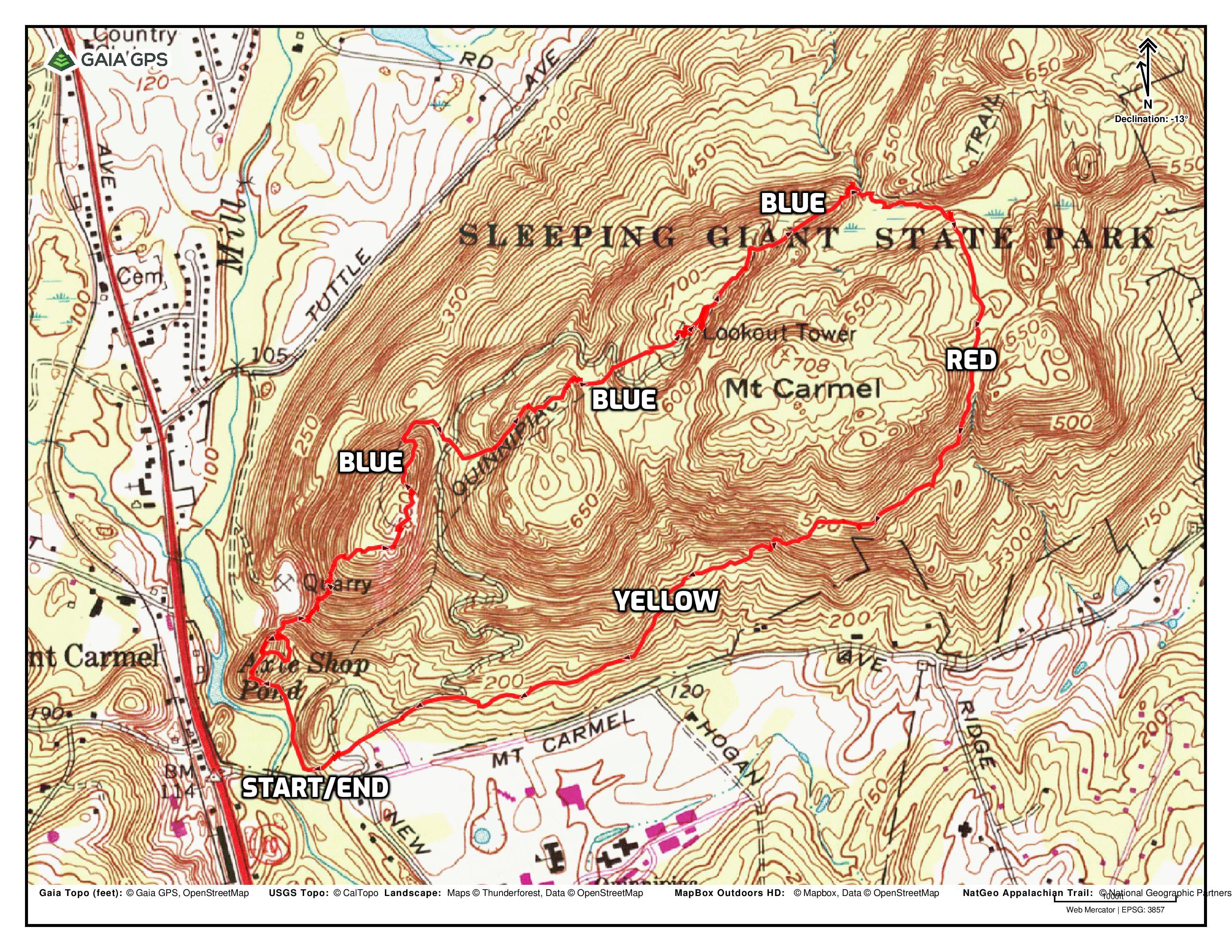
Trails used on this loop hike are as follows:
- Violet Trail
- Blue Trail (Quinnipiac Trail)
- Circle Trail (Red)
- Yellow Trail
Sleeping Giant State Park
Hike Overview:
This hike begins at the southwest corner of the parking area, near the ranger station and follows the Violet Trail in a northerly direction a short distance along the Mill River. When the blue-blazed Quinnipiac Trail joins in from the left, we began following the blue blazes east as it climbs the “head” of The Giant. We followed the Blue Trail all the way to the stone tower and beyond, turning right on the red-blazed Circle Trail and heading south, then turning right on the Yellow Trail, heading west and back to the parking area, where the hike began. This hike was done clockwise.
Tower Loop via the Quinnipiac Trail – Sleeping Giant State Park
The Hike:
A look up at the head of The Giant before we began the hike.
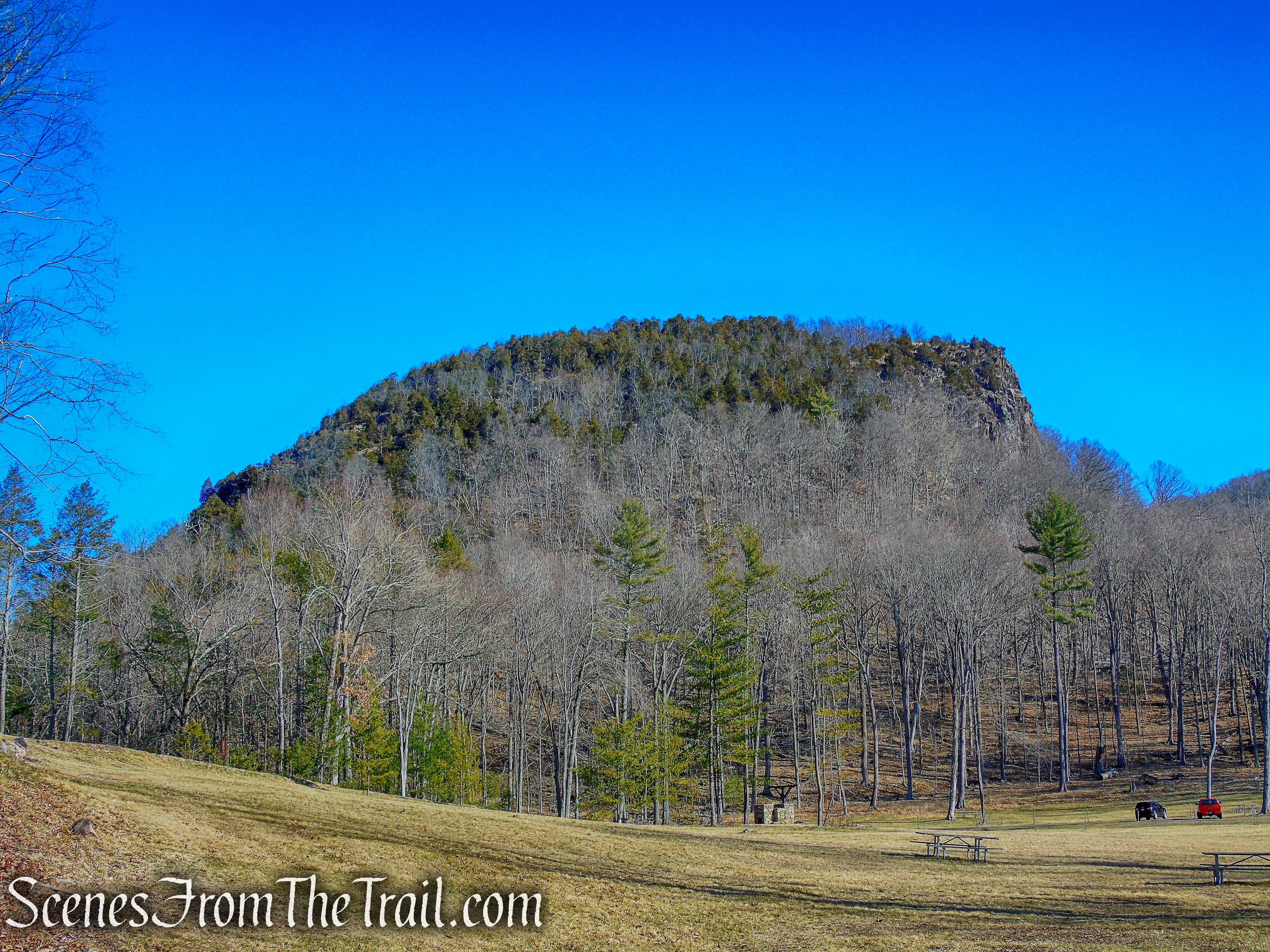
the “Head” – Sleeping Giant State Park
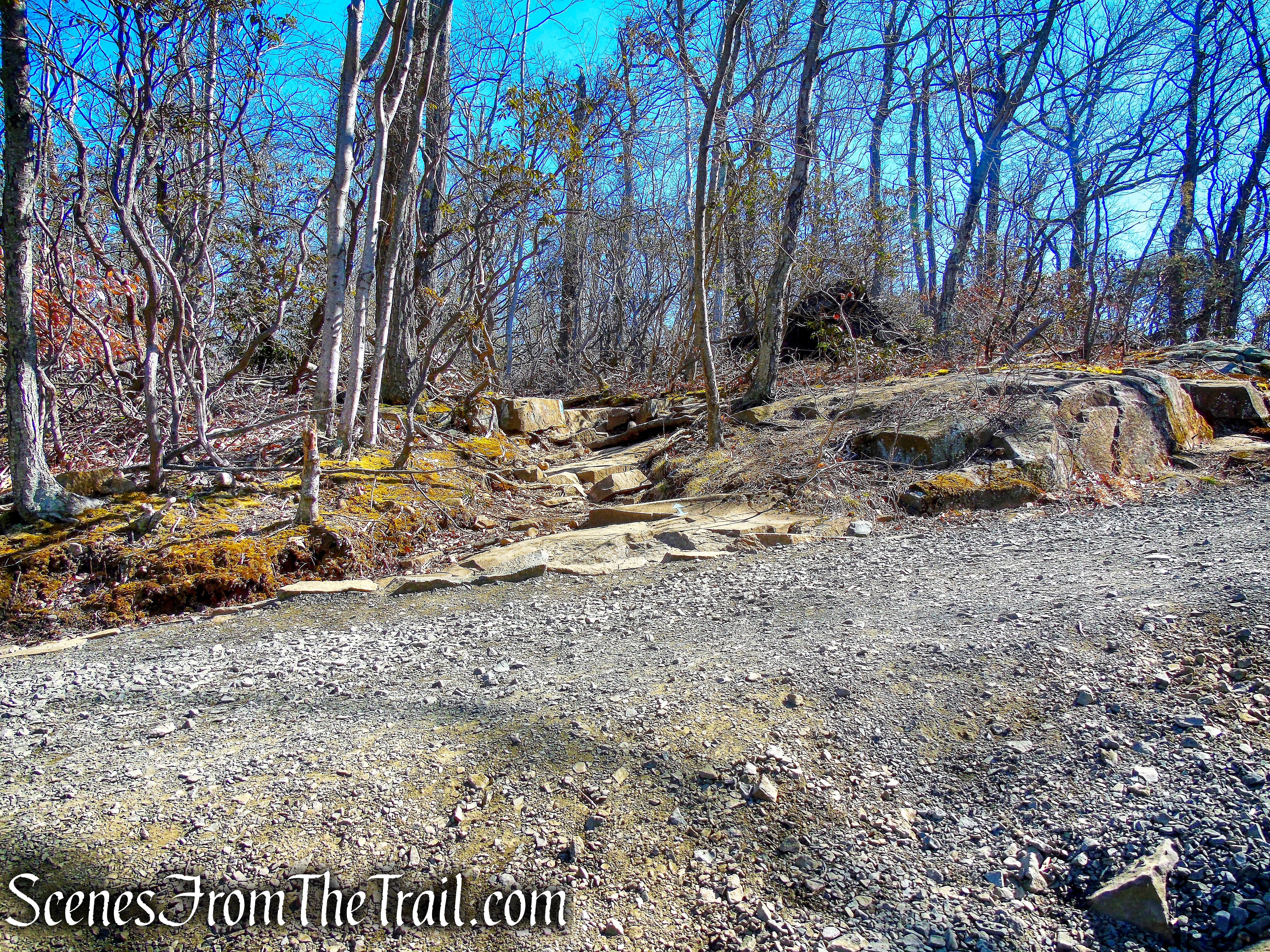
From the southwest corner of the parking area, follow the Violet Trail as it heads in a northerly direction along the Mill River. In just over 200 yards, the blue-blazed Quinnipiac Trail comes in from the left along with the Red Diamond Trail. In another 100 feet, both the Blue and Red Trails leave to the right. Turn right, leaving the Violet Trail and follow the co-aligned Blue/Red trails. In another 150 feet, the two trails split. Veer left and follow the Blue Trail.

Quinnipiac Trail – Sleeping Giant State Park
Quinnipiac Trail – Sleeping Giant State Park
veer left on Quinnipiac Trail
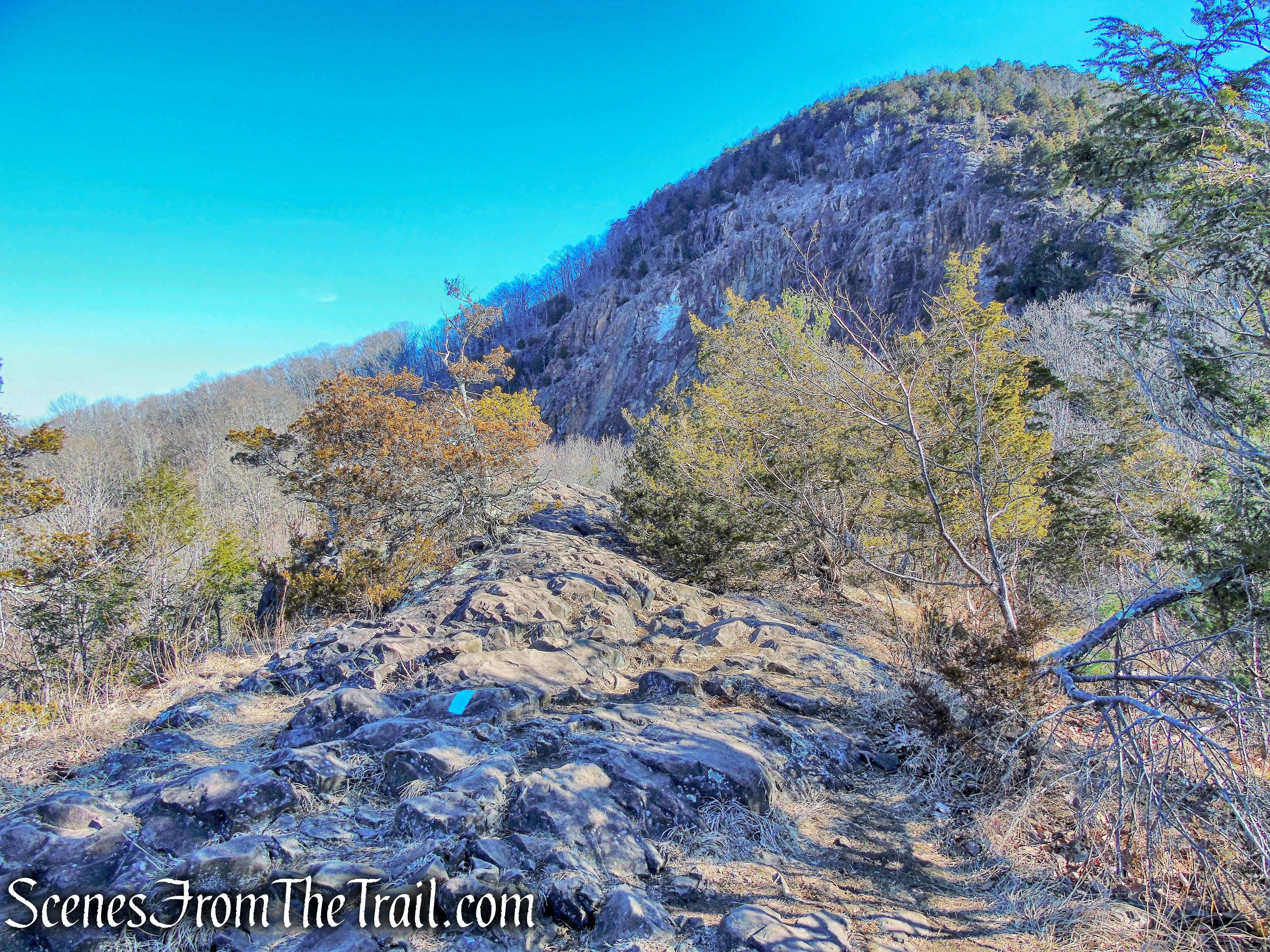
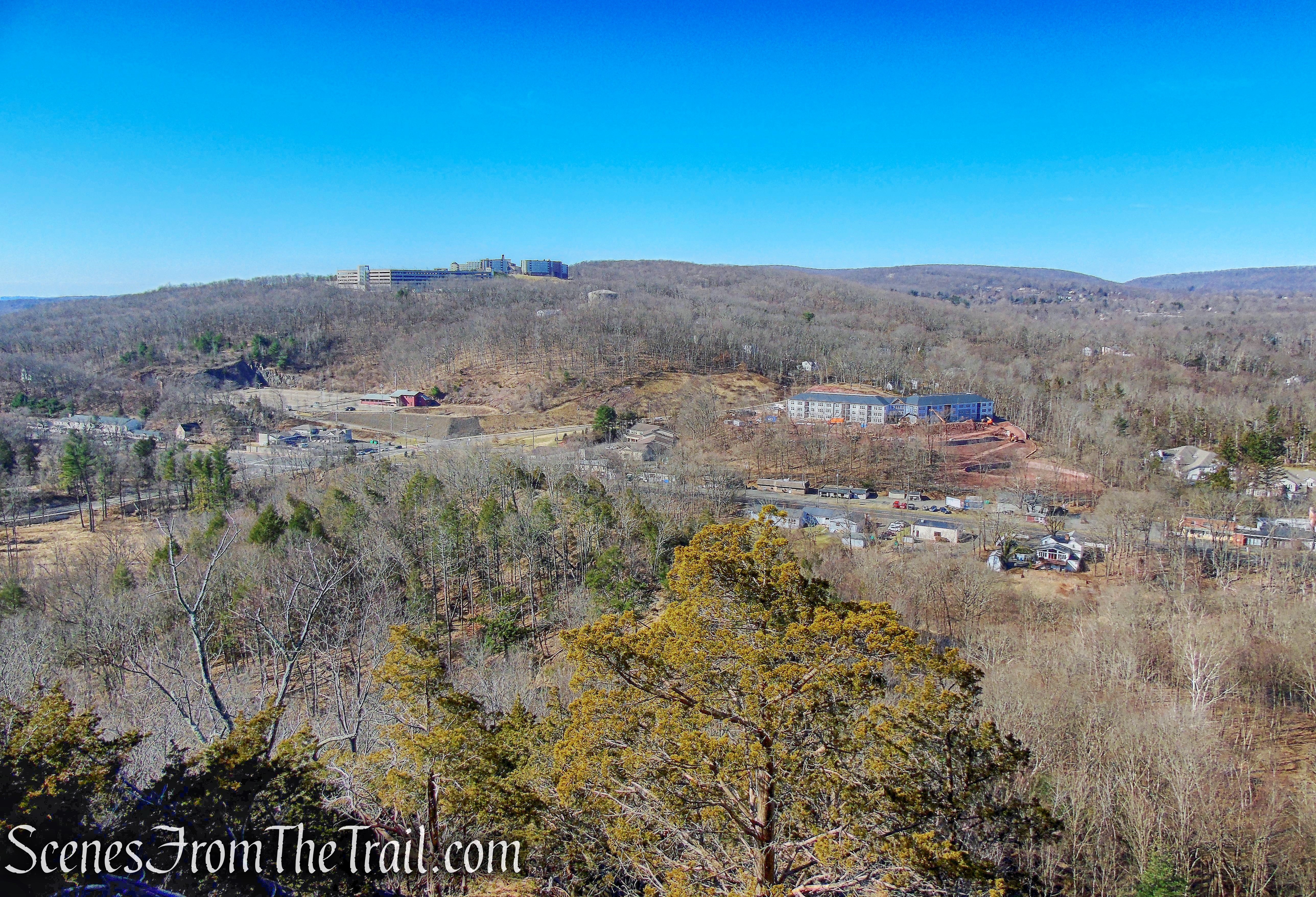
The Blue Trail climbs steeply and then levels off a bit as it travels along the rim of the quarry, with the Giant’s head looming just beyond. As the trail comes out on open rock, there are views west over the town of Hamden and beyond.
Quinnipiac Trail – Sleeping Giant State Park
Quinnipiac Trail – Sleeping Giant State Park
Quinnipiac Trail – Sleeping Giant State Park
Quinnipiac Trail – Sleeping Giant State Park
The Blue Trail continues heading northeast and soon comes to a short steep descent. It’s almost straight down with the hand and footholds far apart.

Quinnipiac Trail – Sleeping Giant State Park
This spot can be avoided by taking the Red Diamond Trail when the Blue/Red trails split. The Red Diamond Trail crosses just below this spot.

Quinnipiac Trail – Sleeping Giant State Park
The Blue Trail now begins an earnest climb of the head. The loose rock and steep dropoff down to the quarry makes this area especially hazardous if the ground is wet. It is not recommended to hike this section during times of rain or ice.

Quinnipiac Trail – Sleeping Giant State Park

Quinnipiac Trail – Sleeping Giant State Park

Quinnipiac Trail – Sleeping Giant State Park

Quinnipiac Trail – Sleeping Giant State Park

Quinnipiac Trail – Sleeping Giant State Park
There isn’t much shade along the way so if you find some, you may want to take a break and enjoy the view.
Quinnipiac Trail – Sleeping Giant State Park

Quinnipiac Trail – Sleeping Giant State Park
Quinnipiac Trail – Sleeping Giant State Park
Quinnipiac Trail – Sleeping Giant State Park
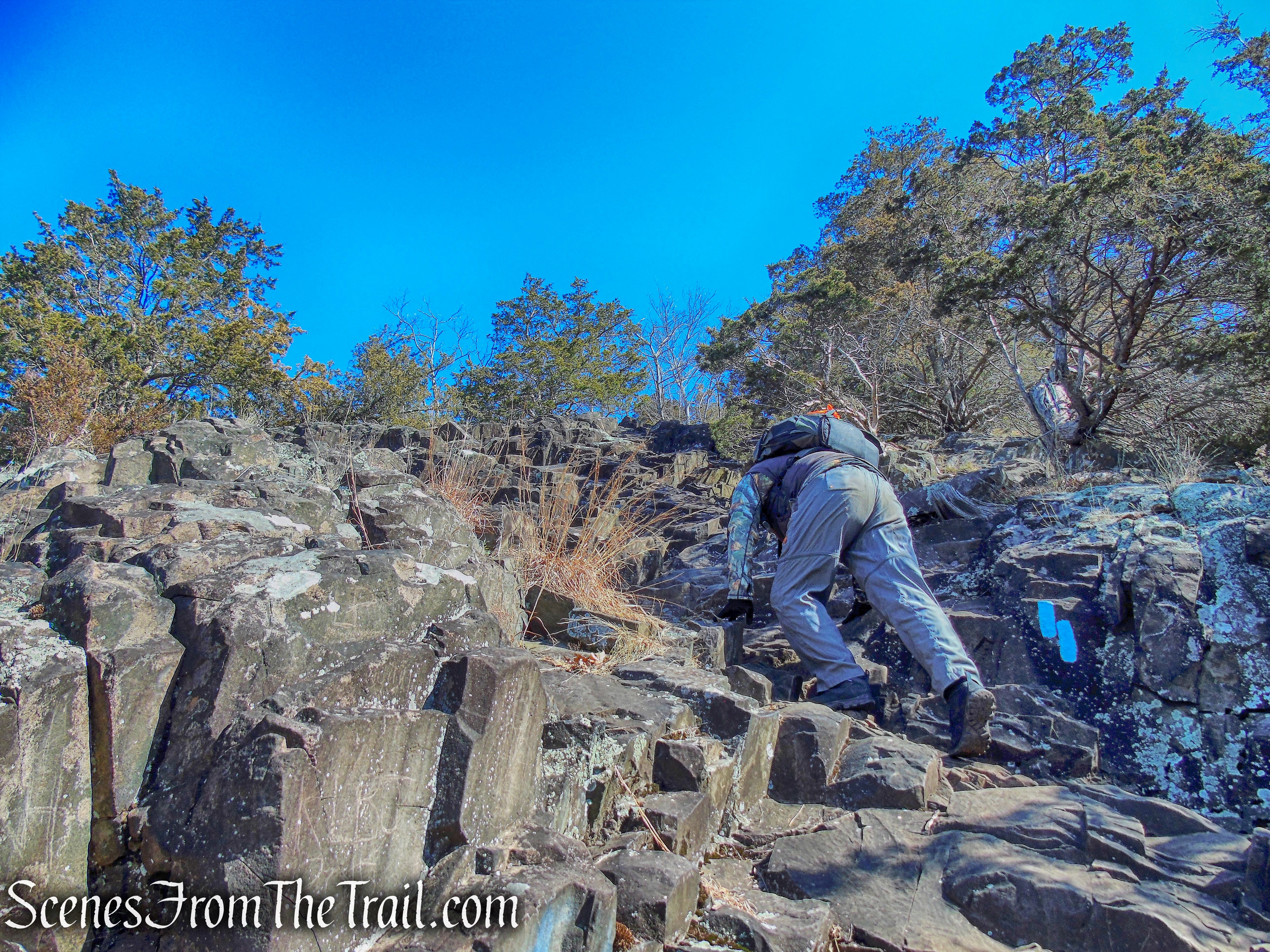
As the trail climbs the head, it becomes even more steep, but the craggy traprock makes the footing much better.

Quinnipiac Trail – Sleeping Giant State Park

Quinnipiac Trail – Sleeping Giant State Park

Quinnipiac Trail – Sleeping Giant State Park
Looking northwest from the trail, gives you a good idea of the steepness.
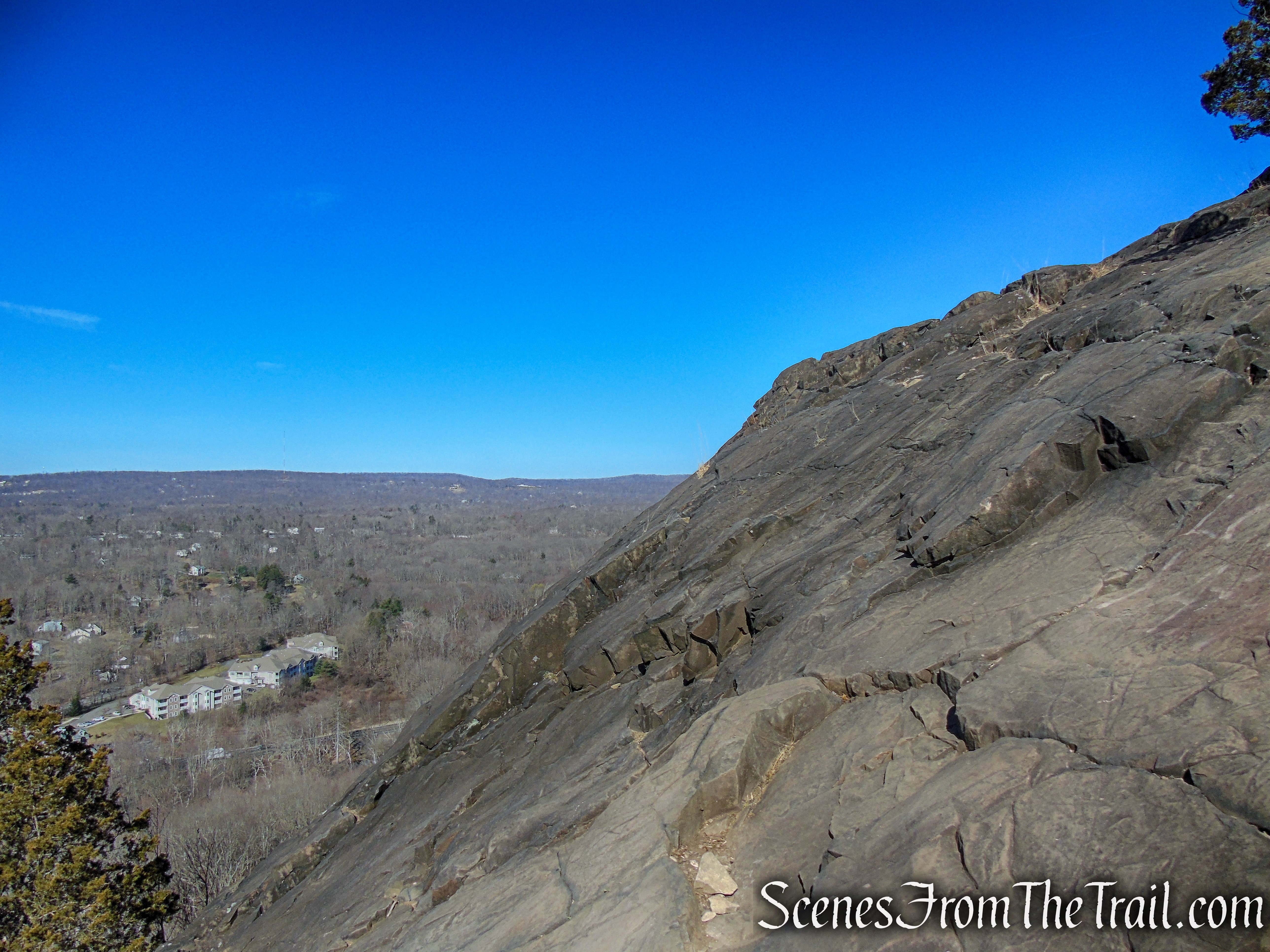
Quinnipiac Trail – Sleeping Giant State Park
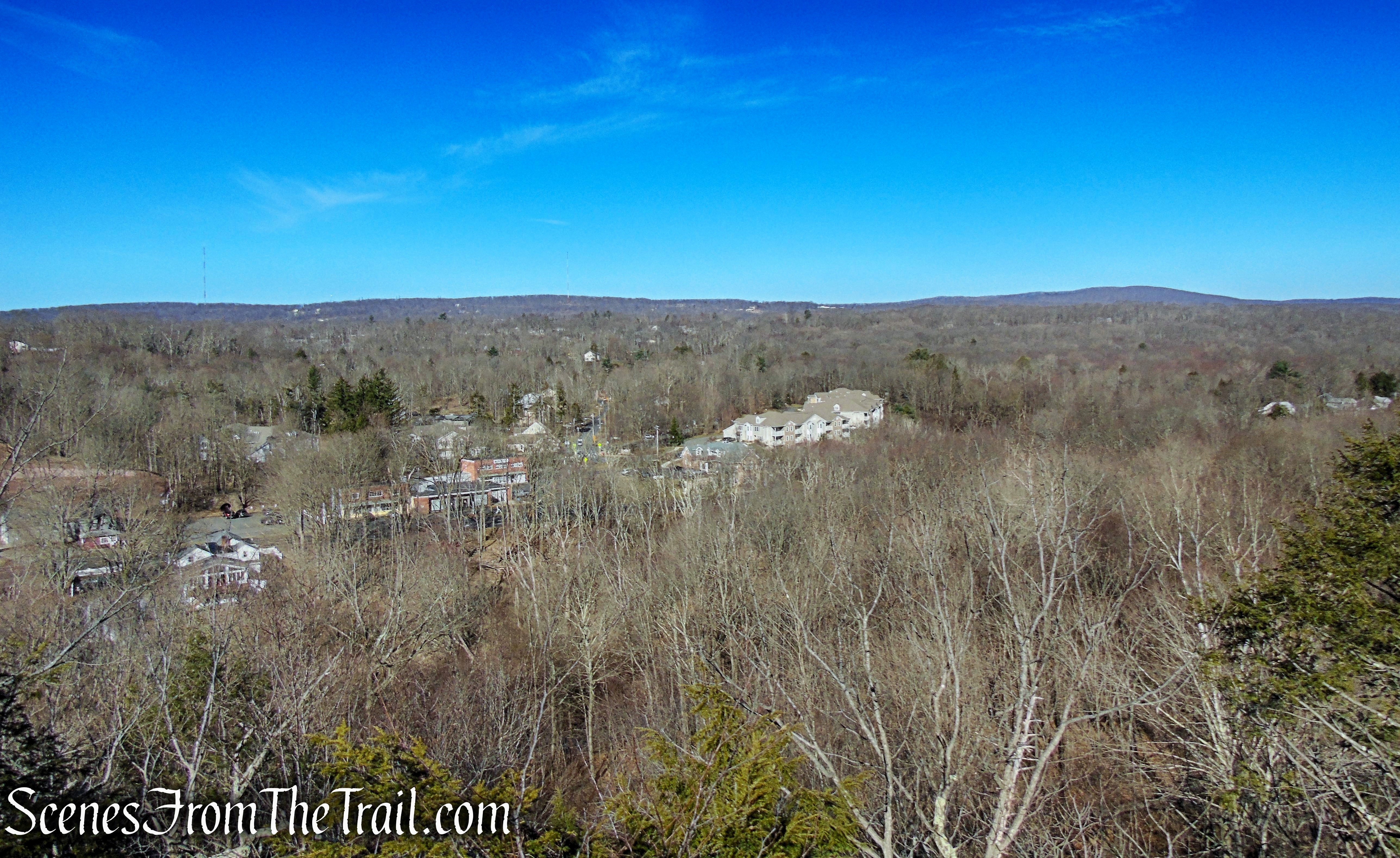
As the steep climb continues, there are views to the south and southeast.

Quinnipiac Trail – Sleeping Giant State Park
Quinnipiac Trail – Sleeping Giant State Park
Quinnipiac Trail – Sleeping Giant State Park
As the trail goes over the head, it levels off briefly then resumes its climb.
Quinnipiac Trail – Sleeping Giant State Park
Quinnipiac Trail – Sleeping Giant State Park
The trail levels off again as it travels across the head, then climbs again as it reaches the chin, with views southeast towards the chest of The Giant.
Quinnipiac Trail – Sleeping Giant State Park
Quinnipiac Trail – Sleeping Giant State Park
After 0.7 mile from the start of the hike and over 500 feet of elevation gain, this is a good spot to take a break and soak in the view.

Quinnipiac Trail – Sleeping Giant State Park
Quinnipiac Trail – Sleeping Giant State Park
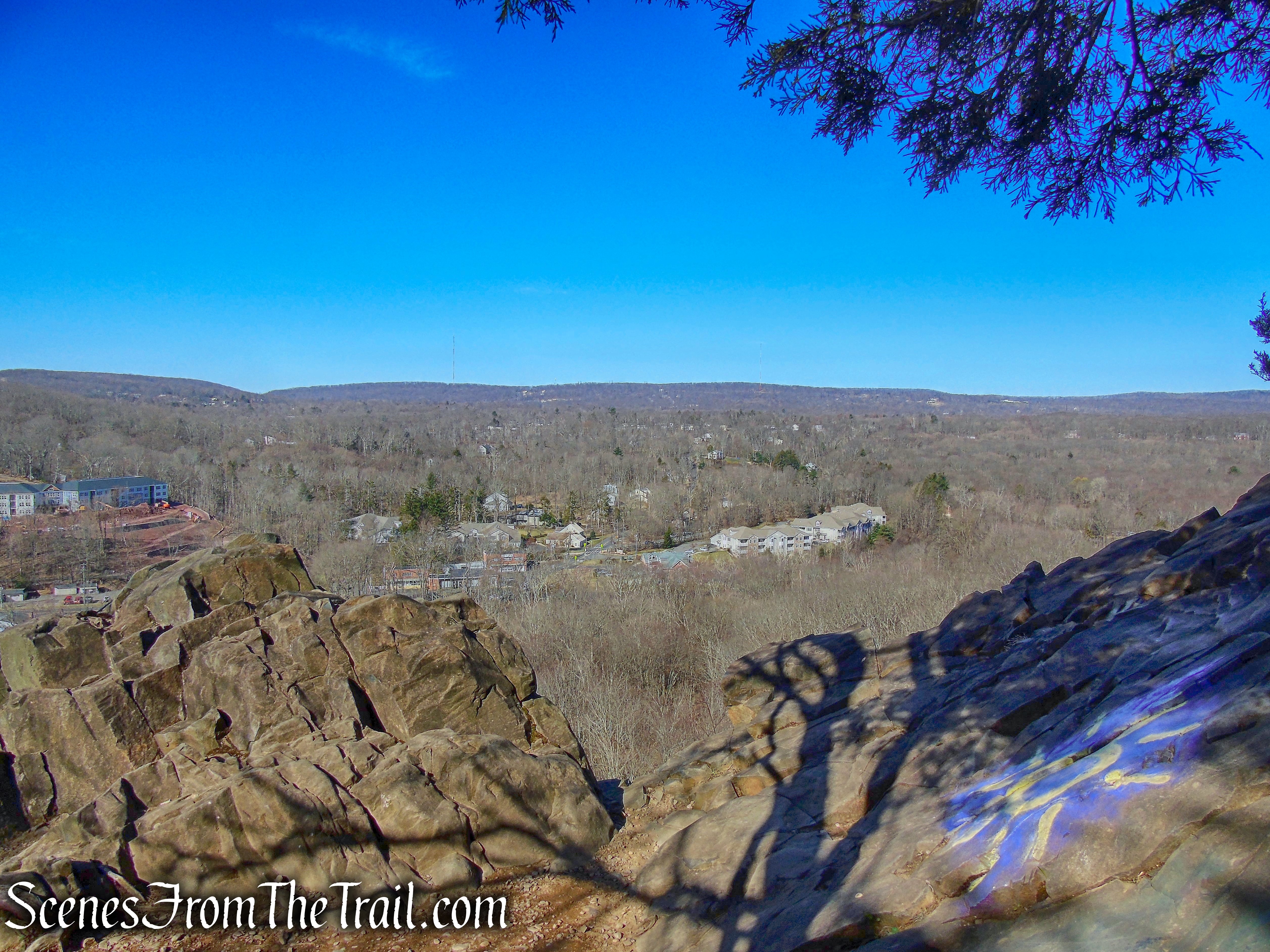
The trail continues along the edge of the chin and climbs a rock ledge before descending steeply.
Quinnipiac Trail – Sleeping Giant State Park
Quinnipiac Trail – Sleeping Giant State Park
Quinnipiac Trail – Sleeping Giant State Park

Quinnipiac Trail – Sleeping Giant State Park

Quinnipiac Trail – Sleeping Giant State Park
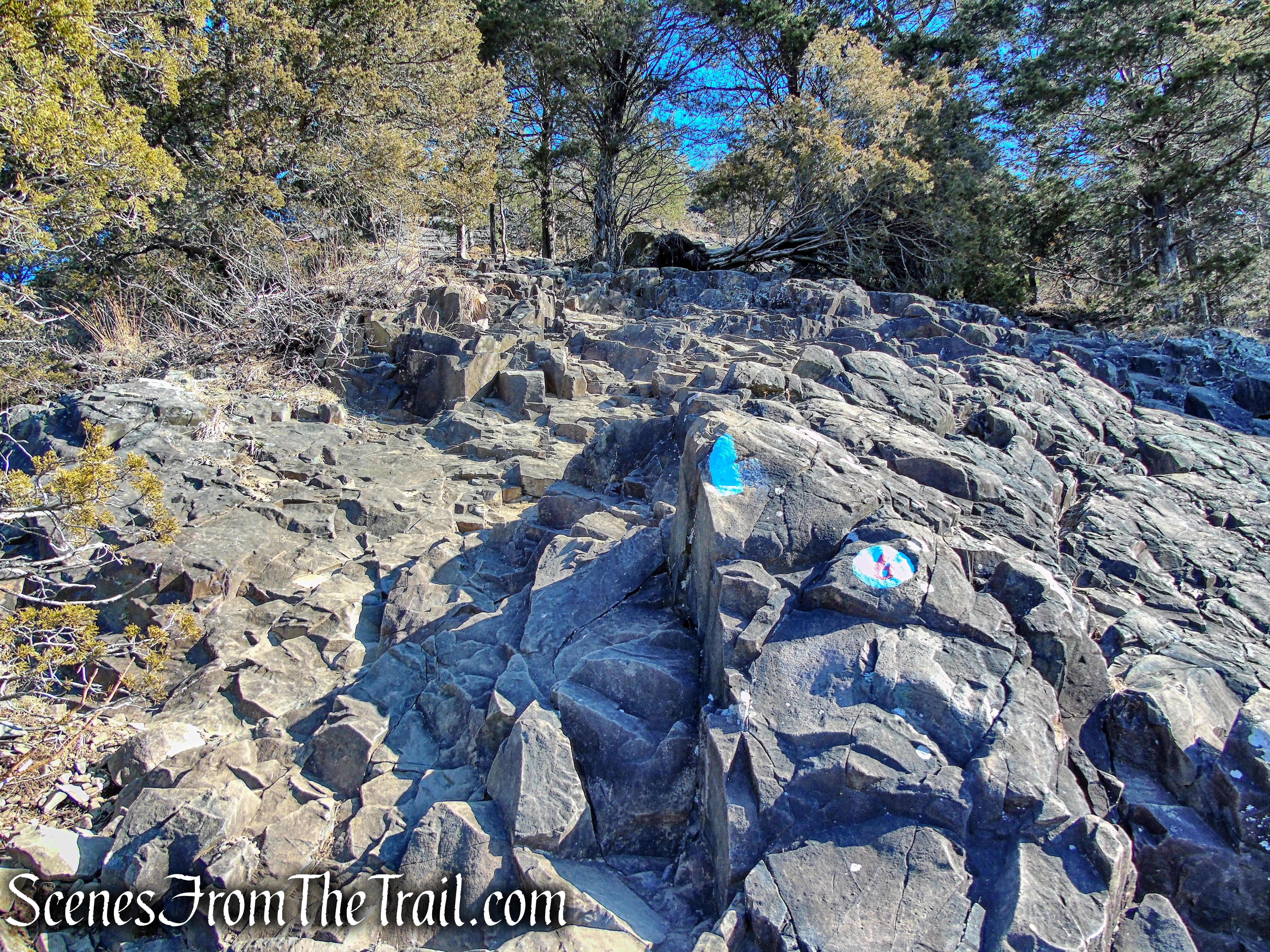
At the base of the descent, the trail turns right and crosses the Red Hexagon Trail then the Tower Trail (gravel road) a short distance later. The Blue Trail passes to the left of the chest, heading in an easterly direction. It soon descends then climbs again, crossing the Tower Trail for a second time. A short distance later, it reaches the stone observation tower. You have now hiked about 1.5 miles.

Quinnipiac Trail – Sleeping Giant State Park

Quinnipiac Trail – Sleeping Giant State Park

Quinnipiac Trail – Sleeping Giant State Park
Quinnipiac Trail – Sleeping Giant State Park
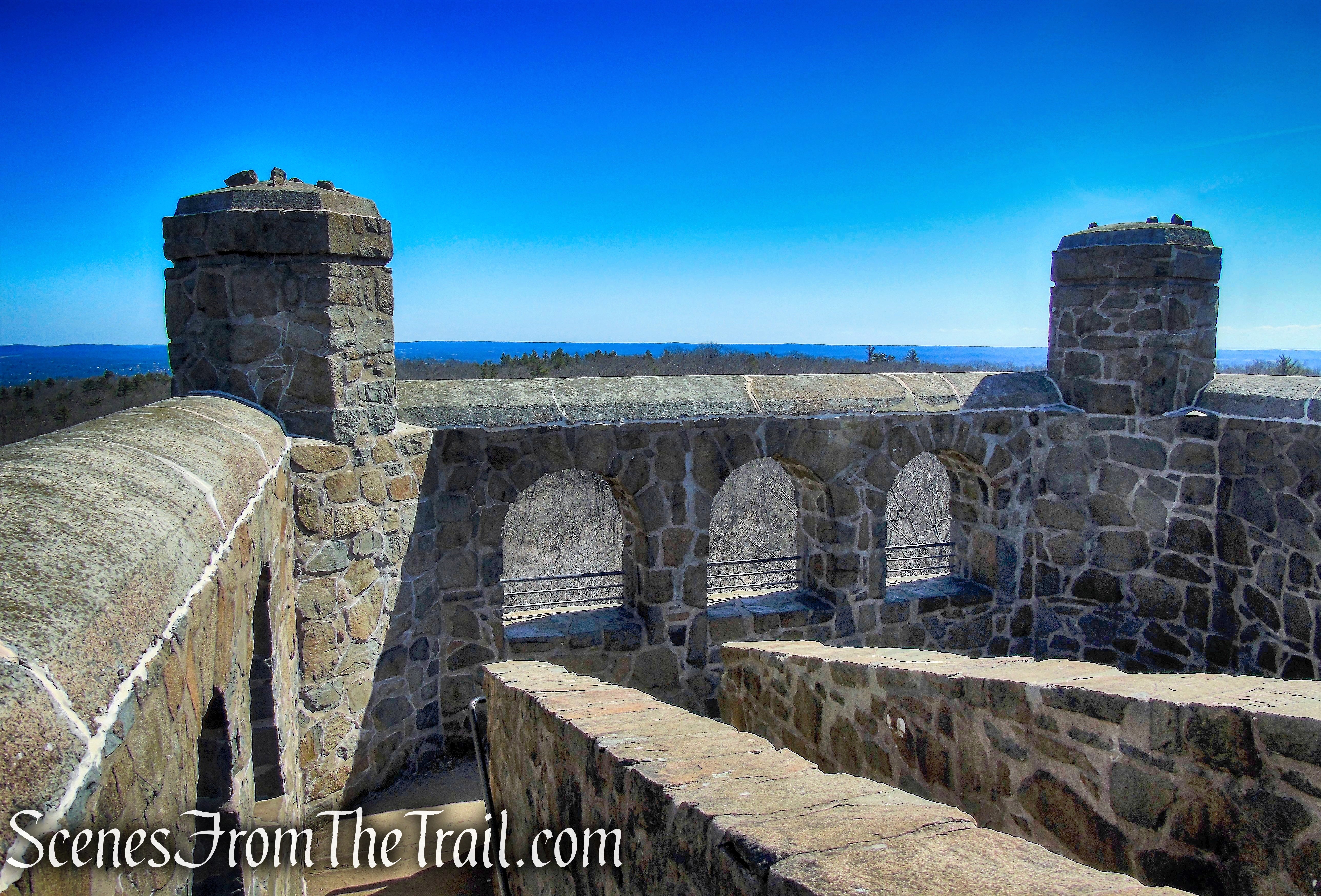
On The Giant’s left hip is a large open-air fieldstone building 739 feet above mean sea level, the highest point of the 1,500-acre park. The square four-story tower was built in the Romanesque-style between 1936 and 1939 by 60 workers through the Works Progress Administration, as a Depression-era relief and recovery project.

observation tower – Sleeping Giant State Park
Henry Webb helped build a gradual ascent to the Tower and installed ramps, rather than steps, inside the castle-like tower. Stone material from the 1900 Park house, the first house built on the third ridge, was used to construct the tower.

observation tower – Sleeping Giant State Park
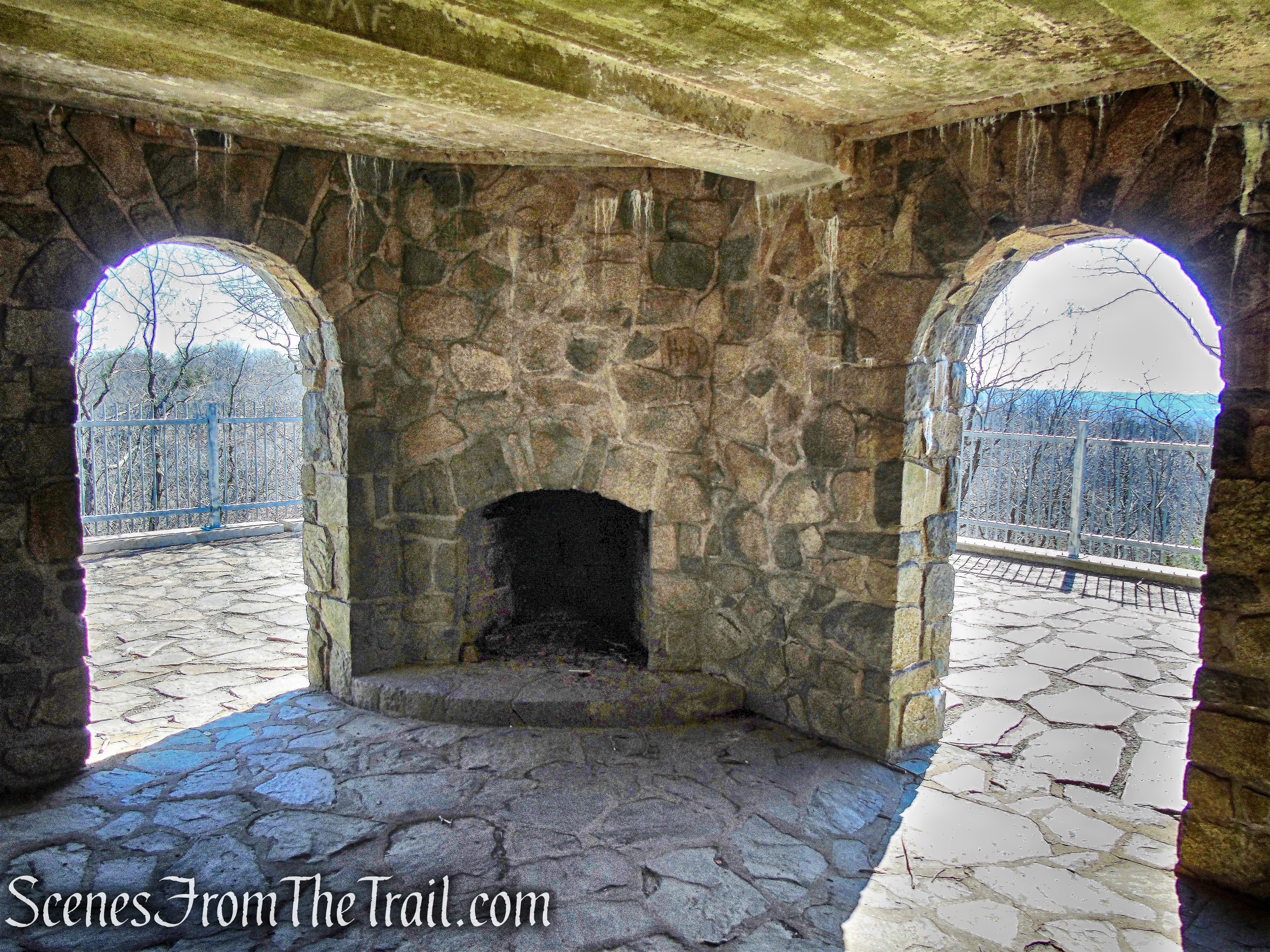
Restrooms used to be in the one-story flat roofed section but were bricked off in the 1960’s and the fixtures were removed in the 1990’s. The rooms are now open to the public for exploration. While both rooms have window and door holes, one still has a bench with cemented-over toilets. There are marks on the room’s walls where partitions used to exist. A closet-sized room was used for restroom supplies.

observation tower – Sleeping Giant State Park
On the first floor, there is a large room with two fireplaces.
observation tower – Sleeping Giant State Park
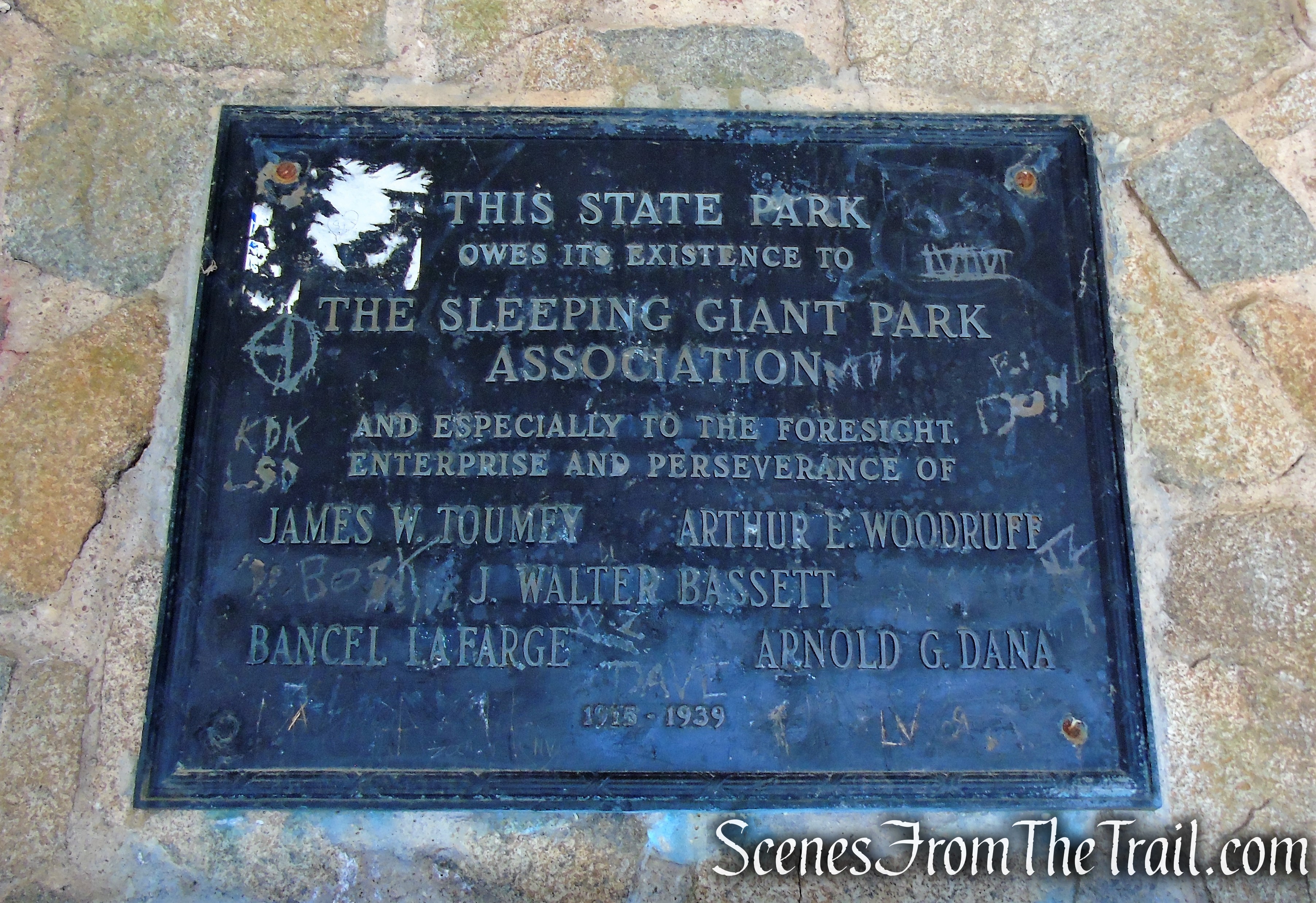
The Sleeping Giant Park Association (SGPA) celebrated the tower’s opening in 1939 with a plaque dedicated to the pioneers who tirelessly worked to get the property designated as a state park in 1924.
observation tower – Sleeping Giant State Park
The 50’x50′ tower with a 30′ high observation deck was added to the National Register of Historic Places in 1986.

observation tower – Sleeping Giant State Park
A spider web and a spider were installed in the third floor window, a feature added to all structures built by Webb. The spider has since gone missing. The monogram “CSP,” which stands for Connecticut State Parks, was constructed in the second floor window.

observation tower – Sleeping Giant State Park
According to the SGPA, “during World War II, the tower was ‘manned’ and there was a telephone installed to notify authorities in the event that any ‘enemy planes’ were spotted.”
observation tower – Sleeping Giant State Park
While there are observation windows on the tower’s second and third levels, the best views are at the top, on the fourth level.
observation tower – Sleeping Giant State Park
To the south, the Long Island Sound is visible in the distance on a clear day.
observation tower – Sleeping Giant State Park
If you are worn out by this point, you can simply walk about 1.6 miles downhill on the Tower Trail, which is a gravel road.
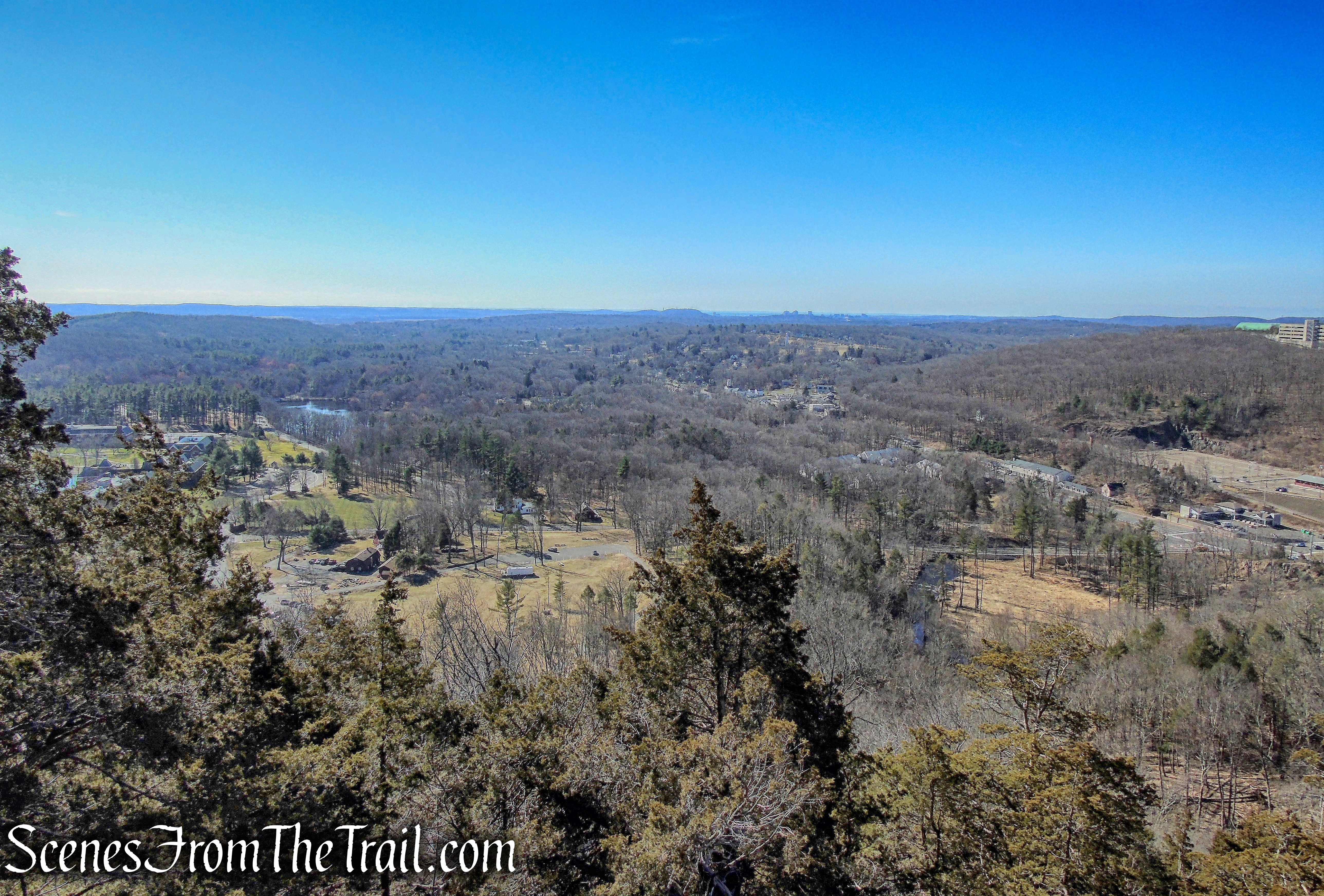
The Blue Trail continues northeast along the ridge, with south-facing views from rock ledges, to the right of the trail.

Quinnipiac Trail – Sleeping Giant State Park

Quinnipiac Trail – Sleeping Giant State Park

Quinnipiac Trail – Sleeping Giant State Park
The Red Circle Trail descends the south slope of the Giant, beginning at the left leg, skirting a wet area. The trail is rugged and rocky, and at times you have to scramble over boulders. After crossing a stream the trail soon joins a woods road and heads south. The Red Circle Trail crosses intersections with the Green and Orange trails as it continues its descent. Between the right knee (left) and right leg (right), the Red Circle Trail crosses the White Trail and veers to the west.
turn right on Red Circle Trail

Red Circle Trail – Sleeping Giant State Park

Red Circle Trail – Sleeping Giant State Park
Red Circle Trail – Sleeping Giant State Park
After 0.6 mile, the Red Circle Trail comes to a junction with the Yellow Trail. Turn right on the Yellow Trail which runs along the southern half of the ridge, beginning about halfway up. Follow the yellow blazes as they descend gradually for about 0.9 mile. The Yellow Trail makes a good return trip west from the Red Circle Trail. This trail is mostly shady, with outlooks from two rocky spots. Short, steep switchbacks lead down to ancient hemlocks at the Hexagon Trail intersection.
The Yellow Trail ends at a gravel road, the route of the Tower Trail. Follow the gravel road down towards the parking area and walk to the southwest corner of the parking lot, where the hike began.

Yellow Trail – Sleeping Giant State Park
Review:
This is an excellent hike that is both rewarding and challenging. The rock scrambles on the Blue Trail over the head of The Giant is the highlight of the hike. The views of the surrounding Mill and Quinnipiac River valleys are exceptional. Only saw a handful of people (pre-pandemic) until we got to the tower and several others after the tower. The tower is the easiest and most popular destination in the park. The crushed stone path, switchbacks uphill for about 1.6 miles and can be completed by anyone, so expect crowds. This is one of the better hikes in the area and Sleeping Giant State Park is a popular hiking spot. Don’t expect solitude unless you start out really early.
Pros:
Quinnipiac Trail, Red Circle Trail, rock scrambles, scenic views, well marked trails, large parking lot (also means more people).
Cons:
Popular hiking spot and does draw crowds.
Take a hike!
Tower Loop via the Quinnipiac Trail – Sleeping Giant State Park
Sources:

You are one busy hiker.
LikeLiked by 1 person