For an updated version (2025) of this hike, click HERE:
June 30, 2018 – Gardiner, NY
Difficulty: Moderate
Length: Approximately 2.5 miles
Max elevation: 1,224 ft.– total elevation gain approximately 567 ft.
Route type: Circuit
Fee: $15.00 day hiking fee (Non-Member) – Purchase Membership
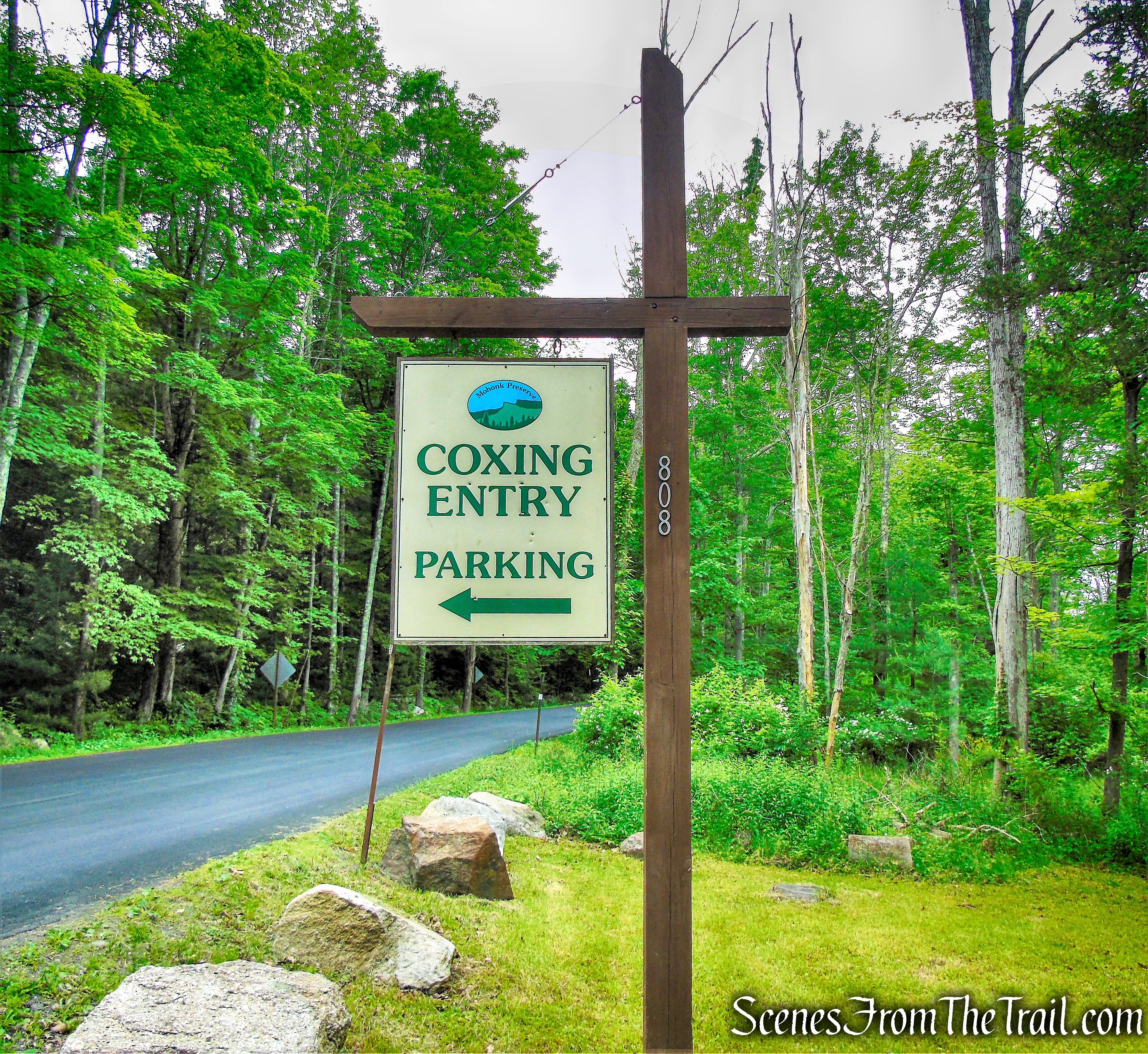
Trailhead parking: Mohonk Preserve Coxing Trailhead – Gardiner, NY 12525
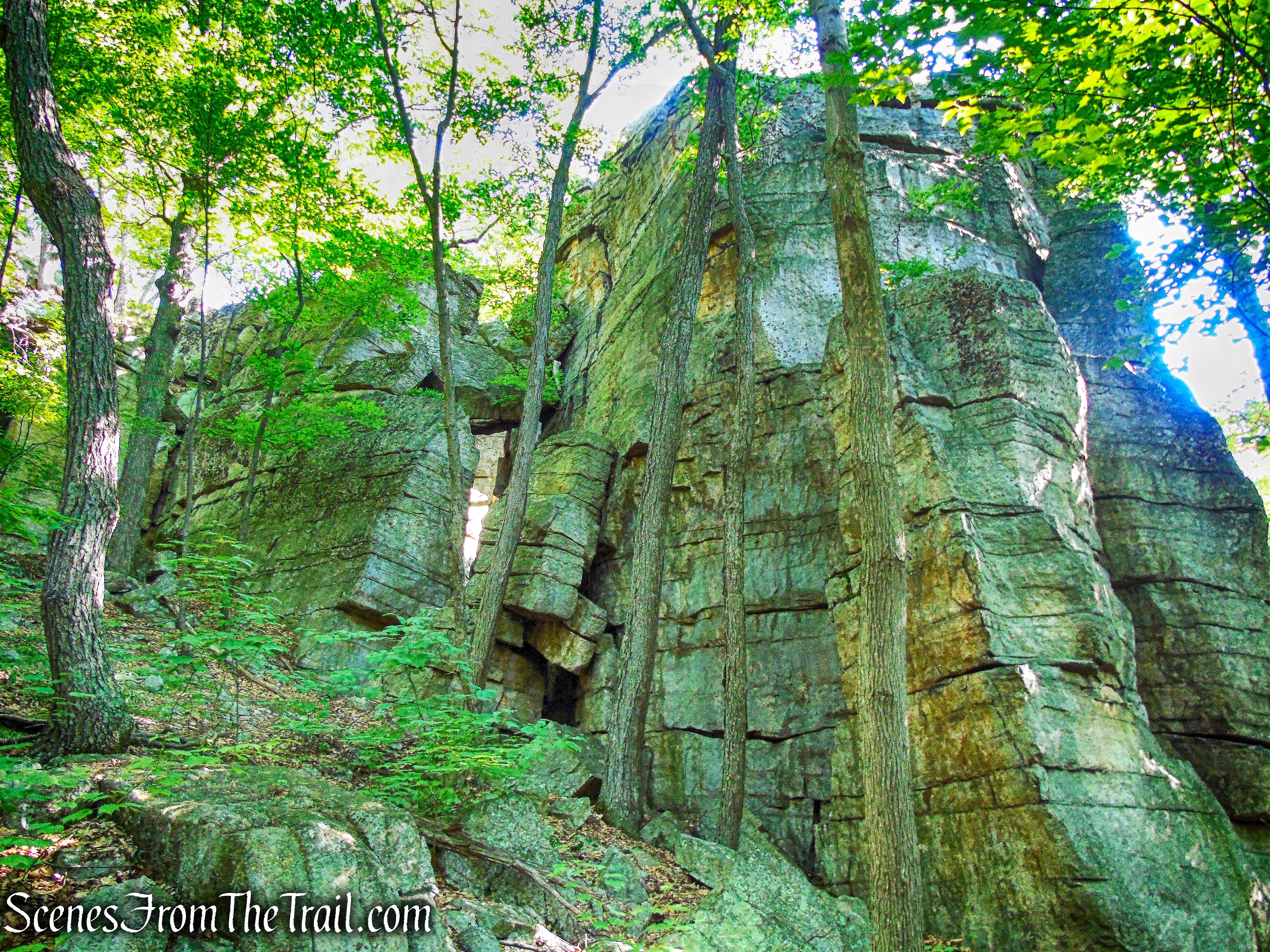
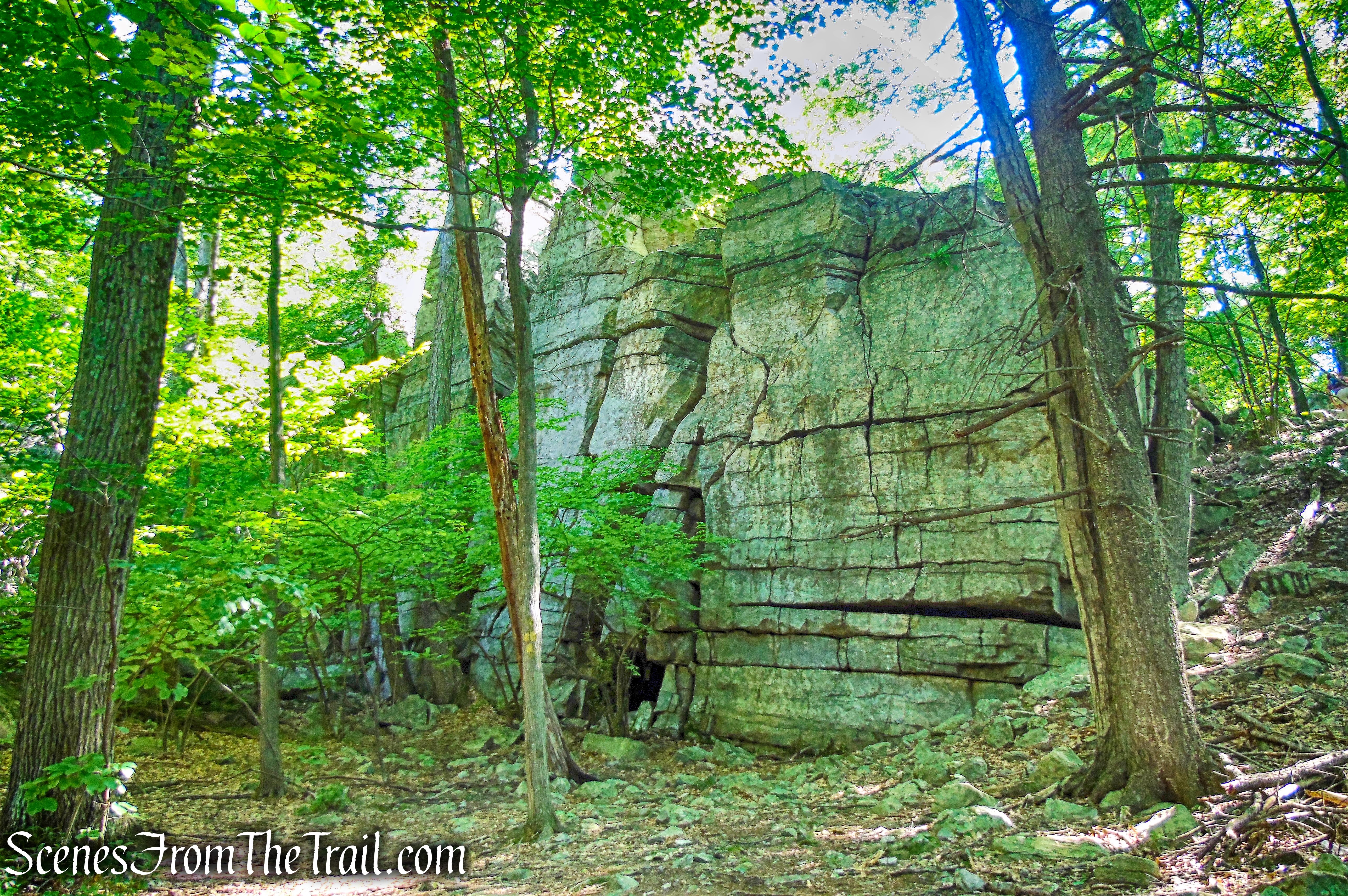
The Lost City is a line of cliffs with glacially created vertical fractures. They resemble a city skyline when viewed from a distance. The Lost City area offers a series of crevices and boulders similar to the well-known Lemon Squeeze of the Mohonk Mountain House. Like the Lemon Squeeze, it requires the use of hands and feet to traverse the talus field which leads up the cliffs.
Lost City
I had heard about the Lost City, but there isn’t a lot of info online, so I decided to go check it out and play it by ear. My intention was to go with someone that had hiked it before. Since there is no blazed path through the talus fields and crevices, I didn’t want to climb and crawl through tight openings and end up at a dead end atop a monolith. Recently I hiked nearby and did the High Peter’s Kill and Millbrook Ridge Loop. While on that hike, I walked briefly on an unmarked trail along the edge of the cliffs. I wanted to see if that trail continued to the top of the Lost City cliffs. As it turned out, the trail did indeed run along the top of the cliffs, from Lost City to the High Peter’s Kill Trail. The people that I went with had never hiked the Lost City and I only found that out once we were at the base of the cliffs. Since none of us knew a precise route up to the cliffs, this hike turned into a short loop, but was still a really good hike.
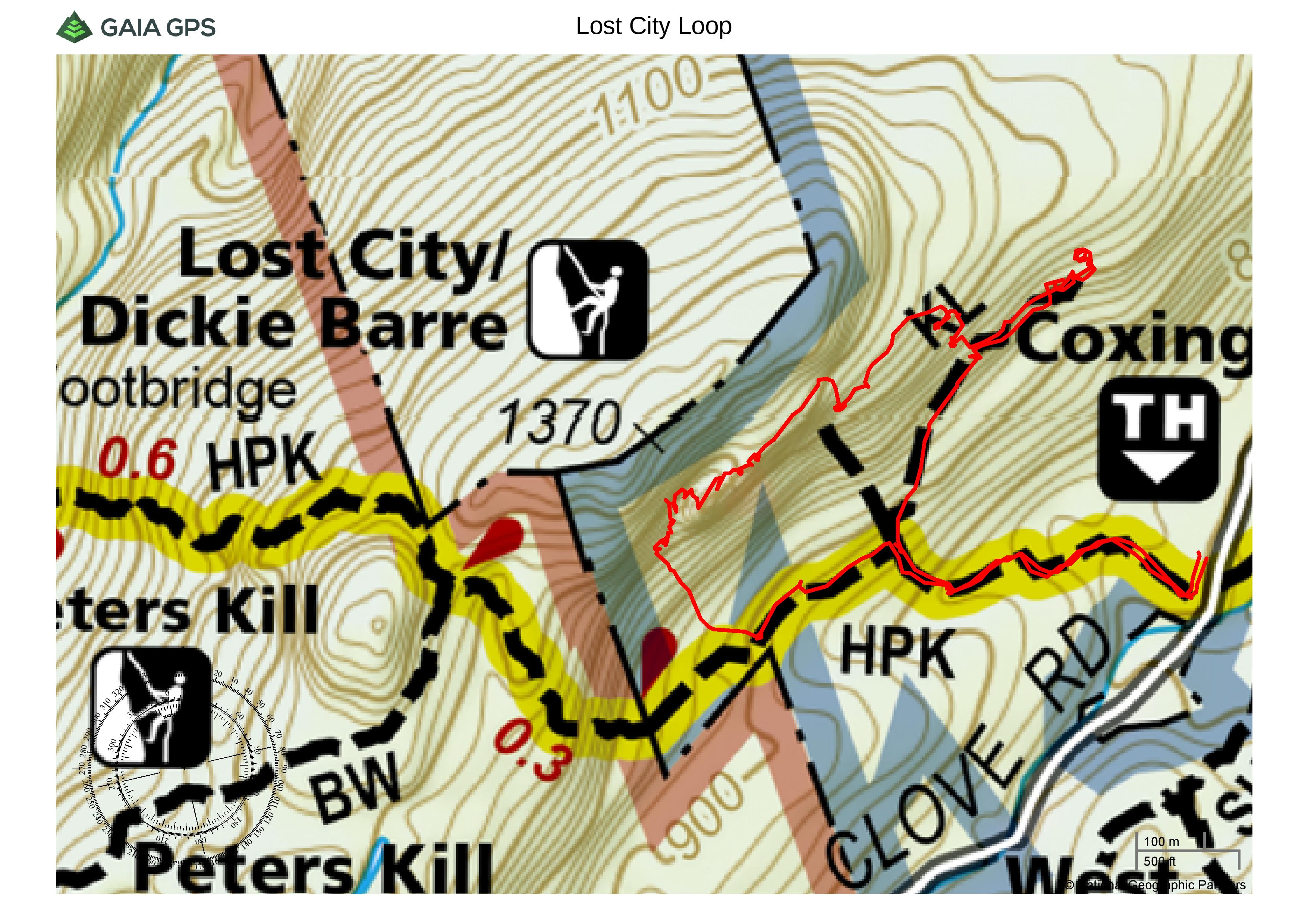
Lost City Loop – Mohonk Preserve
A new feature that I have added is the Google Earth Fly-Through. It follows the path that we hiked and it gives you a good idea of the terrain, layout, amount of parking etc. Check it out, it’s pretty cool.
View the Google Earth Fly-Through video of the hike below.
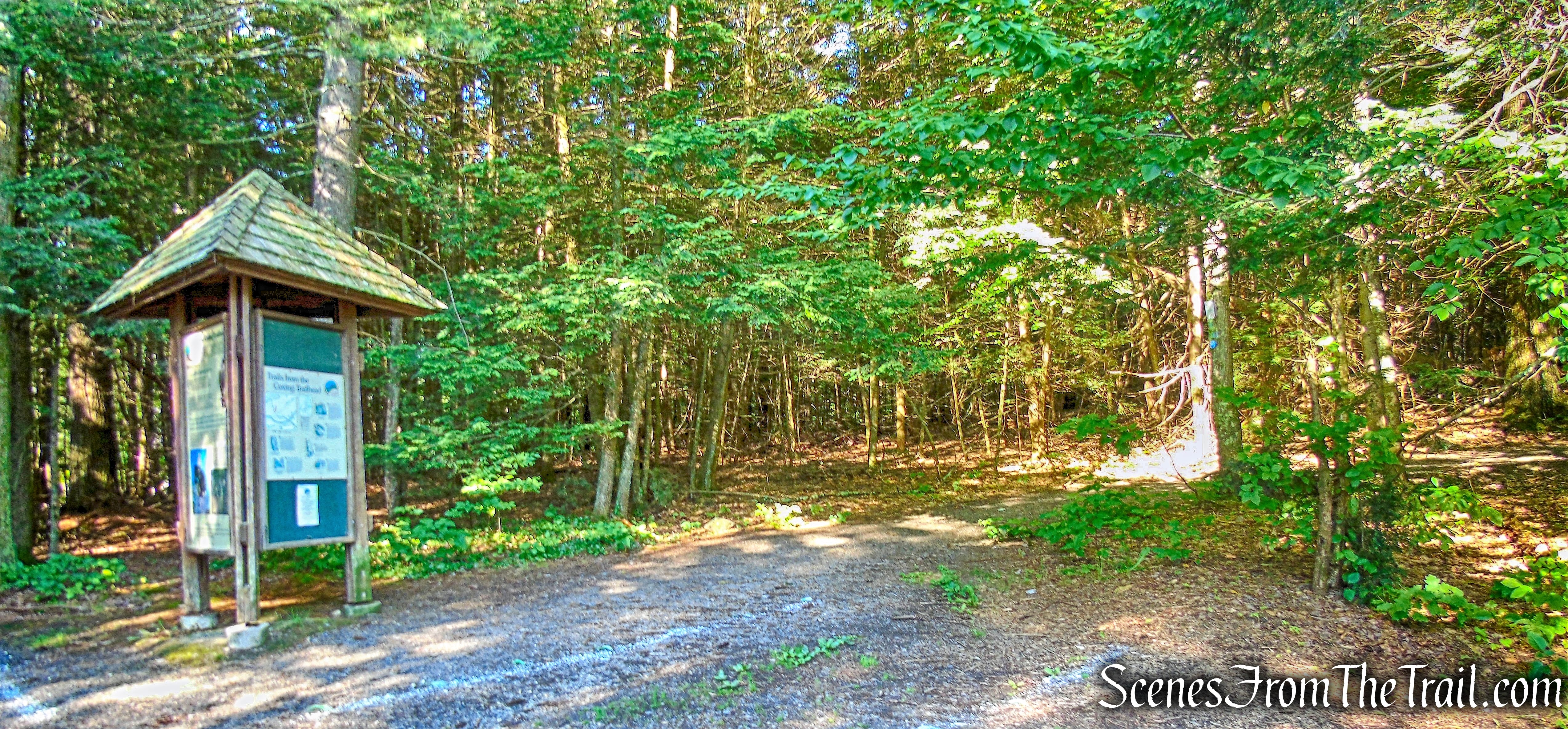
We arrived at the Coxing Trailhead at about 8:30 am on a Saturday morning.
Coxing Parking Area
There were about a dozen cars in the lot when we arrived, but as is always the case on weekends at Mohonk Preserve, the lot fills up quickly. At the southern end of the parking area, there is a kiosk, which marks the start of the light-blue-blazed High Peter’s Kill Trail. This is also the route of the blue-blazed Shawangunk Ridge Trail (SRT).
High Peter’s Kill Trail – Coxing Trailhead
The High Peter’s Kill Trail follows a woods road.
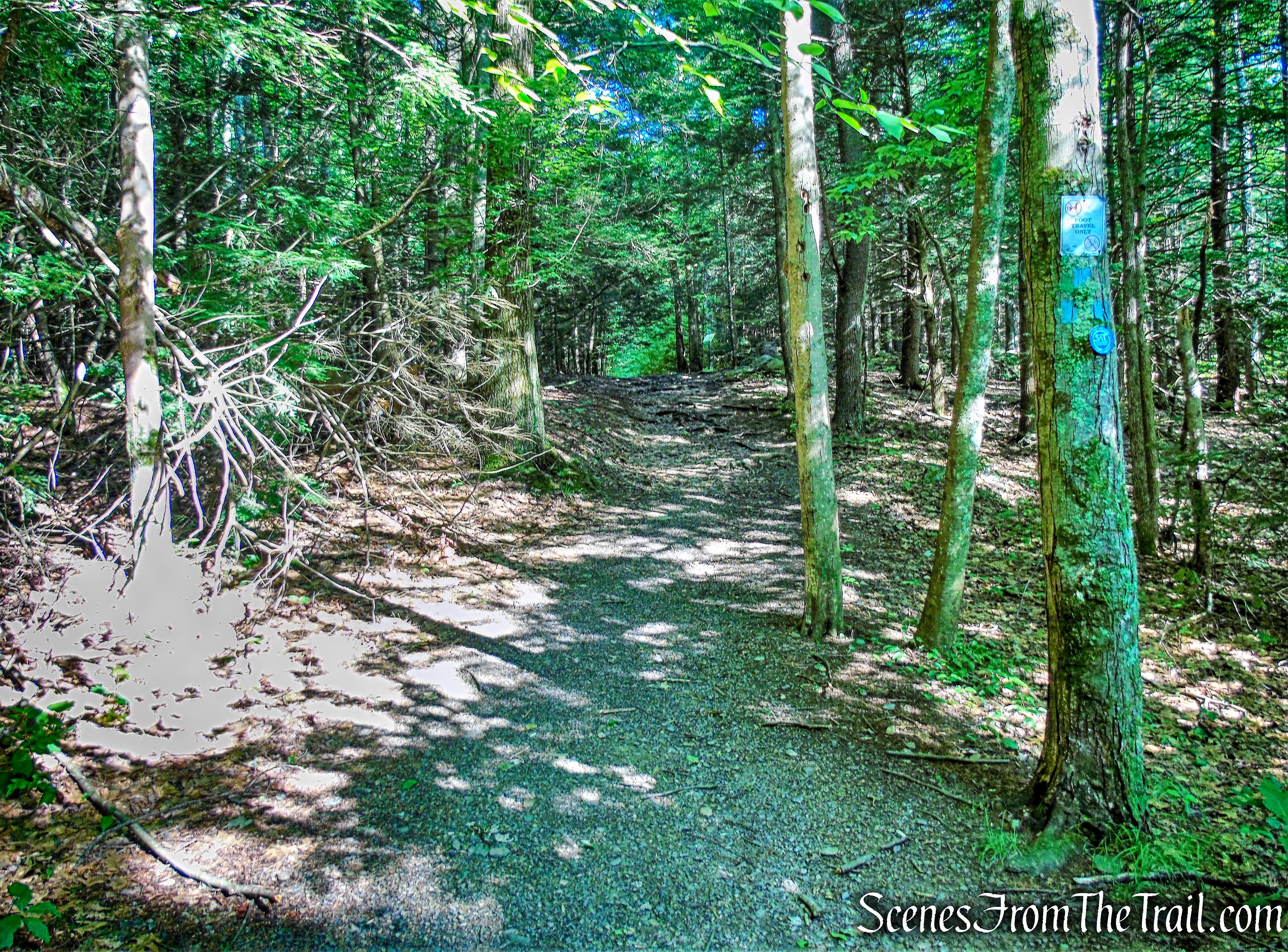
High Peter’s Kill Trail
In a short distance, the trail passes the Enderly Burial Ground on the right.
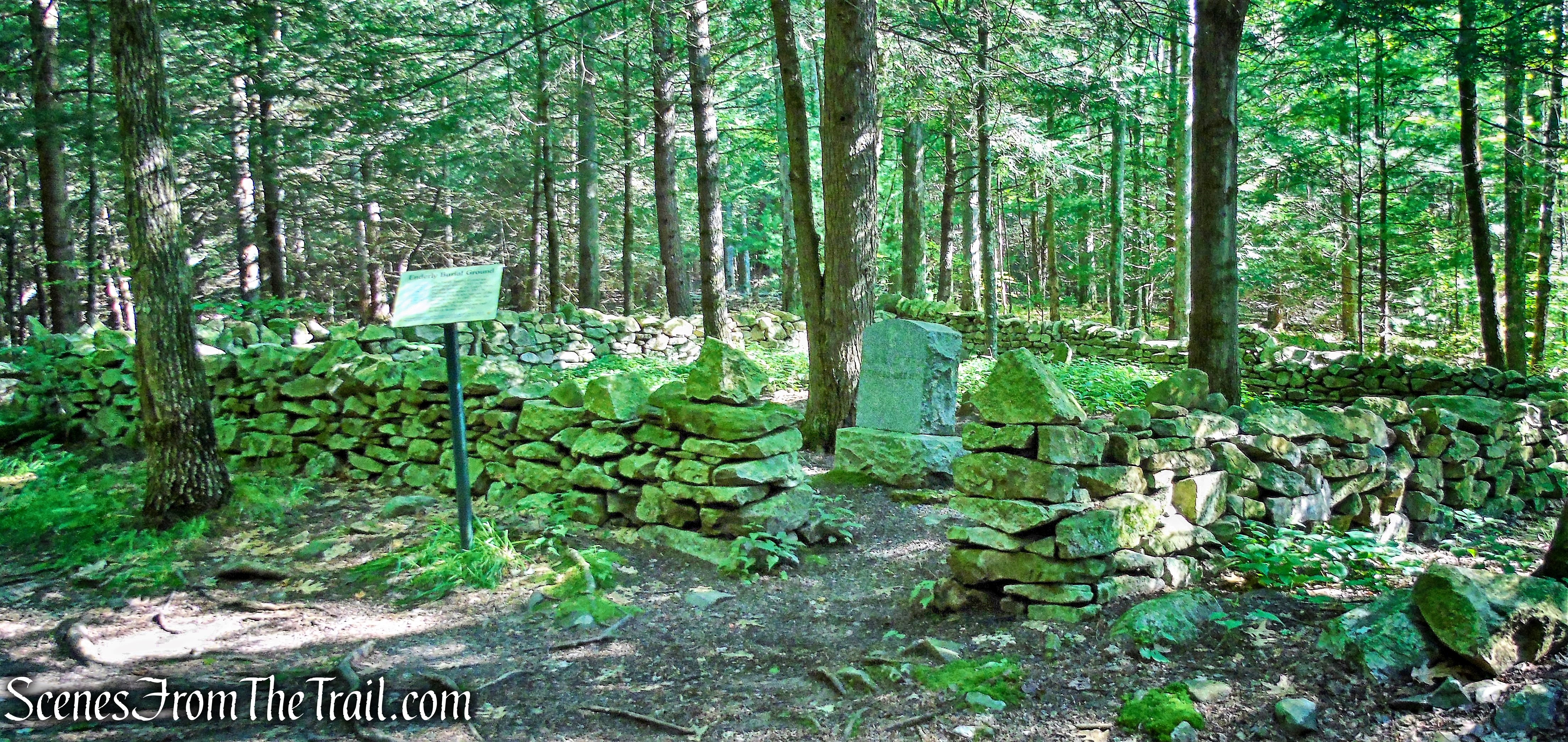
Enderly Burial Ground
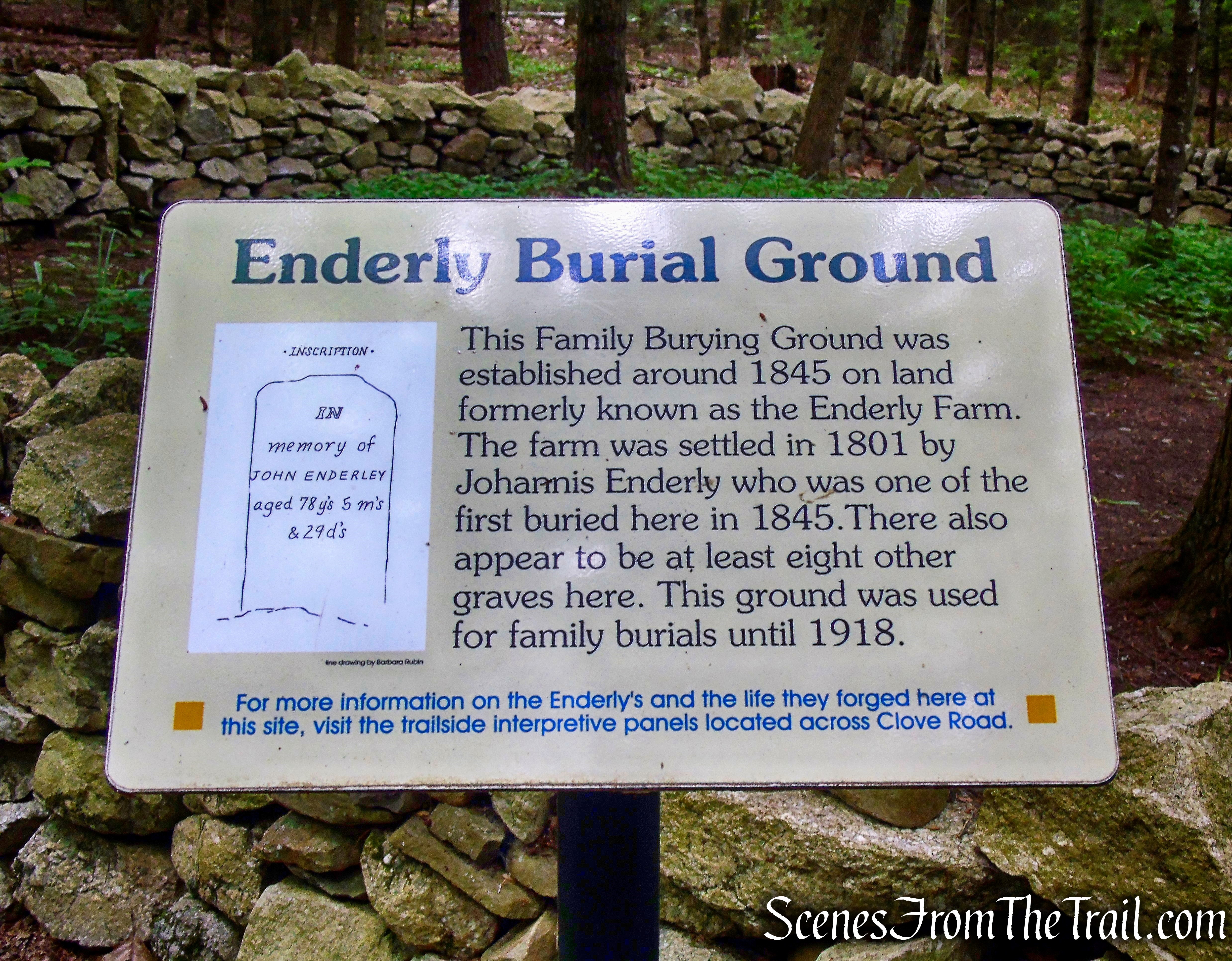
Enderly Burial Ground
The trail then crosses a wet area on a boardwalk and continues through a hemlock forest.
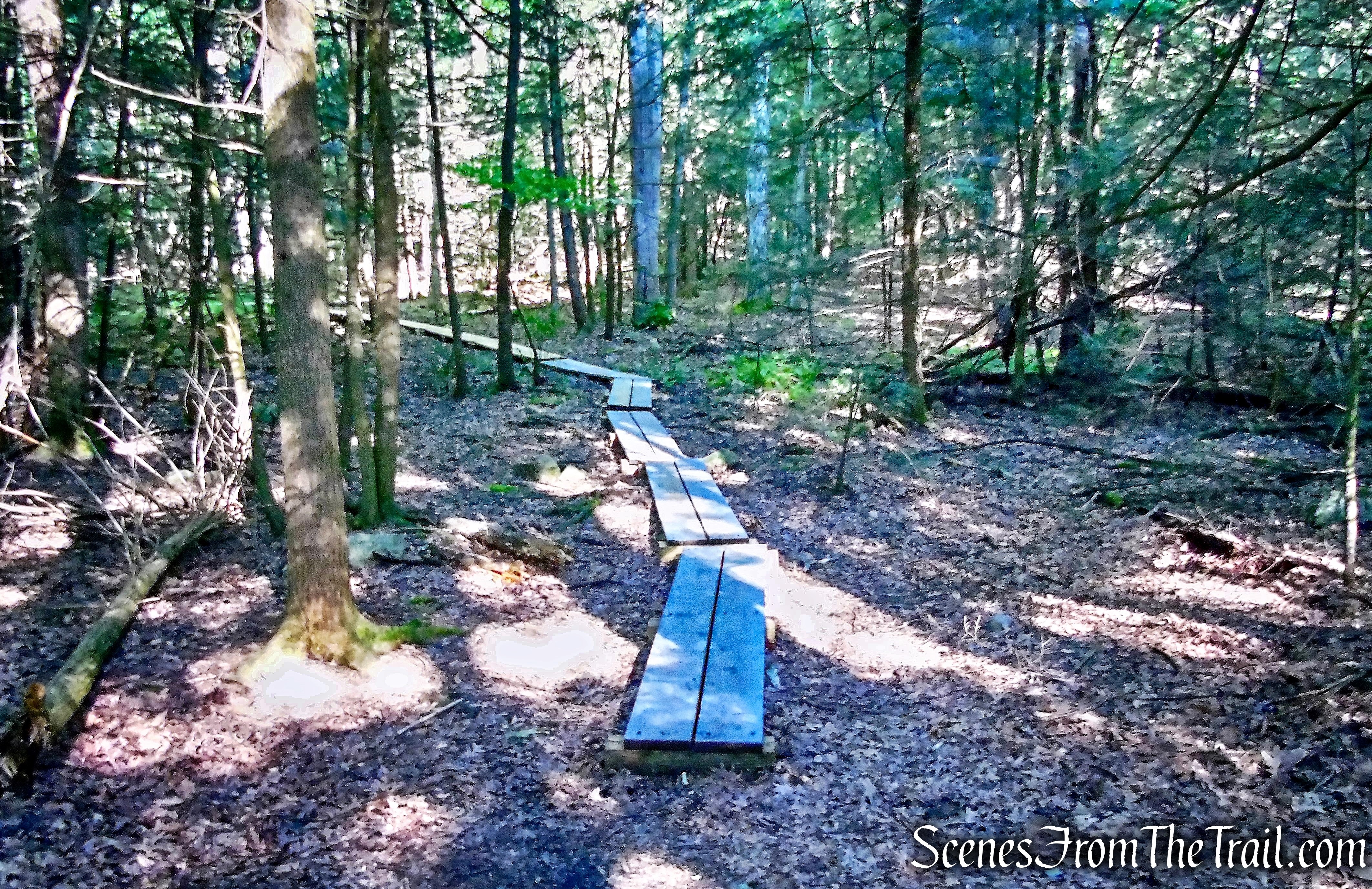
High Peter’s Kill Trail
After crossing a stream on a wooden bridge, the trail begins a gentle climb, paralleling the stream for a short distance. It then crosses the stream on rocks and bears right, away from the stream. A short distance later, we came to a junction with the yellow-blazed King’s Lane Trail, which continues straight ahead.
King’s Lane Trail
King’s Lane is an old woods road, once used for hauling loads of conglomerate to be made into grindstones. The road now serves as a path for rock climbers to reach the cliffs of The Lost City.
King’s Lane Trail
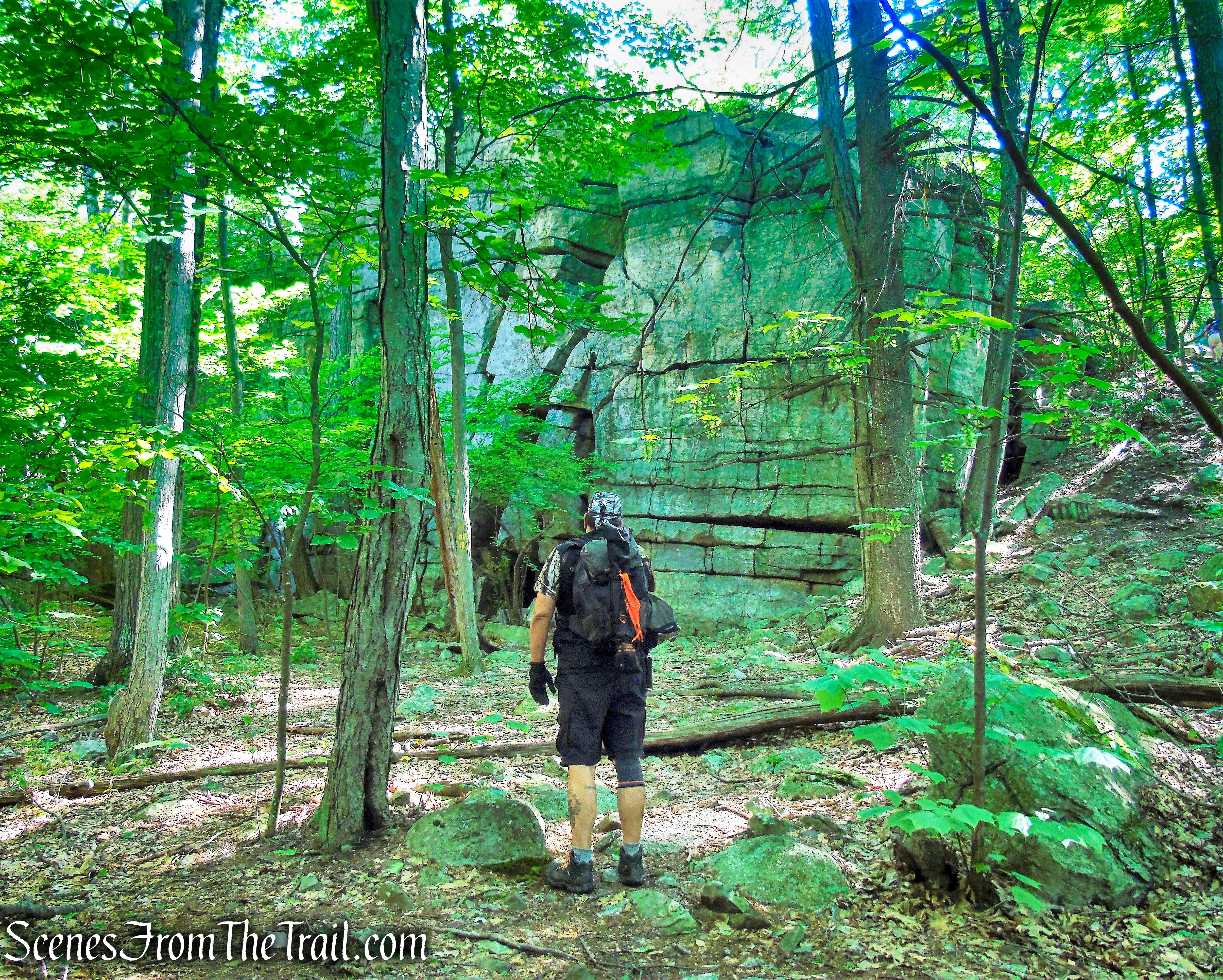
The road leads gradually uphill, with the cliffs visible through the trees on the left. We walked on King’s Lane for about 550 yards, to its terminus. We passed a few side trails on the way up, but continued to the end, trying to figure out which was the best way to go. We reached a clearing and we left the trail to approach the cliffs and have a look around.
Lost City
It was eerily quiet and not knowing which way to go or if even we were in the right place, made me a little uneasy. I like to plan things out and study the route before I head anywhere I haven’t been. The imposing cliffs in front of us had many openings and hiding places for critters, which didn’t make me feel any better. I didn’t want to climb into a bear or snake den.
Lost City
Lost City
I wanted to feel the place out before we started exploring in depth, so we found a path around a large rock formation and climbed up top for a better vantage point.
Lost City
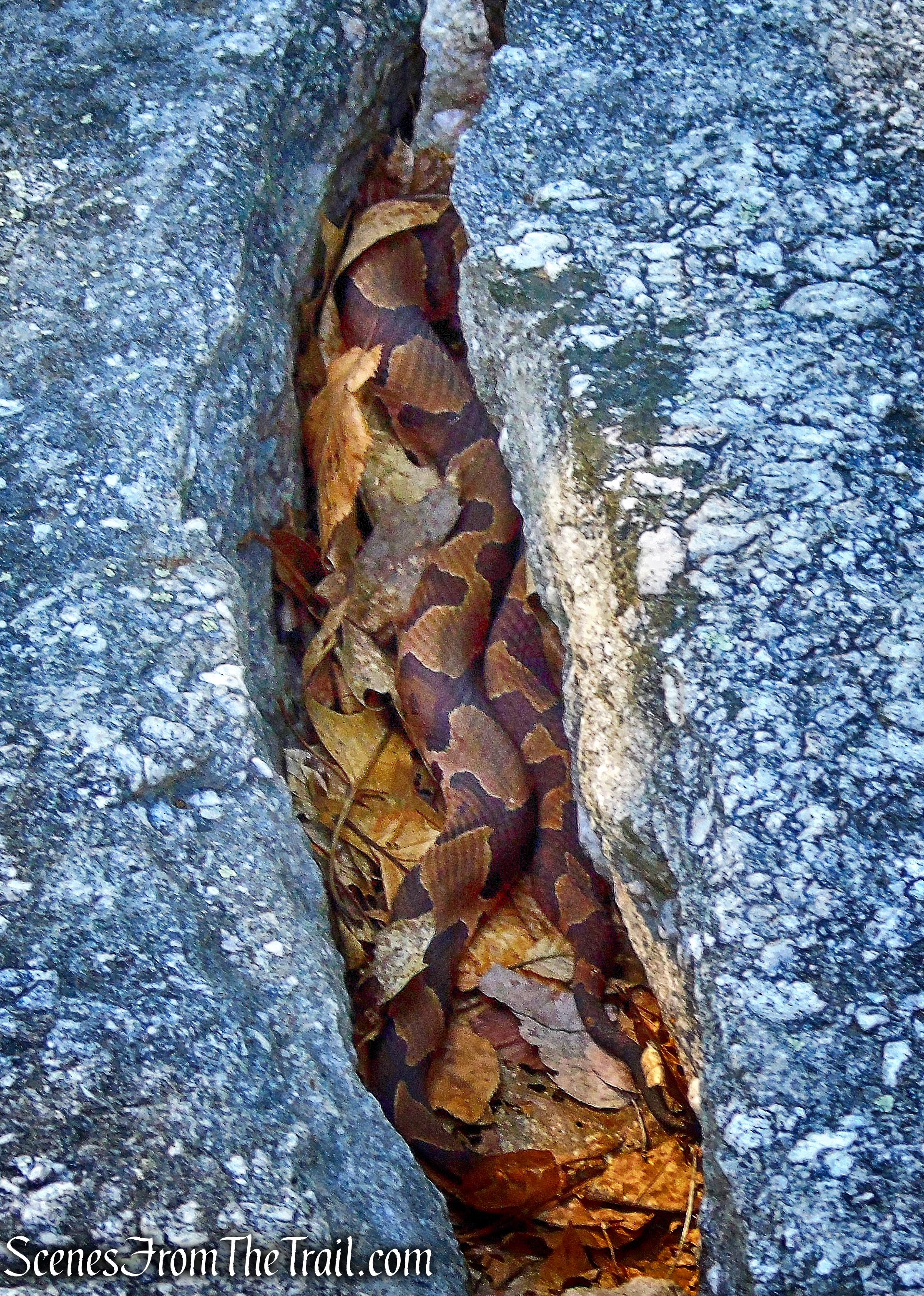
As soon as we got to top, one of my colleagues sat down right beside this Copperhead and immediately jumped up. It was nestled in a crack in the rock and very nicely camouflaged among the leaves. It appeared to have just finished shedding.
Copperhead
Needless to say, after that encounter, we were all a little hesitant about crawling through any tight spaces. We made our way back down and retraced our steps on King’s Lane, passing different rock formations with all kinds of nooks and crannies.
Lost City
We walked up another side trail that we had passed earlier and found a gap in the cliffs. There is a path leading up the side that climbs rather steeply. We decided to take that route.
Lost City
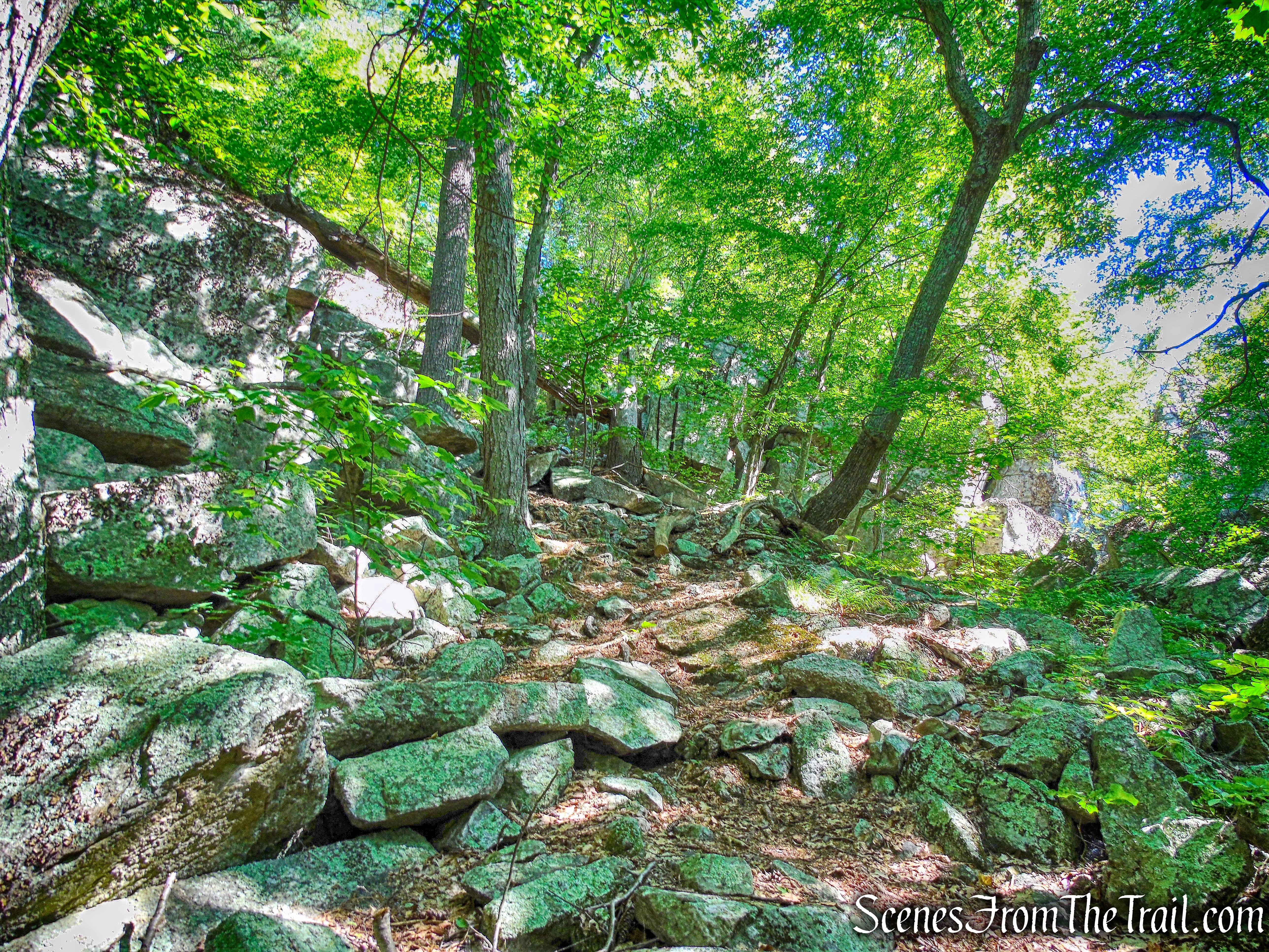
We began following a faint path that heads southwest atop the cliffs.
unmarked path atop the cliffs
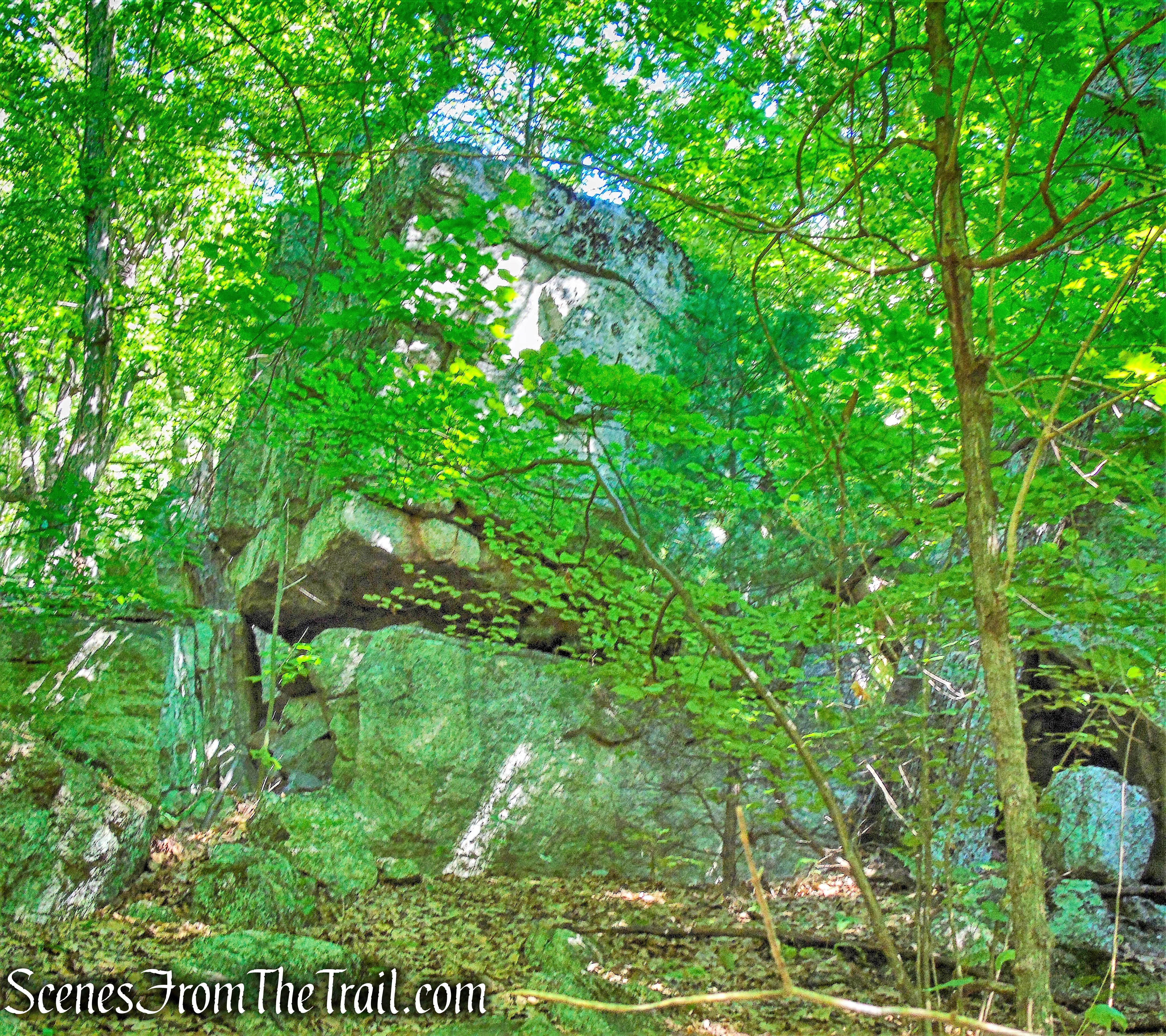
We stopped to examine the fissures in the cliffs.
fissure in the cliff
As we walked along the edge of the cliffs, views opened up. Looking southeast, to the left of the narrow notch is The Trapps and Millbrook Mountain is on the right.
The Trapps and Millbrook Mountain
Looking northeast, Skytop Tower is visible in the distance.
looking northeast
Looking straight down from the edge of the cliffs, possibly a route up.
Lost City
Walking along this unmarked path on the edge of the cliffs was really enjoyable. The scenery in this area is exceptional.

Lost City
Looking down one of the fissures of The Lost City.
Lost City
We continued heading southwest, stopping occasionally to take in the views.

Lost City cliffs
The beauty of this area is that we did not encounter any other hikers from the time we got on King’s Lane.
Lost City cliffs
We decide to stay along the edge of the cliffs rather than follow the path that led away from it. We then began to descend steeply, scrambling down some giant boulders and talus fields. We passed many more crevices on the way down.
Lost City
This massive monolith looks like a skyscraper.
monolith – Lost City
Even though we didn’t do the rock scrambling and crevice exploration that we expected when we set out on this hike, the downhill scramble was fun.
Lost City
Climbing over the massive boulders on our way down.
Lost City
Since there is no set path, we just figured out the best way down.
Lost City
Lost City
When we cleared the talus field, we bushwacked through the woods until we reached the High Peter’s Kill Trail. Here we turned left and headed northeast.
High Peter’s Kill Trail
When we reached the junction with King’s Lane, we turned right to remain on the High Peter’s Kill Trail.
High Peter’s Kill Trail
We then retraced our steps along the light-blue-blazed High Peter’s Kill Trail until we reached the Coxing Trailhead, where our hike began.
Coxing Trailhead
After we completed the hike, we took an obligatory walk over to Split Rock and relaxed a bit. It was quite crowded at noon when we arrived there, but nonetheless a gorgeous spot.

Split Rock
Although this was supposed to be more of an exploration of The Lost City than an actual hike, I have no regrets. My hikes are never written in stone and I can adapt and improvise whenever necessary. Bottom line is that as long as I am in the woods or on a mountain top, it’s a good day. I now discovered new areas to roam and I fully expect to be back soon and fully explore. The walk along the cliffs and the downhill scrambling were very enjoyable.
Pros: Lost City, cliff walk, views, rock scrambling, The Gunks.
Cons: Copperhead snake.
Take a hike!
Lost City Loop – Mohonk Preserve
Source:

I was looking for a description of this hike & you delivered! Stunning photos, excellent narrative. Thank you for the legwork in finding a most unique niche.
LikeLike