March 27, 2021 – Sharon, Connecticut
Difficulty: Moderate
Length: Approximately 4 miles
Max elevation: 1,302 ft.– total elevation gain approximately 768 ft.
Route type: Double Stem Lollipop Loop
Maps: Red Mountain Trail System
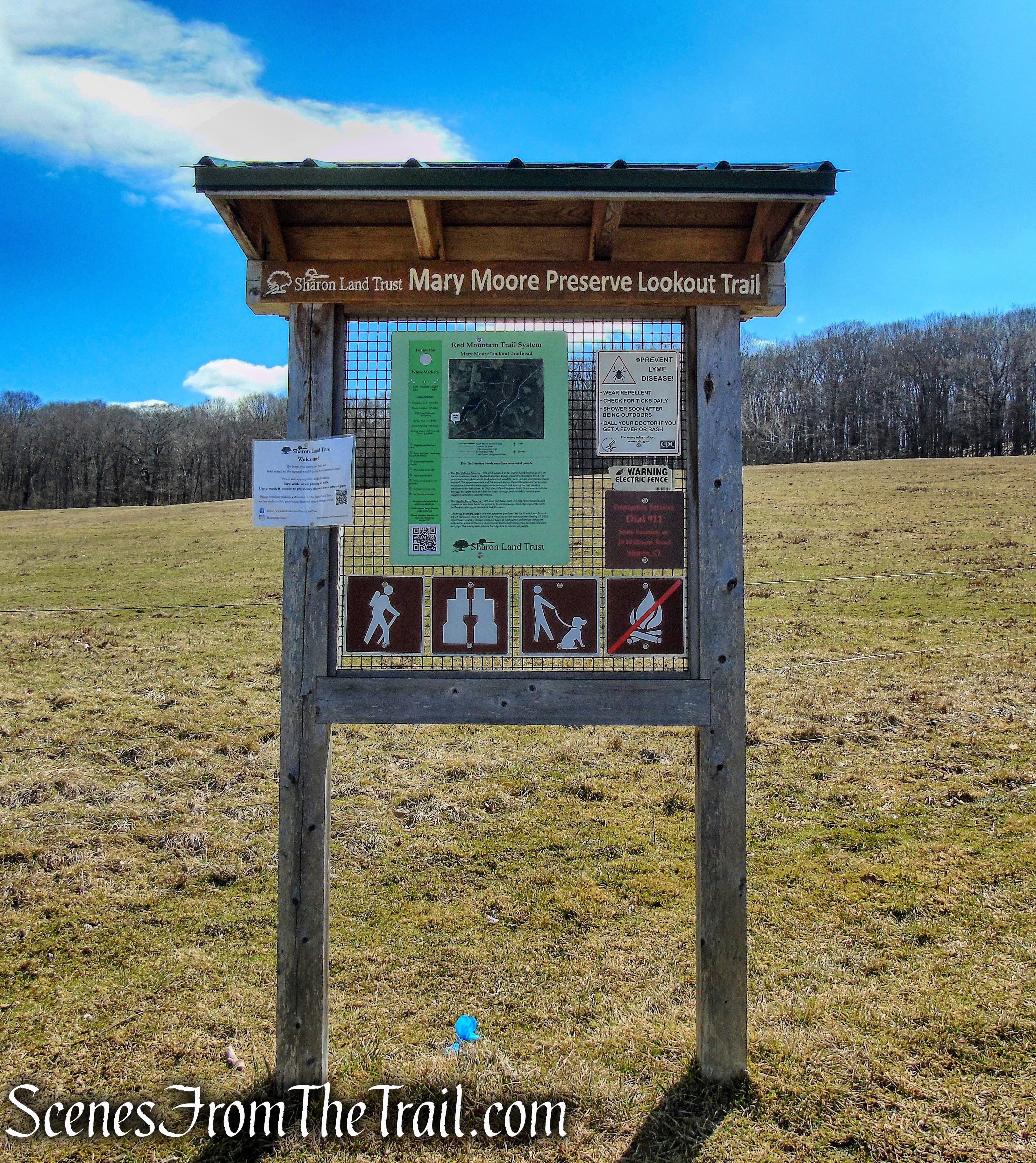
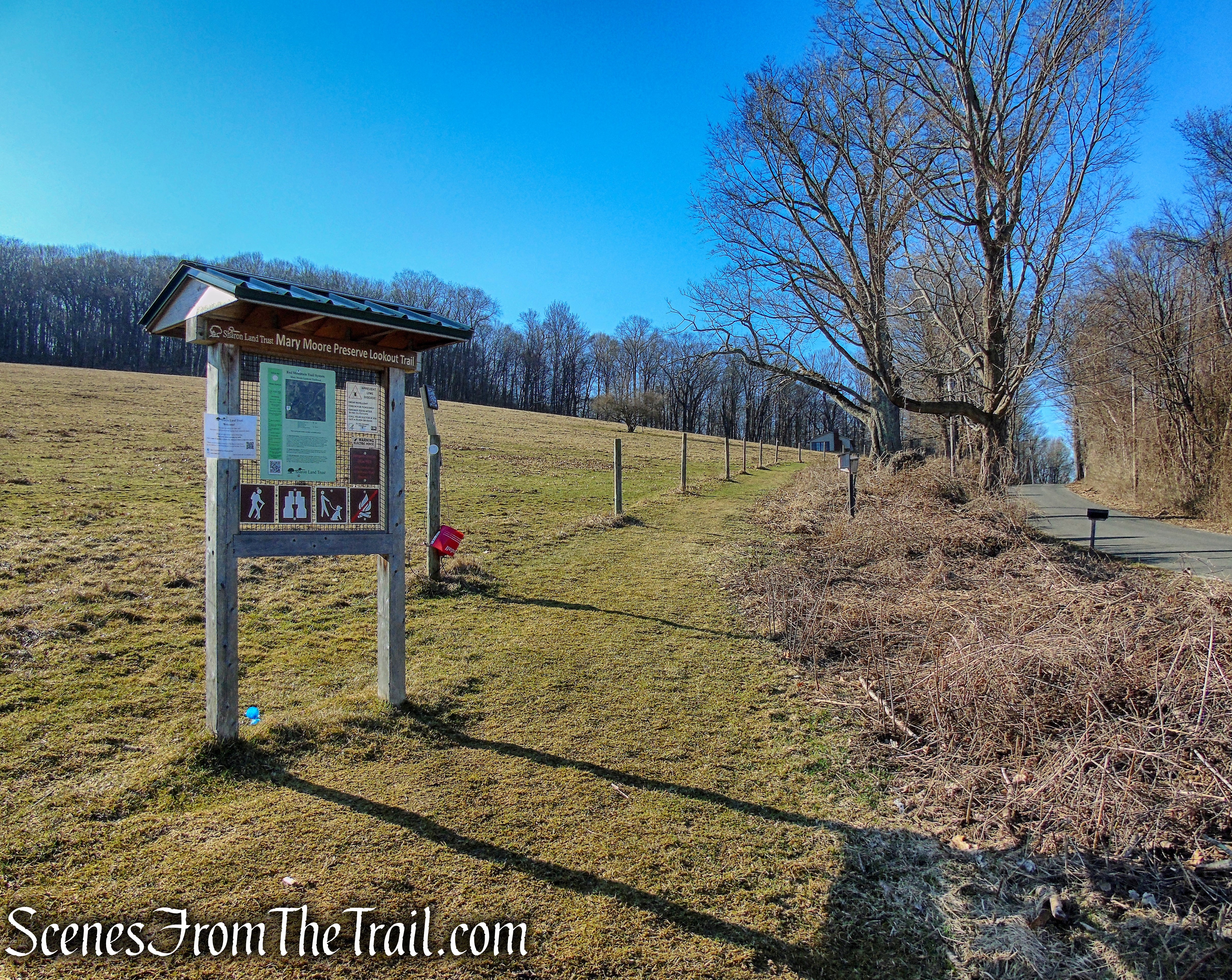
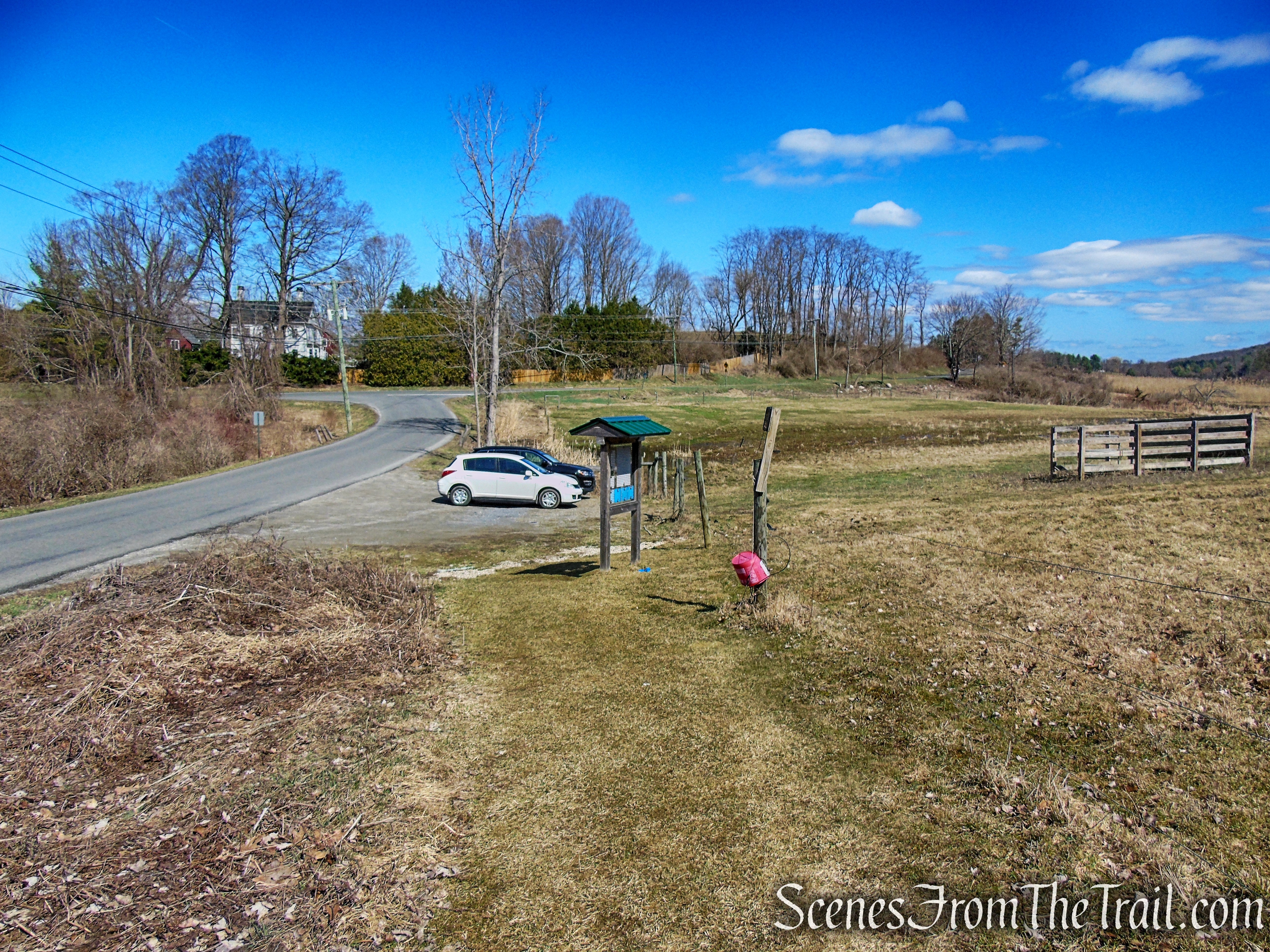
Trailhead parking: Mary Moore Preserve Trailhead – 24 Williams Rd, Sharon, CT 06069
Overview:
Nestled in the southern foothills of the Berkshires, the topography of Sharon, Connecticut in Litchfield County, is one of its most memorable and recognizable features. Ranging from hilltops to hollows; its high fields and steep hillsides create a diversity of special character. Varying slopes and terrain increase the apparent extent of the landscapes. Intricate, inward-oriented hollows lie in contrast to expansive, outward-viewing hilltops and ridgelines.

Mary Moore Preserve – Sharon Land Trust
Red Mountain is one of four principal ridgelines in Sharon which run northeast to southwest. The trail system travels over three Sharon Land Trust parcels over the Red Mountain Range.
- Mary Moore Preserve ~ 181 acres donated to the Sharon Land Trust in 2013 is on the southwestern reach of the Red Mountain Range adjacent to Beardsley Pond. The parcel includes upland shrub land, advanced meadow, farm pasture, and stream/marsh wetland. The upper meadows and the summit area in the northeastern corner provide exceptional views that encompass three states and rank among the best viewing positions in the Berkshires. In 2020, the cliff trail loop was built. It is a wonderful hike through the upper field and into the forest, through boulder fields, ravines, past beautiful cliffs and a seasonal stream.
- Wike Brothers Farm ~ 268 acre easement purchased by the Sharon Land Trust & the CT Farmland Trust in 2010 & 2014. Funding for the purchase provided by CT DEEP Open Space Grants, Federal Grants, CT Dept. of Agriculture and private donations. Wike Farm is one of Sharon’s oldest family farms supporting grass-fed beef, chickens and pigs. This trail system follows the ridge line to connect all parcels.
- Hamlin Farm Preserve ~ 259 acres purchased with an Open Space Grant in 2002 consists of two farm fields but primarily forest that ranges from the edge of the farm fields east to the upper reaches of Red Mountain.
Please note: There are no signs within the interior of the preserves indicating when you are leaving or entering any of the properties.
There are two access points to the trail system. The main entry point is at the Mary Moore Preserve on Williams Road where there is space for approximately 4 vehicles. The other access point is at the end of Stone House Road, the trailhead for the Hamlin Preserve that has a slightly larger parking area.
Trails Overview:
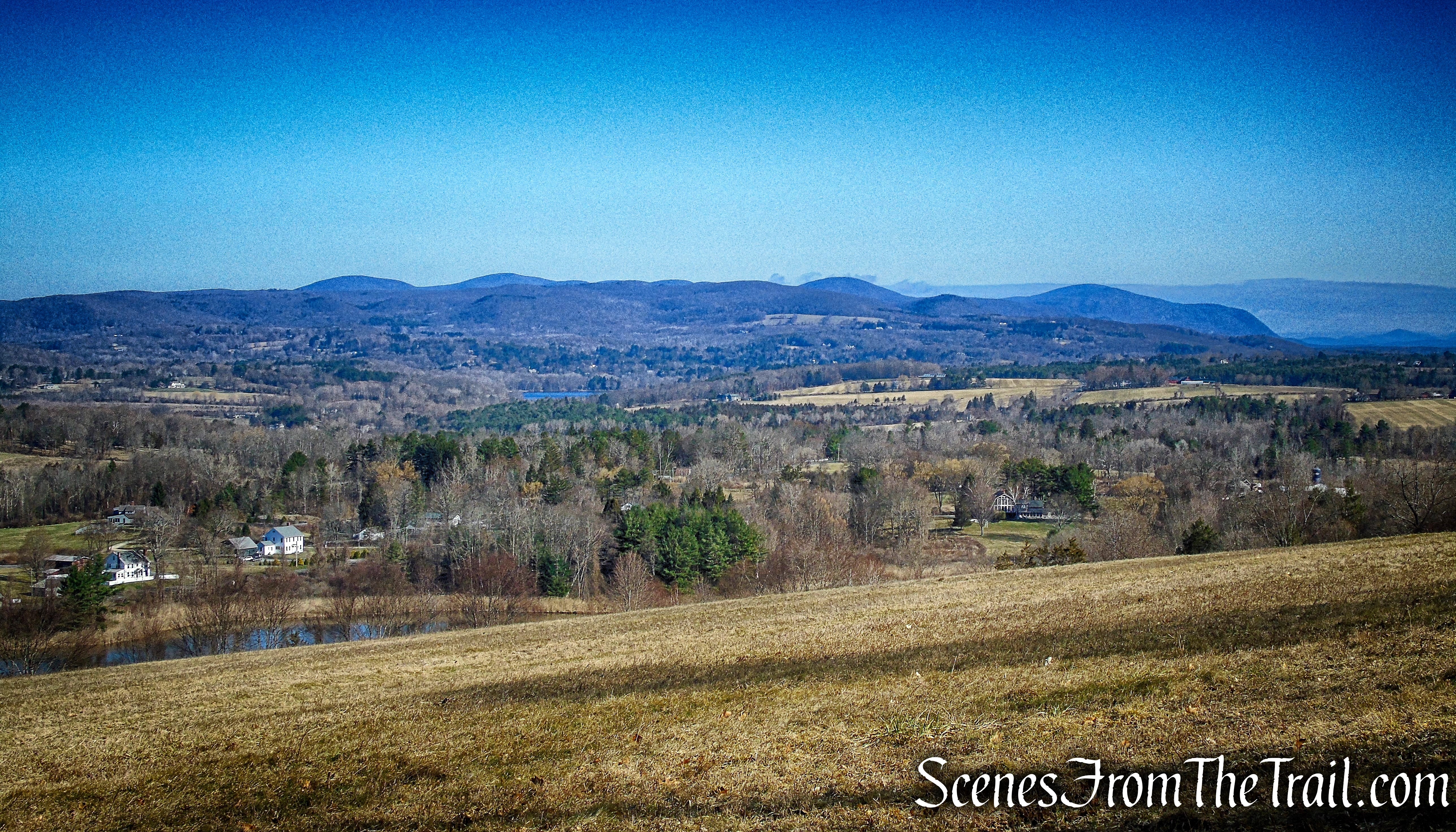
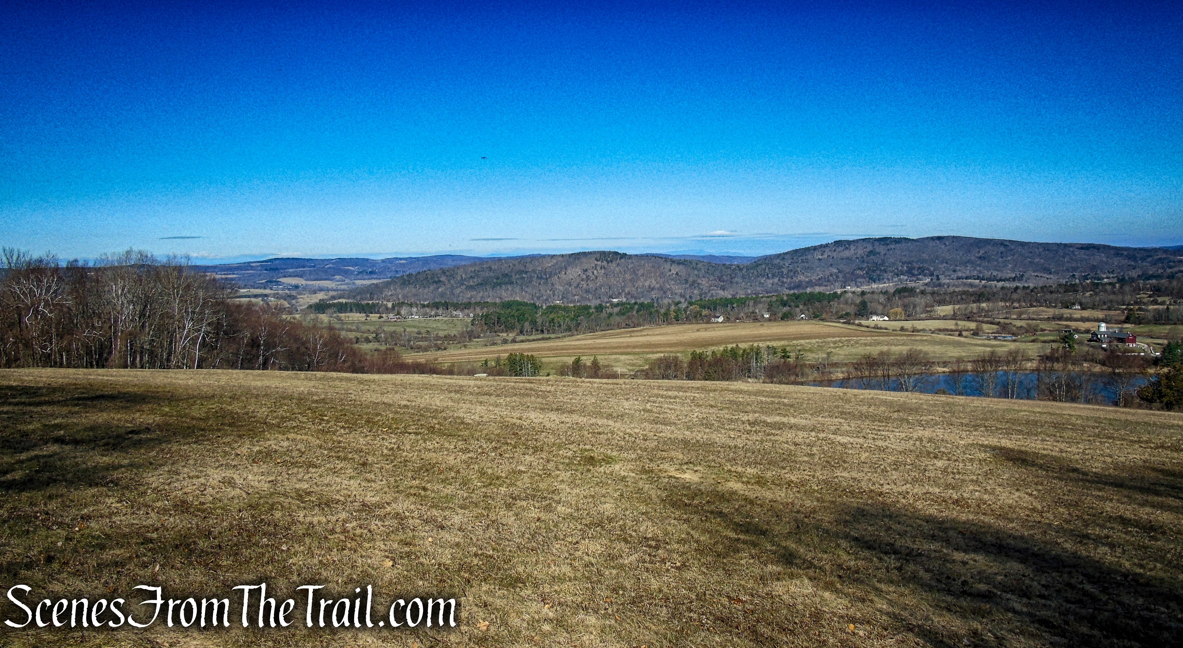
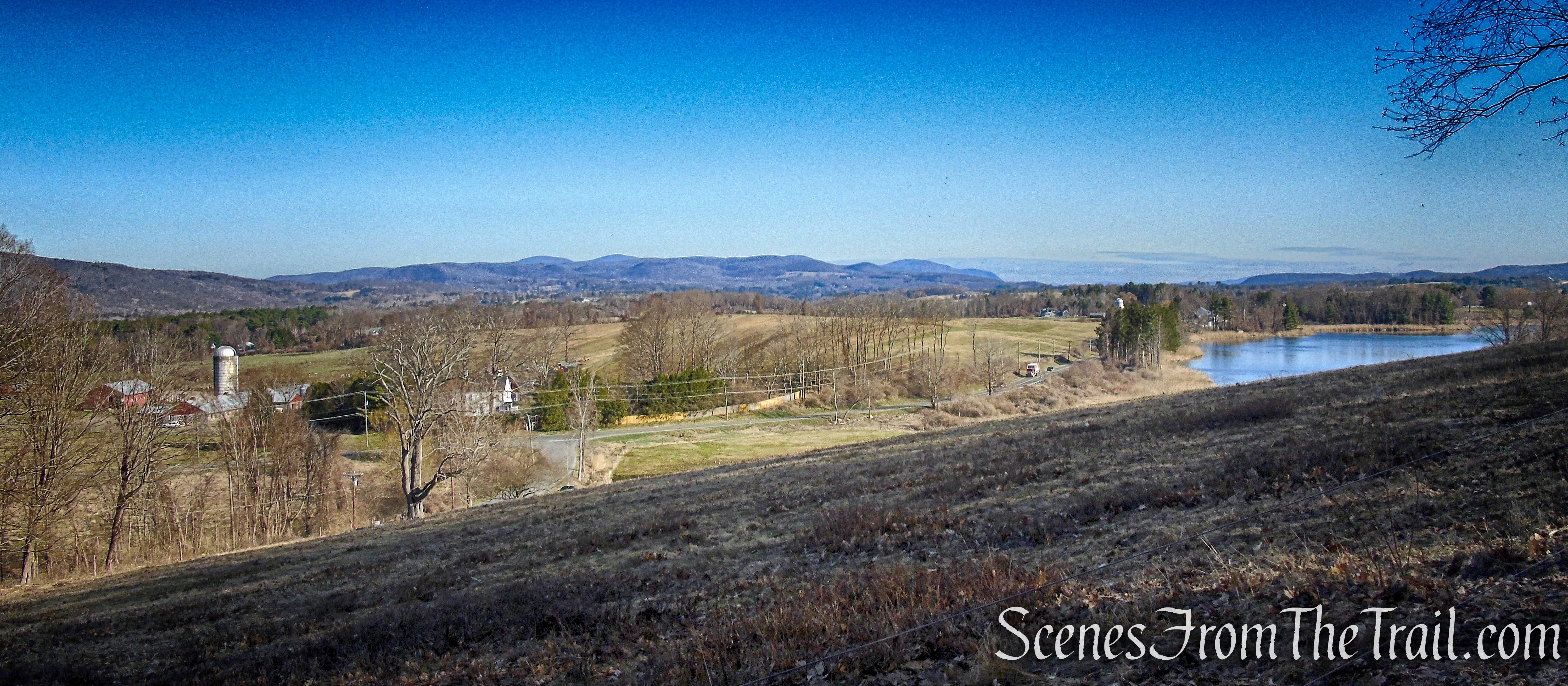
There are currently over 4 miles of trails throughout the three preserves, with more trails currently being constructed as of March 2021. Starting at the Mary Moore Preserve, the trail climbs the southwestern reach of Red Mountain, through sloping meadows and second growth forest. The trail then traverses the ridgeline to the upper reaches of Red Mountain in the Hamlin Preserve. Along the way, the trail passes what is known as the upper meadow affording hikers with stunning views of farm fields, hills and mountains on the western horizon. The upper meadows and the summit area in the Mary Moore Preserve provide exceptional views of the South Taconic Mountains of Massachusetts, Connecticut and New York.
Mary Moore Lookout
A point to point hike from one trailhead to the other is approximately 3 miles. An out and back from one trailhead to the other is approximately 6.6 miles. A shorter lollipop loop from the Mary Moore Preserve trailhead, using the new Cliff Loop Extension is approximately 2.5 miles. A simple out and back to the Mary Moore Lookout is about 1.5 miles. The latter two, seem to be the more preferred routes of visitors seeking a shorter hike with a view.

Red Mountain Trails – Sharon Land Trust
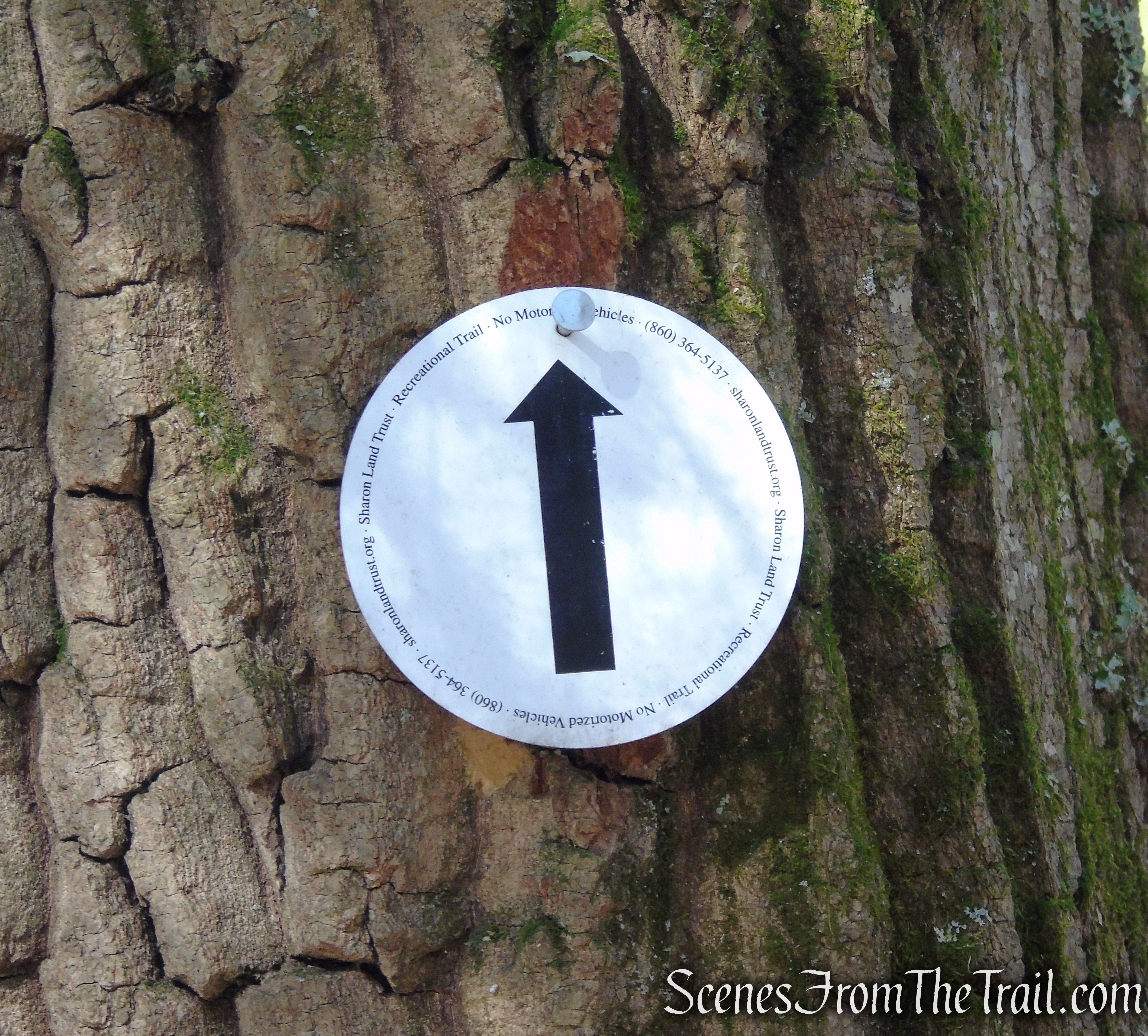
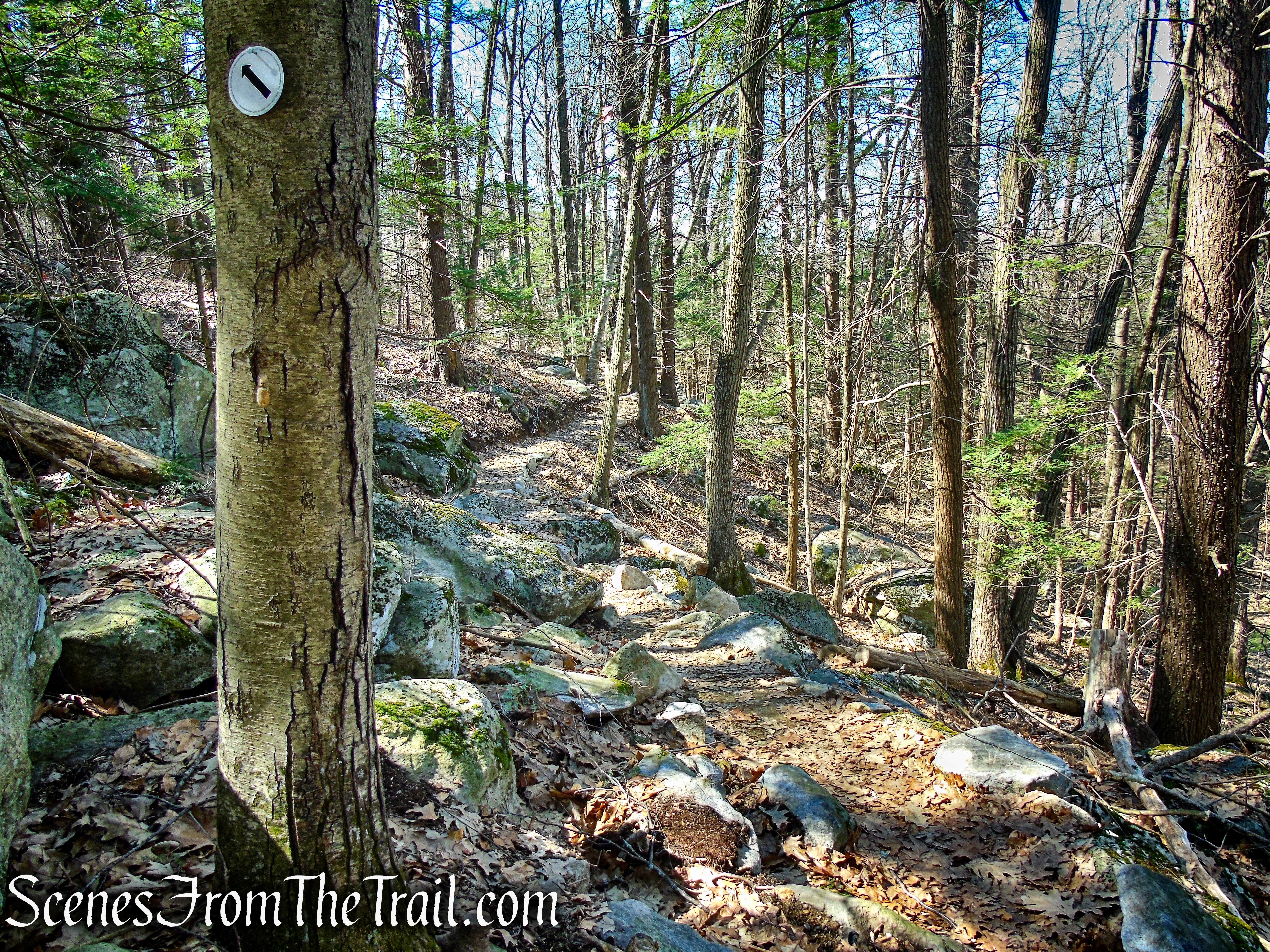
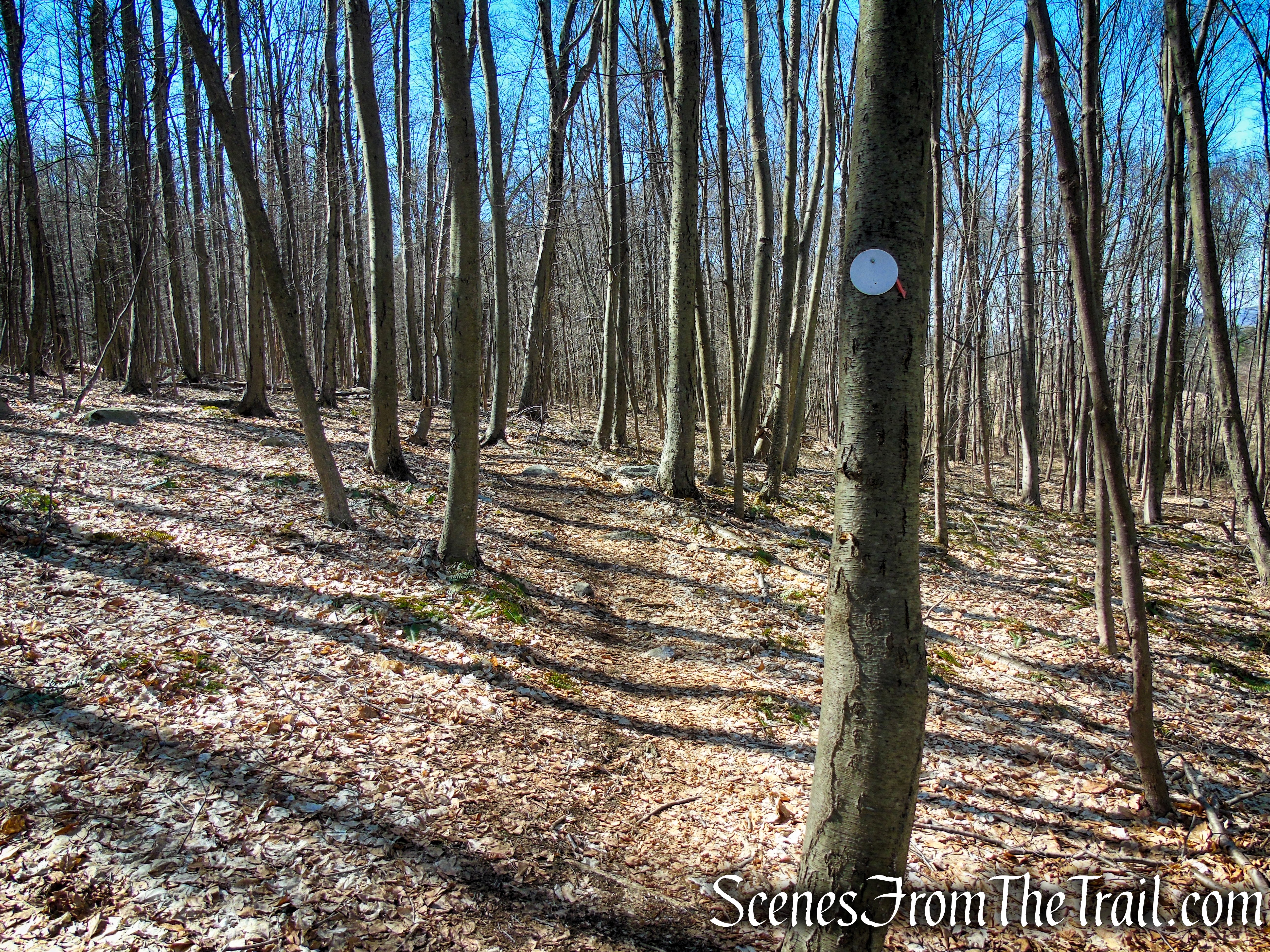
Although the map shows the trails in different colors and names to distinguish them from one another, they are all blazed white, with the exception of the newly added Cliff Loop Extension (shown as green on the map). If hiking the entire trail system it’s basically an out and back if starting at either trailhead or a point to point if you have a vehicle at each trailhead. The new section of trail (completed in the summer of 2020) is marked with round white discs that have directional arrows in the center and can be used to complete a semi loop.
Cliff Loop Extension – Red Mountain Trails
The Red Mountain Trail System is managed and maintained by the Sharon Land Trust.
Hike Overview:
Always scouring the internet for new places to hike, I ran across this one on another hiking blog. The images of the views was enough to convince me to give it a try. Although the last viewpoint, is about a 3/4-mile into the hike, the rest of the hike was worth doing as well.
Mary Moore Lookout
The viewpoint aside, the scenic landscape, the absence of crowds and the well marked trails, make for a very enjoyable hike through the woods.
Cliff Loop Extension – Sharon Land Trust
This hike begins and ends at the Mary Moore Preserve Trailhead where there is room for about 4 vehicles.
Mary Moore Preserve – Sharon Land Trust

Red Mountain Trails – Sharon Land Trust

Red Mountain Trails – Sharon Land Trust
The Hike:
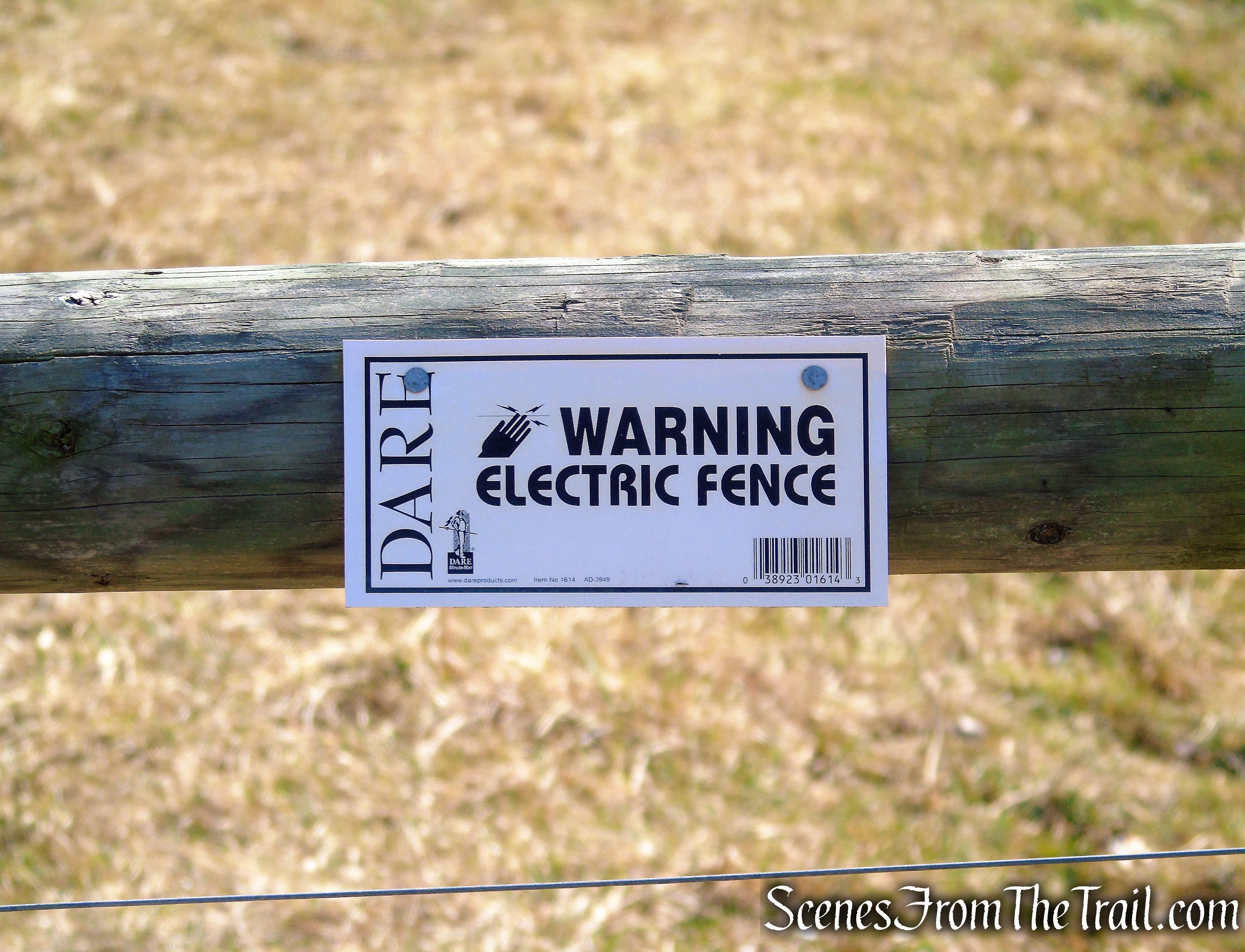
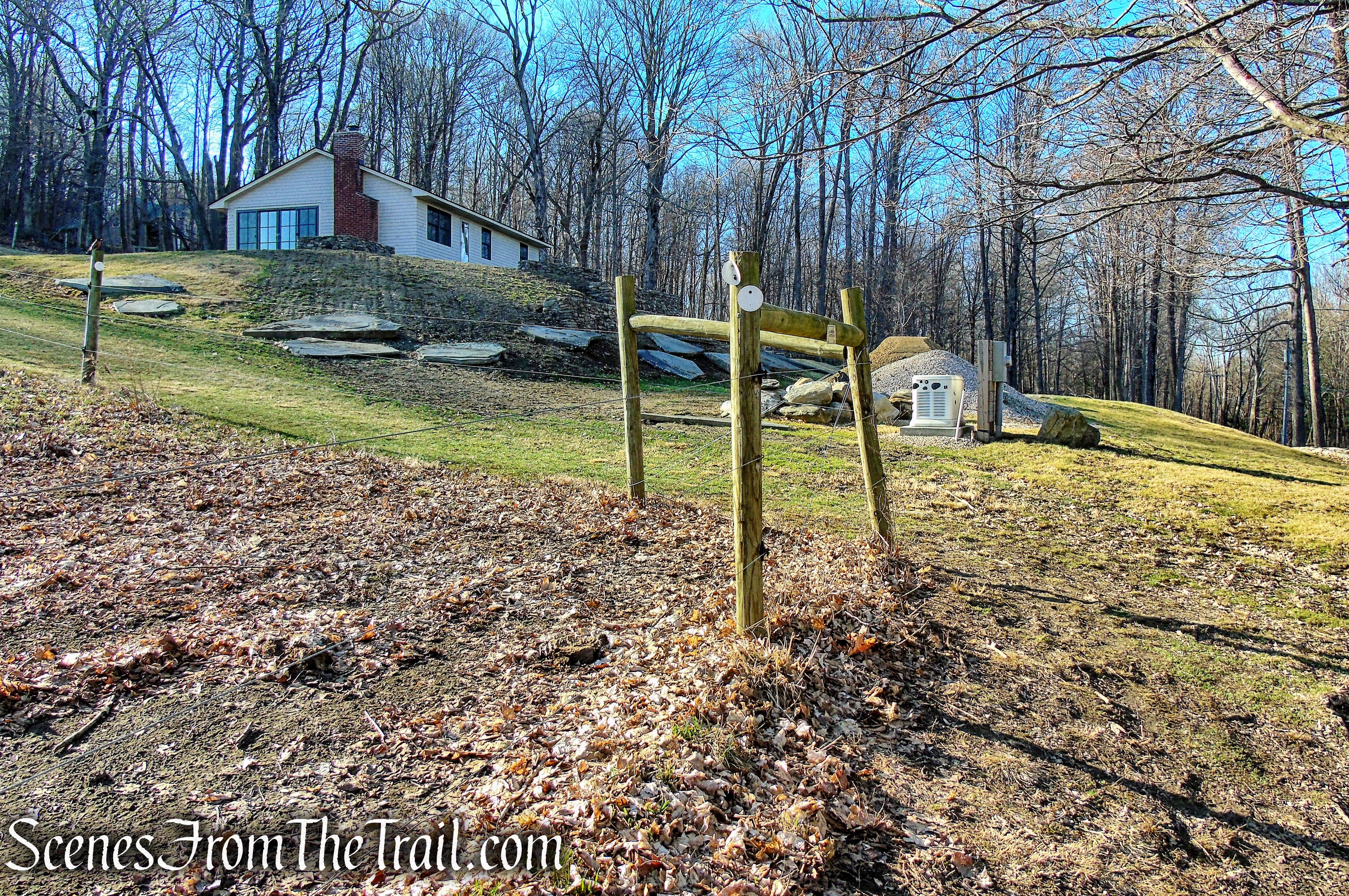
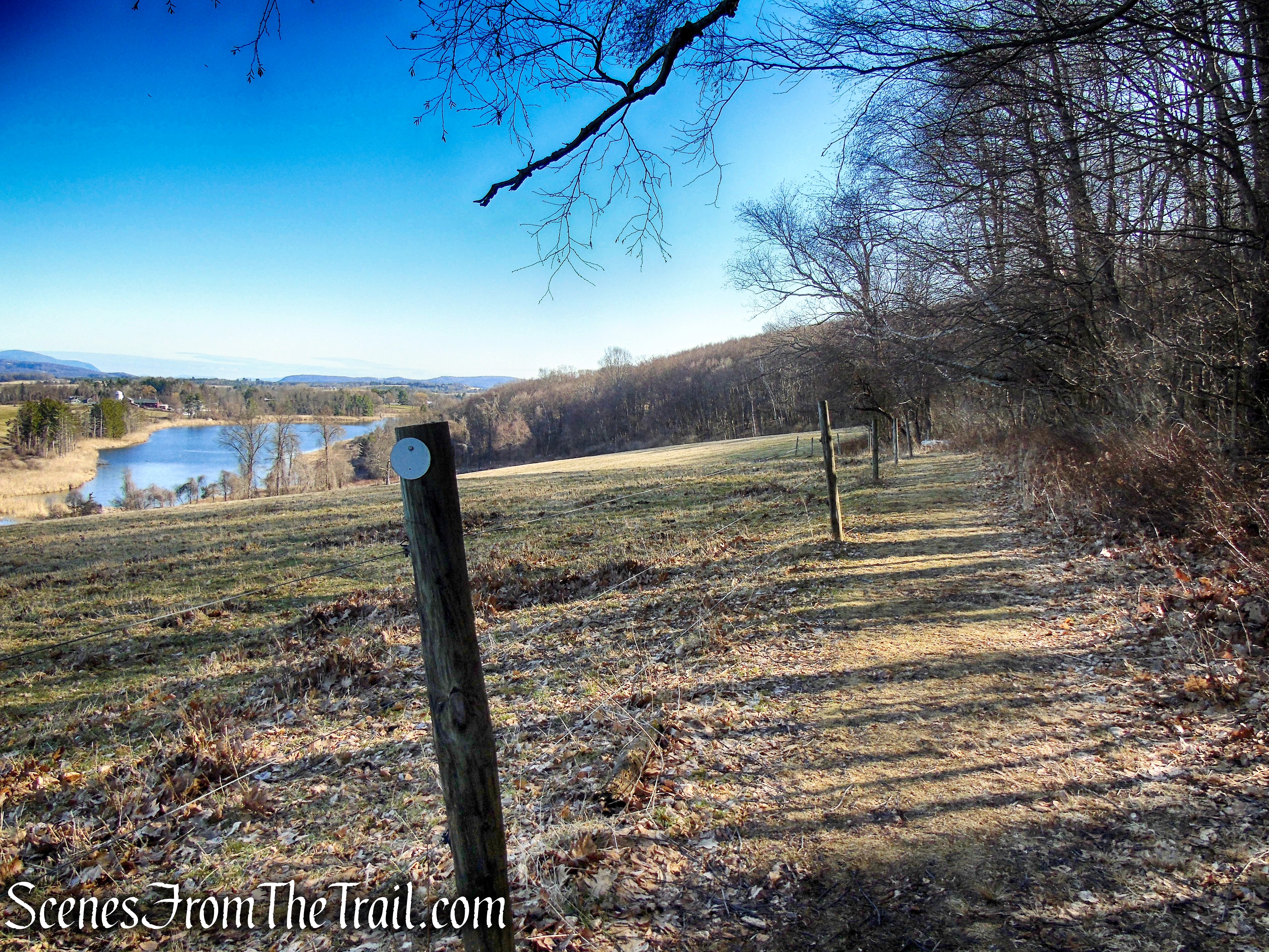
Please Note: The beginning of the hike follows the fence line along the pasture. The fence is electrified, keep pets and children away from it. The field on the other side of the fence is part of the Mary Moore Preserve, but it is actively used for cattle farming. You may see cows grazing in the pasture and the electric fence will keep hikers on the right side of the trail.
Mary Moore Lookout Trail – Sharon Land Trust
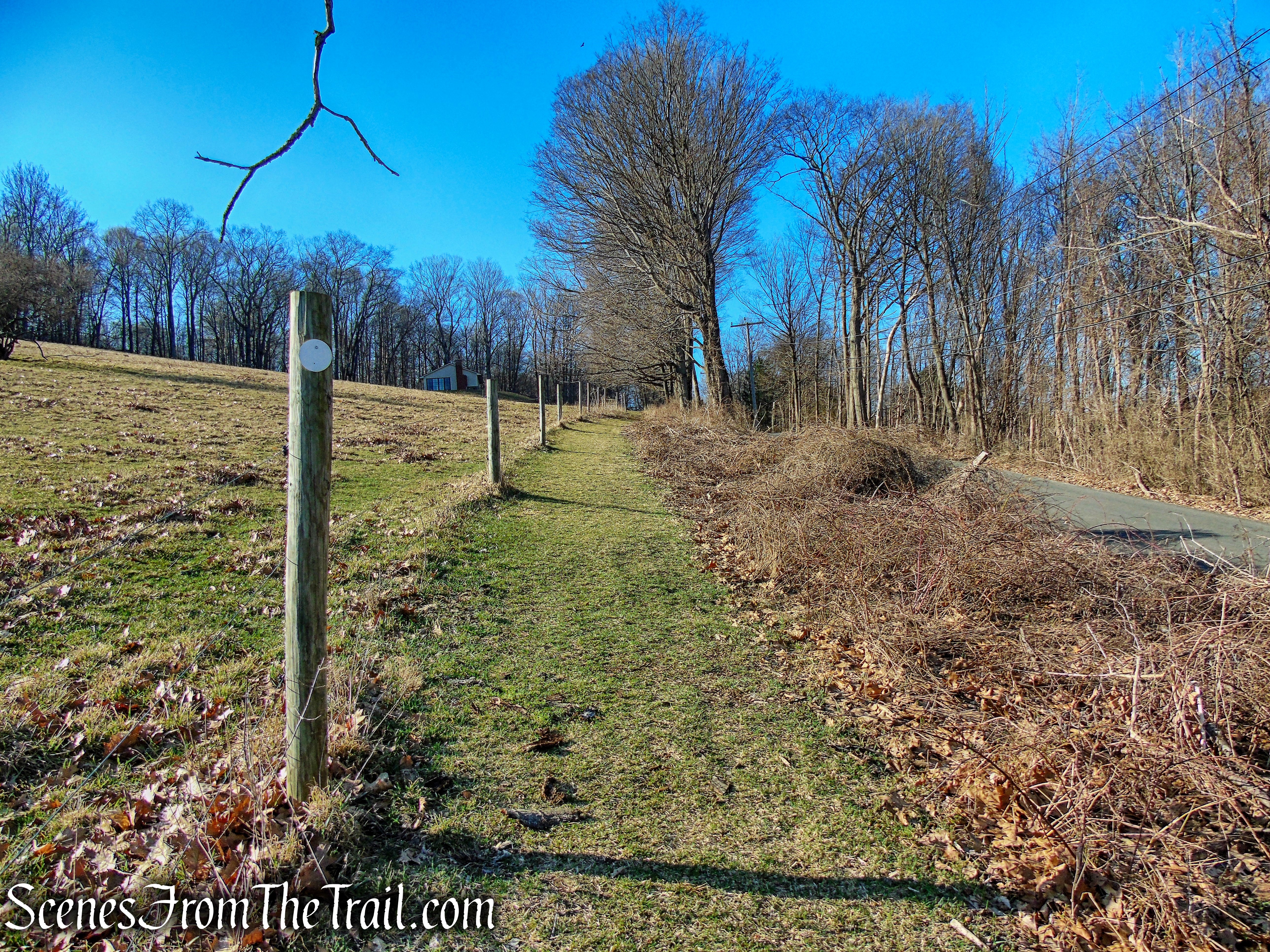
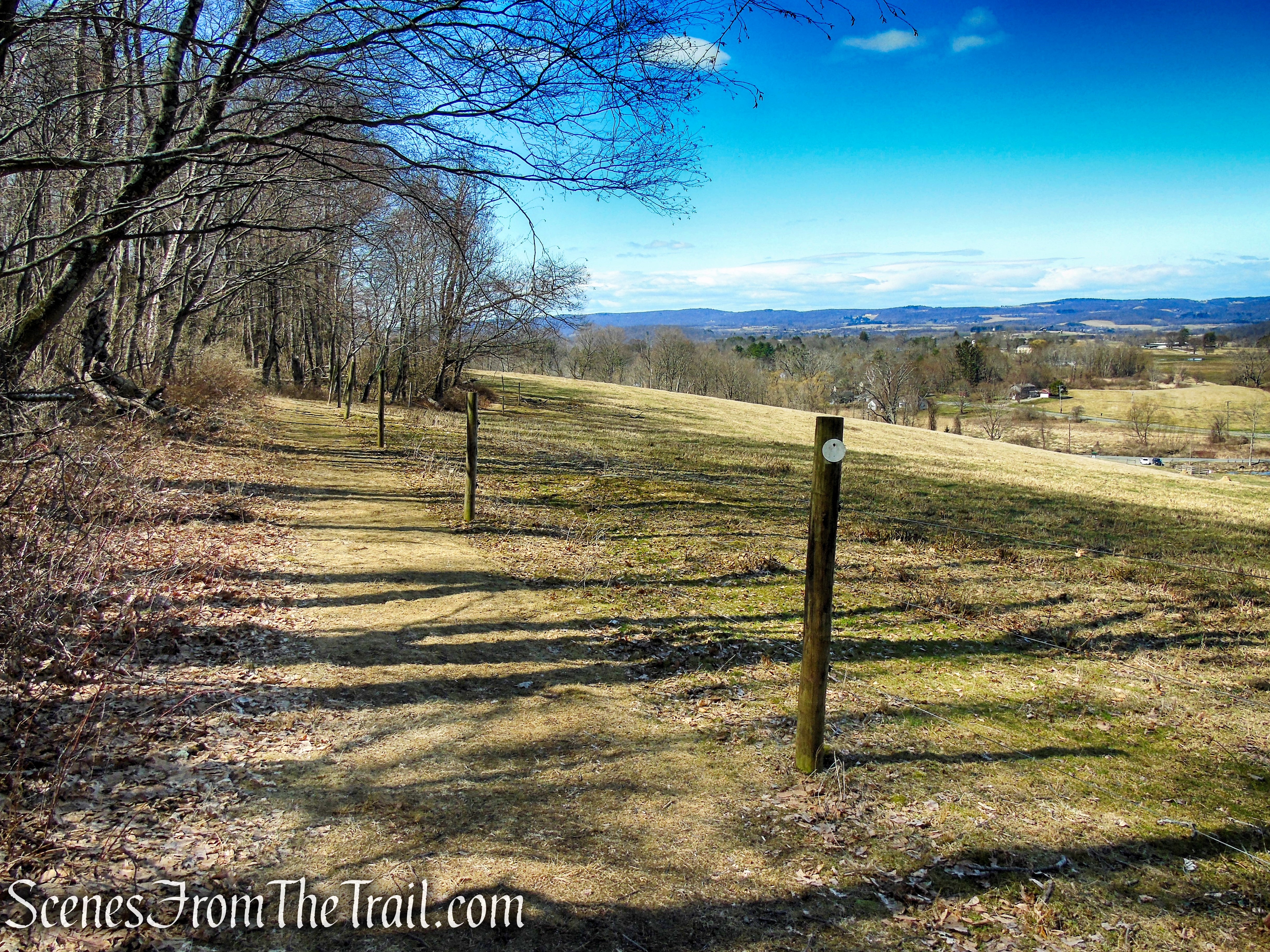
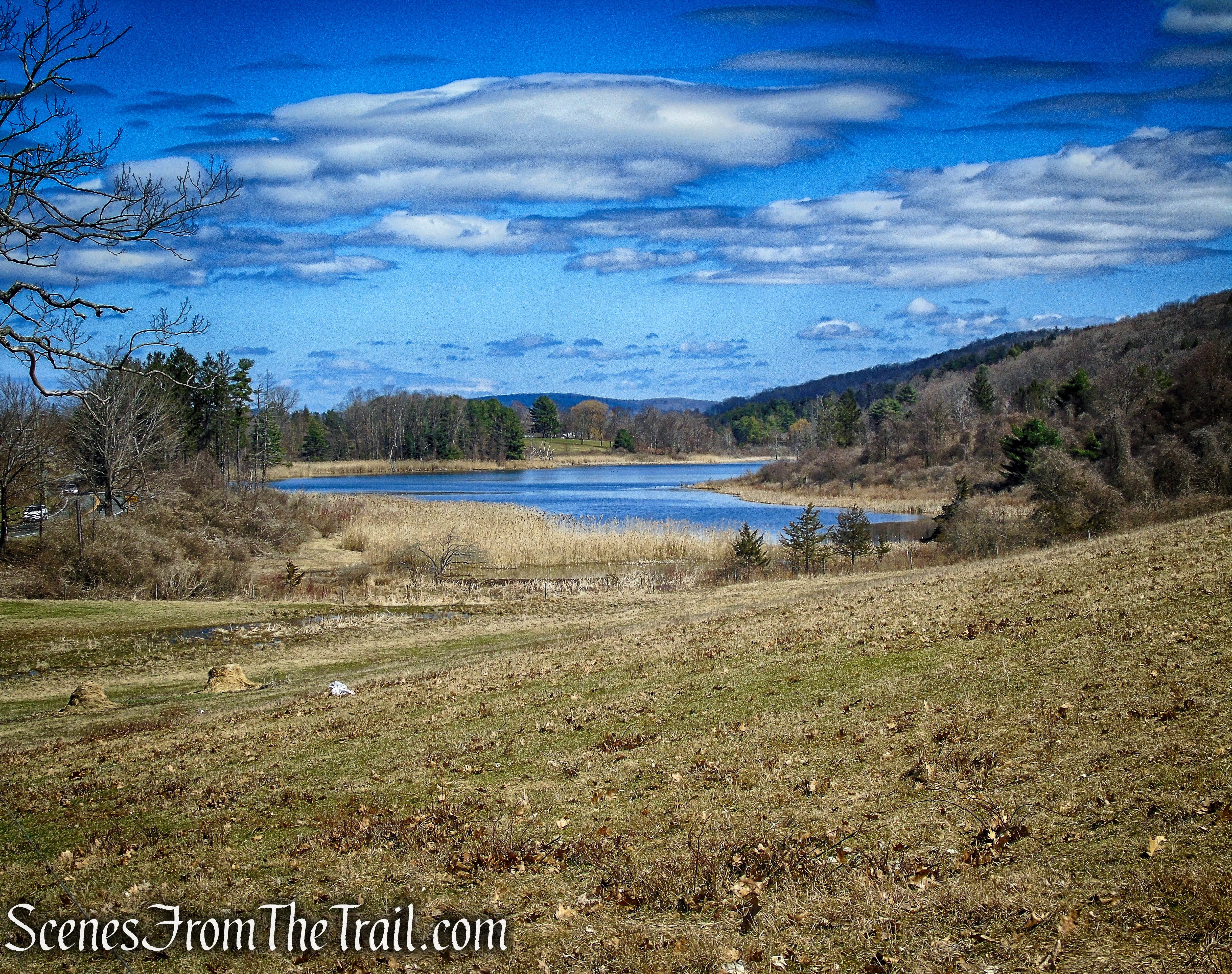
To the right of the kiosk follow the white blazes up the hill alongside the fence. You will be following the white blazes for the entire hike. As the trail approaches a house, turn left following along the electric fence, continuing uphill towards the woods. Looking to your left, views towards Beardsley Pond and beyond start to open up.
Mary Moore Lookout Trail – Sharon Land Trust
Mary Moore Lookout Trail – Sharon Land Trust
Mary Moore Lookout Trail – Sharon Land Trust
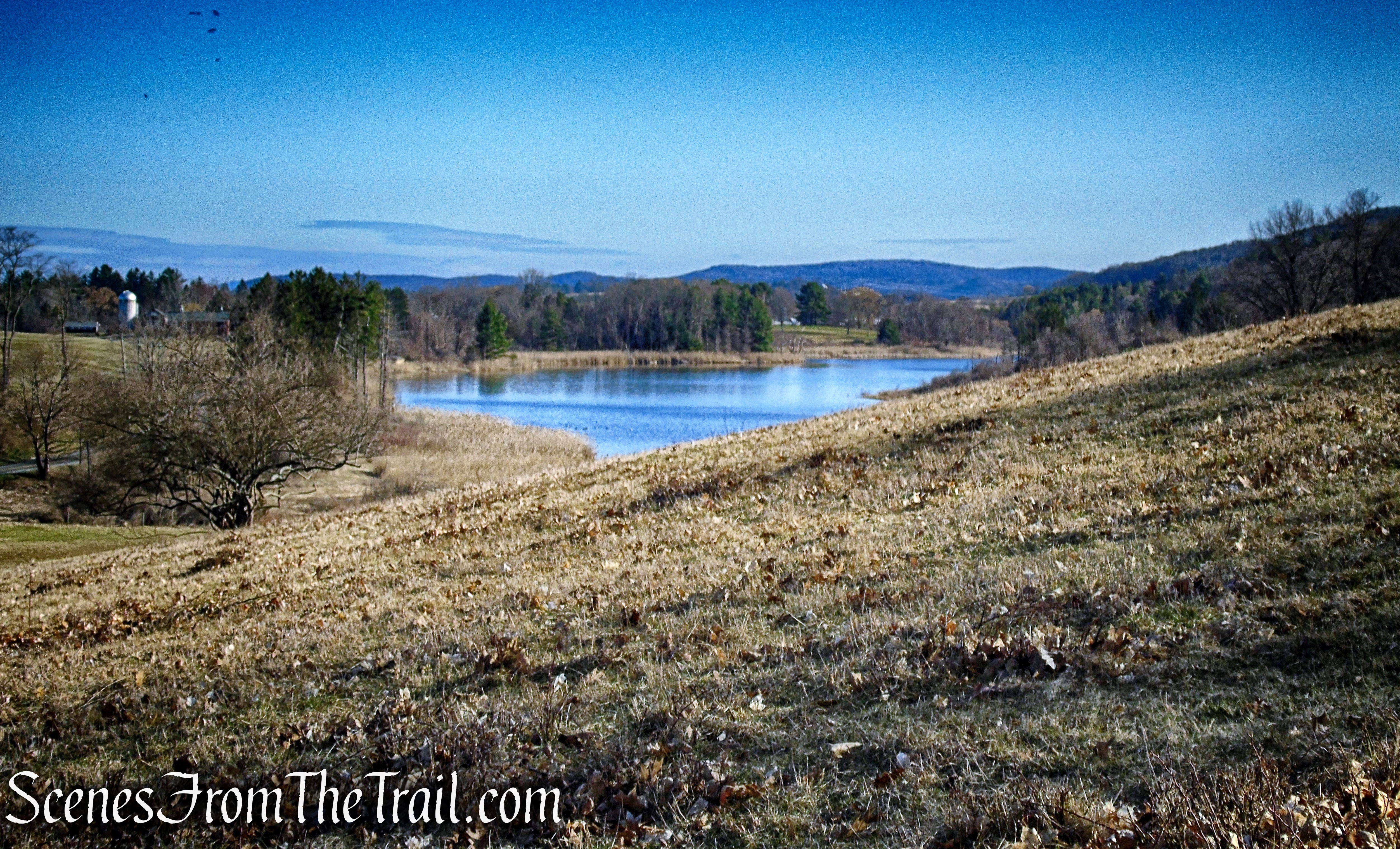
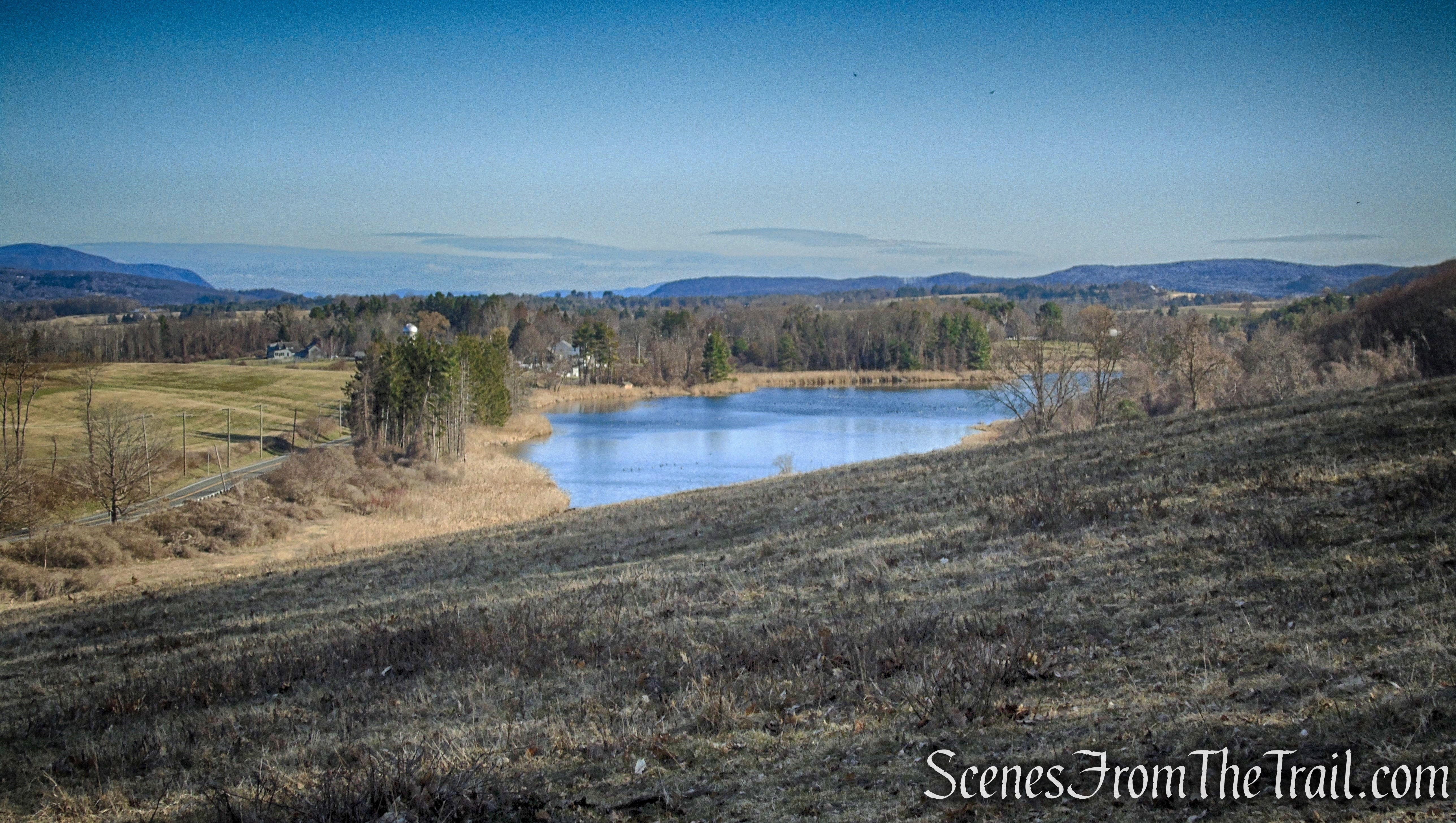
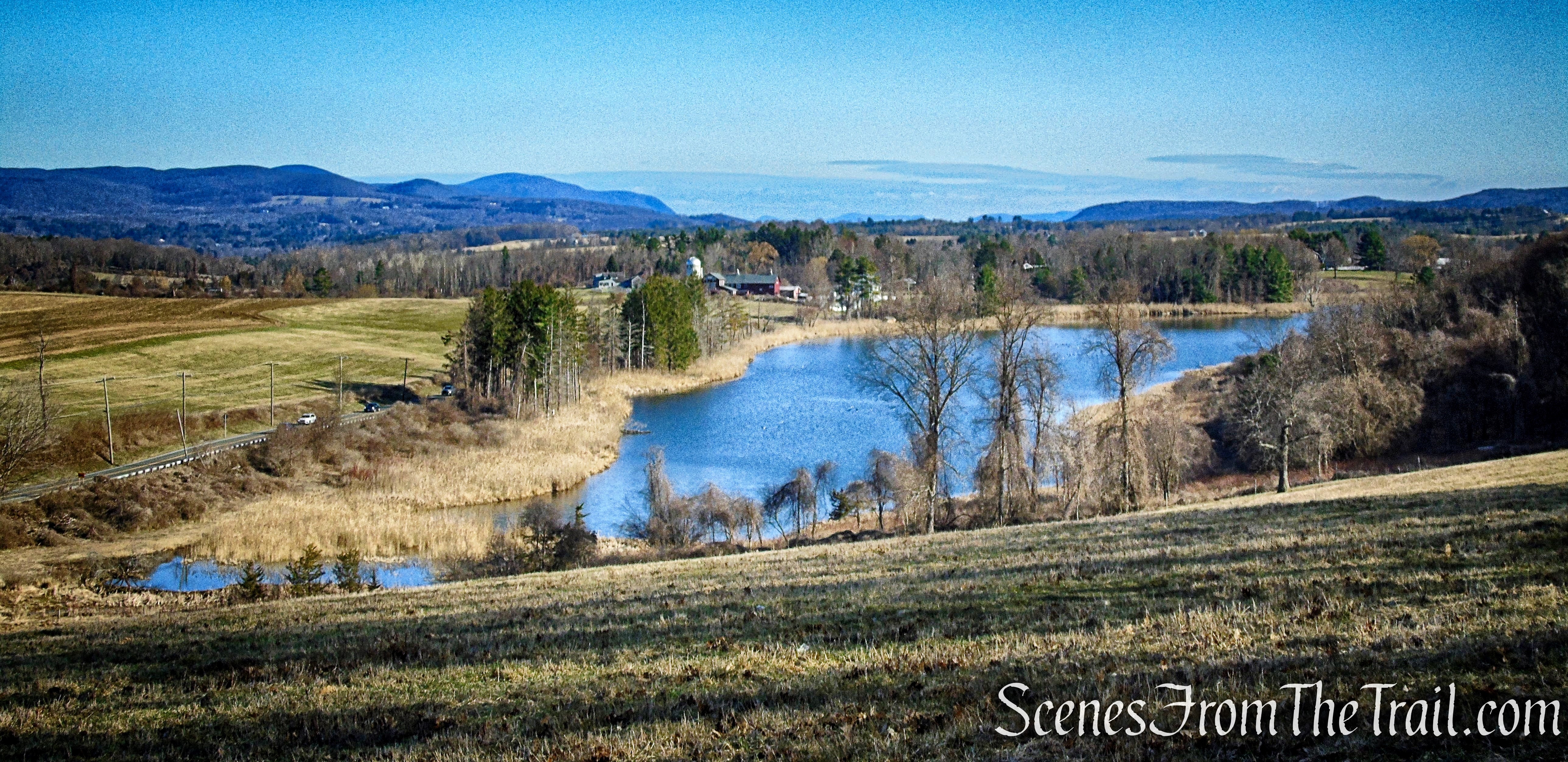
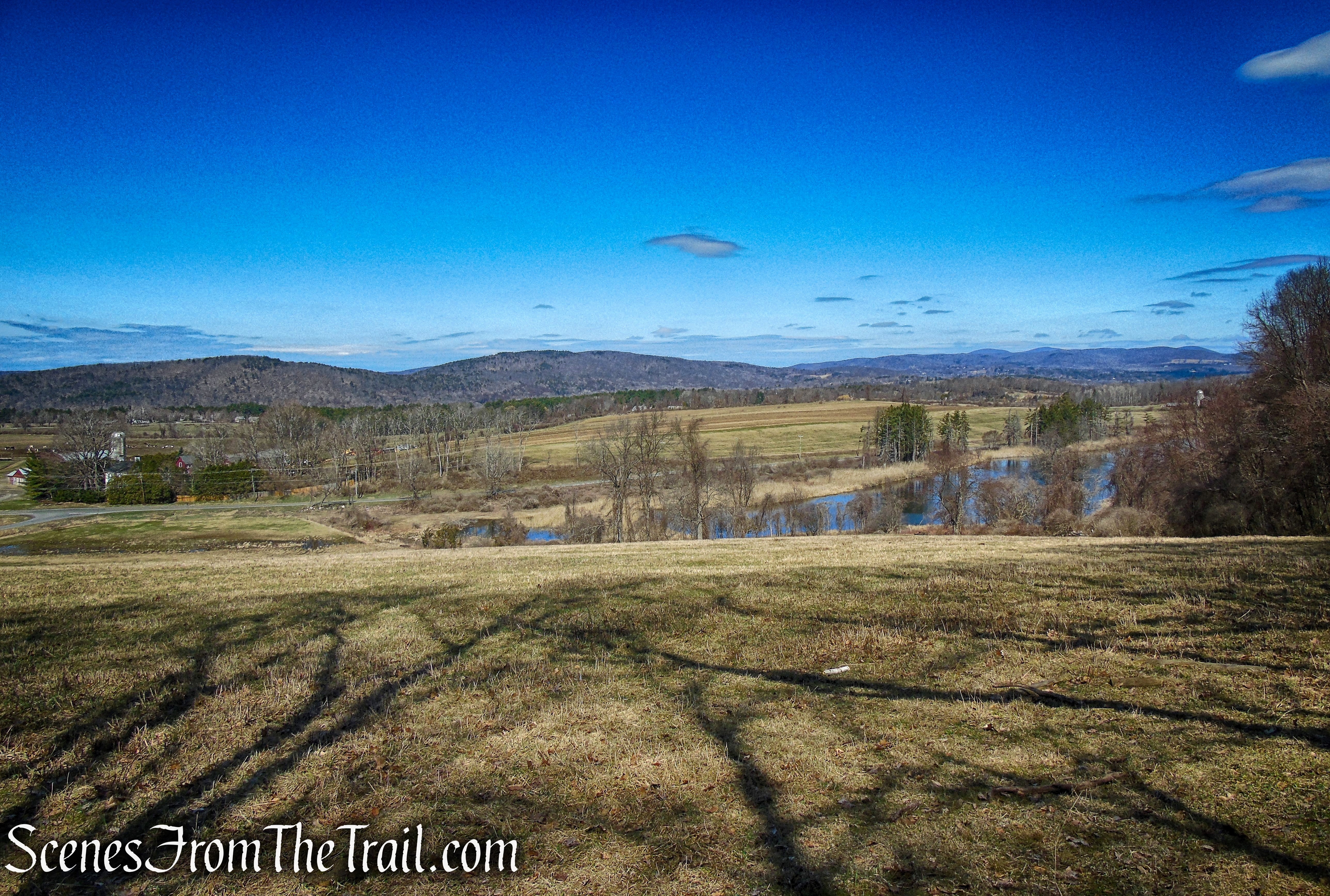
Beardsley Pond as viewed from the Mary Moore Lookout Trail
As the trail nears the woods, it turns left, following the fence line. You may want to take a minute and look across the hilly meadow to take in the view once again. As you walk along the fence, the view gets better.
Mary Moore Lookout Trail – Sharon Land Trust
Mary Moore Lookout Trail – Sharon Land Trust
Mary Moore Lookout Trail – Sharon Land Trust
Mary Moore Lookout Trail – Sharon Land Trust
Mary Moore Lookout Trail – Sharon Land Trust
Mary Moore Lookout Trail – Sharon Land Trust
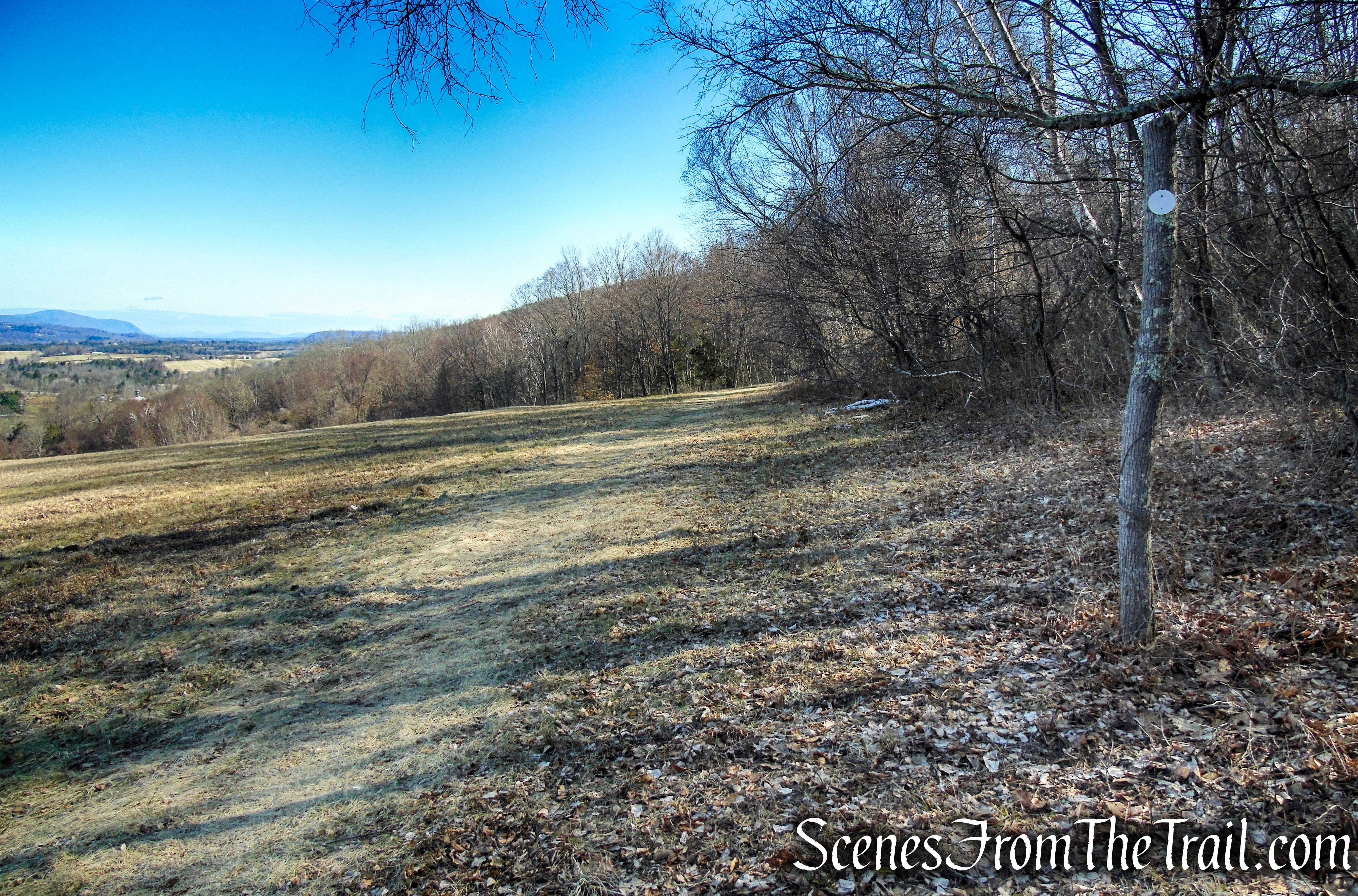
At the end of the fence, the trail leaves what is known as the upper meadow and ducks into the woods. Follow the white blazes as they pass through a collapsed stone wall and head northeast. In about 630 feet, the trail comes to a junction marked by a sign. To the left is your return route, for now, continue ahead towards Lookout/Stone House Road.
Mary Moore Lookout Trail – Sharon Land Trust
Mary Moore Lookout Trail – Sharon Land Trust
The trail begins a steady ascent of Red Mountain, sometimes on switchbacks. In about 1,000 feet from the junction, the trail reaches the Mary Moore Lookout.
Mary Moore Lookout Trail – Sharon Land Trust
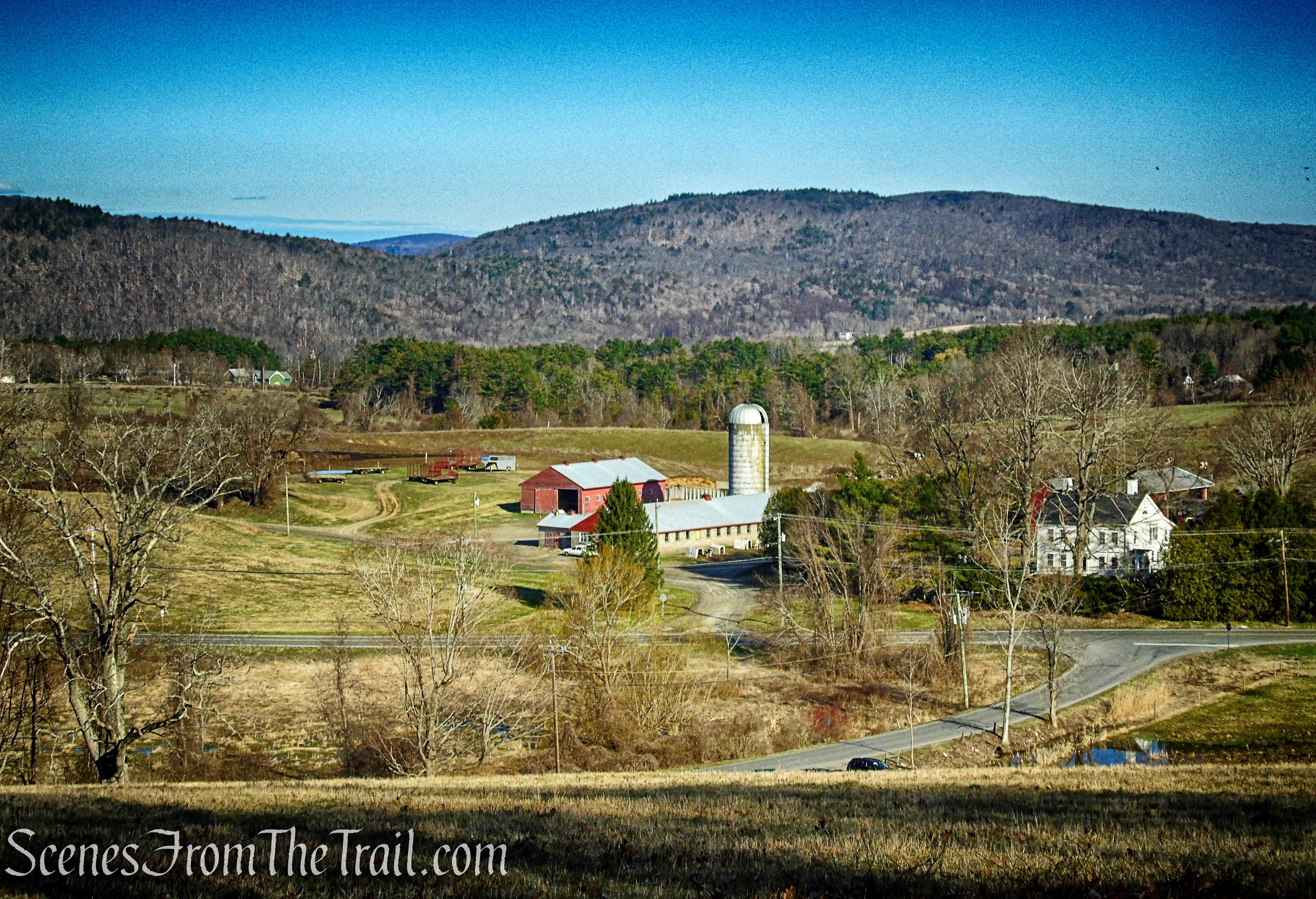
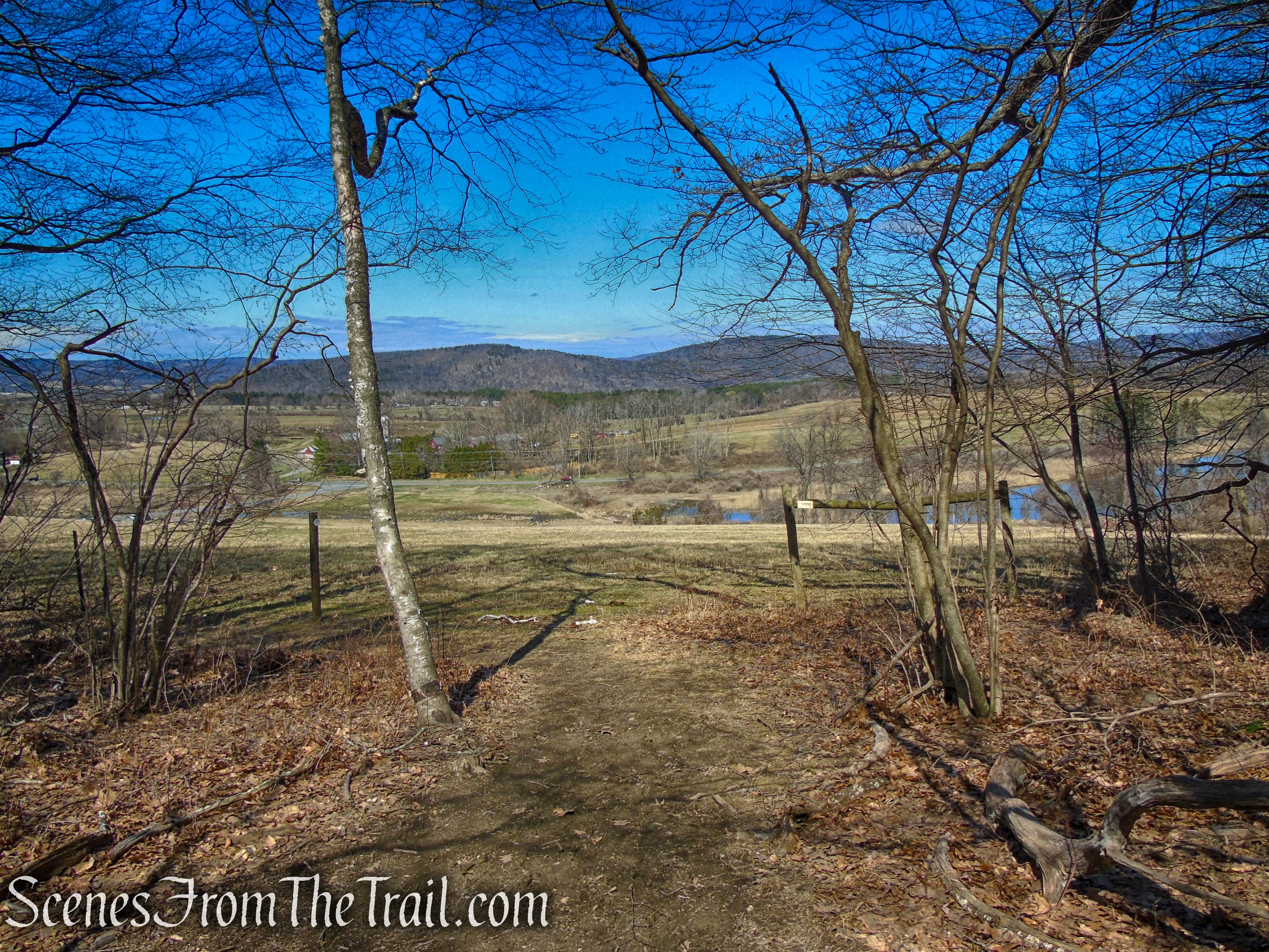
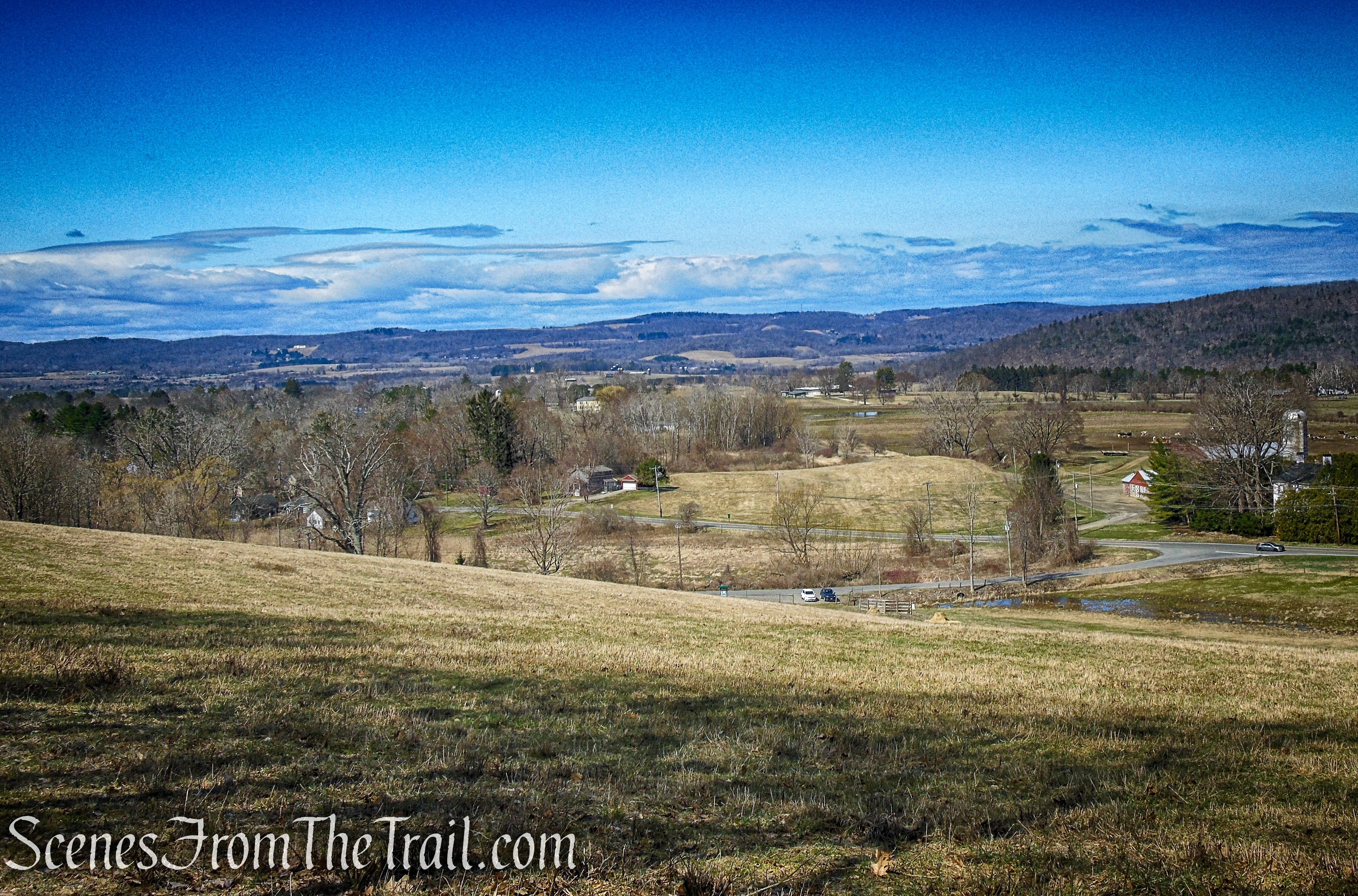
You have now hiked about 3/4 of a mile and gained about 275 feet in elevation. This is a good spot to take a break and enjoy the view. From this spot, you can see the South Taconic Mountains of Massachusetts, Connecticut and New York. One can see farmland, spread out along the flatlands, their red barns and silos with cows grazing in the nearby fields.
Mary Moore Lookout
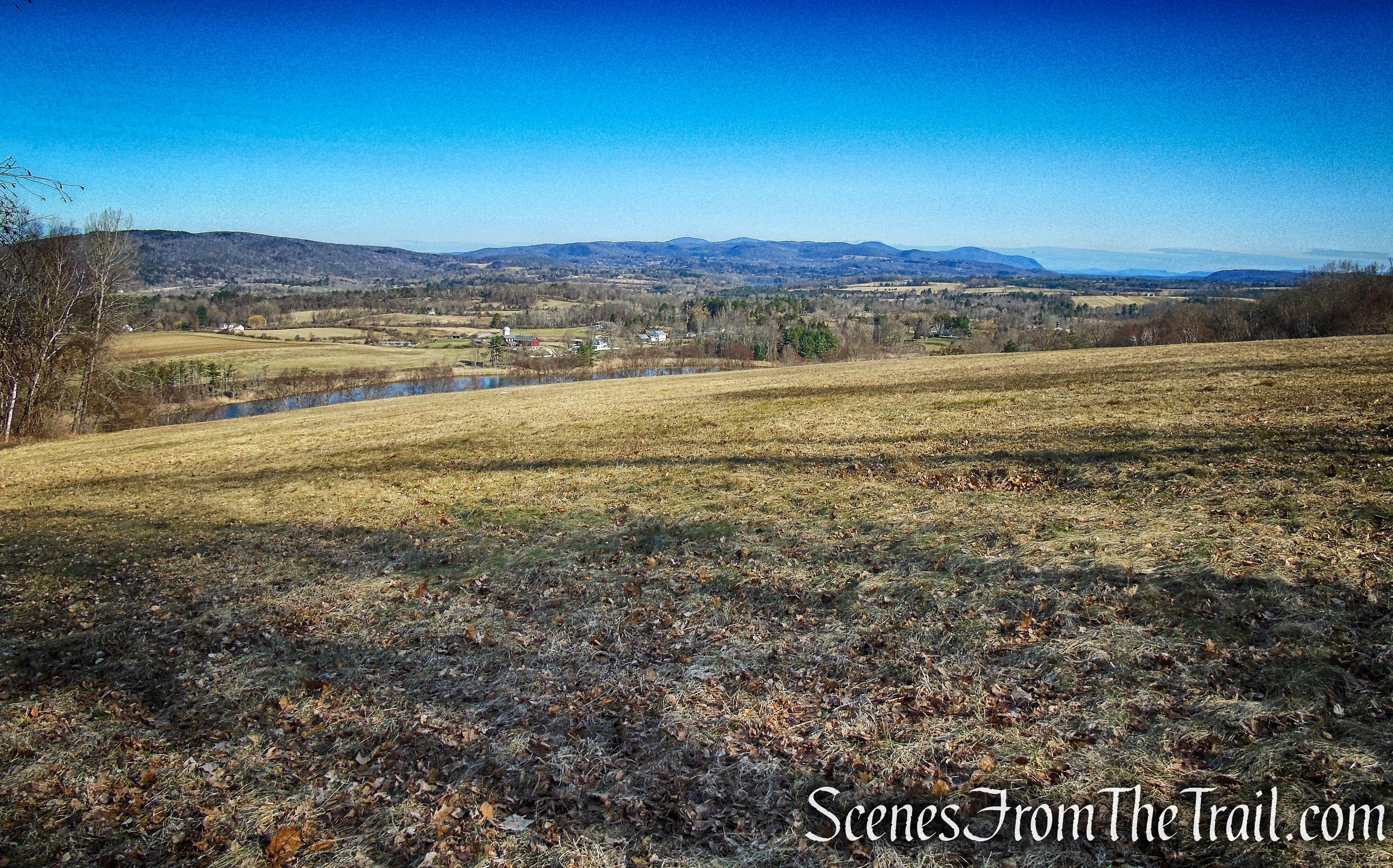
Mary Moore Lookout
Mary Moore Lookout
When you are ready to continue, follow the white blazes along the edge of the woods. The trail leaves the meadow, reenters the woods and continues a steady ascent of Red Mountain.
Mary Moore Lookout Trail – Sharon Land Trust

Mary Moore Lookout Trail – Sharon Land Trust
Mary Moore Lookout Trail – Sharon Land Trust
Mary Moore Lookout Trail – Sharon Land Trust
Mary Moore Lookout Trail – Sharon Land Trust
The trail levels off briefly, skirting the steep slopes.
Mary Moore Lookout Trail – Sharon Land Trust
Mary Moore Lookout Trail – Sharon Land Trust
Mary Moore Lookout Trail – Sharon Land Trust
In another 1/2 a mile (from the lookout) the trail reaches another junction, the other end of the Cliff Loop. If you only want to do a 2.5 mile loop, turn left. If you wish to extend the hike, continue ahead. The continuation of the hike described here, is an out and back which will return you to this spot.
Mary Moore Lookout Trail – Sharon Land Trust
The trail continues to climb, but on a more moderate grade. At the top of the rise, you will reach an elevation of about 1302 feet above sea level, the highest point reached during this hike. The trail levels off briefly, then begins a steady descent into White Hollow, passing through the Wikes Preserve and entering the Hamlin Preserve. There are no signs indicating when you are entering or leaving any of the three preserves.
Mary Moore Lookout Trail – Sharon Land Trust
Mary Moore Lookout Trail – Sharon Land Trust
Mary Moore Lookout Trail – Sharon Land Trust
Mary Moore Lookout Trail – Sharon Land Trust
Wike Connector Trail – Sharon Land Trust
Wike Connector Trail – Sharon Land Trust
At the base of the descent, the trail turns left on an old woods road and climbs gradually. In about another 400 feet, the trail reaches a junction, marked by a sign.
Wike Connector Trail – Sharon Land Trust
Hamlin Bear Trail – Sharon Land Trust
This was our turn around spot. If you would like to extend the hike, you can continue on. If not, retrace your steps along the woods road for about 400 feet, turn right on the footpath which ascends steeply.
Hamlin Bear Trail – Sharon Land Trust
From this junction that leaves the woods road (Wike Connector Trail on map), it is about 1.6 miles back to your vehicle at the Mary Moore Preserve trailhead.
Hamlin Bear Trail – Sharon Land Trust
Wike Connector Trail – Sharon Land Trust
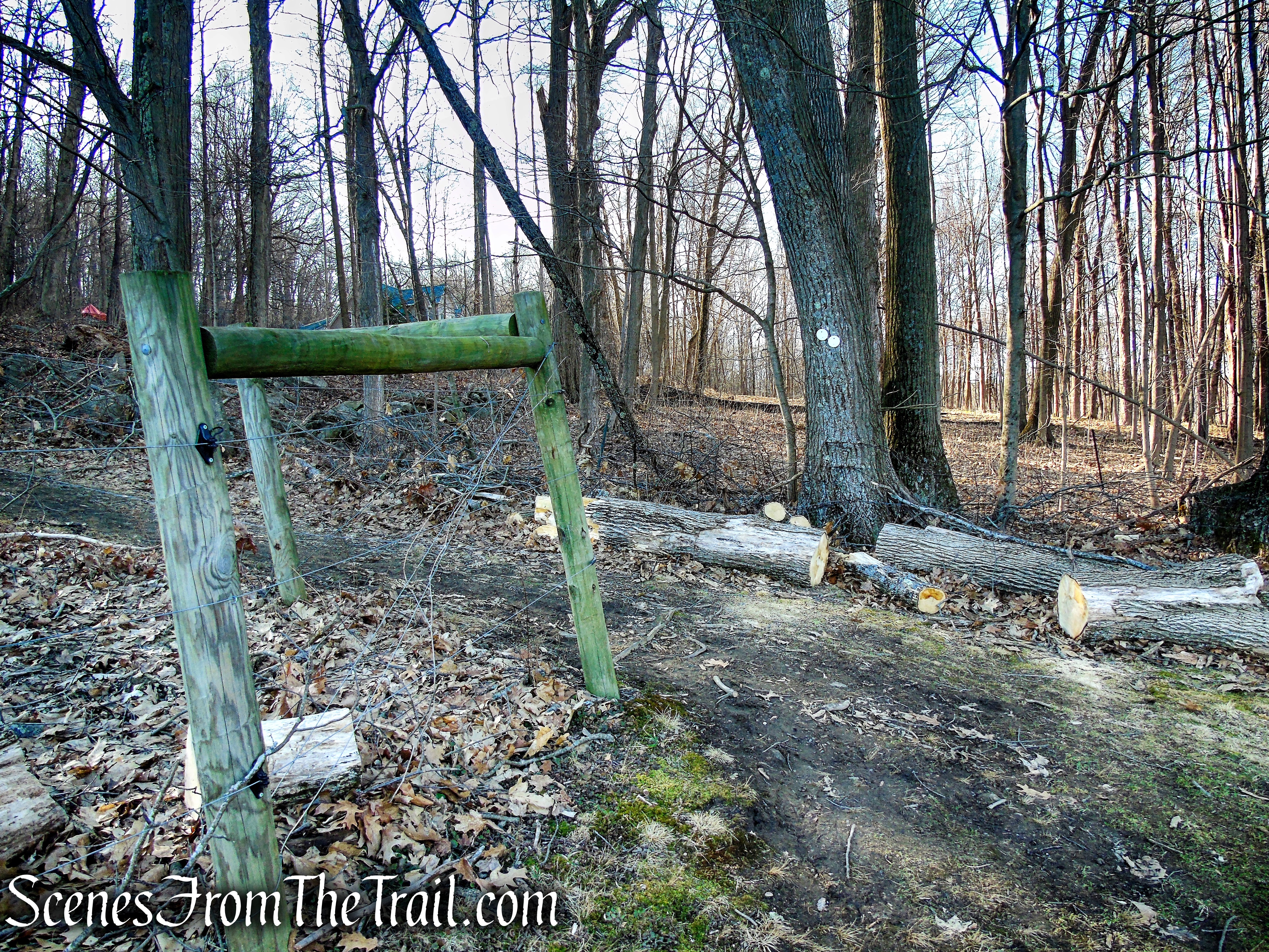
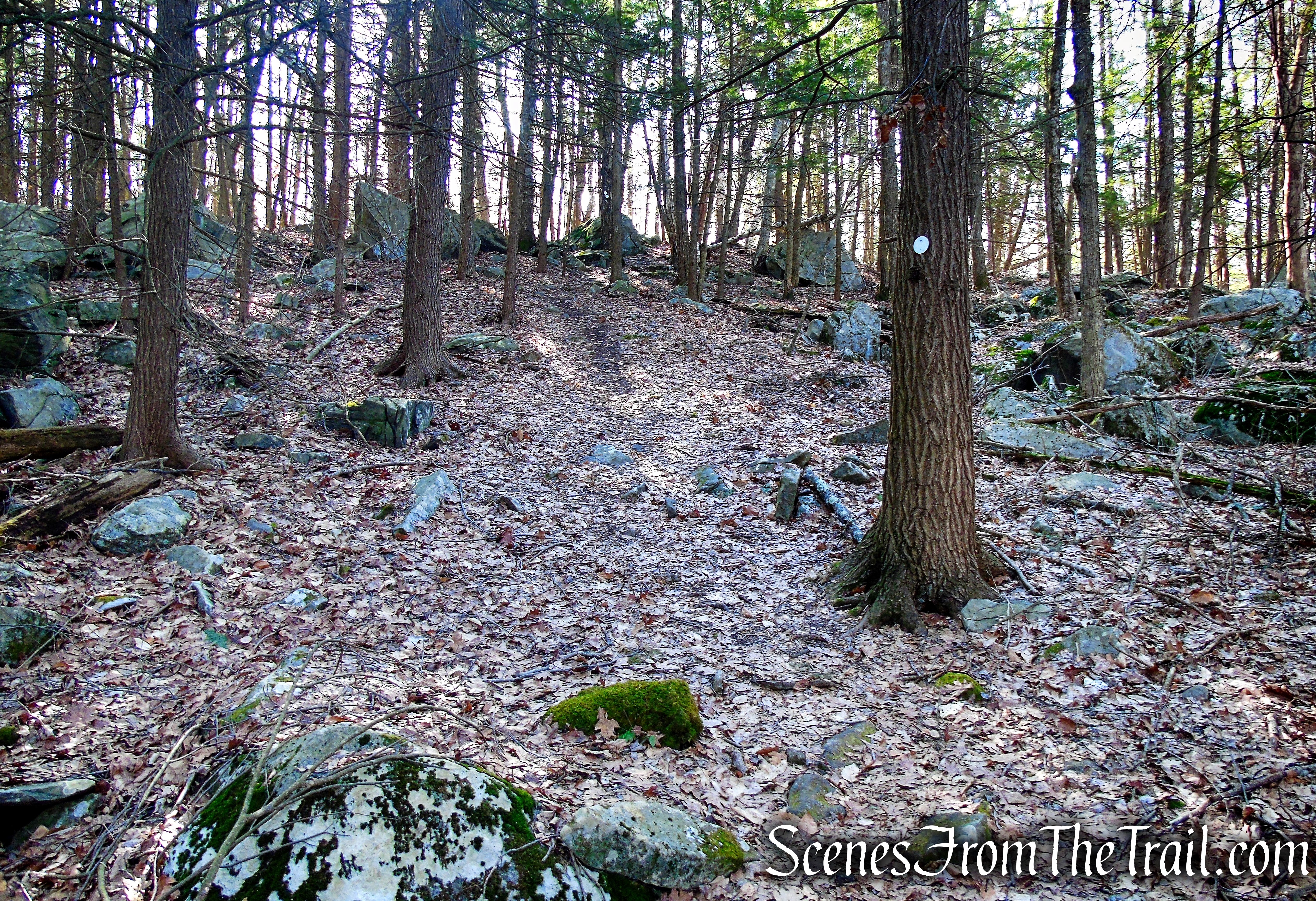
After retracing your steps, you will arrive at the Cliff Loop junction. Turn right here and follow the white blazes marked with directional arrows. This section of trail, also know as the Cliff Loop Extension, was completed in the summer of 2020.
Cliff Loop Extension – Sharon Land Trust

Cliff Loop Extension – Sharon Land Trust
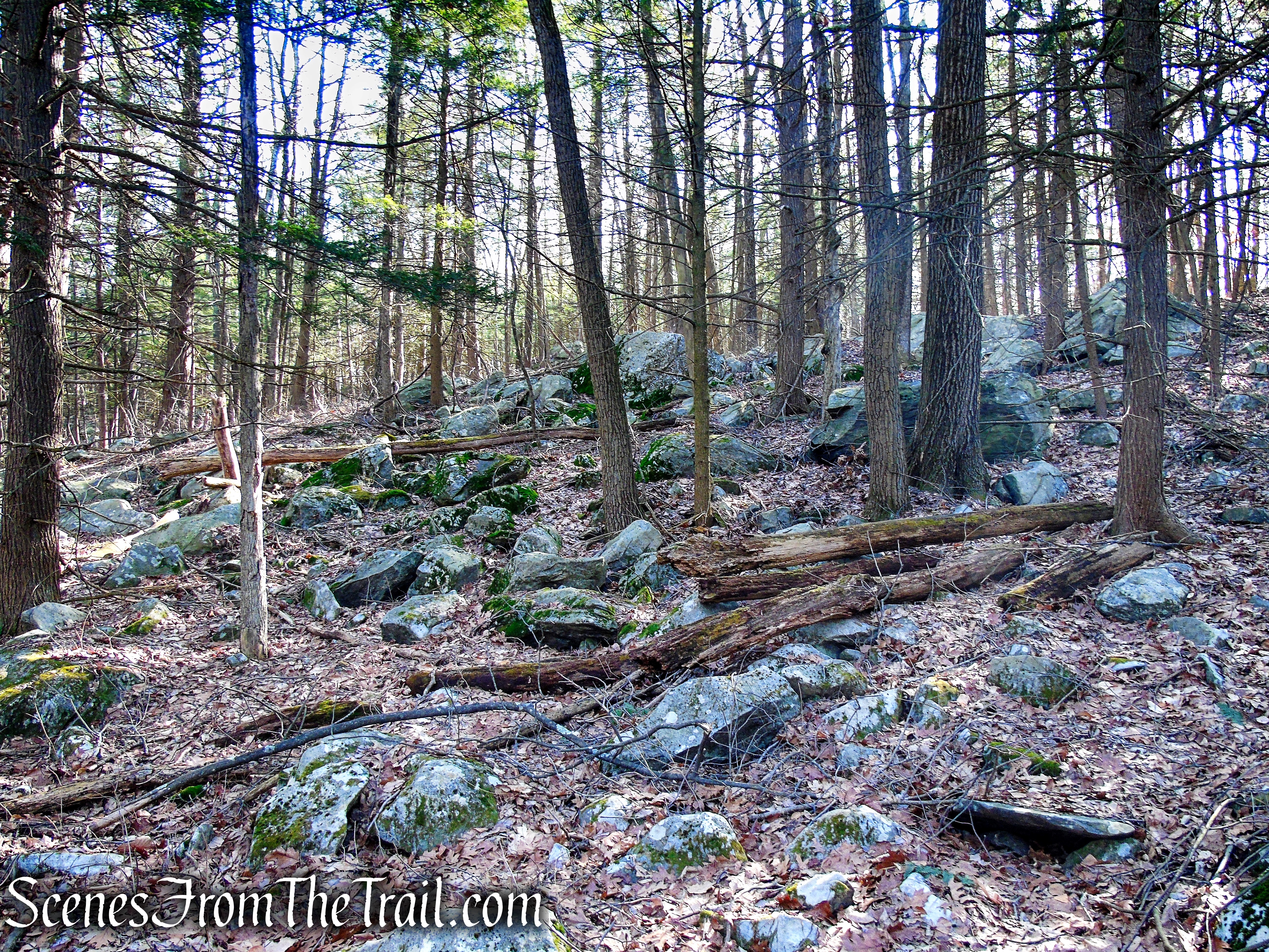
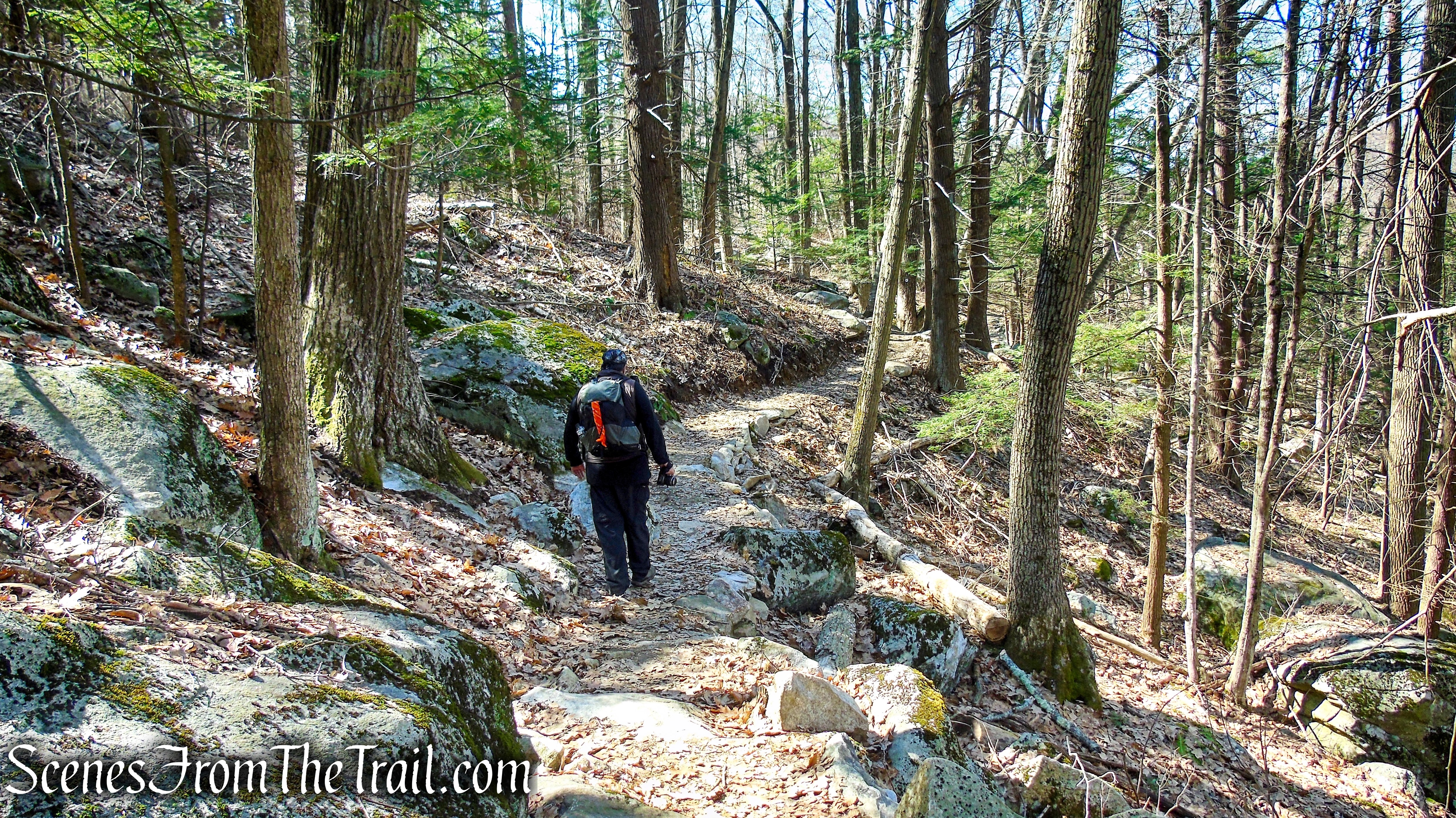
The trail descends the mountain gradually, passing large rocks along the trail and cliffs to the right that are strewn with boulders.
Cliff Loop Extension – Sharon Land Trust

Cliff Loop Extension – Sharon Land Trust
Cliff Loop Extension – Sharon Land Trust
Soon the trail turns left, heading southwest and passes through a lovely section of trail that was carefully laid out by volunteers of the Sharon Land Trust in 2020.
Cliff Loop Extension – Sharon Land Trust
Cliff Loop Extension – Sharon Land Trust
About 1/2 mile from the junction, the trail leaves the woods and enters the lower end of the meadow, beneath the Mary Moore Lookout.
Cliff Loop Extension – Sharon Land Trust
continue along through the field, staying close to the trees. You will soon see wooden posts with white blazes. To the right, Beardsley Pond is visible through the trees.
Cliff Loop Extension – Sharon Land Trust
Cliff Loop Extension – Sharon Land Trust
Cliff Loop Extension – Sharon Land Trust
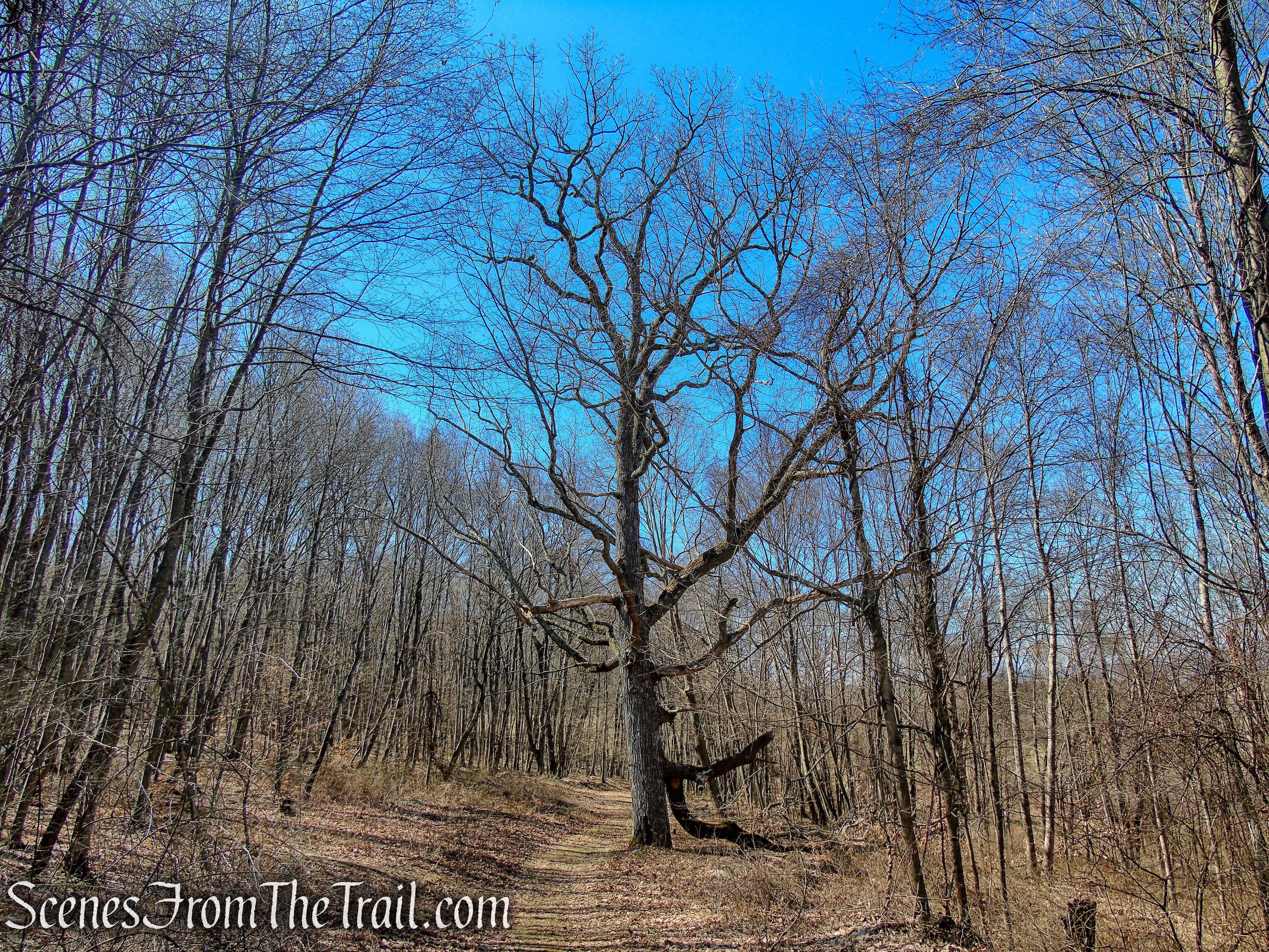
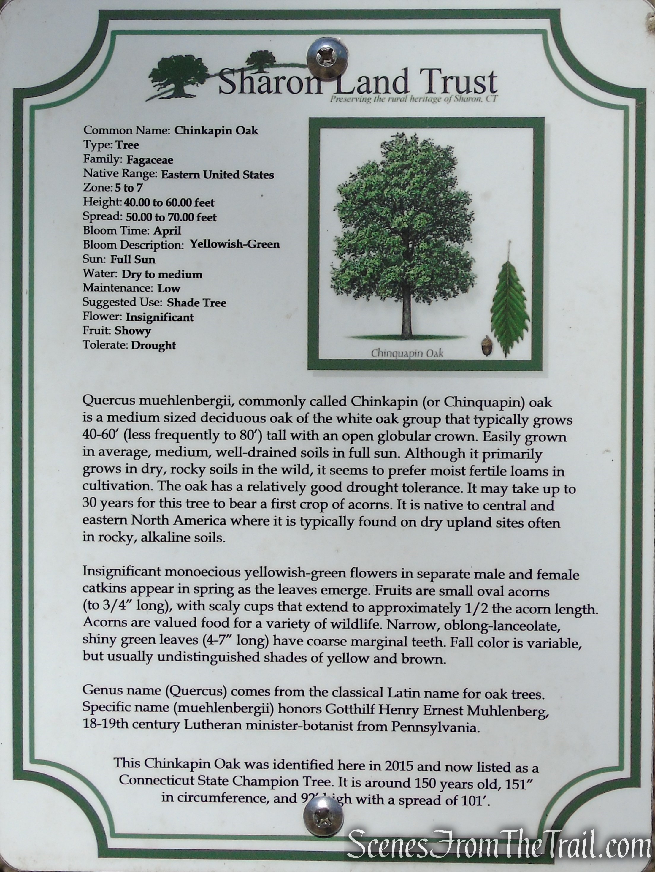
At the end of the field, the trail turns left on a footpath, but continue ahead just a few feet and check out the Chinkapin Oak. This Chinkapin Oak is listed as a Connecticut State Champion Tree. It is around 150 years old, 151 inches in circumference, and 92 feet high with a spread of 101 feet.
Chinkapin Oak – Sharon Land Trust
Chinkapin Oak – Sharon Land Trust
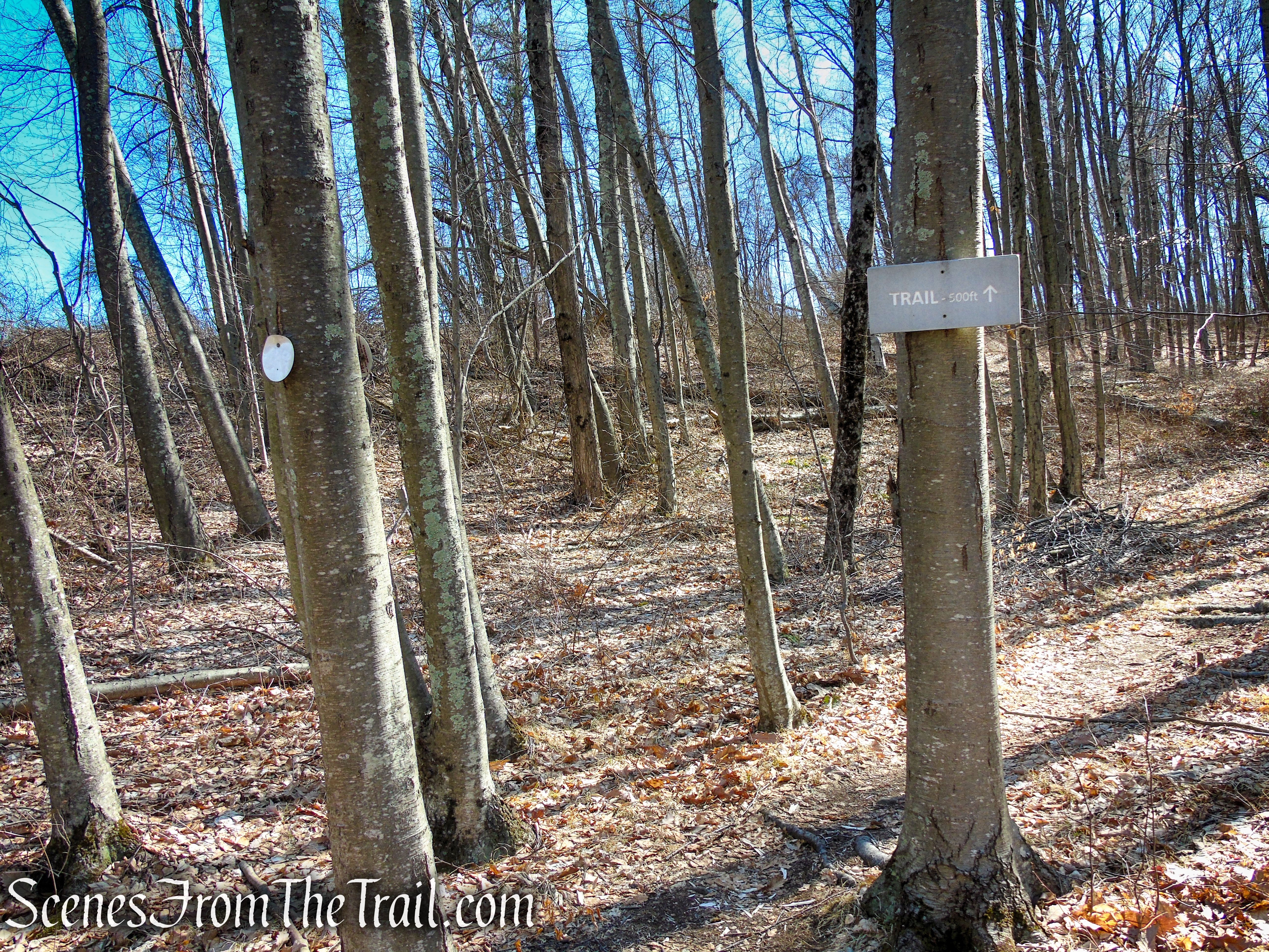
When you are done follow the white blazes uphill for about 500 feet. DO NOT continue on the woods road past the tree.
Cliff Loop – Sharon Land Trust
Cliff Loop – Sharon Land Trust
Cliff Loop – Sharon Land Trust
When the Cliff Loop comes to a T-Intersection, turn right, now retracing your steps from the beginning of the hike. In about 630 feet, the trail reaches the upper meadow. Turn left and follow the fence line as it wraps around the pasture, stopping every so often to get one last look at the lovely views.
Mary Moore Lookout Trail – Sharon Land Trust
Mary Moore Lookout Trail – Sharon Land Trust
Mary Moore Lookout Trail – Sharon Land Trust
Mary Moore Lookout Trail – Sharon Land Trust
Mary Moore Lookout Trail – Sharon Land Trust
Follow the fence line down the hill, back to the parking area where the hike began.
Mary Moore Lookout Trail – Sharon Land Trust
Review:
This is a really nice hike with great views and scenic landscape. The trails and preserves are very well kept and maintained. Not one bit of trash was observed anywhere on the day of our visit. The trails are well blazed with signs at all the junctions. Very quiet woods with minimal foot traffic. This hidden gem is well worth the visit and is suitable for most hikers. Whether you just want to do a short out and back of 1.5 miles to the Mary Moore Lookout, Cliff Loop (2.5 miles from Mary Moore parking area) or a much longer hike to Stone House Road and back, you will not be disappointed.
Pros:
Panoramic views of three states, well marked trails, litter free and well maintained preserves, minimal foot traffic.
Cons:
Small parking area, but that is probably for the best.
Take a hike!
Red Mountain Trails – Sharon Land Trust
Sources:
