February 16, 2019 – Tuxedo Park, NY
Difficulty: Moderate
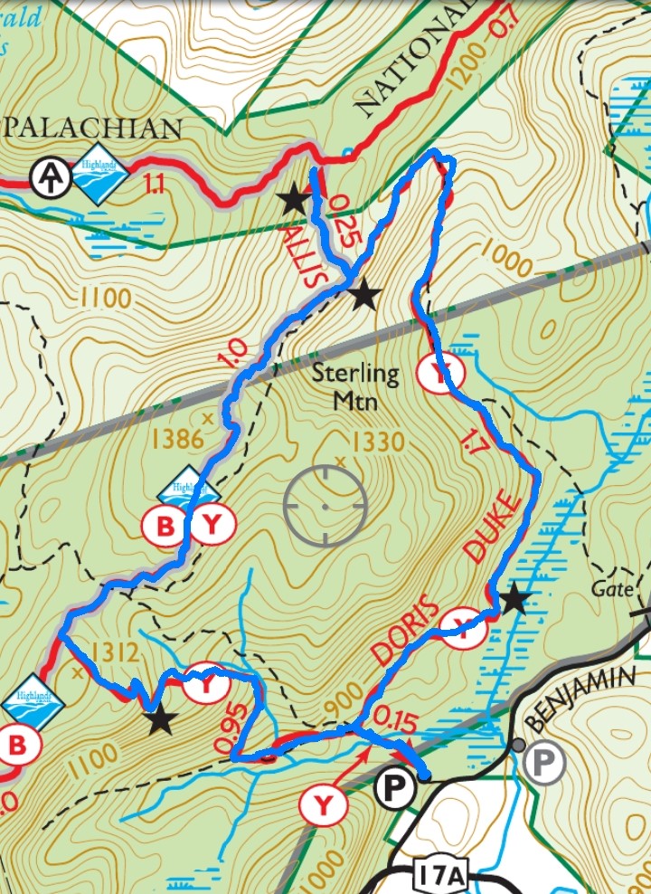
Length: Approximately 4.4 miles
Max elevation: 1,386 ft. – total elevation gain: approximately 781 ft.
Route type: Circuit
Map: Sterling Forest State Park Map – Free map
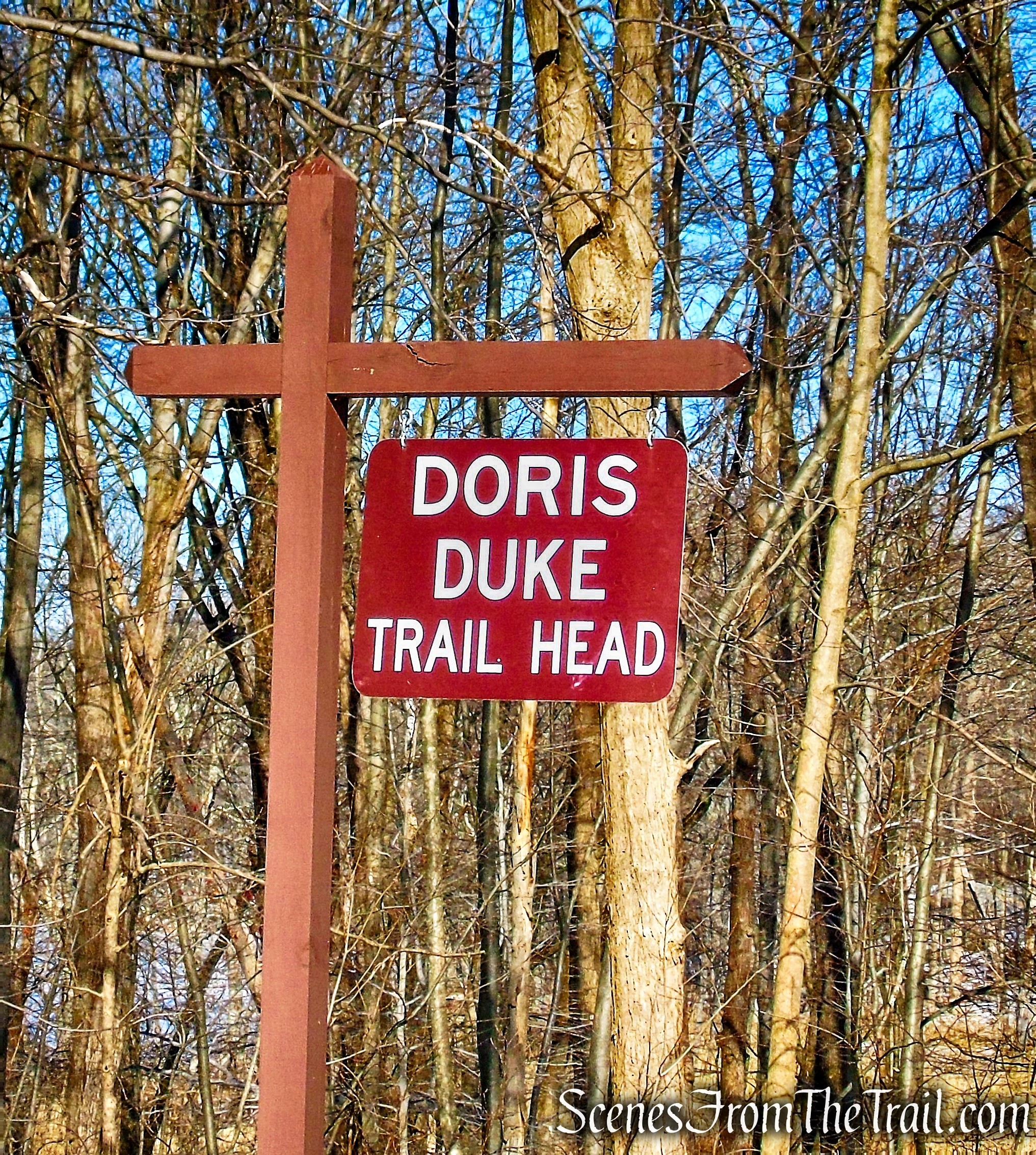
Trailhead parking: Doris Duke Trailhead Benjamin Meadow Rd, Tuxedo Park, NY 10987
Overview:
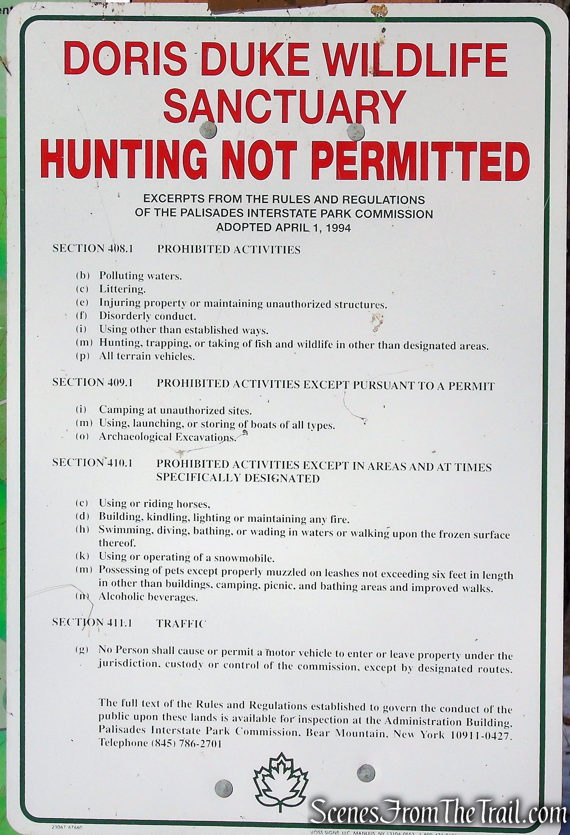
The 1,400-acre Doris Duke Wildlife Sanctuary was established through a $5 million donation from the Doris Duke Charitable Foundation during the fight to preserve Sterling Forest. Located in the northern end of the park and encompassing a portion of the Appalachian Trail Corridor, this no-hunting zone is a haven for many resident and migratory species, including rare invertebrates and plants. Nevertheless, hikers are advised to wear bright colors throughout all areas of the park during hunting season, which begins Oct. 1 in Sterling Forest.
Doris Duke Wildlife Sanctuary
Construction on the Doris Duke Trail began in 2013 as part of the Sterling Forest Back Country Trails program, a partnership between the New York-New Jersey Trail Conference and the New York State Office of Parks, Recreation, and Historic Preservation, which supports crews educated and supervised by the trail conference’s professional trail builders. The official opening of the trail was celebrated with a ribbon-cutting hike Sept. 20, 2015.
Doris Duke Trail
Trails Overview:
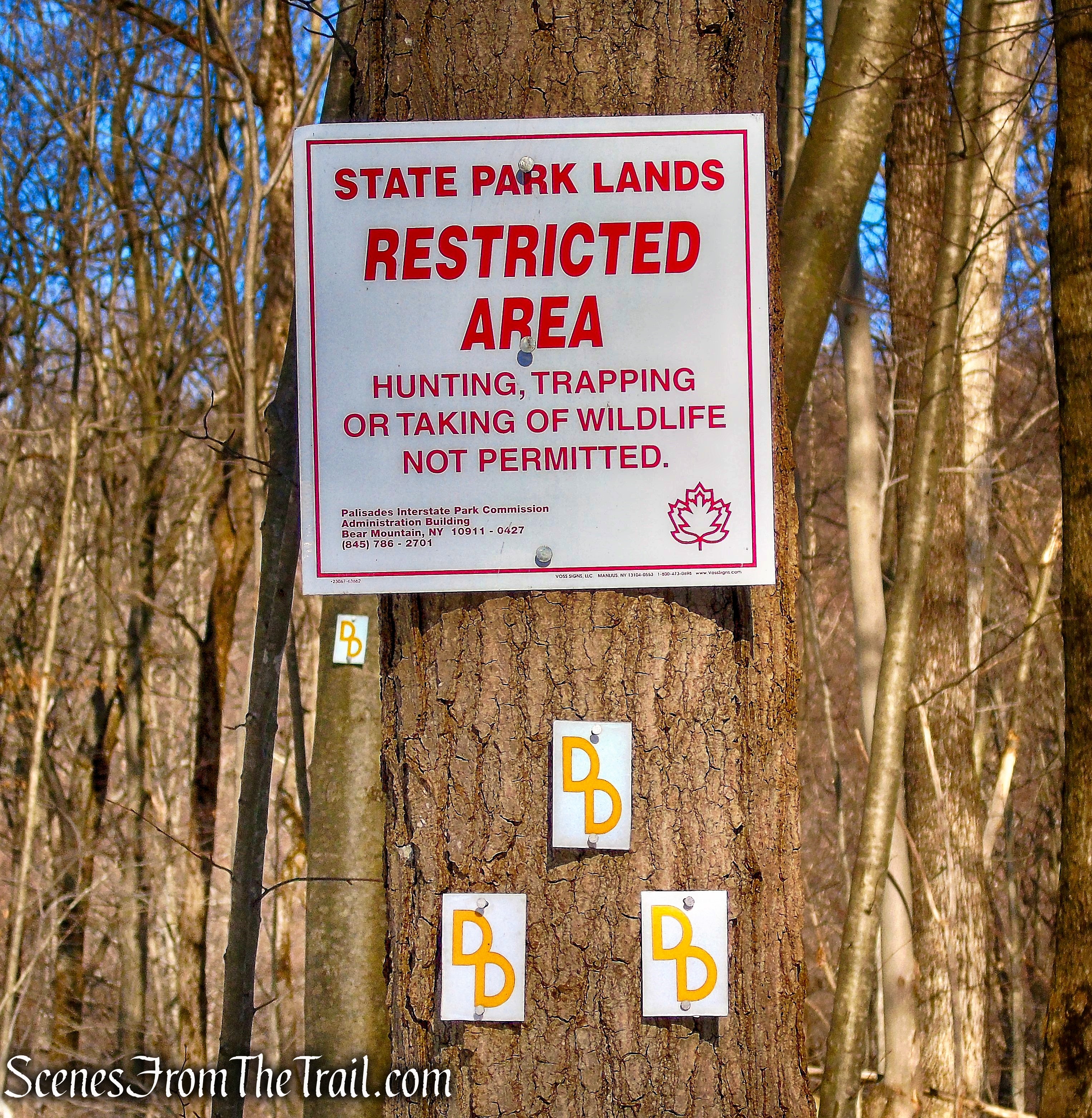
The Doris Duke Trail (yellow “DD” logo on white) loops through the Doris Duke Wildlife Sanctuary as it climbs through strands of deciduous forest, past cliffs and caves to a ridgeline, with views of Mombasha Lake and Schunemunk Mountain to the north. The Doris Duke Trail includes a section of the historic Allis Trail, which connects to the Appalachian Trail along the Sterling Ridge.
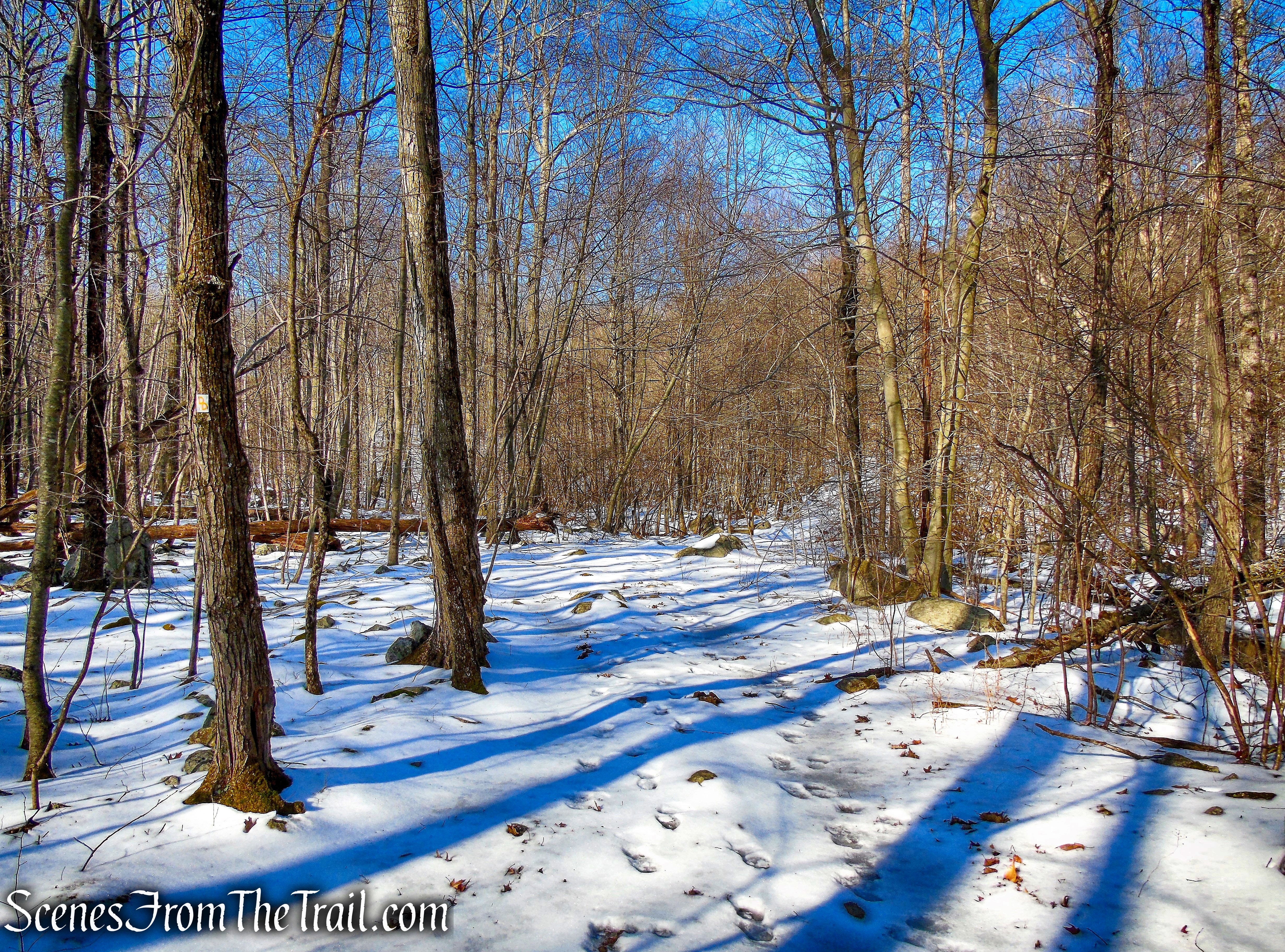
The trail itself is a model of modern sustainable trail-building techniques, showcasing bench-cut construction, stepping-stone crossings, rock stairs and other structures to harden the tread. For much of its length – where sustainable – no extensive work beyond brush removal was necessary at all: There are simply blazes on trees to keep hikers on track.
Doris Duke Trail
The Hike:
The 3.9 mile long loop trail was done counterclockwise, with a side trip on the Highlands/Allis Trail to a viewpoint near the junction with the Appalachian Trail.
Doris Duke Trail
From the eastern end of the parking area, enter the woods at a triple blaze for the Doris Duke Trail (yellow “DD” logo on white). The trail follows a woods road and soon crosses a wooden footbridge over a stream (built as an Eagle Scout project). About 200 feet beyond the bridge, you’ll notice a sign on the right “DD Loop.” Turn right, leaving the woods road, and head into the woods on a footpath, now following the loop of the Doris Duke Trail in a counterclockwise direction.
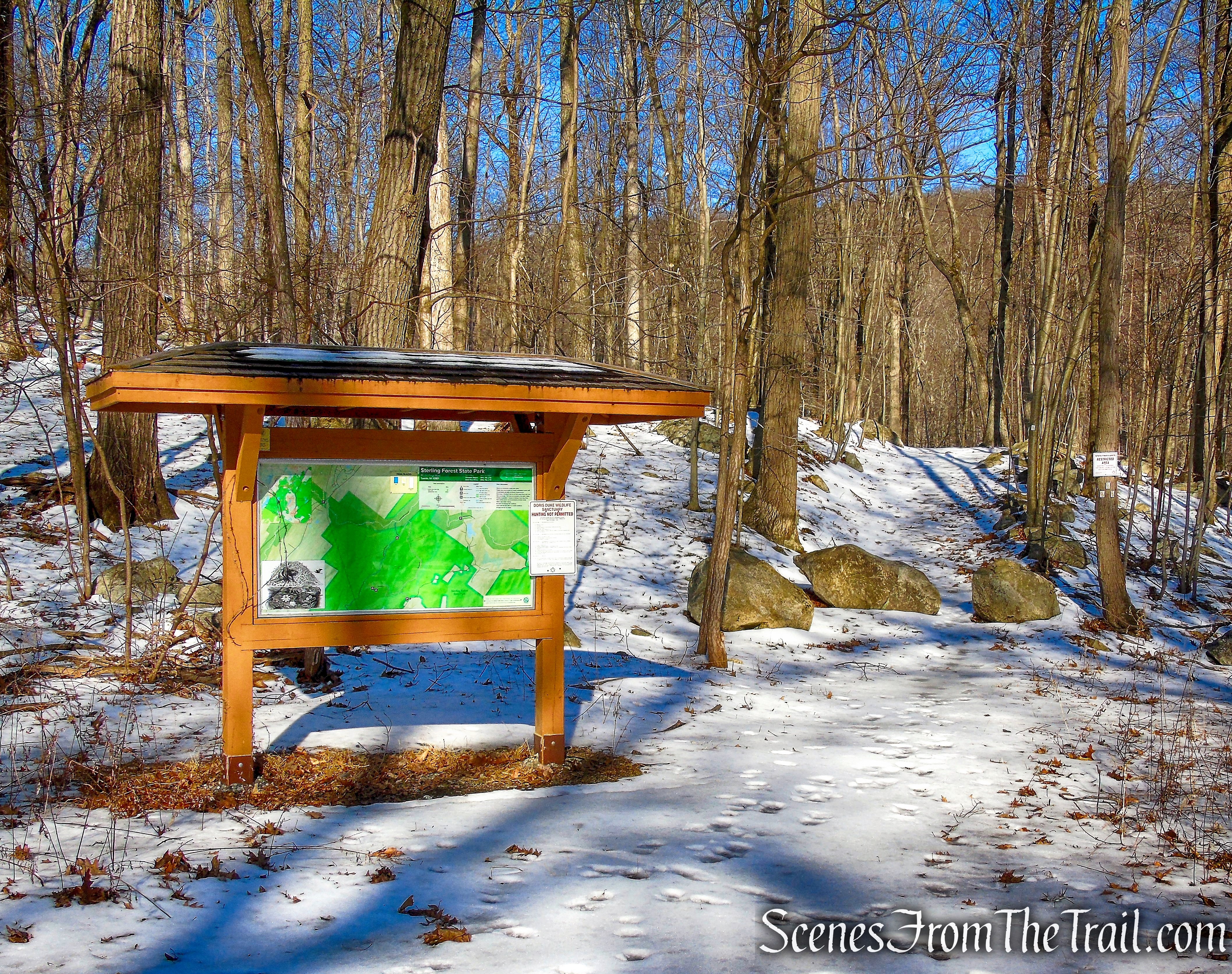
Doris Duke Trail begins to the right of the kiosk
enter the woods at a triple blaze for the Doris Duke Trail
Doris Duke Trail follows a woods road
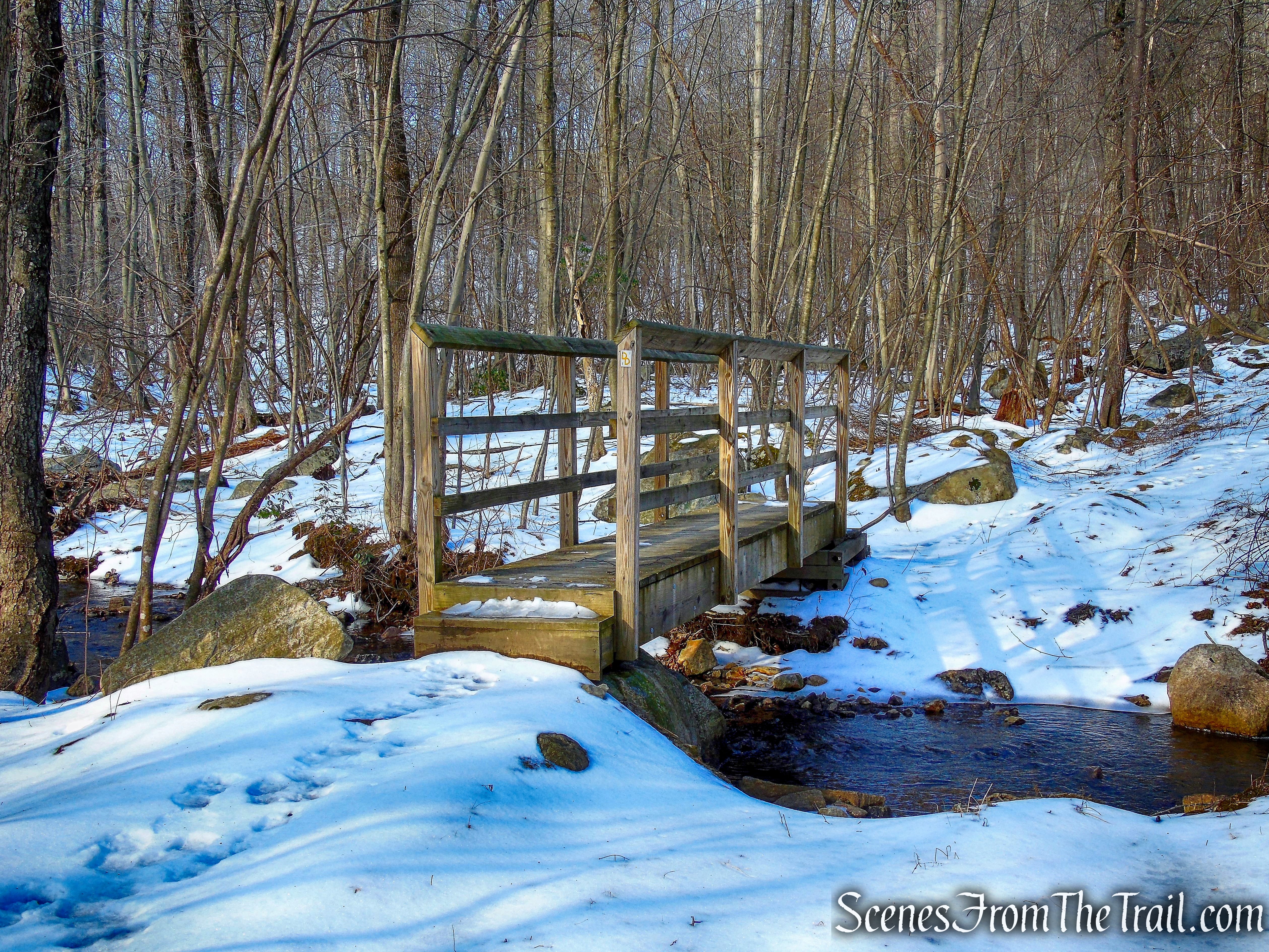
Doris Duke Trail crosses a wooden footbridge
Turn right, leaving the woods road – Doris Duke Trail
Turn right, leaving the woods road – Doris Duke Trail
head into the woods on a footpath – Doris Duke Trail
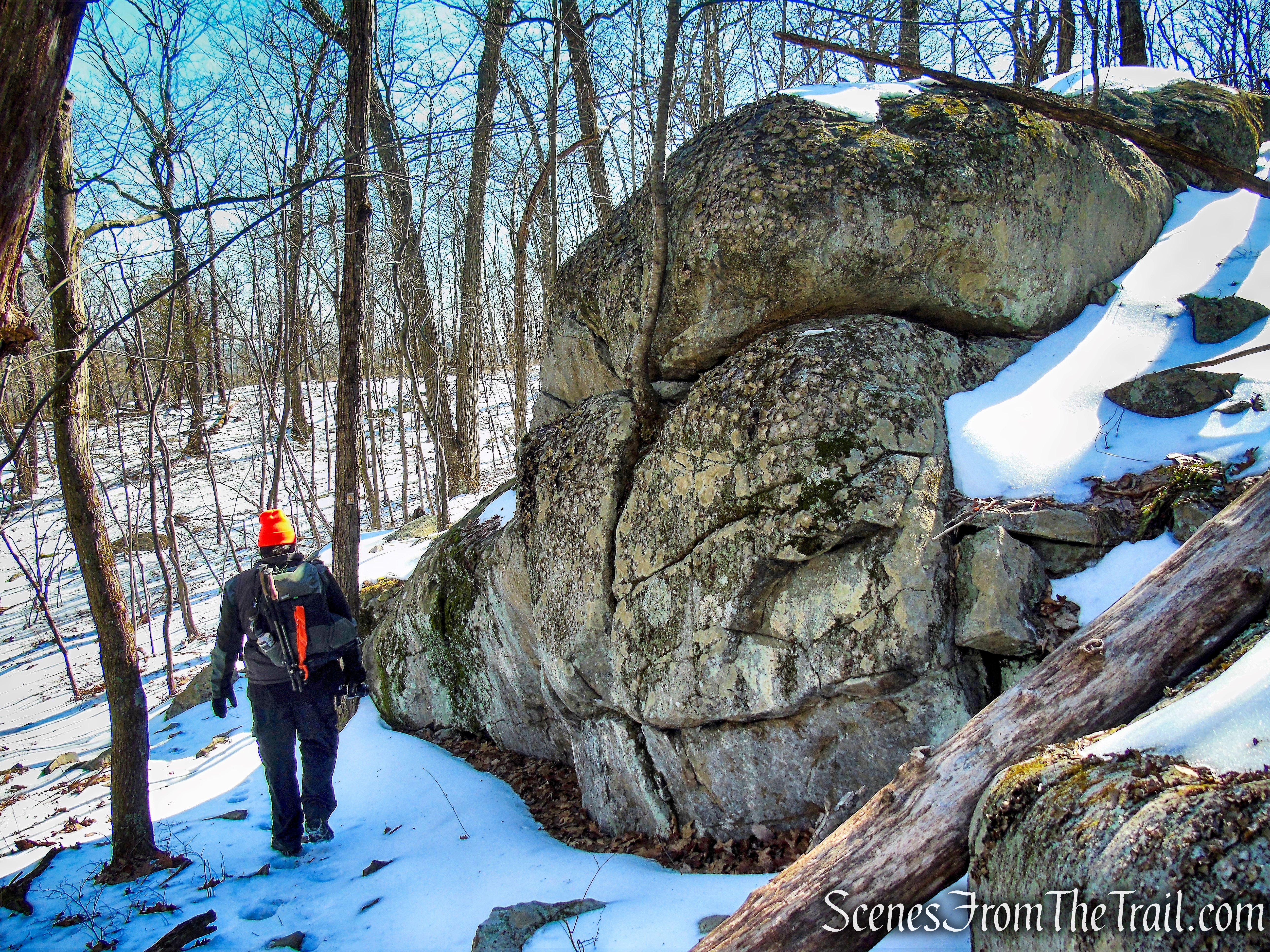
Soon, you’ll pass massive cliffs on the left. A short distance beyond, the trail begins to descend towards a wide marsh. It comes out on a rock outcrop overlooking the marsh (note the beaver lodge in the marsh), then bears left and continues along the base of the hill, parallel to the marsh.
Doris Duke Trail
massive cliffs – Doris Duke Trail
massive cliffs – Doris Duke Trail
massive cliffs – Doris Duke Trail

Doris Duke Trail descends towards a marsh
Doris Duke Trail descends towards a marsh
rock outcrop overlooking the marsh – Doris Duke Trail

Beaver Lodge – Doris Duke Trail
Doris Duke Trail continues along the base of the hill
Doris Duke Trail parallel to the marsh
After joining an old woods road, the trail bears left, leaving the road, and continues on a footpath. The trail curves to the left and begins to climb. It levels off, passes a balanced boulder on the left, then continues a gradual climb, soon joining a wide woods road.
Doris Duke Trail joins an old woods road
Doris Duke Trail
Doris Duke Trail bears left, leaving the road, and continues on a footpath
Doris Duke Trail
balanced boulder – Doris Duke Trail
balanced boulder – Doris Duke Trail
Doris Duke Trail
Doris Duke Trail joins a woods road
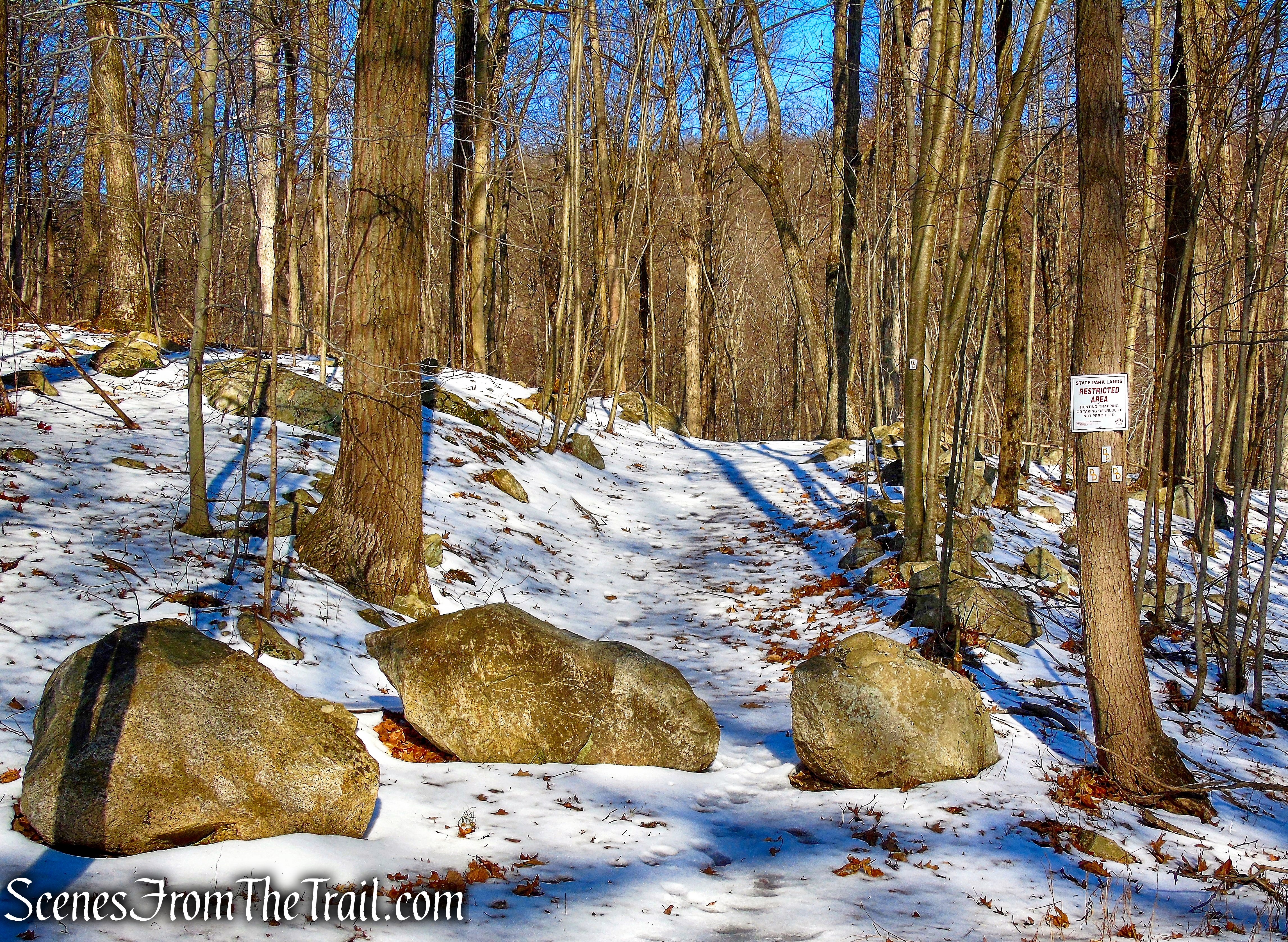
Although the Doris Duke Wildlife Sanctuary does not allow hunting, it lies within Sterling Forest State Park, where hunting is allowed. The trail travels through a small section of the area where hunting is permitted. Although there are signs posted, the boundaries are unclear and bright colors should be worn.
Doris Duke Trail
Doris Duke Trail
The Doris Duke Trail follows the road uphill towards the crest of the ridge, with several detours to avoid eroded and overgrown sections. As it approaches the crest, the trail bears left and continues on a footpath. Rock steps have been placed in places along this section of the trail to improve the tread for the hiker.
Doris Duke Trail
Doris Duke Trail
Doris Duke Trail
Doris Duke Trail
Doris Duke Trail
Upon reaching the crest of the ridge, the trail heads southwest along the ridge. Soon, it climbs to a panoramic viewpoint from a rock outcrop (marked by a large cairn).
Doris Duke Trail
Doris Duke Trail southwest along the ridge
Doris Duke Trail climbs to a viewpoint
Doris Duke Trail
Mombasha Lake may be seen on the left, and the hills of Sterling Forest and Harriman State Park are visible in the distance. This is a good spot to take a break.
viewpoint from Doris Duke Trail
viewpoint from Doris Duke Trail
Just beyond, you’ll come to a junction with the blue-blazed Allis Trail (also the route of the Highlands Trail). If only doing the Doris Duke Trail loop, continue to head southwest along the ridge following the yellow “DD” logo on white blazes.
If you want to take a short side trip to another viewpoint (0.4 mile out and back to this spot), turn right and head north on the Allis Trail, now following the blue blazes.
junction with the blue-blazed Allis Trail
The Allis Trail descends steeply then begins a short, but relatively steep ascent. The trail then levels off as it heads north along the ridge. In about 400 yards from the junction with the Doris Duke Trail, the Allis Trail reaches a west-facing viewpoint. A very short distance later, the Allis Trail ends at the junction with the Appalachian Trail. This is the turnaround spot.
Allis Trail
Allis Trail
Allis Trail
Allis Trail
Allis Trail
Allis Trail
Allis Trail
view west from Allis Trail
terminus of Allis Trail
Retrace your steps on the Allis Trail (about 400 yards), back to the junction with the Doris Duke Trail and turn right.
Allis Trail
Just ahead is the junction with the Doris Duke Trail. Bear right and continue to head southwest along the ridge, now following the teal diamond blazes of the Highlands Trail, dark blue blazes of the Allis Trail and the yellow-on-white logo blazes of the Doris Duke Trail.
junction with the Doris Duke Trail
head southwest on Doris Duke Trail
co-aligned Highlands/Allis/Doris Duke Trails
Doris Duke Trail
Soon, you’ll begin a steady climb and reach the highest point on the ridge (1,386′), marked by several white pines. Unfortunately, there are no views from this high point, but just before if you turn around as you near the top of the rise, there is a view to the northeast. The trail now begins to descend, with several steep sections. In about half a mile, you’ll cross a woods road and follow stepping stones across a wet area.
Doris Duke Trail climbs
Doris Duke Trail
Doris Duke Trail climbs
Doris Duke Trail climbs
Doris Duke Trail climbs
view near the high point of Doris Duke Trail
view near the high point of Doris Duke Trail
Doris Duke Trail
Doris Duke Trail
Doris Duke Trail
Doris Duke Trail
Doris Duke Trail
Doris Duke Trail
stepping stones – Doris Duke Trail
A short distance beyond, the Doris Duke Trail turns left, leaving the Allis Trail. Follow the yellow-on-white Doris Duke blazes, which head downhill, soon reaching an east-facing viewpoint with cedar trees. Beyond the viewpoint, the trail passes lichen-covered rocks on the right, goes by another viewpoint, and continues to descend. The trail approaches a stream on the left, with attractive cascades, then curves to the right and goes down to a woods road.
turn left on Doris Duke Trail
turn left on Doris Duke Trail
Doris Duke Trail
east-facing viewpoint – Doris Duke Trail
lichen-covered rocks – Doris Duke Trail
lichen-covered rocks – Doris Duke Trail
Doris Duke Trail
viewpoint – Doris Duke Trail
Doris Duke Trail
Doris Duke Trail
Doris Duke Trail turns left on woods road
The Doris Duke Trail turns left on the road, but a short distance ahead, it bears left, leaving the road, and soon crosses the stream on stepping stones. It rejoins the road and follows it to back to the start of the loop. Turn right and retrace your steps across the footbridge and back to the parking area where the hike began.
Doris Duke Trail
Doris Duke Trail bears left, leaving the road
Doris Duke Trail
Doris Duke Trail crosses the stream on stepping stones
Doris Duke Trail rejoins the road
Doris Duke Trail passes the start of the loop
retrace your steps across the footbridge – Doris Duke Trail
back to the parking area – Doris Duke Trail
Review:
This was a really good hike. The Doris Duke Trail is well laid out with plenty of blazes that makes it easy to follow, even with snow on the ground. The area is quite scenic with lots of rock formations and cliffs. The views aren’t that spectacular, but make for a nice spot for a break after the ascents. The side trip on the Allis Trail, to the junction with the AT, is a good option that extends the hike by just under 1/2 mile (out and back). It is an attractive section of trail that offers a different viewpoint.
We encountered a hiker with his dog near the start and two female hikers at the last viewpoint, all going in the opposite direction. I would like to revisit this hike in warmer weather to gain a different perspective of this beautiful trail.
This is also a good beginner hike, as you can choose to follow the same blazes for the entire hike by cutting out the side trip on the Allis Trail.
Pros: Well blazed trail, rock formations and cliffs, all around scenic area.
Cons: None.
Take a hike!
Doris Duke Trail
Sources:

Thank you! We vacationed every summer in Belvale during the forties and fifties. So beautiful.
LikeLike