December 25, 2018 – West Nyack, NY
Difficulty: Moderate
Length: Approximately 4 miles
Max elevation: 636 ft.– total elevation gain 735 ft.
Route type: Circuit
Map: Hudson Palisades Trails Map #109 – Buttermilk Falls Park Map
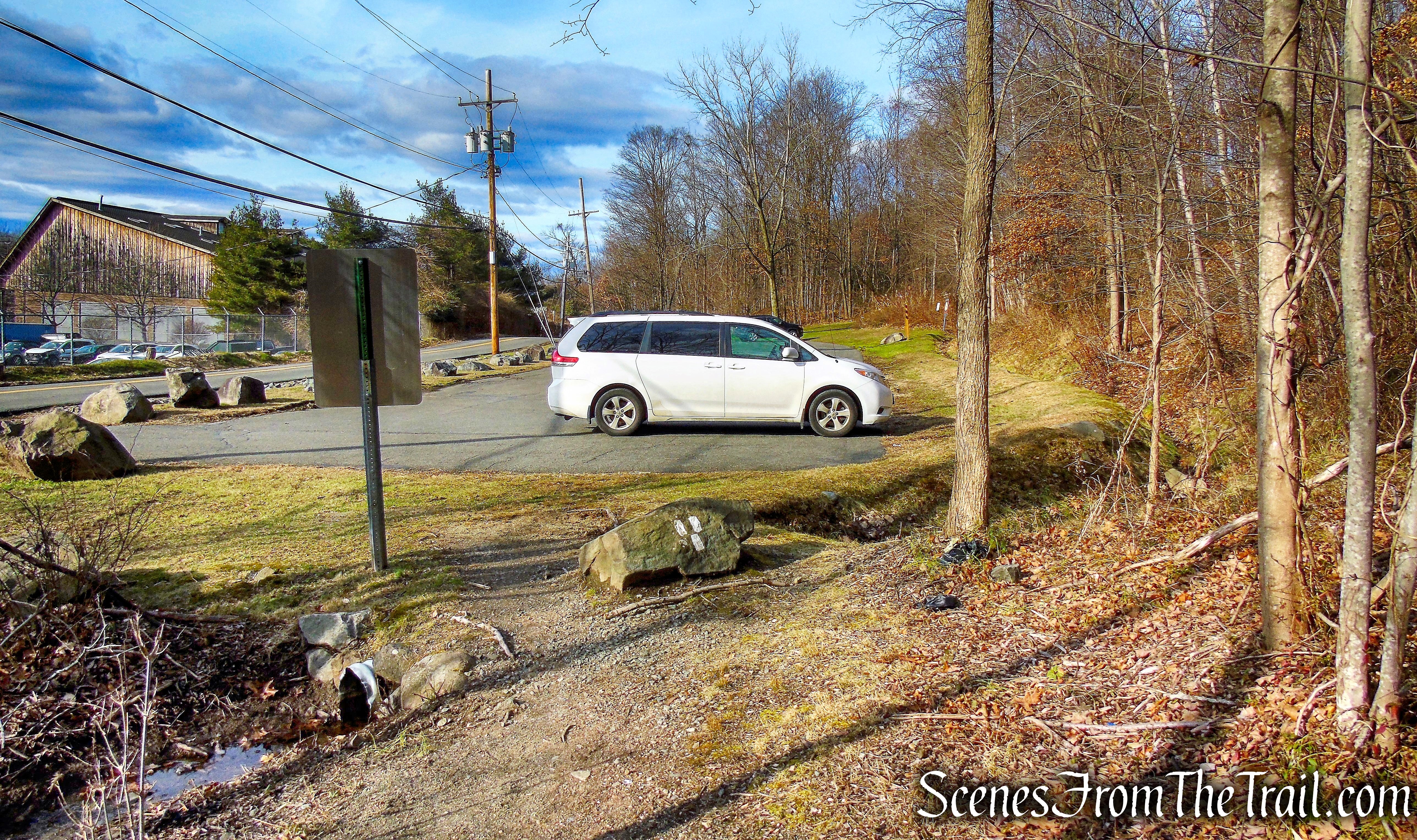
Trailhead parking: 199 South Greenbush Road – Nyack, NY
Overview:
This 75-acre park is primarily steep woodland with Buttermilk Falls cascading down the mountain in a westerly direction; part of the Palisades ridge. There are numerous Chestnut Oak, Red Oak, White Oak, Maple, Hemlock, Dogwood, Wild Rose and Sumac. The Park was purchased in 1975 and for decades the falls have been a natural attraction for its deep gorge and ravine effects. From rock outcrops at the scenic overlooks, one can look south towards New Jersey, west towards the Ramapo Mountains, and north to South Mountain. At the turn of the century, President Teddy Roosevelt during his visits to Blauvelt, frequently rode horseback stopping at this point for a view.
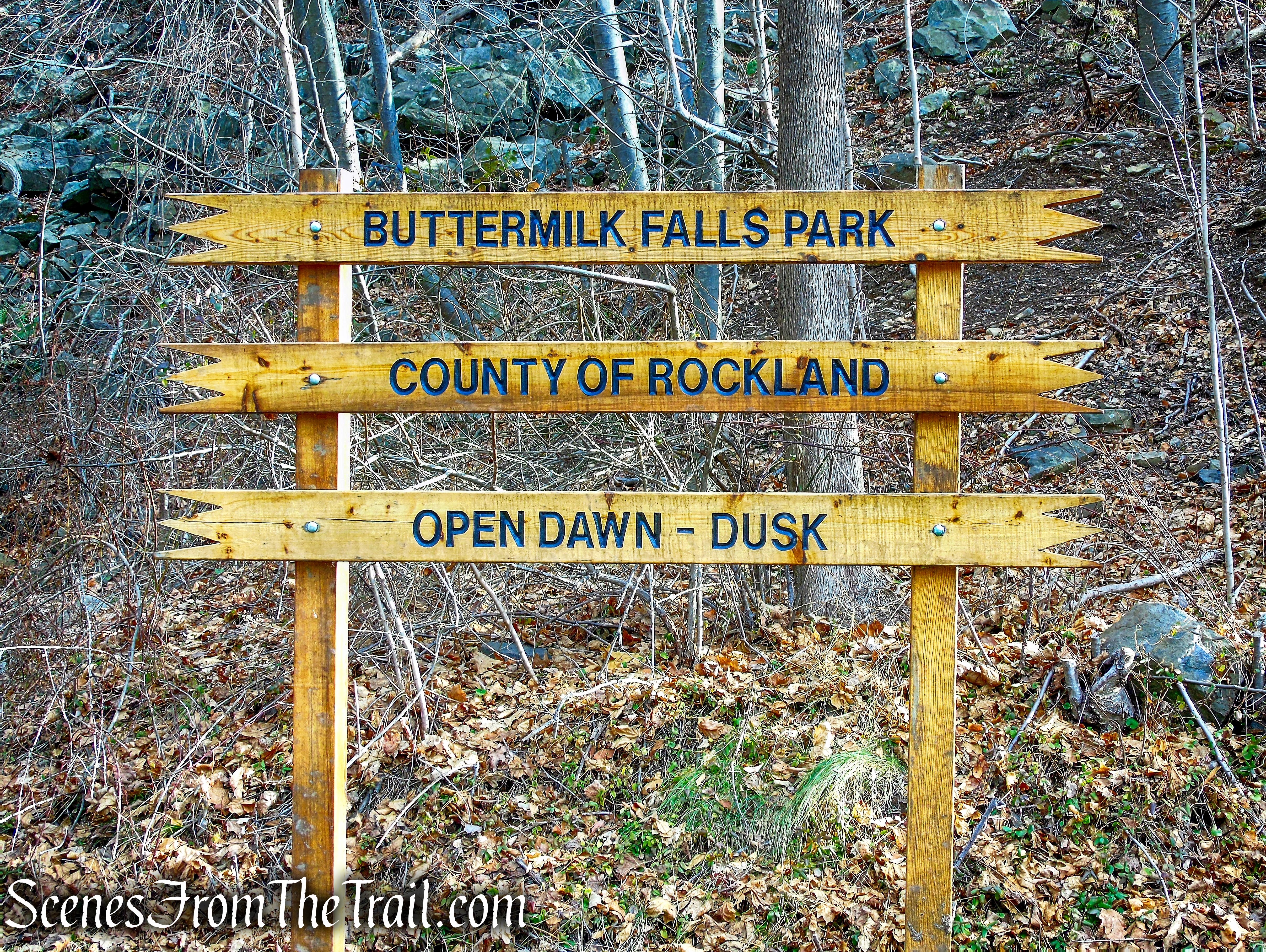
Buttermilk Falls County Park
There are approximately 1.5 miles of trails that lead from the parking lot to the Falls and Stream, and to several scenic overlooks. The trails connect to local undeveloped parks and Blauvelt State Park allowing for longer loop hikes involving the Long Path.
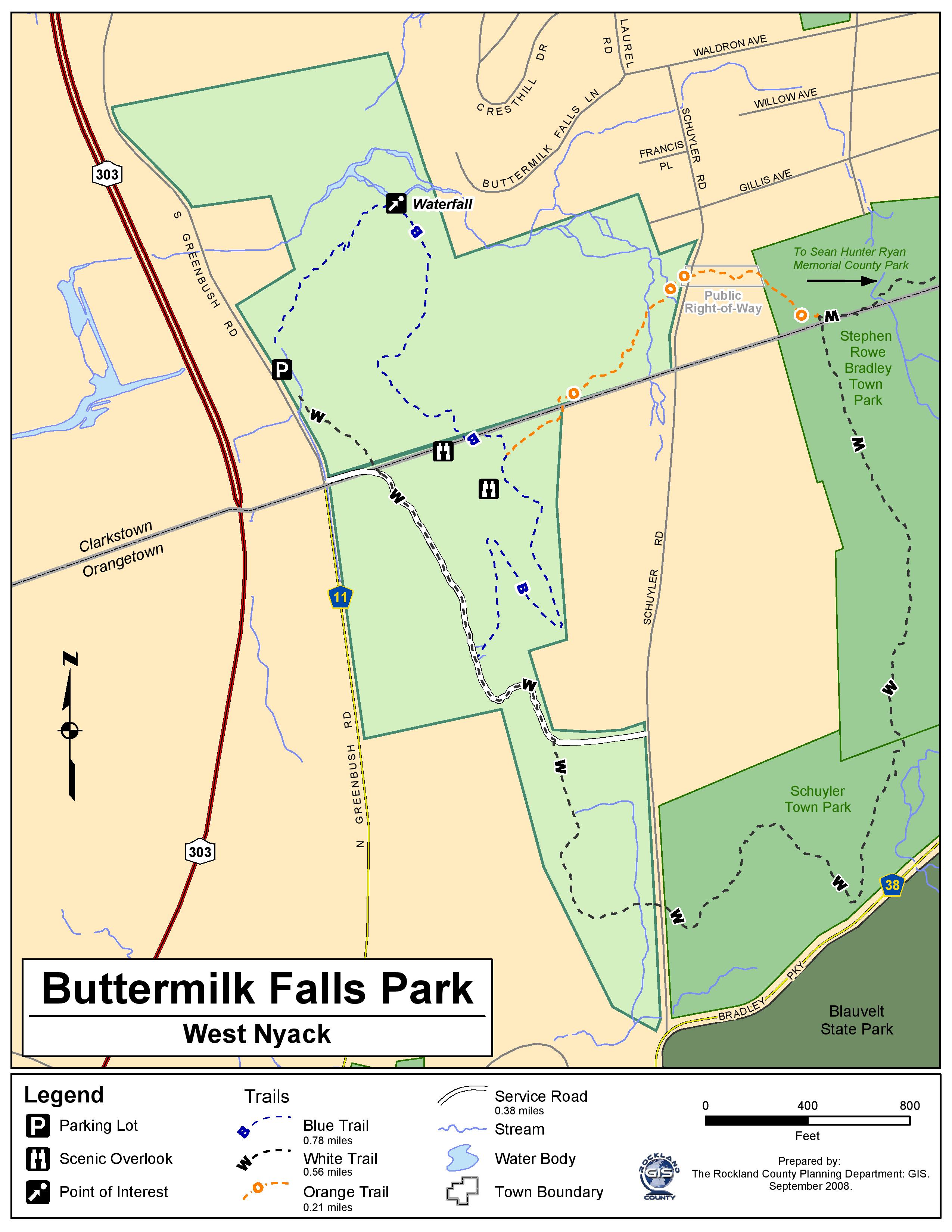
Buttermilk Falls County Park Map
The Hike:
The description below details the hike as done in a clockwise fashion, starting and ending in Buttermilk Falls County Park.
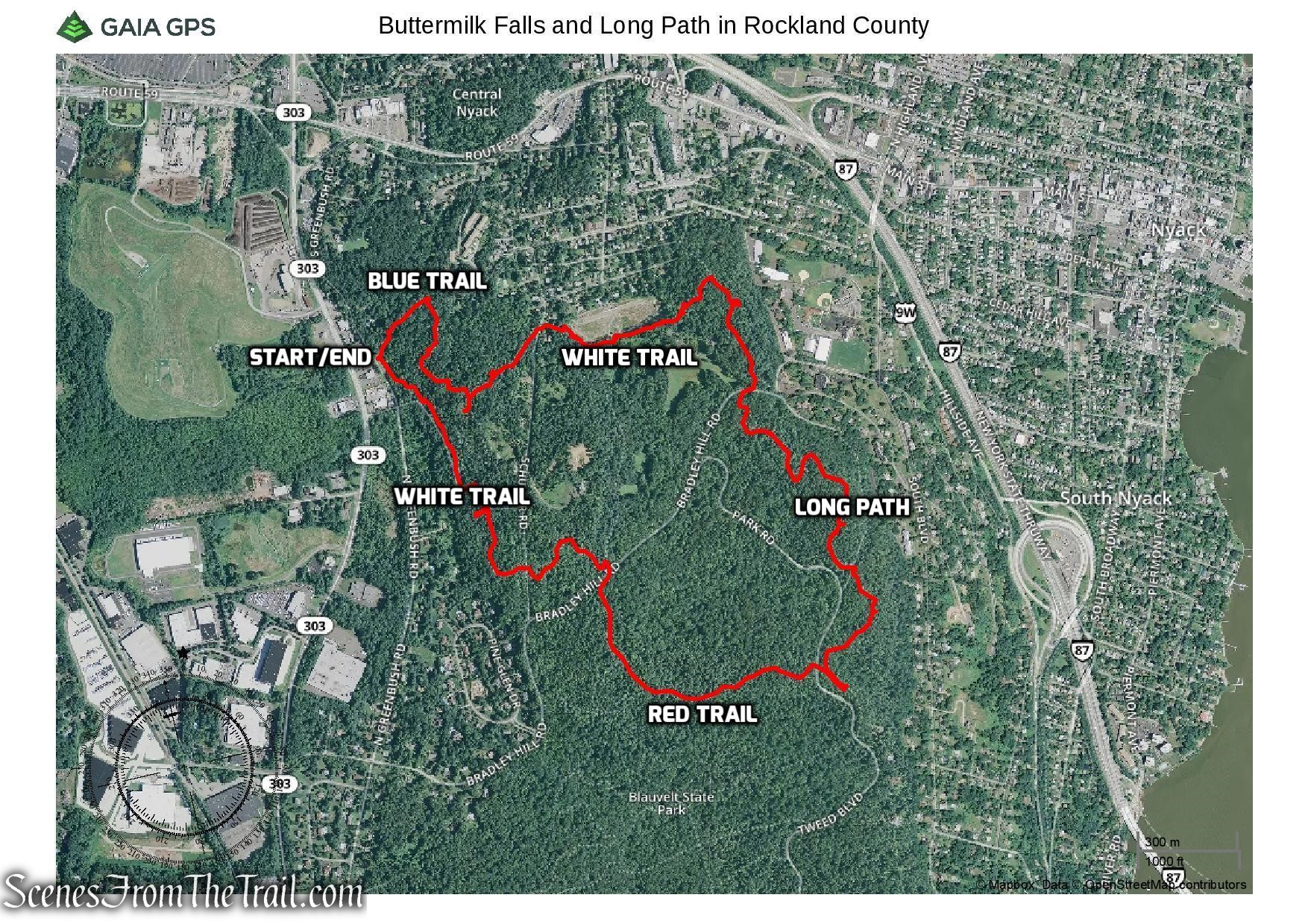
Buttermilk Falls and Long Path in Rockland County
From the northern end of the parking area, head into the woods on a blue-blazed trail, which climbs gradually to the right of a ravine. Pay careful attention to the blazes, as there are a number of side trails in this area.
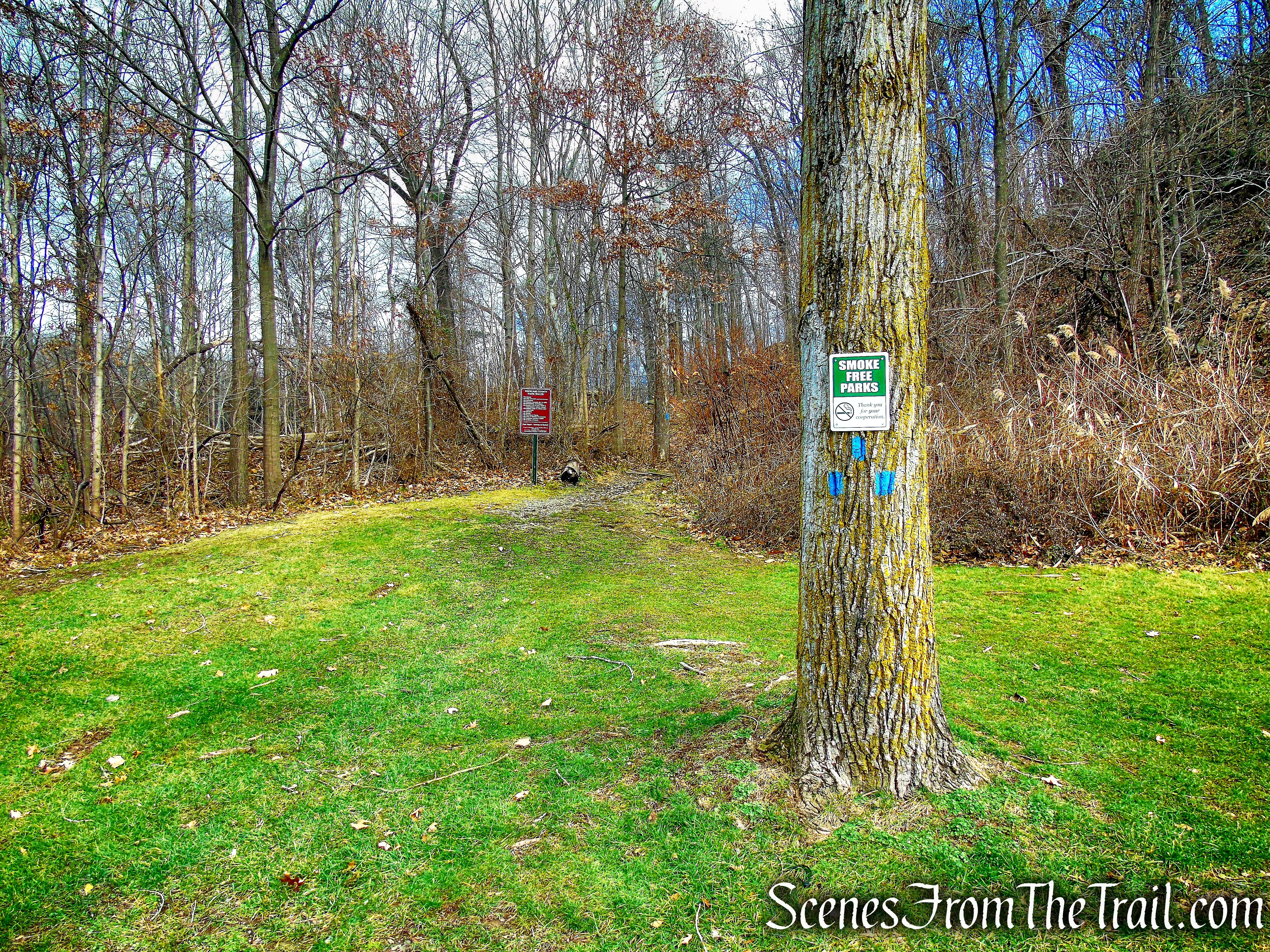
Start of Blue Trail
Blue Trail
After turning sharply and ascending on a switchback, you’ll reach the remnants of two stone pillars to the left of the trail, with scenic Buttermilk Falls cascading down the mountain.
Buttermilk Falls
The trail now bears right and continues to climb.
Blue Trail
After a brief descent, you’ll reach a limited west-facing viewpoint, with a field visible below.
Blue Trail
Continue ahead uphill on the blue trail, and you’ll soon come to a broader viewpoint.
Blue Trail
You may hear and see a train along the West Shore railroad tracks running parallel to the hills in the background.

view from Blue Trail
After a little more climbing, you’ll reach a T-junction with a woods road. Turn right and continue along the blue-blazed trail for about 150 feet to a third viewpoint, with the broadest view.
Blue Trail
You can see all the way west to the Ramapo Mountains and, on a clear day, the skyscrapers of Newark are visible on the horizon to the south.
view from Blue Trail
view from Blue Trail
Retrace your steps to the junction and continue ahead on an orange-blazed trail, which begins here.
Orange Trail
The trail soon bears left at a fork and descends on a footpath to cross a stream on rocks.
Orange Trail
Orange Trail
It then climbs slightly to cross paved Schuyler Road.
Orange Trail
On the other side of the road, the orange-blazed trail crosses a lawn and reenters the woods. Almost immediately, it turns sharply left and descends steeply.
Orange Trail
It then bears right and joins a wide wood-chip path, paralleling a large storm water retention area behind a fence on the left.
Orange Trail
In 150 feet, the orange-blazed trail bears right and ends at a junction with a white-blazed trail.
terminus of Orange Trail
Turn left onto the white-blazed trail, which parallels the east side of the storm water retention area. It crosses a wet area and a stream on rocks and begins a steady climb. To the right, you’ll pass a line of trees felled by Hurricane Sandy in 2012.
White Trail
White Trail
After reaching the end of the retention area, the trail reenters the woods and continues to climb. Just beyond a short level stretch, the white-blazed trail ends at a junction with the aqua-blazed Long Path.
terminus of White Trail
Turn right onto the Long Path and continue to climb, passing through a gap in an old stone wall near the crest of the rise.
Long Path
Sean Hunter Ryan Lookout
Sean Hunter Ryan Lookout
Long Path
Long Path
After another level section, the Long Path descends to cross paved Bradley Hill Road diagonally to the right.
Long Path
Sean Hunter Ryan Memorial County Park
It reenters the woods, climbing gradually.
Long Path
As the trail approaches the crest of the rise, there are views through the trees to the left over the Hudson River and the Tappan Zee Bridge.
Long Path
The Long Path descends to cross a macadam road, climbs again, then descends.
Long Path
Long Path
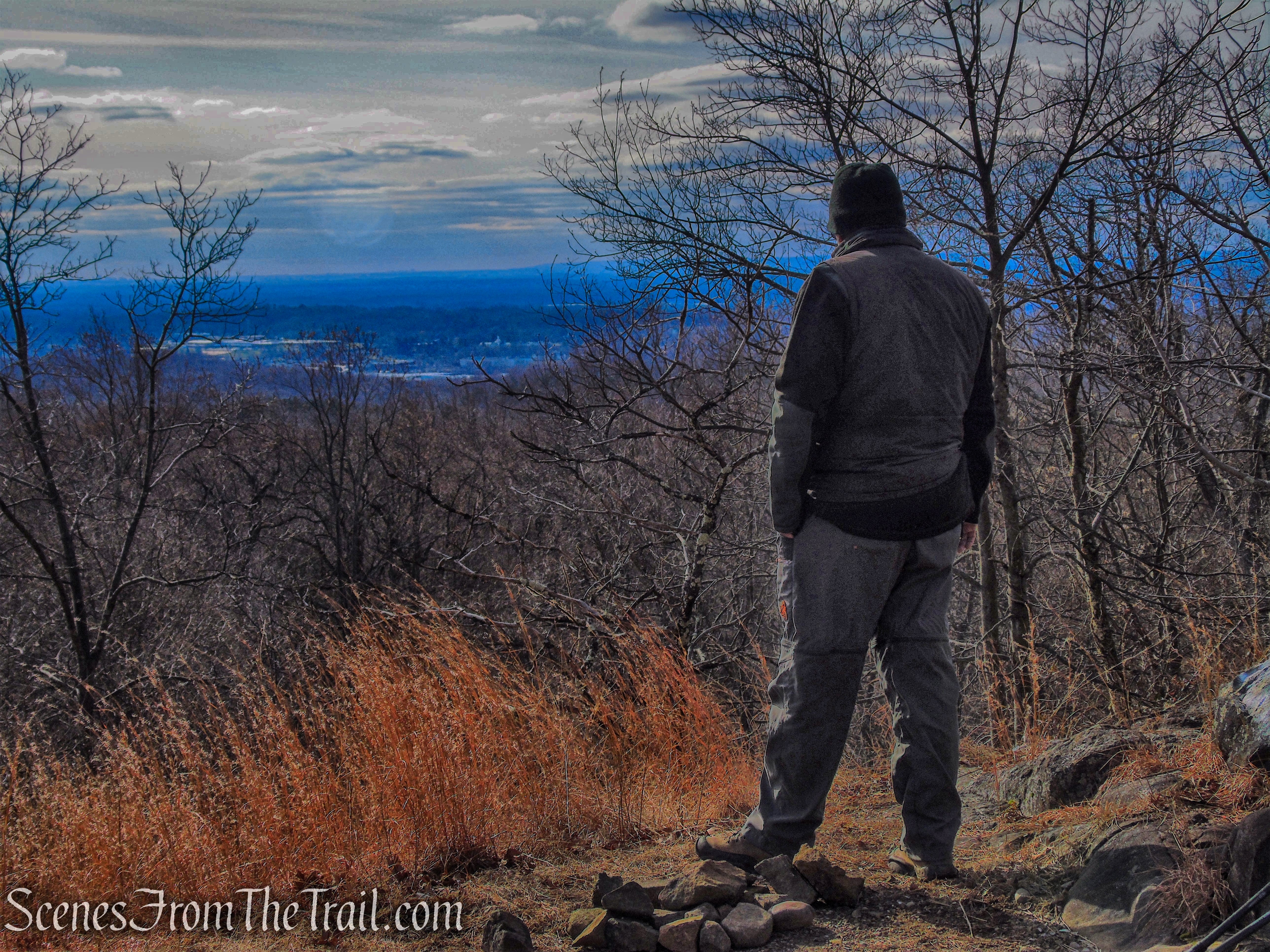
After climbing railroad tie steps, you’ll notice a triple-red blaze on the right. You’ll be continuing on this red-blazed trail, but first proceed ahead on the Long Path for another 150 feet to an expansive south-facing viewpoint from a graffiti-scarred rock, with the New York City skyline visible in the distance.
Long Path
Long Path
Long Path
After taking in the view, retrace your steps and bear left onto the red-blazed trail, which crosses Tweed Boulevard, climbs slightly, then begins a steady, gradual descent, with some views through the trees to the left. In half a mile, you’ll notice a white-blazed trail that begins on the left, but you should continue ahead on the red-blazed trail.
start of Red Trail
Red Trail
Red Trail
About 100 feet after crossing Bradley Hill Road, the red-blazed trail ends at a junction with another white-blazed trail.
Red Trail
Turn left onto the white-blazed trail, which climbs for a short distance, then begins to descend.
terminus of Red Trail
Soon, it crosses Schuyler Road, crosses a stream on a wooden footbridge, and continues to descend on a woods road.
White Trail
At a T-intersection, the trail bears left onto a wider gravel road and descends more steeply. Along the way, a blue-blazed trail begins on the right, but you should continue ahead on the white-blazed road.
White Trail
As the road bears left near the base of the descent, watch carefully for a turn where the white blazes turn right, leaving the road. Continue to follow the white-blazed trail, which descends stone steps, crosses a boardwalk, and soon ends at the parking area where the hike began.
White Trail
terminus of White Trail
Review:
This was a nice hike through the woods and the trails are well blazed throughout. The waterfall is better viewed after heavy rain. The Orange Trail was very swampy and had quite a few blowdowns. There is also some red blazes in the vicinity of the Orange Trail that are not on the trail map. The views are nothing special, but still a nice hike nonetheless. We only encountered a lone female hiker with a dog on the Long Path. We saw several large groups of deer and several hawks and Turkey Vultures.
Pros: Secluded woods, well blazed trails, lots of wildlife.
Cons: Orange Trail needs work, lackluster views.
Take a hike!
Buttermilk Falls and Long Path in Rockland County
Source:
