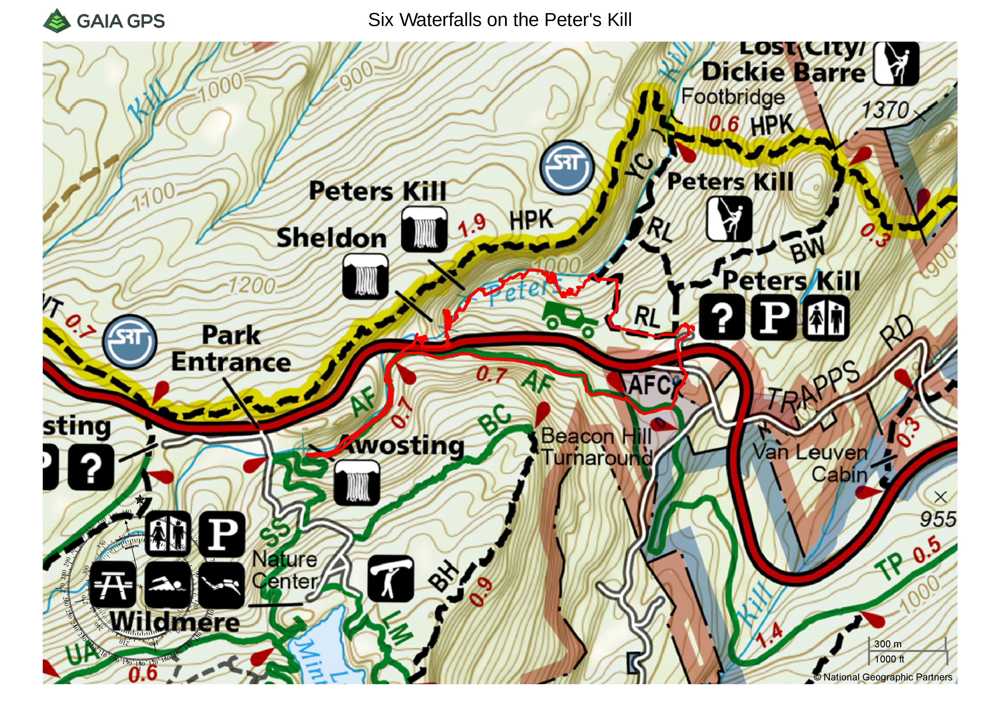
August 25, 2018 – Gardiner, NY
Difficulty: Moderate
Length: Approximately 3.5 miles
Max elevation: 1,305 ft.– total elevation gain approximately 421 ft.
Route type: Circuit
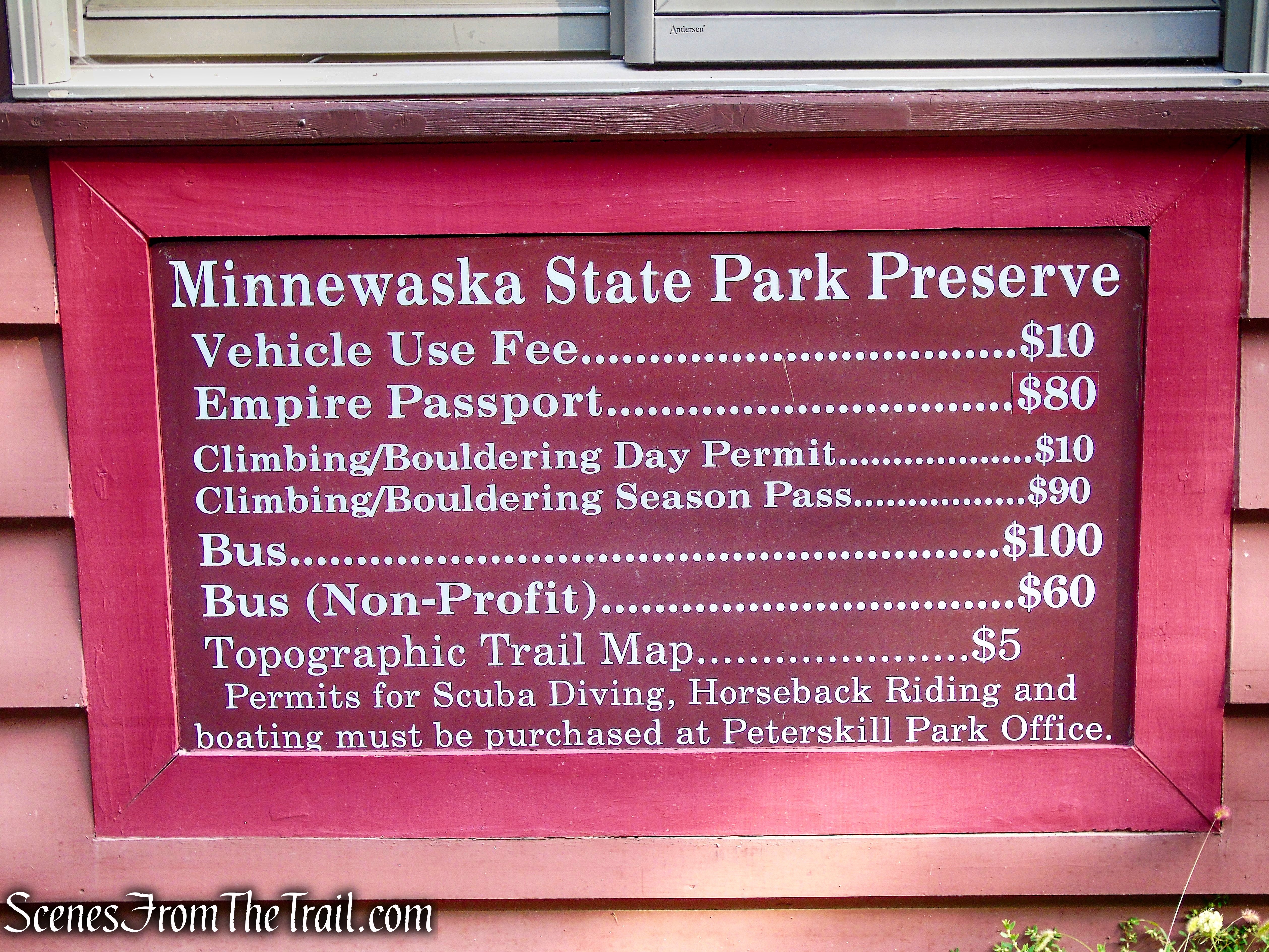
Fee: $10.00 per vehicle – Empire Pass Accepted
Trailhead parking: Peter’s Kill Area – 5080 Route 44-55, Gardiner, NY 12525
Please note: Waterfall conditions are dynamic, changing with weather and seasons. Stay on the trail when possible and be cautious of your surroundings, like slippery or rocky terrain, fast moving water, or steep drops.
Located in Ulster County, NY, Minnewaska State Park Preserve is situated on the dramatic Shawangunk Mountain ridge, which rises more than 2,000 feet above sea level and is surrounded by rugged, rocky terrain. The park features numerous waterfalls, three crystalline sky lakes, dense hardwood forests, incising sheer cliffs and ledges opening to beautiful views, clear streams cut into valleys, world-class rock climbing and 35 miles of carriageways and 35 miles of footpaths on which to bike, walk, hike and simply enjoy. And, all this within an hour and a half drive from New York City.

Minnewaska State Park Preserve
Visitors have twelve potential access points onto Preserve property. The entrance to the Peter’s Kill Area and Preserve office is accessed from Highway 44/55 and provides 120 parking spaces.
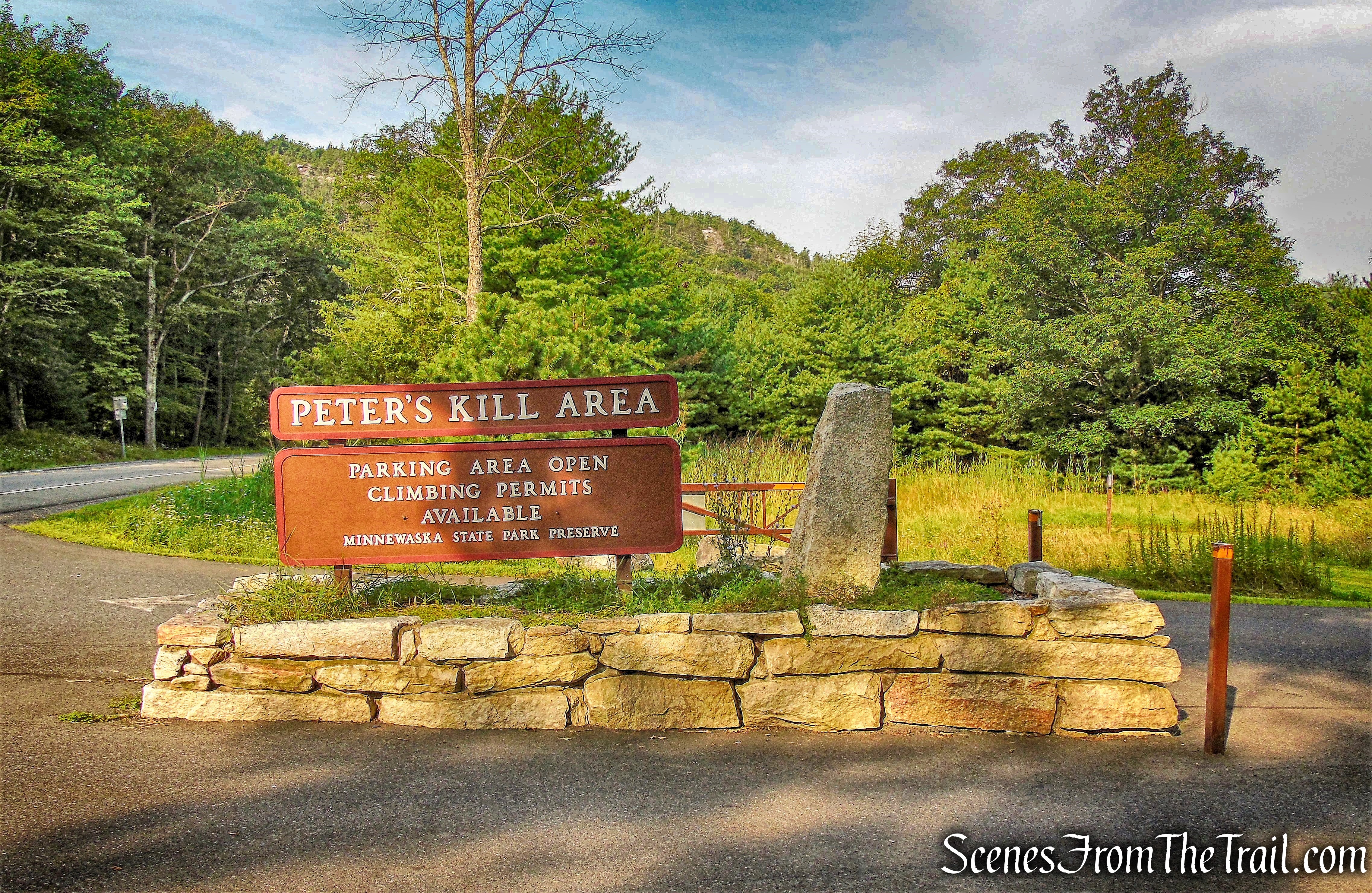
Peter’s Kill Area – Minnewaska State Park Preserve
The Peter’s Kill parking lot is used by visitors accessing the Peter’s Kill climbing area, by hikers heading for the Peter’s Kill Creek and High Peter’s Kill Trail and by visitors wishing to talk with staff.
Peter’s Kill Area – Minnewaska State Park Preserve
The Shawangunks (or “Gunks,” as they are more popularly called) have long been acclaimed as a rock climber’s paradise, but they could equally as well be celebrated for their waterfalls. Waterfalls of significant height are important viewpoints within the Preserve. These include: Stony Kill Falls on the Stony Kill near the Preserve’s northern edge. Rainbow Falls, Awosting Falls, Peter’s Kill Falls, and Sheldon Falls can be found along the Peter’s Kill. There is an unnamed falls which is located near the Sanders Kill in the northeastern corner of the Preserve. Verkeerder Kill Falls lies immediately adjacent to the southern edge of the Preserve along the Verkeerder Kill Falls Trail, in the Sam’s Point Area. A smaller secondary waterfall, situated along the Sanders Kill, just south of Routes 44/55, is visible from vehicles traveling west along that route. These falls are scenic features, characteristic of the Preserve.

Awosting Falls
Streams flowing within the Preserve form another example of small and intimate visual resources to be experienced. The Peter’s Kill flows northeast, approximately 9 miles from Lake Awosting into Rondout Creek in Alligerville, NY.
Peter’s Kill
Along the way, there are a series of picturesque cascades and waterfalls that flow within a relatively narrow channel.
Peter’s Kill
With all the recent rain, waterfalls that are normally a trickle in August, are flowing quite nicely this year. The previous week, we visited Stony Kill Falls and intended to do this hike right afterwards. It had rained throughout the previous night and the rocks were quite slick and hazardous to walk on. Fast forward one week and we were back to give it a another shot. The objective of this hike was to walk down to the Peter’s Kill and then follow it upstream and see the beautiful cascades and waterfalls. There are no formal trails in this area, so this hike entails bushwacking, walking on the rock slabs along the bank and several water crossings. The level of difficulty is determined by the volume of water flowing through the Peter’s Kill.
I have seen descriptions of similar hikes that have been done in the opposite direction, but I think it is a much better hike walking upstream. First off, you get to see the falls/cascades as you approach instead of constantly turning around to look back at them, Also, it is easier to assess your route around the falls and/or uphill from below. We did this hike counterclockwise from the Peter’s Kill Area.
Chasing Waterfalls Along the Peter’s Kill
A new feature that I have added is the Google Earth Fly-Through. It follows the path that we hiked and it gives you a good idea of the terrain, layout, amount of parking etc. Check it out, it’s pretty cool.
View the Google Earth Fly-Through video of the hike below.
We began the hike on the red-blazed Red Loop Footpath, which begins at the western end of the lower parking area. The Red Loop Footpath, as its name implies, is a loop and one can either go to the right or to the left, and will end up right back here by following the red blazes. We went to the left of the kiosk, following a mowed path through a grassy area.
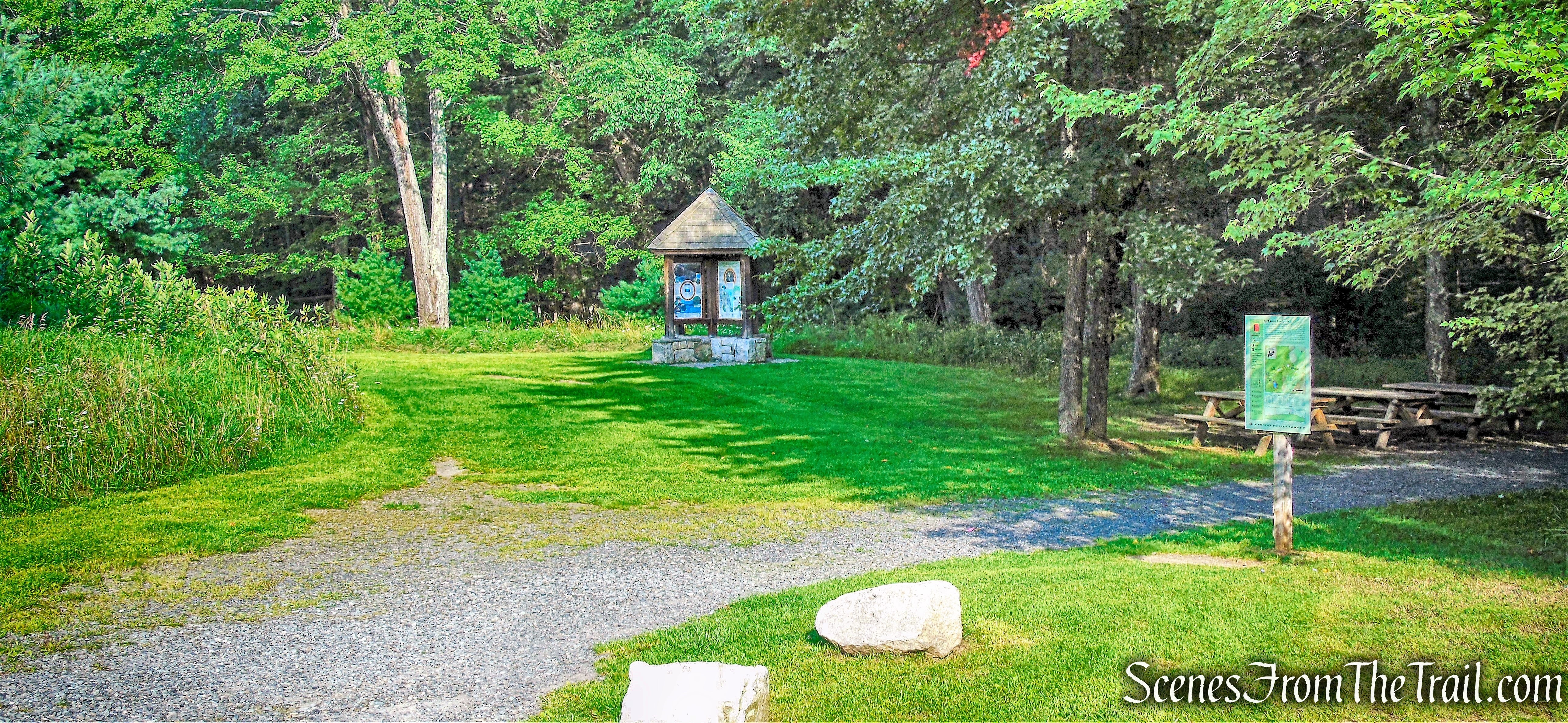
Red Loop Footpath
The trail heads west through a field, with the cliffs of Beacon Hill visible to the left. There are no trail markers through the field, but the path is obvious.
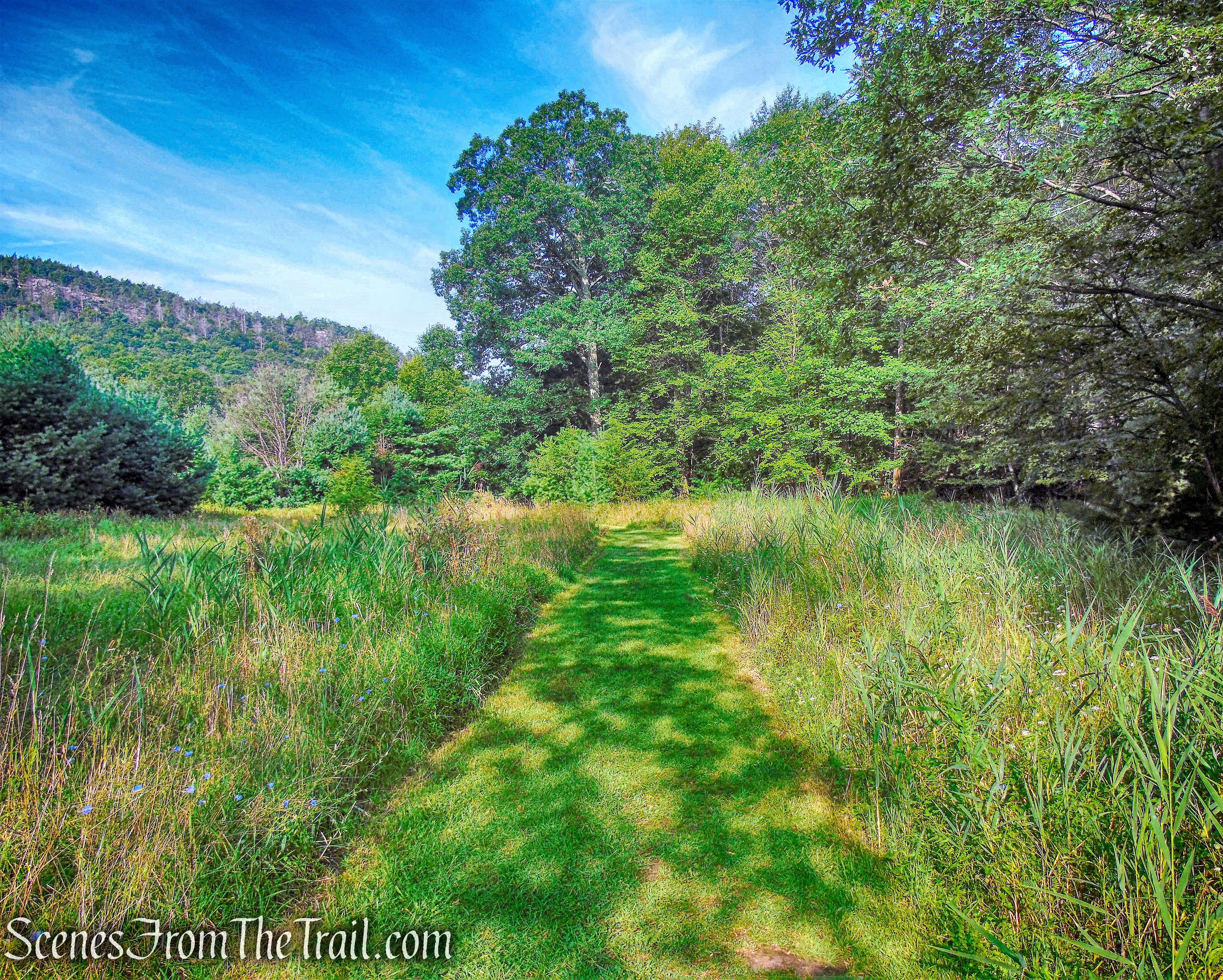
Red Loop Footpath
The trail descends gradually through a field of Purple loosestrife.
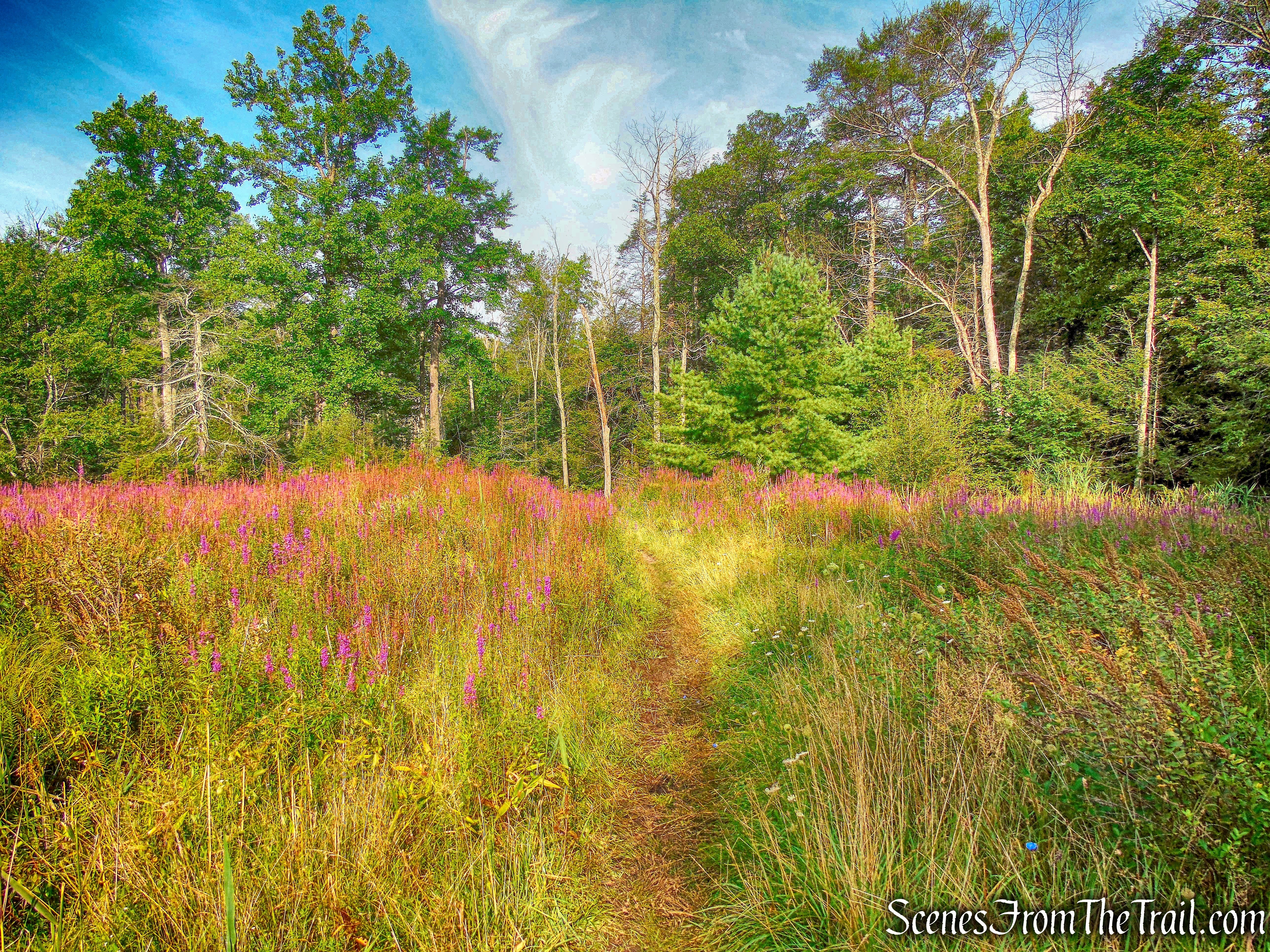
Red Loop Footpath
The trail then enters the woods and where we spotted the first red blaze.
Red Loop Footpath
The trail continues descending through the woods and turns right at a large rock outcrop, briefly levels off, then switchbacks down the hill. At the base of the descent, the Red Loop Footpath reaches the Peter’s Kill and turns right. Here we left the red-blazed trail and proceeded straight a few feet, to the Peter’s Kill.
leave the Red Loop Footpath and turn left onto the Peter’s Kill
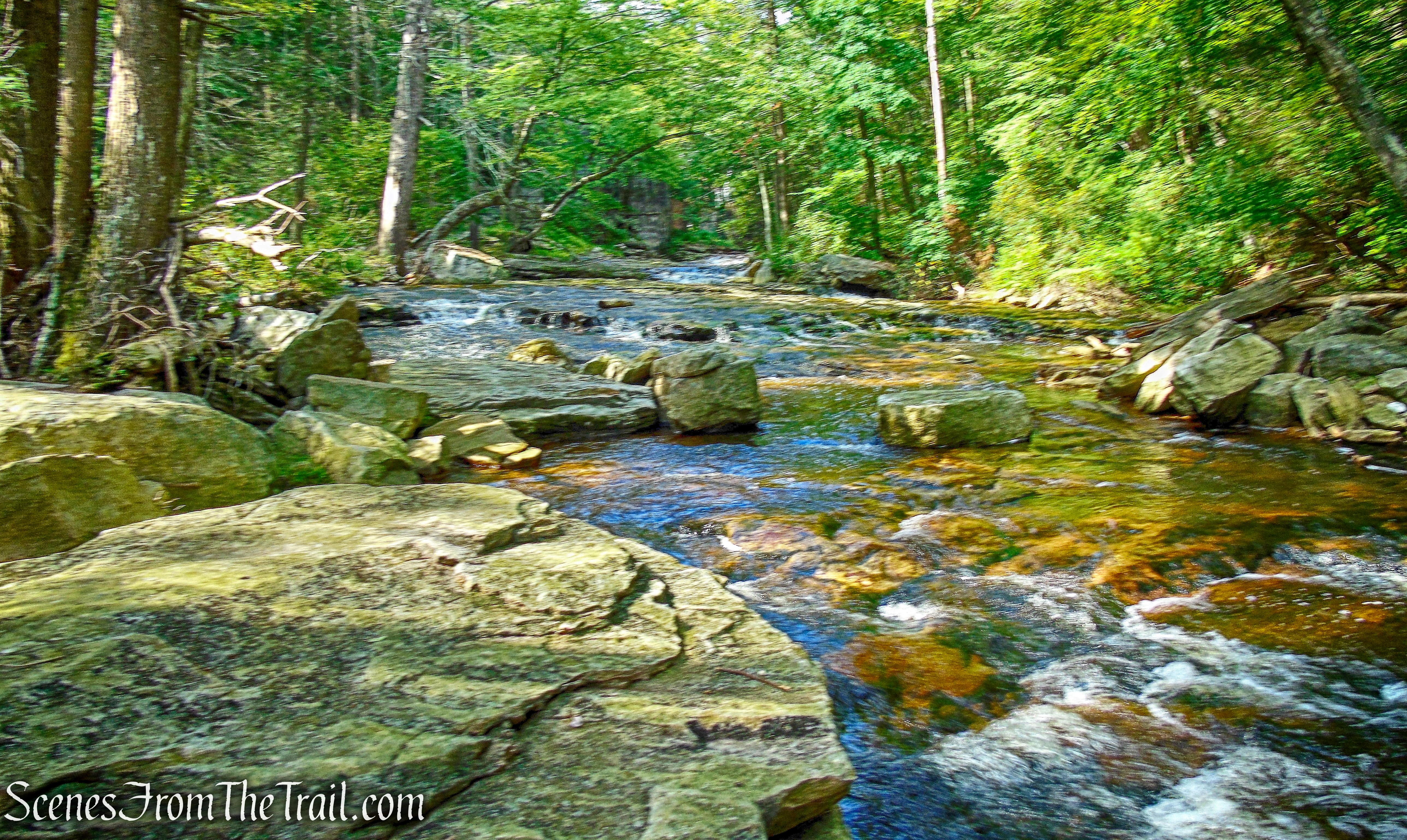
Now walking on the slanted rock slabs of the Peter’s Kill, we began heading upstream.
Peter’s Kill
There is a faint footpath that we followed briefly along the shore, then came out again on the rock slabs. At this point the Peter’s Kill curves to the north (right). To the left of the stream, the hillside is quite steep, so we decided to cross in this area. The Peter’s Kill is not very deep, but you will get wet if you are not careful. Hiking poles come in very handy for water crossings.
Peter’s Kill
After crossing over to the right side of the stream, we continued upstream, a short distance to Saw Mill Falls. Saw Mill Falls is a cascade over cascade type of falls and measures about 18 feet. This is a swimming hole that gets a little crowded on hot days, but we were out early and there was not a soul in sight.
Saw Mill Falls
We recrossed the stream here, which was a little more difficult due to the water level and rocks being spaced farther apart, but we managed just fine.
Crossing the Peter’s Kill in front of Saw Mill Falls
Once on the other side, another angle of Saw Mill Falls.
Saw Mill Falls
Now walking along the left side of the Peter’s Kill, we came to the upper cascade of Saw Mill Falls.
Upper Saw Mill Falls
We stopped here briefly to enjoy the beauty of our surroundings.
Upper Saw Mill Falls
The entire route upstream is very scenic and secluded. Some road noise could be heard from nearby 44/55 at times, but the sound of the water mostly blocked it out.
Peter’s Kill
The water level on this day was just perfect, allowing us to walk on the smooth rock slabs for most of the way.
Peter’s Kill
At times when the water was higher, we found footpaths which we followed alongside the Peter’s Kill. There are footpaths that go in different directions, but we made sure to stay close to the water.
footpath along the Peter’s Kill
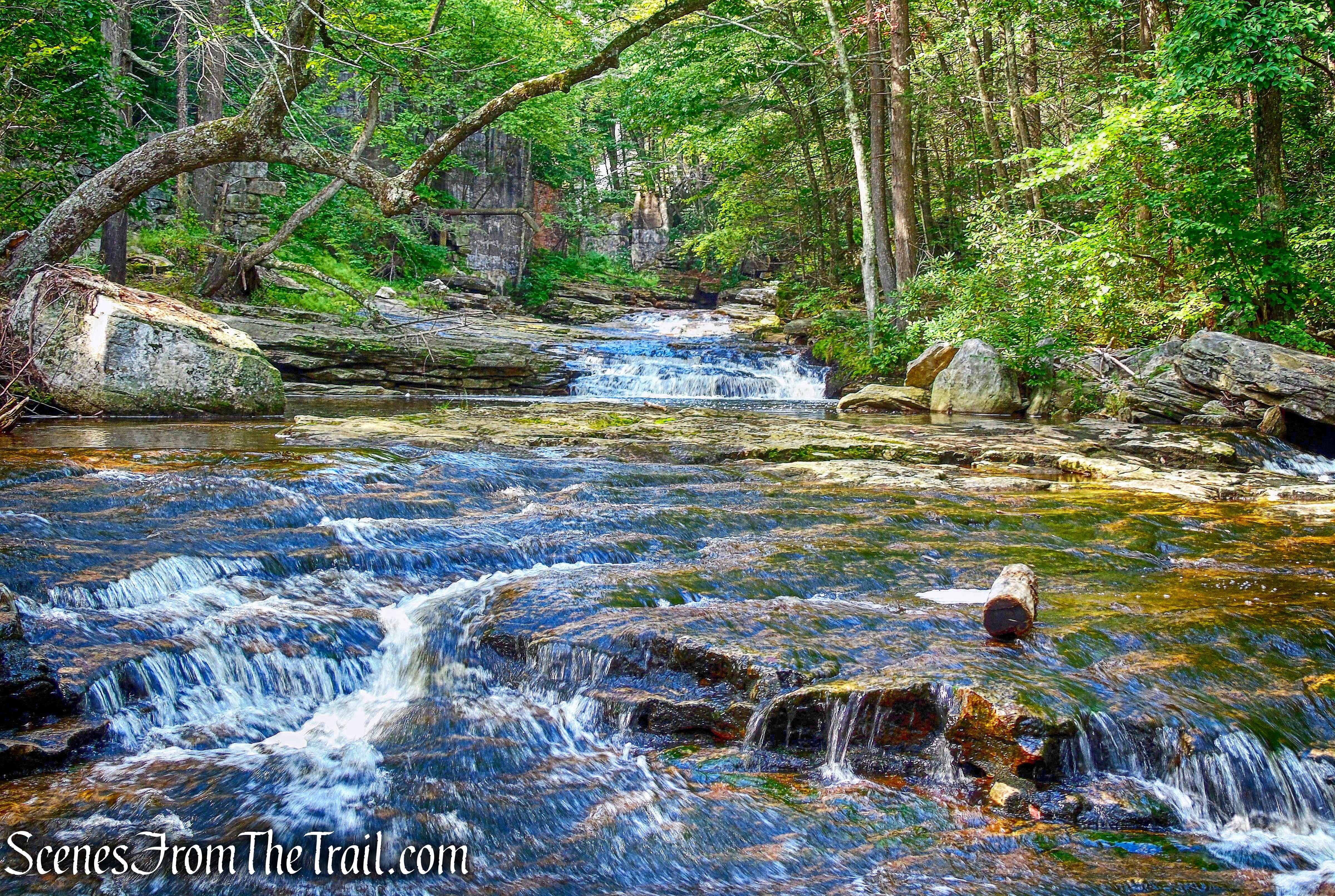
The Peter’s Kill weaves a rugged path down to Rondout Creek. Along that path, it has carved its way down to bedrock in many places, leaving the stream flowing over smooth rock slabs and a series of lovely cascades and waterfalls.
Peter’s Kill
Same cascade, different angle.
Peter’s Kill
While making our way upstream, I couldn’t help but wonder why there is no formal trail through this area.
Peter’s Kill
I came across this while doing a little research: The Red Loop Trail in the Peter’s Kill area was approved for a reroute in 2006. This trail provides a connection between the Peter’s Kill parking lot and the Peter’s Kill. Due southwest of the Red Loop Trail, there is an historic Power House and two waterfalls along the stream, the Peter’s Kill Falls and Sheldon Falls. Currently, there is no designated trail providing access to these historic and natural resources. Due to the location of the falls, this is a high use area and a myriad of social trails has therefore developed. The historic Power House provides a unique opportunity for interpretation and the falls represent some of the natural beauty that exists at Minnewaska State Park Preserve. The potential exists to develop a sustainable trail to provide a connection from the Peter’s Kill parking lot (via the Red Loop Trail) to the Power House and the two falls.
To be honest, I prefer that they just leave it the way it is.
Peter’s Kill
As we continued upstream, I could make out a large stone structure on the left.
Peter’s Kill
The historic resorts that were once located on Lake Minnewaska were served by a hydroelectric power house located on the Peter’s Kill.
Hydroelectric Power House ruins on the Peter’s Kill
Construction was finished on the power house in 1921. It began operation on October 14th, 1922 and continued to provide hydroelectric power until the late 1960’s.
Hydroelectric Power House ruins on the Peter’s Kill
This power house was for generating electricity at both The Wildmere and The Cliff House, two big resort hotels on Lake Minnewaska.
Hydroelectric Power House ruins on the Peter’s Kill
The power house is a stone structure that is not secured and is open to visitor exploration. The walls, entrance bridge and interior equipment are largely intact; the roof collapsed many years ago.
Hydroelectric Power House ruins on the Peter’s Kill
Water from the Peter’s Kill was diverted under this structure, which fed a large generator. When the Peter’s Kill didn’t have sufficient flow, an oil combustion engine was used to generate the electricity.
Hydroelectric Power House ruins on the Peter’s Kill
A wooden and metal sluiceway runs from a concrete dam at the top of the Peter’s Kill Falls to the power house.
sluiceway
The sluiceway is largely intact with only a few missing sections.
sluiceway
There are two stone abutments that use to carry the sluiceway pipe over the Peter’s Kill. A section of pipe that enters the power house, is visible to the right.
stone abutments
A closer look at the massive pipe.
sluiceway pipe sticking out from Hydroelectric Power House ruins on the Peter’s Kill
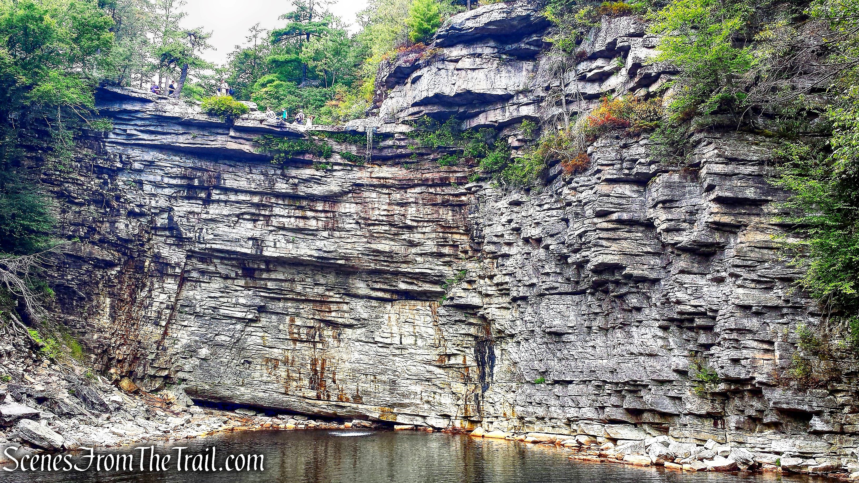
Adjacent to the power house is Peter’s Kill Falls as it drops off rock ledges. We would be on that ledge in a short while.

Peter’s Kill Falls
Peter’s Kill Falls is a chute and cascade type of falls and measures about 53 feet high. In times of high water, such as spring thaw, the water covers most of the rock ledge.
Peter’s Kill Falls
We crossed to the other side, which may be more difficult in times of high water, to get an up close view of Sheldon Falls.
Sheldon Falls
There is conflicting information about this waterfall online. It is referred to as Peter’s Kill Falls on some sites, but after viewing some vintage photographs, I am confident that I got the names right. I am not sure of the height, but it is spectacular as it cascades over a staircase of rock ledges.
Sheldon Falls
We then made our way back near the power house and bushwacked up the steep hillside. It is possible to climb up the left side of Peter’s Kill Falls, but the rocks were a little wet and we decided against it. We came out on Route 44/55 and turned right. In a short distance, there is a footpath that leads to Upper Peter’s Kill Falls.
Upper Peter’s Kill Falls
Upper Peter’s Kill Falls has a dam above it. When the water is high, one side overflows and courses down a stream bed to make a secondary waterfall
Upper Peter’s Kill Falls
Looking east from atop the falls.
view north from Upper Peter’s Kill Falls
A massive stone structure sits between the road and the waterfall. During the mid 1800’s, this roadside spot was the site of a sawmill operated by George Davis, who eventually orchestrated the sale of hundreds of acres of land, including Lake Minnewaska itself, to Alfred Smiley.
stone ruins
The dam above Peter’s Kill Falls, which can be seen from the road.
Peter’s Kill dam
We headed out to Route 44/55 and carefully crossed.
looking out at Route 44/55 from the dam at Upper Peter’s Kill Falls
We walked past the gate and began walking on the Awosting Falls Carriage Road.
Awosting Falls Carriage Road
The Awosting Falls Carriage Road was built in 1907 to link the Mohonk Mountain House with Minnewaska, and it is marked with red diamond blazes. The road descends on a broad curve to reach the base of Awosting Falls, which is particularly spectacular after heavy rains.
Awosting Falls Carriage Road
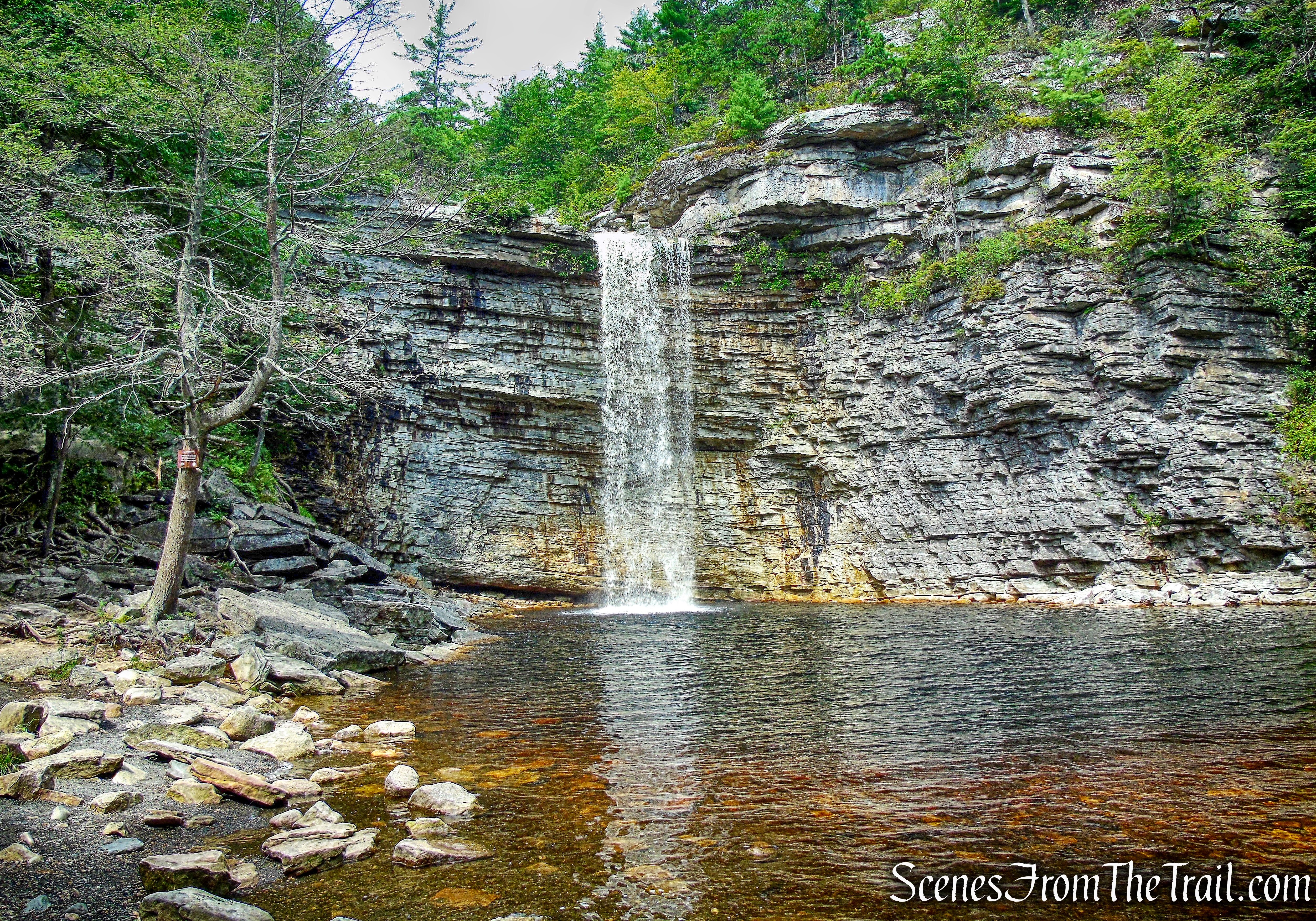
Due to its close proximity to the entrance and parking area, Awosting Falls is probably the most visited and photographed of all the Minnewaska State Park waterfalls.
Awosting Falls
Awosting Falls is a vertical drop over gorgeous Shawangunk conglomerate into a plunge pool. I have seen it listed anywhere from 60 – 80 feet tall.
Awosting Falls
In an unusually dry summer, I visited the Awosting Falls in August of 2014 and it was nothing but a trickle.
Awosting Falls – August 30, 2014
The falls are gorgeous at most anytime of the year, but during the early spring thaw, the flow is usually stronger. Below is an image from a visit in April of 2015.
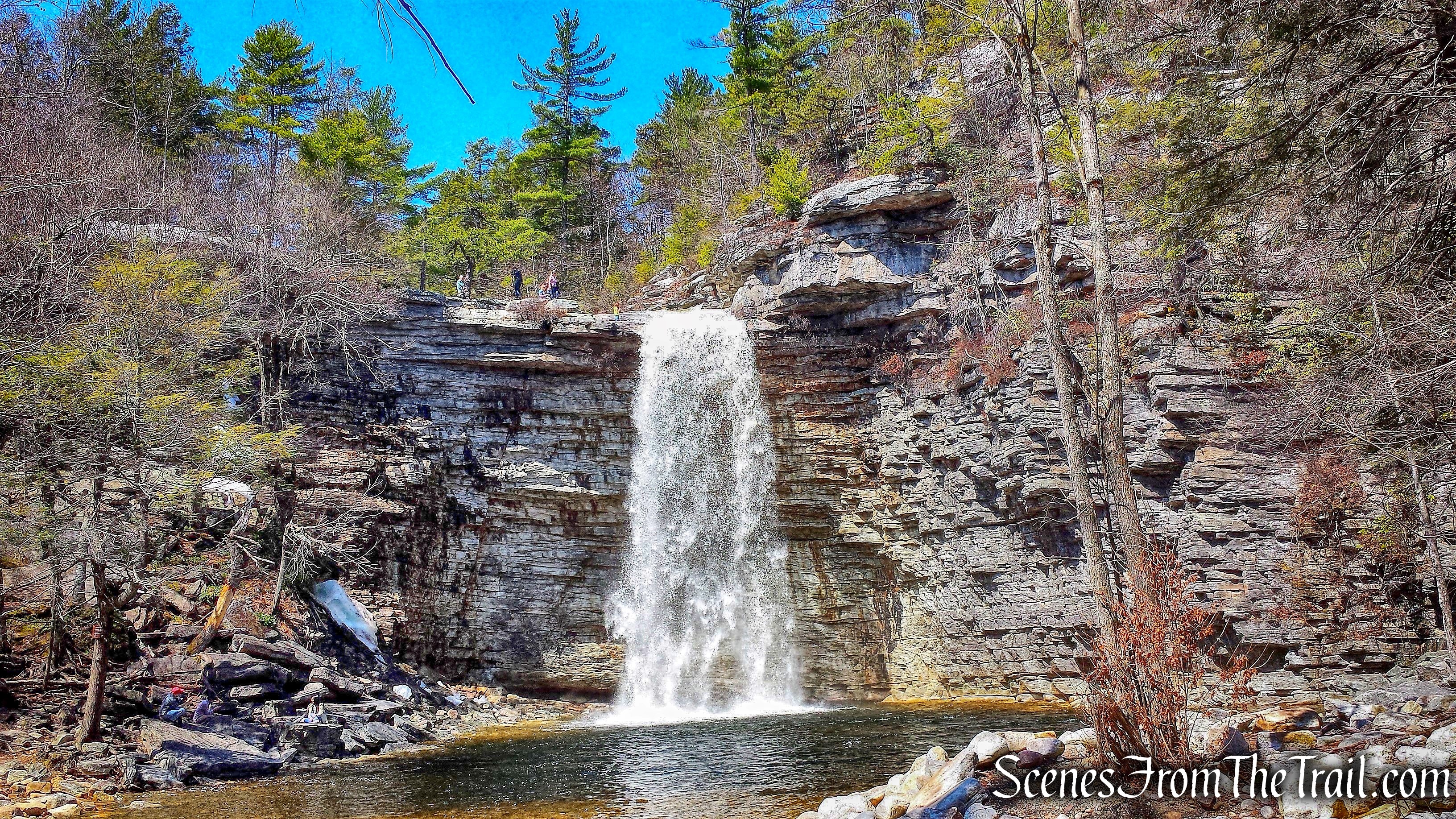
Awosting Falls – April 18, 2015
Awosting Falls is also beautiful in the wintertime when the base of the Falls become frozen. Below is an image from a visit in February of 2015.
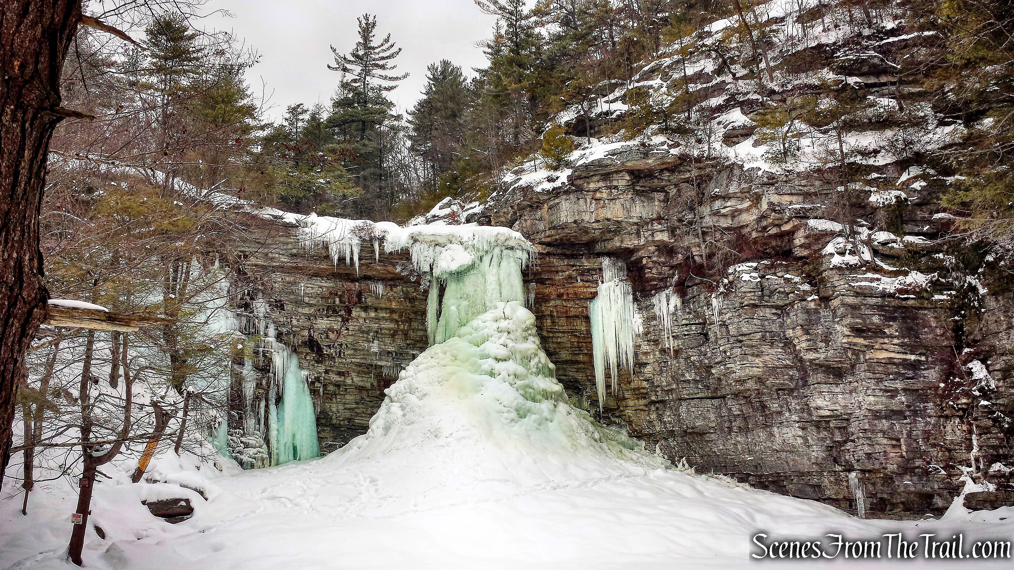
Awosting Falls – February 8, 2015
After spending a little time at Awosting Falls, we retraced our steps along the carriage road. When we reached the fork, we veered right. The left fork leads out to Route 44/55, the way we came in.
veer right on Awosting Falls Carriage Road
The Awosting Falls Carriage Road weaves through the hillside as it descends gradually. At first it travels close to the road, then veers away from it.
Awosting Falls Carriage Road
The road descends through massive cliffs that were blasted in order to construct the road.
Awosting Falls Carriage Road
A look back at the cliff.
Awosting Falls Carriage Road
At a fork with an unmarked road, we stayed left.
stay left on Awosting Falls Carriage Road
Approximately one mile from Awosting Falls, we turned left on the white-blazed Awosting Falls Connector Footpath.
turn left on Awosting Falls Connector Footpath
In about 260 yards, we arrived at the terminus of the Awosting Falls Connector Footpath, at Route 44/55. We crossed the road and returned to the Peter’s Kill Area, where our hike began.
terminus of Awosting Falls Connector Footpath
Another great hike in The Gunks! The weather was perfect and the falls were flowing. The Peter’s Kill is definitely worth a visit and since there are no blazed trails, it gets less foot traffic than the rest of Minnewaska.
Pros: Peter’s Kill, waterfalls, lovely cascades, lesser traveled, The Gunks.
Cons: More foot traffic near Awosting Falls.
Take a hike!
Chasing Waterfalls Along the Peter’s Kill

I’m having just a bit of trouble following the map and I’d like to have it on my Gaia before I head out. Do you have it saved on Gaia to share?
LikeLike
Here you go:
https://www.gaiagps.com/datasummary/track/267b7a77-04f1-4763-a70c-df365298ce05/
LikeLiked by 1 person
Thank you so much!! 🙂
LikeLiked by 1 person