April 22, 2018 – Hewitt, NJ
Difficulty: Moderate
Length: Approximately 5.3 miles
Max elevation: 734 ft. – total elevation gain: approximately 610 ft.
Route type: Circuit
Map: North Jersey Trails Map – Free map
Trailhead parking: 1334 Greenwood Lake Turnpike, Hewitt, NJ 07421
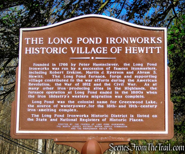
Long Pond Ironworks was founded in 1766 by the German ironmaster Peter Hasenclever. With financial backing from British investors, Hasenclever purchased the existing Ringwood Ironworks as well as huge parcels of land, including the 55,000-acre Long Pond Tract. He also imported more than 500 European workers and their families to build ironmaking plantations at Ringwood, Long Pond and Charlottenburg in New Jersey and at Cortland in New York. From the wilderness they carved roads; built forges, furnaces and homes; and created supporting farms. At Long Pond, they dammed the river in order to provide water power to operate the air blast for a furnace and a large forge.
Long Pond Ironworks
Within the 175-acre Long Pond Ironworks Historic District lie the ruins of three iron blast furnaces, including the original Colonial-era furnace constructed in 1766, and two larger furnaces built for Civil War production; evidence of iron forges; remains of water power systems; and a variety of workers’ homes and commercial buildings that were critical parts of the ironworking village.
Long Pond Ironworks Historic District
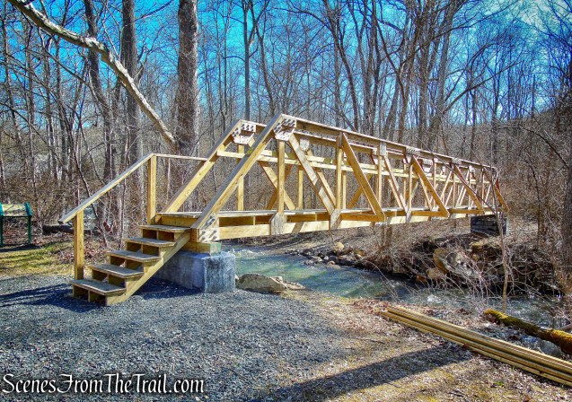
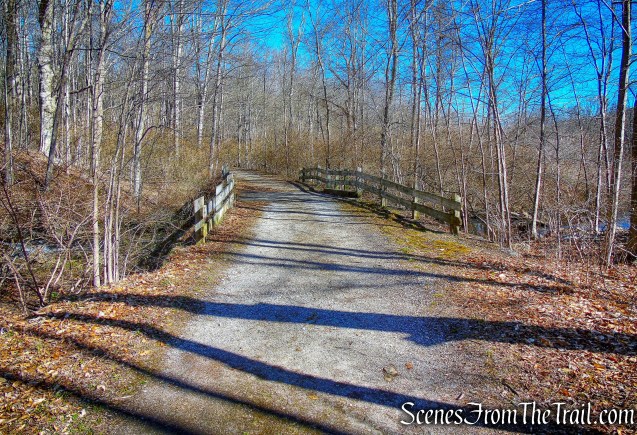
This area is loaded with history and I have wanted to hike it, but the footbridge over the Wanaque River was swept away by Hurricane Irene in 2011 and hadn’t been replaced. That made this hike impossible to do. The bridge was replaced in late 2016 and when I read that, I scheduled a hike.
wood-truss footbridge
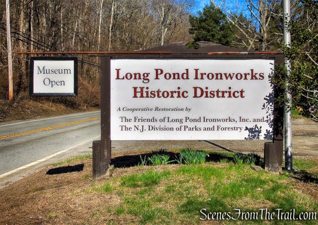
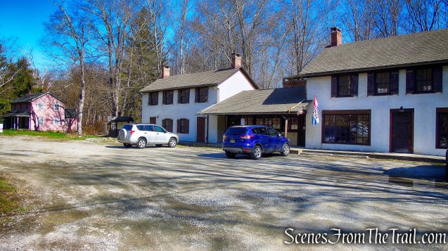
It was a beautiful day for a hike with temps in the mid 50’s and sunny. After the harsh winter, I was raring to get in the woods without any snow on the ground. We arrived at the Visitor Center and Museum just after 9:00 am on Sunday morning. I usually take a photograph of the area I will hike on my NY/NJ Trail Conference maps, then crop and print them. This makes viewing them much easier. I also like to print a copy of the trails and turns as a quick reference. Unfortunately the maps and directions were left behind, through no fault of my own. I still had the original maps in my backpack and I wasn’t about to turn around. The Visitor Center is open on weekends and they have great maps and brochures. We did this loop hike counterclockwise from The Visitor Center.
Long Pond Ironworks Visitor Center and Museum
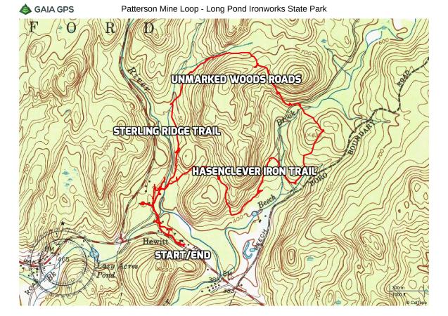
Patterson Mine Loop – Long Pond Ironworks State Park
A new feature that I have added is the Google Earth Fly-Through video. It follows the path that we hiked and it gives you a good idea of the terrain, layout, amount of parking etc. Check it out, it’s pretty cool.
View the Google Earth Fly-Through video of the hike below.
From the parking area, we proceeded west, crossing a grassy area in front of an historic home, the Sommers Stites House which dates back to the 1860’s.
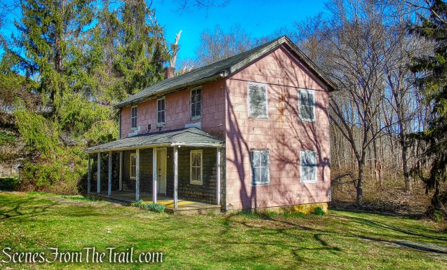
Sommers Stites House
Continuing on a footpath that passes behind a second home, the Laird-West House.
Laird-West House
This house also dates back to the 1860’s, but portions of the house may be older.
Laird-West House
Then the path passes in front of three other historic buildings, including the Ward-Ryerson-Patterson House which was built around 1780 and functioned as a farmstead and country inn until 1980. The relocated house and 240 acres of land were purchased in 1842 by George Patterson and remained in the Patterson family for eighty-one years. The Patterson House served as a restaurant in the twentieth century under names such as the Wanaque Valley Inn, the Copper Kitchen, the Paul Bunyan Inn and the Holy Mackerel Seafood Restaurant.
Ward-Ryerson-Patterson House
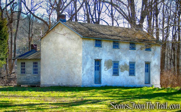
The Patterson House, circa 1780, and the Whritenour House, circa 1810, were privately-owned satellite farms that provided goods and services to those living in Long Pond. The Patterson House and the Whritenour House were relocated to Long Pond in 1985 before the Monksville Reservoir was flooded in 1987.
Whritenhour House
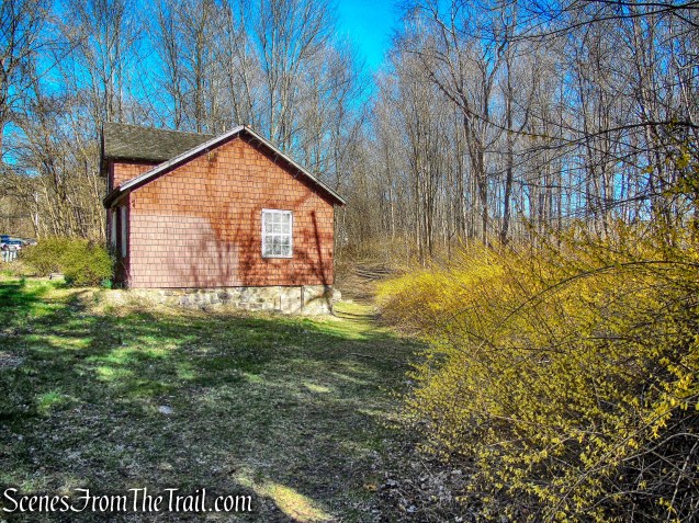
The Harty-Milligan House is a two-story, two bay, and worker’s cottage that dates to back to 1861.
Harty-Milligan House
Approaching the third building, the footpath joins an old woods road and curves to the right, soon passing two more historic buildings. The Stone Double House was built before the Revolutionary War. It is the only surviving building which was here at the time of the Revolutionary War.
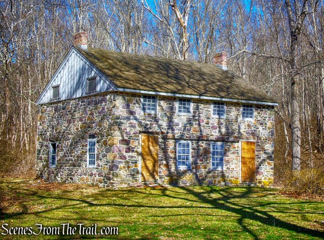
Stone Double House
Owl Peak Brook runs alongside the Stone Double House. The brook was dammed behind the cascade to create an ice pond from which ice was then harvested.
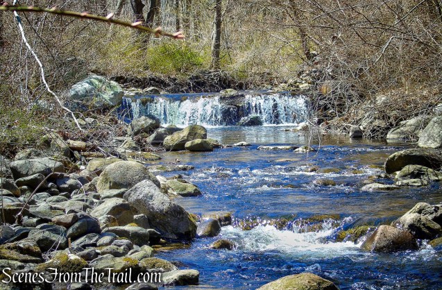
cascade – Owl Peak Brook
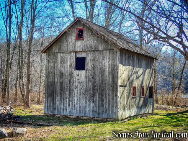
Mule Barn
We then crossed a bridge over Owl Peak Brook. This is a rebuild of the last one whose design probably dates to the early part of the 20th century. The bridge is very strong with huge timbers spanning the stone abutments.
Owl Peak Brook Bridge
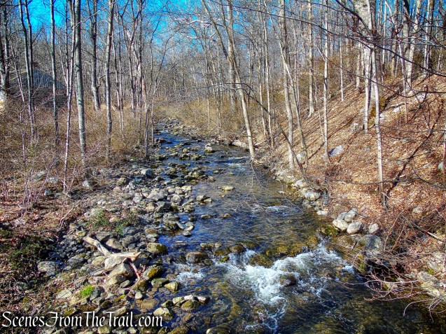
Owl Peak Brook
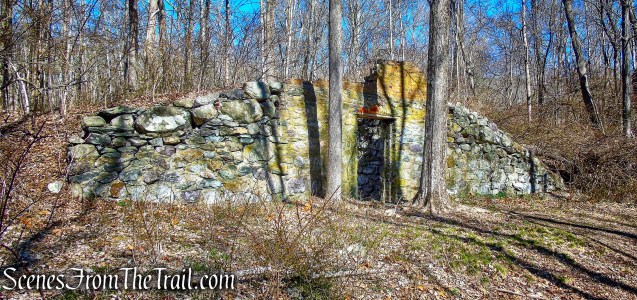
After crossing Owl Peak Brook (also known as Hewitt Brook) on the bridge, the blue-on-white-blazed Sterling Ridge Trail and the teal-diamond-blazed Highlands Trail join from the left. Just ahead are the ruins of the company store and Hewitt Post Office. The Company Store was a center of village life for over 160 years. Containing not only a wide assortment of merchandise, but also the post office and company bookkeeper’s office. Purchases at the store were deducted from workers’ wages.
Company Store
Just past the Company Store is the Ice House. Built into the hillside and about two feet into the ground, the ice house provided a location to store ice harvested from nearby ponds.
Ice House
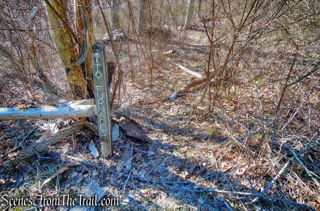
When we were done checking out these structures, we took a footpath down the hillside to see the furnaces.
footpath
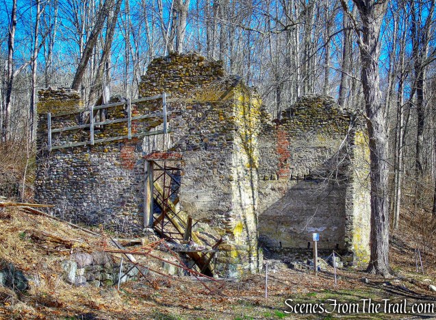
The stone blast furnace was built by Hewitt and Cooper Company at the outbreak of the American Civil War. Originally, this furnace stood over 60 feet high. A high quality gun metal was processed here; in fact the furnace became known as the Gun Metal Furnace. Abram Hewitt was a major supplier of gun metal to the Union Army and so contributed to the North’s important industrial advantage over the Confederacy.
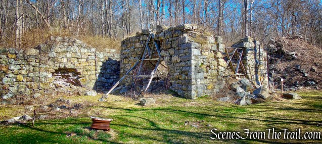
Civil War era blast furnace
Continuing along the edge of the Wanaque River, we approached the Hewitt era waterwheel houses.
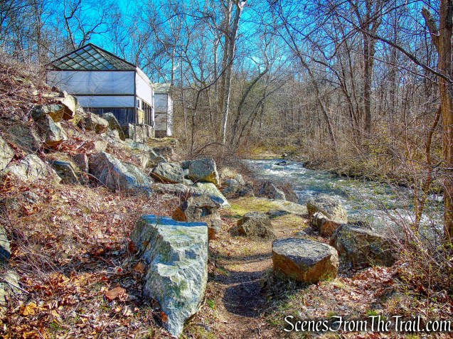
waterwheel houses
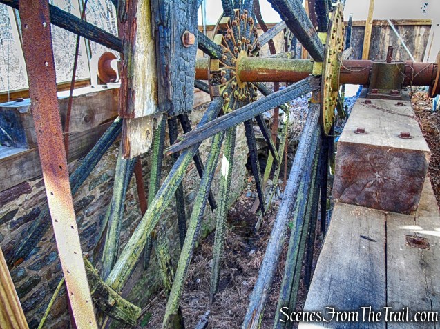
Once the fires were lit in the furnaces, oxygen was blown into the furnace with two 20-foot bellows run by cams on revolving shafts powered by a waterwheel.
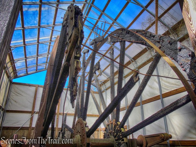
south waterwheel
In 1957, vandals set fire to the two waterwheels, but the Friends of Long Pond Ironworks (FLPI) obtained funds to preserve one wheel in its charred condition with the original iron axle, and rebuild the second 25 ft. diameter wooden wheel on a cast iron axle.
south waterwheel
Today both waterwheels sit under a protective covering, but can be easily viewed.
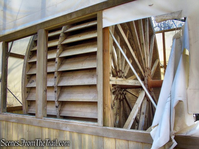
north waterwheel
On April 30, 1882, the furnaces were extinguished, ending more than 120 years of ironmaking at Long Pond.
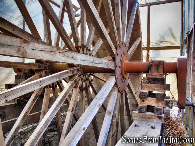
north waterwheel
When we were done exploring these interesting ruins, we walked back to the wood-truss footbridge. The 60 ft. bridge was constructed in the fall of 2016, through the efforts of the New York-New Jersey Trail Conference, to replace a bridge that was washed away by Hurricane Irene in 2011.
wood-truss footbridge
The view north of the Wanaque River with the waterwheel houses visible through the trees in the distance.
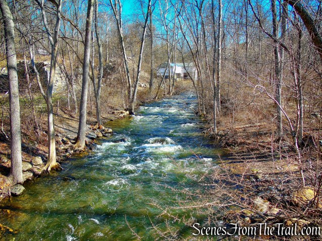
Wanaque River
After crossing the footbridge, in addition to the Sterling Ridge and Highlands Trails, we were now also following the yellow-blazed Hasenclever Iron Trail, which begins on the west side of the footbridge.

yellow-blazed Hasenclever Iron Trail
In about 300 feet, we followed the yellow blazes as the Hasenclever Iron Trail turns right, leaving the Sterling Ridge/Highlands Trail.

yellow-blazed Hasenclever Iron Trail
This yellow blazed trail follows, for the most part, a road built in the 1770’s, between the ironworks here at Long Pond and those at Ringwood Manor five miles away. Ironmaster Peter Hasenclever was running operations at both sites. This road was abandoned many years ago, and today, some sections are barely recognizable, while others are badly eroded. While the marked trail generally follows the road, there are places where it detours slightly to avoid wet or eroded sections.

Hasenclever Iron Trail
In a short distance we reached Stop 1 of the Hasenclever Iron Trail, marked by a laminated sign which provides informative historical details. We would be passing six such signs along the route of this hike.
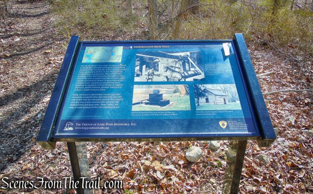
Hasenclever Iron Trail
To the left of the trail, I spotted an abandoned vehicle behind a mound of dirt. It turns out that it is an early 60’s Chevy Corvair.

early 60’s Chevy Corvair
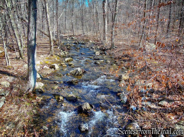
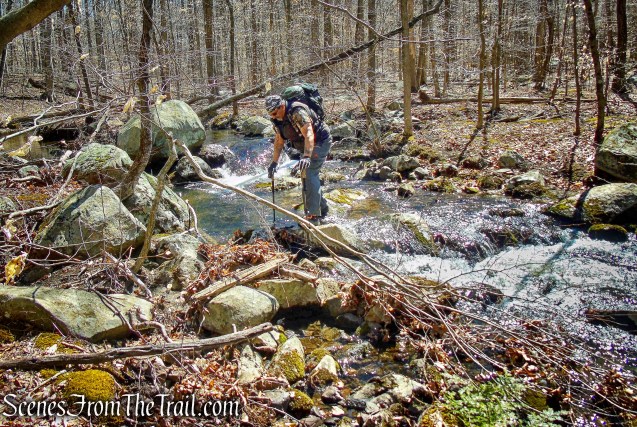
Continuing on the Hasenclever Iron Trail, we then rock hopped a stream.
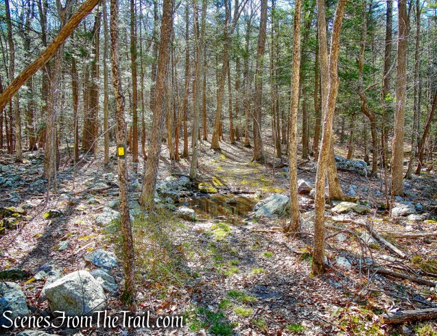
Hasenclever Iron Trail
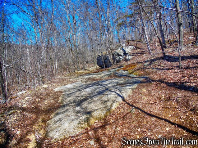
The Hasenclever Iron Trail then begins a steady ascent for about 0.5 mile.
Hasenclever Iron Trail
The trail then begins a steady descent heading south, with imposing cliffs and rock formations to the left of the trail. The Monksville Reservoir becomes visible through the trees.

Hasenclever Iron Trail
Just before reaching the reservoir, the trail turns sharply left and begins to parallel the reservoir. A short distance ahead, is Stop 2 of the trail, where the stone ruins of a building used to process or store limestone are barely visible on the left.
Hasenclever Iron Trail
Next is Stop 3, near where the trail departs from the original route of the Ringwood-Long Pond road, which is now submerged under the reservoir. In a short distance, the trail turns left and leaves the woods road it has been following. It now enters the woods on a footpath to skirt a private home. To the left of the trail, there are huge rock formations and and cliffs visible through the trees.
Hasenclever Iron Trail
The trail eventually curves to the right and descends to reach a junction with the dirt Beech Farm Road, which is Stop 4 on the trail. To the north (left), the road leads to the remains of Beech Farm, a homestead that dates back to Colonial times. We turned right onto Beech Farm Road, following the yellow blazes with Beech Brook on our left.
Hasenclever Iron Trail
A short distance ahead, we crossed Beech Brook on a wide concrete bridge with a guardrail.
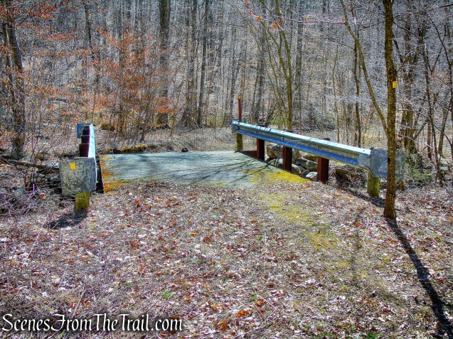
concrete bridge – Hasenclever Iron Trail
Beech Brook
After crossing the bridge, the trail enters Tranquility Ridge County Park.

Hasenclever Iron Trail – Tranquility Ridge County Park
About 500 feet beyond the bridge, the trail turns left, leaving the road, and reaches Stop 5, where a 200-year-old tree on the right marks the site of an old homestead. The trail now ascends gradually along a woods road, with a detour around an eroded section. In about 0.3 mile, we reached Stop 6. Here, the yellow-blazed Hasenclever Iron Trail bears right, but we turned left onto an unmarked woods road which heads downhill towards Beech Brook (further upstream than the earlier crossing). This crossing can be tricky in times of high water, and we walked a short distance upstream and crossed just below a cascade.
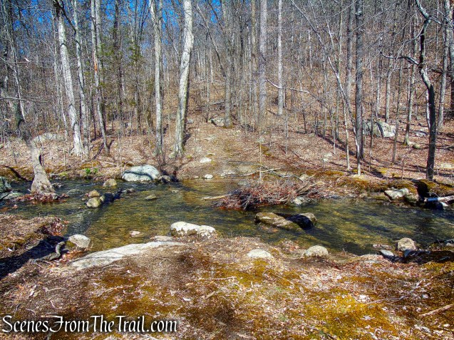
Beech Brook
Just beyond the brook, we reached a T-intersection, where we turned left on another woods road. In about 200 feet, we reached a fork, where we veered right. The woods road now climbs along the side of a mountain, first rather steeply, then more gradually.
woods road
At the crest of the rise, there is a mine pit to the right of the trail which is filled with leaves. This is one of the openings of the Patterson Mine, which was opened around 1870 and last worked in 1903. To the left of the trail are two water-filled pits, also part of the mine complex. Adjacent to each opening is a pile of tailings, the waste rock excavated during the mining process.
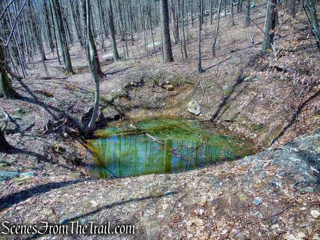
Patterson Mine
The Patterson Mine is associated with the Ward-Ryerson-Patterson House, which formerly stood on the north side of the Greenwood Lake Turnpike opposite the Whritenour House.
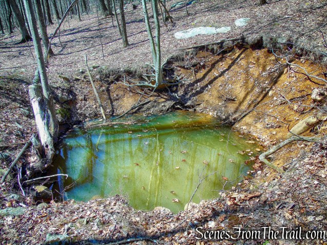
Patterson Mine
When we were done exploring this interesting area, we returned to the woods road and continued ahead, now proceeding downhill. Soon, the joint Sterling Ridge/Highlands Trail (blue-on-white and teal diamond blazes) joins from the right. At this junction, the trail leaves Tranquility Ridge County Park and re-enters Long Pond.
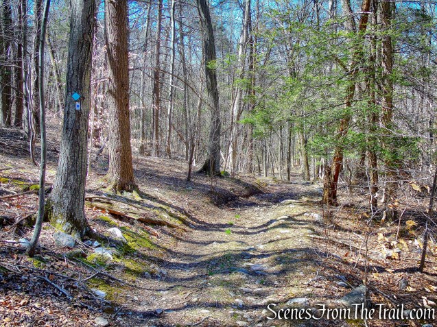
joint Sterling Ridge/Highlands Trail
We Continued along on the marked trail, which heads downhill, paralleling a stream on the right. At the next junction, marked by a triple yellow blaze, the Jennings Hollow Trail begins on the right, but we continued ahead on the joint Sterling Ridge/Highlands Trail, passing through a hemlock grove.
joint Sterling Ridge/Highlands Trail
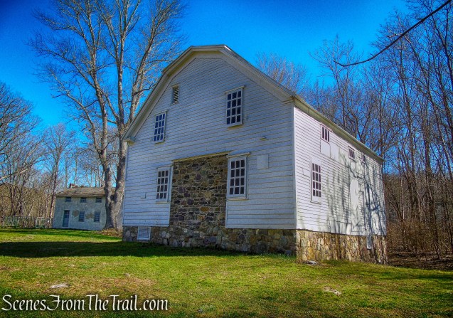
In three-quarters of a mile, we reached the wood-truss footbridge over the Wanaque River. Crossing the bridge, we turned left and began retracing our steps back to the parking area where the hike began. On the way there we took a right and walked up the driveway of a dilapidated house. It is known as “The Manager’s House.”
The Manager’s House
This is a large wood frame building constructed around the time of the Civil War for use by the on-site manager of the ironworks. According to the Friends of Long Pond Ironworks website, “this was the nicest house in the village and structurally is holding its own. We do hope to restore the building and perhaps come up with an adaptive reuse for it.”
The Manager’s House
The Manager’s House
We returned to the road and made our way back to the visitor center. There we took a break then took a walk behind the building to get a look at the Monksville Reservoir. Known for its trophy size muskellunge, walleye, bass and trout, Monksville Reservoir is heavily used by anglers, sporting clubs and the US Sailing Association. It was created in 1987 by damming the Wanaque River. It is named after the former community of Monksville, which was relocated and flooded upon its completion.
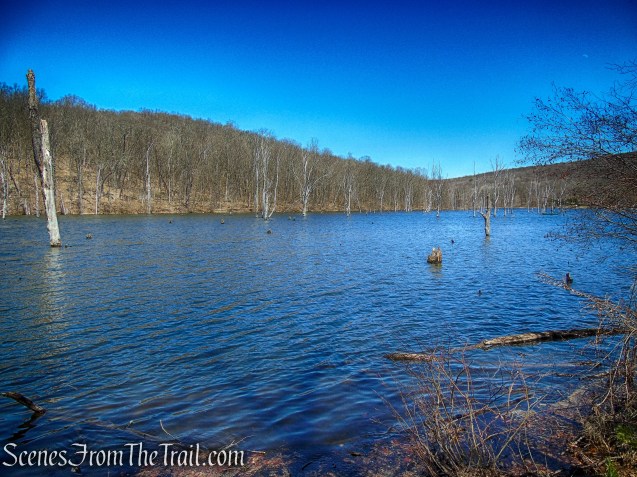
Monksville Reservoir
While at the reservoir I spotted a Tree Swallow sitting on a tree in the water. I also saw a Great Cormorant a little farther away.

Tree Swallow
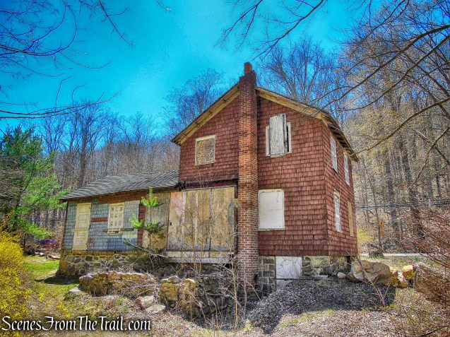
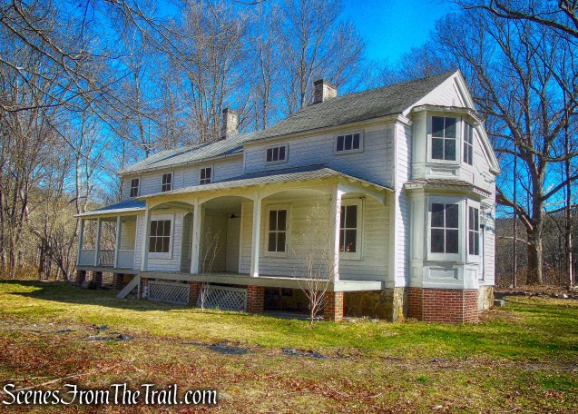
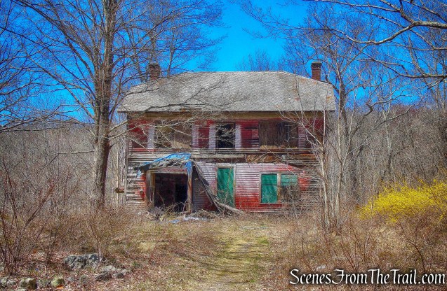
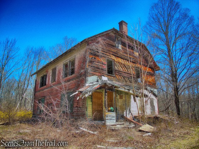
Walking back out towards the road, we passed the very dilapidated Stephens-West House.
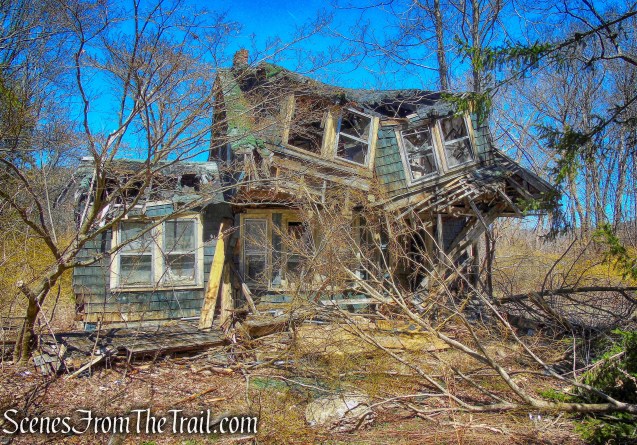
Stephens-West House
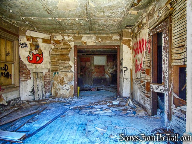
The inside wasn’t much better.

Stephens-West House
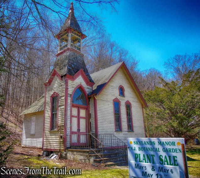
Right across the road is the Hewitt Methodist Church, built in 1895.
Hewitt Methodist Church
The historical value of Long Pond Ironworks is paralleled only by its natural beauty. The forests that were once cut down to make charcoal for the furnaces have returned, and the river that was once diverted into the hydropower systems
again cascades over ancient rock formations. This hike is a great introduction to Long Pond Ironworks State Park. There are numerous trails and mines to explore and I will be back to do some more exploring.
Pros: Historical features, stream crossings, well marked trails, ruins.
Cons: Trails can be a little swampy after rain.
Take a hike!
Long Pond Ironworks State Park
Sources:
- The Friends of Long Pond Ironworks
- The History Girl
- New York-New Jersey Trail Conference
- Iron Mine Trails – Lenik, Edward J. – Kindle Edition

LOVE THIS HIKE!! thanks for an intro to a new adventure !
I’m sorry I never got back to you on the Abercrombie Mansion “hike”! wow! we loved it – and I meant to share my pics with you- but I switched phones and my pics are all down loaded on my laptop now…blah blah blah – anyway- it was FAB!! We loved it – and really enjoy your recommendations ! thanks again ! Beth
LikeLike
You’re welcome and thanks for reading. I’m glad that you enjoy my posts. I always try to find interesting places to hike and explore. Enjoy your weekend.
LikeLike