November 11, 2017 – Beacon, NY
Difficulty: Strenuous
Length: Approximately 6 miles
Max elevation: 1,540 ft.– total elevation gain approximately 1,731 ft.
Route type: Circuit
Map: East Hudson Trails Map #102
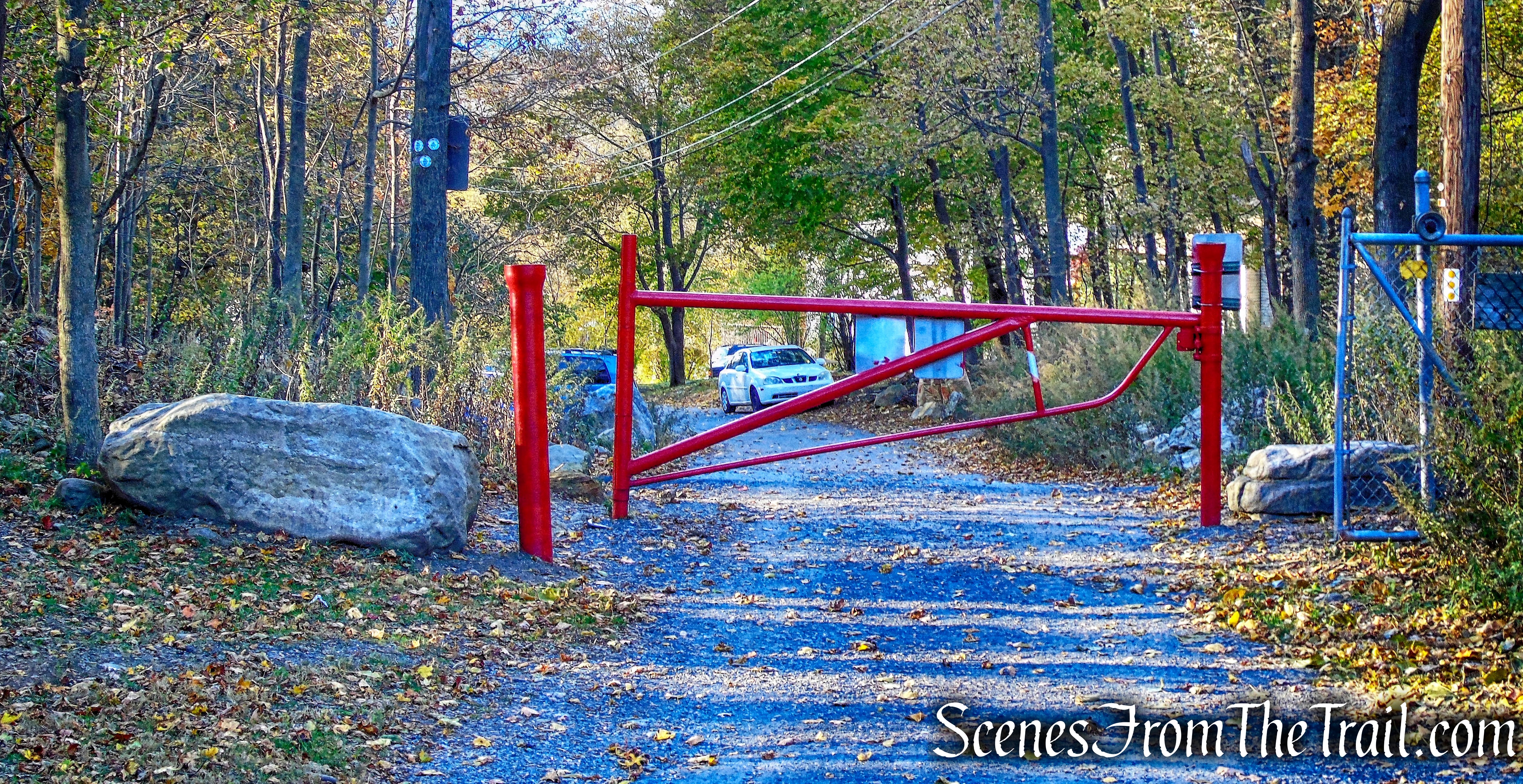
Trailhead parking: Pocket Road Beacon, NY 12508
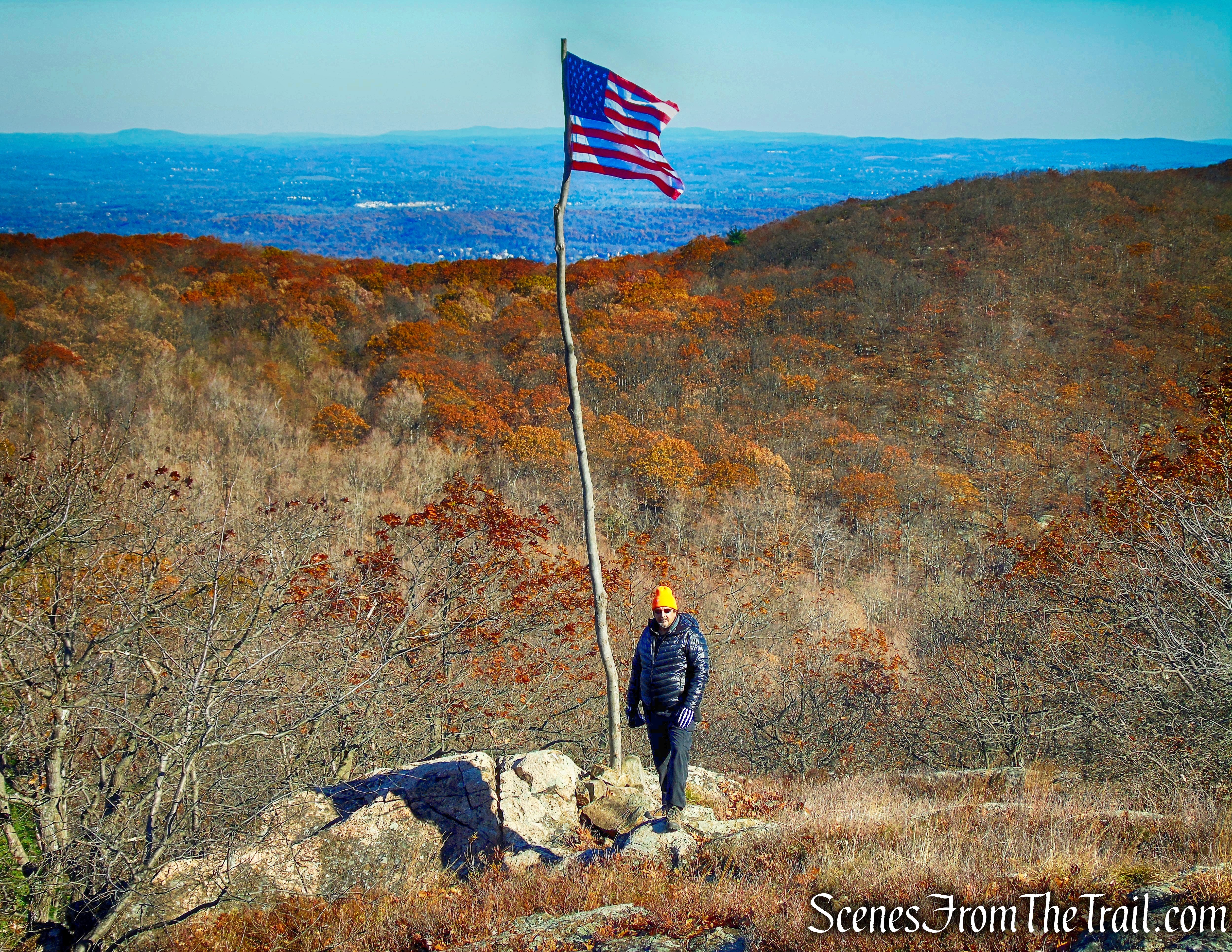
Darcy’s Ridge is not the official name, although it should be. It is located in the Fishkill Ridge mountain range, near Mount Beacon. Located there is an American Flag on a makeshift pole, which has been maintained by the Darcy family since 1988. Every Memorial Day and Veterans Day, a hike led by the Mid-Hudson Adirondack Mountain Club, leads hikers to this spot where they hold a small ceremony to honor those that have served in the military. It is always a great honor to visit this spot knowing the story behind the flag.
Darcy’s Ridge
It’s a relatively short 1.5 miles to the flag from the Pocket Road Trailhead. It is not an easy hike up the steep and rocky trail. Since I have visited the flag before, I wanted to extend the hike somewhat and explore other trails in the area. I am familiar with the area, having hiked the ridge searching for the flag several years ago. Energy level and temperature, which was in the high 20’s – low 30’s and a little windy on this Veterans Day, would be a determining factor of the length and route of our hike.
Darcy’s Ridge and North Beacon Mountain Loop
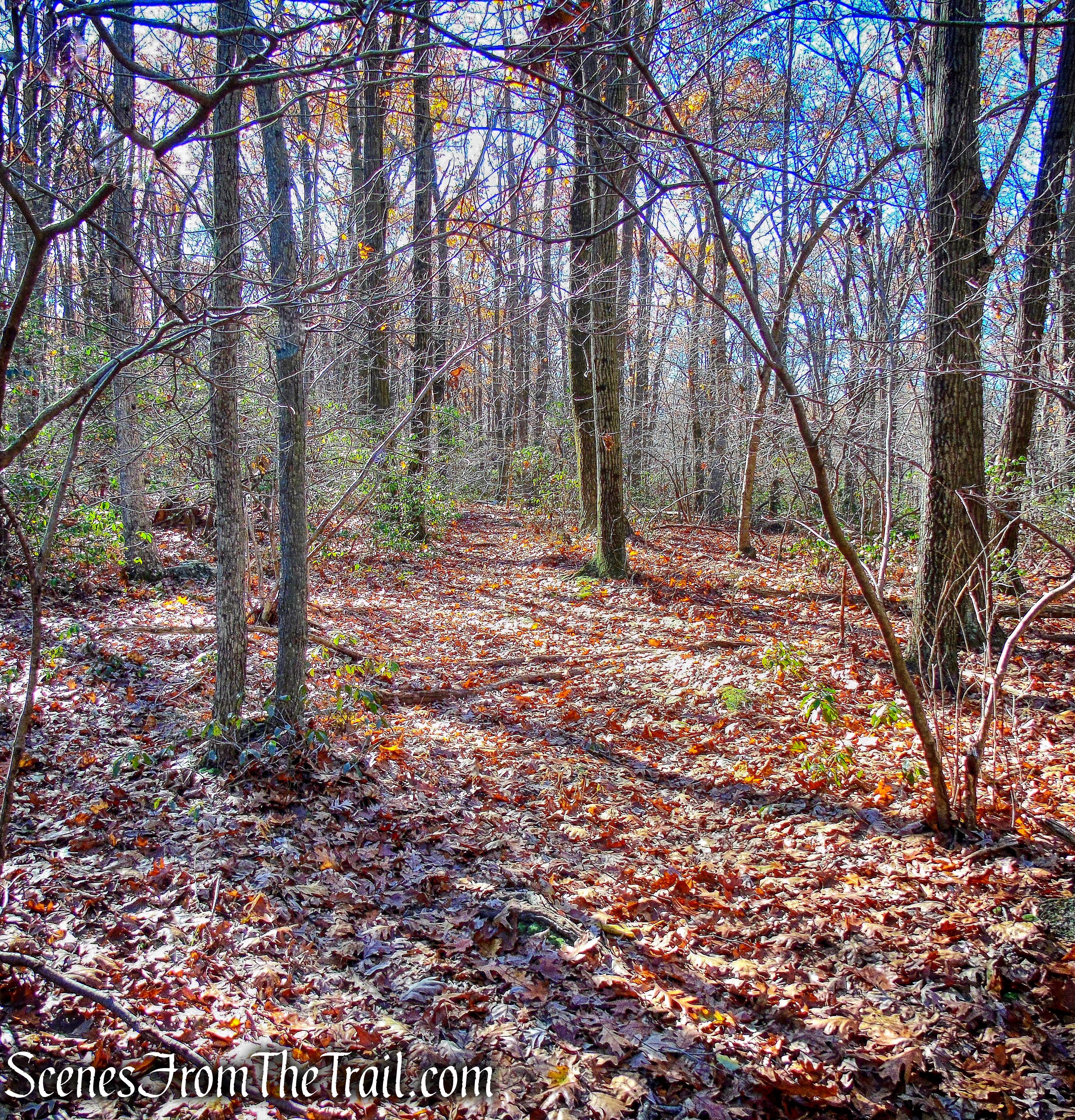
Upon arriving at the Pocket Road trailhead, there were quite a few people there already. There is room for about 6 cars at the end of Pocket Road. We got our gear together and began our hike ahead of the others. We timed it so that we would arrive just ahead of the group so that we would not have to wait too long in the cold. The three white discs on a tree, mark the beginning of the white-blazed Fishkill Ridge Trail.
Fishkill Ridge Trail
Passing to the right of the water tower, we walked on the paved road as it turns to gravel and began heading southeast.
Fishkill Ridge Trail
In a short distance, the trail passes a small reservoir on the left, then enters the woods. The trail becomes rockier as it climbs and parallels Dry Brook.
Fishkill Ridge Trail
In about 0.5 miles, the yellow-blazed Dry Brook Connector Trail comes in from the right. That would be our return route, but for now, we continued following the white blazes. In about 0.85 miles, we crossed Dry Brook on rocks.
Fishkill Ridge Trail
The trail continues to climb, now more steeply, as it passes by the multi-tiered Dry Brook Falls.
Dry Brook Falls
The trail continues climbing and at about 1.1 miles, it comes to a gravel road, known as Mount Beacon Monument Road.
Mount Beacon Monument Road
Turning left on the gravel road, we walked a few feet then turned right into the woods to continue on the Fishkill Ridge Trail. Almost immediately upon re-entering the woods, we left the Fishkill Ridge Trail and turned right, heading uphill on an unmarked old woods road. The road is eroded and looks more like a gully than a road at first. I have walked it before and was a little unsure, but after a short distance, it begins to resemble a woods road.
unmarked old woods road
The woods road climbs moderately and passes some old stone walls. After about 500 yards, the Blue Connector Trail joins from the left at a T-intersection. Here we turned right and followed the blue blazes for about 422 yards until its terminus. Straight ahead is another woods road, but we turned right.
Terminus of Blue Connector Trail
We then began following the yellow-blazes of the Wilkinson Memorial Trail, which climbs steeply on switchbacks. We followed the yellow blazes for about 560 yards.
Wilkinson Memorial Trail
At the top of the rise, the Wilkinson Memorial Trail makes a sharp left. To the right is an unmarked footpath that leads up a small hill. I tend to call this the Flag Trail.
Flag Trail
After a short hike up the Flag Trail and gaining approximately 1380 feet, we arrived at Darcy’s Ridge.
Darcy’s Ridge
We sat and caught our breath for a few minutes, knowing that the group would be arriving shortly. The flag that flies here was first erected by the Darcy family on May 31, 1988 and continues to be maintained by them. You can read about it here.
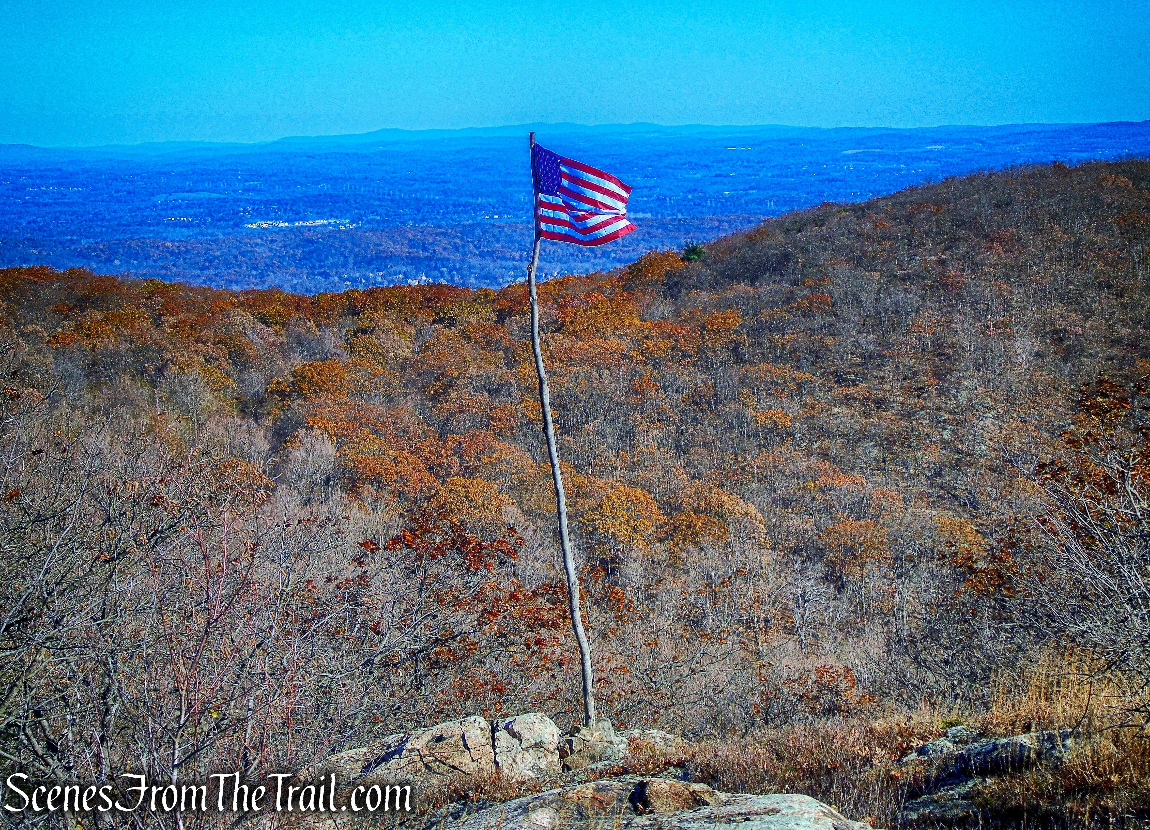
Darcy’s Ridge
Not long after we arrived, the rest of the hikers began to trickle in. Once they were all there, I was able to capture an image of the group, said to be the most people to ever attend the ceremony.
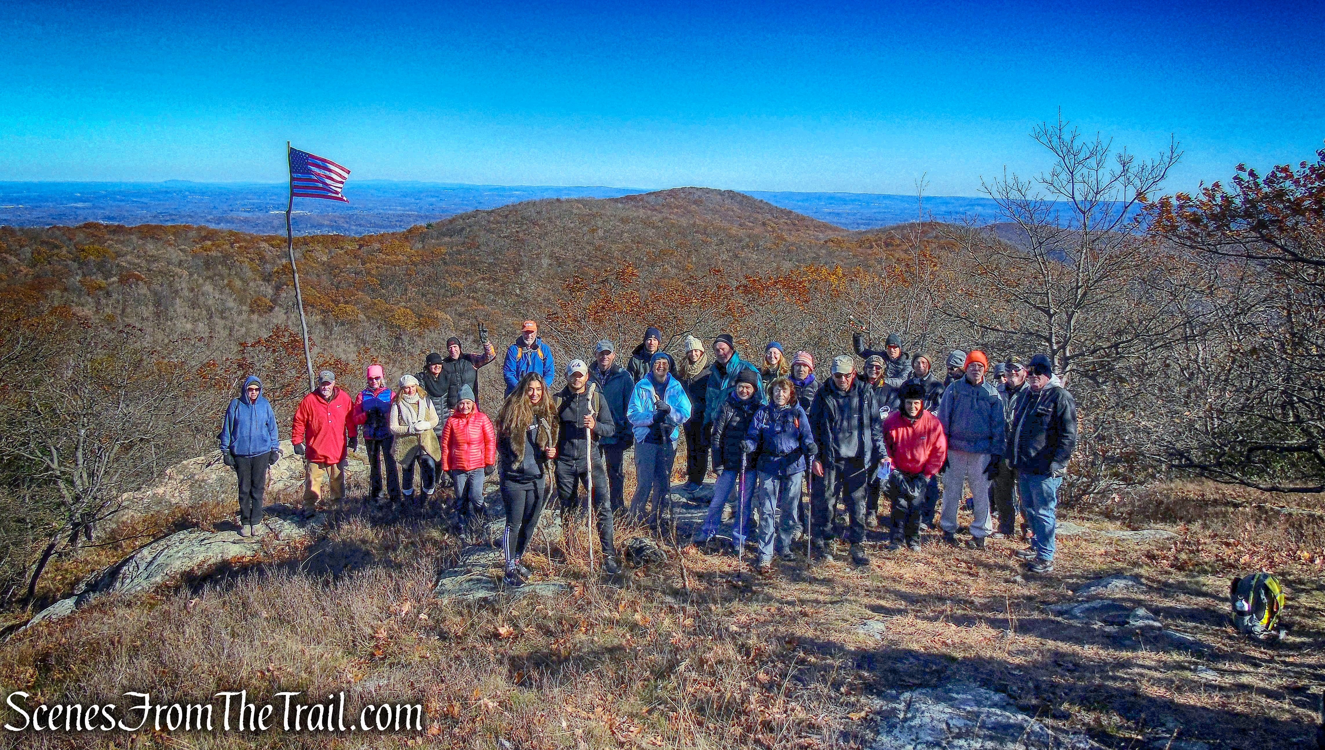
Darcy’s Ridge
A pair of musicians played the National Anthem, Taps and the anthems for each branch of the service.
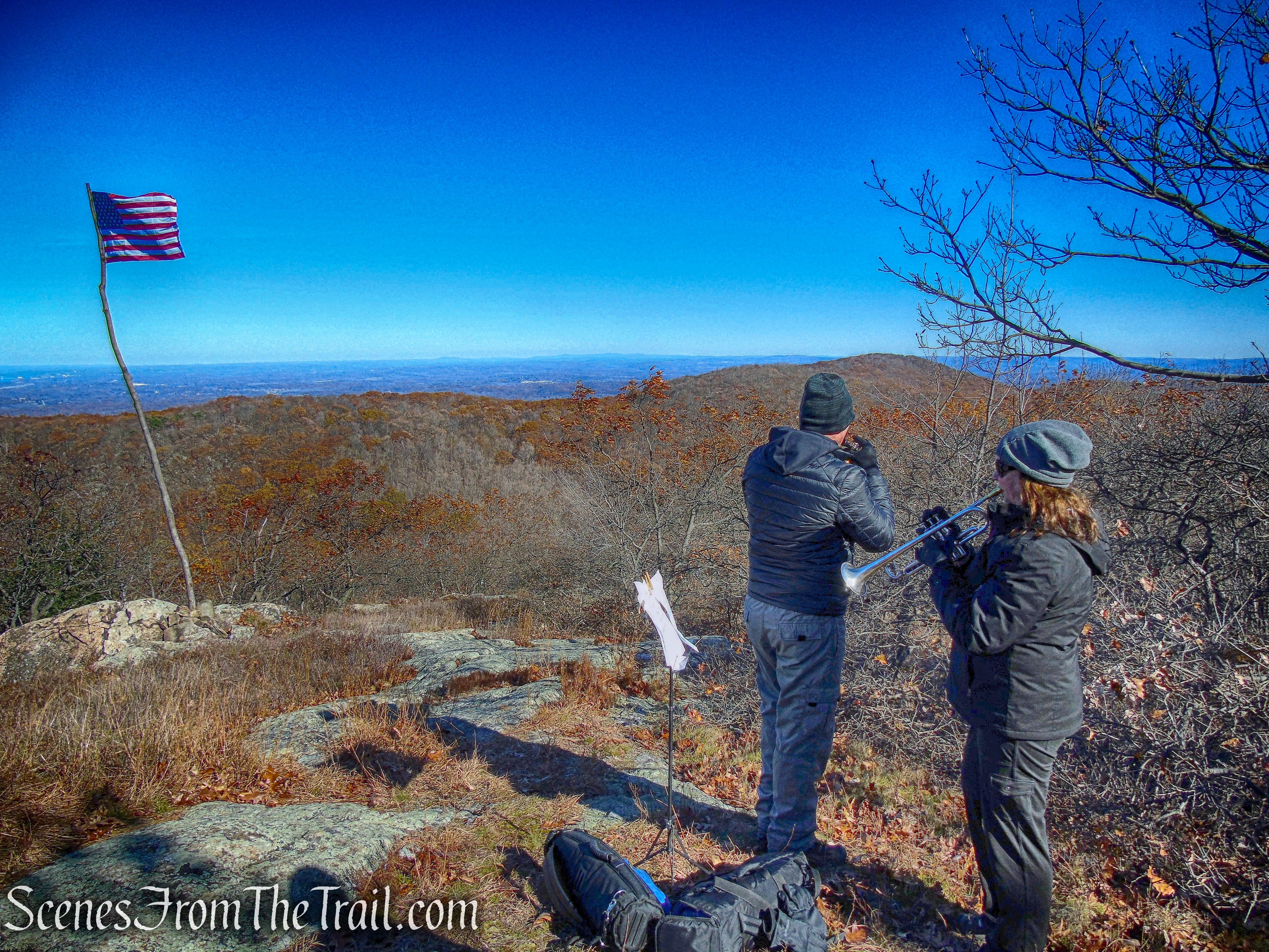
Darcy’s Ridge
After the ceremony was over, people started to leave. We stayed back to enjoy the view along with some hot chocolate as we took in the sanctity of this place. We then retraced our steps back down the Flag Trail and turned right onto an old woods road.
old woods road
Unlike the other woods road that we traveled on earlier, this one looked abandoned rarely traveled. At times it was hard to follow, but my trusty GPS device kept me on the right path.
old woods road
After about 0.5 miles, we came to the Beacon Reservoir.
Beacon Reservoir
We then left the woods road and came to the bank of the Beacon Reservoir. The reservoir supplies water to the city of Beacon. It is located at 1,285 feet above sea level in a hollow between Beacon Mountain and Scofield Ridge, in the neighboring Town of Fishkill, very close to the Putnam County line. It was created in 1922 by damming Dry Brook, a tributary of Fishkill Creek.
Beacon Reservoir
Visible from the reservoir is the Mount Beacon Fire Tower, which was built in 1931 and restored in 2013.
Mount Beacon Fire Tower
We headed north along the eastern side of the reservoir until we came to the dam. There we crossed over to the western side of the reservoir and onto North Beacon Mountain.
Beacon Reservoir dam
We walked through the woods briefly and came to a gravel road. The same road we crossed earlier, lower on the mountain, Mount Beacon Monument Road. We followed the road as it ascends along the shoulder of North Beacon Mountain.
Mount Beacon Monument Road
Along the way, I saw a rock outcrop just off the trail that looked interesting. We took a detour and were rewarded with a perfect view of the Mount Beacon Fire Tower as it sits on South Beacon Mountain at 1650 feet above sea level.
Mount Beacon Fire Tower
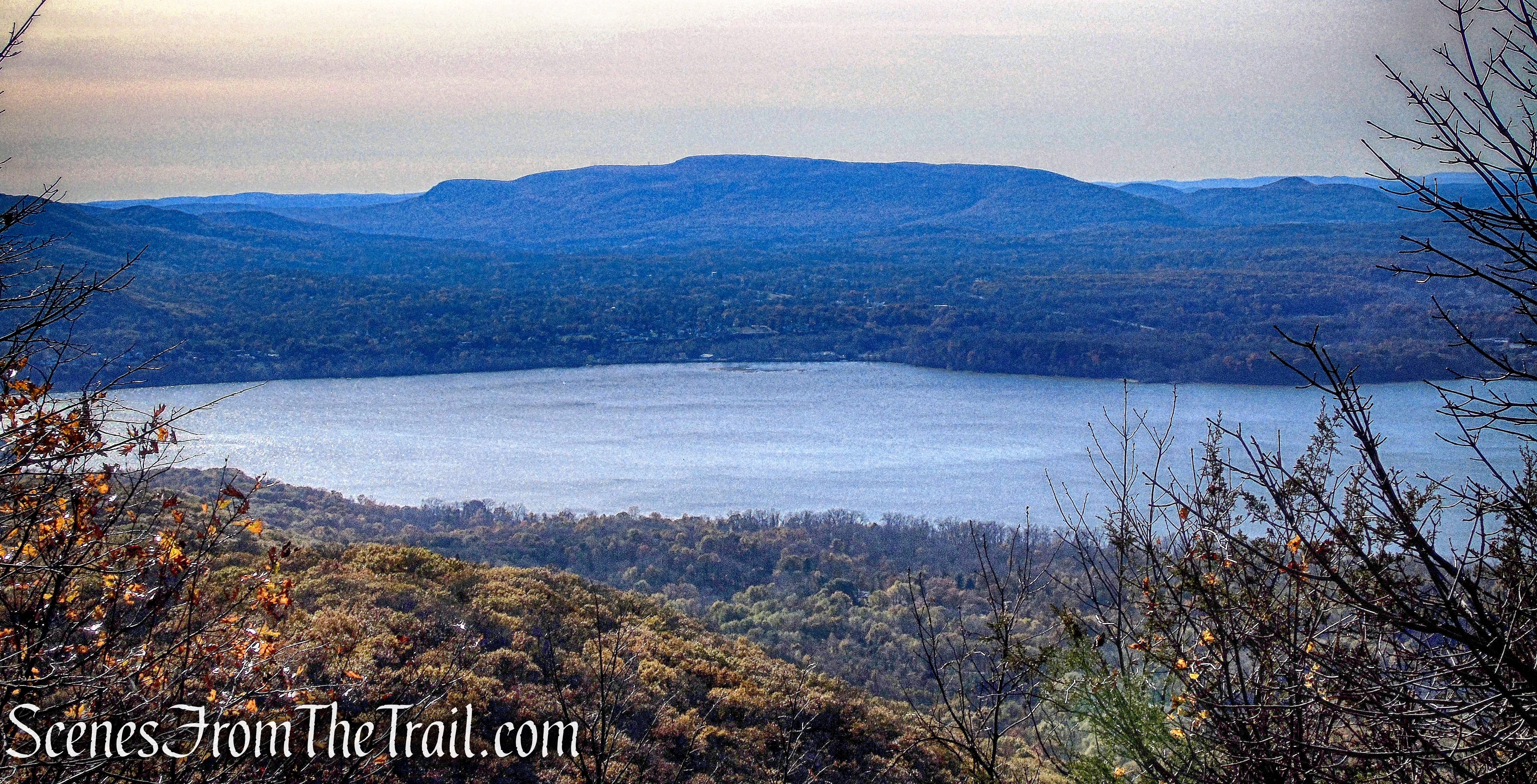
A few feet further, we were greeted with a nice view of the Hudson River.
view of the Hudson River
We stayed here a while and relaxed while enjoying the view. Mount Beacon is a popular hiking destination, but this spot was desolate. We then returned to Mount Beacon Monument Road and headed downhill with the Hudson River visible through the trees.
Mount Beacon Monument Road
The road leads to the ruins of the wheel house that powered the Mount Beacon Incline Railway up the mountain from 1901 to 1978.
wheel house ruins
wheel house ruins
When we first got to the site of the old casino, there was no one in sight. Minutes later, the place was crowded with people.
site of the Casino
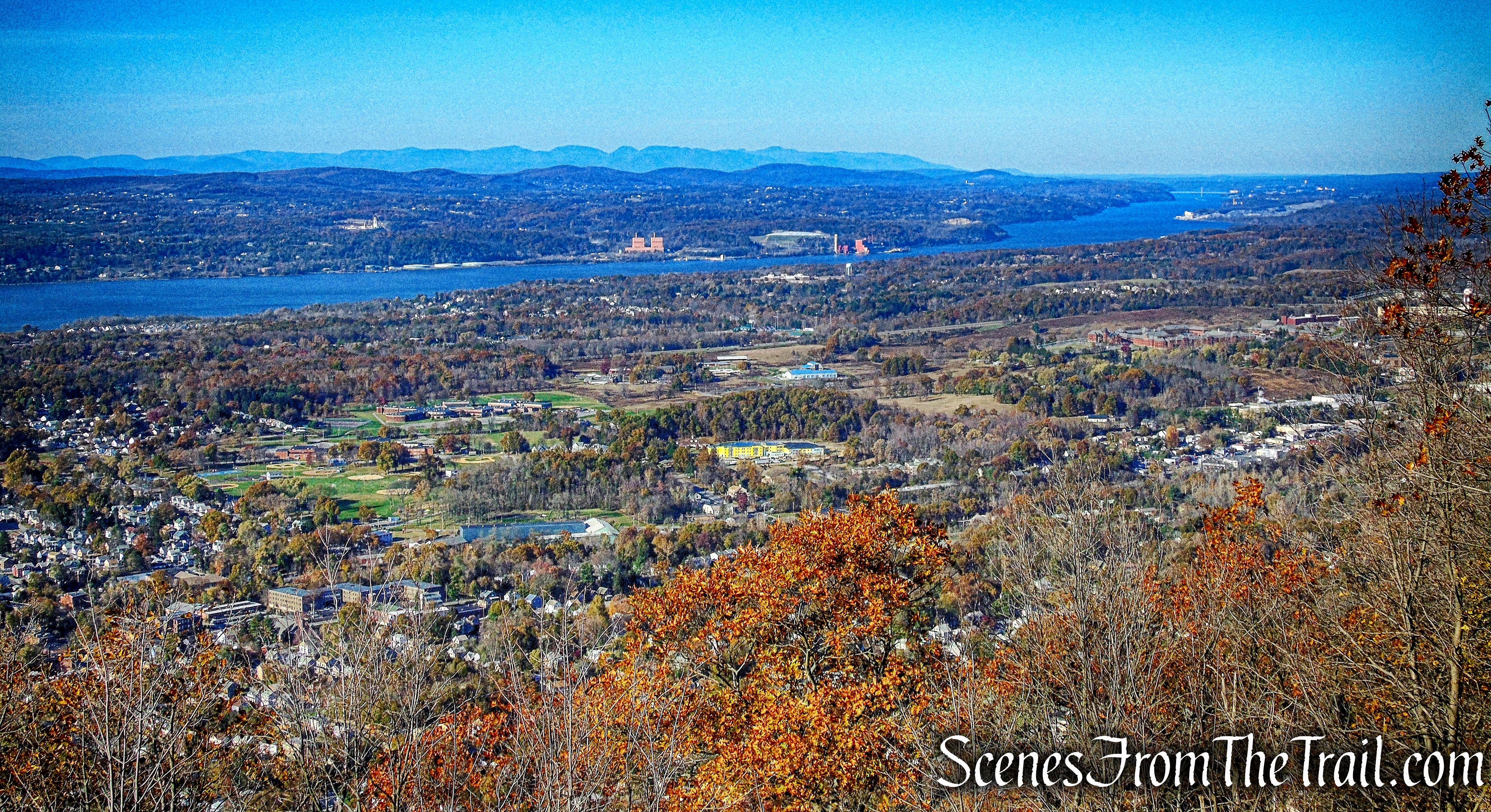
The views as always are quite grand from here. The Newburgh–Beacon Bridge is visible just below, with the Gunks and the Catskills just beyond.
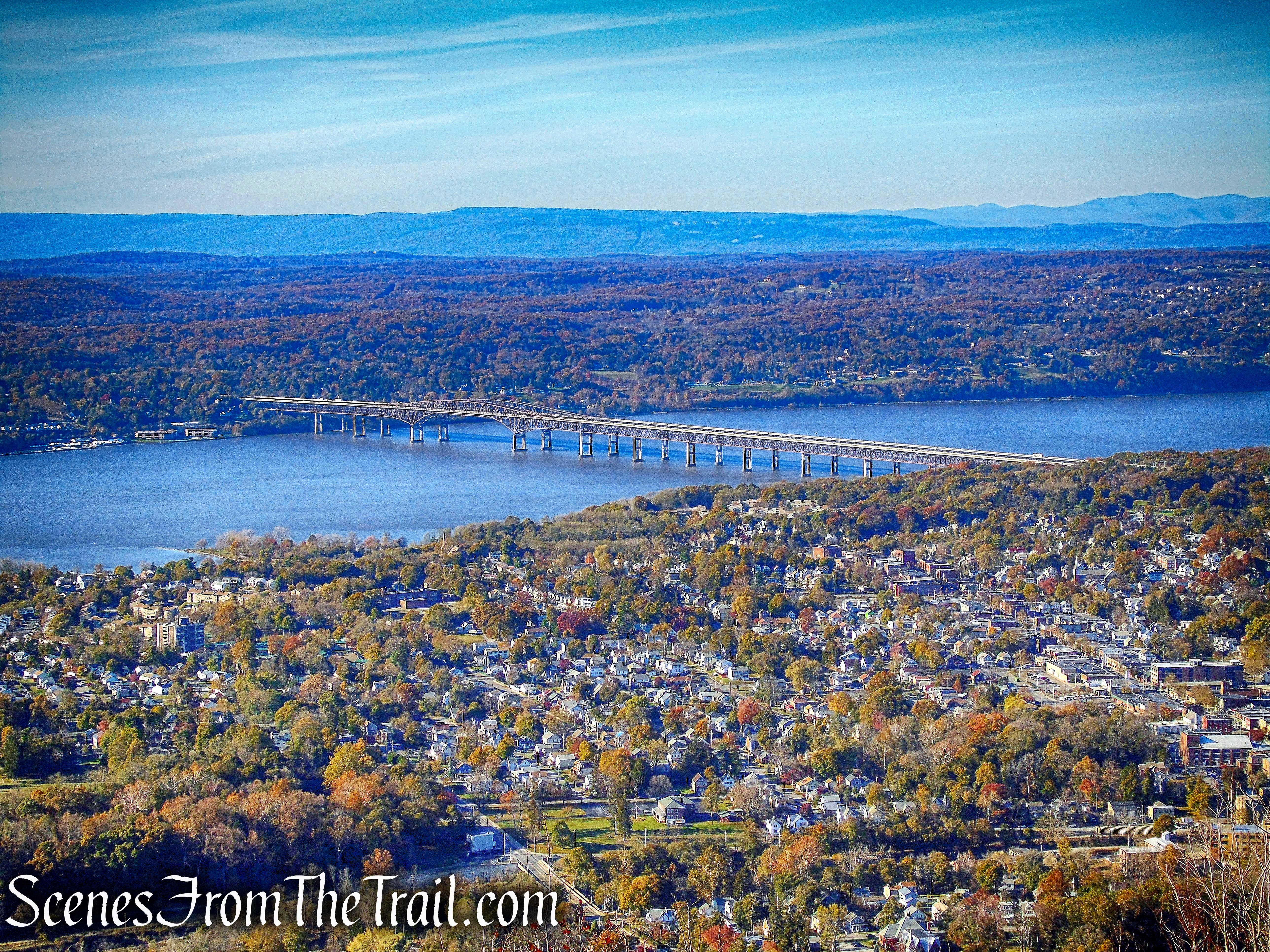
Newburgh–Beacon Bridge
Across the Hudson River, Schunemunk Mountain is visible to the southwest.
Schunemunk Mountain
We hung out here for a short while, fully appreciating these Hudson Valley views.
Hudson Valley view
We walked by the the ruins of the wheel house on our way out for a different perspective.
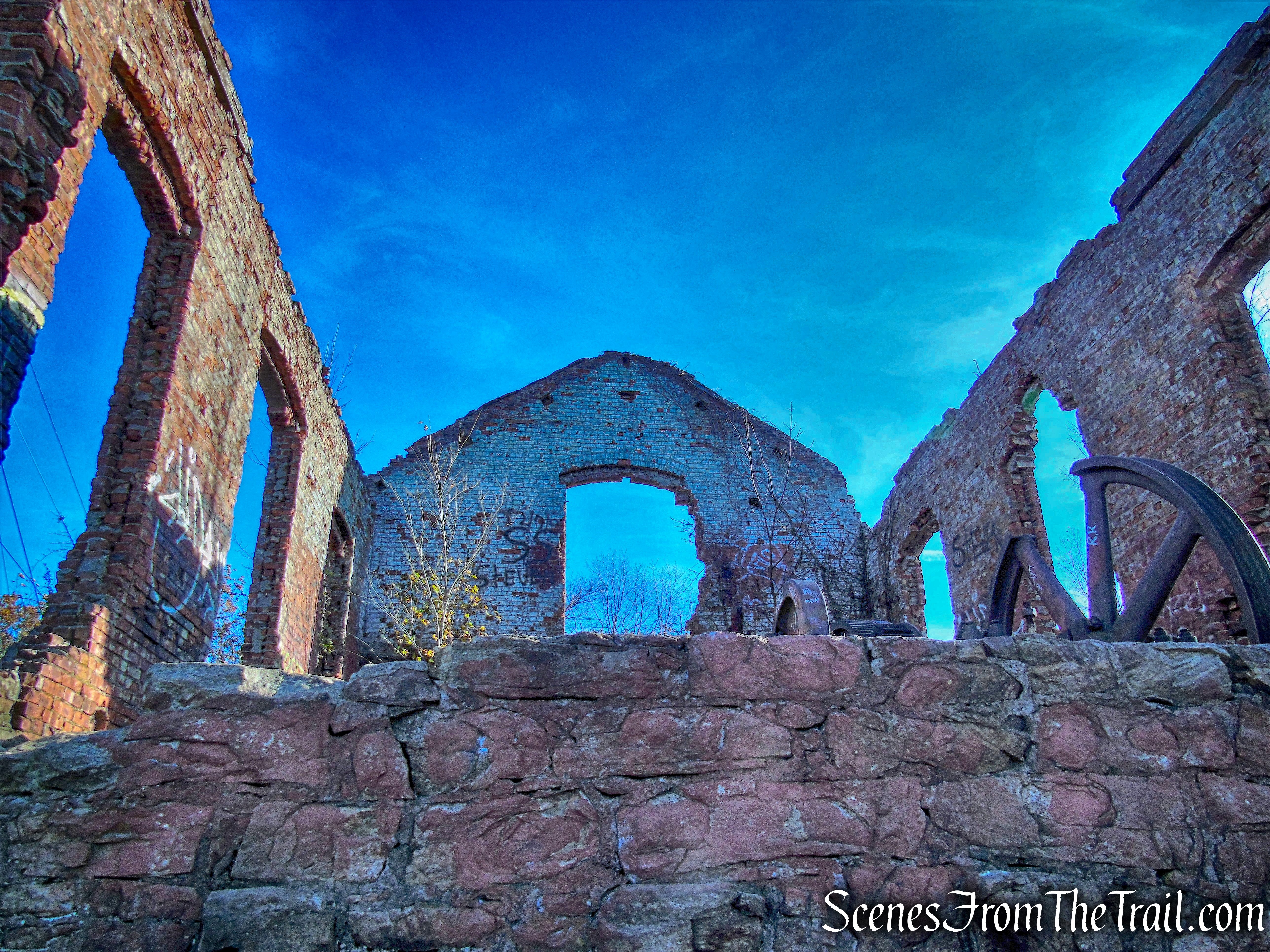
the ruins of the wheel house
We then took the red-blazed Casino Trail to make our way down North Beacon Mountain.
Casino Trail
The Casino Trail descends steeply on switchbacks and since the day warmed up a bit, we passed countless people making their way up. After about 0.6 miles on the Casino Trail, we took the yellow-blazed Dry Brook Connector Trail.
Dry Brook Connector Trail
The Dry Brook Connector Trail travels on an old woods road for almost a mile. An abandoned jeep sits alongside the trail.
Dry Brook Connector Trail
The trail gains about 200 feet of elevation before it levels off and then descends. At this point in the hike, it felt like a whole lot more. The Dry Brook Connector Trail ends at a T-intersection with the white-blazed Fishkill Ridge Trail.
Dry Brook Connector Trail
Turning left onto the Fishkill Ridge Trail, we walked another 0.5 miles to the Pocket Road Trailhead, where our hike began.
Pocket Road Trailhead
An exhausting, yet fulfilling Veterans Day hike. For the most part, we had the trails to ourselves on a chilly day. I enjoy hiking the Hudson Highlands and will be back soon for another challenging hike.
Take the virtual hike below, with additional images added.
Pros: Darcy’s Ridge and the flag, Hudson Valley views, challenging trails.
Cons: Crowds on Mount Beacon.
Take a hike!
Darcy’s Ridge
