October 7, 2017 – Narrowsburg, NY
Difficulty: Easy – moderate
Length: Approximately 3.4 miles
Max elevation: 1,129 ft.– total elevation gain approximately 531 ft.
Route type: Circuit
Map: Upper Delaware River Valley Maps
Trailhead parking: Ten Mile River NPS River Access Crawford Rd Narrowsburg, NY 12764
The National Park Service has an agreement with the Greater New York Councils of the Boy Scouts of America to provide public access to one of its trails along the Delaware River. The Boy Scouts of America have owned this property since 1927, providing an educational opportunity for thousands of boys from the New York City area. Please respect their property. The Tusten Mountain Trail is the only Ten Mile River Boy Scout Camp Trail open to the public.
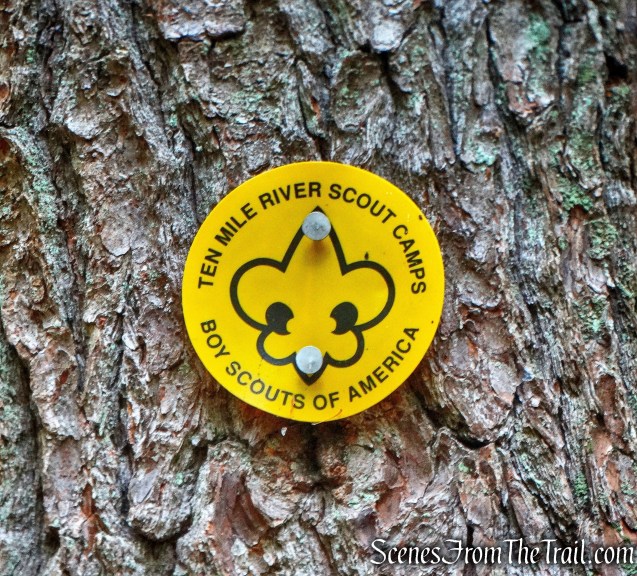
Yellow Boy Scout blaze – Tusten Mountain Trail
Entry to the trail is granted at the Ten Mile River public access point on Crawford Road in Narrowsburg, NY, where Ten Mile River flows into the Delaware River.

Ten Mile River Access
The Tusten Mountain Trail is one of six trails featured in the “Take a Hike!” brochure, which gives names, locations, descriptions, and difficulty levels of trails in the Upper Delaware River Valley. It also provides a checklist to keep track of the trails you’ve hiked which can be turned in upon completion for a “Take a Hike!” patch.

Tusten Mountain Trail
View the Google Earth Fly-Through video of the hike below.
The previous weekend, we did three of the hikes on the list, the Bouchoux Trail, Damascus Forest Trail and the Cobey Pond Trail. We were now going to complete the final three hikes to earn our Take a Hike! patch. Just north of the parking area there is a kiosk that points out the direction of the trail.

kiosk – Tusten Mountain Trail
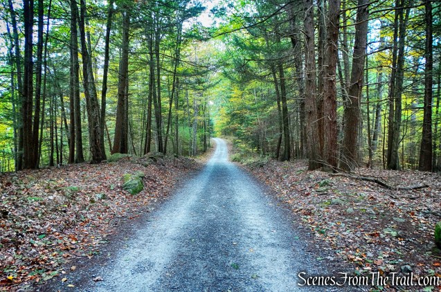
The hike begins on Ten Mile River Road which runs parallel to the Ten Mile River.
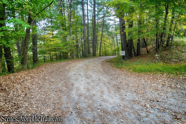
Ten Mile River Road
We began following the red-blazed TMR (Ten Mile River) and the yellow-blazed Tusten Mountain Trails (Boy Scout symbol).
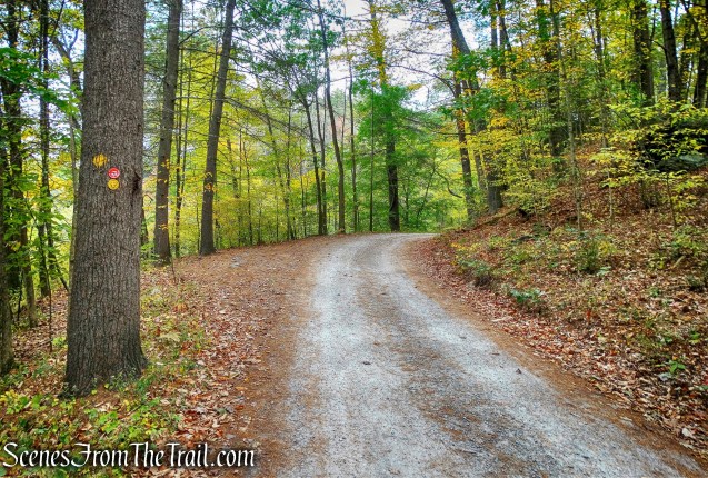
Ten Mile River/Tusten Mountain Trails
In about 0.2 miles from the start of the hike, the trail turns left on Tusten Road and crosses a stone arch bridge.
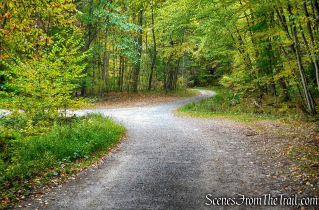
left on Tusten Road
The Stone Arch Bridge was constructed in 1875 when industry at Tusten included lumbering and the quarrying of bluestone.

Stone Arch Bridge
A view upstream of the Ten Mile River from the Stone Arch Bridge. The Reeves Mill settlement grew along the Ten Mile River in the mid-1700’s. It lasted until Native Americans from the Lenape tribe raided the settlement in the 1760’s. The Tusten Settlement followed in the 1770’s, lasting until the 1900’s.
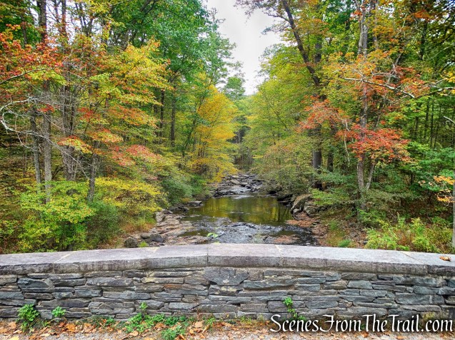
Ten Mile River
A look downstream where the Ten Mile River flows into the Delaware River. Early settlers relied on logging and carrying trees by raft down the Delaware River. Later industries were tanning and bluestone quarrying.

Ten Mile River
After crossing the bridge, the trail curves left and passes by a Boy Scout camp.

Boy Scout camp
The trail rises gently as is heads northwest and parallels the Delaware River.
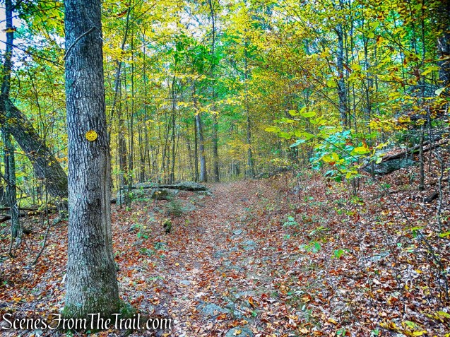
Tusten Mountain Trail
About 0.5 miles from the Boy Scout camp, the trail leaves the road and turns right, into the woods. There used to be a sign pointing the way here, but not any longer.

Tusten Mountain Trail turns right
In a short distance after entering the woods, we came to the trail register. It’s a good idea to sign in whenever there is a trail register. It’s for your safety, should anything go wrong and it also helps to calculate the amount of usage a trail gets, which helps with funding. This is the start of the loop that climbs and descends Tusten Mountain. Either way gets you there, we went to the right.
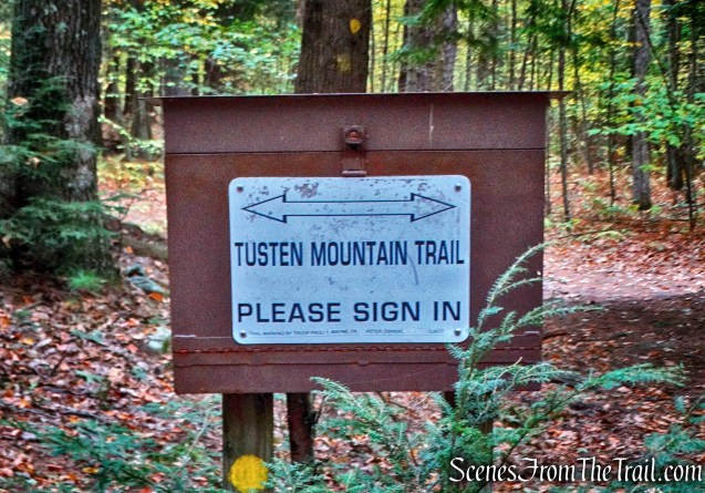
trail register – Tusten Mountain Trail
Less than 300 yards from the trail register there is another Boy Scout camp just off the trail, on the right.

Boy Scout camp
Judging by the condition, it looks to be abandoned.

Boy Scout camp
The outhouse is still standing.
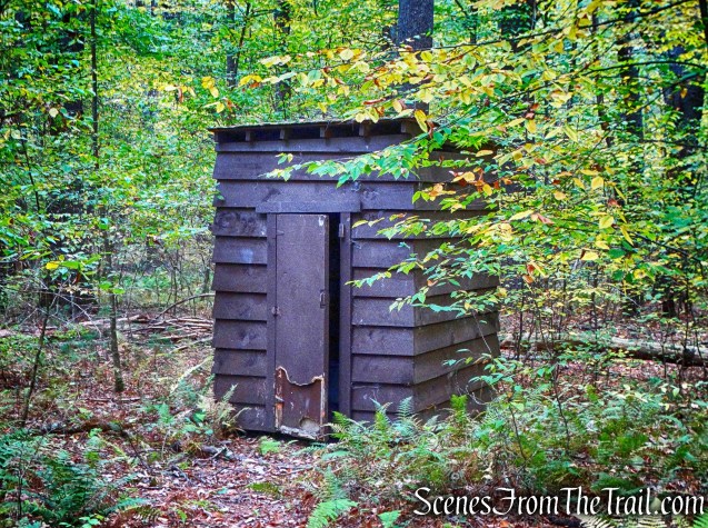
outhouse – Boy Scout camp
Shortly after the abandoned camp, there is a sagging wooden footbridge that has seen better days. I made sure to walk with my weight on the beams and not the rotting boards.

wooden footbridge
Although the spacing of the blazes on the trail is sufficient, they are a little confusing at the junctions. Where there are 2 blazes to signify a turn, they are not offset, instead, the blazes are one on top of the other. The next blaze after the junctions are too far in, instead of being visible from the junction.

Tusten Mountain Trail
The trail now steepens and then levels off as it passes the site of a former quarry.
former quarry
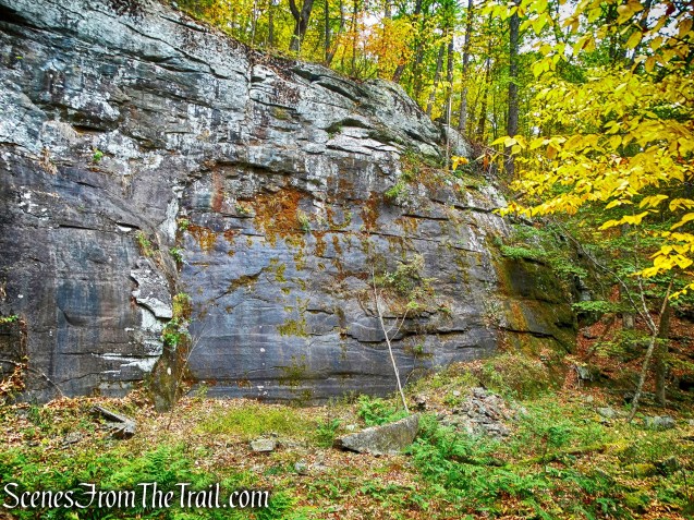
The trail climbs steeply again and travels by and through some massive rock formations.

rock formation – Tusten Mountain Trail
The trail levels off again as it passes through another old quarry.
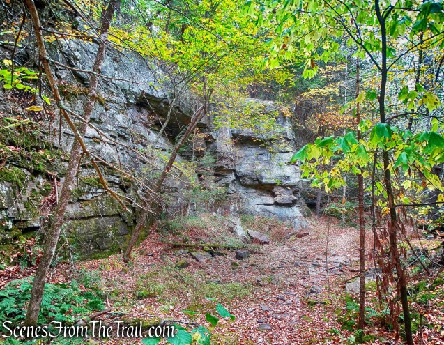
old quarry – Tusten Mountain Trail
The trail continues to climb on a more moderate grade and then reaches a rock outcrop with a view northwest of the Upper Delaware River Valley. We stopped here to rest up and enjoy the view. Below the ledge is the site of another former quarry, but care should be exercised if exploring as there is a steep drop-off.
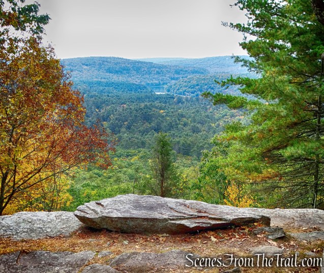
view northwest of the Upper Delaware River Valley
The Tusten Mountain Trail heads west and descends steeply. There is a yellow rope tied to a tree for assistance if needed. I didn’t used it and would suggest checking to make sure it is secure before trusting it.
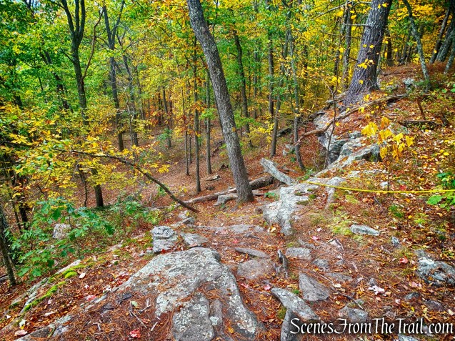
descent on Tusten Mountain Trail
After the initial steep drop, the trail descends much gentler along a woods road.
Tusten Mountain Trail
From here, we reached the trail register and retraced our steps back to the parking area, where our hike began. We stopped and rested for a few minutes by the Delaware River before we took off for our next hike at Minisink Battleground Park.
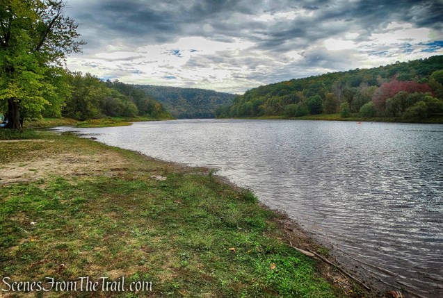
Delaware River as viewed from Ten Mile River NPS River Access
Pros: Scenic views, Stone Arch Bridge, Delaware River, quarries, rock formations.
Cons: Fix the blazes!
Tusten Mountain

Ooo! I really like this hike ! Gotta do this- thanks !
LikeLiked by 1 person
Do all 6 and earn a free patch.
LikeLike
Thanks for opening my eyes to this region! Love exploring NPS areas.
LikeLiked by 1 person
To be honest, I only did these hikes for the patch, but in the process, I discovered some really beautiful and historical areas. Long drive (almost 2 hrs.), but I truly enjoyed every bit of it.
LikeLike
Beautiful photos, great color.
LikeLike