July 9, 2017 – Red Hook, NY
Difficulty: Easy
Length: Approximately 3 miles
Max elevation: 154 ft. – total elevation gain approximately 430 ft.
Route type: Circuit
Map: Montgomery Place grounds map
Trailhead parking: 26 Gardener Way, Red Hook, NY 12571
Montgomery Place, now Bard College: The Montgomery Place Campus, near Barrytown, New York, is an early 19th-century estate that has been designated a National Historic Landmark. The Montgomery Place estate was owned by members of the Livingston family from 1802 until the 1980’s. The north and south sections of the property, known as the North and South Woods, remain heavily wooded. The South Woods, approximately 70 acres in size, is the oldest oak forest in the Hudson Valley. The North Woods slopes down to the ravine that the Saw Kill flows through. Winding paths and trails lead through both wooded tracts. In the North Woods they lead to a waterfall; in the South Woods to the river’s edge.
I had heard of this place and viewed images online of the buildings and grounds which seemed interesting to me. I wanted to break in some new hiking boots and wanted to do so as painlessly as possible. This place fit the bill because the grounds are not that big and I could opt out at any time. We arrived on the grounds shortly before 10:00 am on a Sunday Morning and the visitors lot was empty. I was surprised, but pleased that there wouldn’t be anyone photobombing my photographs. They do give tours on Saturdays, but on Sundays the grounds are open to the general public for free.
I forgot to turn on my GPS so I did not include a hike route. The trails are marked with signs at the main junctions, but we did walk in circles a few times. Nevertheless it is difficult to get lost in the North Woods section of the grounds. The visitor center is quite large as is the parking lot. The restrooms were open and clean on the day we visited. Montgomery Place is a nice place to visit if you are just interested in a casual walk on a nice day.

visitor center
Walking through the center of the visitors center, there is a gravel path off to the left. Continuing straight, takes you towards the river and the mansion.
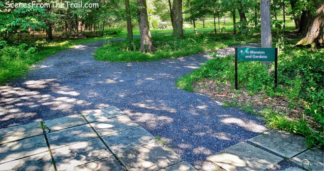
towards the river and the mansion
If you bear left, the path takes you to the South Woods Trail, which we did not check out on this trip. The path that goes right takes you across the road and a field onto the Sawkill Trail.

junction
We proceeded straight towards the mansion and passed the coach house, a fancy name for a garage. Prominent NYC architect A. J. Davis built the coach house in 1860 for Louise Livingston. Coach houses were built as essential features of upper-class estates and served as high-status buildings that accommodated valuable horses and expensive painted coaches and leather tack. With the arrival of the automobile, the coach house was transformed into the family garage and an apartment upstairs was added for the family chauffeur.
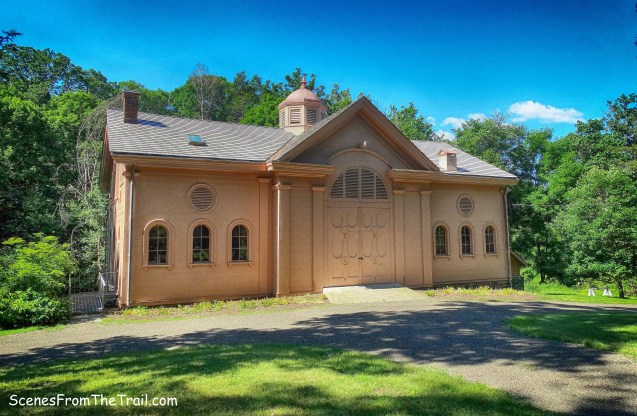
coach house
We veered off the path and cut across the lawn and approached the mansion from the front. The Montgomery Place Mansion was completed in 1805 under the direction of Janet Montgomery Livingston.

Montgomery Place Mansion
Walking along the north side of the mansion we came to the large open porch. If not for the fact that this was a hike of sorts, I could have sat there all day sipping lemonade.
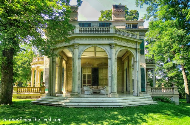
large open porch
A view of the rear of the mansion.
rear of the mansion
Walking from the rear of the mansion there are Hudson River views.
Hudson River view
We then walked along the south side of the mansion towards the garden. I was unimpressed with the garden, but they had an exhibit called “Historic Garden Tools of Montgomery Place.” There was no one around and I am not sure if that’s standard operating procedure or if someone left the door open.

Historic Garden Tools of Montgomery Place
We then headed back towards the mansion and ventured down the West Lawn Trail on the left and passed a pond. We then walked around and found a trail that led into the woods. After walking a big circle, we headed back on that trail until we came to a junction with the Sawkill Trail.

Sawkill Trail
The Sawkill Trail goes through the woods and down into the ravine.
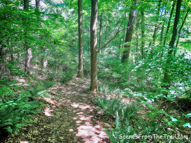
Sawkill Trail
This trail does not see regular maintenance as there is some erosion and several blowdowns along the way, but nothing too serious.
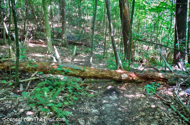
blowdown on Sawkill Trail
At the base of the descent near the banks of the Sawkill Creek, there is the ruined building of the hydroelectric power station that was used to supply elecrticity to the estate.
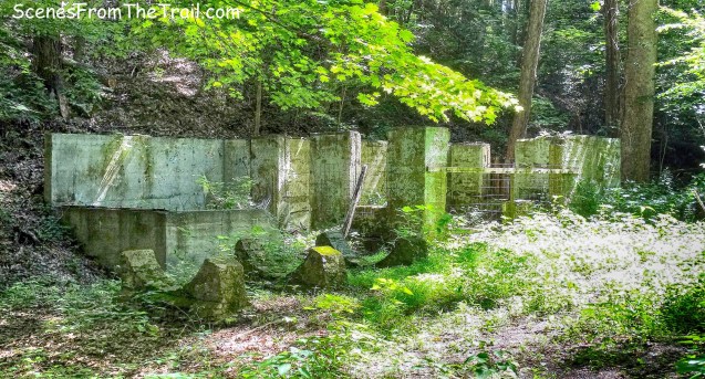
hydroelectric power station
We walked over to the Sawkill Creek over a wooden footbridge that spans a wet area. There are a few benches where one can sit and relax alongside the Sawkill Creek.

wooden footbridge
Looking upstream, the Lower Falls are visible in the distance.
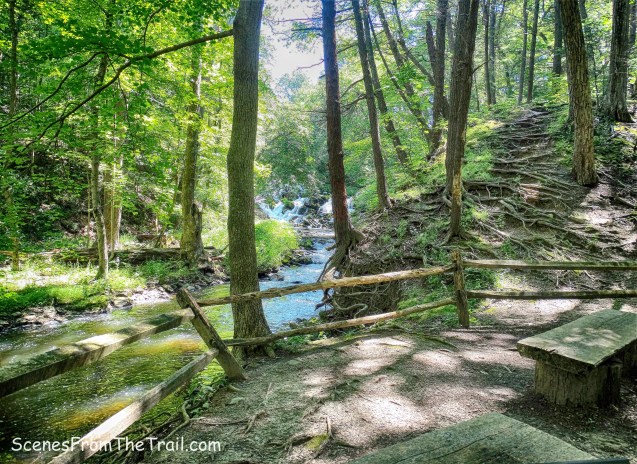
Sawkill Creek with Lower Falls
I went around the barrier looking for a better vantage point, but it was difficult to get a good angle.

Lower Falls
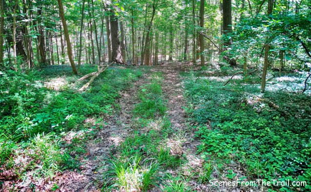
We then made our way uphill on a woods road and arrived at a junction where we made a sharp left on the Lake Trail.

woods road
The trail ends with the Sawkill Creek straight ahead, the lake to the right and a wooden shack on the left that was used by swimmers to change into their suits.

wooden shack
There isn’t a great view of the lake from here, but walking off the trail downstream, I was able to get a clear view of the waterfall that cascades over the dam from the lake.

waterfall that cascades from the dam
We retraced our steps back up the Lake Trail and turned left on another woods road that leads around the northeast end of the lake.
woods road
The woods road dead ends at the Sawkill Creek and we turned around and headed back to the Lake Trail then continued on the Sawkill Trail which led us out to the field by the entrance road and back to the parking area. A nice walk on a Sunday morning and we didn’t encounter anyone on the trail. That works for me. Since this was a modest 3 mile walk, we decided to check out the main campus of Bard College and I am glad we did. Since it is right next door, I included some images below that I captured.
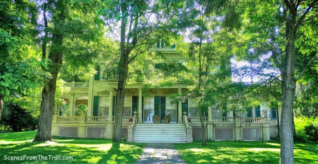
Blithewood Manor was built in 1900, and its site, originally designed by renowned landscape architect A. J. Downing. The building and grounds were donated to Bard College in 1951.

Blithewood Manor
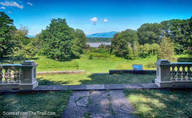
The estate is perched on the edge of the Hudson River and it provides fantastic views of the Catskill Mountains. Looking west across the expansive lawn, one can see Overlook Mountain to the left and Plattekill Mountain to the right.
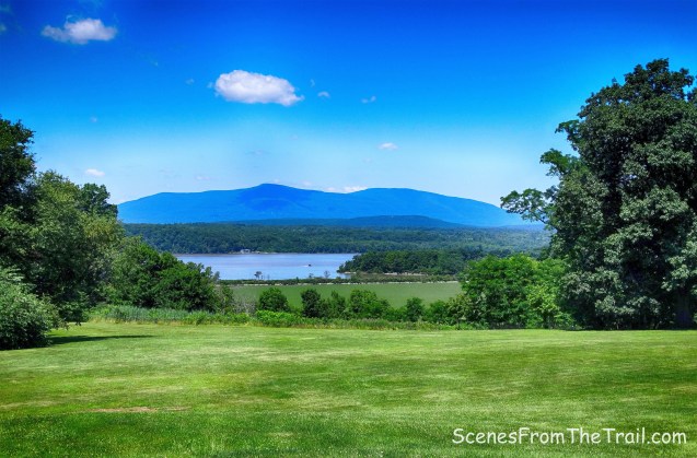
view from Blithewood Manor
Blithewood Garden was designed circa 1903 by Francis L. V. Hoppin. It is a classic example of a walled Italianate garden.

Blithewood Garden

Blithewood Garden
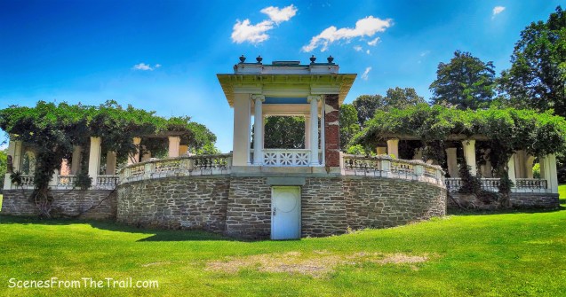
Blithewood Garden

I visited Blithewood last weekend and if you are hungry there is a great bar-b-q truck about 9 mins away.
LikeLike