July 4, 2017 – Nyack, NY
Difficulty: Moderate
Length: Approximately 6 miles
Max elevation: 702 ft.– total elevation gain approximately 1,006 ft.
Route type: Circuit
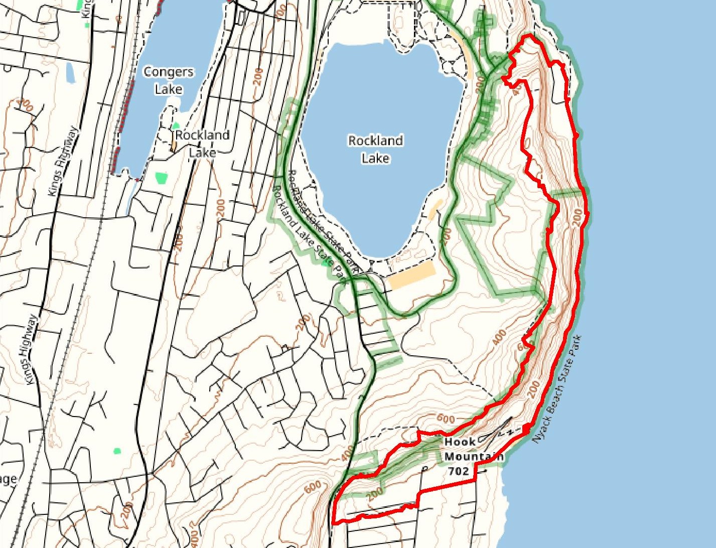
Map: Hudson PalisadesTrails Map 110
Trailhead parking: Nyack Beach State Park 698 N. Broadway Upper Nyack, NY 10960
Hook Mountain State Park is part of the Palisades Interstate Park system, just north of Nyack. It extends along almost seven miles of continuous waterfront and cliff slopes. The Long Path runs along the escarpment above while a bike path follows the river’s edge from Haverstraw Beach State Park to Nyack Beach State Park in Upper Nyack. Hook Mountain’s summit at 702 feet, second only to High Tor, along the Palisades ridge, offers spectacular views overlooking the Hudson River valley.
I wanted to raise a flag somewhere on the 4th of July and after lengthy contemplation I chose Hook Mountain as the site. I have been coming to Hook Mountain since I was a kid and live almost directly across the Hudson River from it, which made it a good choice. We did a clockwise hike from Nyack Beach State Park to the summit and continued on the Long Path along the ridge, returning on the bike path that hugs the shoreline.
hike route
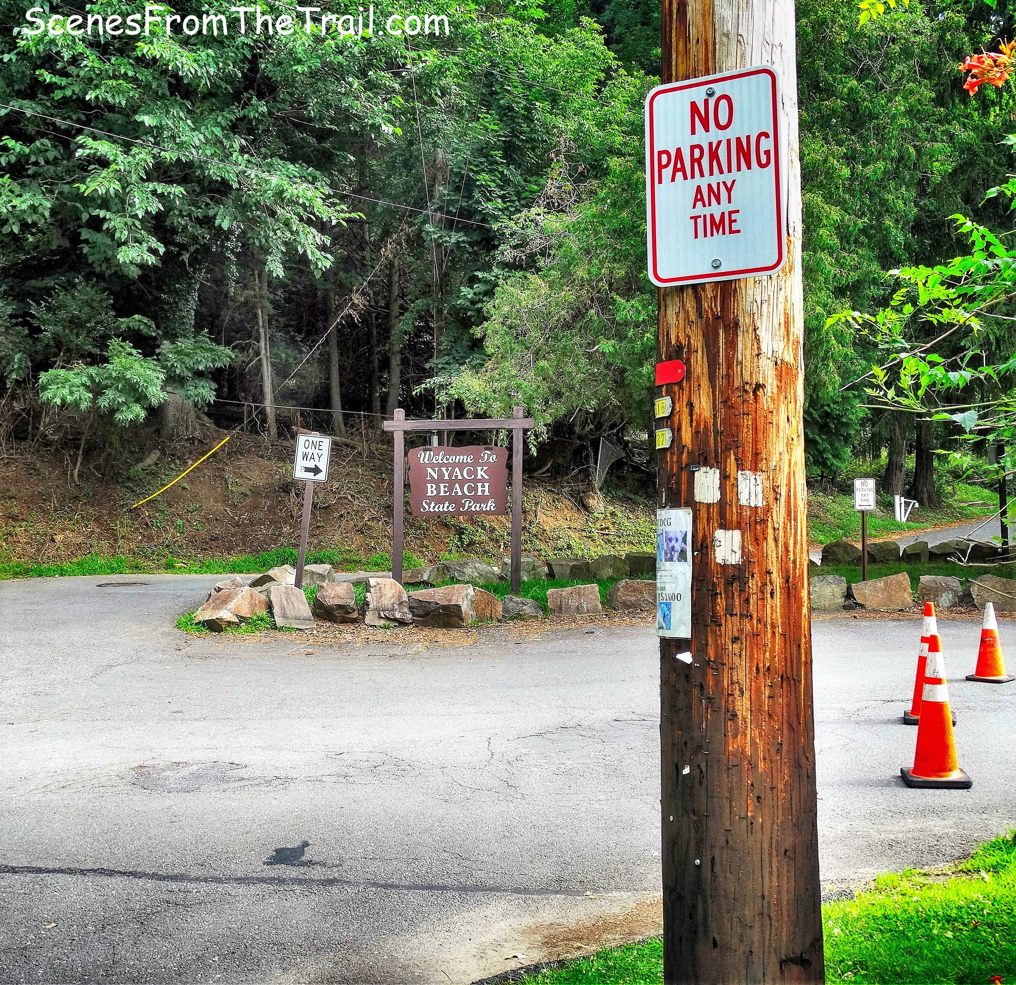
We parked at Nyack Beach State Park which charges $6.00 to park in season and headed back up to the entrance to begin following the white blazes of the Upper Nyack Trail which begins as a road walk.
Upper Nyack Trail
We followed the white blazes which were painted on telephone poles. We Turned right on Larchdale Avenue with the mighty cliffs of Hook Mountain visible to our right.
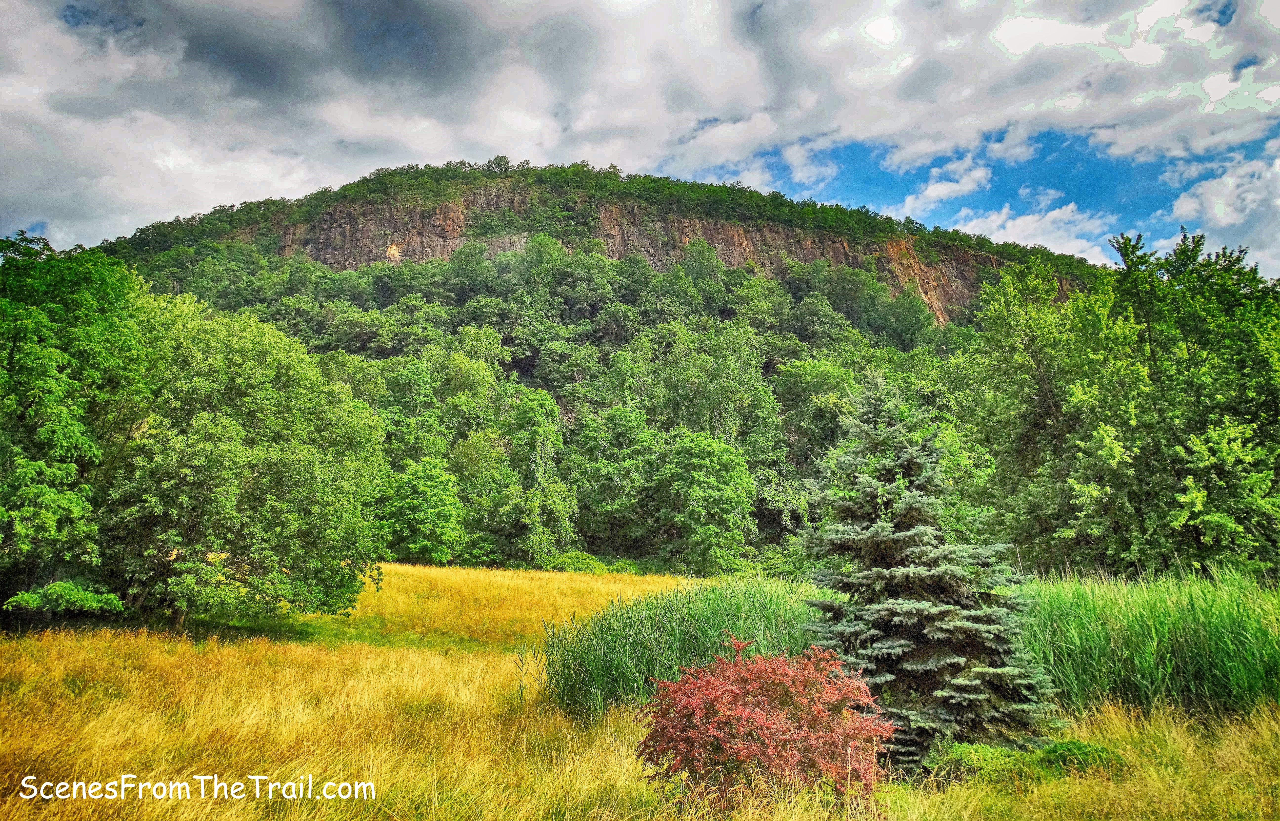
Hook Mountain
At the end of Larchdale Avenue, we turned left onto Midland Avenue. In about 300 feet, the Upper Nyack Trail ducks into the woods.
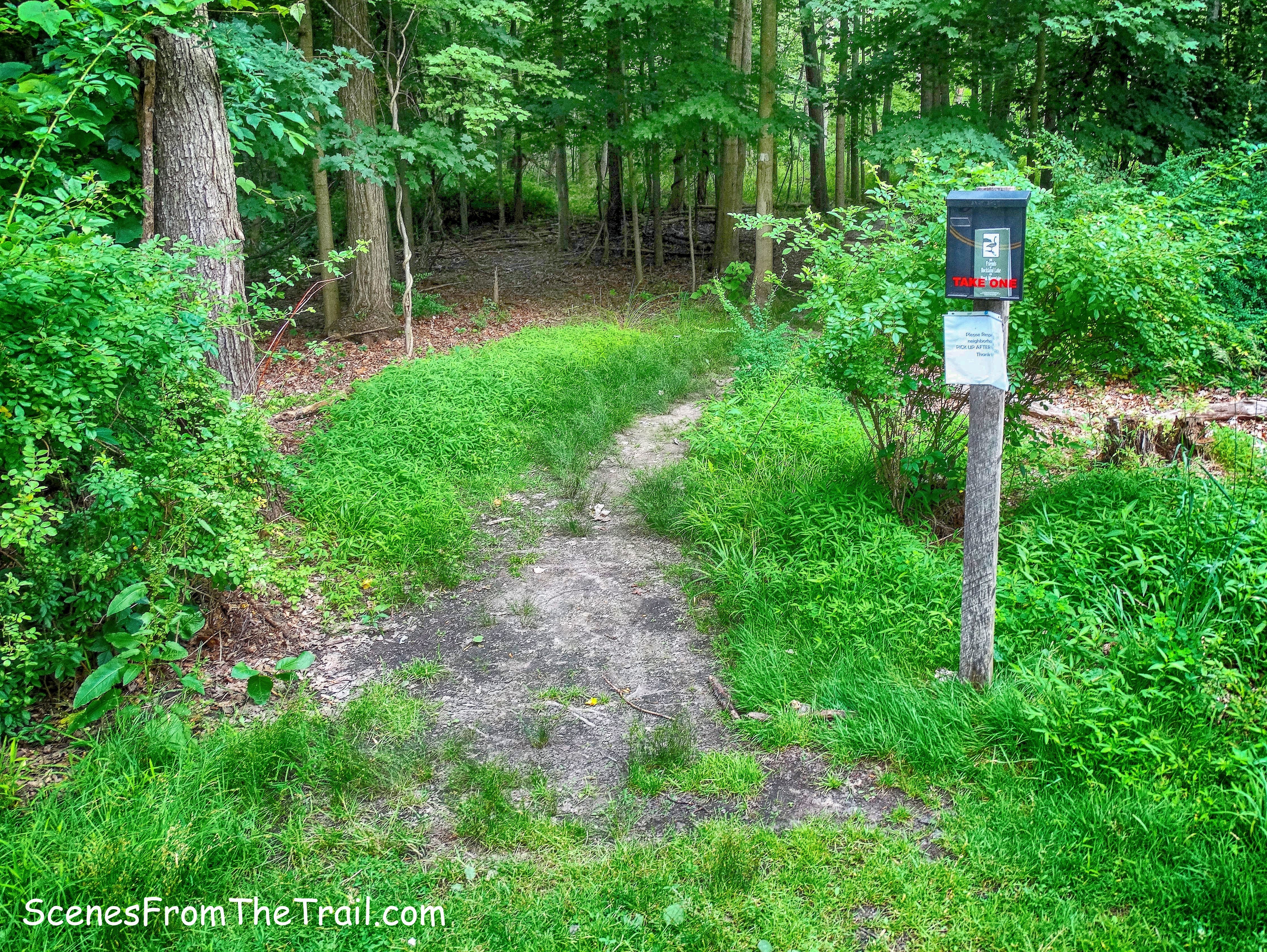
Upper Nyack Trail
Even though this winding trail is just a stone’s throw from homes to the left, it has a feeling of being deep in the woods.
Upper Nyack Trail
Upper Nyack Trail
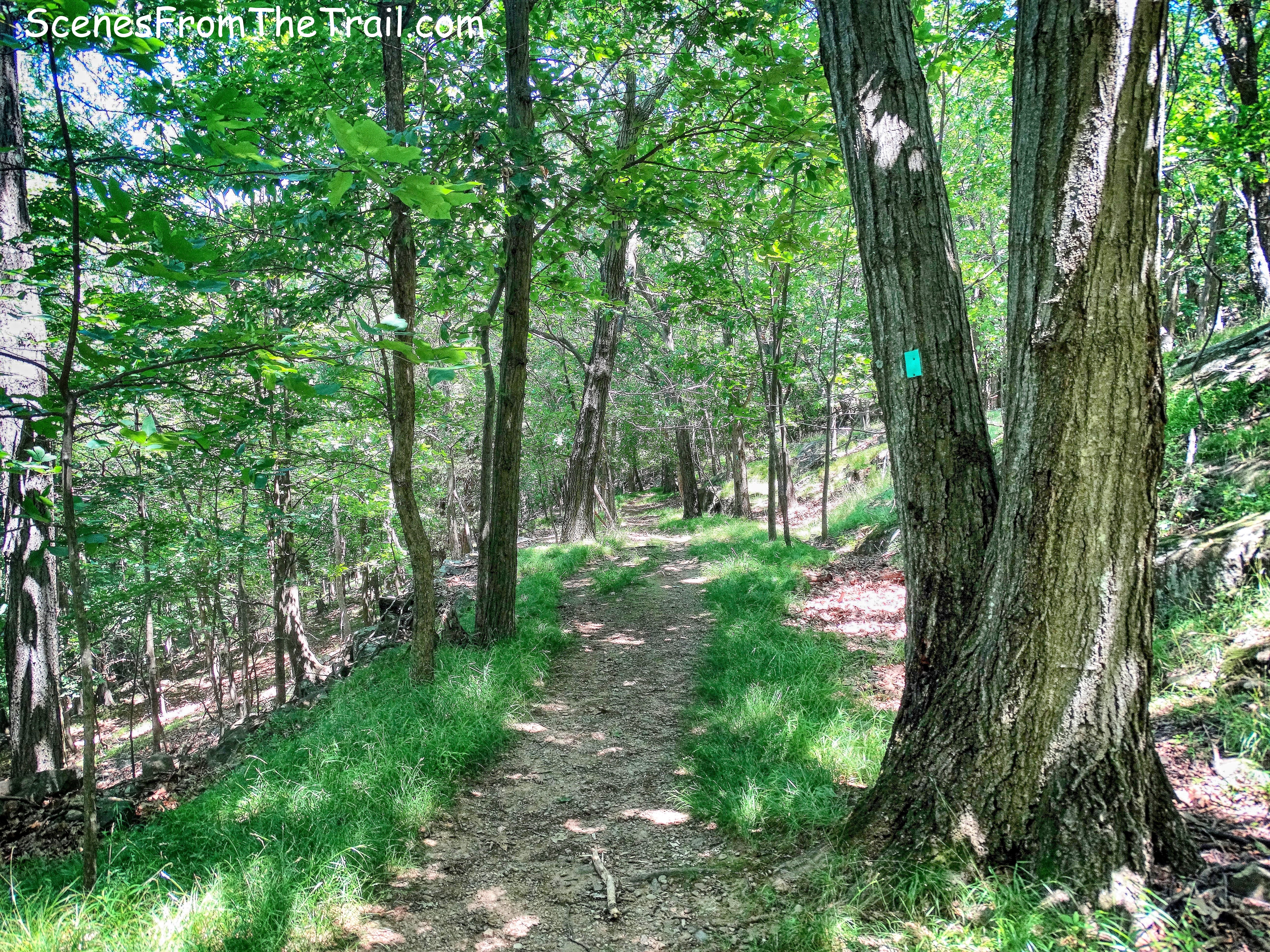
The Upper Nyack Trail ends at a junction with the aqua-blazed Long Path where we turned right.
Upper Nyack Trail/Long Path junction
The Long Path follows the route of an old road that was built in the 1870’s. This road was supposed to extend to the top of Hook Mountain, but it was never finished.
The Long Path
The trail climbs steeply in sections as it narrows to a footpath.
The Long Path
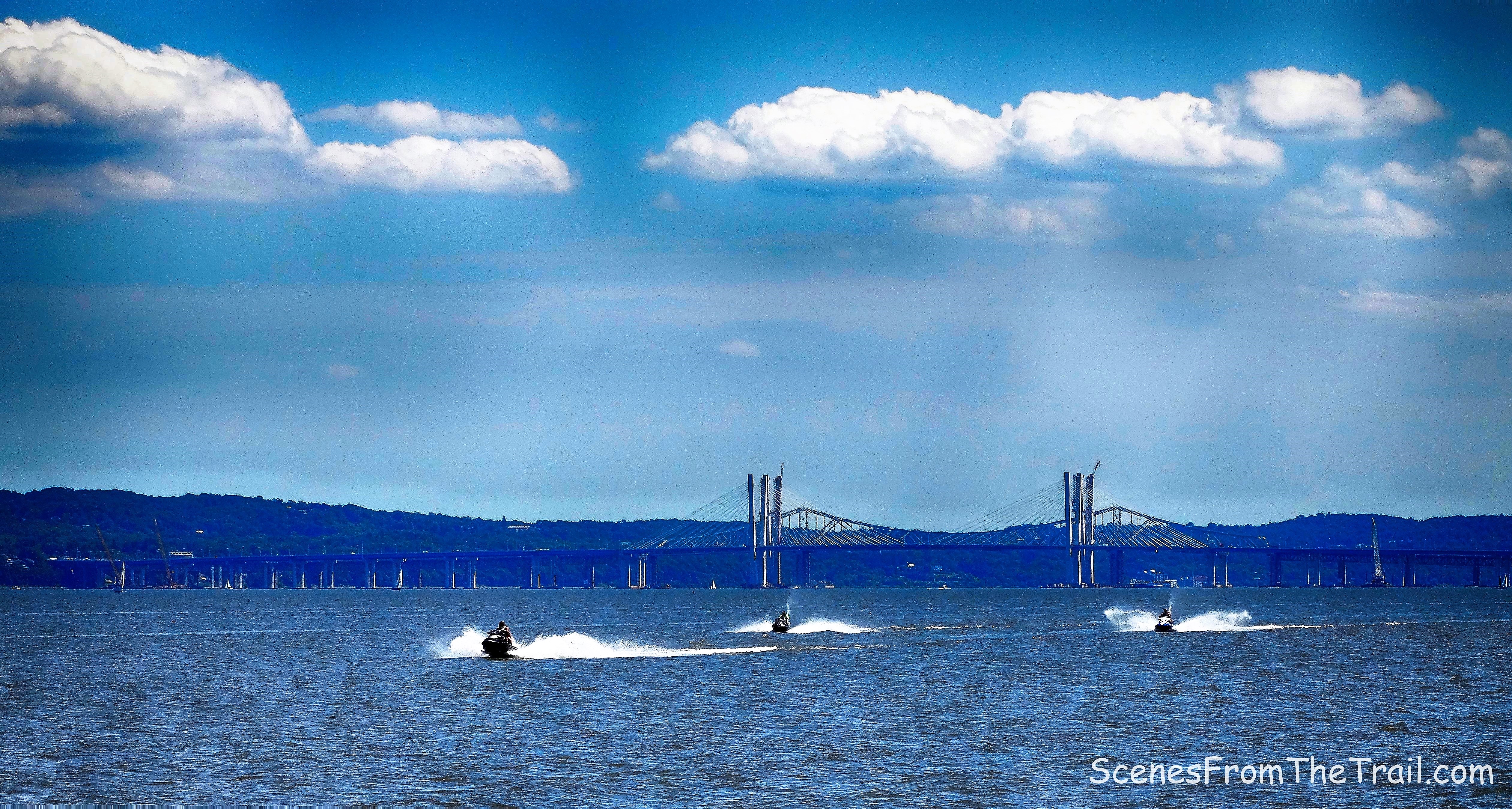
After passing some views of the Hudson River and the Tappan Zee Bridge, the Long Path makes a sharp right as it nears the summit and climbs steeply again.
The Long Path
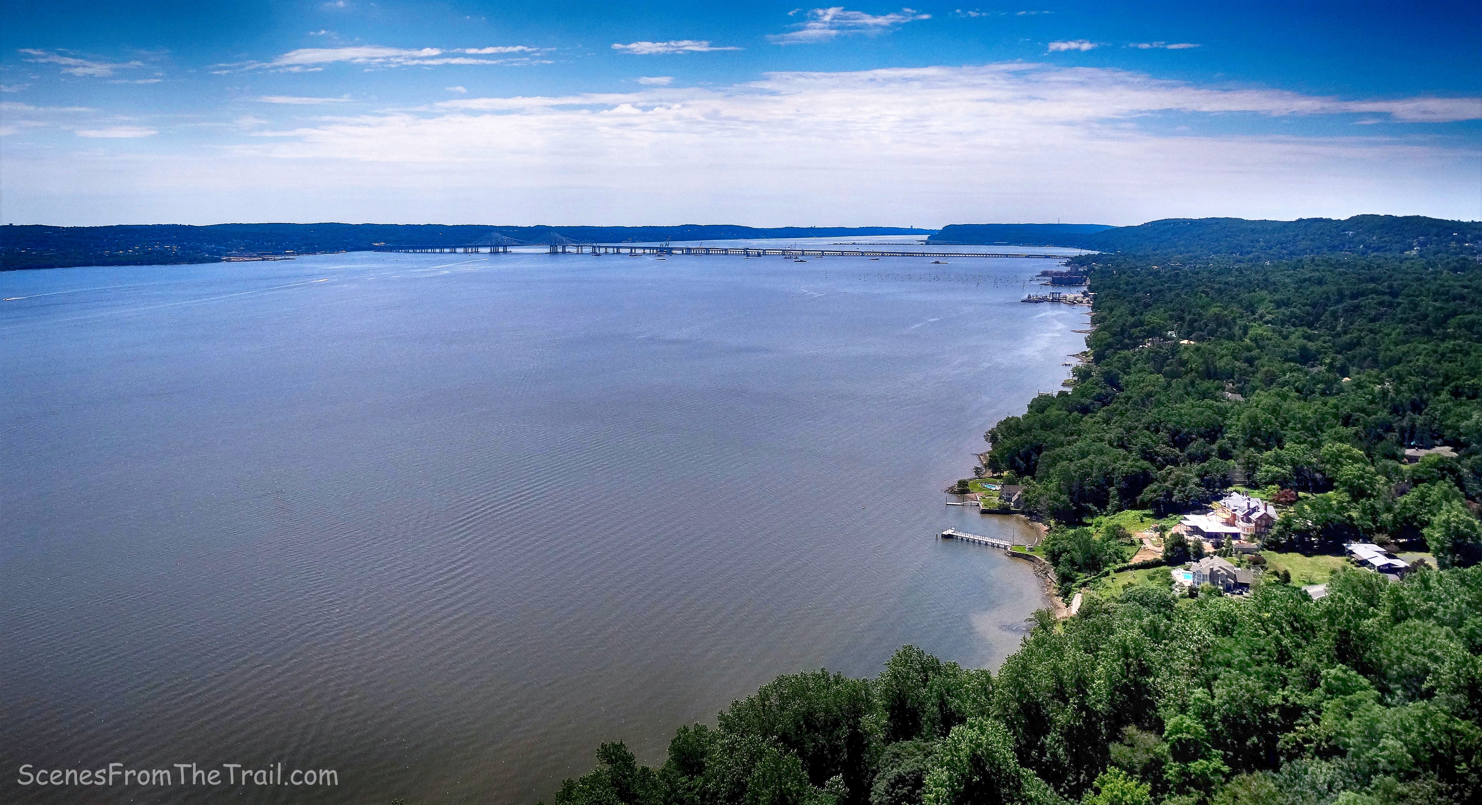
Arriving at the summit about 20 minutes ahead of my hiking partners, I took a well needed rest. The view from here is fantastic and I sat there enjoying it.
view southeast from the summit of Hook Mountain
Looking northeast, Rockland Lake is visible through the trees on the left with The Hudson River just beyond.

view northeast from the summit of Hook Mountain
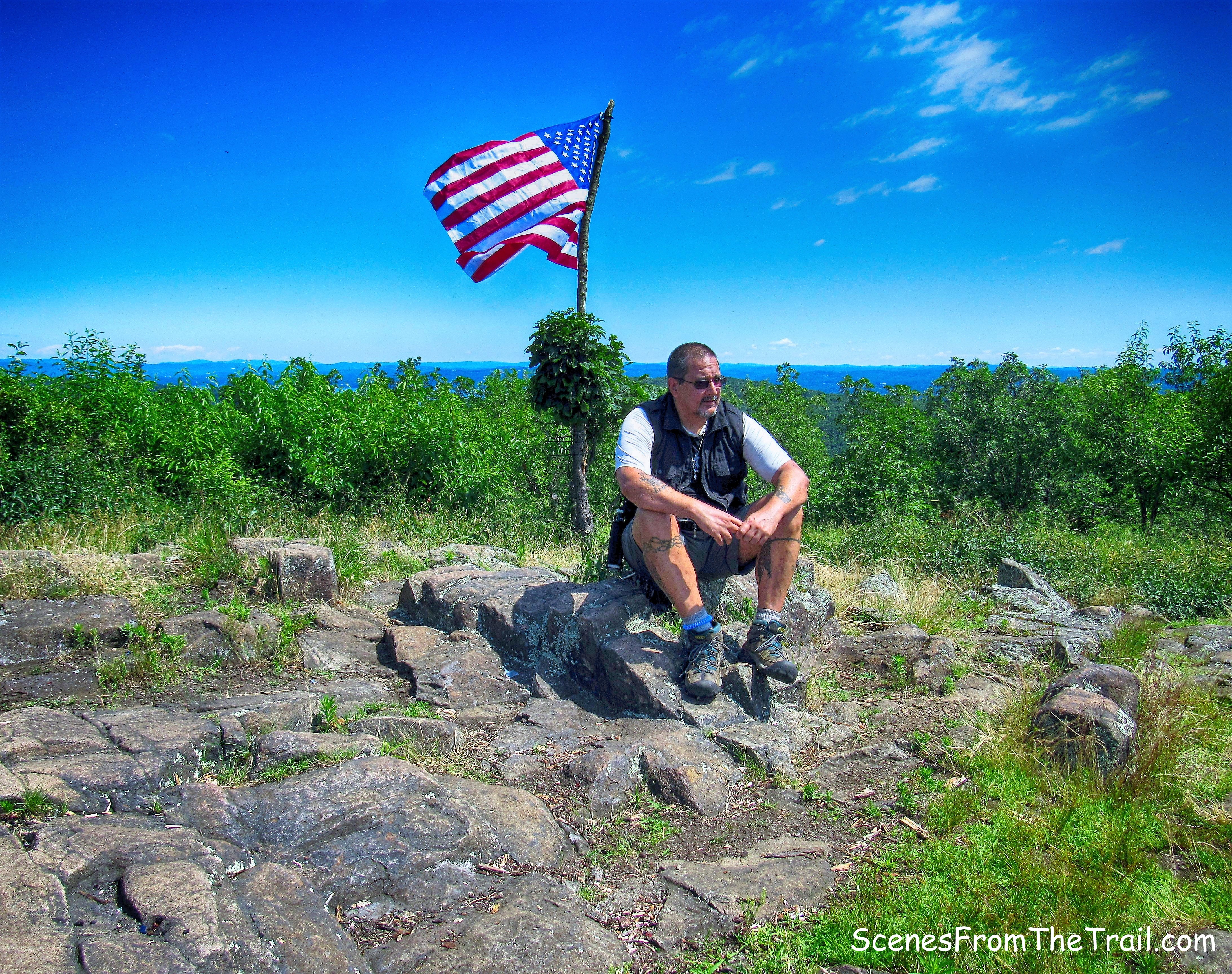
After a brief rest, it was time to get to work. After all, this flag wasn’t going to raise itself. I scoured the woods nearby for a long tree branch that would serve as the flag pole. I ended up walking down a bit and then dragging a couple of branches back up. I then attached the flag to the pole. Don’t worry, I didn’t let it touch the ground, I had someone hold the other end.
attaching the flag to the pole
After a little effort and some help, the flag was in place. What better way to honor America on its birthday than to fly Old Glory.
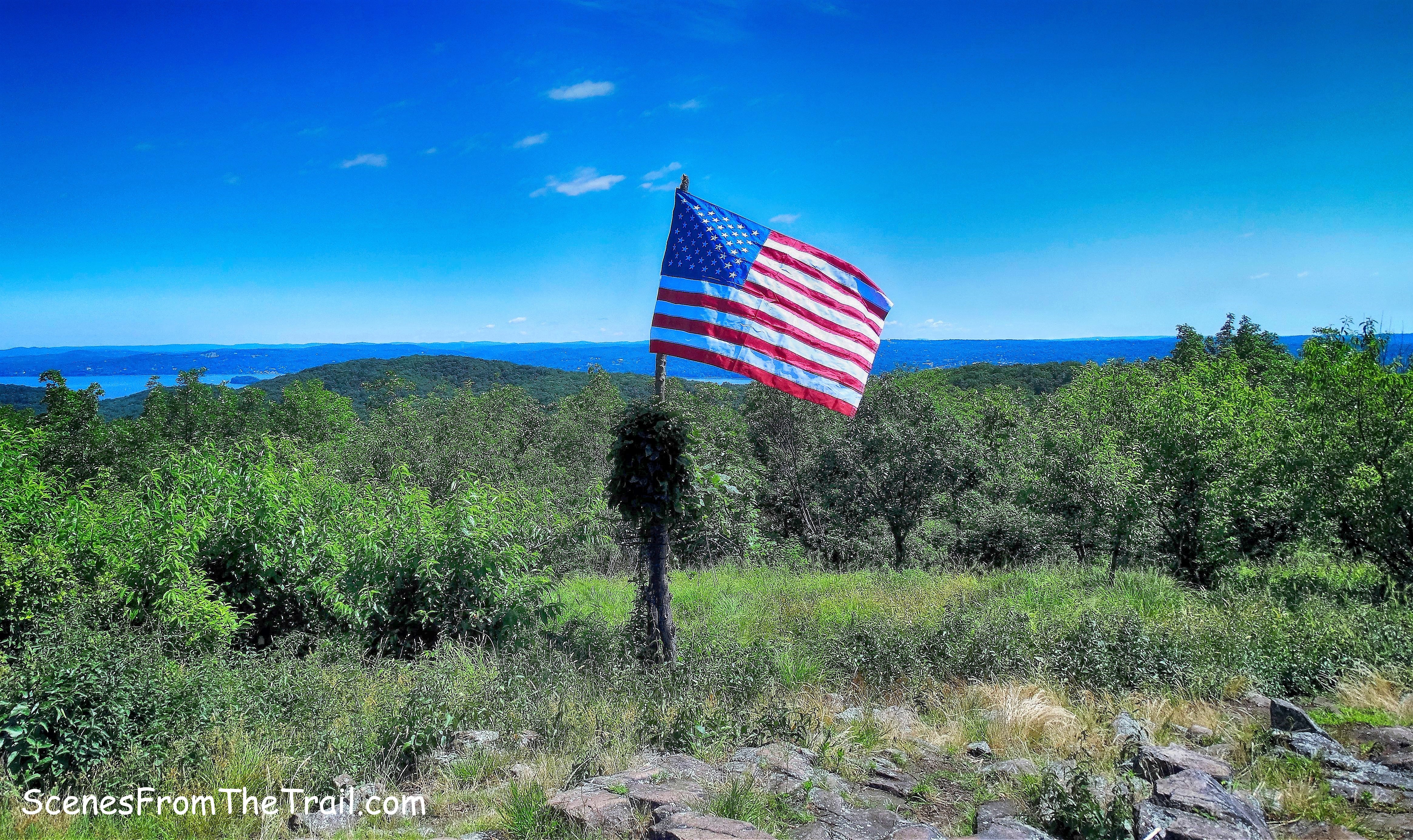
American flag at the summit of Hook Mountain
We then saluted the Hook Mountain American flag and continued on our hike. Still following the aqua blazes of the Long Path, we entered the woods and began to walk the ridgeline which offers many views along the way.
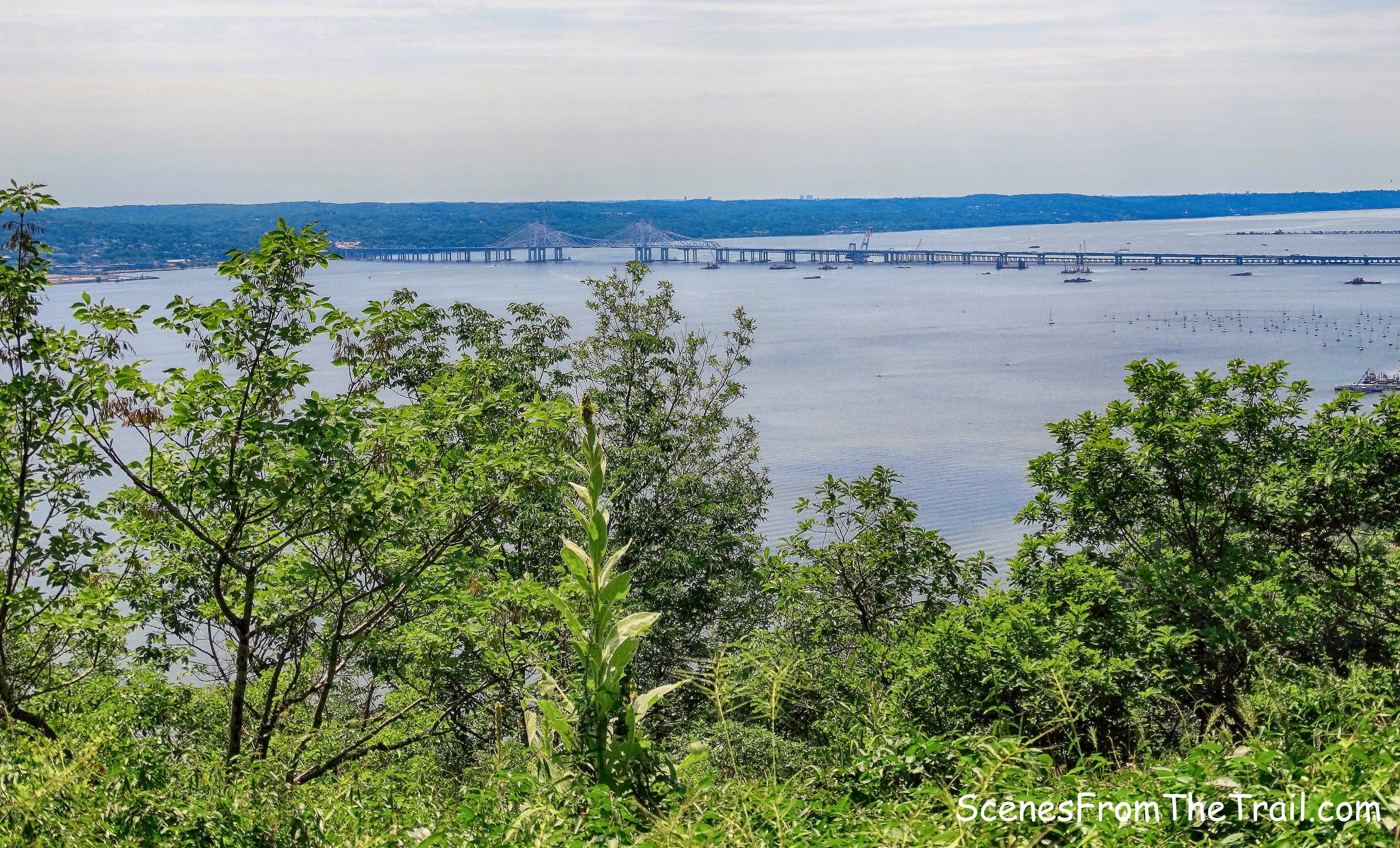
view of the Tappan Zee Bridge
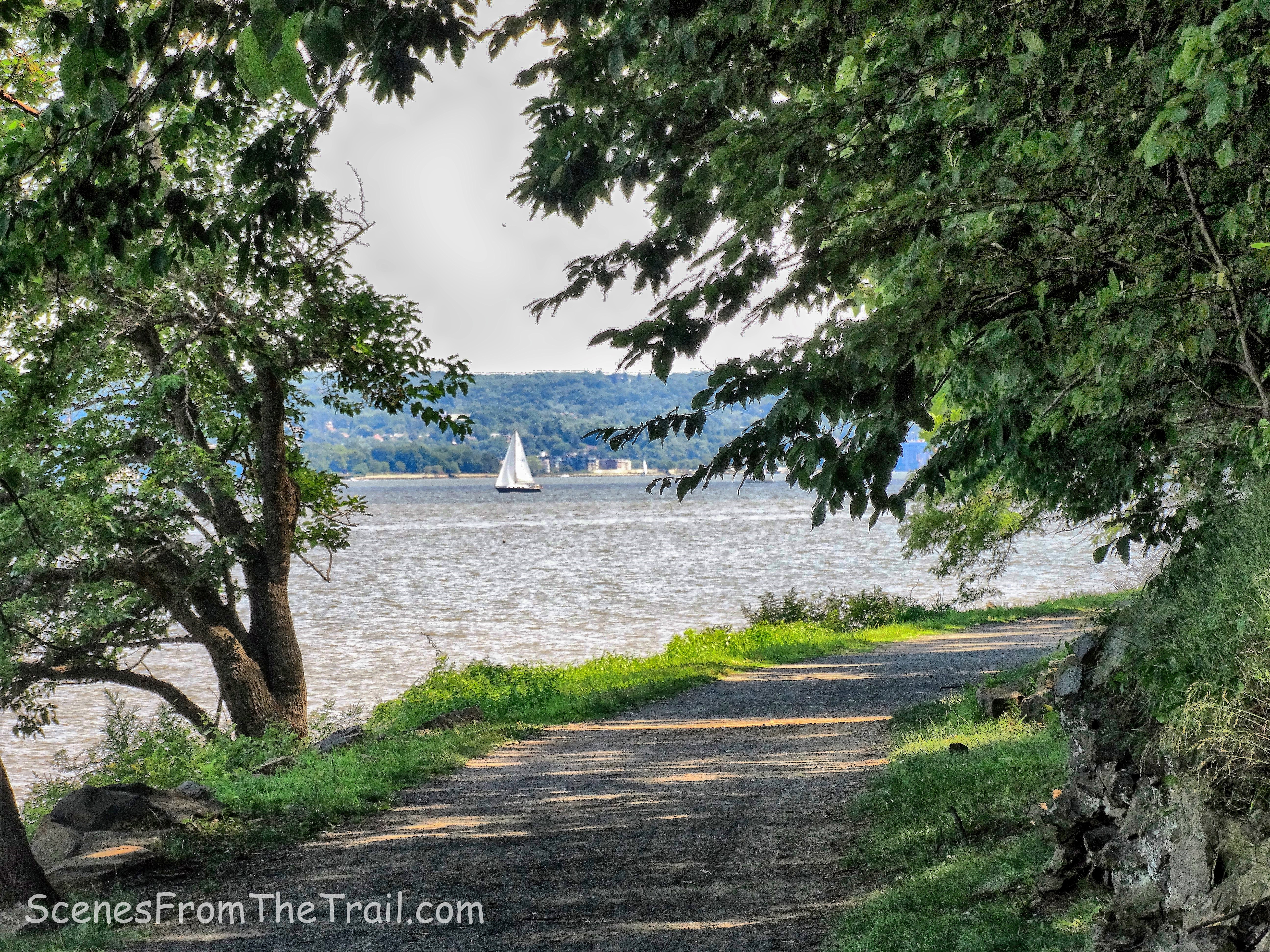
The Long Path had numerous ups and downs, but the views were well worth it.
view of the Hudson River from the Long Path
The Long Path turns left, begins to descend and then joins a woods road. The nicely graded road was a welcome change from the rocky trail on the ridge.
The Long Path
There is a wide stone wall on the left side of the Long Path which I have passed by many times. I have no clue what its significance was, but it is different than other stone walls I have encountered on my hikes.
wide stone wall
There is an unmarked trail that leads off to the right and comes out on the cliffs. There are great views from there as well. That is the way I have gone in the past, but I decided to continue on the Long Path since I never walked down that way. The trail continues its descent and passes the stone ruins of an old building. I can only assume that it had something to do with the Knickerbocker Ice Company which was formed in 1831.
stone ruins
Just beyond, at the base of the descent are more remnants of the ice harvesting industry.
remnants of the ice harvesting industry
The Long Path leads out to Landing Road and continues to the northern section of Hook Mountain. We turned right and followed the paved park road towards the river. Just off the road on the right, are the ruins of the old ice railway that leads close to the river.
old ice railway
old ice railway
Walking down the paved park road, the end of the old ice railway is visible looking back into the woods.
old ice railway
Looking up from the paved park road, the scarred cliffs of Hook Mountain stand proudly in the July sun.
cliffs of Hook Mountain
We came to an intersection where the Hook Mountain Bike Path joins from the right, but continued straight on the paved park road, heading south.
paved park road
On the left side of the park road there is a ruined metal shack that was built into the side of the hill. The roof is just about level with the road.
ruined metal shack
ruined metal shack
The road descends to river level and passes the ruins of a stone building on the right.
ruins of a stone building
The road now changes to gravel and since it was after 2 pm, the cliffs provide plenty of shade. Almost directly across the Hudson River, Sing Sing Correctional Facility is visible.
Sing Sing Correctional Facility
There is a picnic area close to the water and we found a nice shady spot to relax for a bit and enjoy the sights and sounds on the river.
Hudson River
The rest of the way was a nice easy stroll along the river. The shade and the breeze helped to cool us off a little.
Hudson River view
We then arrived back at a packed Nyack Beach State Park. All the parking spots were filled as well as the picnic tables. We were hungry and tired by this point and headed out to our secret picnic area to grill some food. I hope that you enjoyed the hike and please don’t forget to follow my blog. Now get out there and take a hike!
Pros: American flag, views, ruins, Long Path, Hudson River, cliffs, shaded trails.
Cons: Stretches of the ridge are exposed with no tree cover (hot sun).
If you come across the flag and there is an issue with it, please contact me. Thank you.
Take a hike!
