February 4, 2017 – Beacon, NY
Difficulty: easy
Length: approximately 4 miles
Route type: circuit
Map: Beacon Riverfront Trail Map – East Hudson Trails Map
Madam Brett Park has a mile of gently sloping, gravel-surfaced trails that lead to a dramatic waterfall and tidal marsh; a short, narrow woodland trail provides access to the marsh observation platform. A boardwalk along Fishkill Creek allows universally accessible exploration of this important Hudson River tributary and the wildlife it supports.
In 1988, New York State acquired Denning’s Point to expand the Hudson Highlands State Park system. A 64-acre peninsula on the Hudson River at the mouth of the Fishkill Creek, the 1.2 miles of trails, a woods road makes a circuit of the heavily wooded point. Denning’s Point is closed seasonally to protect the habitat of the bald eagle.
Long Dock Park has universally accessible walking paths that connect the park’s many amenities. There also is a link to the 1-mile Klara Sauer Trail (named for Scenic Hudson’s former president), which spans the waterfront from the Beacon train station to Denning’s Point State Park.
After our Abandoned in Beacon exploration, we made our way to Madam Brett Park for a short easy hike. I have been here numerous times to view the waterfall and walk around. It is quite an enjoyable place which is rich in history. From the parking area we walked east past the kiosk onto a gravel road which is marked with white blazes and were greeted with a stunning sight. Tioronda Falls with Mount Beacon in the background.
Tioronda Falls
We walked on the gravel road, occasionally detouring down one of the trails that led to the creek in order to get a good vantage point of the falls. We arrived at the concrete platform and took in the awe-inspiring view.
Tioronda Falls
We walked past the relief valve and onto the iron catwalk……
relief valve and iron catwalk
and walked across the narrow ledge of Tioronda Dam.
Tioronda Dam
I walked quickly along the narrow surface, trying to keep my balance. As a kid, no big deal, but as an adult, a spill would be costly. We walked to the stone platform which was right alongside the falls.
Tioronda Dam
We spent a little time admiring the beauty of Tioronda Falls then retraced our steps back to the parking area. We then headed west on the white-blazed trail which led us to a boardwalk that was sandwiched between Fishkill Creek and the ruins of the Tioronda Hat Works.
boardwalk
Right by the start of the boardwalk is the Tioronda Bridge which once carried South Avenue across Fishkill Creek. Built between 1869 and 1873 by the Ohio Bridge Company, it was demolished by the city in December 2006. The bridge had been listed on the National Register of Historic Places in 1976, but in 2006 had deteriorated to the point that it had to be closed.
Tioronda Bridge
The Tioronda Hat Works opened in 1879 and later became the Merrimack Hat Company which closed in 1949. The brick buildings were used sporadically as warehouses over the following decades. Since about 2010 they have been undergoing a woefully slow demolition.
Tioronda Hat Works
Just a few days before our visit, there was a fire here, but luckily the firefighters were able to keep it from damaging the boardwalk.
Tioronda Hat Works
Like all the mills that used to dot the area, it was powered by Fishkill Creek and Tioronda Falls.
Tioronda Hat Works
When we came to the end of the boardwalk we walked along the wide woods road and then came to a red-blazed trail on the left. This footpath is only 700 feet long and loops around Fishkill Marsh.
red-blazed trail
We walked along the edge of Fishkill Marsh and came to a clearing that afforded us a nice view.
Fishkill Marsh
The red-blazed trail led us back to the white-blazed trail where we turned left. We stopped for a moment and sat on a bench alongside the trail. There we saw a Red-tailed Hawk sitting in a tree just feet from the trail.
Red-tailed Hawk
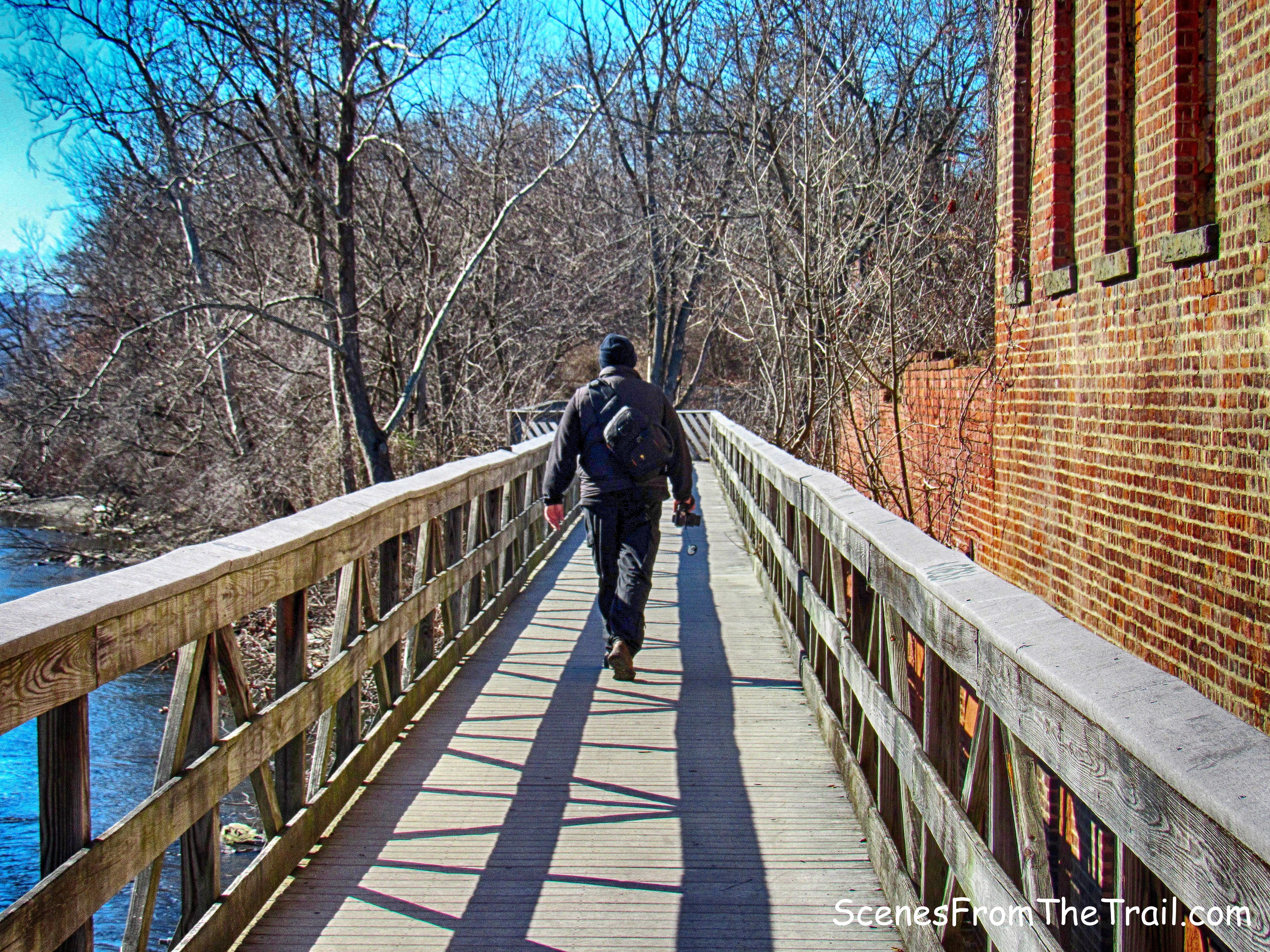
We continued on the white-blazed trail until its terminus and where the connector trail began. We crossed the bridge that spanned the Metro-North railroad tracks.
bridge
A nice view to the west from the bridge as we crossed it into Denning’s Point State Park.
view to the west
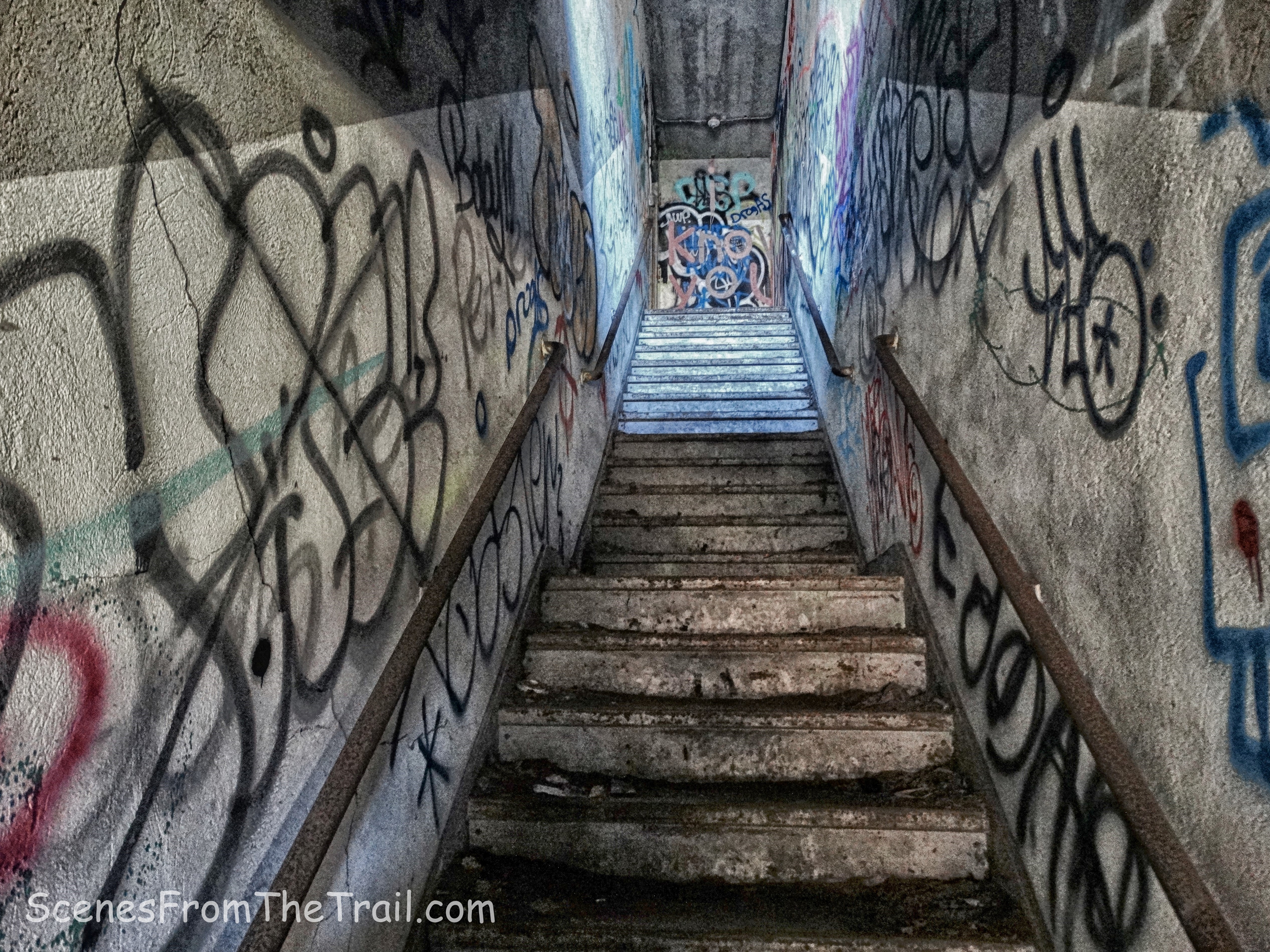
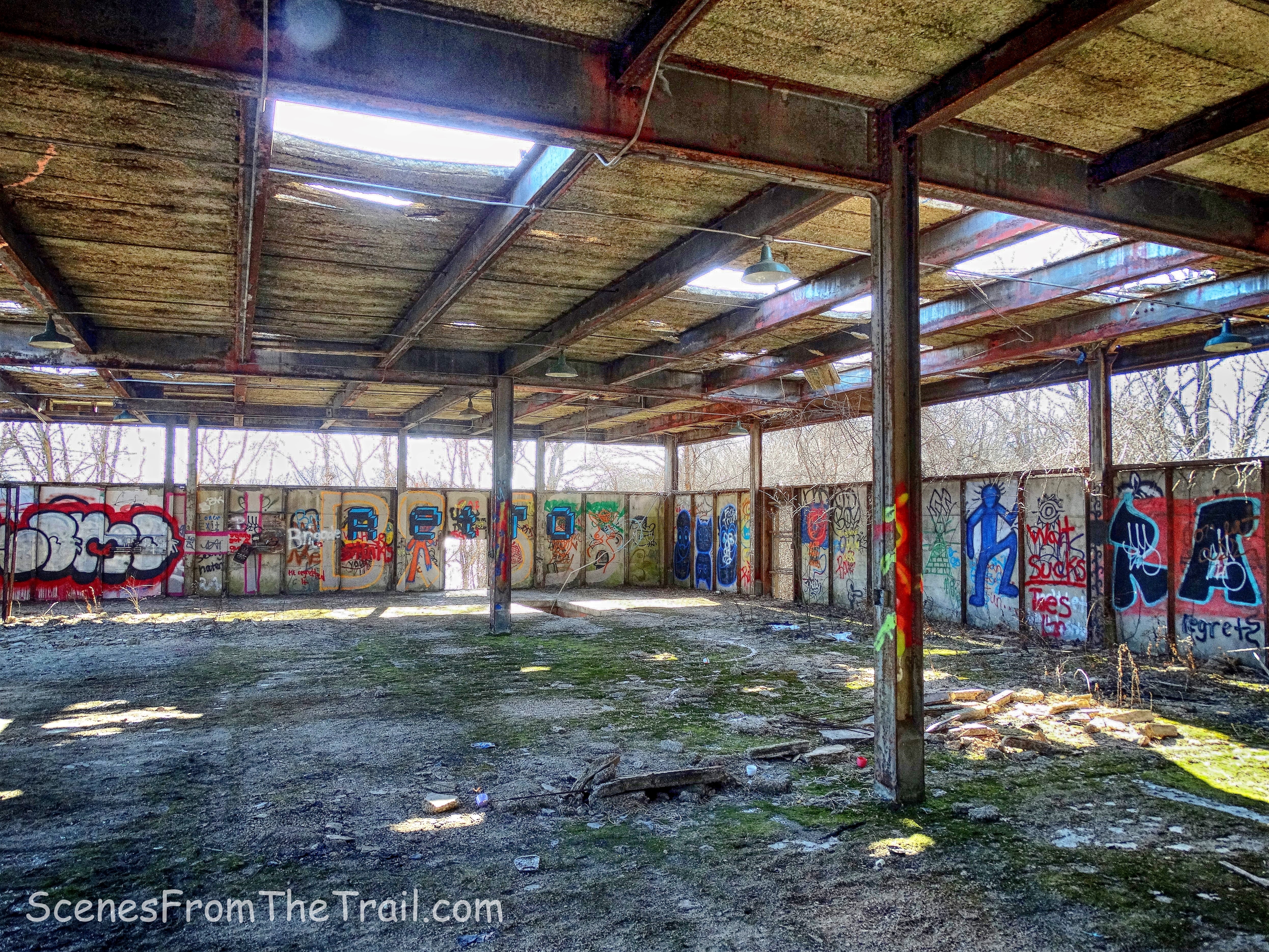
Once over the bridge and crossing over the train tracks, we were then walking on the Denning’s Point Trail. In a few minutes we arrived at the ruins of the Denning’s Point Brick Works. There was a group of noisy youths inside which had passed us earlier on the trail. They were on one of the upper levels so we climbed in a window on the lower level and took a look around.
Denning’s Point Brick Works
The ensuing image looks like what used to be a restroom.
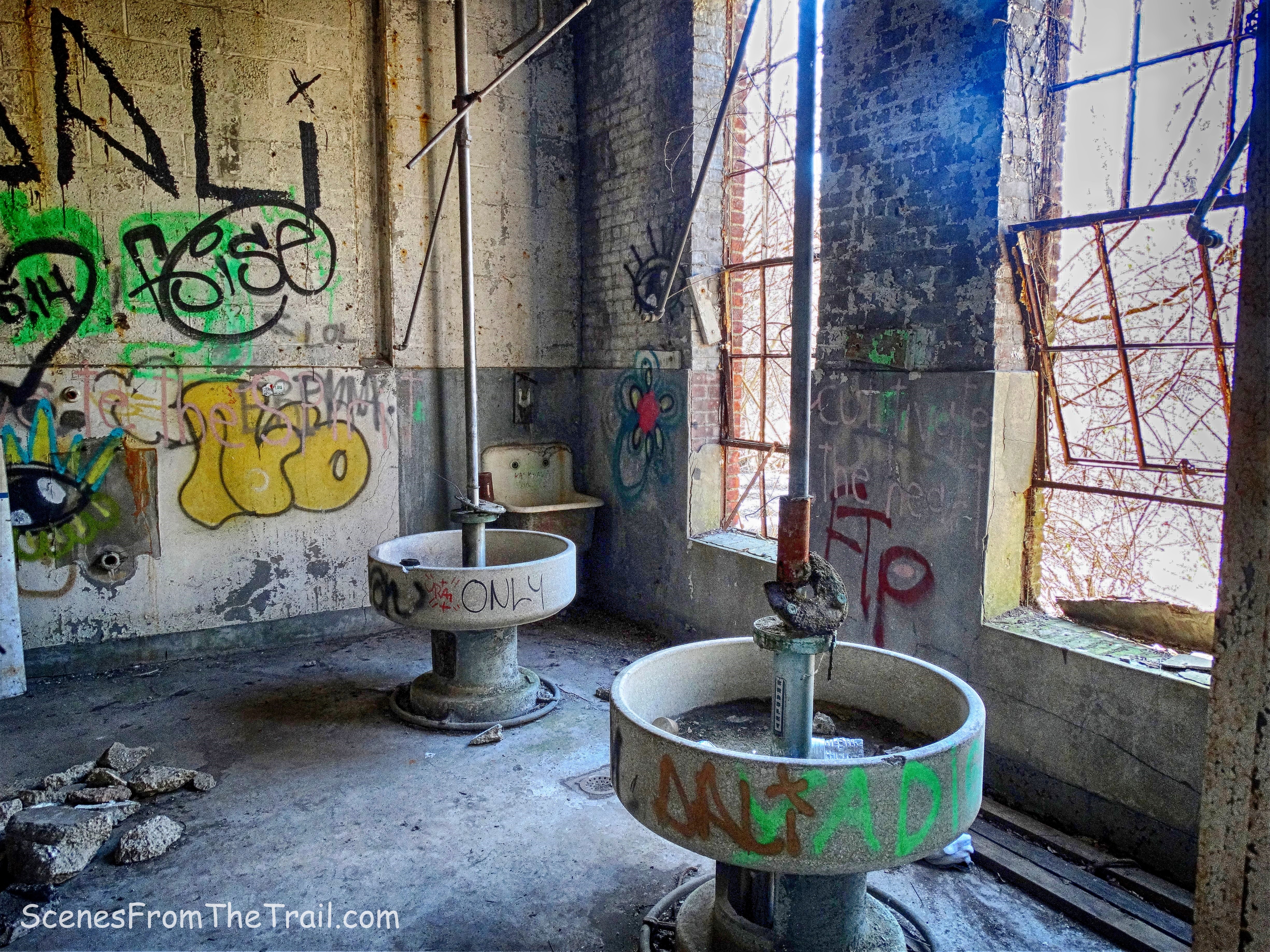
Denning’s Point Brick Works
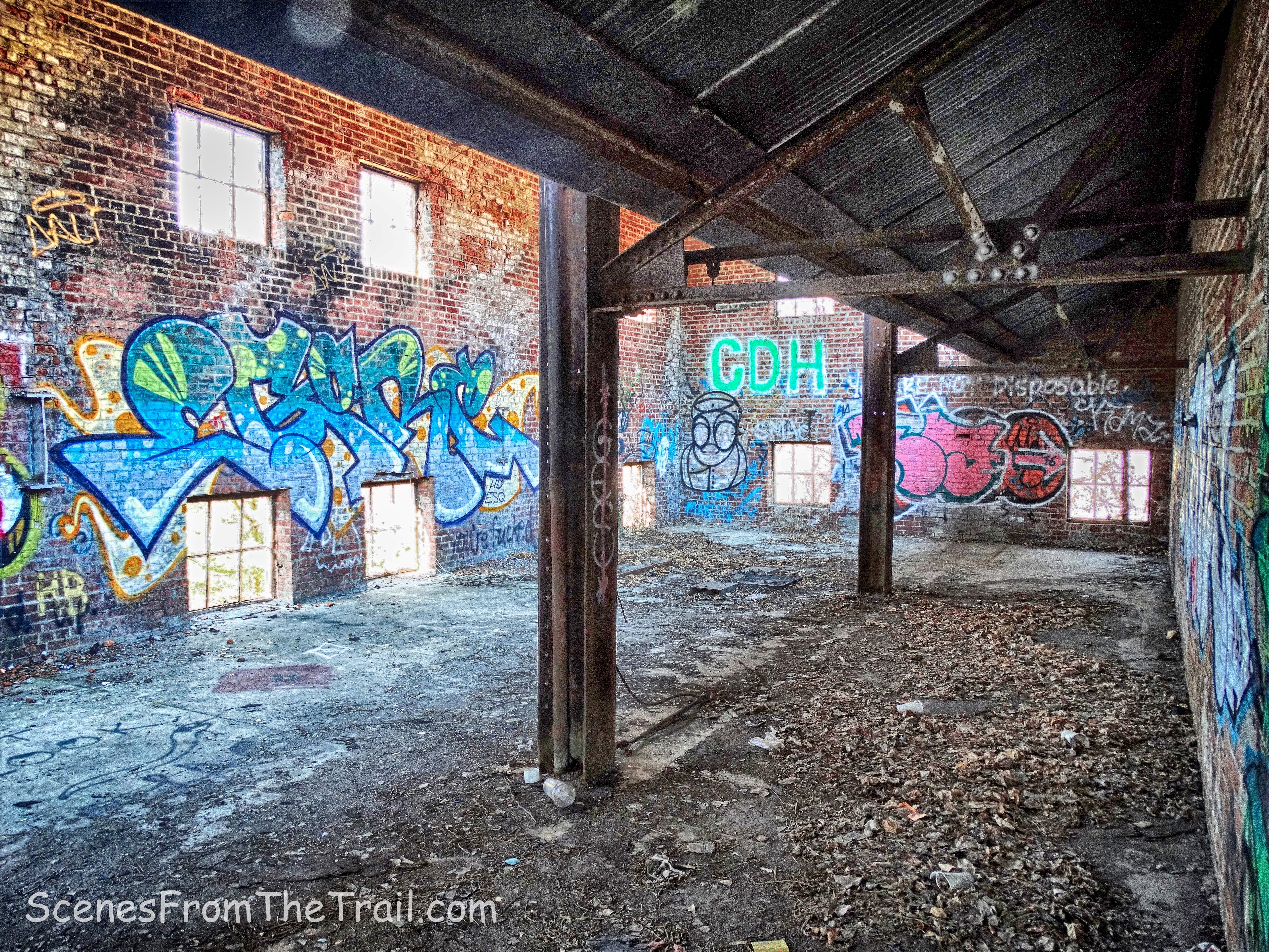
Denning’s Point Brick Works was established around 1885. The yard supplied bricks for high profile projects including the Empire State Building and Rockefeller Center.
Denning’s Point Brick Works
The brickyard operated until 1939, when it literally ran out of clay and was abandoned. We wandered around downstairs for a bit then we headed upstairs.
Denning’s Point Brick Works
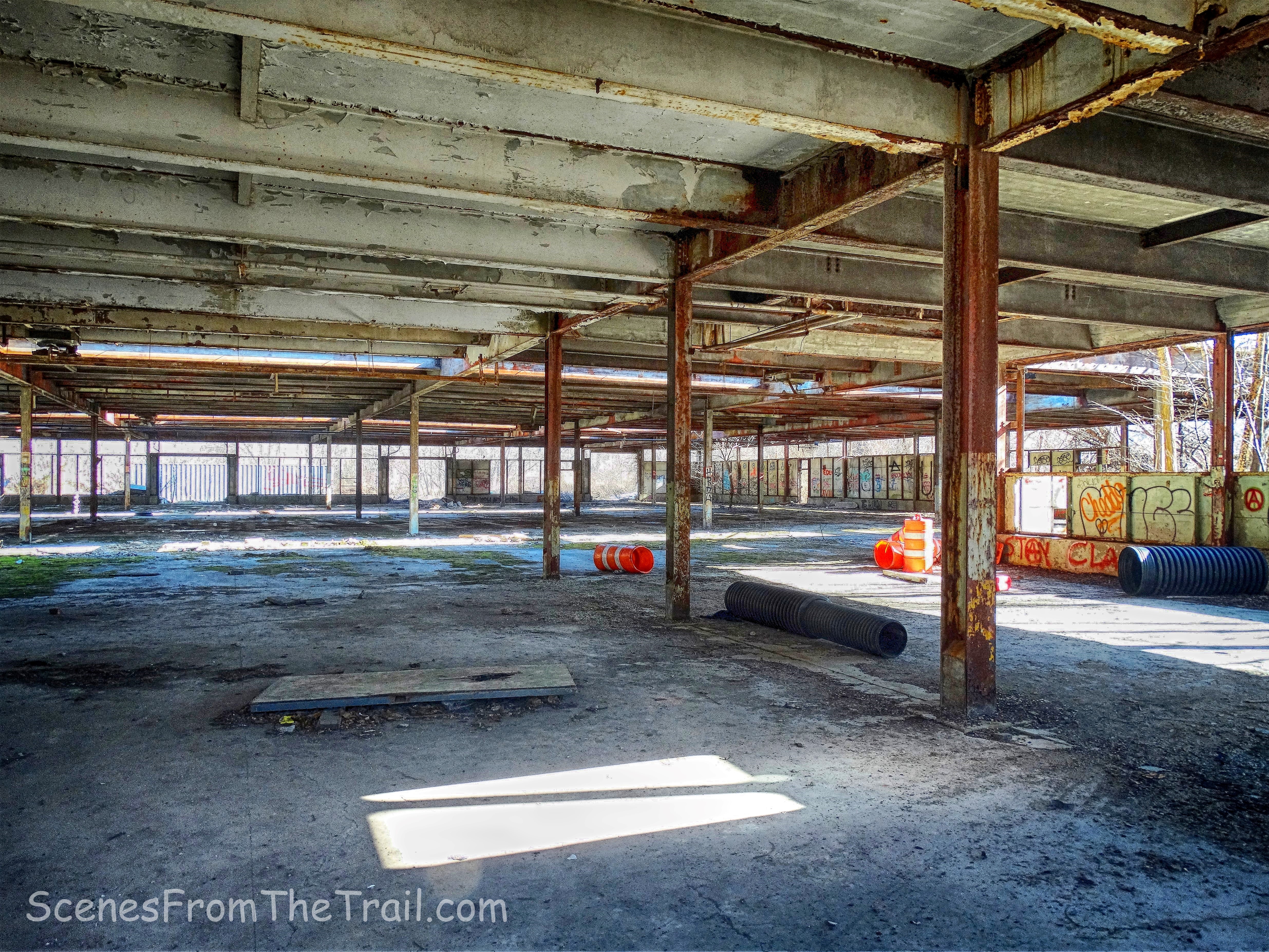
This building is massive and structurally sound for being in such neglect.
Denning’s Point Brick Works
Denning’s Point Brick Works
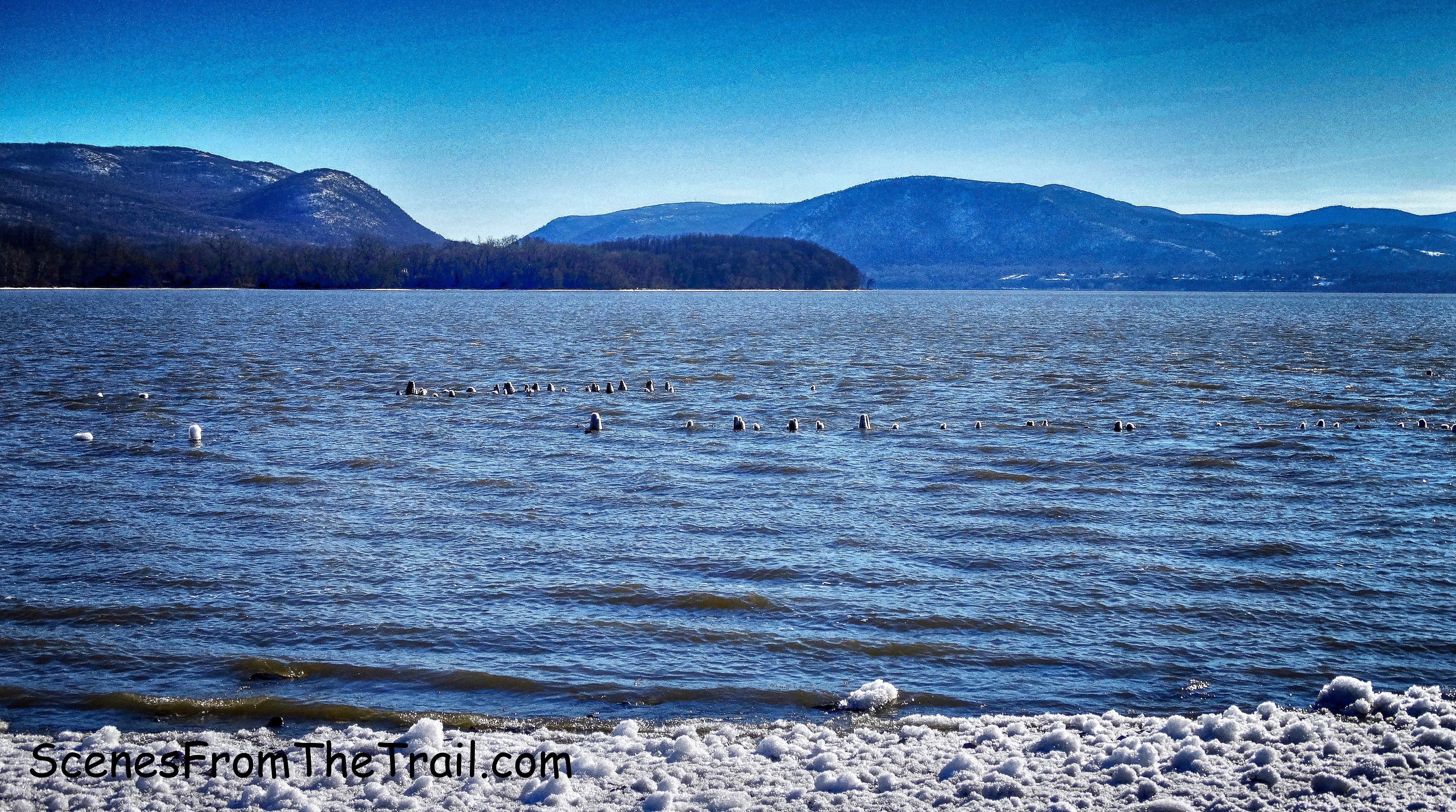
Once we got our fill of the Denning’s Point Brick Works, we stepped back outside to continue our hike. We walked over to the edge of the Hudson River looking south towards Sugarloaf Mountain and Breakneck Ridge.
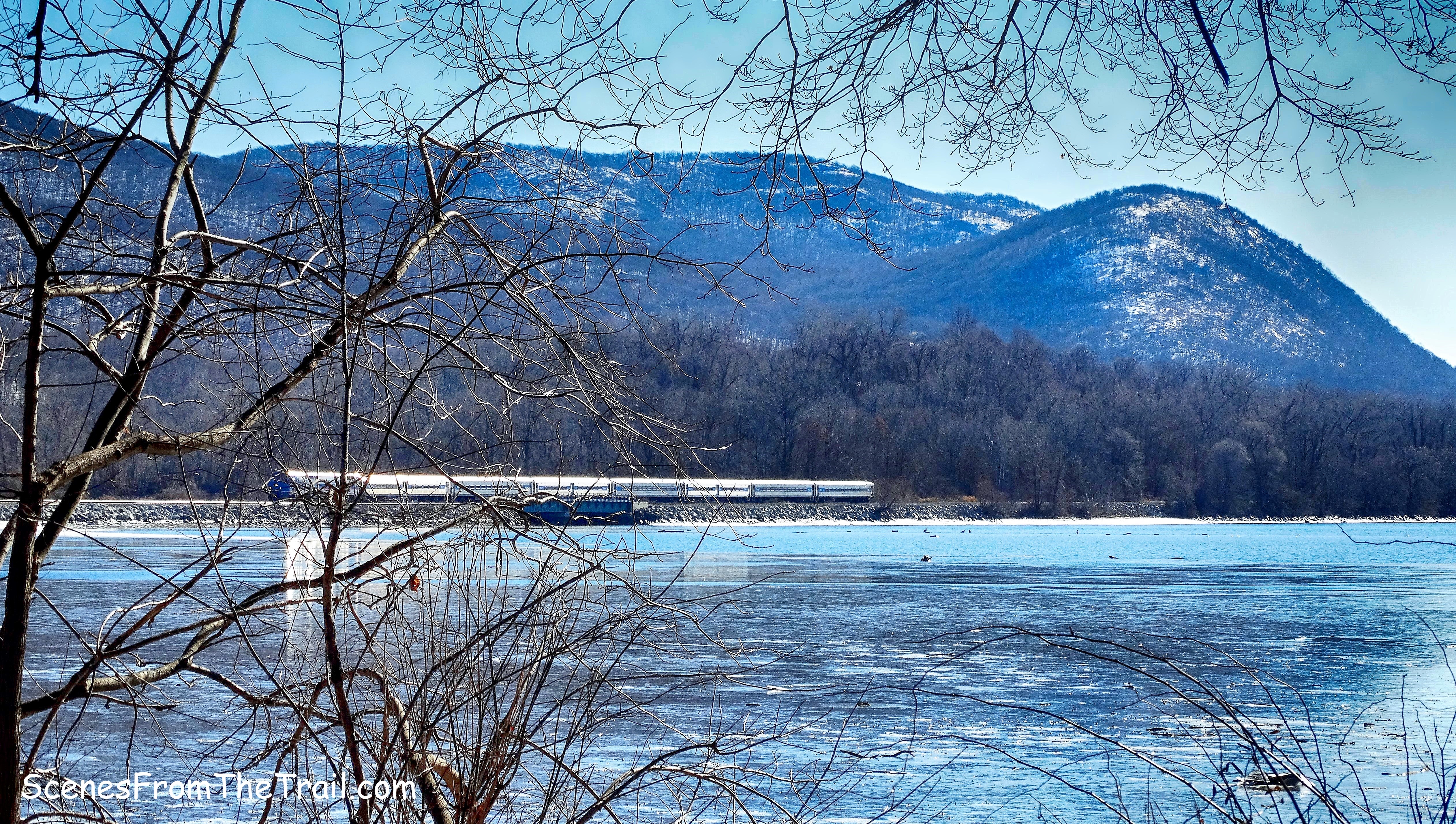
Sugarloaf Mountain
The trail around the point itself was chained off due to nesting eagles. We instead walked past the Beacon Institute building and onto a trail that led towards the river. There we saw what appears to be an old water tank.
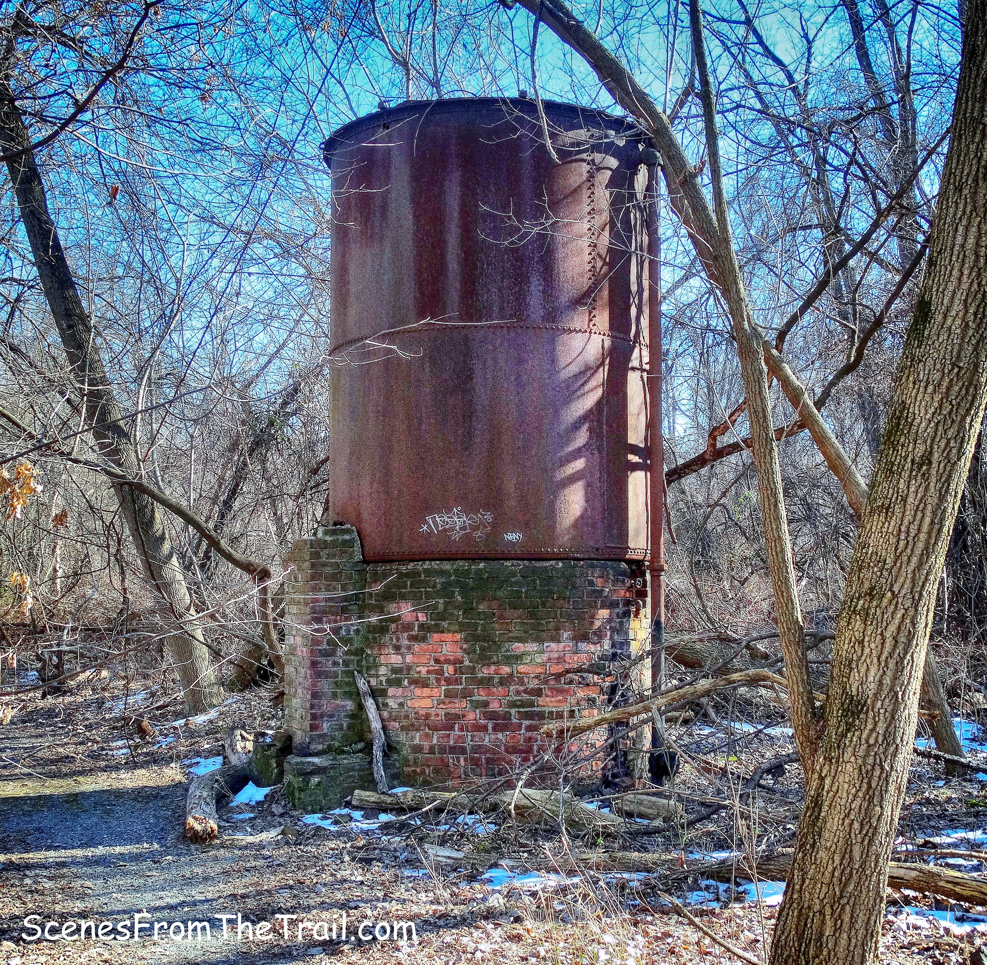
water tank
After spending a little time by the river we retraced our steps on the Denning’s Point Trail and turned left when we arrived at a junction with the Klara Sauer Trail which leads to Long Dock Park.
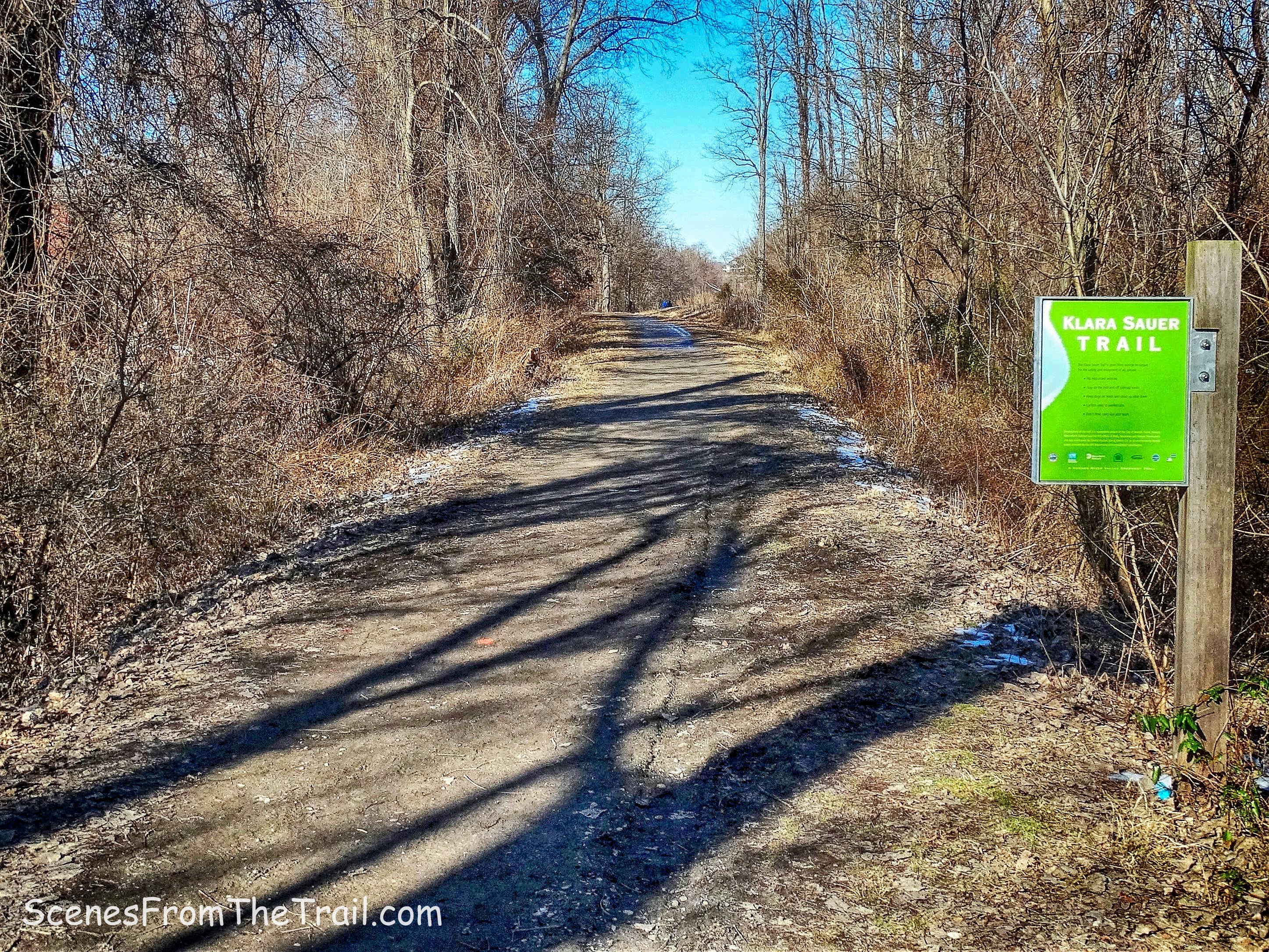
Klara Sauer Trail
We walked north along the abandoned railbed with the Hudson River on our left.
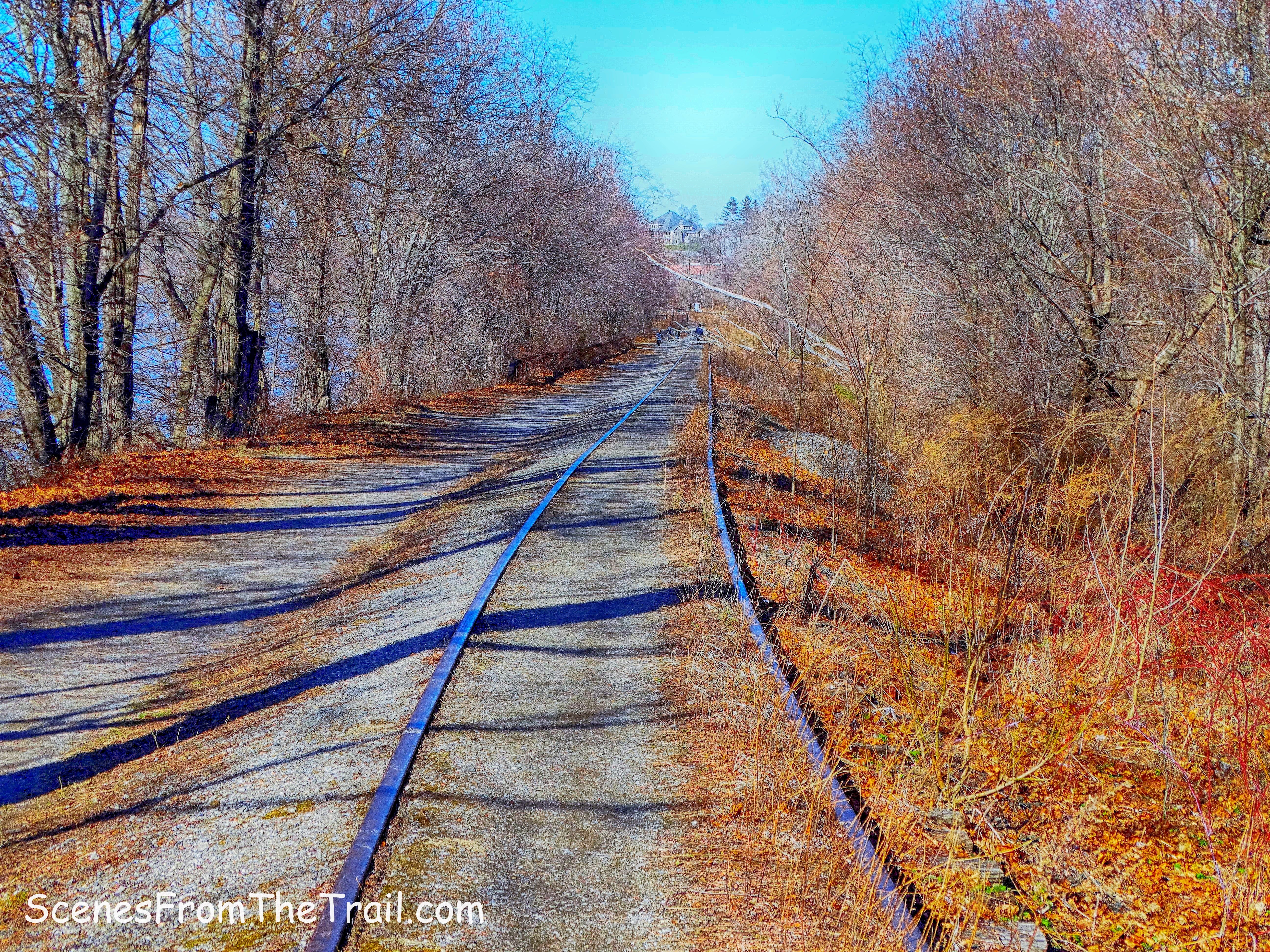
railbed – Klara Sauer Trail
We ended up in the heart of the park with more views of the Hudson River.
Long Dock Park
We then retraced our steps on the Klara Sauer Trail, turning left at the junction with the Denning’s Point Trail which was pretty much a straight shot back to Madam Brett Park. We made our way back to the parking area and enjoyed some hot chocolate and sandwiches. I hope that you enjoyed the hike and don’t forget to follow my blog. As always, I welcome any comments or suggestions regarding past or future hikes. Now get out there and take a hike!
Pros: easy to follow trails, Hudson River, ruins, historical features.
Cons: can get crowded, partial closure due to nesting eagles during winter months.
take a hike!
