September 3, 2016 – Highland Mills, NY
Difficulty: moderate
Length: approximately 4.7 miles
Route type: out and back
Schunemunk Mountain is the highest mountain in Orange County and has over 2700 acres of rolling meadows and a spectacular mountain top. Hikers encounter elevations up to 1664 feet and thrilling 360 degree views of adjacent valleys, portions of the distant Hudson River and surrounding forest and farm lands. The eight marked trails include the Long Path, Jessup, Western Ridge, Trestle, Sweet Clover, Otterkill, Dark Hollow and Barton Swamp Trails totaling over 20 miles which traverse the mountain and glades.
Gonzaga Park is a 216 acre parcel of varying topography, including steep slopes and rock formations, as well as open areas and interesting buildings. This site contains a large athletic field, used primarily for Gaelic Football and other field sports, as well as picnicking and other passive uses. The property also provides access to the Long Path, a hiking trail operated and maintained by the New York/New Jersey Trail Conference. The parcel contains parts of the Towns of Blooming Grove, Monroe and Woodbury.
This hike was my introduction to Schunemunk Mountain. I have been wanting to check this place out for quite some time, but with so many great hikes on my “to do” list, it got pushed to the back burner. A few weeks ago I took out my West Hudson Trails Map and decided to put together a hike at Schunemunk. The Megaliths is the most popular hike on the mountain, but I wanted to try a less traveled area. I saw Gonzaga Park on the map and Googled it. I couldn’t find much information on the park except that it had some interesting stone structures. It once had a Monastery that looked like a castle on the grounds that had been torn down. Remaining were several stone buildings that included a very cool looking small chapel. I knew then that I would begin my hike from there. I prefer circuit or loop hikes over an out and back hike because I prefer not to tread the same ground on the way back. Some out and back hikes give you a different look on the way back, this was one of them.
We arrived at Gonzaga Park about 9:30am on Saturday morning and the lot was empty which was a good sign.
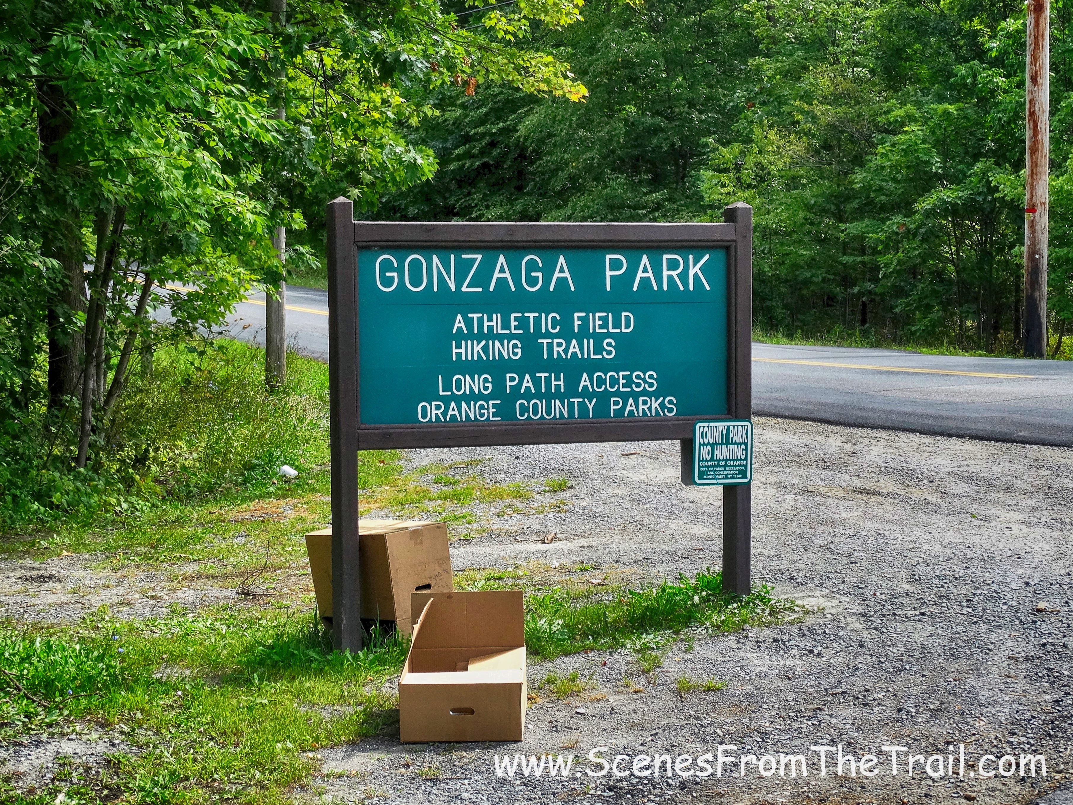
Gonzaga Park
A small stone gazebo like structure appeared on the right as we entered the parking area…..
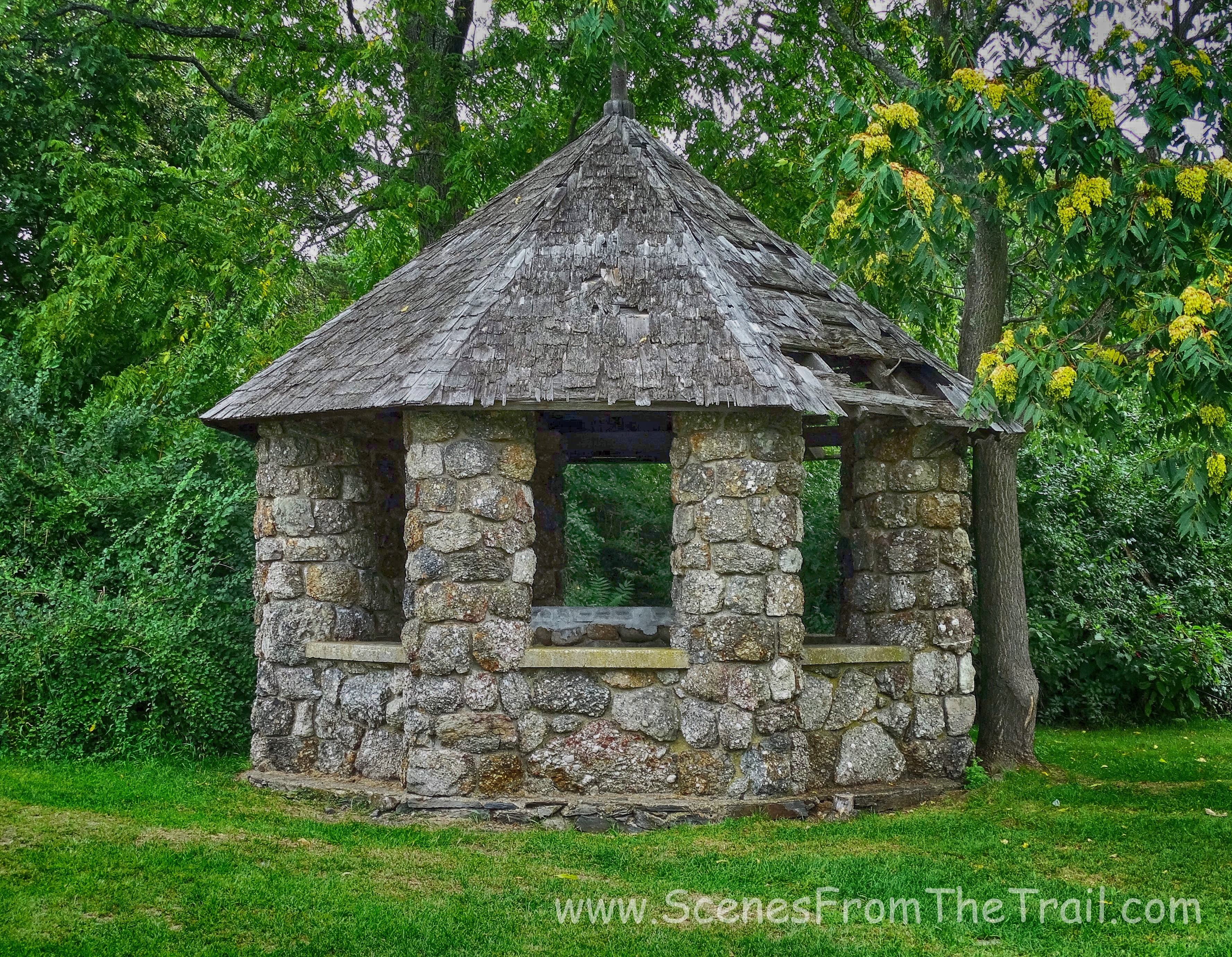
gazebo like structure
and a larger cylindrical structure was a little further in. From older images on the internet it seems that at one time this building was connected to the old Monastery.
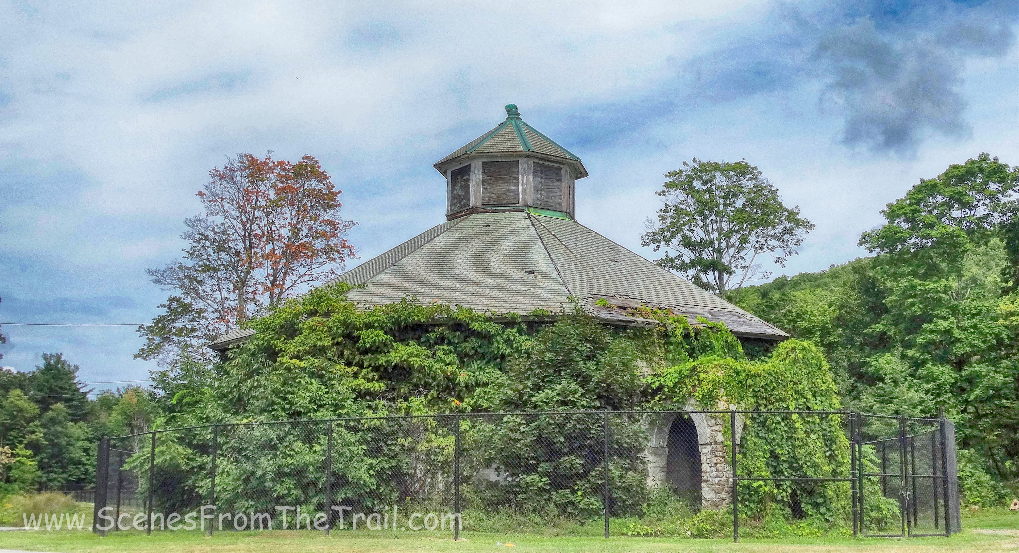
old Monastery
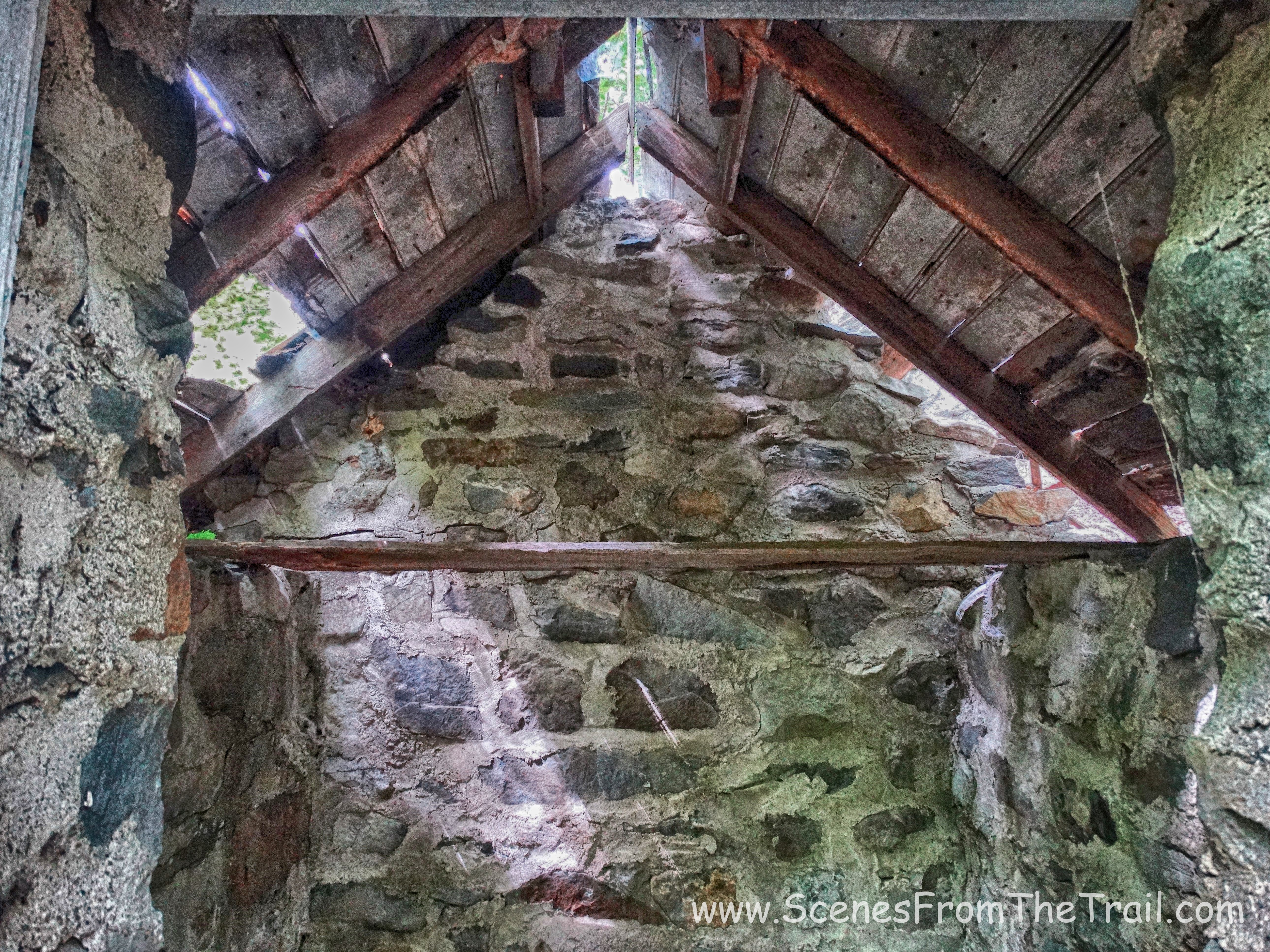
After checking out these two structures which were in close proximity to where we parked, we headed out to find the chapel. I knew the approximate location of where it stood in the park after locating it on Google Maps. On the way to the chapel we encountered another stone building that had seen better days.
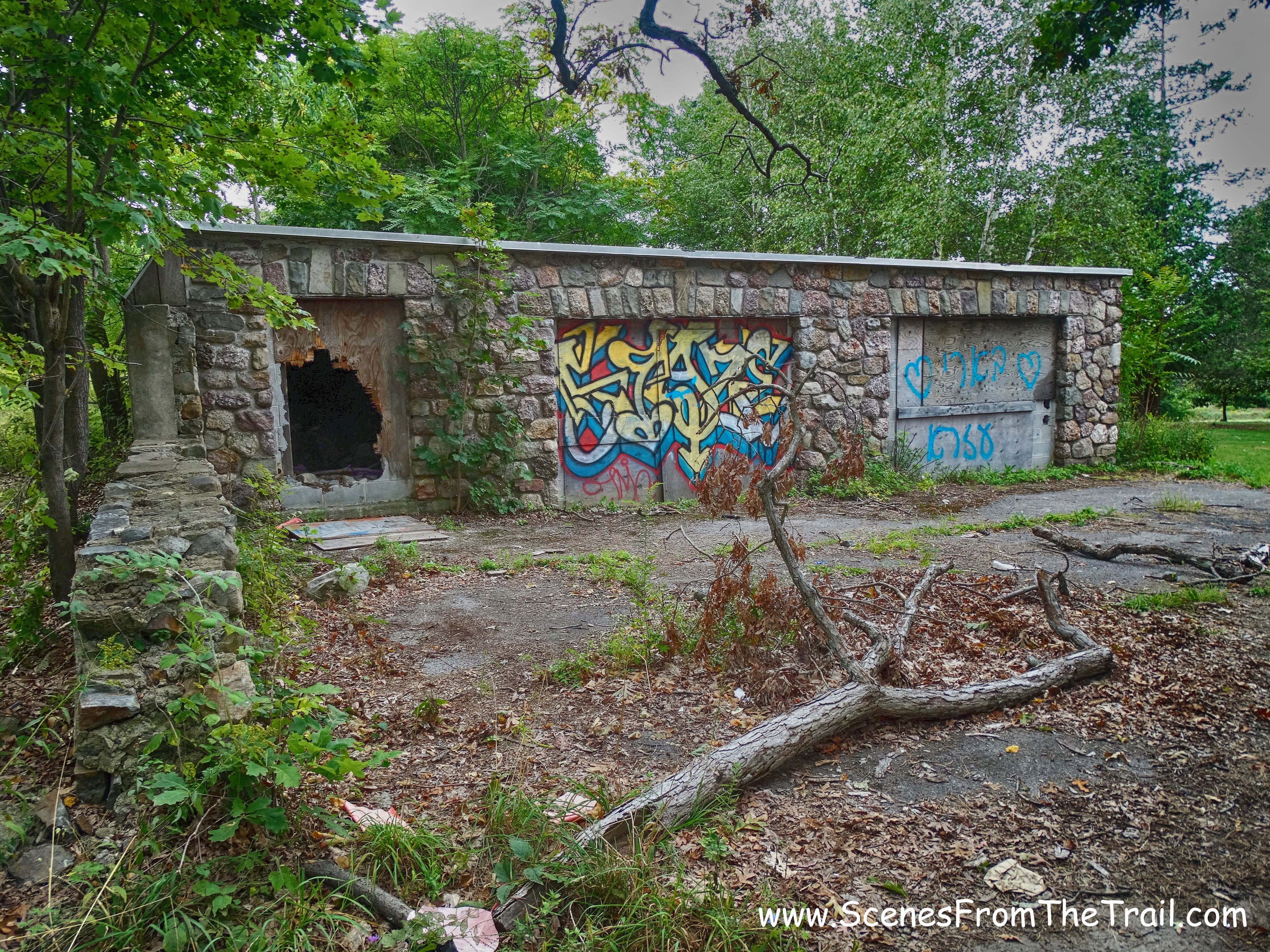
stone building
I peeked my head in to grab an image of the interior, but did not venture inside.
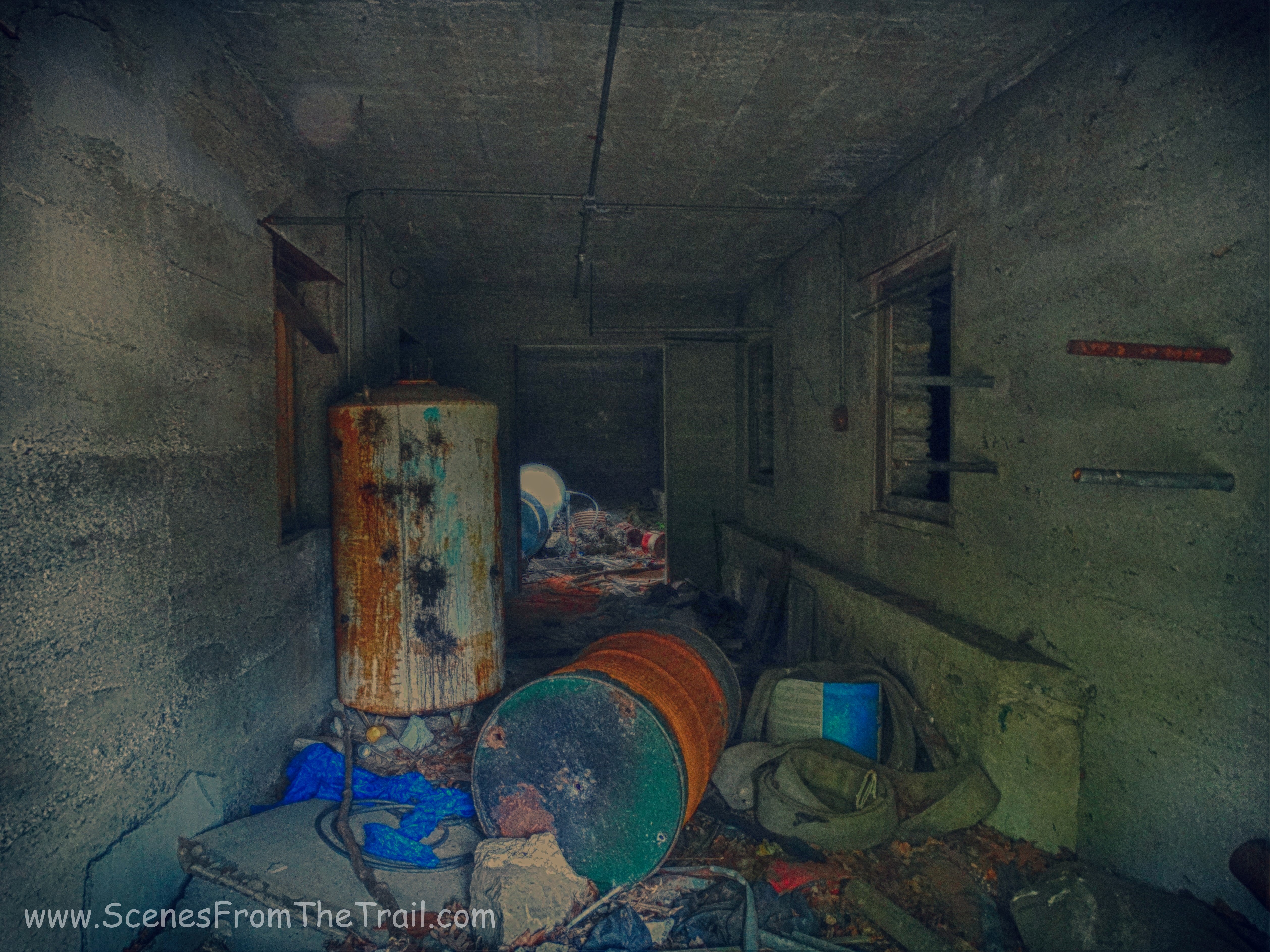
interior of stone building
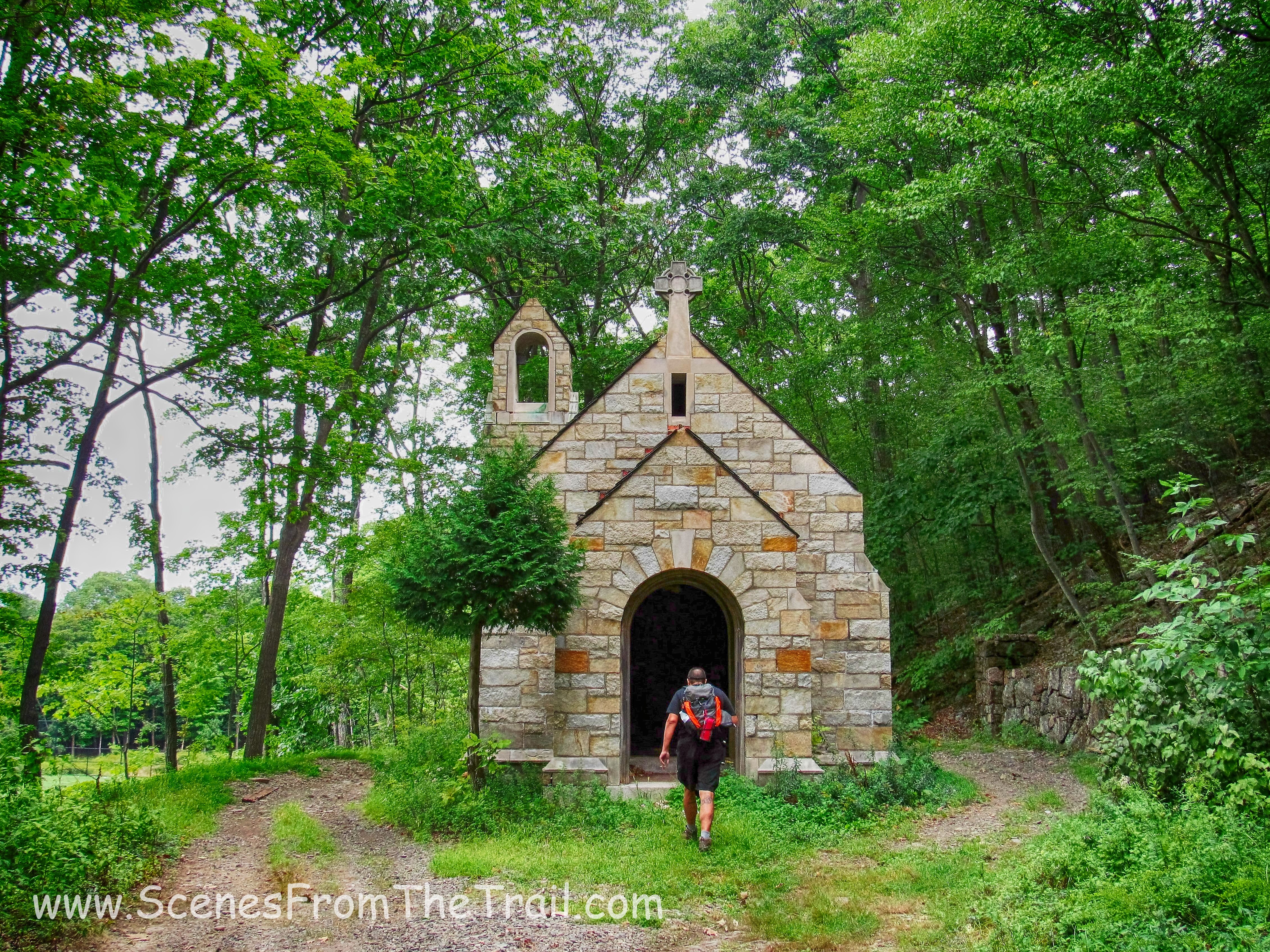
Not too far from that building was a gravel road that led us up to the chapel.
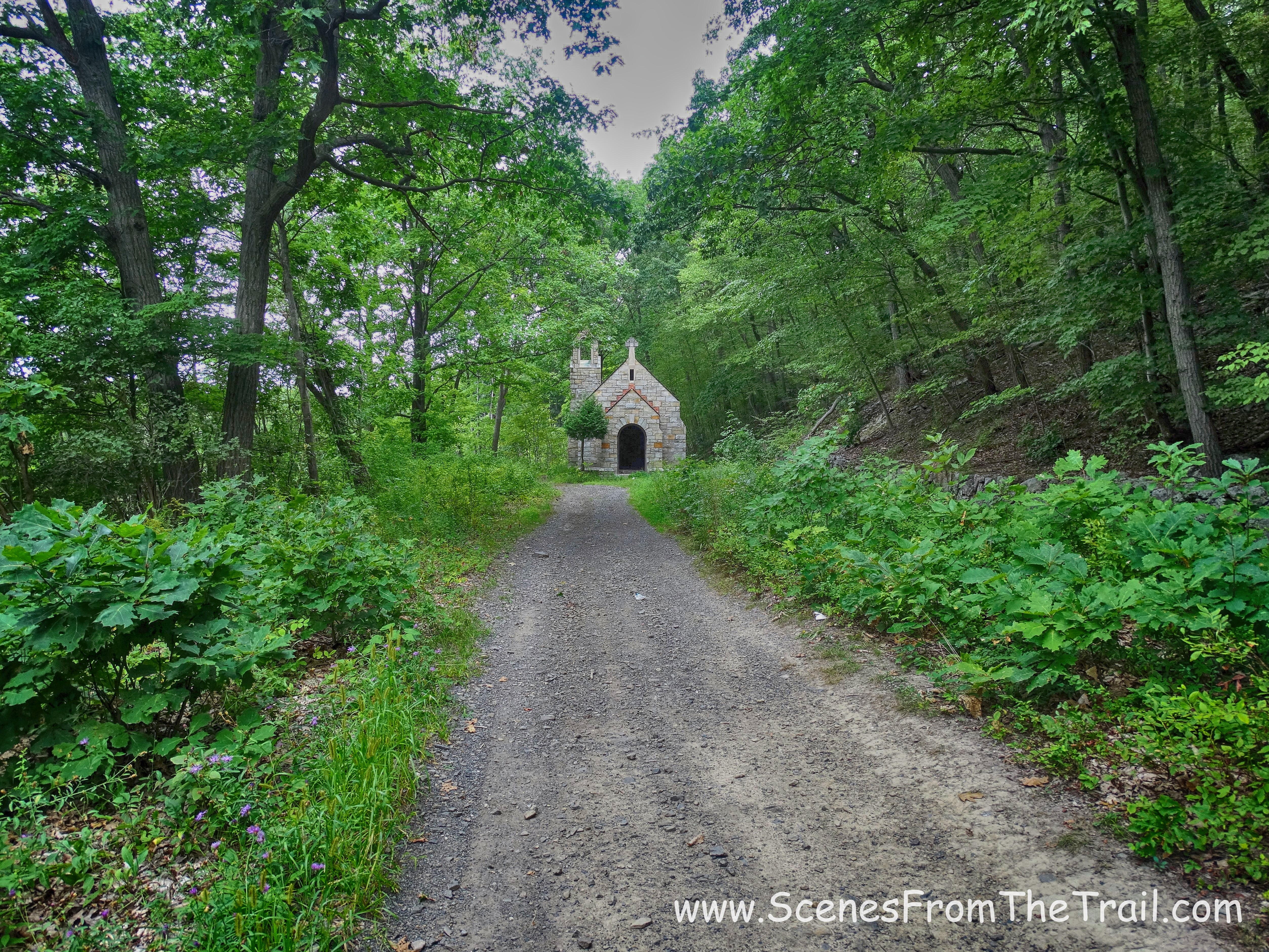
road to the chapel
This was one cool looking chapel. I have encountered many ruined structures on my hikes, but this was right at the top of the list. I’m glad that we found our way to it.
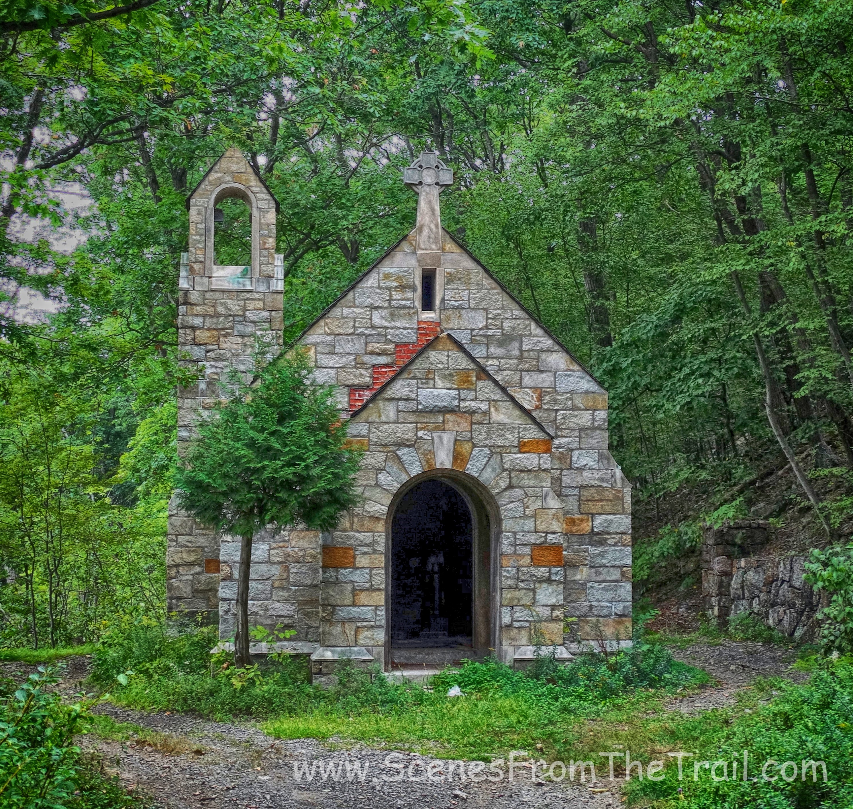
chapel
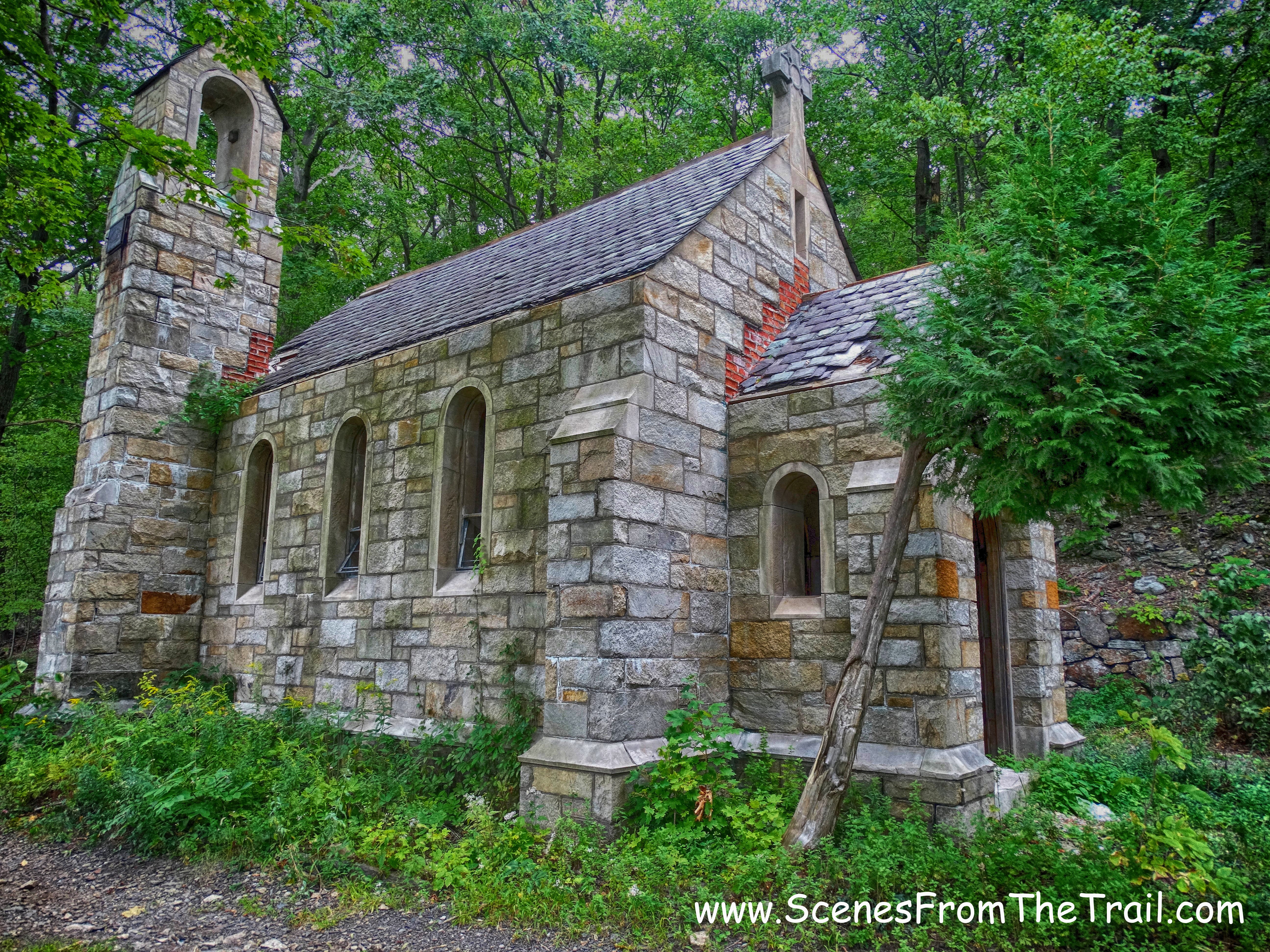
chapel
chapel
chapel
chapel
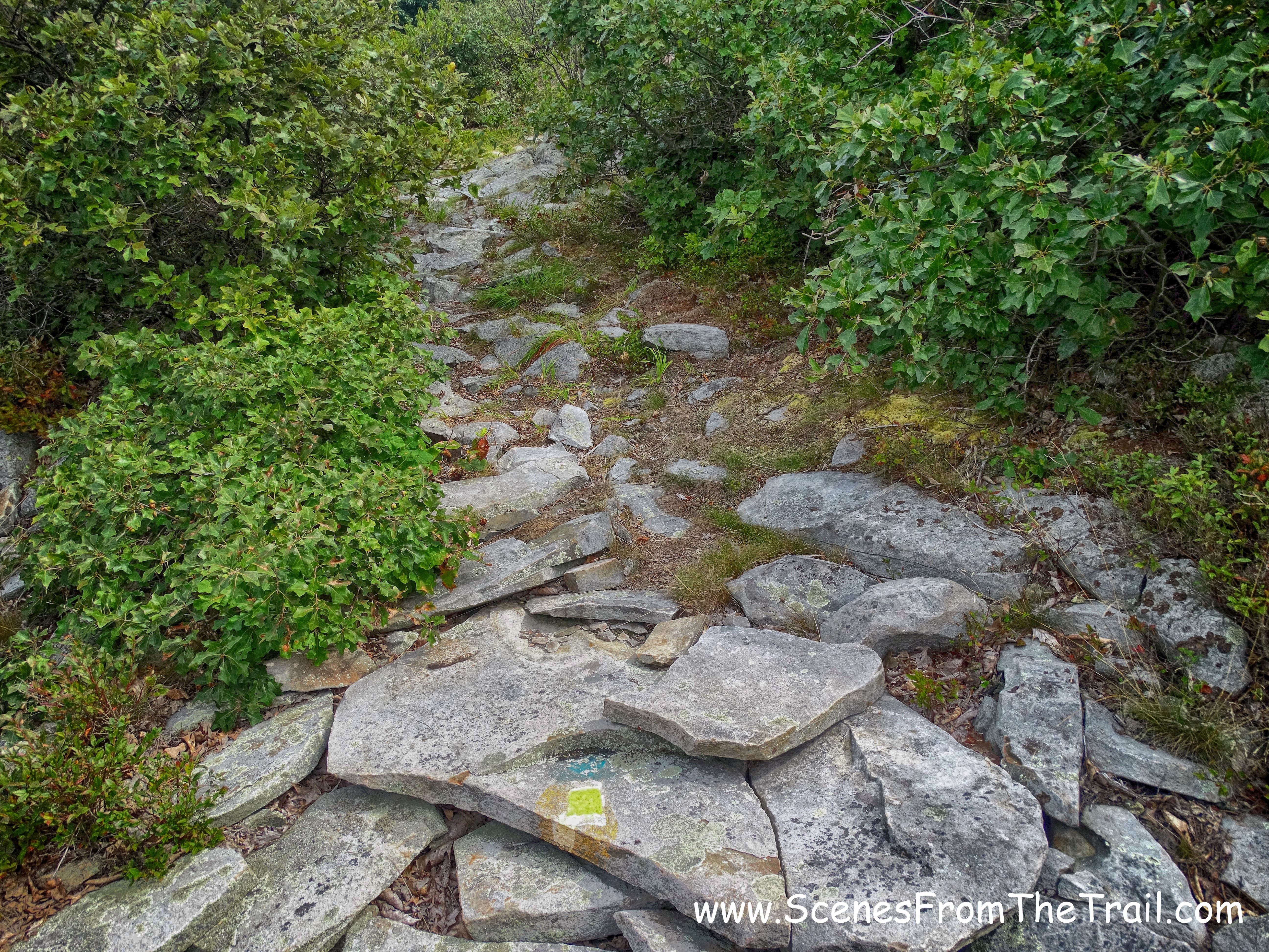
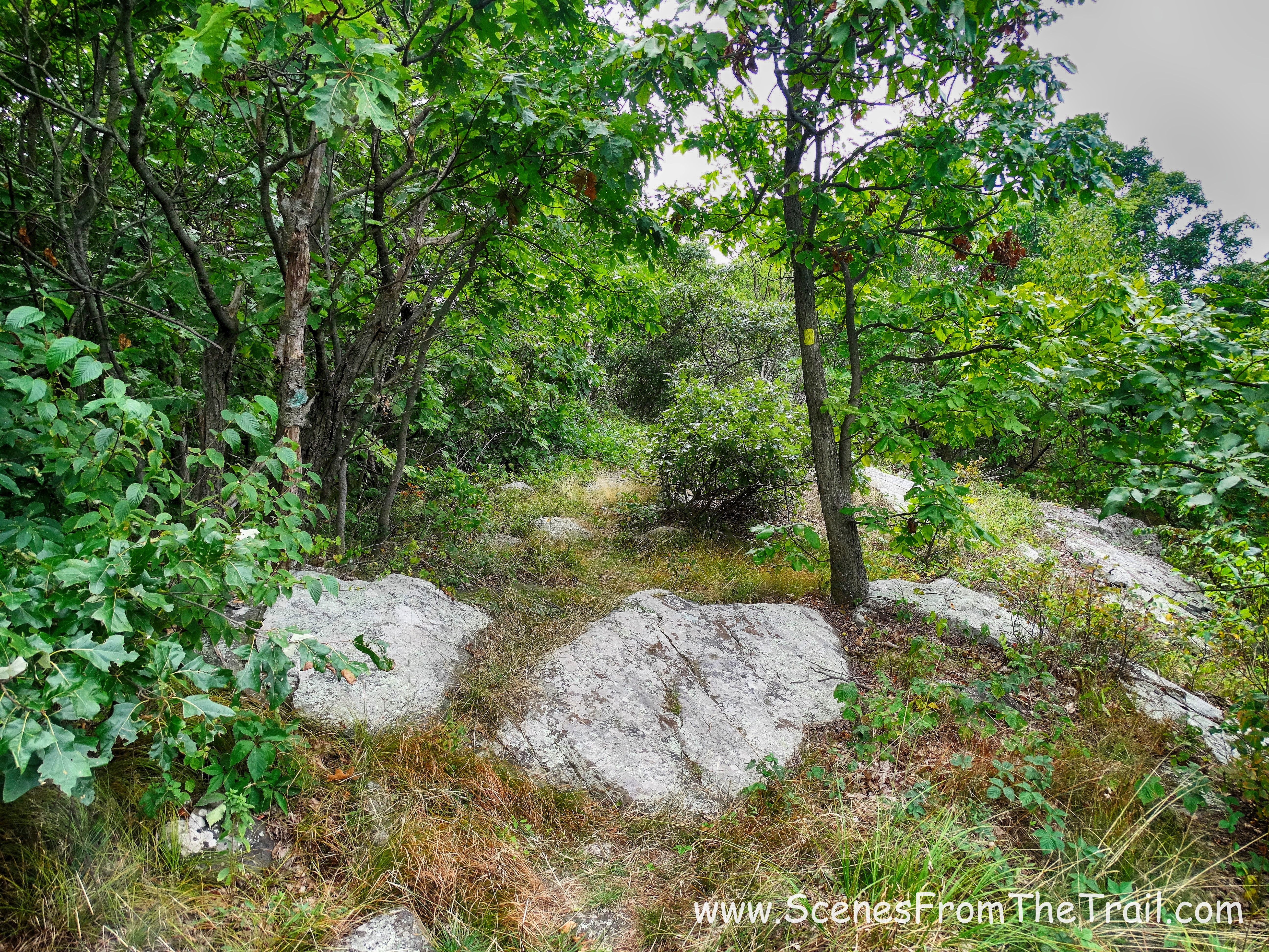
After taking numerous shots of this fantastic looking chapel in the woods, we were ready to begin our hike. Walking down the gravel road away from the chapel, I was able to spot some faded blazes on a tree. For this hike we would be following the yellow blazes of the Jessup Trail. The Jessup Trail (8.6 miles, yellow) is the main north-south trail on the mountain and traverses its full length. The Highlands Trail (teal diamond) is co-aligned with the Jessup Trail for its entire length. The Long Path is co-aligned with the Jessup Trail from Gonzaga Park for the entirety of the hike we were doing on this day. We followed the yellow Jessup Trail blazes, as the Long Path and Highlands Trail are marked with their trail logos only at occasional intervals and at junctions.
The Jessup Trail
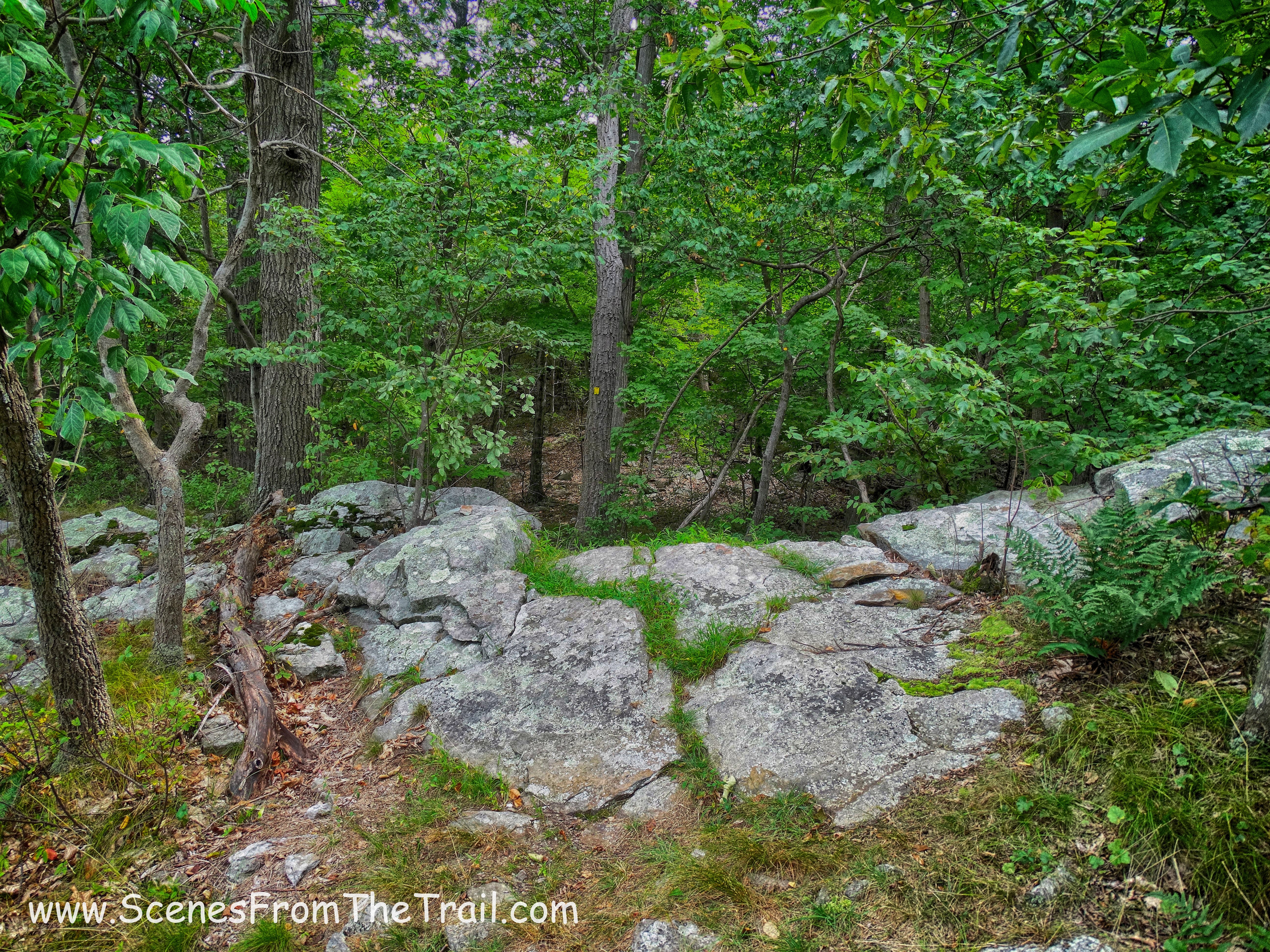
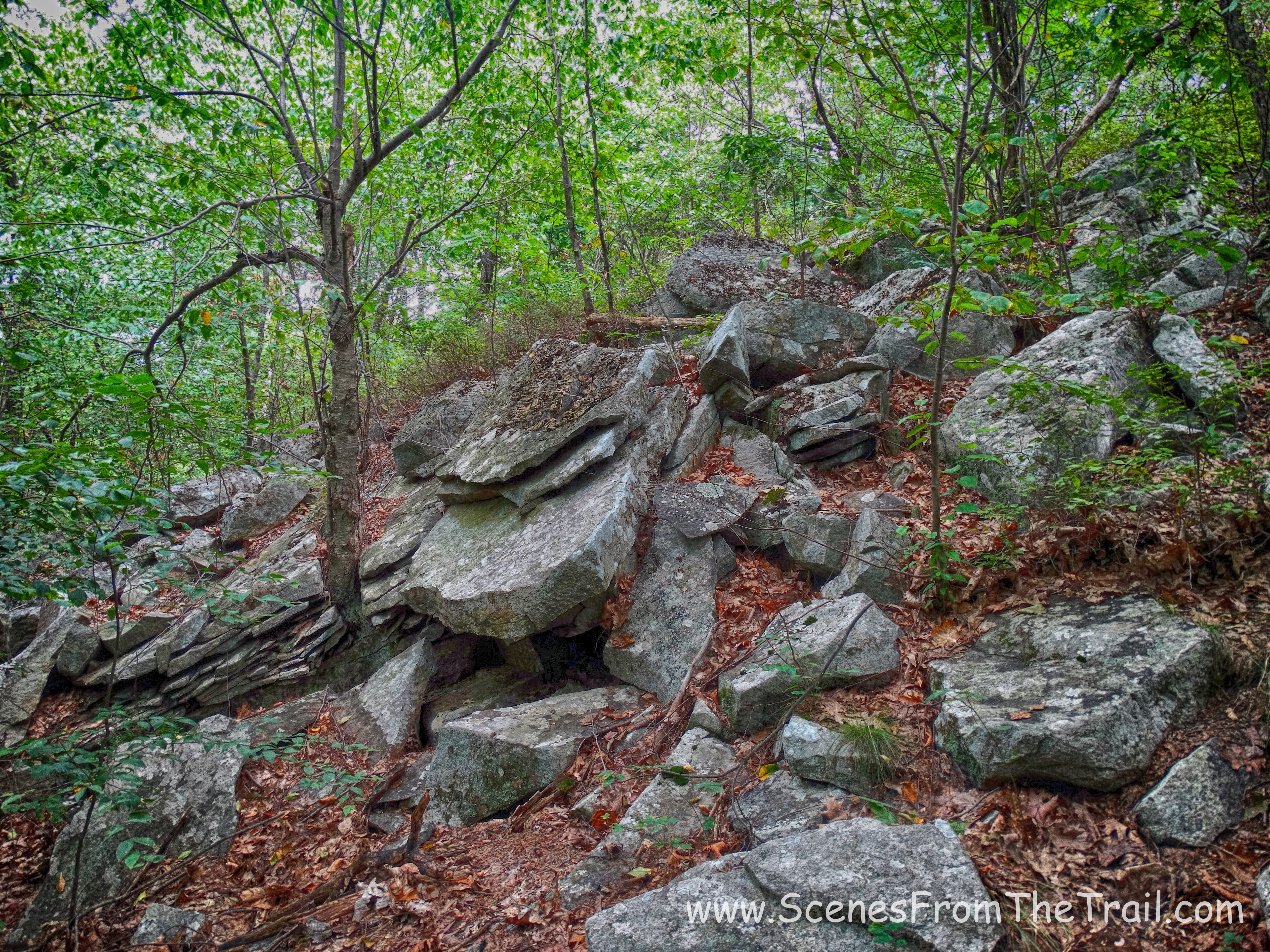
The trail was mostly a woods road that occasionally turned into a footpath, but reverted back to a woods road. It was somewhat rocky, but not too bad. The most strenuous part of the hike was at the beginning where we gained over 300 feet of elevation in about 3/4 of a mile. After that it was mostly undulating terrain with long stretches of level trail.
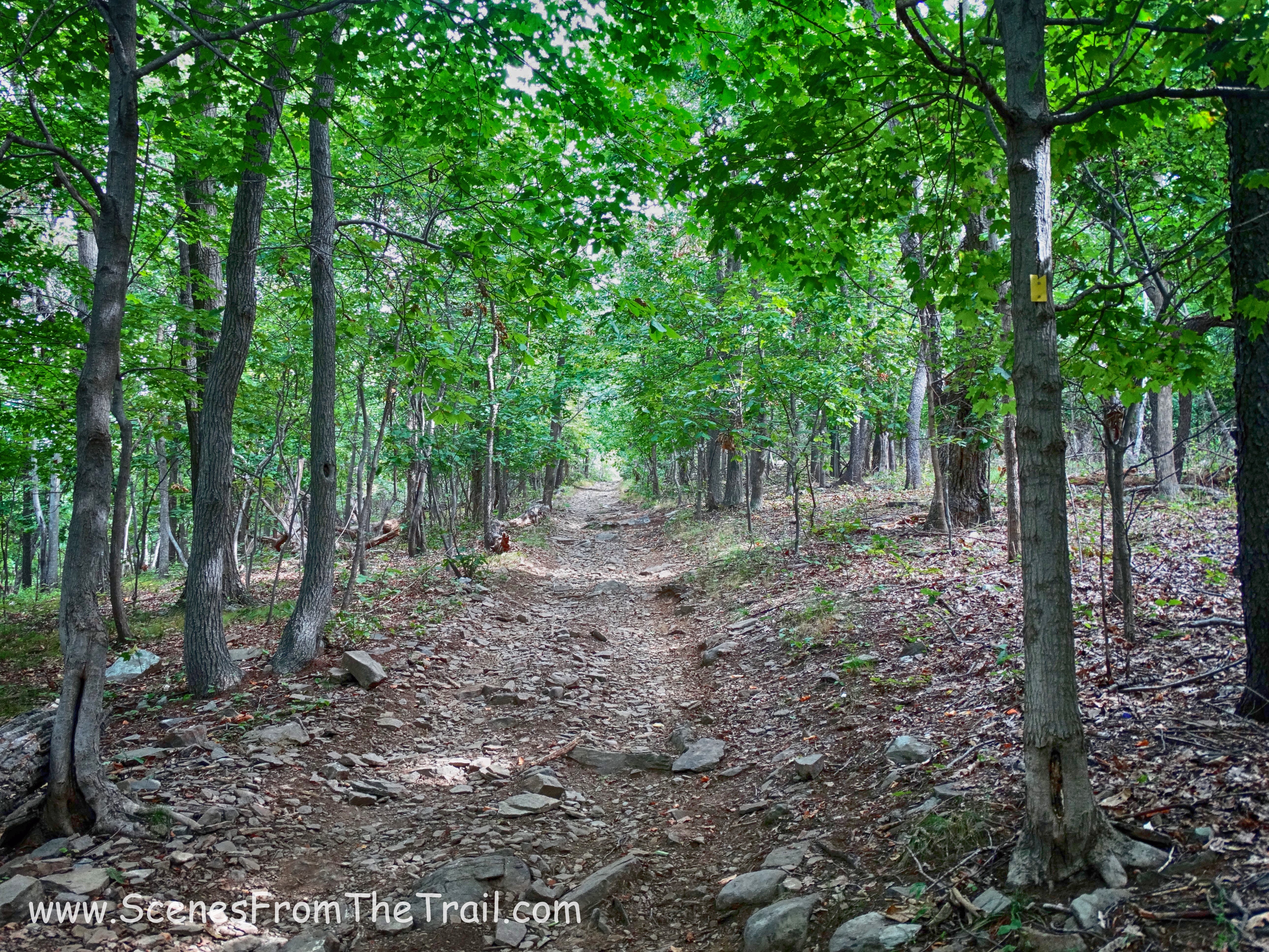
The Jessup Trail
It turned out to be a great day for a hike. Mostly cloudy, but no rain made it a much easier trek up to the top. After about a 1/2 mile into our hike we came to 3 scenic view points in succession. A nice reward early on.
first scenic view
After taking in some views we continued on the yellow blazed Jessup Trail and came upon an old park bench on the mountain. I wish it fit in my backpack because it was more comfortable than sitting on rocks.
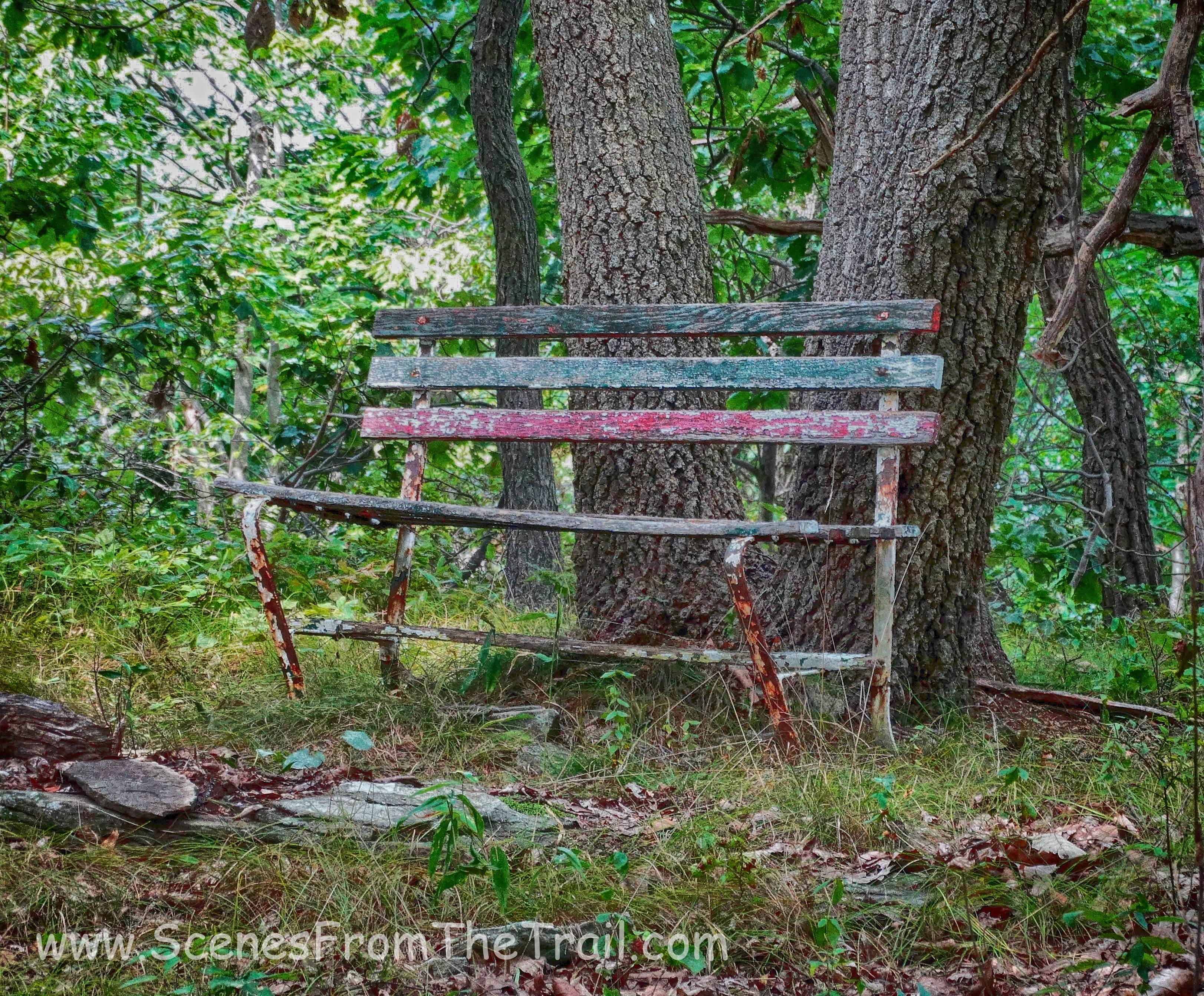
old park bench
We came to a clearing with limited views and I captured an image. Upon further inspection, it seems like there are skulls in the clouds.
skulls in the sky
We came to a steep descent into a ravine which was helped by step like stones. The image below was taken after we climbed down as I looked back.
a look back at steep descent
Then we climbed out of the ravine.
the climb out of the ravine
Once out of the ravine, we walked briefly through the woods…..
The Jessup Trail
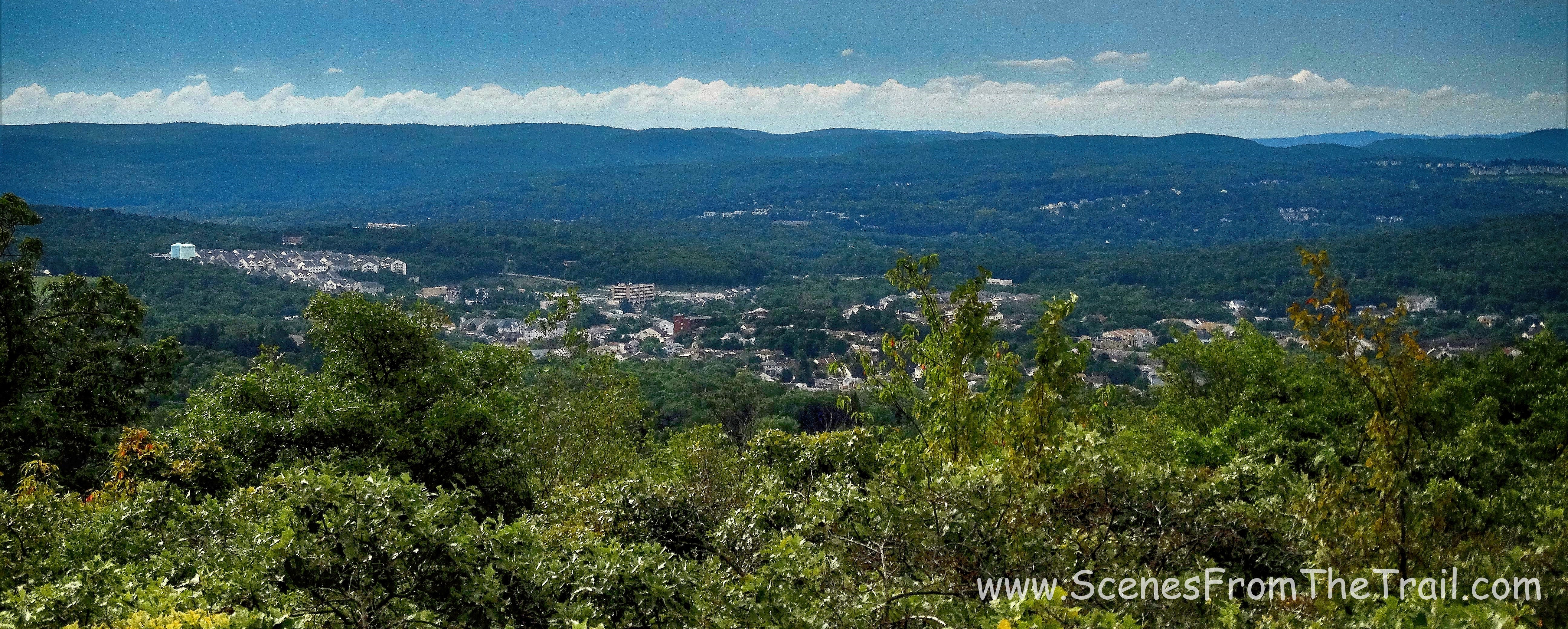
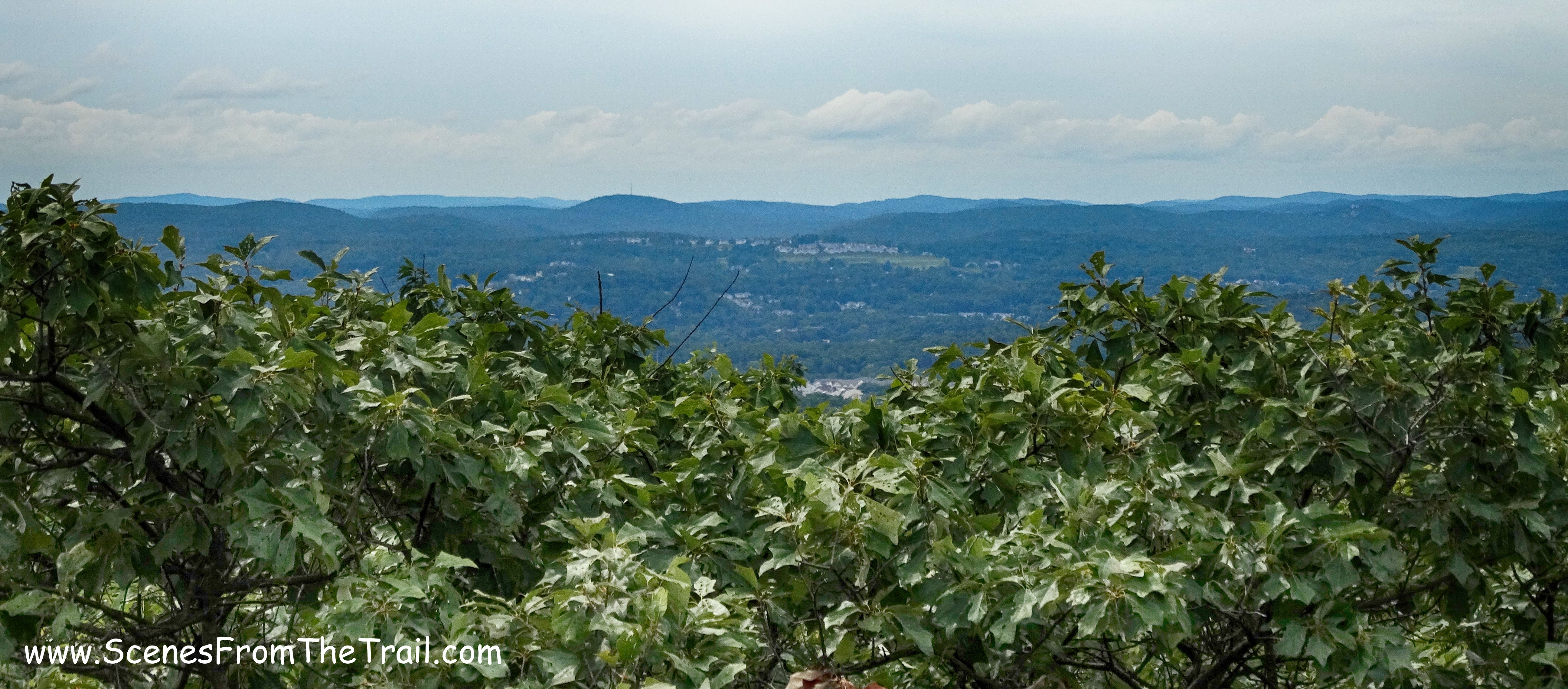
and came out to a clearing that afforded some really good views.
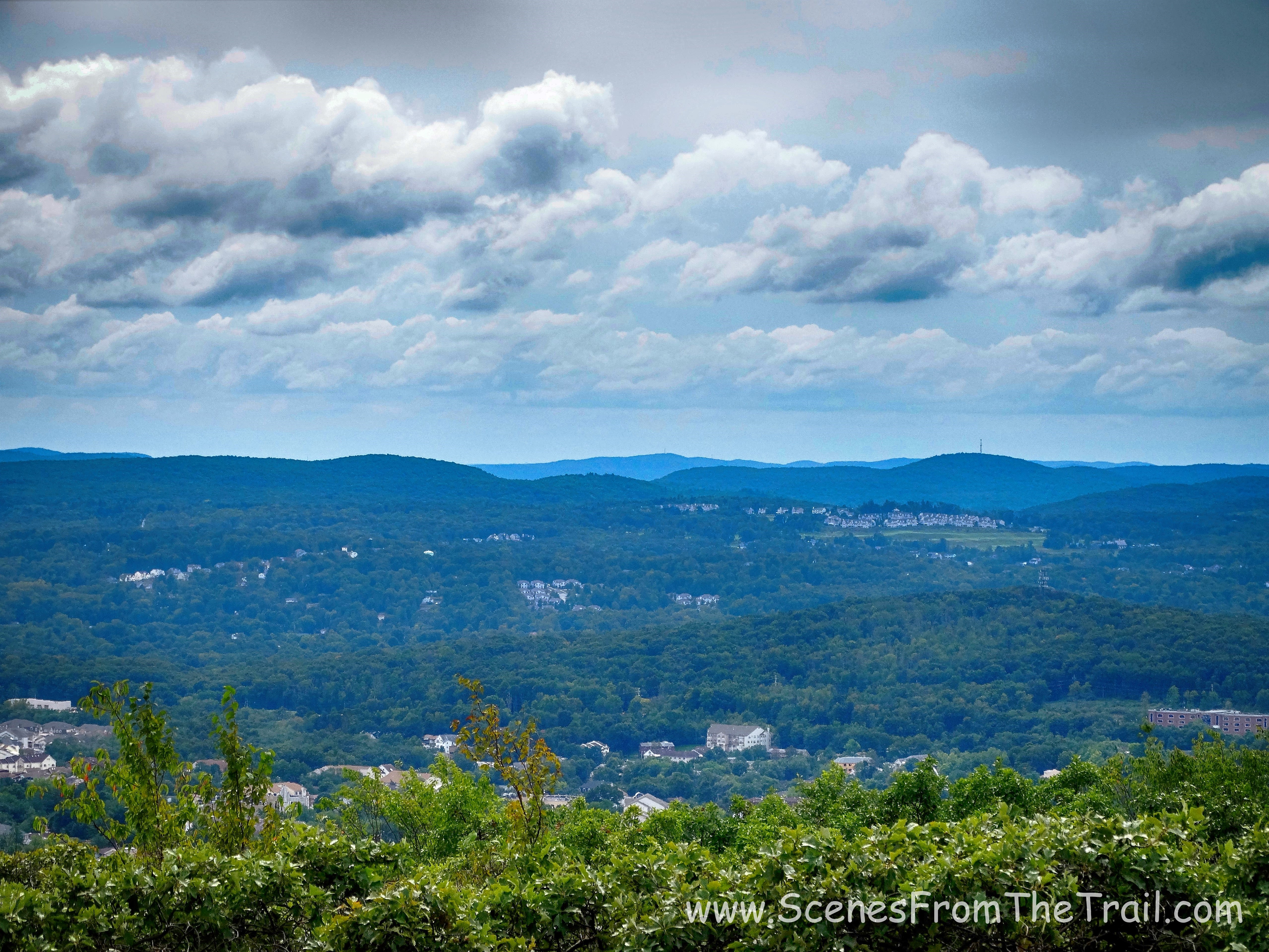
scenic view
There were several more viewpoints that faced north with a nice view of the Shawangunks with the Catskills just beyond.
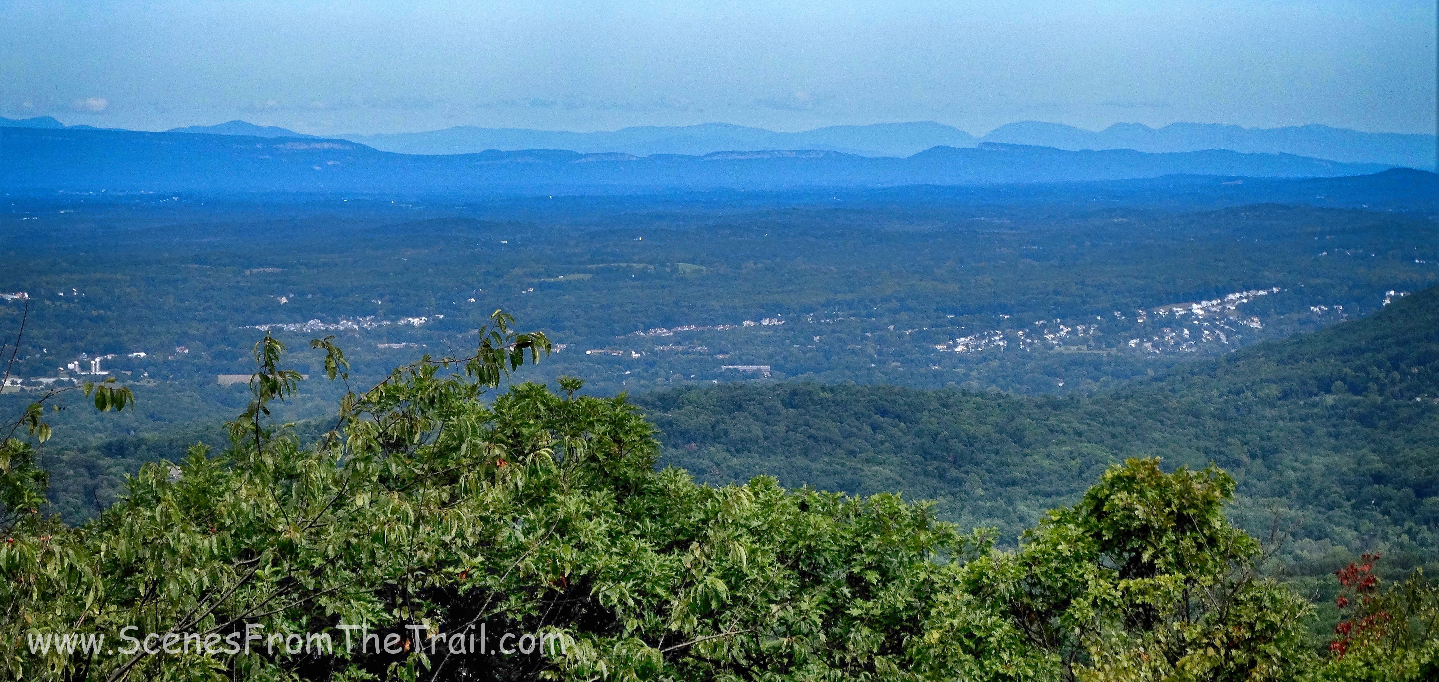
Shawangunks with the Catskills just beyond
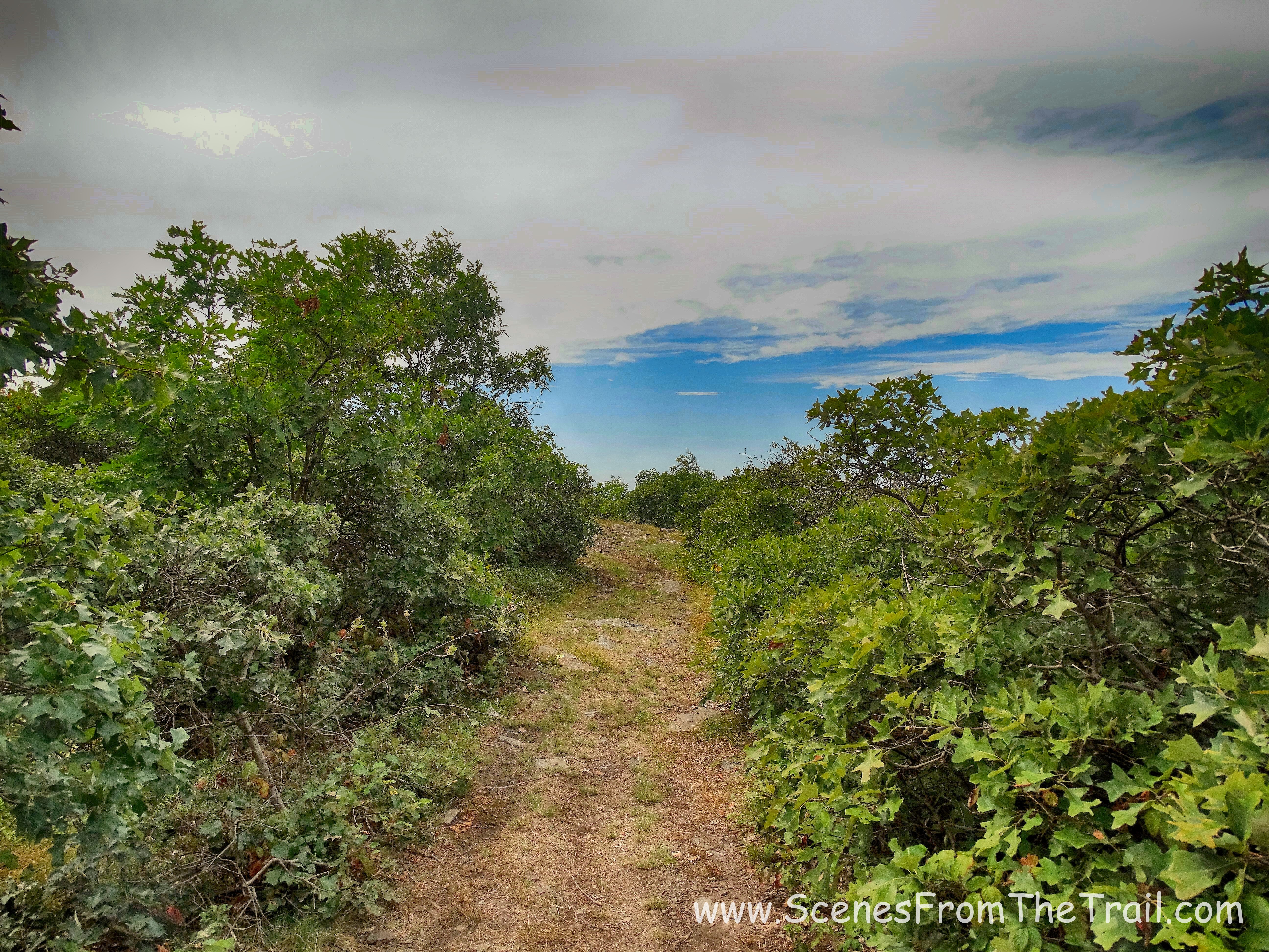
We continued along the trail searching for a southern facing view.
The Jessup Trail
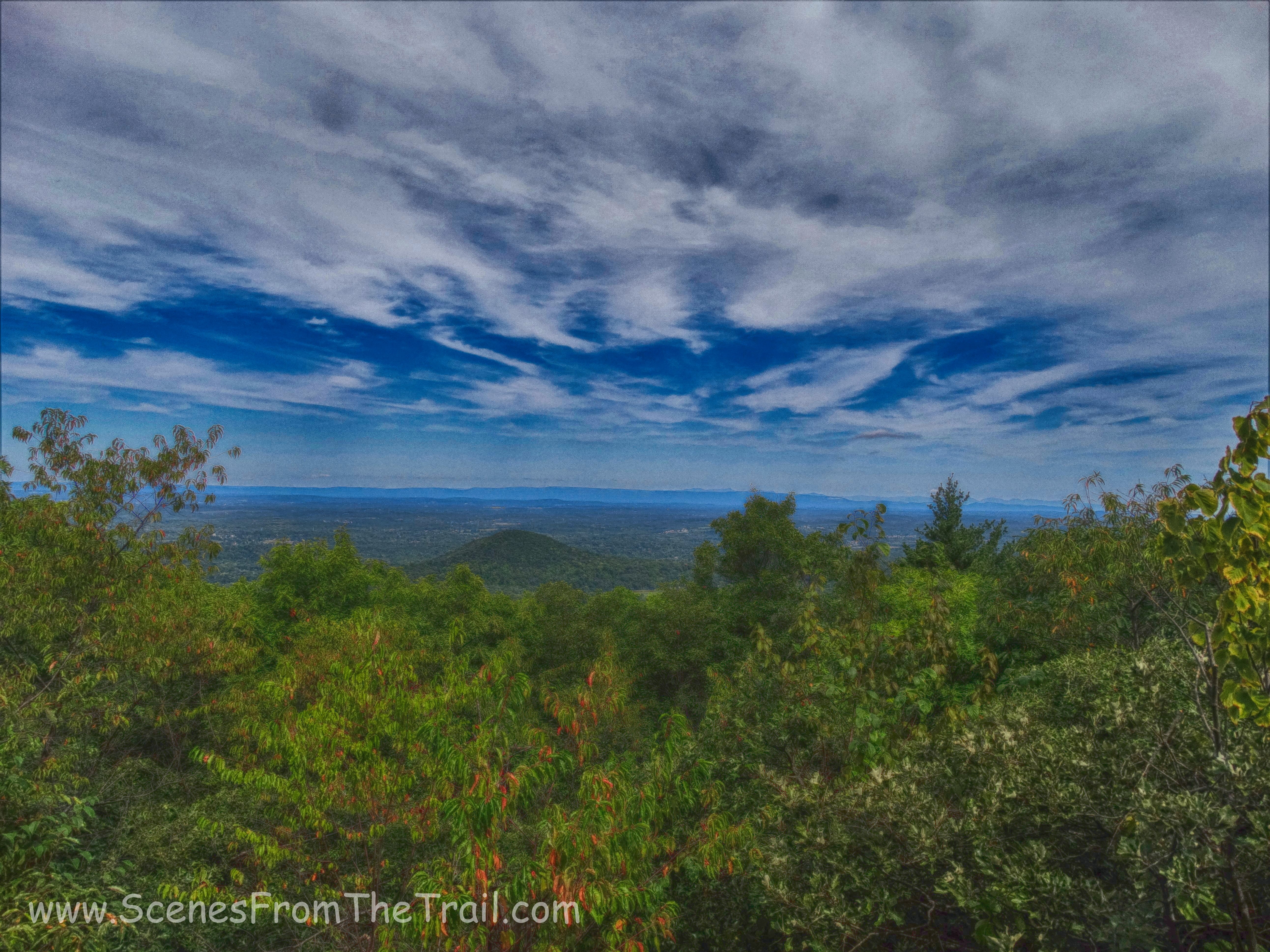
When we came to the southern view we were looking for, this became our turnaround point. Looking south towards Harriman-Bear Mountain State Parks.
southern view
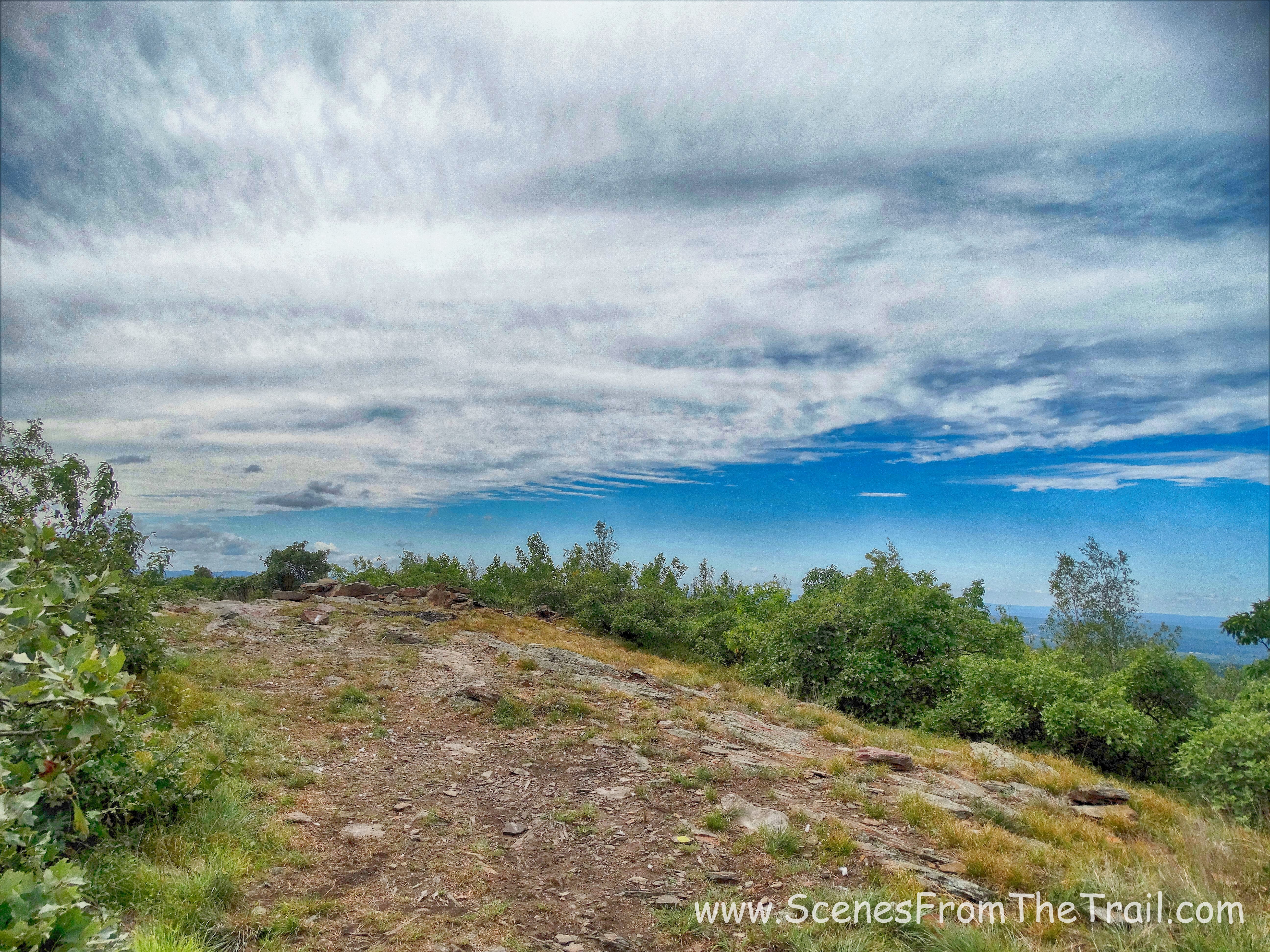
At this point we had hiked about 2.5 miles and decided that this would be a good place to turn around. Like I said earlier, the hike back had a different look. It felt like we were treading new ground instead of retracing our steps.
The Jessup Trail
The Jessup Trail
Seeing the trail from a different perspective made it more enjoyable. We paused at all the viewpoints momentarily to gaze at the gorgeous views one last time as we continued our way back down the mountain.
The Jessup Trail
The Jessup Trail
The hike back was relatively easy with only a few ups and downs. It was a gentle descent down for most of the way with many photo ops.
The Jessup Trail
One last look south towards Harriman-Bear Mountain State Parks.
Harriman-Bear Mountain State Parks
When we neared the end/beginning of The Jessup Trail (Gonzaga Park), we then began following the aqua blazed Long Path which veered left. I knew there was a spring house and a small cemetery along the trail and I wanted to check it out. My hiking partners weren’t too enthused, but I coaxed them along. It was a short walk until I could see the spring house through the trees. Just before the spring house was a rock face with a warning?
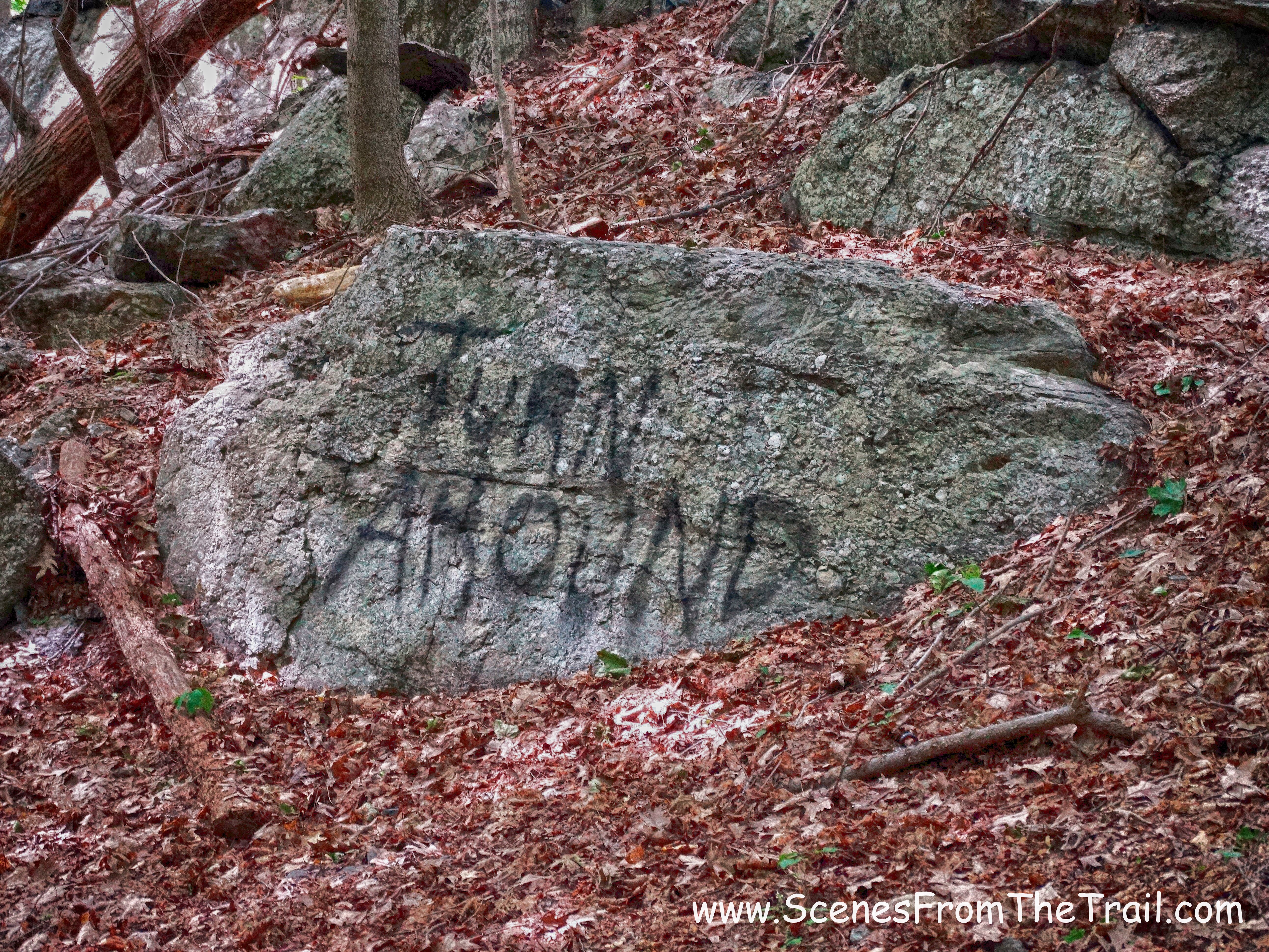
graffiti rock
We got to the spring house and captured some images of the little stone structure.
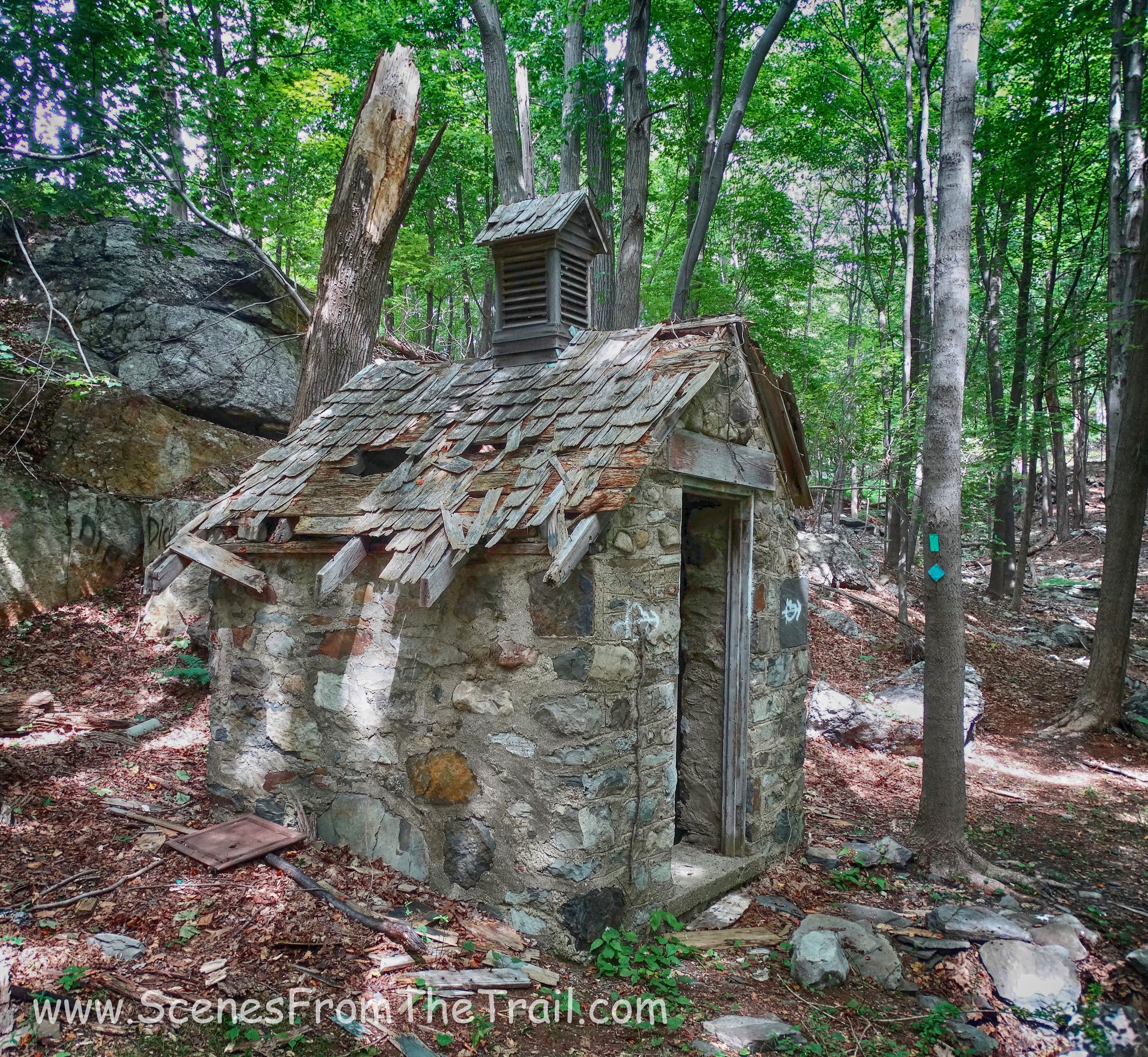
spring house
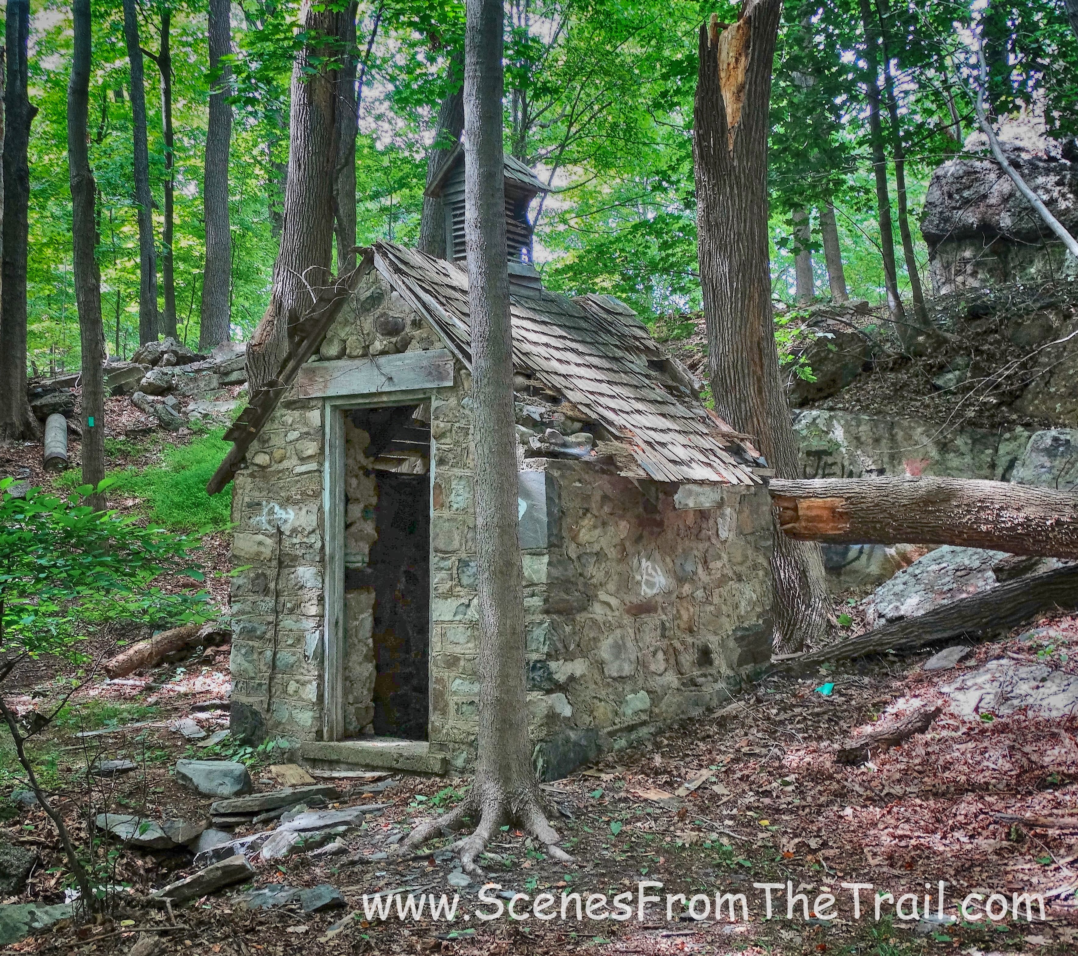
spring house
spring house
I wanted to see the cemetery, but my hiking partners were done and wanted to call it a day. I walked alone over a clearing a short distance away and spotted what I assume was a cemetery.
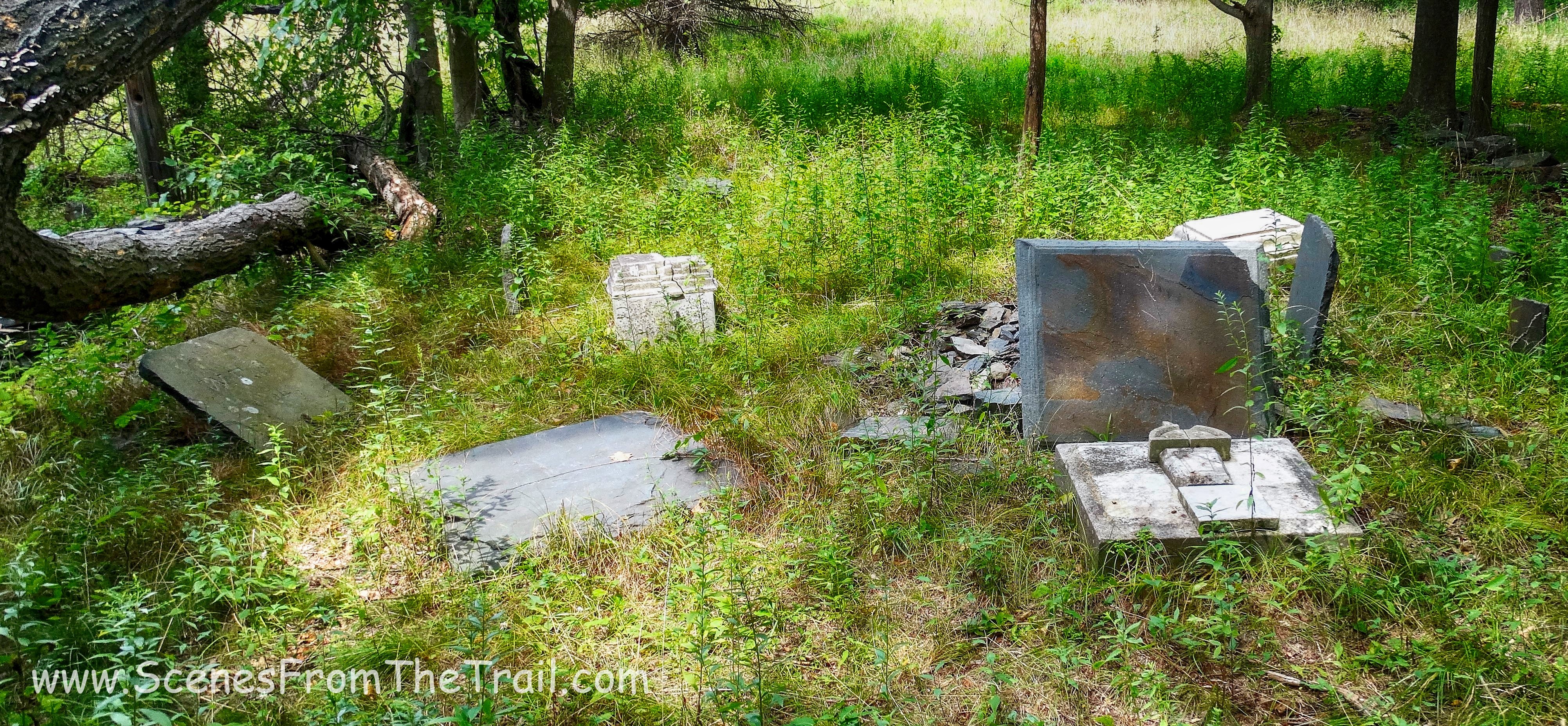
cemetery
At this point we were all a little tired and retraced our steps back to The Jessup Trail where we turned left and walked back to the parking lot, where our hike began. I truly enjoyed this hike as it had enough to keep me interested. The stone structures and especially the chapel were extremely compelling, the trail was scenic as were the views. The absolute best thing about this hike is that we didn’t encounter another living soul at any point on the trail. This hike gets a thumbs up from me. Until next time folks, keep on trekking………
keep on trekking

this is a beautiful report with fine pictures. i enjoyed it almost as much as being there again.
LikeLiked by 1 person
Thank you for reading and I am glad you enjoyed it.
LikeLike
my mother and father where the last care takers of the Gonzaga mountain house back in 90-93 very sad the state had it taken down and I see the 3 graves of the priest have there head stones gone in front of the church sad. but I do love the photos and the report thank you for posting these it warms my heart to see a piece of my past
LikeLike
This place used to be beautiful. Such a shame they let it get run down like this. My friends and I used to walk to this church for sunday service when we didn’t attend our regular church.
LikeLike