May 14, 2022 – Southbury, Connecticut
Difficulty: Moderate
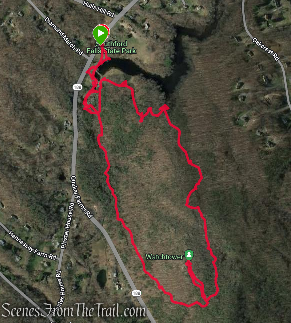
Length: Approximately 2.5 miles
Max elevation: 663 ft.– total elevation gain approximately 452 ft.
Route type: Circuit
Map: Southford Falls State Park Trail Map
Avenza Map: Southford Falls State Park Avenza Trail Map
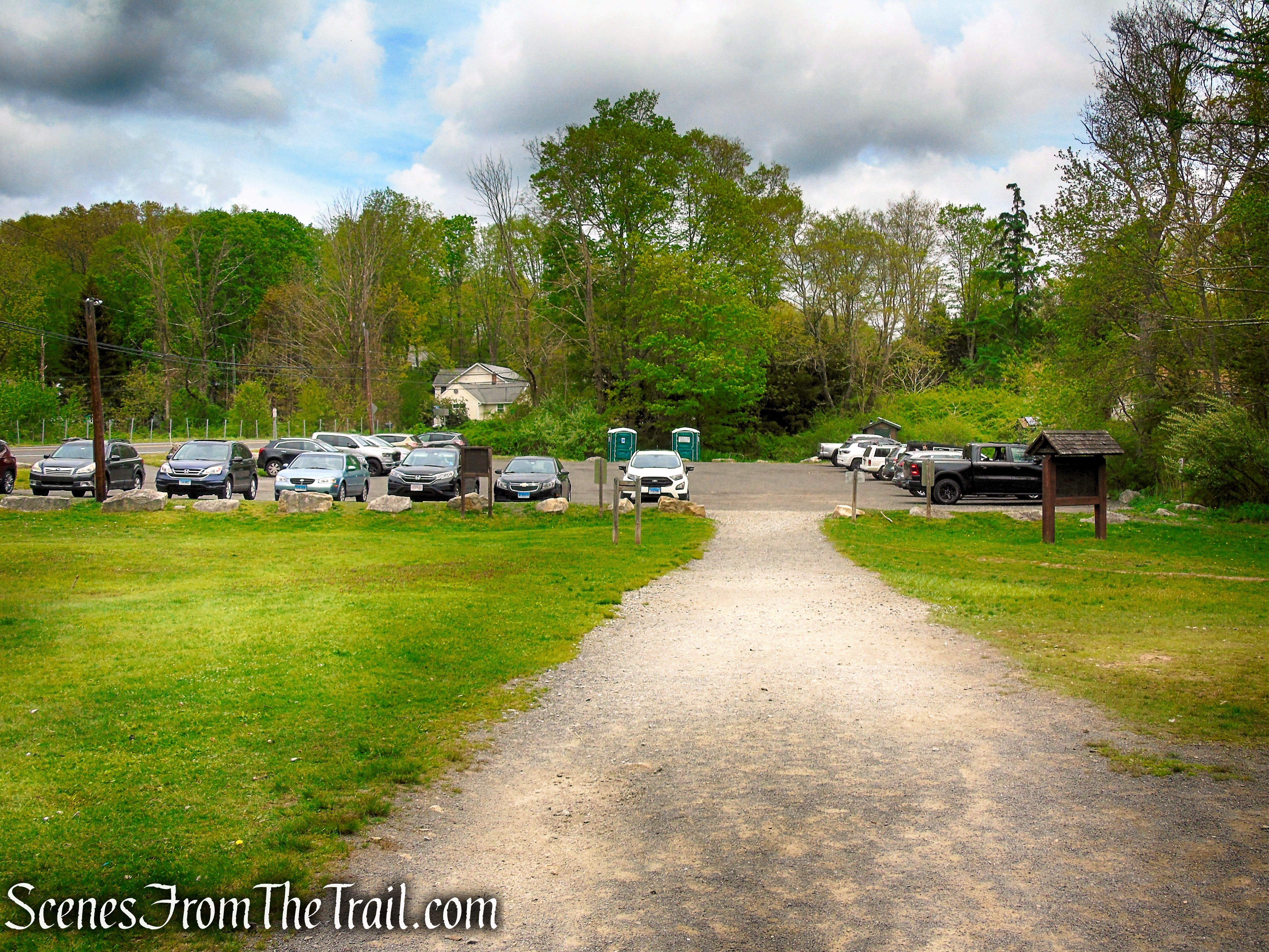
Trailhead parking: 175 Quaker Farms Rd, Southbury, CT 06488
No entrance or parking fees – Bathrooms, Grills, Picnic Tables
Gravel parking lot for about 35 cars
The park is open from 8am to sunset.
Park Overview:
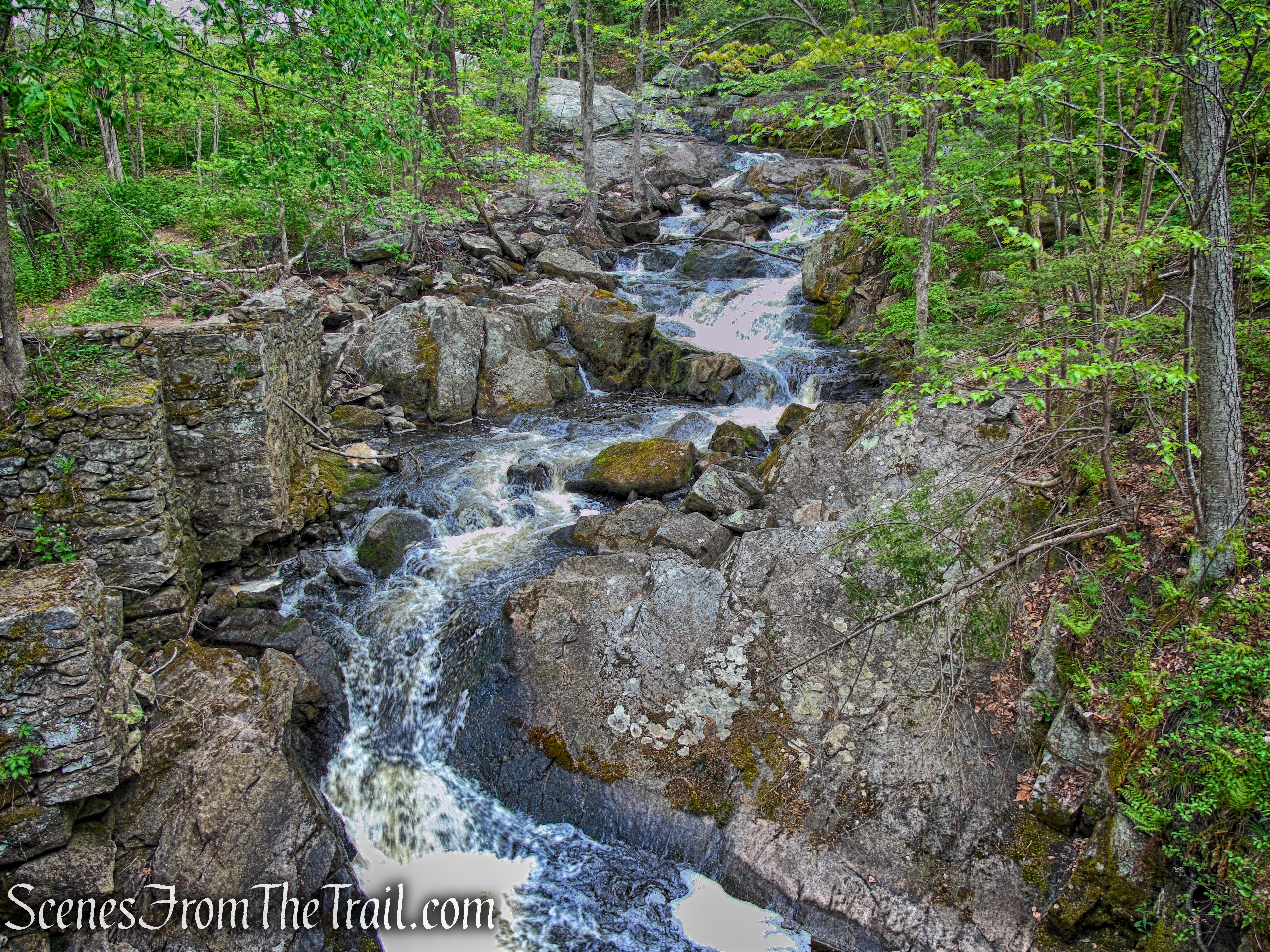
Southford Falls State Park is a public recreation area encompassing 169 acres in the towns of Oxford and Southbury, Connecticut. The state park offers fishing, hiking, a waterfall and a covered bridge over Eightmile Brook. Southford Falls was established as a state park in 1932 and is managed by the Connecticut Department of Energy and Environmental Protection.
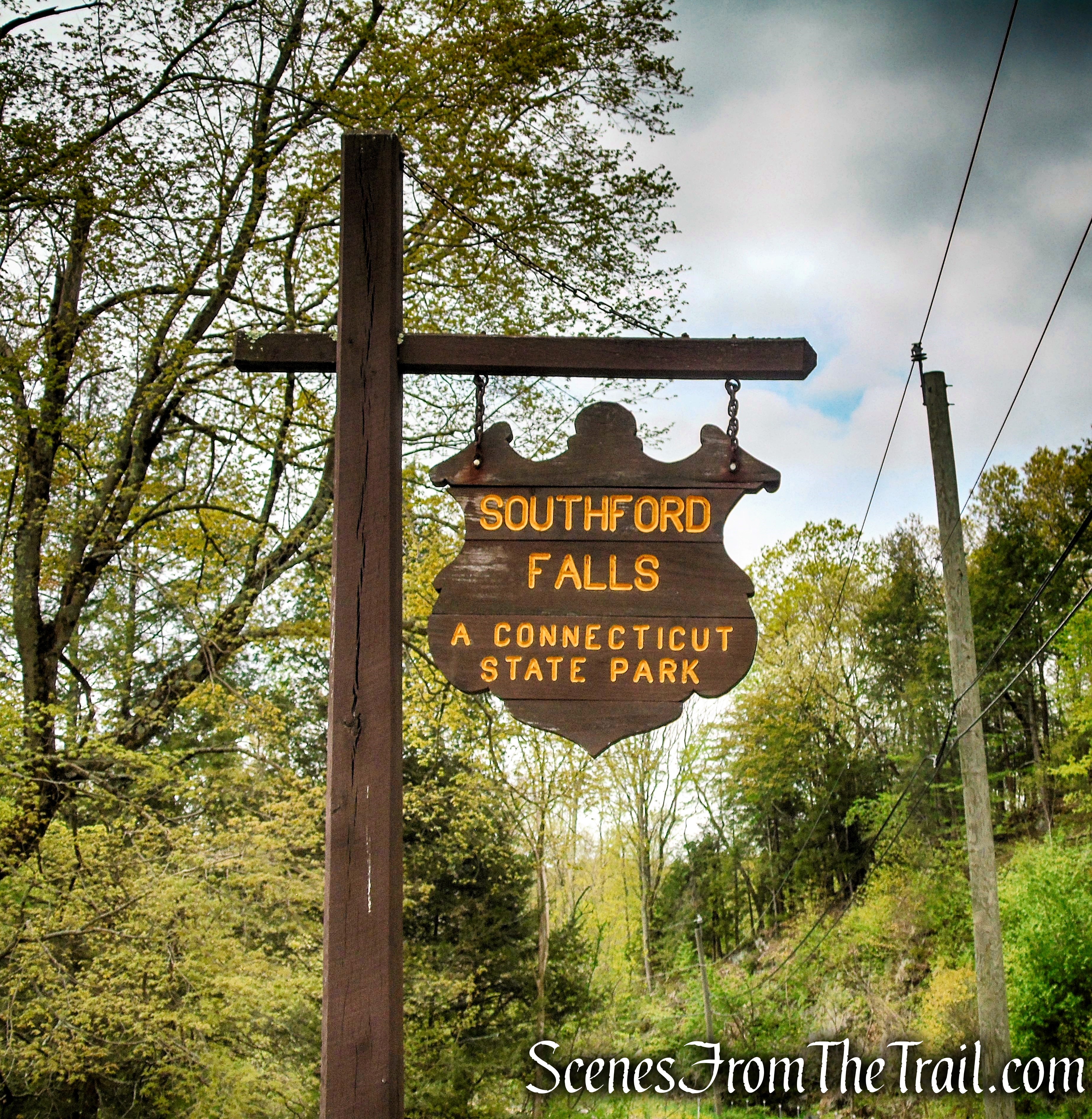
Southford Falls State Park
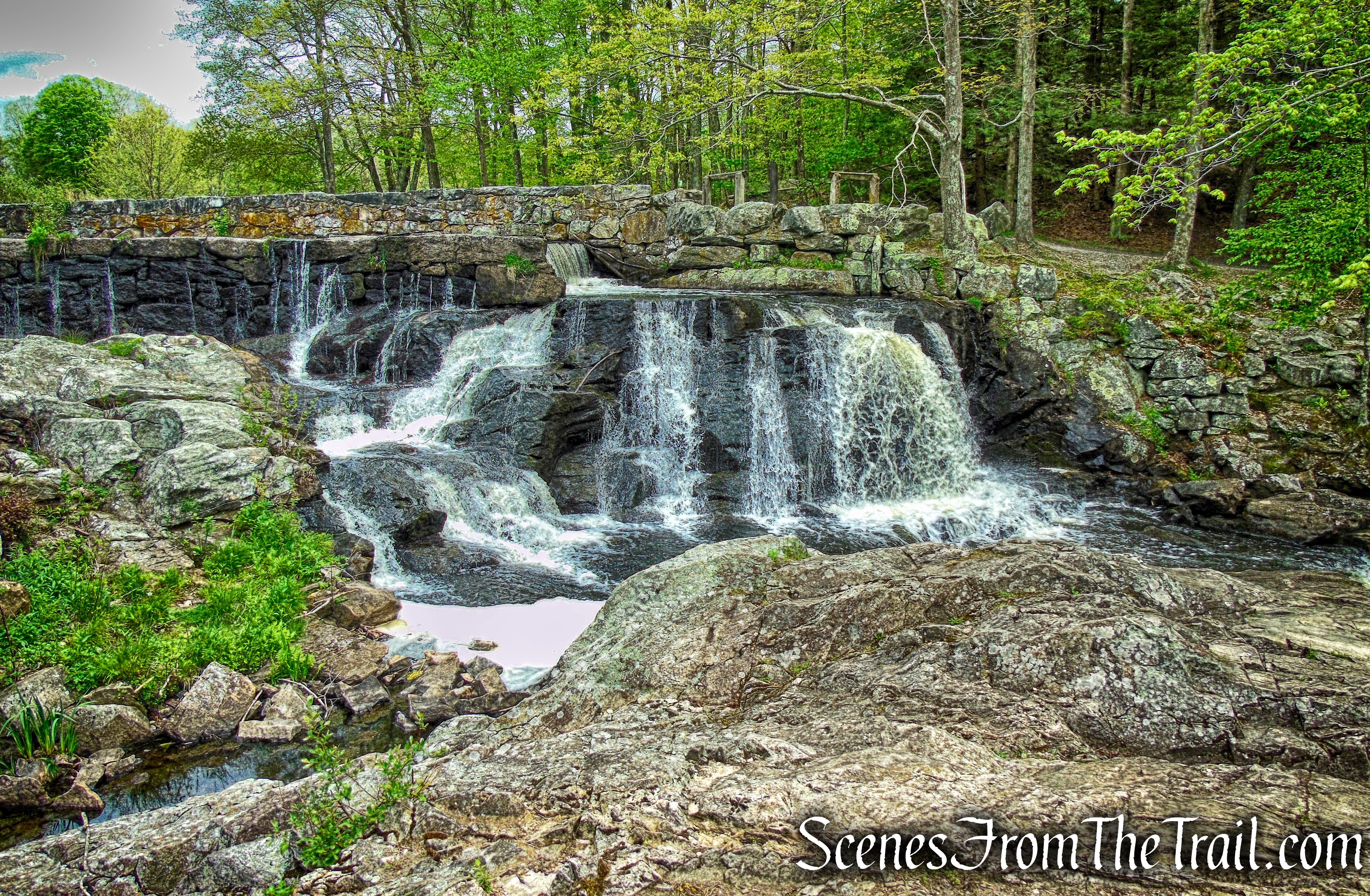
Southford Falls
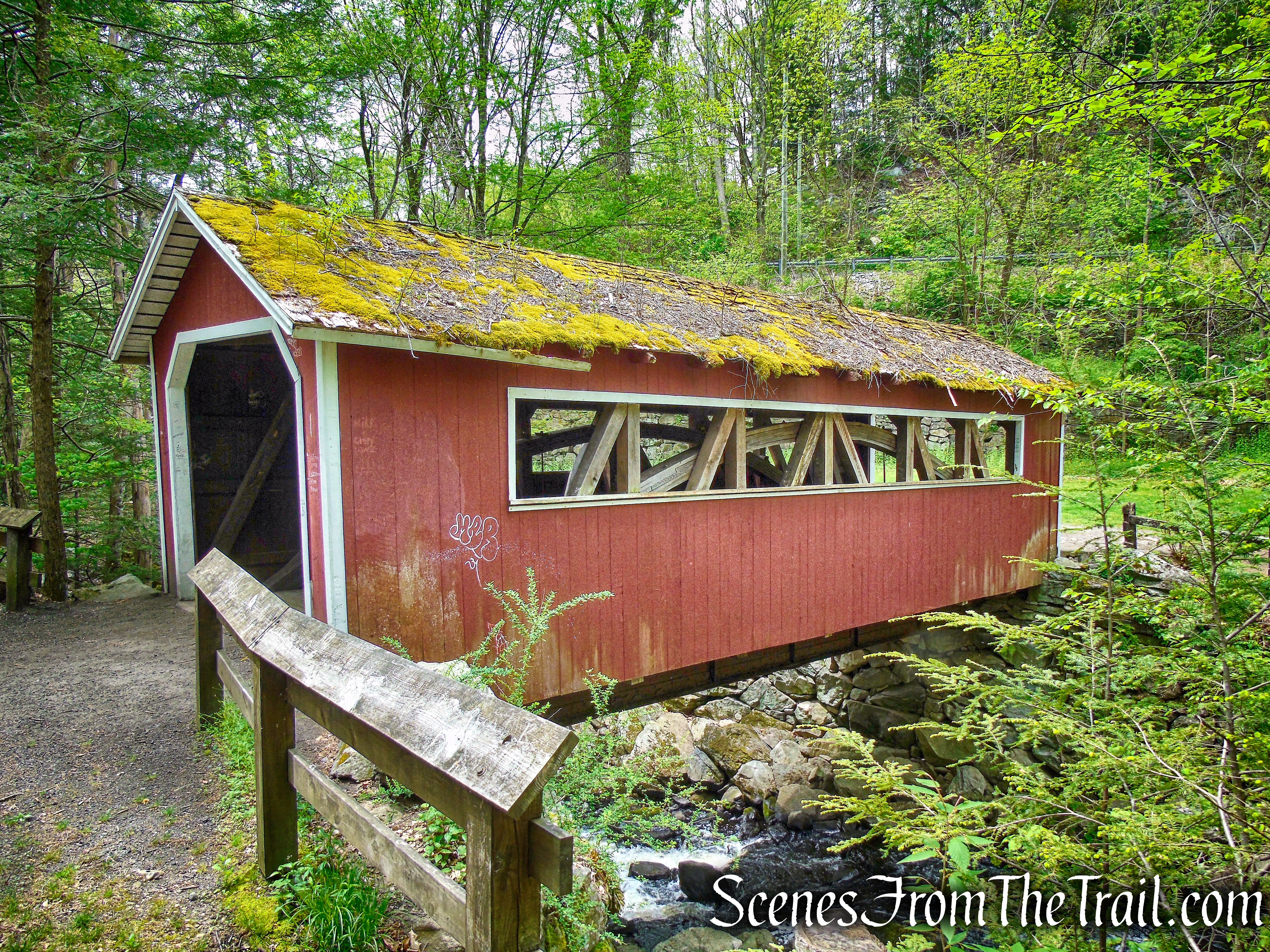
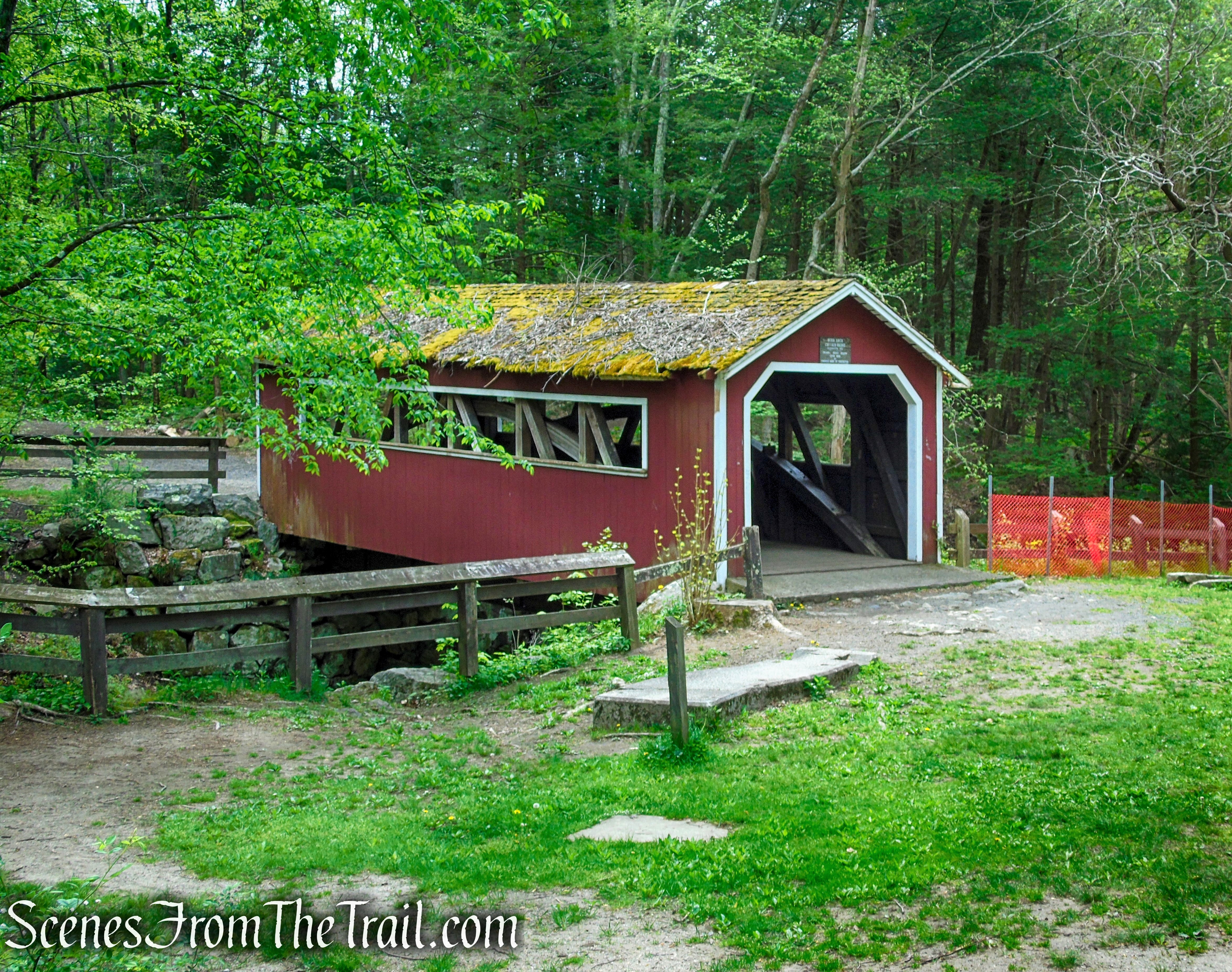
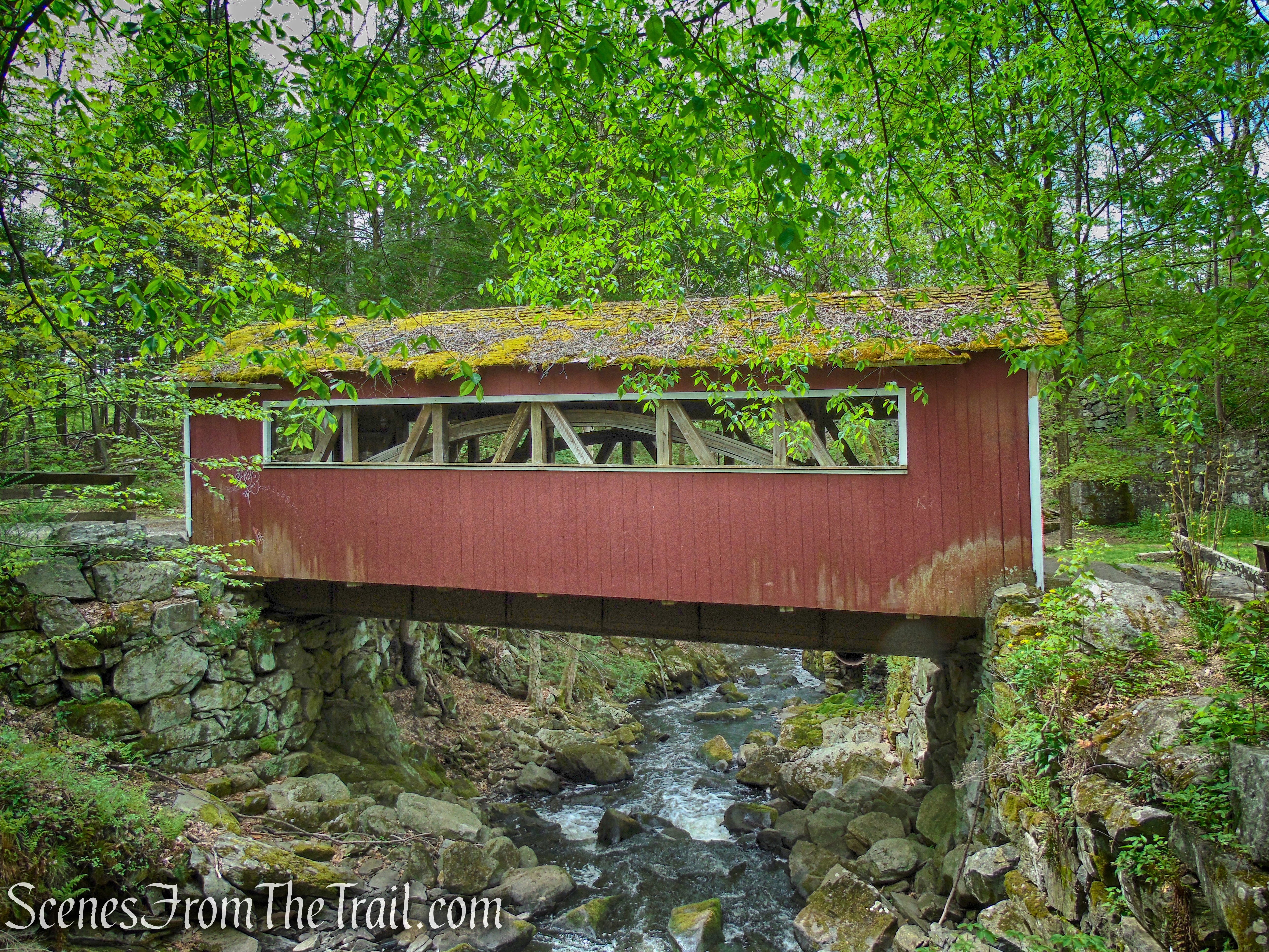
Burr Arch Covered Bridge – Southford Falls State Park
The State Park has hiking trails, picnicking facilities including charcoal grills, skiing and ice-skating in winter, field sports, and fishing. It is a designated Trout Park, stocked weekly with trout from the state’s fish hatcheries.
History:
The sound of the water pouring over the rocks below the dam continues non-stop. It speaks of a time when the plunging waters were the power for Oxford’s early industrial history.
Oxford’s industry boomed with the introduction of Merino sheep here by David Humphreys. The fine wool from the sheep was ideal for making woolen cloth. In 1805 Enos Candee built a fulling mill at the top of the falls. Here Candee provided the cleaning of the raw wool in preparation for the local farmers to spin and weave their wool.
The waterpower was steady because this area is a major drop in elevation from the water’s source at Lake Quassapaug. The force of the water at that point could be used to harness 275 horsepower of rushing water for the mill.
Before long others started building mills in the area. Daniel Abbot first set up a flour mill there. By 1849, he took over Candee’s old fulling mill. There he made paper, drying it outdoors in the sun. Later he built a large building with a loft for drying the paper.
During the Civil War era, the falls were the center of half a dozen industries. R.B. Limburner and Brothers had a paper mill above the falls. Hurd and Bartlett operated another paper mill below the falls. In addition, the area supported an axe factory, a cutlery shop, a gristmill for grinding grain, and a sawmill.
The Limburner mill was sold to White-Wells Company for $15,000. Just five years later in 1875, it was sold to F.A. Keeney for $24,000. The mill burned in 1881.
A new company, the Southford Paper Co., was formed. The owners built a new brick building at a cost of $200,000, supplied with state-of-the-art machinery. The company could not meet its expenses and went bankrupt. White-Wells regained ownership of the facility.
In 1901, the Diamond Match Company purchased the mill to manufacture paperboard, used in its matchboxes and matchbooks. A workforce of 85 to 100 people operated the plant until 1923.
Six months later, production was stopped after a fire destroyed the facility. Three large buildings were destroyed. Though the water rushed through continually, no more mills were built.
Southford Falls was established as a state park in 1932 and encompasses 169 acres. Southford’s name is a blending of Southbury and Oxford, the two towns that the park is located in. The first parcels of land were acquired by the State of Connecticut in 1926. Then in 1932, the Whittemore Company donated the upper portion of Papermill Pond and Eightmile Brook to the State of Connecticut. By 1948, all land acquisitions had been completed.
Little if any traces of the former mills remain today except for the foundation ruins of the Diamond Match Company.
In 1934, the Civilian Conservation Corps (CCC) helped reclaim the land, clearing the wreckage from the gutted factory that lay strewn about.
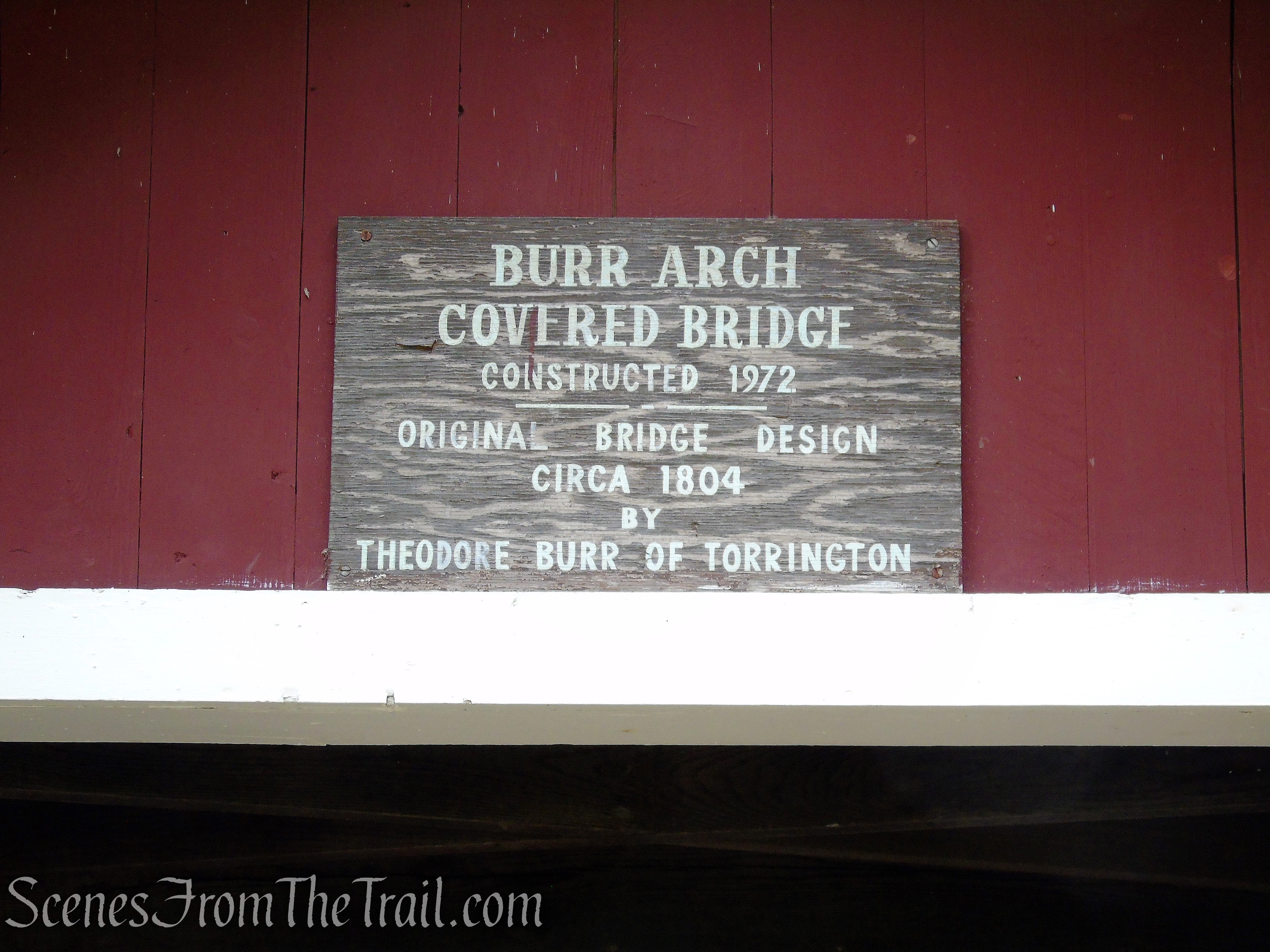
Today, the park is used for passive recreation. It contains a reproduction of a bridge built by Theodore Burr. This Torrington native patented the laminated arch bridge in 1804. Dozens of them were built in the Northeast, and he got a royalty for each one. One of his first arched bridges crossed the Hudson River at Waterford, N.Y. It stood in use for more than a century.
The reproduction was built in 1972, with artist Eric Sloane as design consultant and retired DEP carpenter Ed Palmer as builder.
Trails Overview:
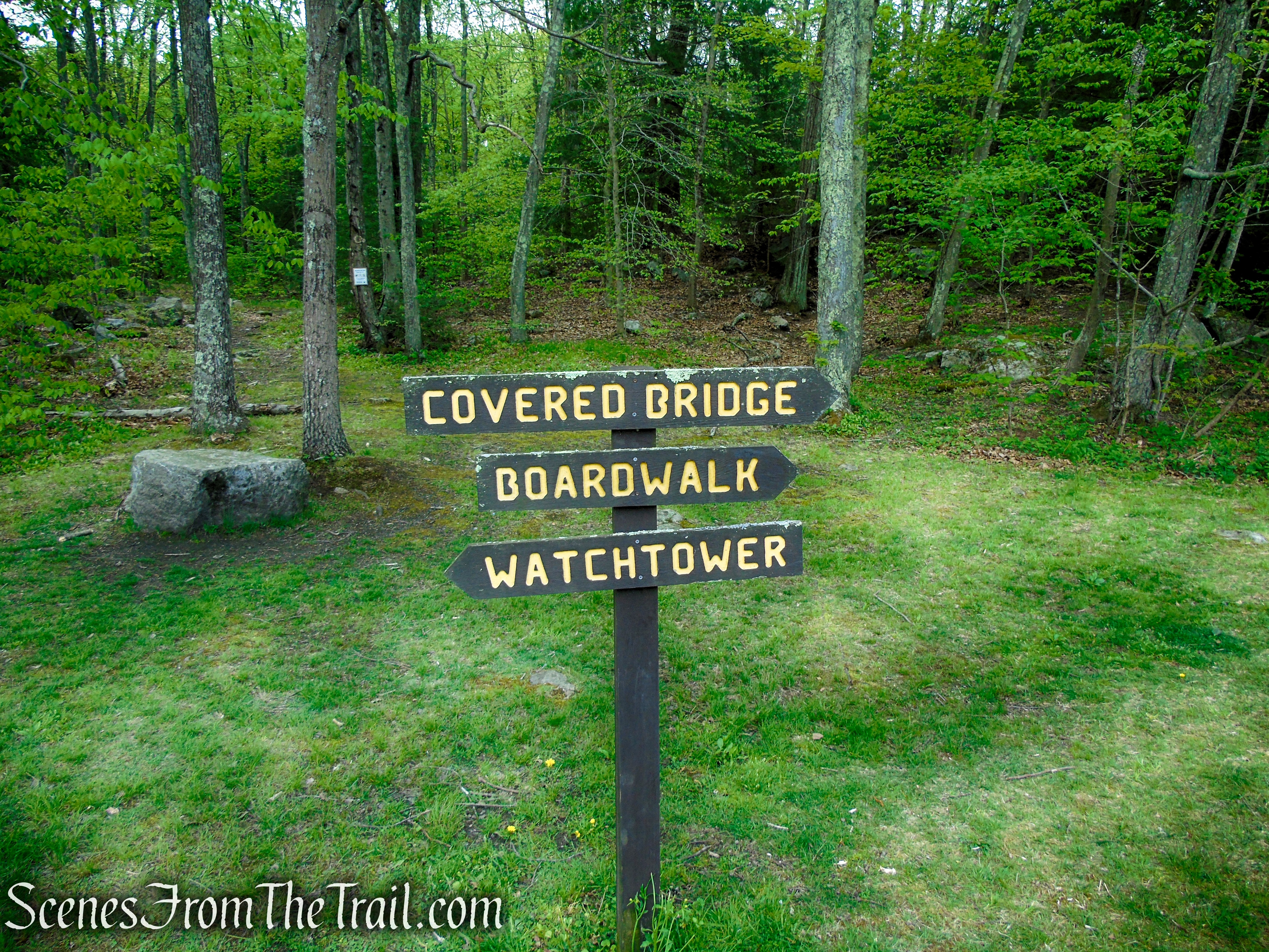
Southford Falls State Park features a small network (about 2 miles) of both marked and unmarked trails alongside Papermill Pond and Eightmile Brook. The trails’ highlights include a covered bridge, an observation tower and a waterfall. The Red Trail begins near the park entrance and loops around the southern section of the park, back to papermill Pond, with a .1 mile out and back to the observation tower mid-way.
Observation Tower – Southford Falls State Park
The main trail in the park is the Red Trail as depicted on the park’s trail map. The problem is that there are red blazes everywhere, which makes it difficult to figure out what trail you are actually on. Some of the blazes are extremely faded which may signify that the trail has been rerouted and/or no longer in use, but who knows.
There are more trails that are not represented on the trail map (dated April 25, 2011), most of which are marked with red blazes or not marked at all. As you get farther away from the main section of the park, the trails become harder to follow and show signs of neglect.
The trail that leads to the observation tower is not blazed red as shown on the map. It is marked with blue blazes.
My advice is to utilize the free Avenza Maps app, utilizing the official, but dated trail map to navigate your way around, otherwise you may be left scratching your head throughout the hike.
Hike Overview:
Having done a short hike to Nonnewaug Falls early morning, we decided to drive 12.5 miles, about 20 minutes, to Southford Falls State Park to do another short hike. I have visited the park a couple of times in the past, but just to view the falls while enjoying a picnic. This time we hiked the trail to the observation tower. For a relatively small park, it has enough points of interest to keep one engaged while there.
We lost the trail several times near the beginning as we followed faded red blazes that led nowhere. Several times as the trail came to a fork, both forks were marked with red blazes, making it really confusing. The Avenza Maps app came in really handy at this point and helped us get on the correct trail. It’s a free app that works with the official park maps. I highly recommend this app for beginners and more experienced hikers as well.
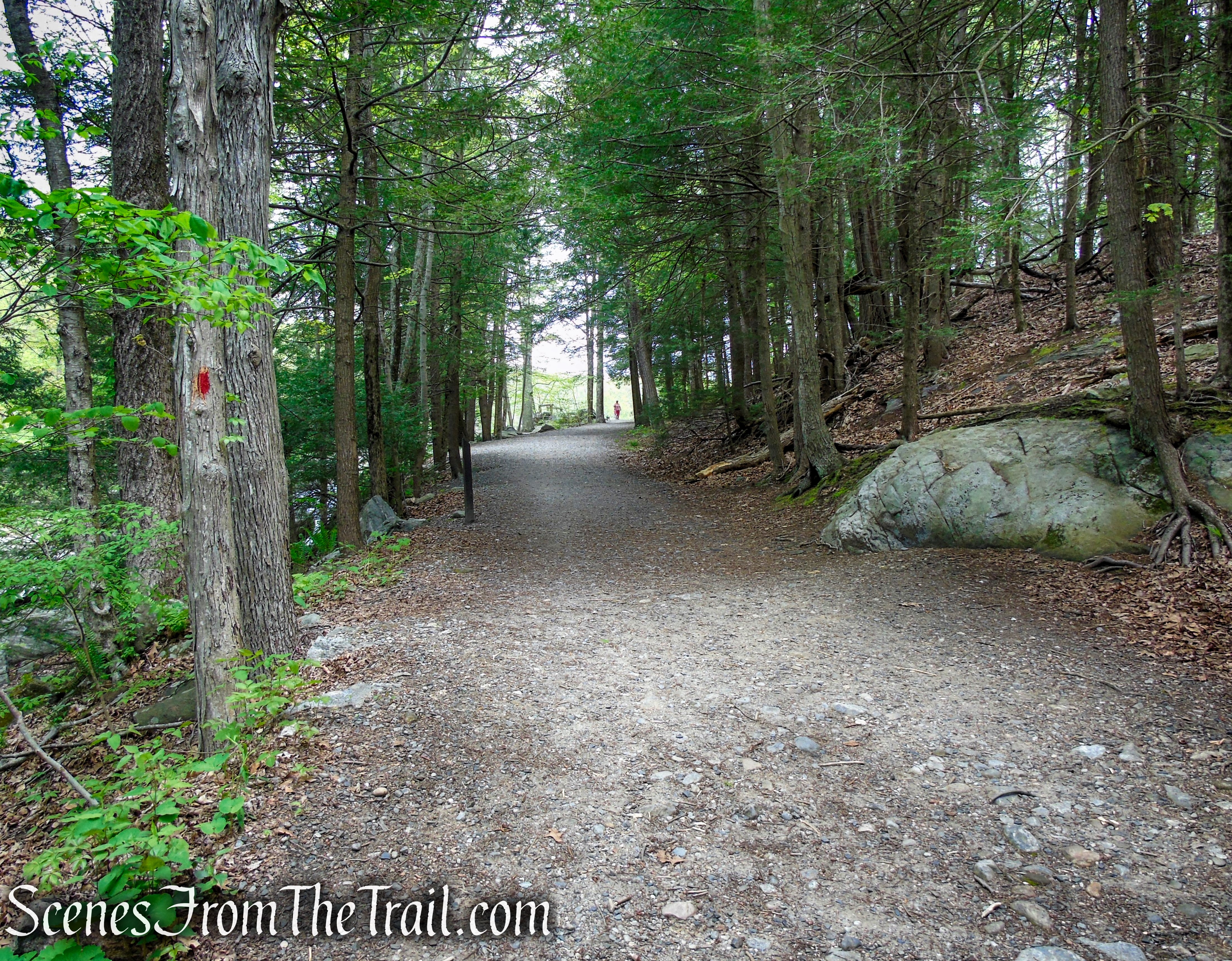
The closer you are to the main section of the park, the easier the trails are. Some sections of the park are surprisingly rugged and good hiking boots are recommended. We began the hike at the parking lot and checked the waterfall first, crossed the covered bridge, then did the loop clockwise.
Southford Falls State Park
This hike is on the lower side of moderate, but it still has several short, steep ascents.
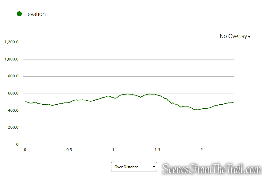
elevation profile – Southford Falls State Park
The Hike:
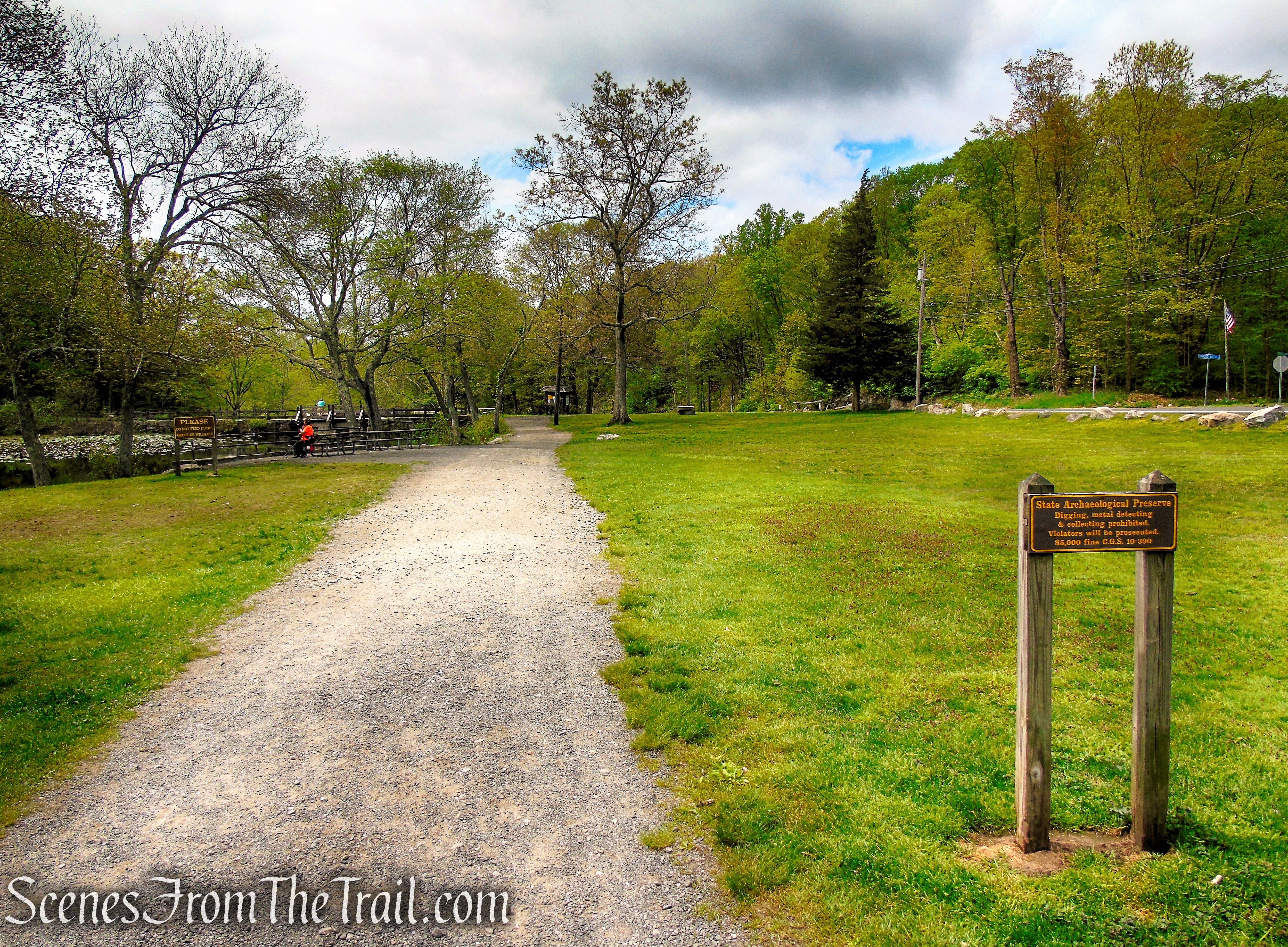
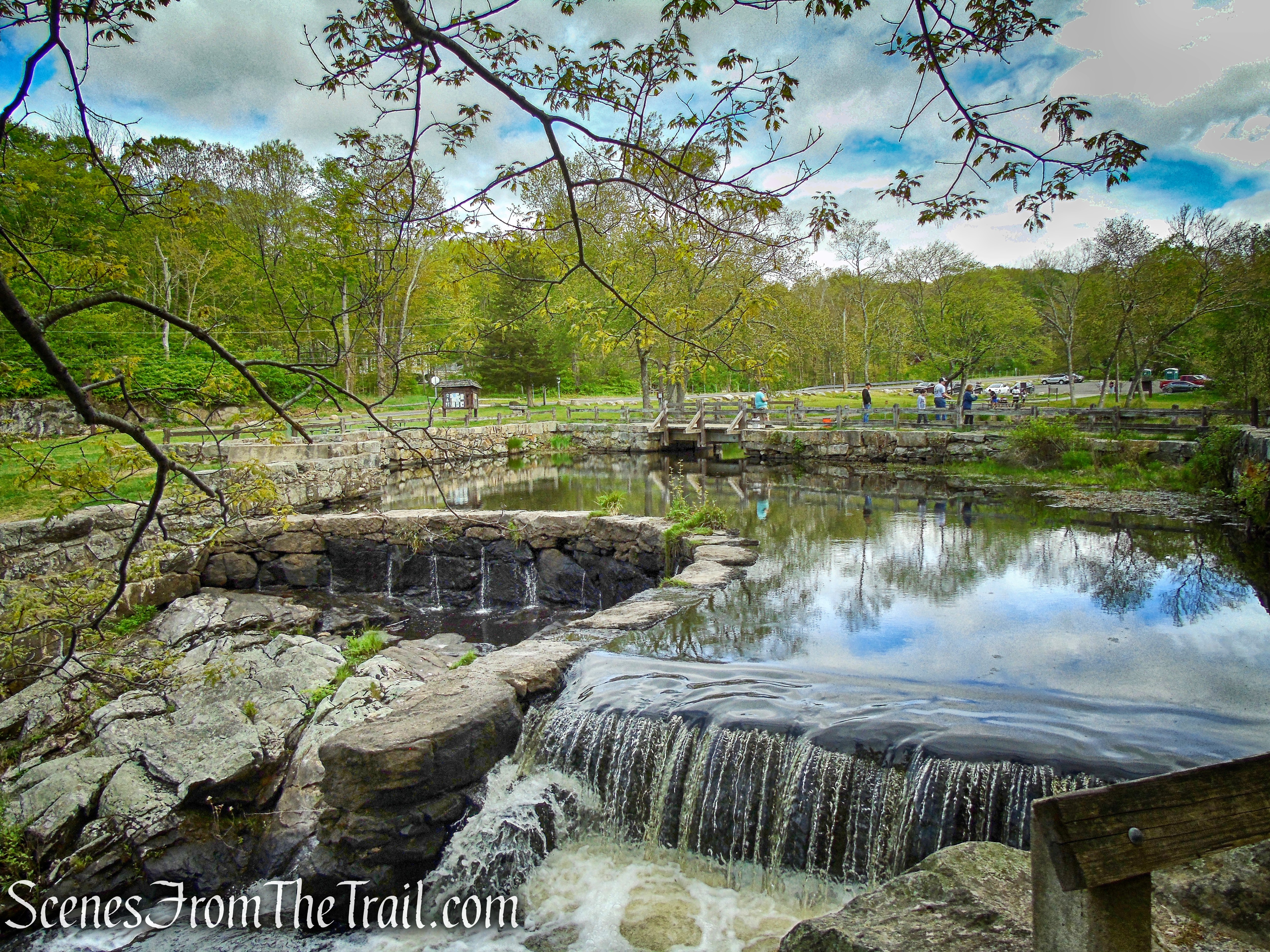
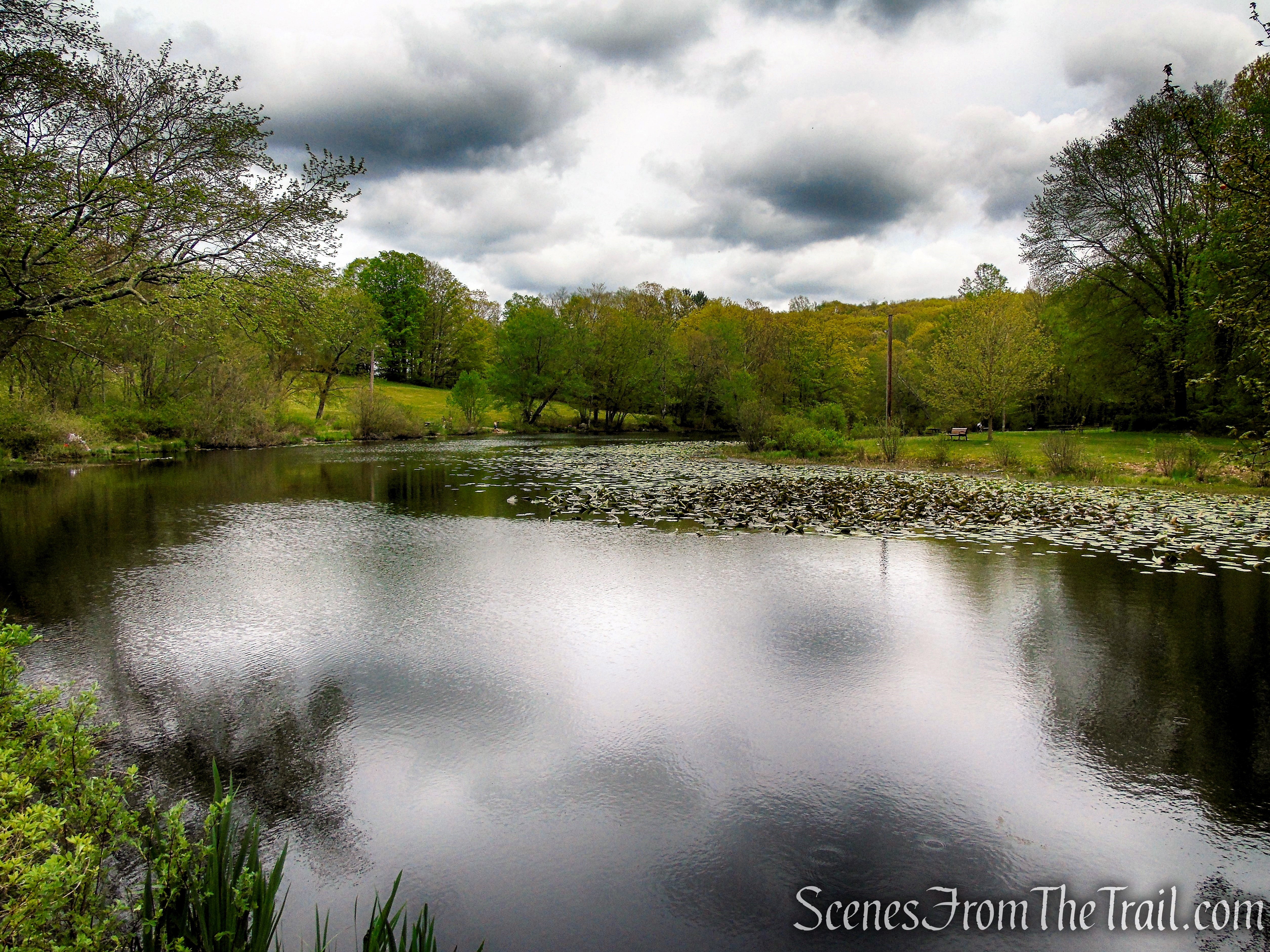
With your back to Quaker Farms Road, turn right onto a gravel path that parallels Papermill Pond. You may want to stroll over to the pond and enjoy the scenic setting.
Southford Falls State Park
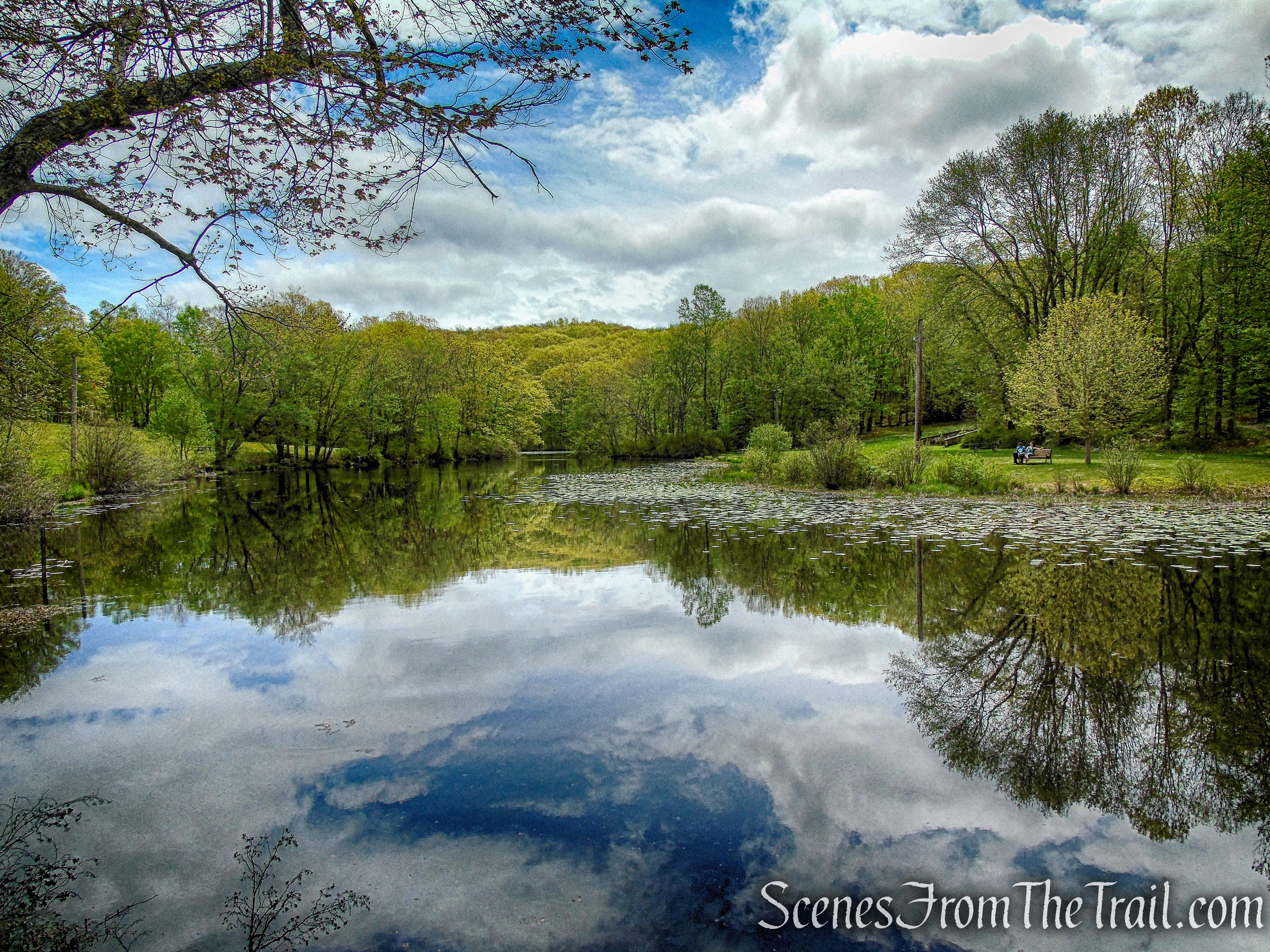
Papermill Pond – Southford Falls State Park
When you are ready to proceed, follow the gravel path to the kiosk. The Red Trail begins at the Kiosk, going to the left and crossing the footbridge just above the falls, and also straight along the western side of Southford Falls. So technically, either way that you decide to go will bring you back to this spot if you follow the red blazes.
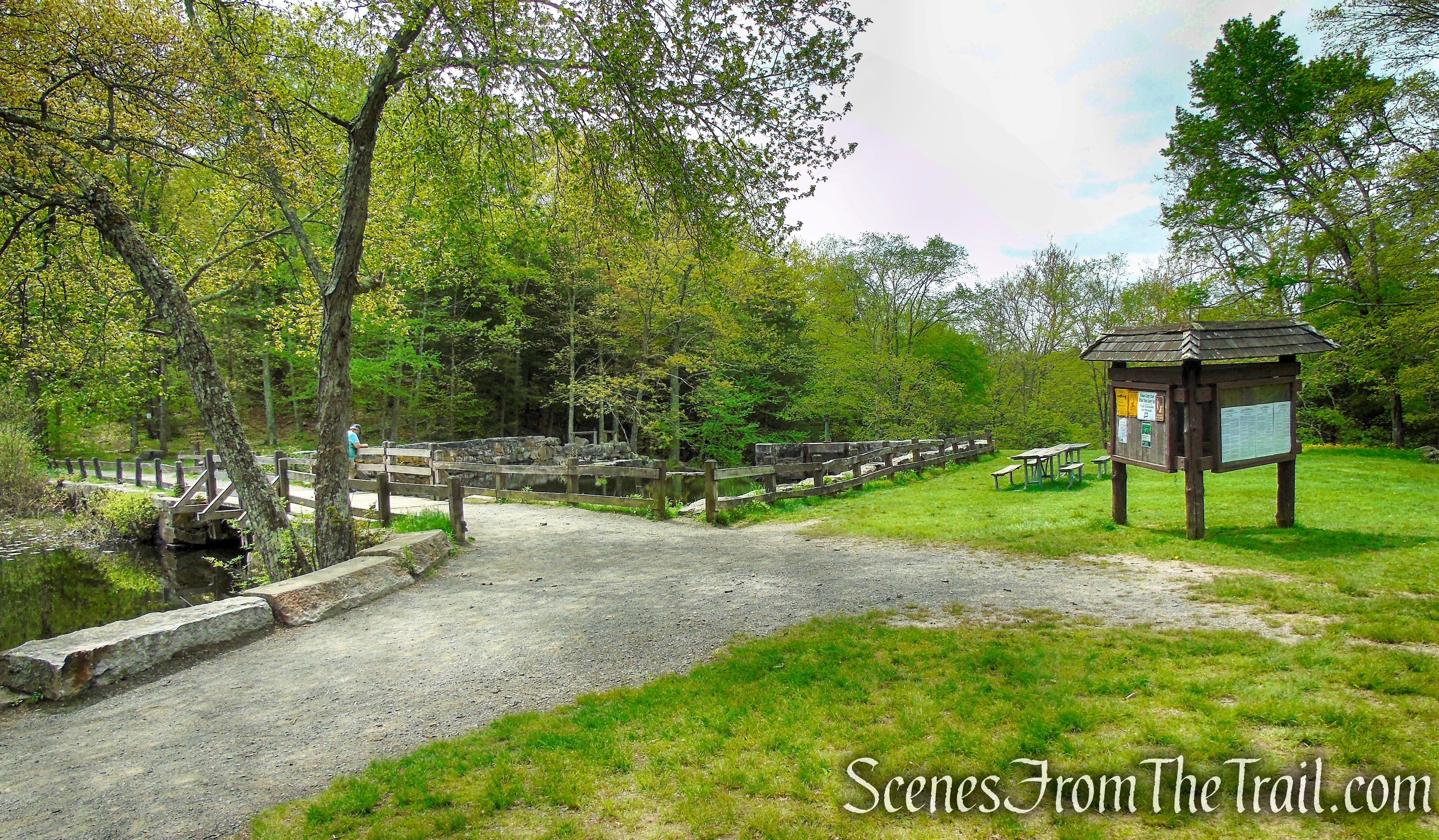
Southford Falls State Park
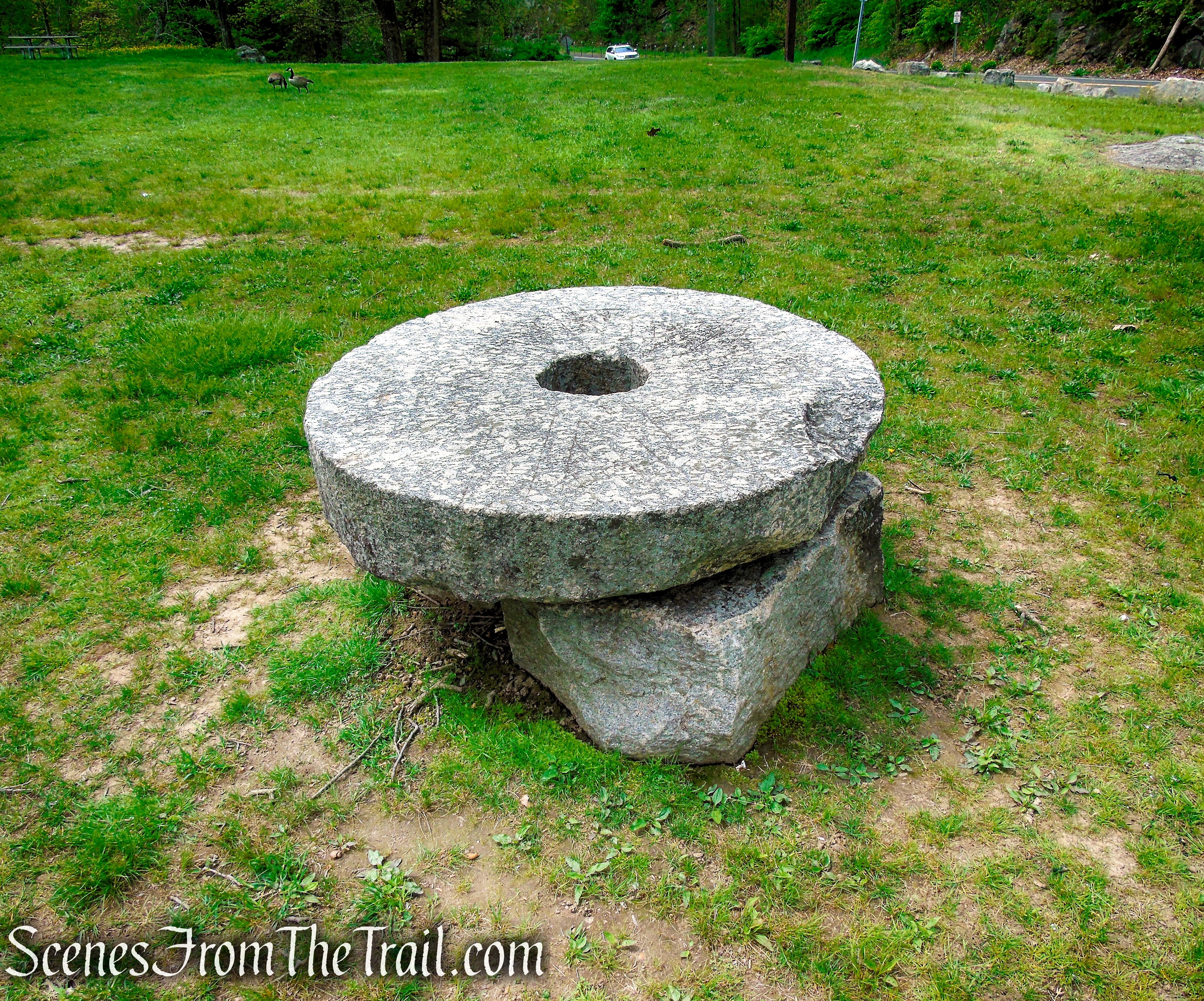
millstone – Southford Falls State Park
We wanted to check out Southford Falls first so we followed the trail downhill from the top of the falls to the covered bridge, stopping to enjoy the scenery.
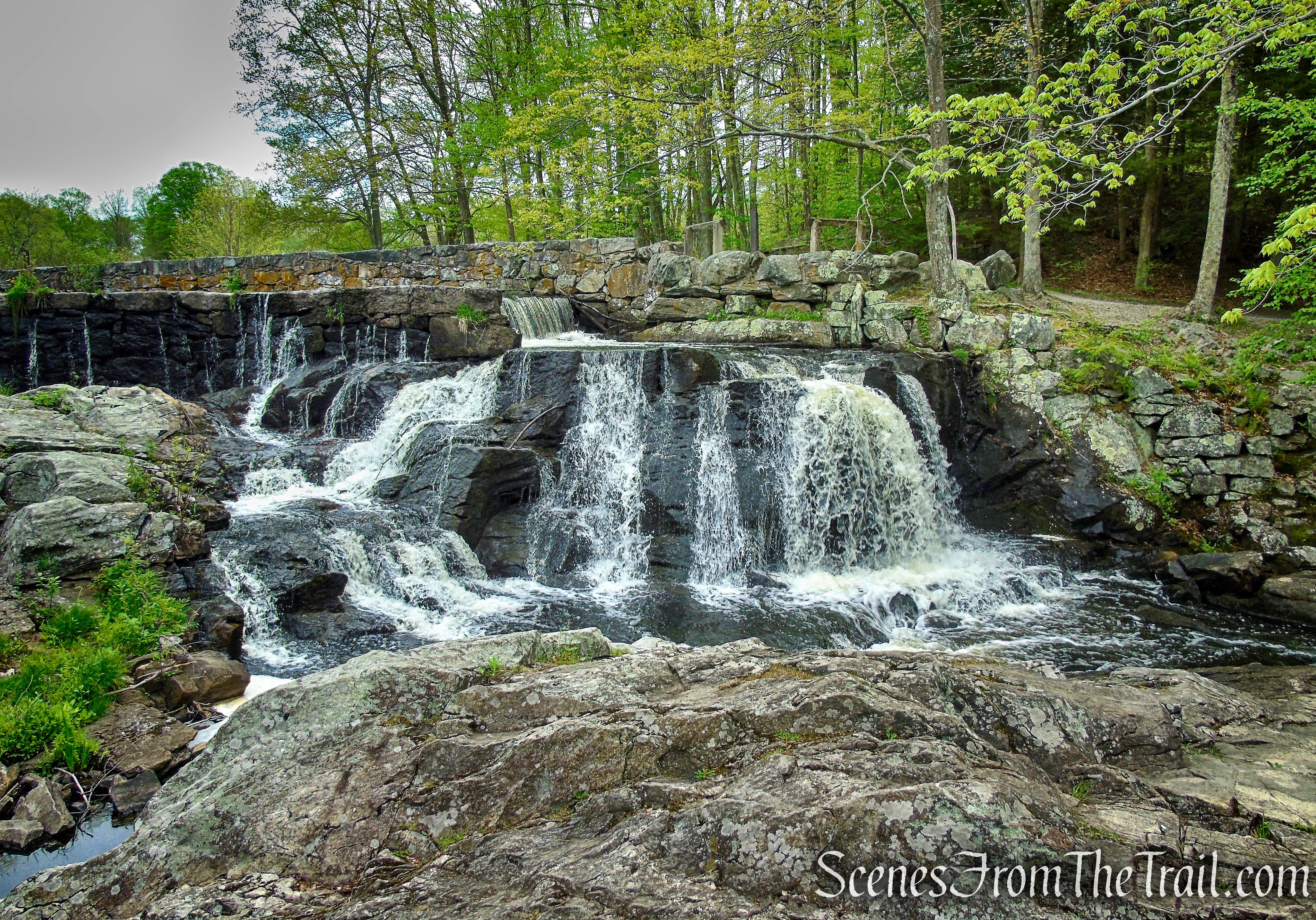
Southford Falls
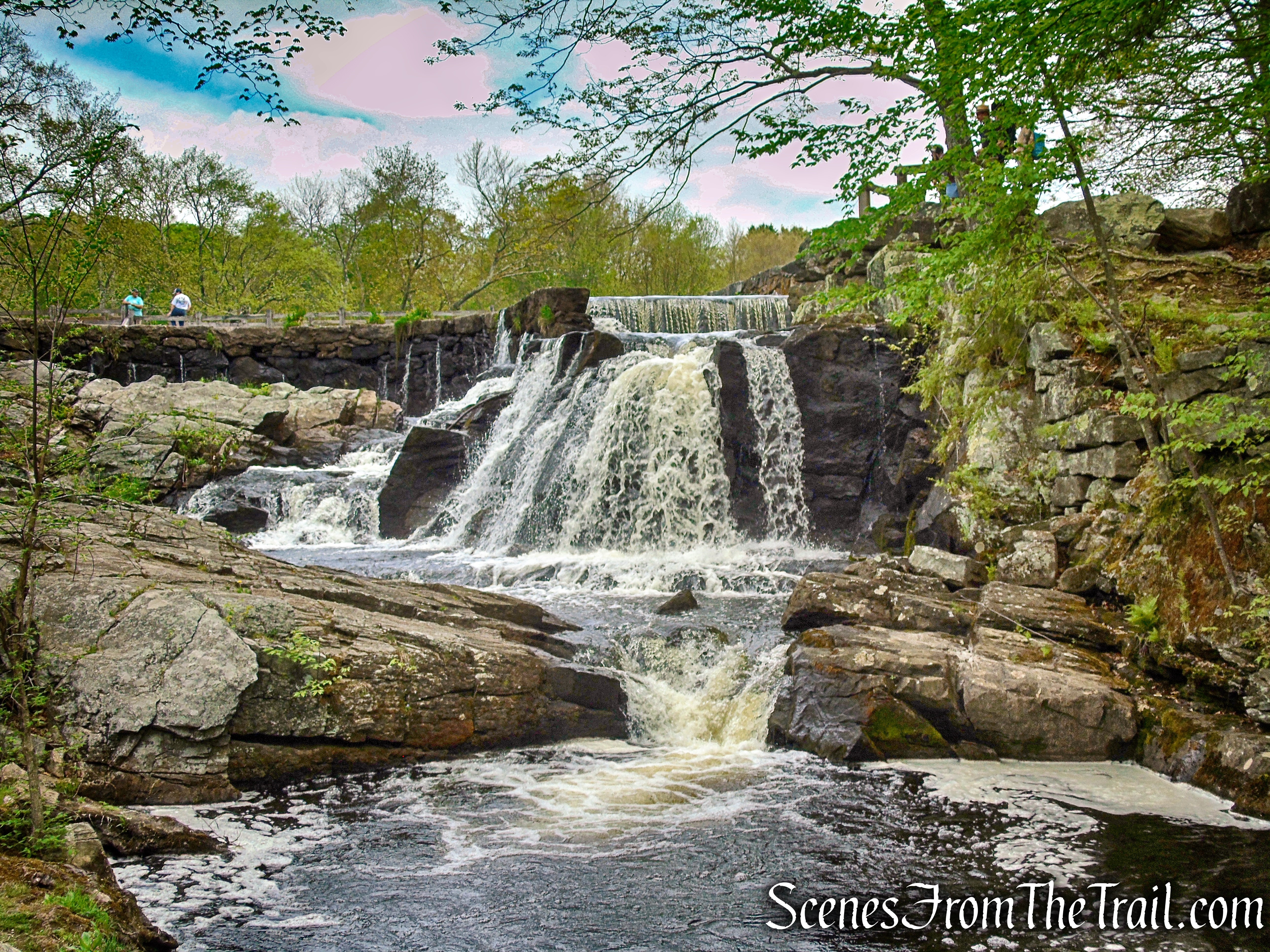
Southford Falls
Burr Arch Covered Bridge – Southford Falls State Park
Burr Arch Covered Bridge – Southford Falls State Park
Burr Arch Covered Bridge – Southford Falls State Park
Eightmile Brook – Southford Falls State Park
After crossing the covered bridge, the Red Trail splits and we turned left on the gravel road, marked with red blazes. The trail now heads upstream along the eastern side of the brook and falls.
Red Trail – Southford Falls State Park
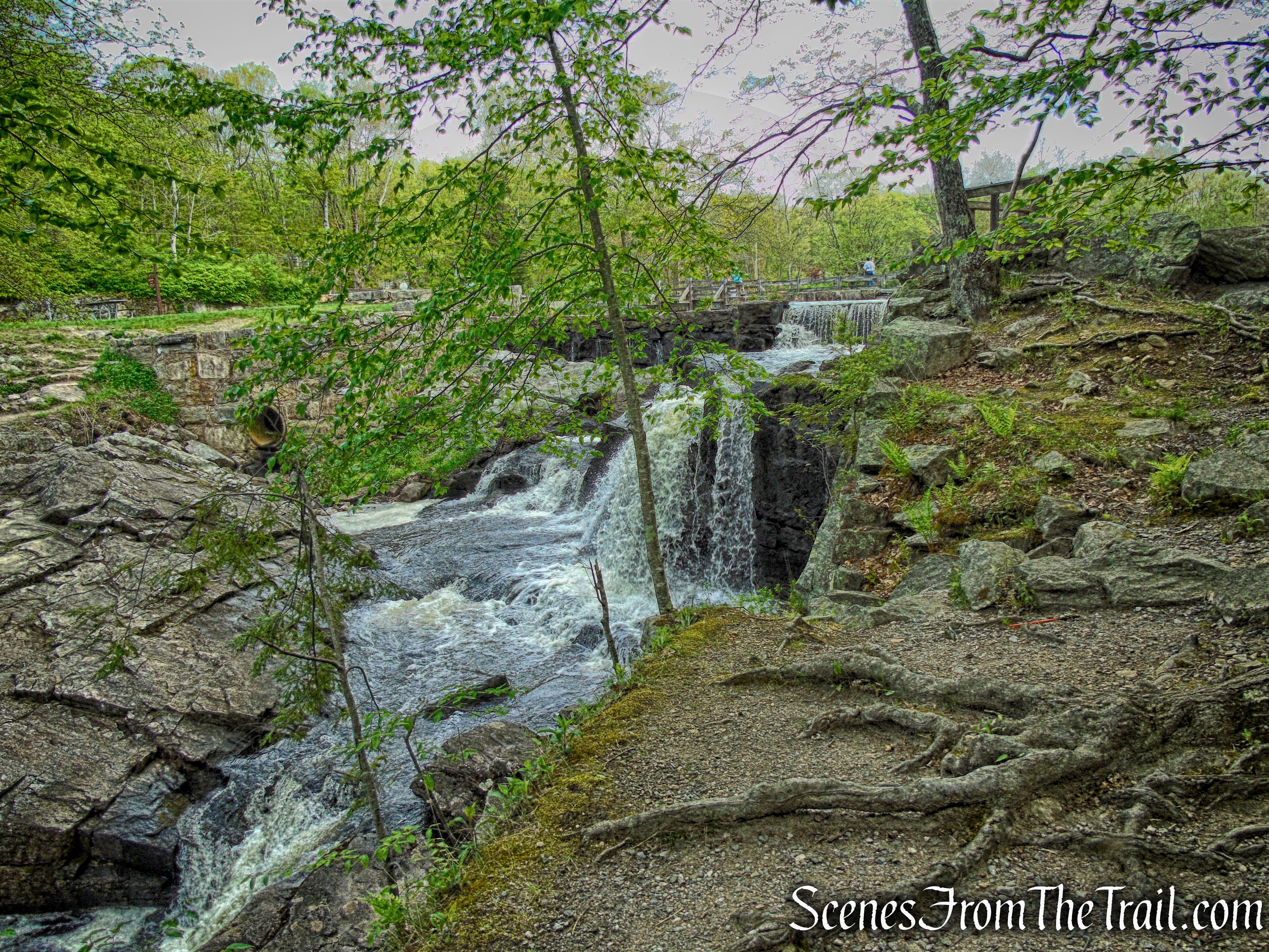
Southford Falls
Southford Falls
The sign at the east end of the footbridge over Papermill Pond.
Red Trail – Southford Falls State Park
We followed the gravel road past the picnic pavilion, not seeing any more red blazes.
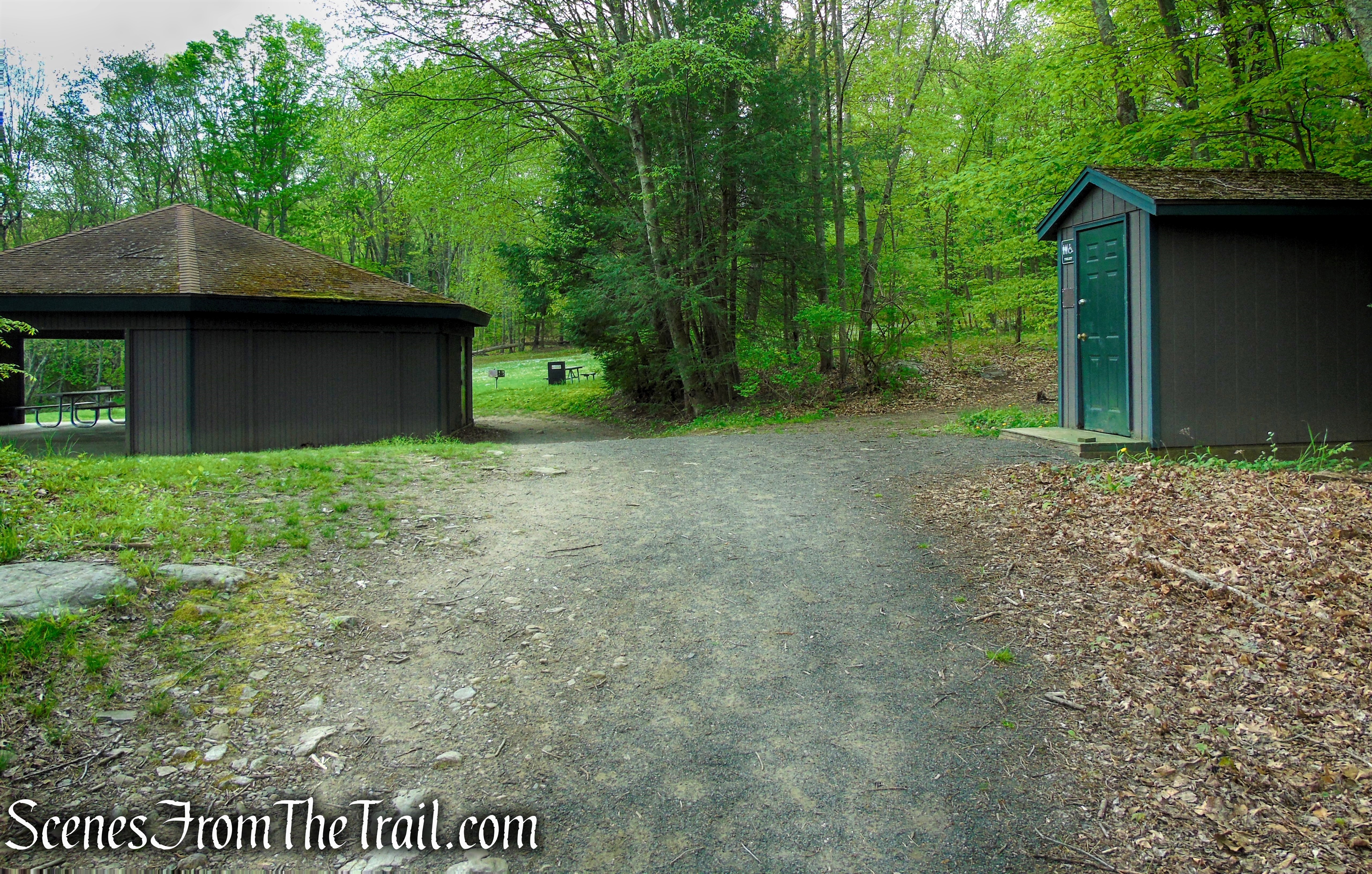
Red Trail – Southford Falls State Park
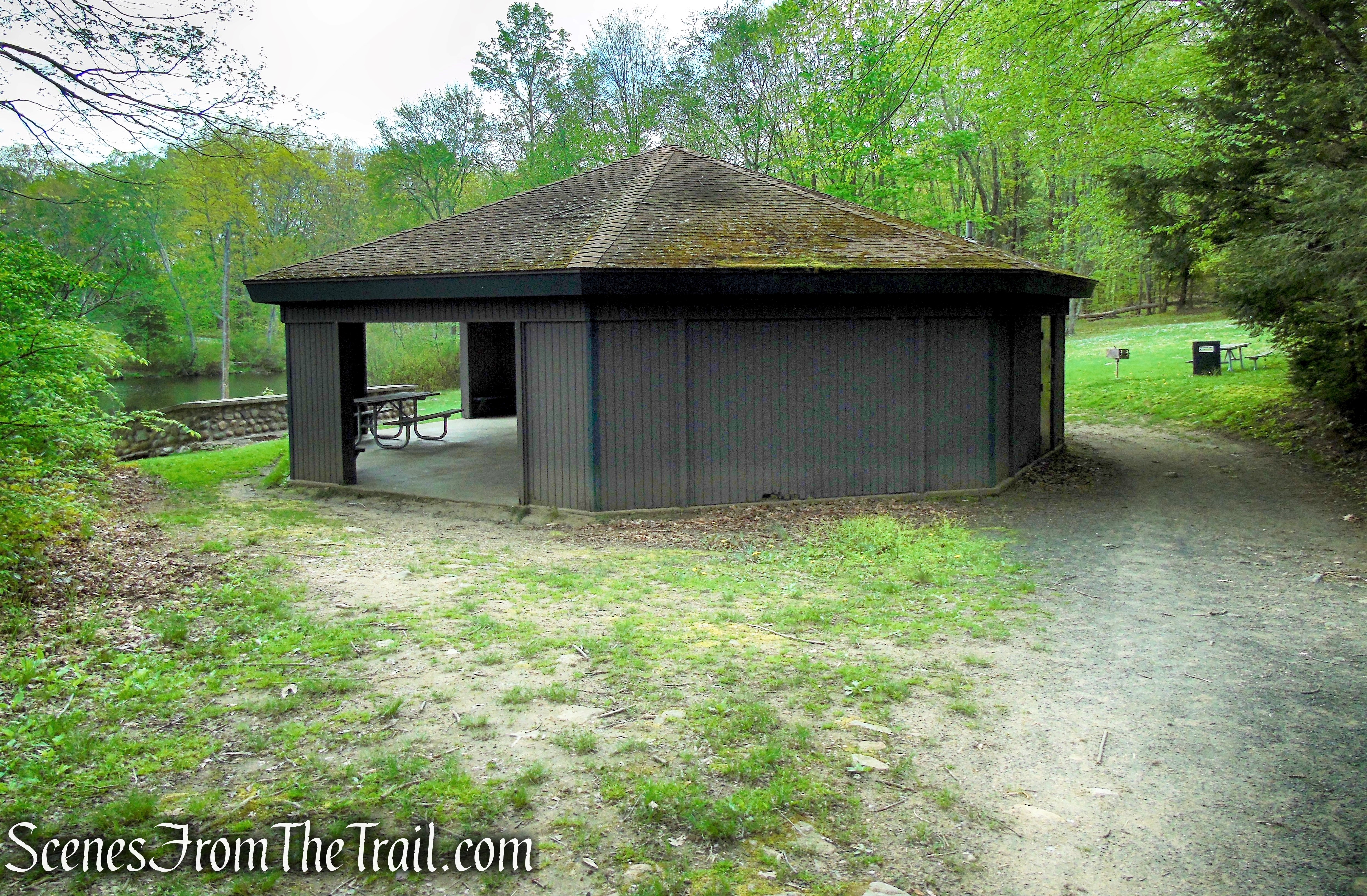
picnic pavilion along the Red Trail
View across Papermill Pond from the picnic pavilion.
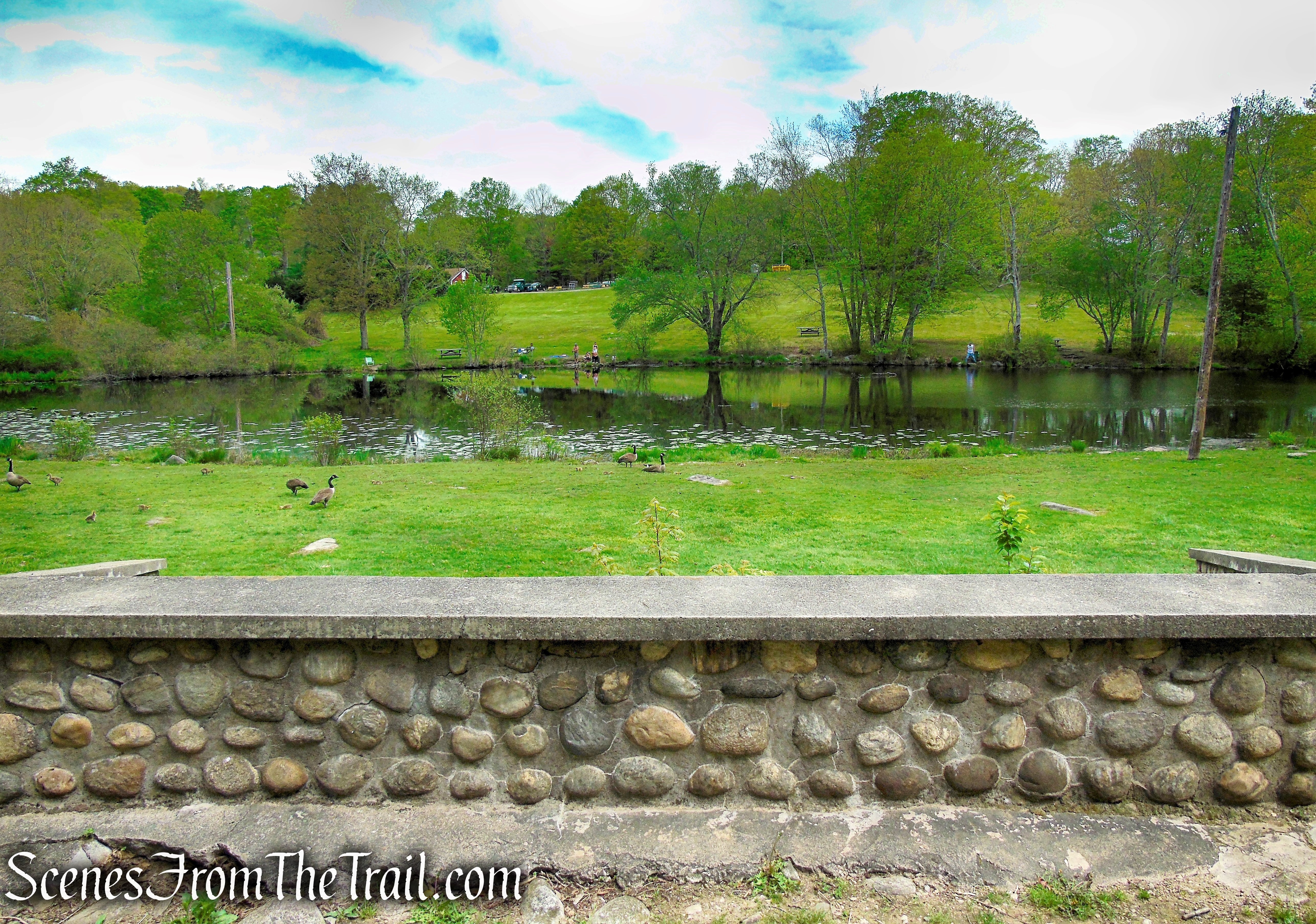
view of Papermill Pond from picnic pavilion
View northwest towards the parking lot from the picnic pavilion.
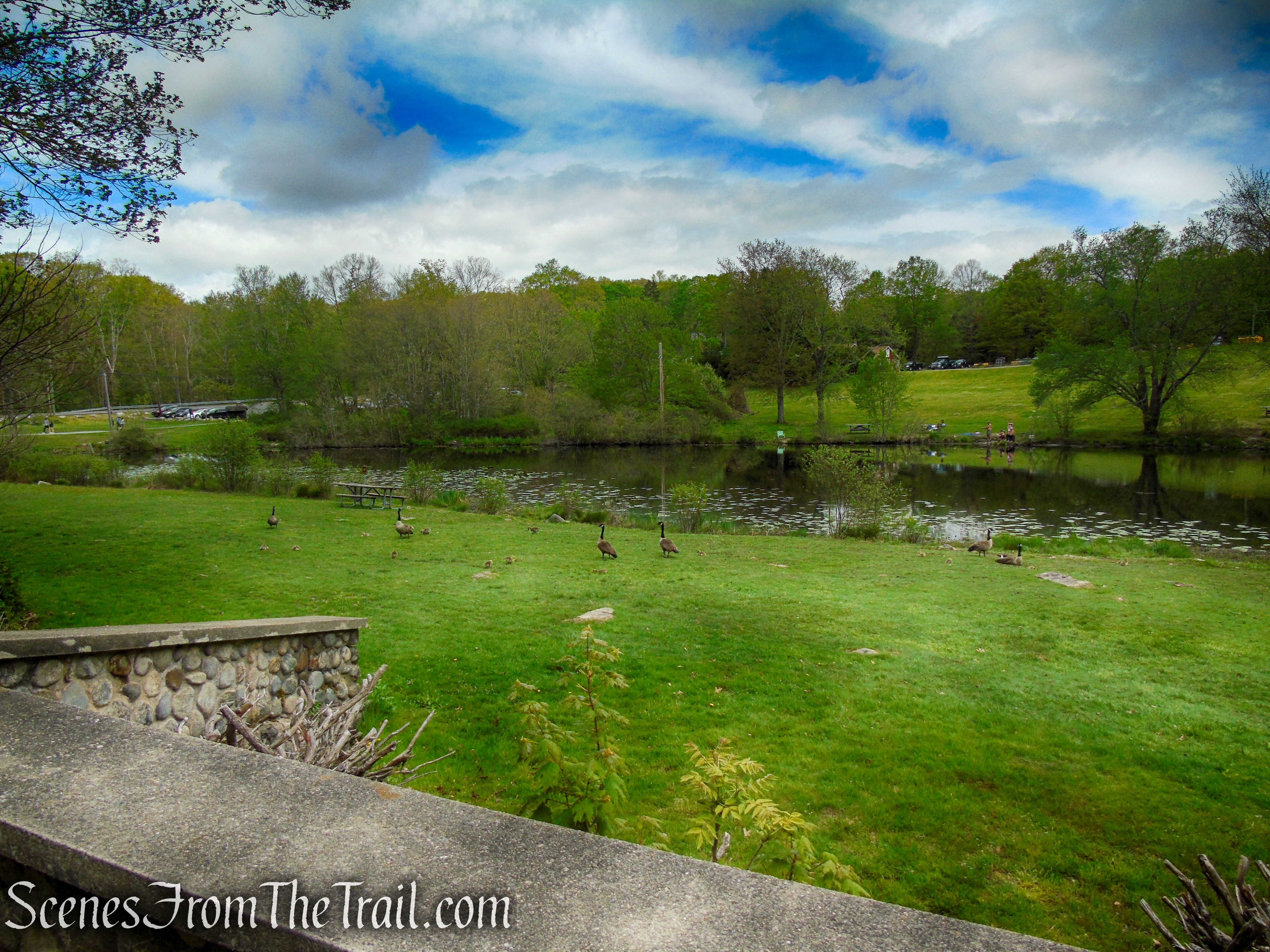
view of Papermill Pond from picnic pavilion
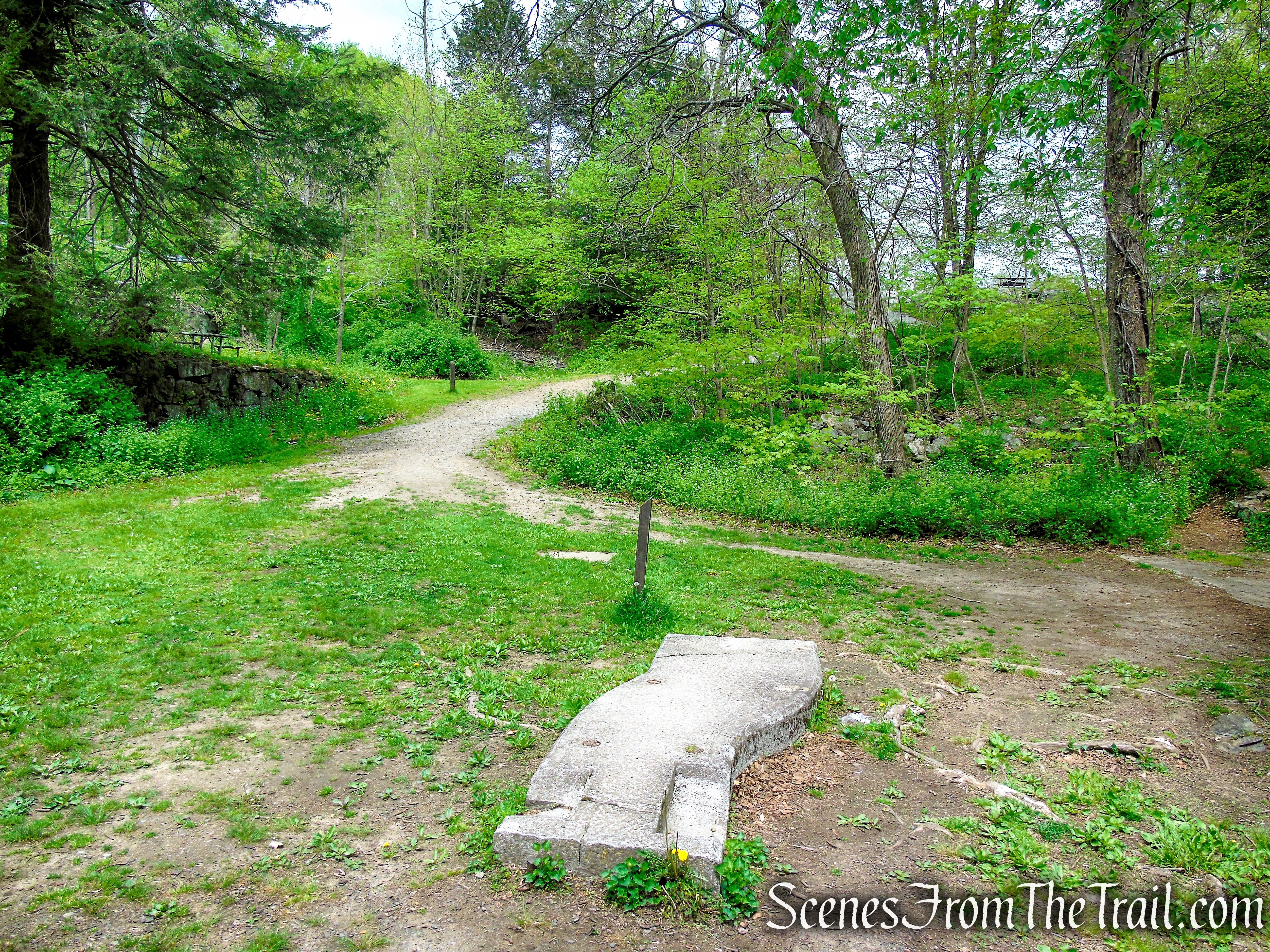
I am pretty sure that the official Red Trail runs along the eastern shore of Papermill Pond and ducks into the woods at the clearing that is visible between the grill and table. Two people are visible walking towards the left arrow just over the right side of the table.
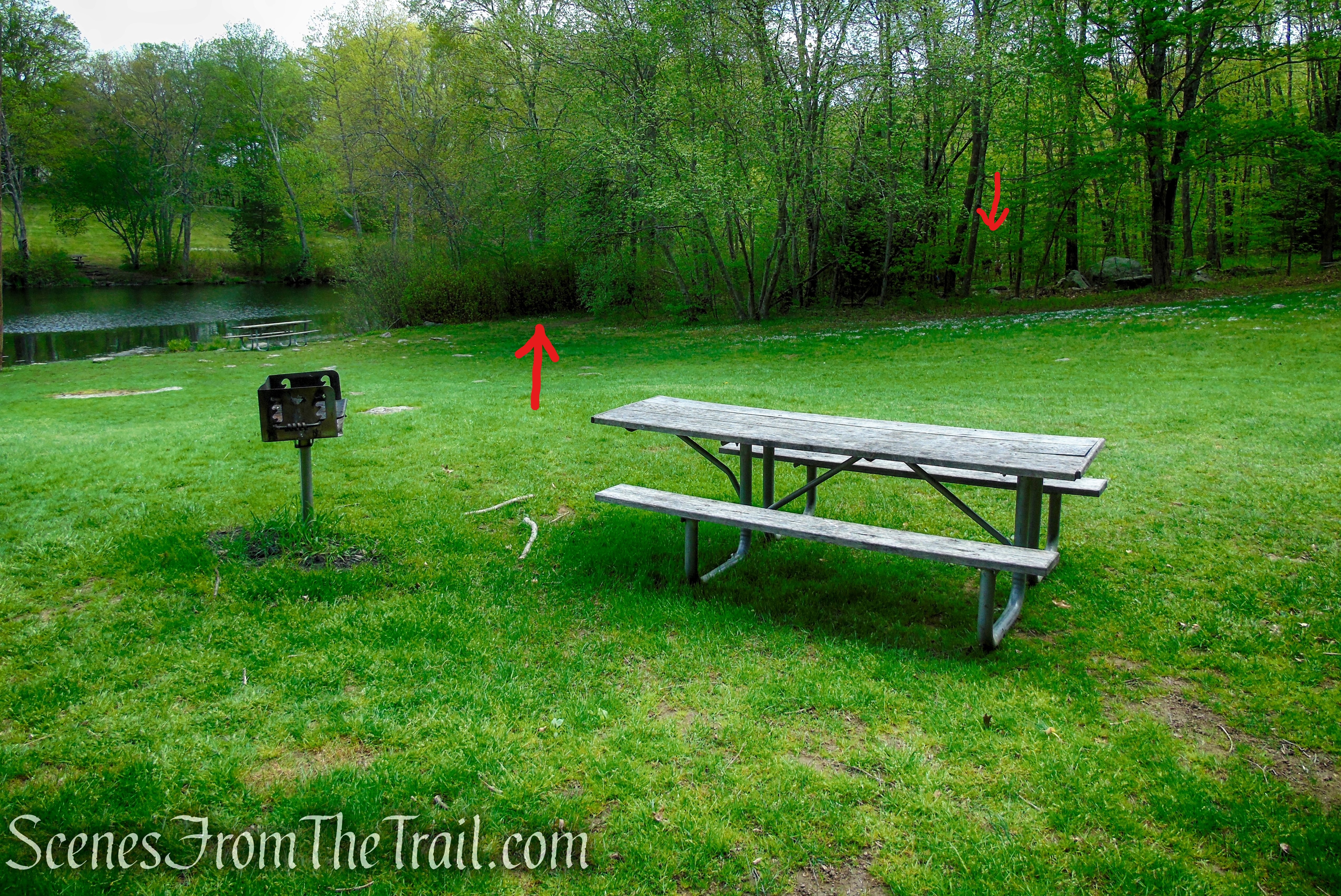
picnic table and grill near picnic pavilion
We instead walked through a bigger clearing and made our way into the woods.
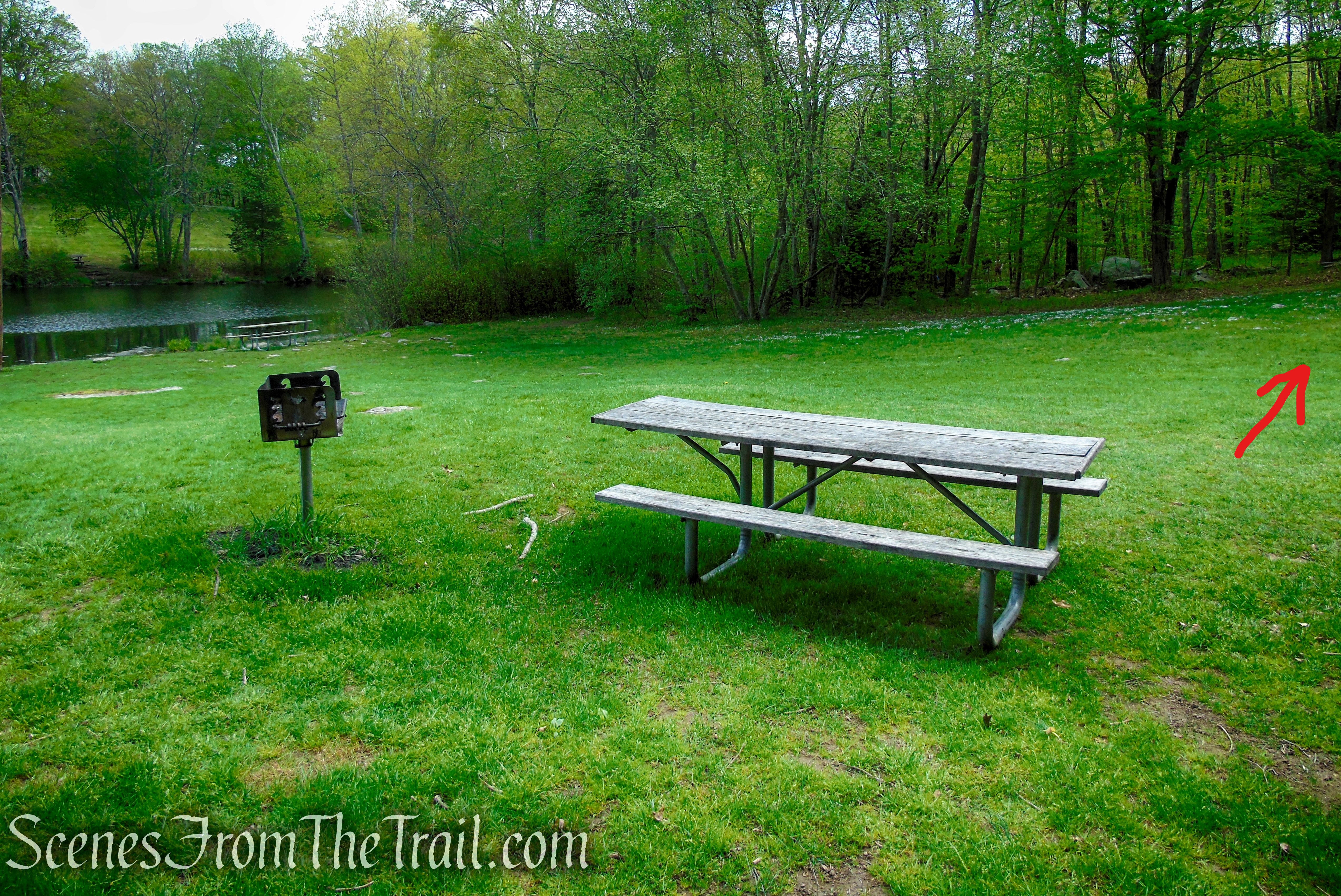
picnic table and grill near picnic pavilion
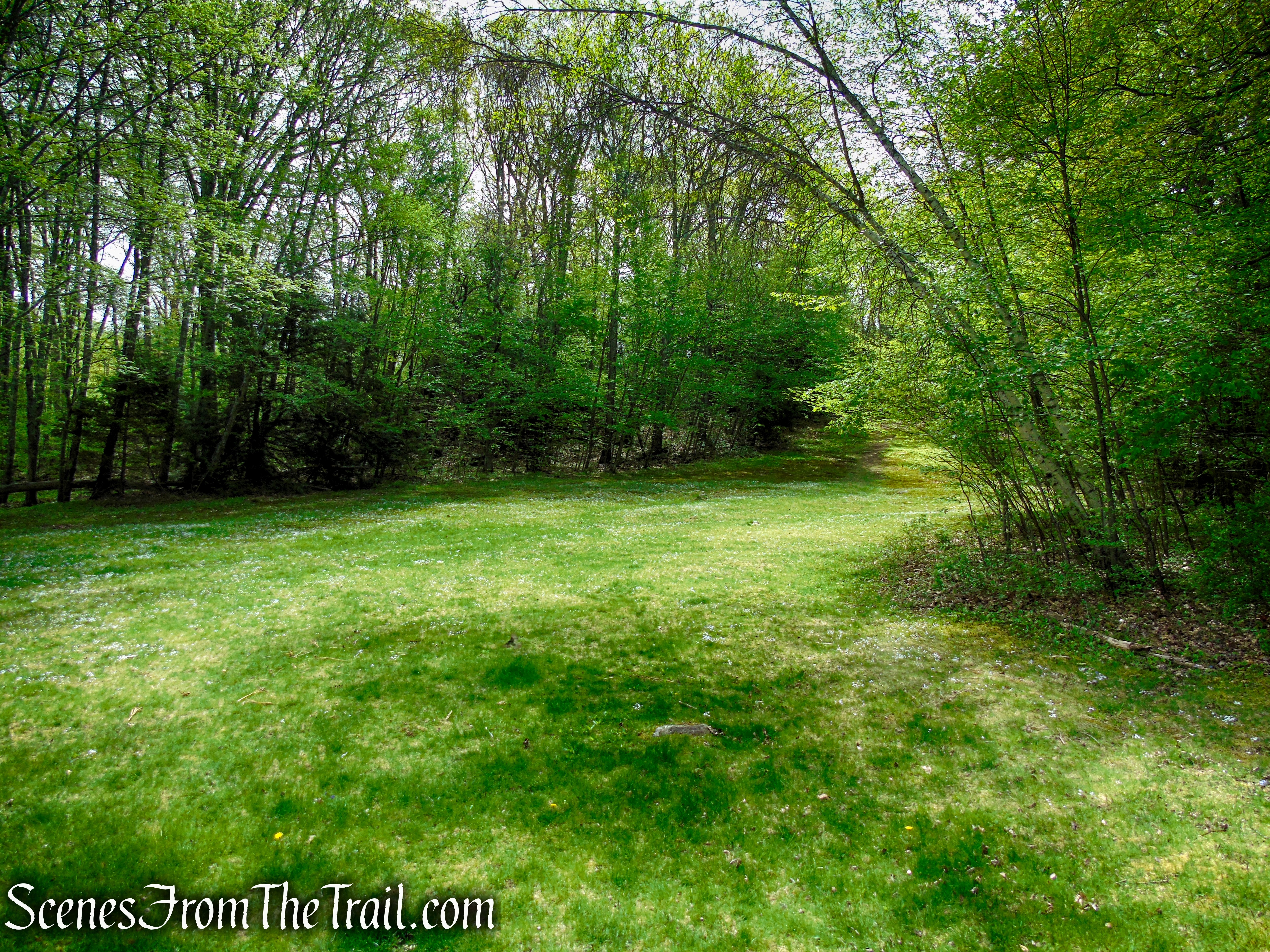
Red Trail – Southford Falls State Park
Red Trail – Southford Falls State Park
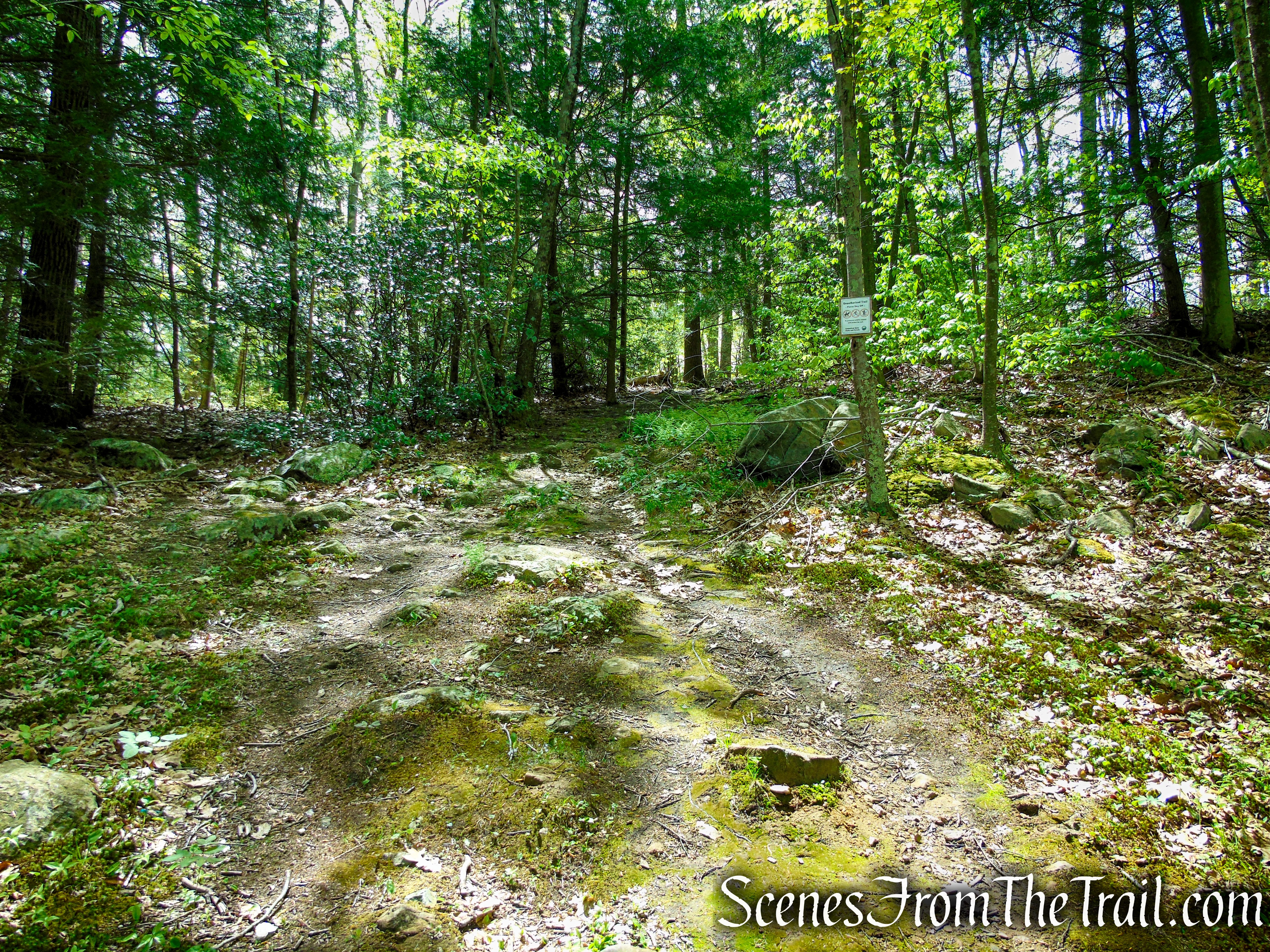
Seeing red, although faded blazes, I figured we were on the right track. After following the red blazes to several dead ends, I took out my phone and turned on the Avenza Maps app. We then took an unmarked trail (not on the trail map) downhill until we met up with the official Red Trail, and turned right.
Red Trail – Southford Falls State Park
Red Trail – Southford Falls State Park
Red Trail – Southford Falls State Park
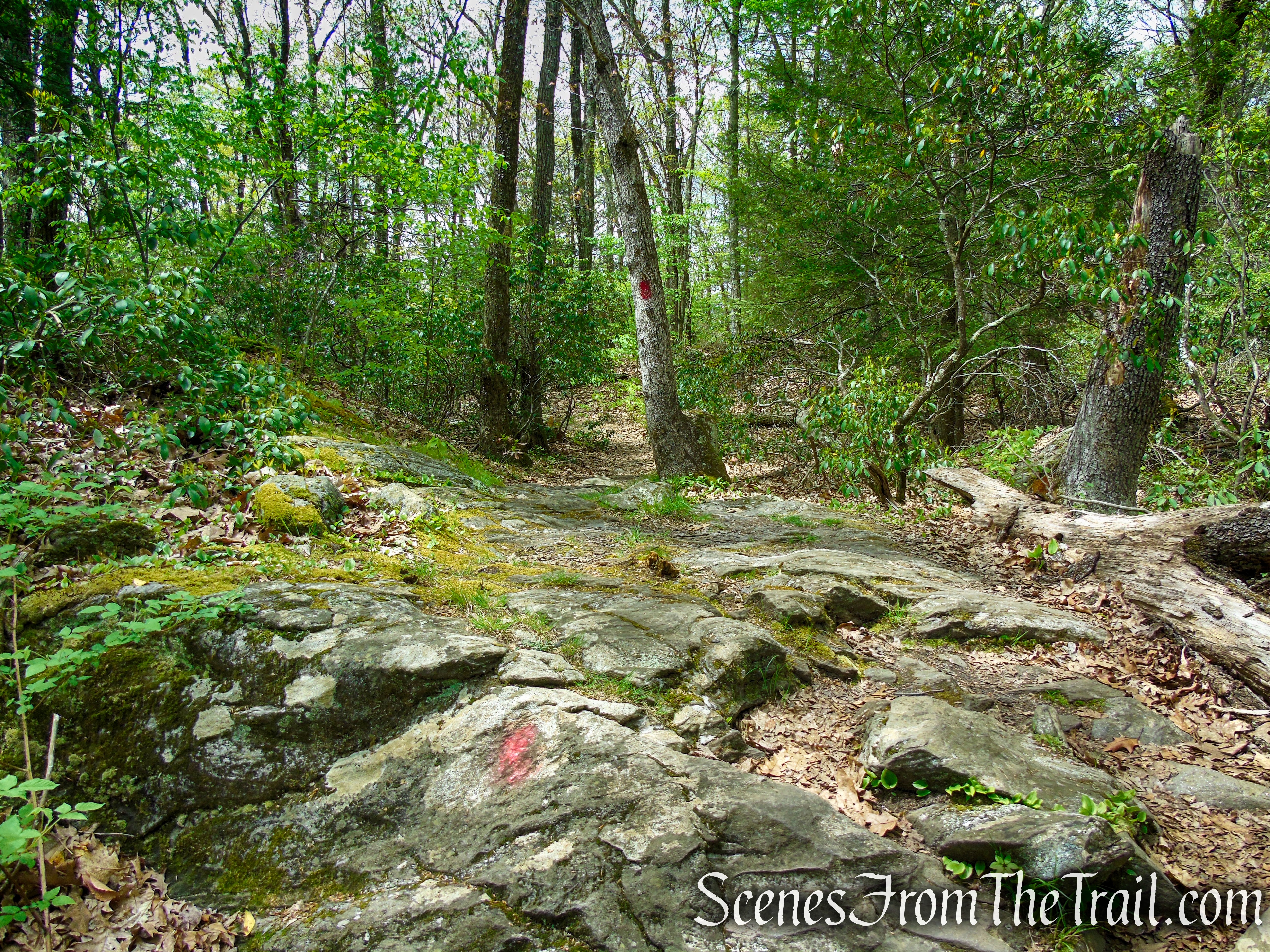
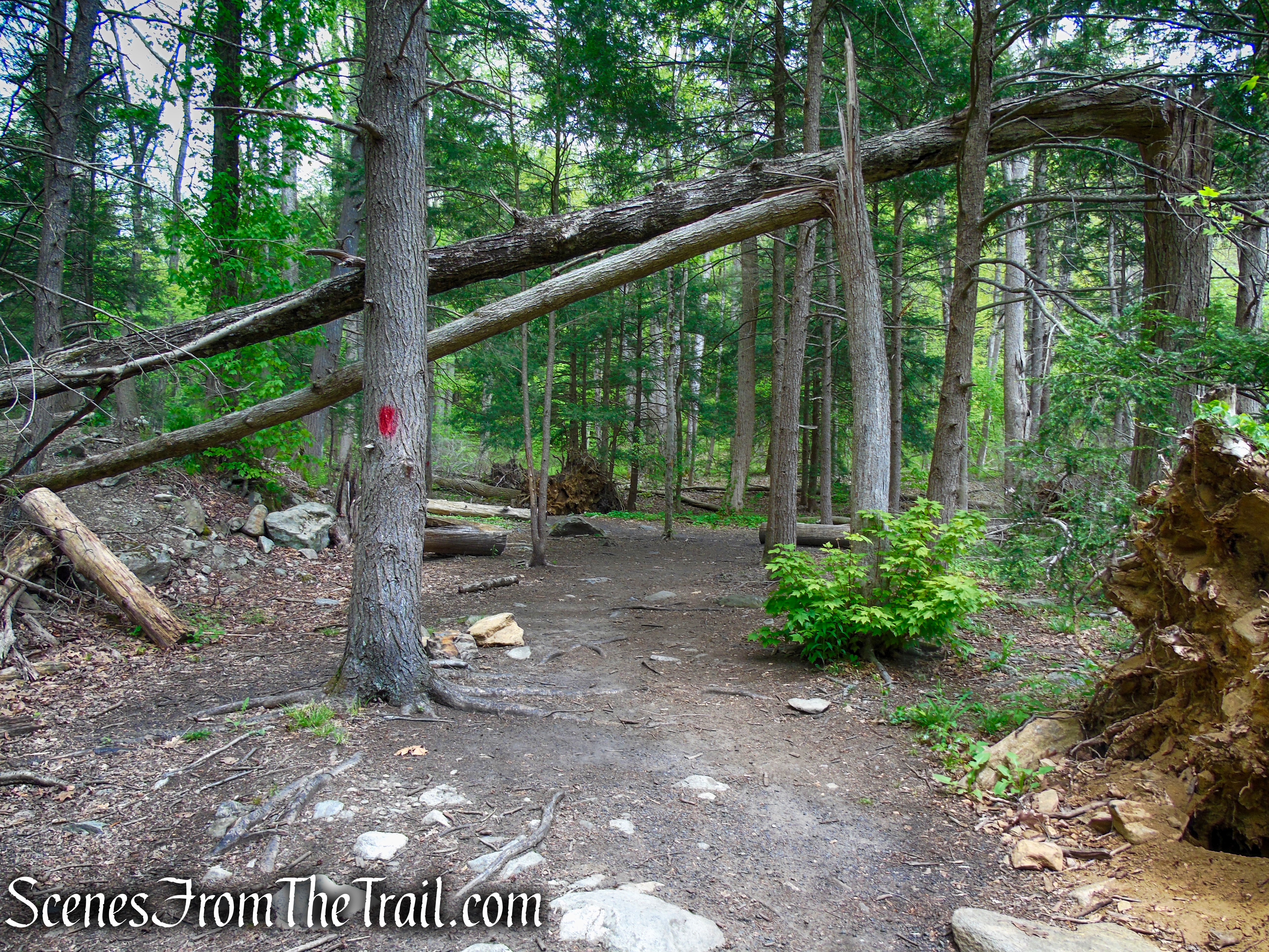
The trail then becomes easier to follow as the blazes are not as faded and are more abundant. The trail climbs steadily on a moderate grade with several dips in elevation.
Red Trail – Southford Falls State Park
Red Trail – Southford Falls State Park
Red Trail – Southford Falls State Park
Red Trail – Southford Falls State Park
Red Trail – Southford Falls State Park
As we approached this area, I could see this large burl through the leaves, and for a moment thought that it was a bear.
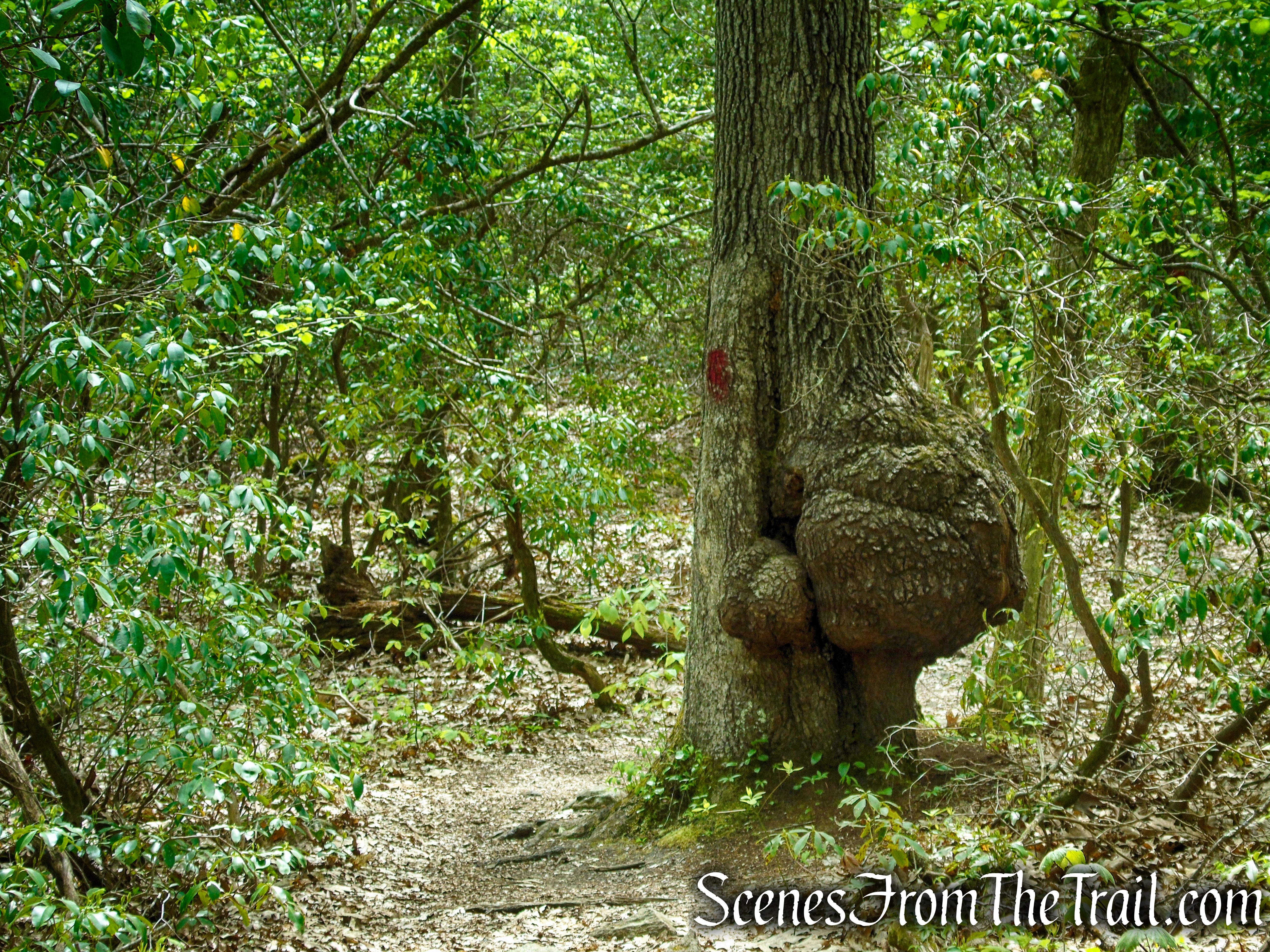
Red Trail – Southford Falls State Park
Red Trail – Southford Falls State Park
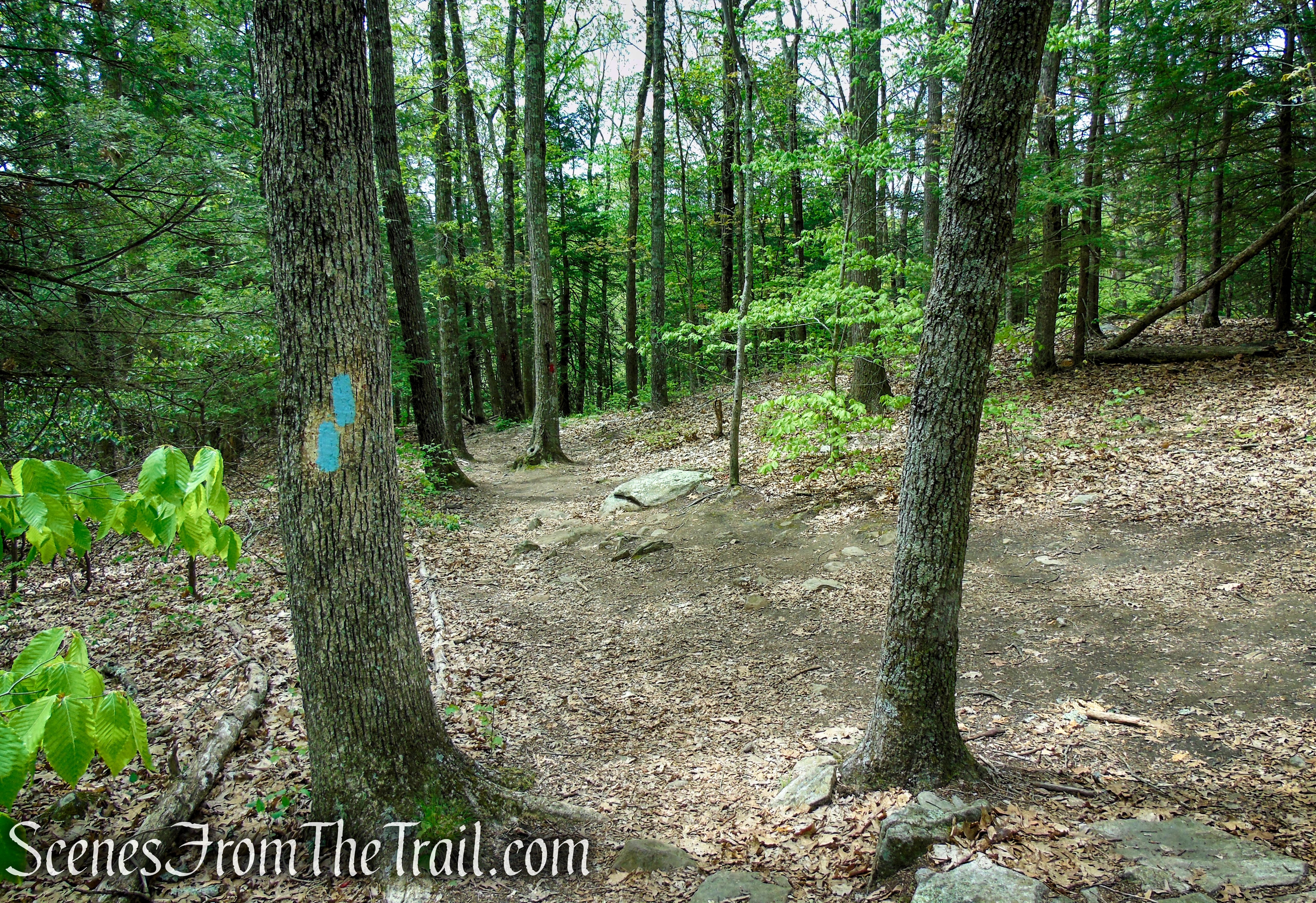
About 0.4 mile before the junction with the blue-blazed Tower Trail, the Red Trail splits. The left fork continues straight and the right fork climbs the hill. We took the right fork thinking that it was the Tower Trail (the trail map shows it as red), but after climbing, the trail descends and joins the official Red Trail again. Turn right at the correct Tower Trail which is now blazed blue.
Tower Trail – Southford Falls State Park
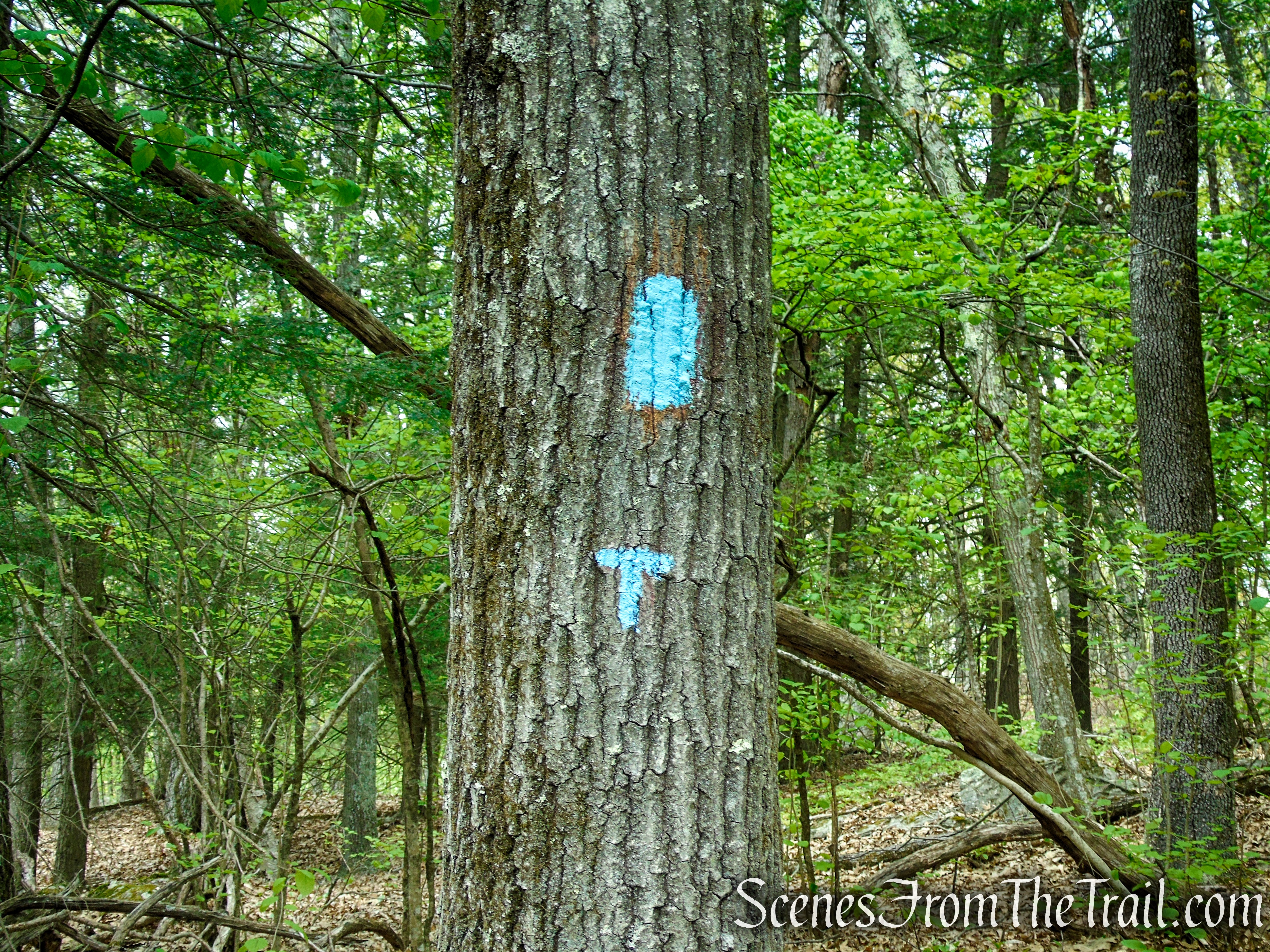
You may see a blue “T” along the way, signifying the “Tower Trail.”
Tower Trail – Southford Falls State Park
Follow the blue blazes for about 175 yards (0.1 mile), until its terminus near the base of the observation tower.
Tower Trail – Southford Falls State Park
The 25-foot metal and wood tower once provided nice views of the area, but the trees have since grown up around it and there isn’t much of a view anymore.
Observation Tower – Southford Falls State Park
The only semblance of a view is to the southwest.
view from tower – Southford Falls State Park
When you are done admiring the “view,” carefully climb down the tower and retrace your steps on the Tower Trail to the junction with the Red Trail.
Observation Tower – Southford Falls State Park
Tower Trail – Southford Falls State Park
terminus of Tower Trail – Southford Falls State Park
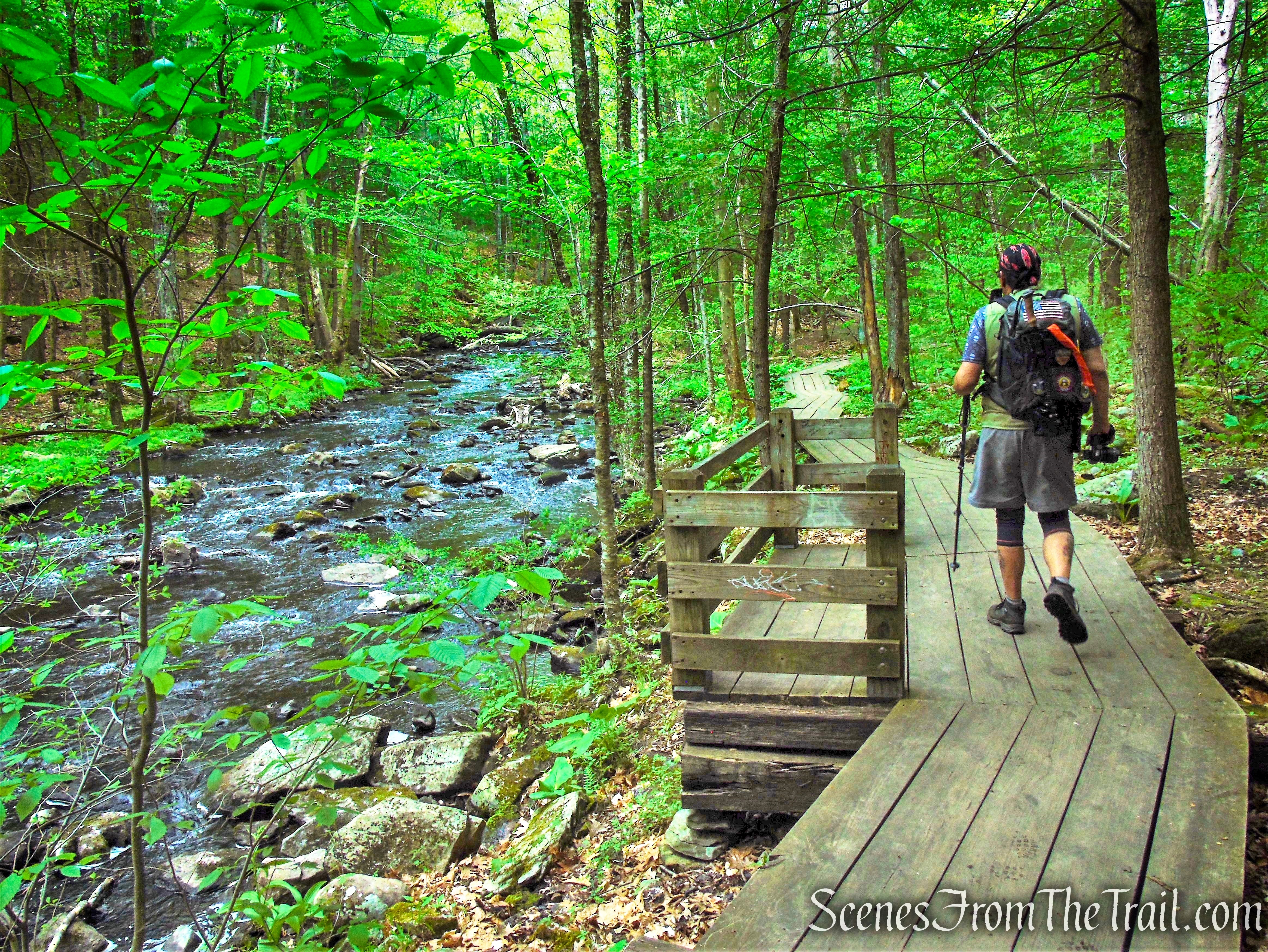
Turn right on the Red Trail as it begins a steady descent, reaching the boardwalk along Eightmile Brook in about 0.35 mile.
Red Trail – Southford Falls State Park
Red Trail – Southford Falls State Park
From here, the trail is relatively flat and quite scenic. The 212-foot long wooden boardwalk runs along the eastern bank of the picturesque Eightmile Brook.
boardwalk along Eightmile Brook
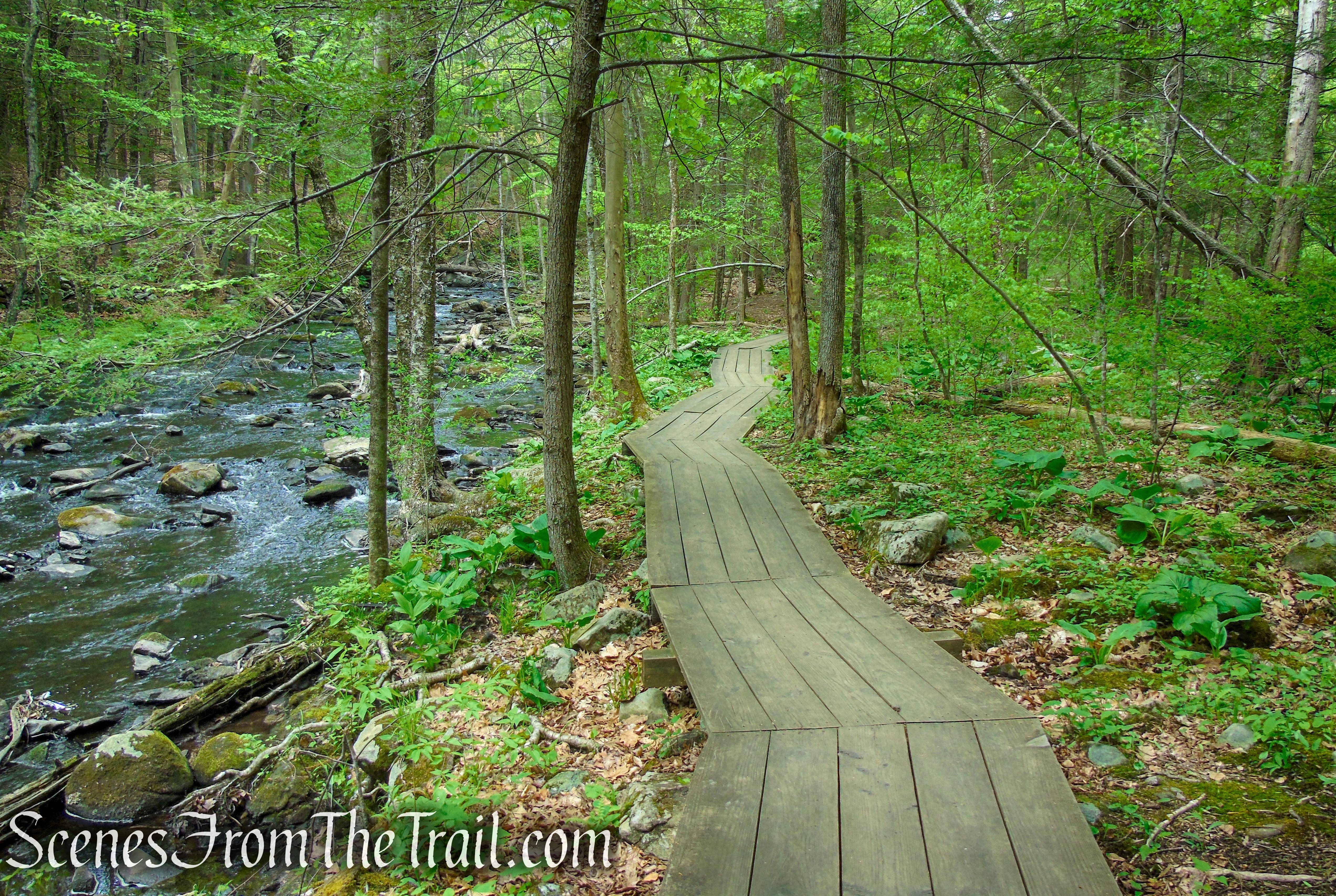
boardwalk along Eightmile Brook
Red Trail – Southford Falls State Park
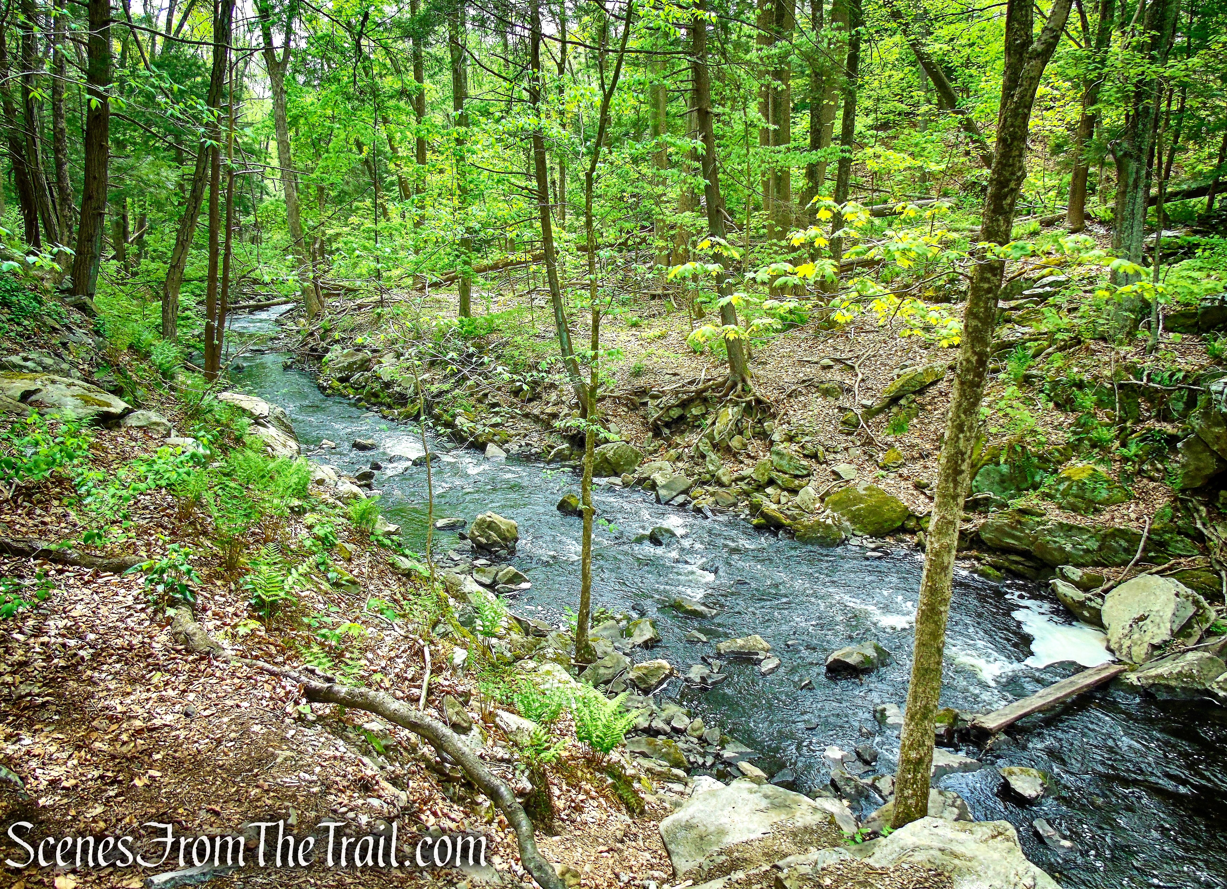
Eightmile Brook – Southford Falls State Park
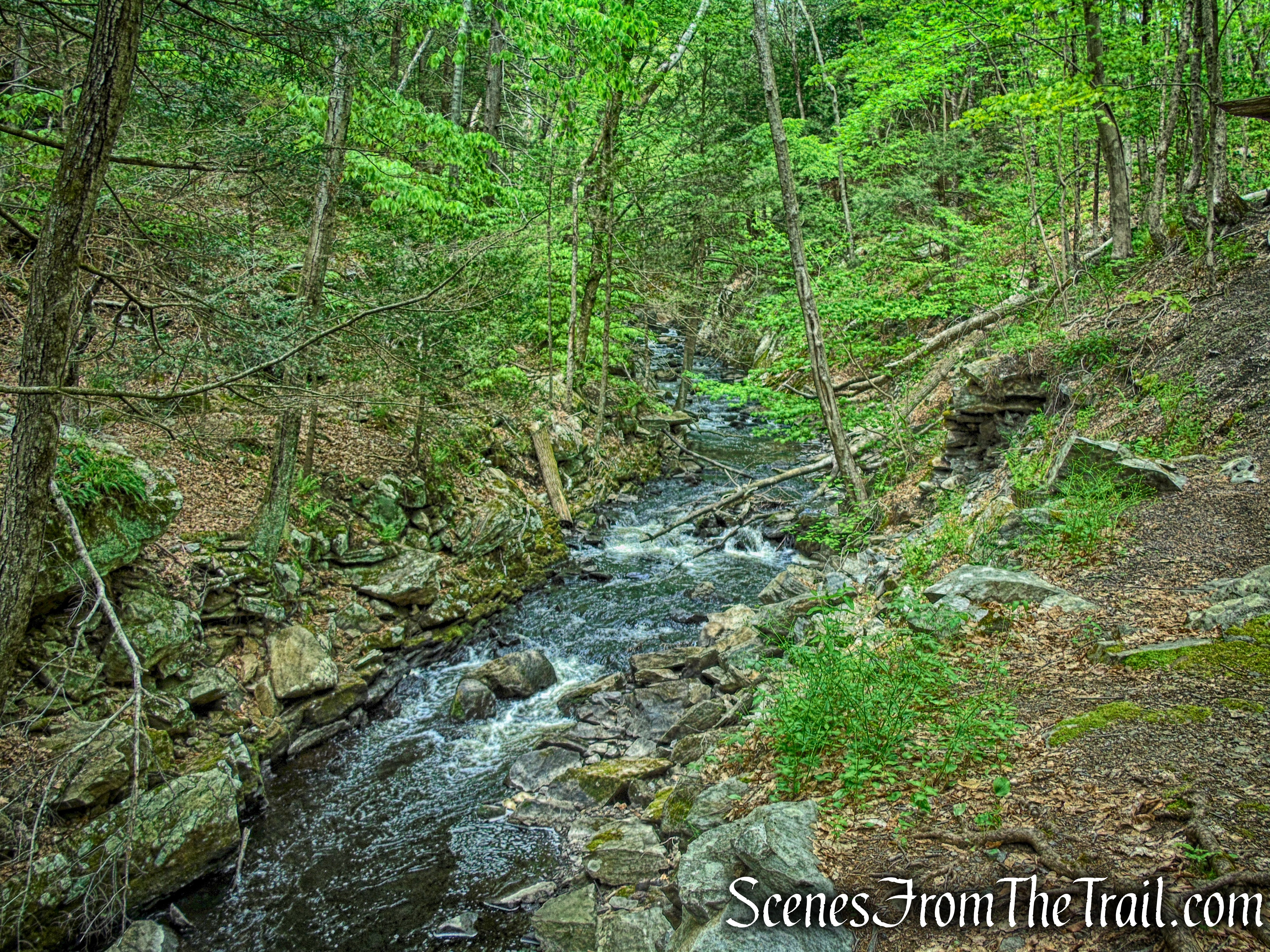
Eightmile Brook – Southford Falls State Park
The Red Trail then follows the gravel road for about another 270 yards before reaching the covered bridge.
Red Trail – Southford Falls State Park
Red Trail – Southford Falls State Park
Burr Arch Covered Bridge – Southford Falls State Park
Burr Arch Covered Bridge – Southford Falls State Park
Burr Arch Covered Bridge – Southford Falls State Park
After crossing the covered bridge, follow the trail uphill past Southford Falls and Papermill Pond, returning to the parking lot, where the hike began.
Red Trail – Southford Falls State Park
Southford Falls
Papermill Pond – Southford Falls State Park
Southford Falls State Park
Review:
A really nice park to visit anytime of the year. Obviously, if your main objective is to view the waterfall, then during the Spring thaw or after heavy rains is a more ideal time to visit. If your main goal is to hike or check out the view from the observation tower, there are much better places with better trails and views. But if you are looking for an all around enjoyable day outdoors with multiple points of interest, then Southford Falls State Park is definitely the place.
Pros:
Southford Falls, Burr Arch Covered Bridge, observation tower, boardwalk, Eightmile Brook.
Cons:
Trails are difficult to follow, needs an updated trail map.
Take a hike!
Southford Falls State Park
Sources:
- Southford Falls State Park
- History Abounds at Southford Falls
- Theodore Burr Covered Bridge Resource Center
- Diamond Match Co. once located here – Jan. 11, 2019

Thank you… very interesting.
LikeLike