May 8 & 14, 2022 – Bethlehem, Connecticut
Difficulty: Easy
Length: Approximately 1.3 miles
Max elevation: 637 ft. – total elevation gain approximately 241 ft.
Route type: Lollipop Loop
Maps: Nonnewaug Falls Trail Map
Trailhead parking: Falls Rd, Bethlehem, CT 06751
No toilets on site – No entrance or parking fees
Dirt and gravel parking lot for about 10-12 cars
Overview:
Nonnewaug Falls, sometimes called Leever Falls, is located in the Nonnewaug Falls Open Space Preserve. The falls itself are in the Town of Woodbury, but the trailhead parking is located in Bethlehem, Connecticut. The East Nonnewaug River bends through sections of farmland in the northeast corner of Woodbury, flowing through a shadowy hemlock forest, where it drops over bedrock into an idyllic, moss-filled gorge.
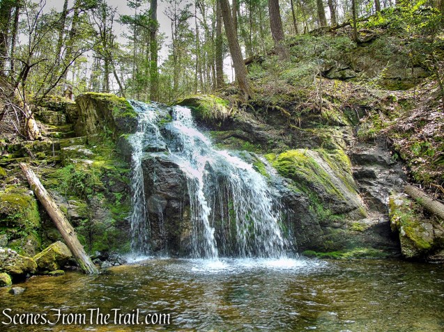
Nonnewaug Falls
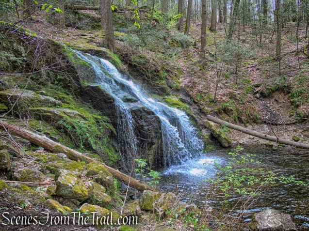
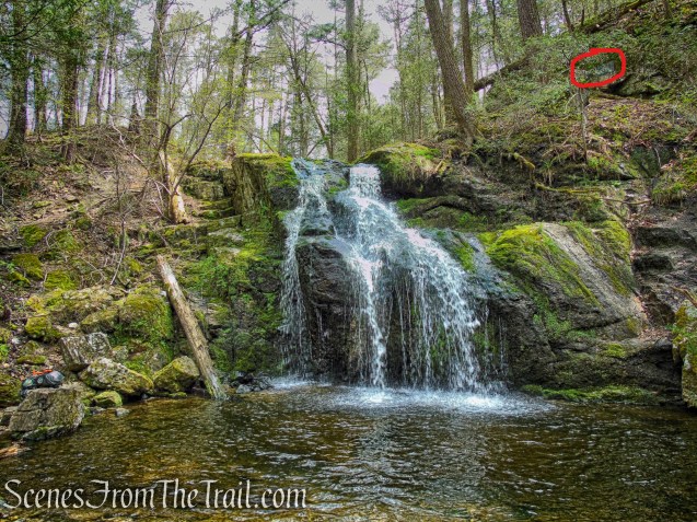
The main falls is 18-20 feet high, cascading dramatically into the mouth of the gorge. Two smaller cascades, close to one another, are located several hundred feet downstream where the ravine narrows considerably. The upper of the two lower cascades is 4 feet high, followed by a 6 foot cascade. However, views of these lower cascades are currently extremely limited.
Please Note: Swimming is strictly prohibited here. Exploration of the falls is limited to the side of the river you arrived at as the other side is private property. Although water is likely to flow over the falls year round, high water showcases them best.
History:
Nonnewaug Falls was formed by glacial melt streaming over bedrock, carving a path into the landscape during the Last Glacial Period (LGP aka last ice age). So named for Chief Nonnewaug, the final leader of the territory’s long-vanished aboriginal inhabitants, Nonnewaug Falls has been a familiar and locally-celebrated landmark for nearly two centuries. Woodcuts published in the 1800’s portray Nonnewaug Falls with much the same rugged and secluded character that it possesses today.
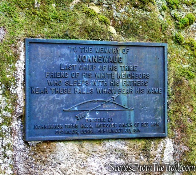
On the opposite bank near the top of the falls, is a bronze tablet mounted on the face of a rock outcrop. It was placed there in 1916 by members of the Nonnewaug tribe of Seymour to memorialize the chief. It reads: “To the memory of Nonnewaug last chief of his tribe, friend of his white neighbors, who sleeps with his fathers near these falls which bear his name.” Nonnewaug is Mohican for “dry land.”
Nonnewaug Falls
The legend is that the old Sachem Nonnewaug, distraught at the sale of his ancestral lands to the English by the young men of the tribe, jumped off the rocks at the top of the falls, was killed, and buried at the scene.
In 2002, Dr. Harold Leever (1914–2001) willed 50 acres of land at the falls to the Town of Woodbury and 12 acres of land to the Bethlehem Land Trust to ensure the waterfall’s preservation for perpetuity.
Trails Overview:
The trail map is not very helpful, but I used the Gaia GPS app with the “Outdoors” map layer. It shows the trails and will lead you in the right direction.
Nonnewaug Falls is reached by a fairly easy and pleasant walk on wide woods roads, through the forest and past open fields. There are several ways to get to the falls, but none are clearly marked.
One guide book reads: “There is a kiosk at the parking area that will show you a trail map. In addition, red posts have been put in place along the route to help guide you to the falls on the proper trails.” Neither is accurate. There is no longer a kiosk at the trailhead, at least I did not see one, and I looked for it. As for the red posts, I saw two and a couple of red blazes on trees, but nothing that will clearly lead you to Nonnewaug Falls.
Hike Overview:
Having done a short hike at Orenaug Park, we decided to check out Nonnewaug Falls as well. It is a short 12 minute drive (6.7 miles) from Orenaug Park to the Nonnewaug Falls trailhead. These two short hikes are ideal to be done in conjunction with one another.
We visited Nonnewaug Falls twice, just a week apart. The first time I couldn’t find the bronze plaque, but I didn’t really look for it. The second time, I was able to locate it. We took a different route each time. On the first visit, we took a steeper route which was a loop. The second time we did an out-and-back, a much easier route. Both routes were about the same distance. The only difference was the loop had about 100 more feet of elevation gain.

Nonnewaug Falls Loop
If you are looking for just an easy stroll to see the waterfall, then the route below is the one for you.

Nonnewaug Falls out-and-back
The Hike:
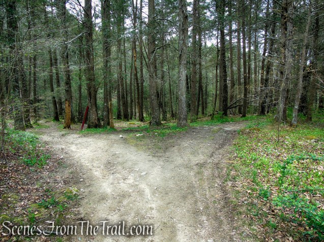
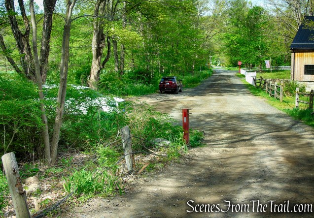
The hike begins at the parking area at the end of Falls Road. From the parking area, proceed past the metal gate and follow the unpaved road east, crossing a bridge that spans the Nonnewaug River. In about 500 feet, the unpaved road comes to a fork. Take the left fork and follow the rocky road steeply uphill.

Nonnewaug Falls Open Space Preserve

Nonnewaug Falls Open Space Preserve

Nonnewaug Falls Open Space Preserve
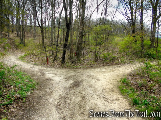
bear left at the fork for the loop

Nonnewaug Falls Open Space Preserve
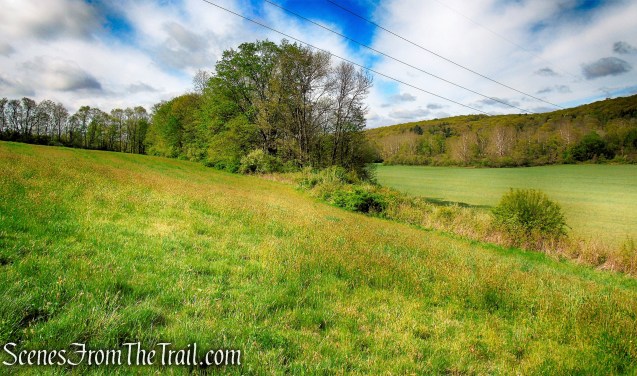
At the top of the rise as the old road approaches the powerlines, bear right at another fork and follow the road as it heads into the woods. In about another 400 yards (from the powerlines), the road reaches a T-intersection with another woods road. Turn left on the woods road, passing two massive old Oak trees.

Nonnewaug Falls Open Space Preserve

Nonnewaug Falls Open Space Preserve
Nonnewaug Falls Open Space Preserve
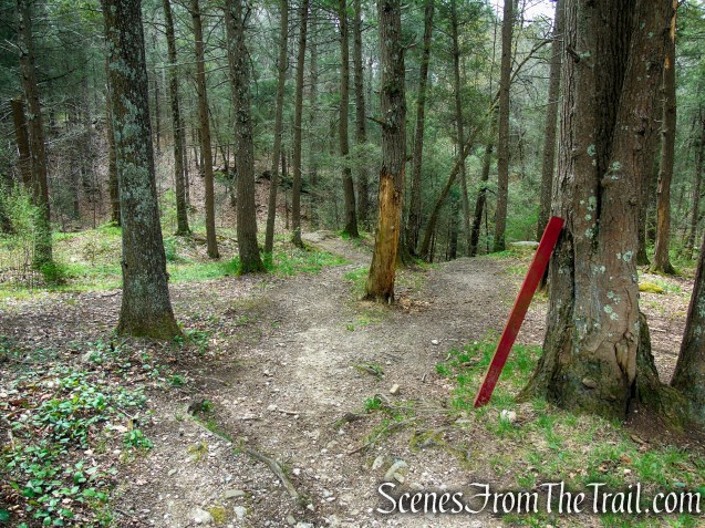
In a short distance, the road reaches an open field. Turn right, crossing the field and enter the forest once again. The woods road splits once it ducks into the forest. Take the left fork (there is a red post at this junction) and continue downhill to the site of the falls.
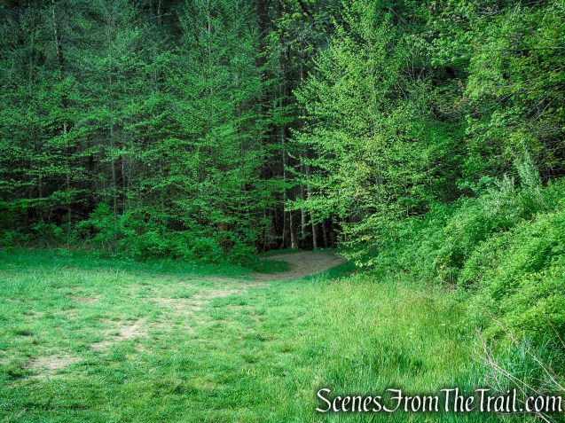
Nonnewaug Falls Open Space Preserve
Nonnewaug Falls Open Space Preserve
Nonnewaug Falls Open Space Preserve
The best view of Nonnewaug Falls is from the base of it. This entails descending a steep slope where the soil is wet and the ground may be unstable. Hiking poles work really well here.

Nonnewaug Falls Open Space Preserve
Nonnewaug Falls

Nonnewaug Falls
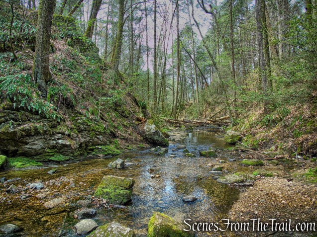
Looking downstream from the base of the falls.
Nonnewaug Falls
William Cothren wrote in his “History of Ancient Woodbury,” published in 1854: “Viewed as a whole, it is as wild and romantic a place as can anywhere be found in our country.”
Nonnewaug Falls
The red circle denotes where the bronze plaque is located.
Nonnewaug Falls
Nonnewaug Falls
Climbing out of the gorge is easier than going down.

Nonnewaug Falls
Looking upstream from near the top of the falls.
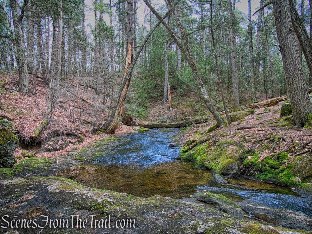
East Nonnewaug River
When you have had your fill of nature’s beauty, retrace your steps past the old Oak trees then continue straight on the woods road, passing the junction that you came from earlier.

Nonnewaug Falls Open Space Preserve

Nonnewaug Falls Open Space Preserve
When you arrive at a Y-intersection, take the left fork as it runs along the top of the field, close to the tree line with broad views over the surrounding countryside. Soon the trail ducks back into the woods, passing the junction from earlier in the hike. Bear left and follow the woods road back to the parking area, where the hike began.

Nonnewaug Falls Open Space Preserve

Nonnewaug Falls Open Space Preserve

Nonnewaug Falls Open Space Preserve

Nonnewaug Falls Open Space Preserve
Nonnewaug Falls Open Space Preserve

Nonnewaug Falls Open Space Preserve

Nonnewaug Falls Open Space Preserve
Nonnewaug Falls Open Space Preserve
Review:
A really pleasant hike with the payoff being the gorgeous waterfall. On both occasions that we visited this spot, we’ve seen few people, mostly when we were on our way out. We were there about 11am the first time and 8:30am the second time. Since this is a short hike, it could be combined with another hike in the area.
Pros:
Gorgeous waterfall, scenic landscape, historical features, somewhat of a hidden gem.
Cons:
No signage or trail blazes.
Take a hike!

Nonnewaug Falls
Sources:
- History of Woodbury
- Nonnewaug Falls – New England Waterfalls
- History of Ancient Woodbury, Connecticut – PDF
- Nonnewaug Falls Open Space Preserve Blog
