May 1, 2021 – Blairstown, New Jersey
Difficulty: Moderate to Strenuous
Length: Approximately 6.2 miles
Max elevation: 1,580 ft.– total elevation gain approximately 805 ft.
Route type: Out and back
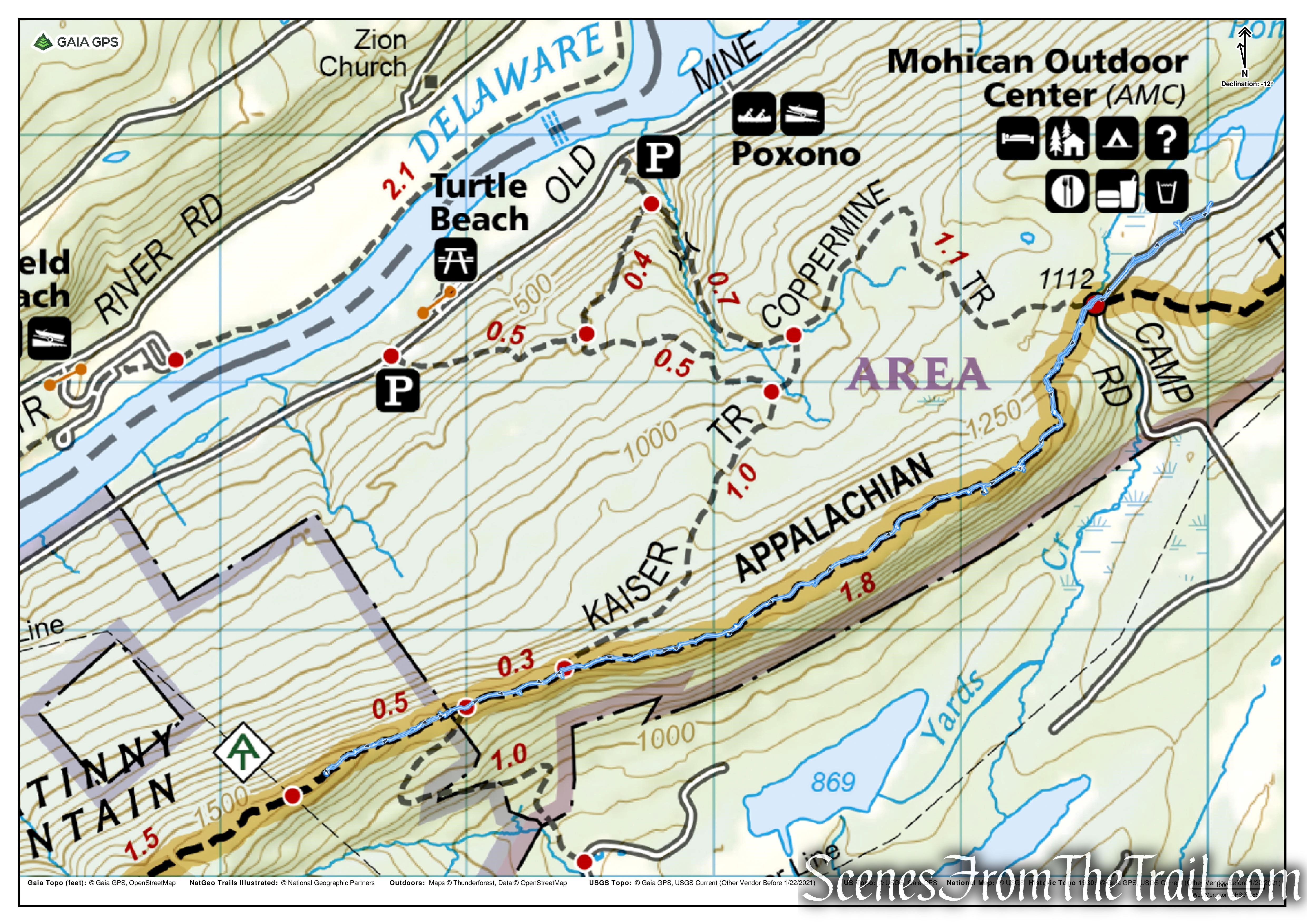
Buy Map: *New 2021* Delaware Water Gap & Kittatinny Trails Map
Avenza App Map: Delaware Water Gap & Kittatinny Combined
Trailhead parking: 50 Camp Mohican Rd, Blairstown, NJ 07825
Restrooms open to hikers at the Lodge/Visitor Center
Overview:
Raccoon Ridge, officially named Mount Mohican, is a peak of the Kittatinny Mountains in Warren County, New Jersey. The mountain stands 1,580 feet above sea level. It lies along the Appalachian Trail in Worthington State Forest. On some maps and guidebooks it is called Raccoon Ridge because of the many bumps before and after the summit. Mt. Mohican is situated between Mt. Tammany and Catfish Mountain. It offers great views to the East, West, and North, with limited views to the South.

Raccoon Ridge
Raccoon Ridge is the premier spot to observe the migrating hawks that pass through northern NJ on their way south. Hawk counting started on this ridge way back in 1935. Raccoon Ridge averages about 15,000 hawks per entire year, which runs from the end of August until early December. Raptors as well as other birds use the thermals and updrafts on these mountain ridges and coastline on their southern migration to conserve energy. Early to mid October is the best time to observe the most species of migrating raptors ranging from the smallest Falcon, the Kestrel, to the largest raptor, the Golden Eagle. About 14 different species of raptors are usually observed during a season.
Trail Overview:
The Appalachian National Scenic Trail (AT) extends along the spine of the Appalachian Mountains from Springer Mountain, Georgia to Mt. Katahdin in Baxter State Park, Maine. Of the 2,174 miles of trail, 28 miles are within the Delaware Water Gap National Recreation Area.

Appalachian Trail – Delaware Water Gap
The Appalachian Trail enters the Delaware Water Gap at Totts Gap, crosses the Delaware River on the Route 80 Bridge, goes to Sunfish Pond and continues northeast to Stokes State Forest. The trail crosses Route 206 and continues along the ridgeline of the Kittatinny Mountains to High Point State Park and eventually goes into New York State.
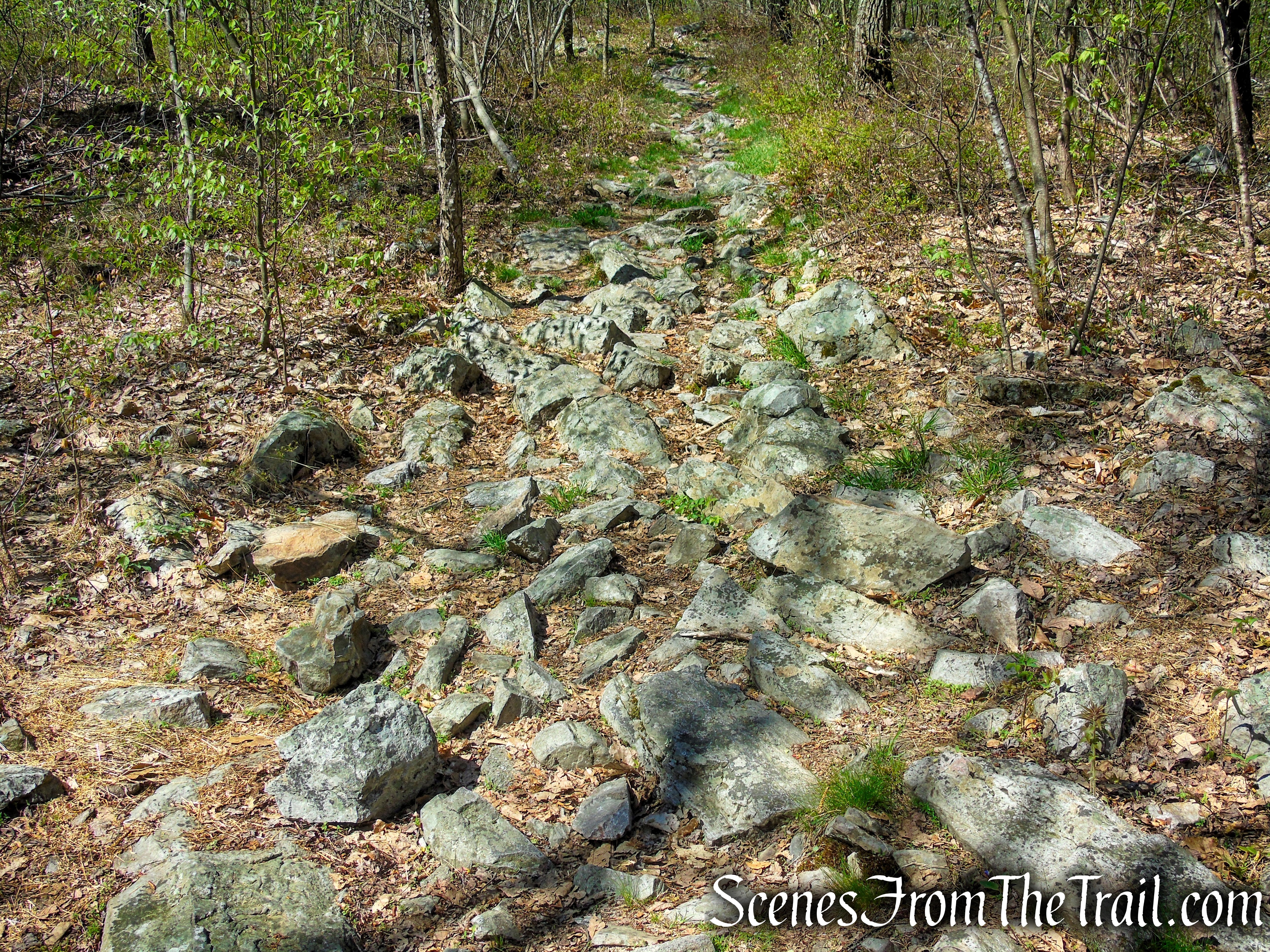
The section featured on this hike is extremely rocky. The trail is covered with both sharp-pointed and round rocks, making it at times an ankle breaker type trail. The white blazes are faded and hard to see at times during the early part of this hike, but the trail is well defined and easy to follow.
Appalachian Trail – Mount Mohican
Hike Overview:
This is a straightforward out and back hike on a section of the historic Appalachian Trail south from the Mohican Outdoor Center in the Delaware Water Gap. Enjoy great ridge views in both directions along the AT. There are plenty of places to stop for lunch or a short break, including the summit of Mount Mohican, which is marked with a large rock cairn.
Although this hike travels mostly through a section of the 70,000-acre Delaware Water Gap National Recreation Area, Raccoon Ridge itself lies within the 6,660-acre Worthington State Forest. The hike begins and ends at the AMC Mohican Outdoor Center, which allows free parking in their sizable lot and public restrooms. The parking lot is located just past the lodge. They do request that you check in at the lodge/visitor center and register your vehicle info. Parking at the Mohican Outdoor Center adds about 0.6 mile to the hike.

AMC Mohican Outdoor Center – Delaware Water Gap
There are restrooms and showers in the Lodge that are open to hikers.

AMC Mohican Outdoor Center – Delaware Water Gap
Along with lodging, maps, books, gifts and hiking gear, they have a deli on site and ice cream. Hikers are always welcome and their staff is friendly as well as helpful. This is a great place to begin and end a hike.

AMC Mohican Outdoor Center – Delaware Water Gap
There is roadside parking where the Appalachian Trail crosses Camp Mohican Road. The road is narrow so we decided to park a little farther up in the parking lot.

Camp Mohican Road – Delaware Water Gap
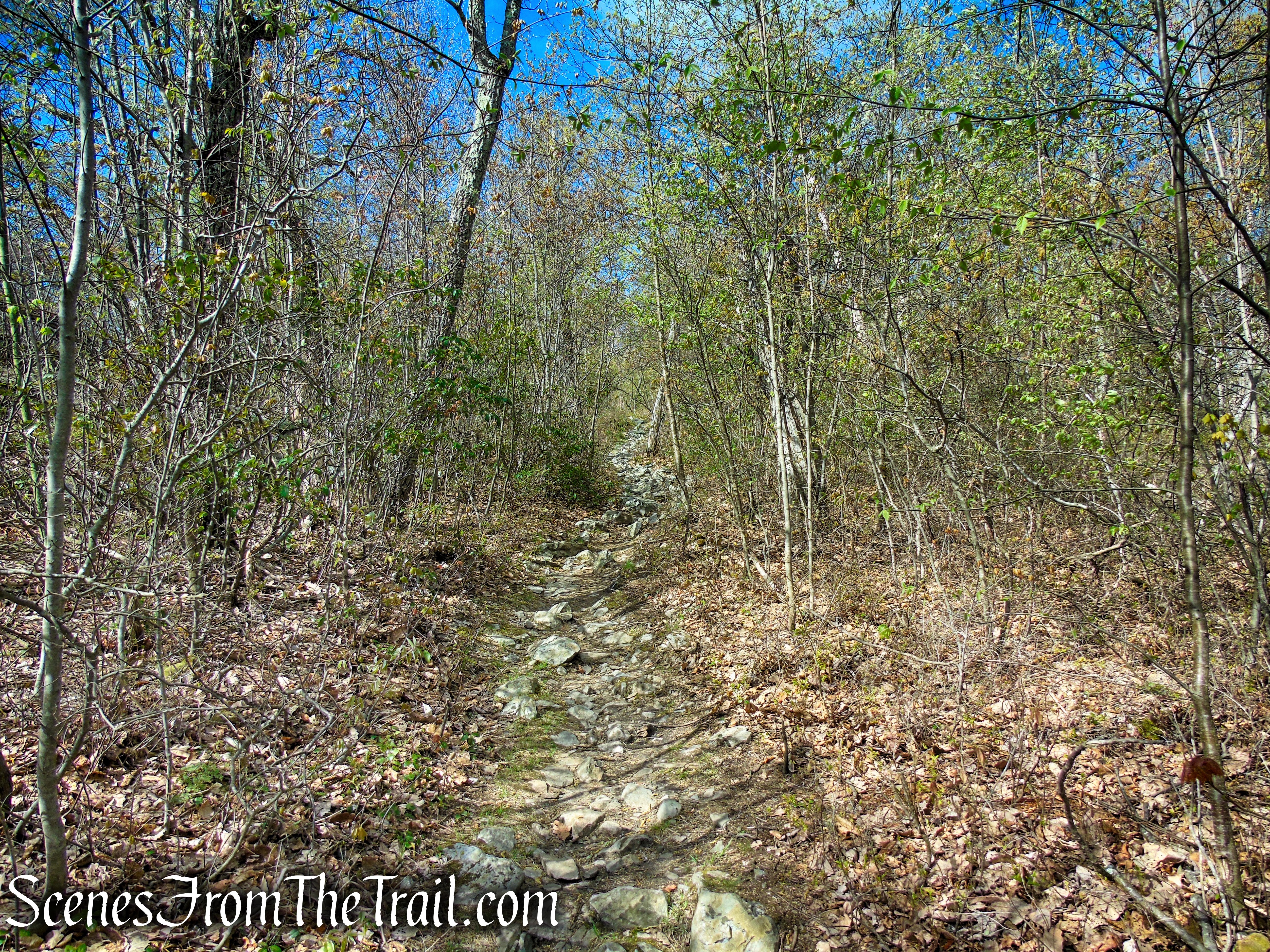
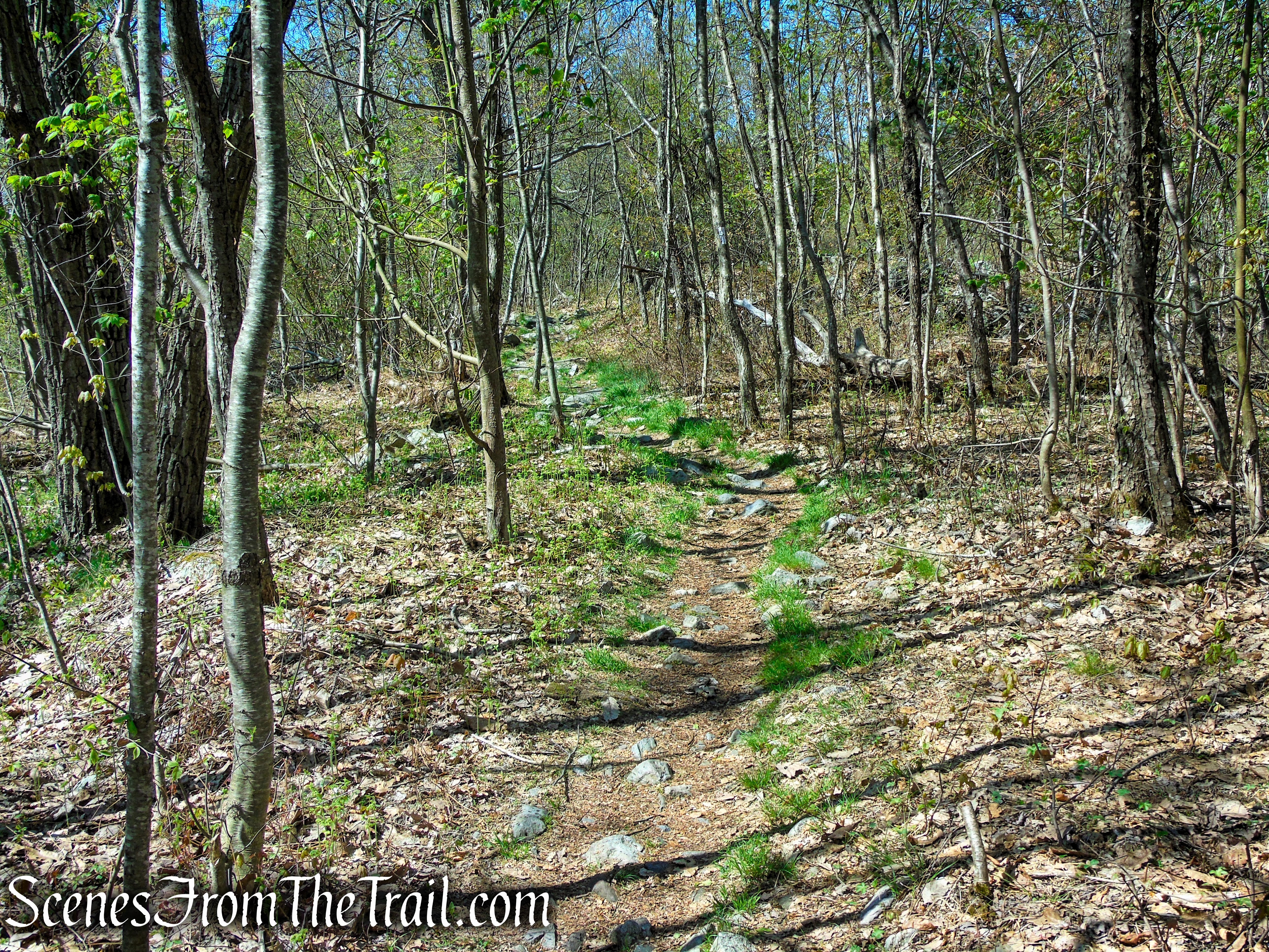
This out and back hike follows the white-blazed Appalachian Trail for its entirety. Along some sections of the trail, the painted blazes are faded or nonexistent, but the trail is well trodden and easy to follow. The trail is extremely rocky from start to finish, a sort of ankle breaker type trail. Smaller size rocks which protrude through the ground, which requires hikers to almost continually look down to keep from tripping and falling. A quality pair of hiking boots with good ankle protection is strongly recommended for this hike.
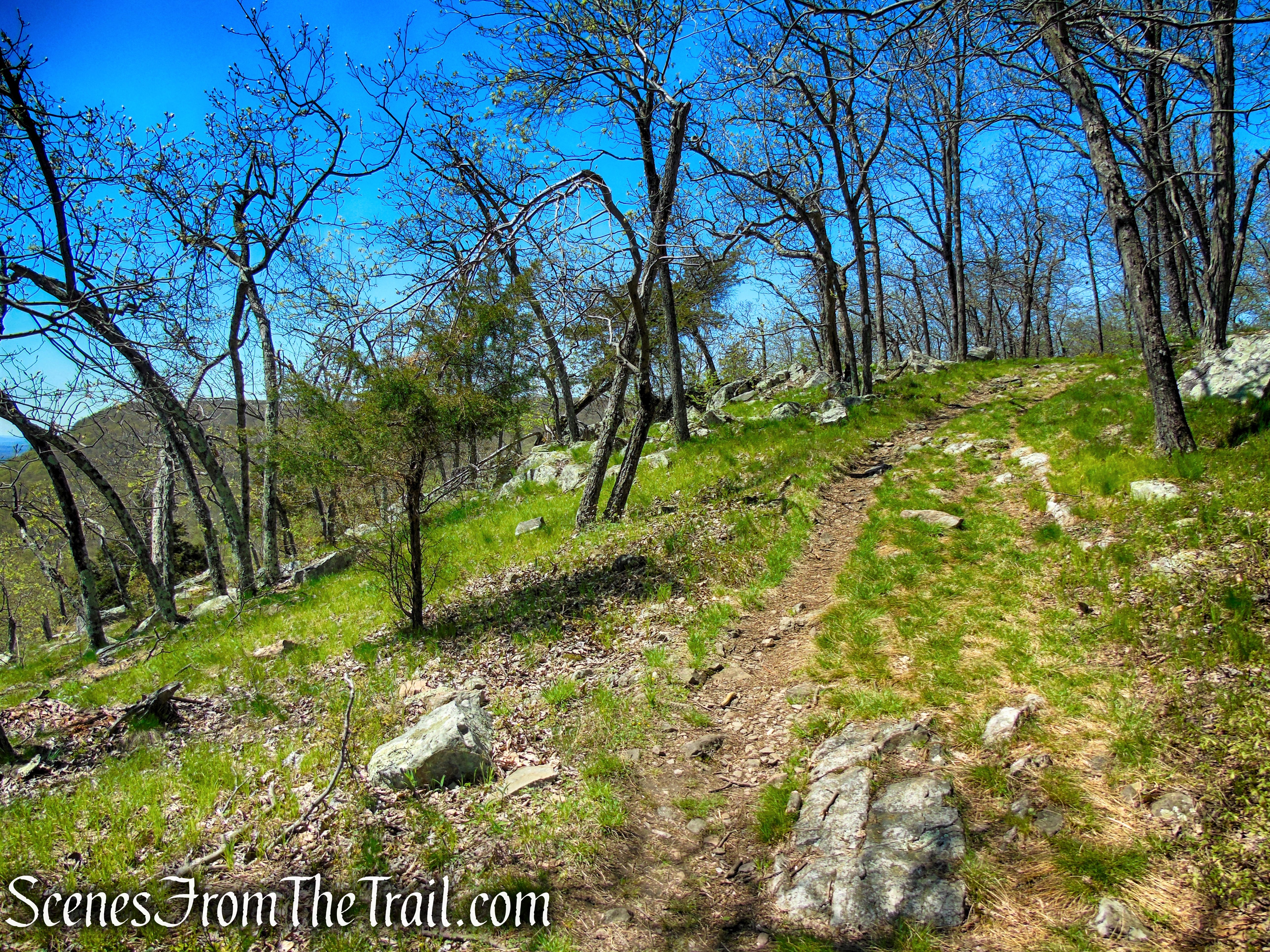
Raccoon Ridge from Mohican Outdoor Center
The ascent to the ridge is the steepest part of the hike, but the numerous ups and downs on the way to Raccoon Ridge can wear you down. Remember that you will be coming back the same way.
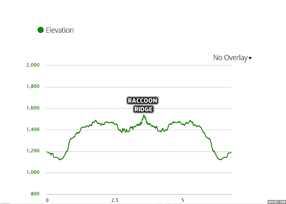
elevation profile – Raccoon Ridge
Rocky trail notwithstanding, this hike offers some of the best views around. There are plenty of spots to stop and relax along the way while enjoying the numerous viewpoints. It is also not as highly trafficked as some of the other trails nearby.

Delaware River from Raccoon Ridge
The Hike:
From the parking area, turn right onto Camp Mohican Road and head downhill for about 0.3 mile. Don’t forget to stop at the lodge/visitor center to check in. Continue down the hill to where the Appalachian Trail crosses the road.

Camp Mohican Road – Delaware Water Gap
Camp Mohican Road – Delaware Water Gap
Turn right onto the white-blazed Appalachian Trail and cross the wooden footbridge that spans Yards Creek.
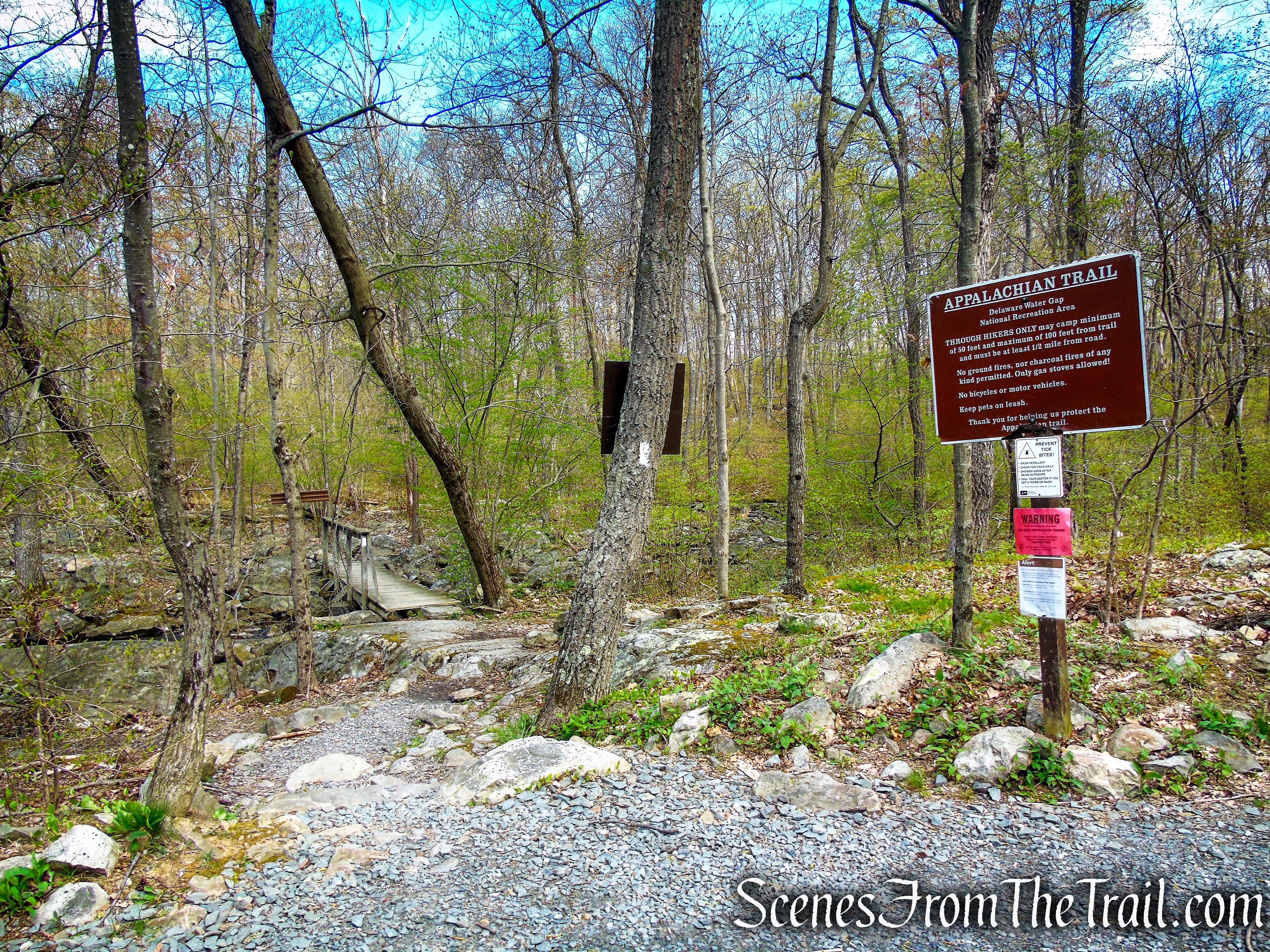
Appalachian Trail – Delaware Water Gap
Appalachian Trail – Delaware Water Gap
Appalachian Trail – Delaware Water Gap
In a short distance, the Coppermines Trail begins on the right, but you should veer left at this junction, and climb steadily along the AT, steeply in places, up to the ridge of the Kittatinny Mountains.

Appalachian Trail – Delaware Water Gap

Appalachian Trail – Delaware Water Gap

Appalachian Trail – Delaware Water Gap
Appalachian Trail – Delaware Water Gap
Appalachian Trail – Delaware Water Gap
Appalachian Trail – Delaware Water Gap
Appalachian Trail – Delaware Water Gap
In about half a mile, you’ll reach a limited east-facing viewpoint to the left of the trail at a camp site. This makes a good spot to take a break from the steep climb.

1st viewpoint – Mount Mohican
Looking east across the Kittatinny Valley.
view east – 1st viewpoint
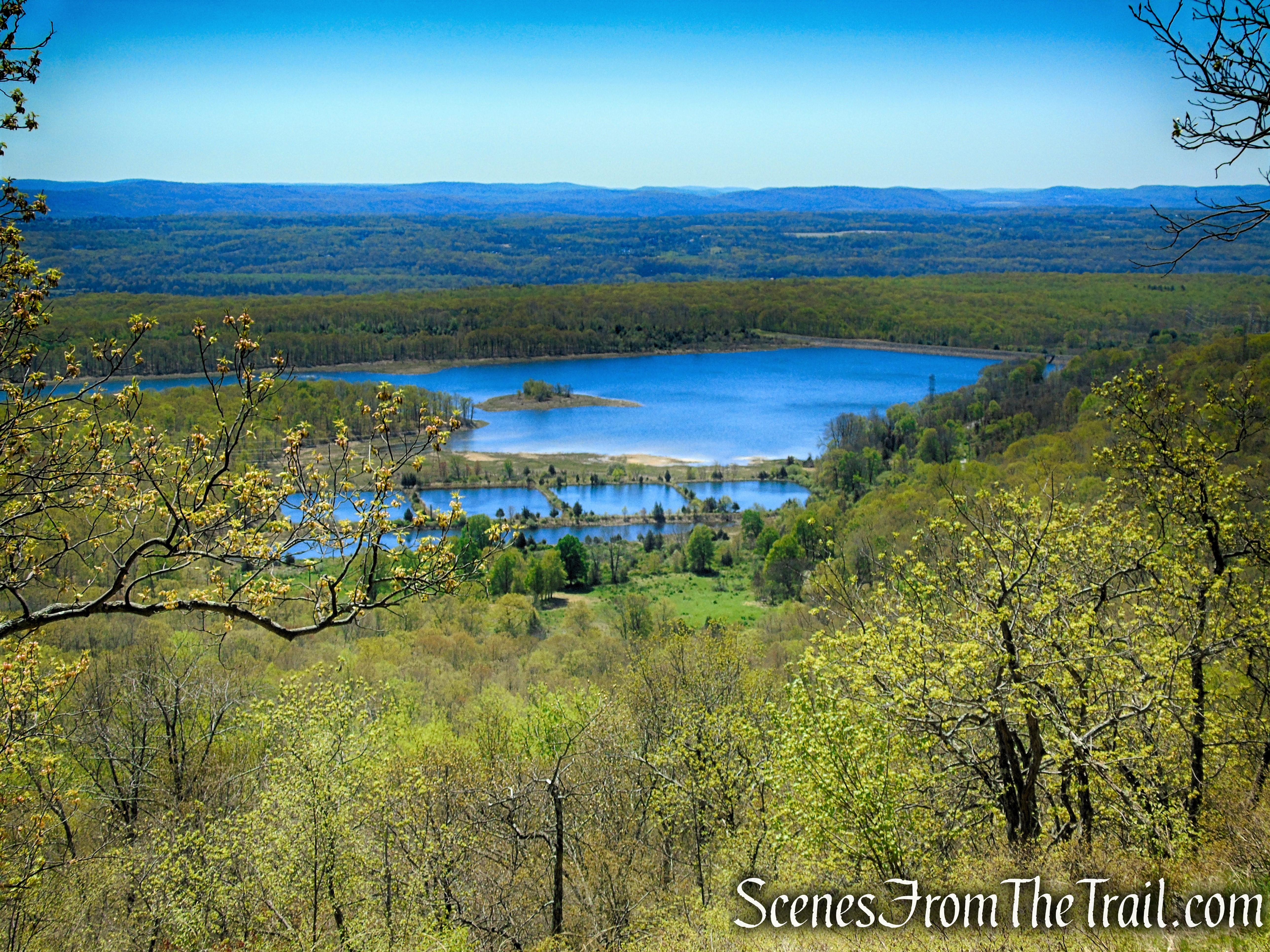
Looking southwest towards the Lower Yards Creek Reservoir.

view southwest – 1st viewpoint
To the left, Catfish Mountain protrudes above the trees.

view northeast – 1st viewpoint
The A.T. now ascends more gradually, then levels off. In another mile, you’ll come to a series of open grassy areas, with panoramic east-facing views. Lower Yards Creek Reservoir is visible directly below, and the northern end of Mt. Tammany may be seen to the south. The A.T. continues south along the ridge, with more views to the left of the trail.

Appalachian Trail – Mount Mohican
Appalachian Trail – Mount Mohican

Appalachian Trail – Mount Mohican

Appalachian Trail – Mount Mohican

Appalachian Trail – Mount Mohican

Appalachian Trail – Mount Mohican

Appalachian Trail – Mount Mohican

Appalachian Trail – Mount Mohican
In another half a mile, the AT descends briefly, then levels off. Here, the blue-on-white-blazed Kaiser Trail joins from the right (the junction is marked with a sign). Continue ahead on the AT. When the Kaiser Trail (also designated as Kaiser Road) leaves to the left in a third of a mile, you should continue to follow the AT, which climbs briefly, descends a little, then begins a steady climb.

Continue past the junction with the Kaiser Trail
Lower Yards Creek Reservoir.
Appalachian Trail – Mount Mohican
Appalachian Trail – Mount Mohican

Appalachian Trail – Mount Mohican

Appalachian Trail – Mount Mohican

Appalachian Trail – Mount Mohican

Appalachian Trail – Mount Mohican
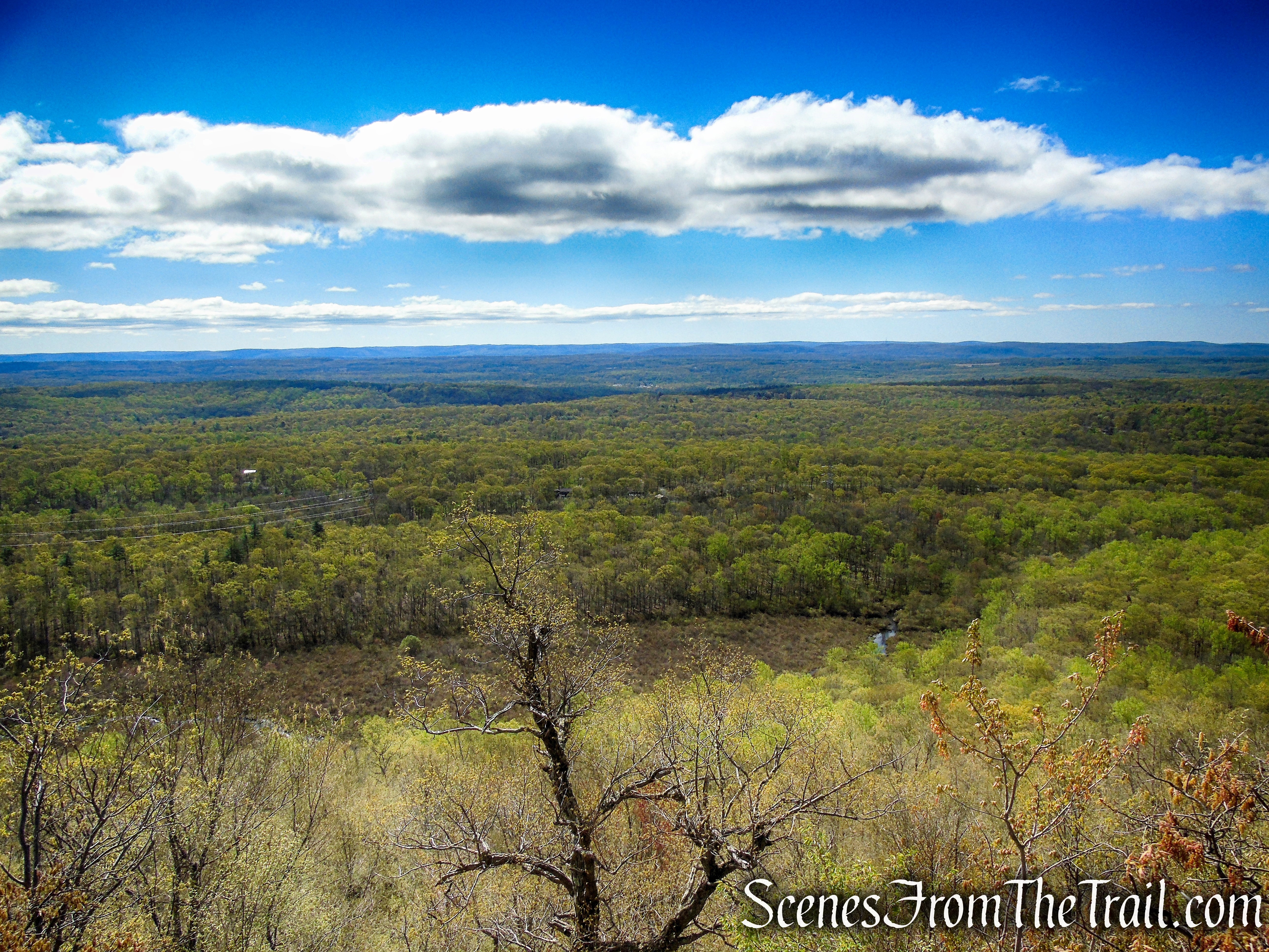
Soon, you’ll reach a sign marking the boundary between the Delaware Water Gap National Recreation Area and Worthington State Forest. Just beyond, you’ll come to a panoramic west-facing viewpoint over the Delaware River, with Poxono Island visible to the north, and Smithfield Beach directly across the river in Pennsylvania.

Appalachian Trail – Mount Mohican – Worthington State Forest

Appalachian Trail – Mount Mohican – Worthington State Forest

Appalachian Trail – Mount Mohican – Worthington State Forest
Proceed ahead on the A.T. to the wide-open summit of Mt. Mohican (also known as Raccoon Ridge), marked by a large cairn. From here, there are spectacular views to the west, east and north.

Appalachian Trail – Mount Mohican – Worthington State Forest
This is the turn around spot on this hike. Take your pack off, have a seat and take in the gorgeous views from Raccoon Ridge.

Raccoon Ridge summit
Upon arriving at the summit, there were several people there, but they left. For more than 30 minutes, we had it all to ourselves.

Raccoon Ridge summit
Bring an American Flag to plant at the summit.

Raccoon Ridge summit
The Delaware River and Smithfield Beach directly across the river in Pennsylvania.

Delaware River from Raccoon Ridge
The Delaware River and Smithfield Beach directly across the river in Pennsylvania.
Delaware River from Raccoon Ridge
Looking west towards Pennsylvania.

view west from Raccoon Ridge
Looking south.

view south from Raccoon Ridge
Lower Yards Creek Reservoir from Raccoon Ridge.

Lower Yards Creek Reservoir from Raccoon Ridge
Looking back over the route just hiked, with the Delaware River on the left.

view northeast from Raccoon Ridge
When you are ready to continue, retrace your steps on the AT, keeping your eyes open for Bald Eagles.

Bald Eagle – Appalachian Trail – Delaware Water Gap
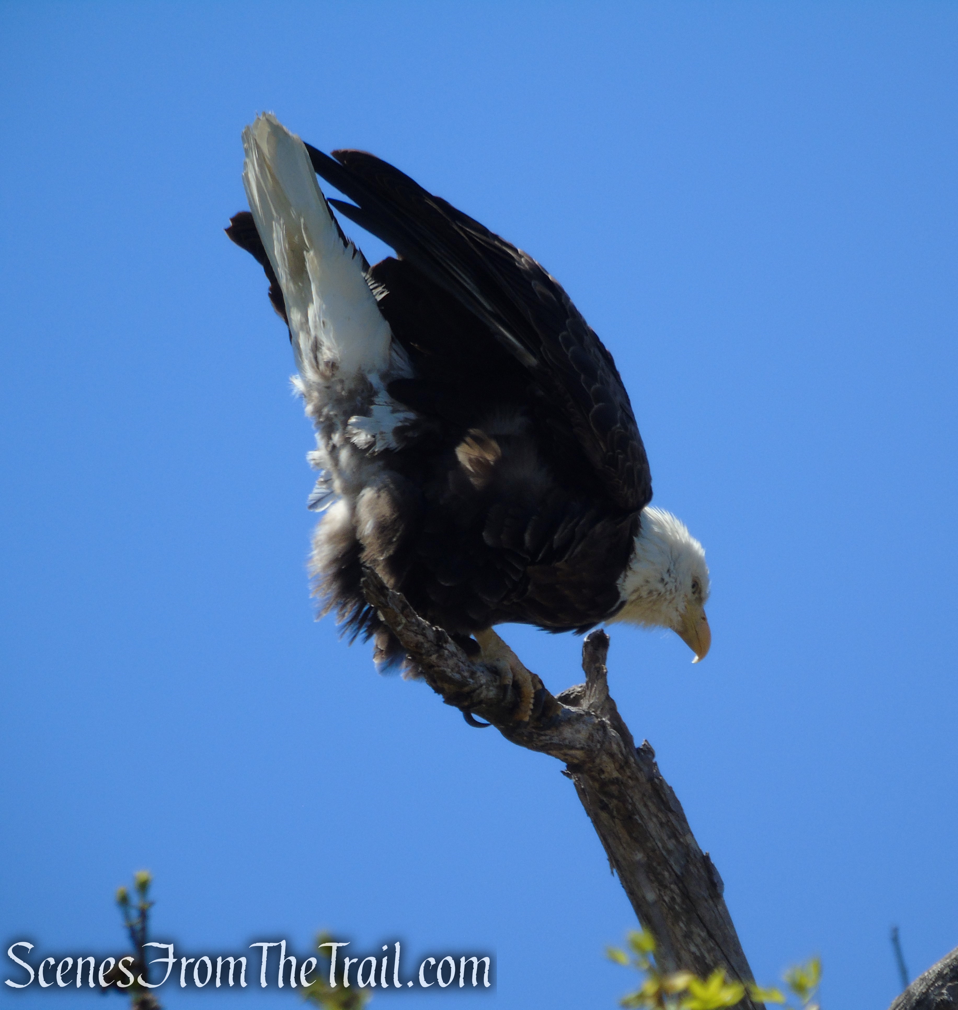
Bald Eagle – Appalachian Trail – Delaware Water Gap
When the Appalachian Trail reaches Camp Mohican Road, turn left and walk up the road for 0.3 mile, back to the parking area where the hike began. Don’t forget to stop at the camp store for some ice cream!

turn left on Camp Mohican Road

turn left on Camp Mohican Road
Review:
A fantastic hike along the Kittatinny Mountain range on the historic Appalachian Trail. Although rocky nearly every step of the way, the views and the scenic landscape, along with seeing a Bald Eagle, makes this hike worth every step. During leaf-off season, there is almost a constant view through the trees from the trail along the ridge. The numerous viewpoints gives one an excuse to stop and rest. A sturdy pair of hiking boots with good ankle protection is highly recommended. I must have tripped, stumbled or side-stepped a rock over a dozen times. The white blazes could use a fresh coat of paint in some areas, but the AT is a beaten path and thus easy to follow. Unlike some of the more popular hiking destinations, we ran into relatively few people during this hike. I was surprised that there wasn’t a crowd at the summit, but possibly because of the distance and the somewhat rugged nature of the trail, less people seem to want to venture out this far for an Instagram pic. Overall a great hike. Don’t forget to stop in at the camp store for some cold refreshments. They have Good Humor Chocolate Eclairs, they’ll hit the spot after your hike.
Pros:
Outstanding views, Appalachian Trail, Raccoon Ridge, easy to follow trail, ice cream.
Cons:
The summit needs a flagpole.
Take a hike!

Raccoon Ridge from Mohican Outdoor Center
Sources:
- Appalachian National Scenic Trail – Delaware Water Gap
- AMC Mohican Outdoor Center
- Worthington State Forest
- Mount Mohican – Peakbagger
- Delaware Water Gap – Appalachian Trail Conservancy
- Mohican Outdoor Center – Skylands Visitor
- Fall Raptors on Raccoon Ridge
- Kittatinny Ridge and Valley Region – PDF
- Worthington State Forest – Skylands Visitor
- Kittatinny Ridge – NJ Conservation Foundation
