April 7, 2019 – Kent, NY
Rehiked: November 2, 2025
Difficulty: Easy – moderate
Length: Approximately 3.6 miles
Max elevation: 814 ft.– total elevation gain approximately 394 ft.
Route type: Circuit
Map: Hawk Rock/Mead Farm Trails
Trailhead parking: At the end of Whangtown Road, Carmel Hamlet, NY 10512
Please note: This hike takes place on NYC watershed property and requires a DEP Access Permit, which comes with a mirror hanger parking permit. There is no cost for the permit, which takes about five minutes to fill out, and can be printed off your home computer.
Update:
On November 2, 2025, I hiked the same route I took back in 2019. It looks a bit different now — many of the trail markers are missing, and some turns are easy to miss if you’re not paying close attention. I made a couple of wrong turns, but since I was familiar with the route, I was able to correct them without going too far off course. It’s important to stay alert for the next marker, as many junctions are poorly marked and there are numerous unmarked roads and trails in the area.
Overview:
What is commonly referred to as the Hawk Rock hike, is a loop trail through the 1,085-acre Horse Pound Brook Unit, a NYC Department of Environmental watershed property. You can explore the ruins of an old farm, as well as a few stone chambers along the way. At the far end of the loop, the landscape changes noticeably. A large patch of mountain laurel compliments two large boulders on either side of the trail that takes hikers down into a hemlock grove to Hawk Rock. Hawk Rock is a towering rock formation that bears a striking resemblance to a perching hawk.
Hawk Rock
A DEP permit is required to legally park and hike the land. It is free and easy to acquire. Without one, you can be ticketed and your vehicle is also subject to being ticketed and/or towed. Much of the property was off limits to hikers until 2000, when 785 of 1085-acres were finally opened to hikers. With the approval of the New York City DEP, a trail to Hawk Rock was established and preservation activities are still being conducted at the Mead Farm, a colonial homestead.
The Kent Conservation Advisory Committee has a permit from the DEP to maintain the Mead Farm site and the trails to Hawk Rock.
History:
The Mead Farm is on land that was originally part of the hunting grounds for the Nochpeem tribe of native Americans, a part of the Wappinger Confederacy. In 1697 the land became a part of the Upper Highland Patent which in turn was a part of the huge Philipse Patent. Sometime in the 1860’s Moses F. Mead (1813-1868) purchased the eastern part of the farm where the ruins are today. Eventually, long after it had last been farmed, the New York Department of Environmental Protection, purchased a large tract that included the land that had been the Brown-Barett-Mead Farm to protect it from development and preserve it as a part of New York City’s watershed.
Hawk Rock, located on the west side of Horse Pound Brook, is a 25-ft high monolithic glacial erratic that contains three carved designs, interpreted as a turtle, a beaver, and a bird. The Hawk Rock Site, long known to local residents, has been a source of speculation regarding its origin for many years. Documentary and oral history research and field analysis have determined that this petroglyph was carved in the late 1920’s by local residents. The local name of this prominent feature is appropriate; its likeness to a perched hawk is immediately apparent.
Trails Overview:
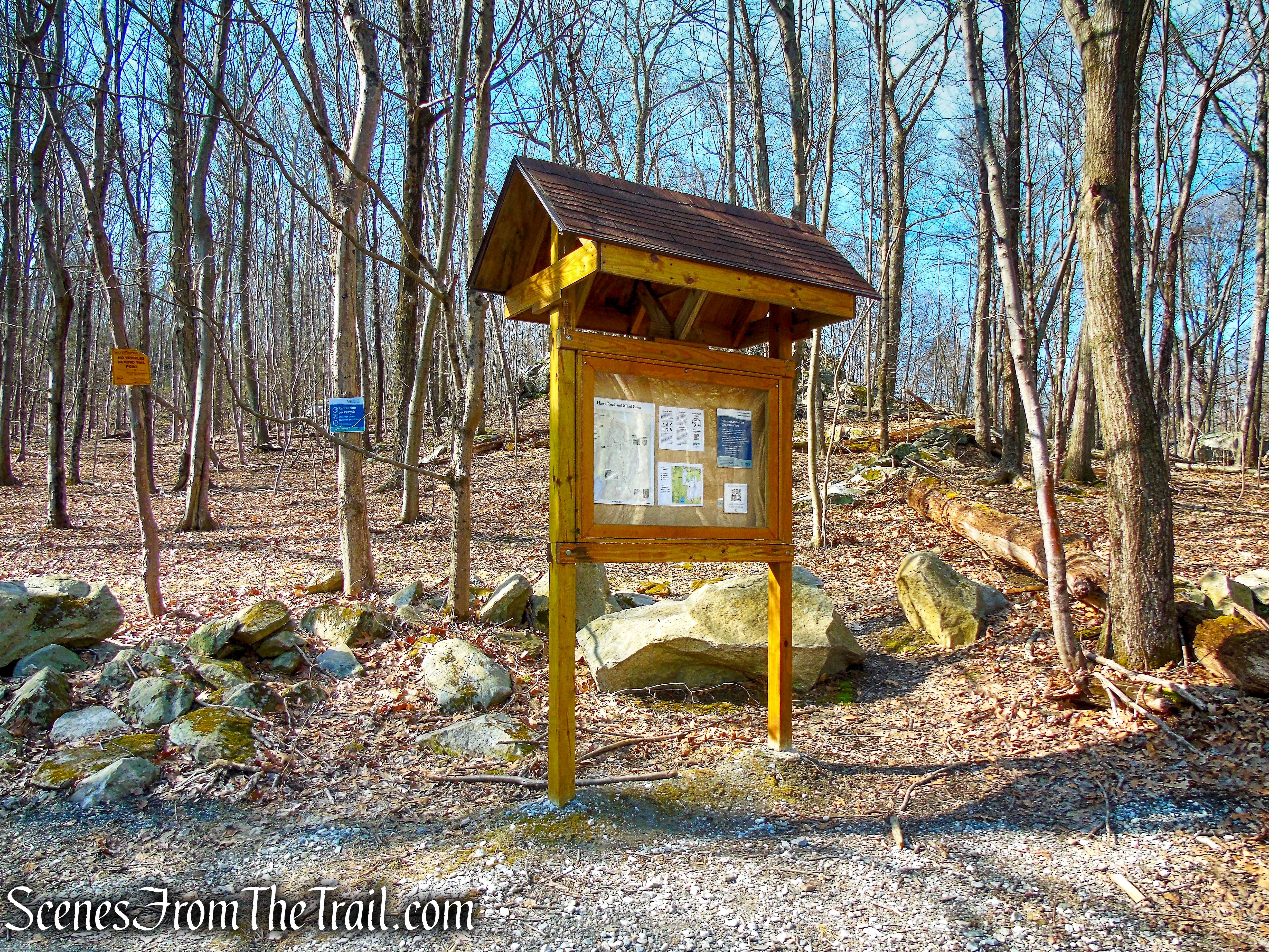
In the summer of 2015 for his Eagle Scout Leadership Service Project, Patrick LaFontaine renovated the trail in the Hawk Rock/Mead Farm area. He constructed and installed an informational kiosk at the Whangtown Road parking area, marked the trails with specially designed markers and blazes, created a brochure that includes a trail map, and removed the invasive Japanese Barberry from archeological sites. The project was possible due to a combined total of more than 300 volunteer hours by adults, Scouts, and other youth.
The trails, which run mostly along woods roads, are well blazed and relatively easy to follow. There are quite a few unmarked trails and old dirt roads that branch off from the main trails, some which lead to private property. There are signs posted throughout indicating the private lands.

Whangtown Road trailhead
Hawk Rock Trail
Pre-Hike Detour:
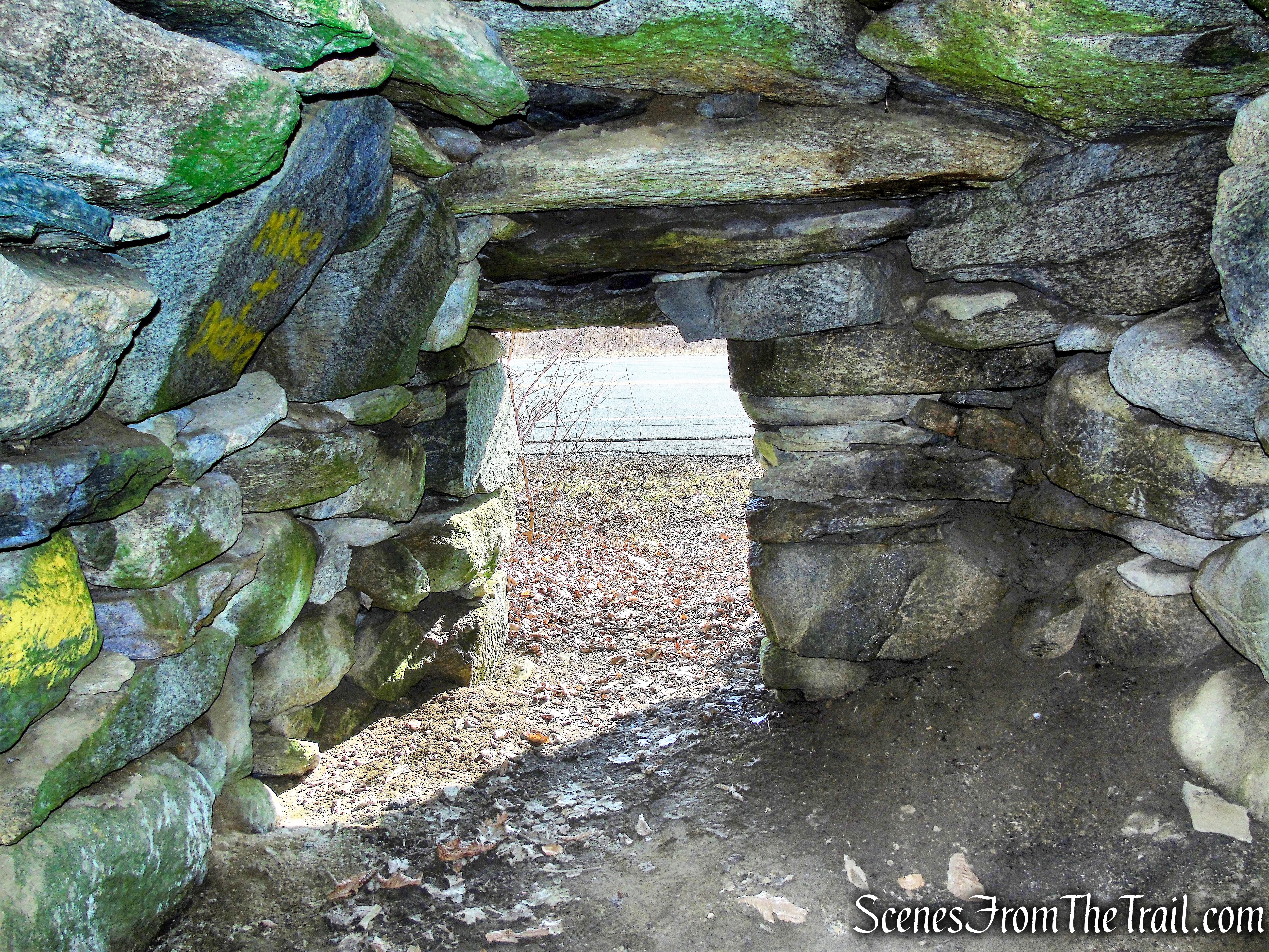
On the way to the trailhead, we stopped by the Meads Corners Stone Chamber, located on Route 301 and near Farmers Mills Road.
Meads Corners Stone Chamber
The densest concentration of stone chambers are found in Putnam County, NY, on the east bank of the Hudson, just north of Westchester, where there are approximately 200 stone chambers within that county or immediately outside its borders.
Meads Corners Stone Chamber
Corbelled Stone Chambers are scattered throughout the Eastern part of North America. They were intricately built by overlapping stones to curve the wall inward, with a massive lintel stone placed across the top of the entranceway and capstones put in place to form the roof. They were often built into hillsides and near water sources. There is much debate over who built them and their original purpose. Some believe they are equivalent to root cellars built by the colonists while others believe they date back thousands of years.
Meads Corners Stone Chamber
The Hike:
We arrived at the trailhead at about 8:40 am on a Sunday morning. The small parking area, which can accommodate about 4-5 cars, was empty. We did the hike in a counter clockwise manner, beginning on the red-blazed Hawk Rock Trail. That is the suggested route on the brochure and the trail is blazed that way.
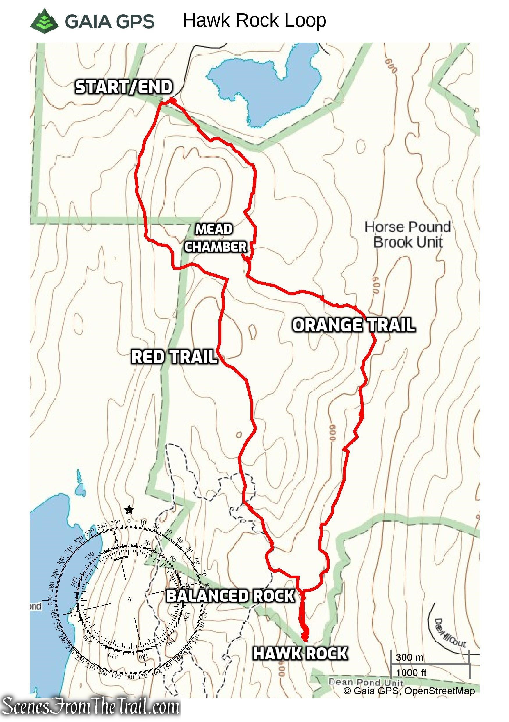
Hawk Rock Loop
To the right of the kiosk, there are three red blazes on a tree that mark the start of the Hawk Rock Trail. The trail gradually ascends on a woods road that heads in a southerly direction. There are other woods roads all along the trail, but keeping an eye on the red blazes will keep you on the right path.
Hawk Rock/Mead Farm Trails
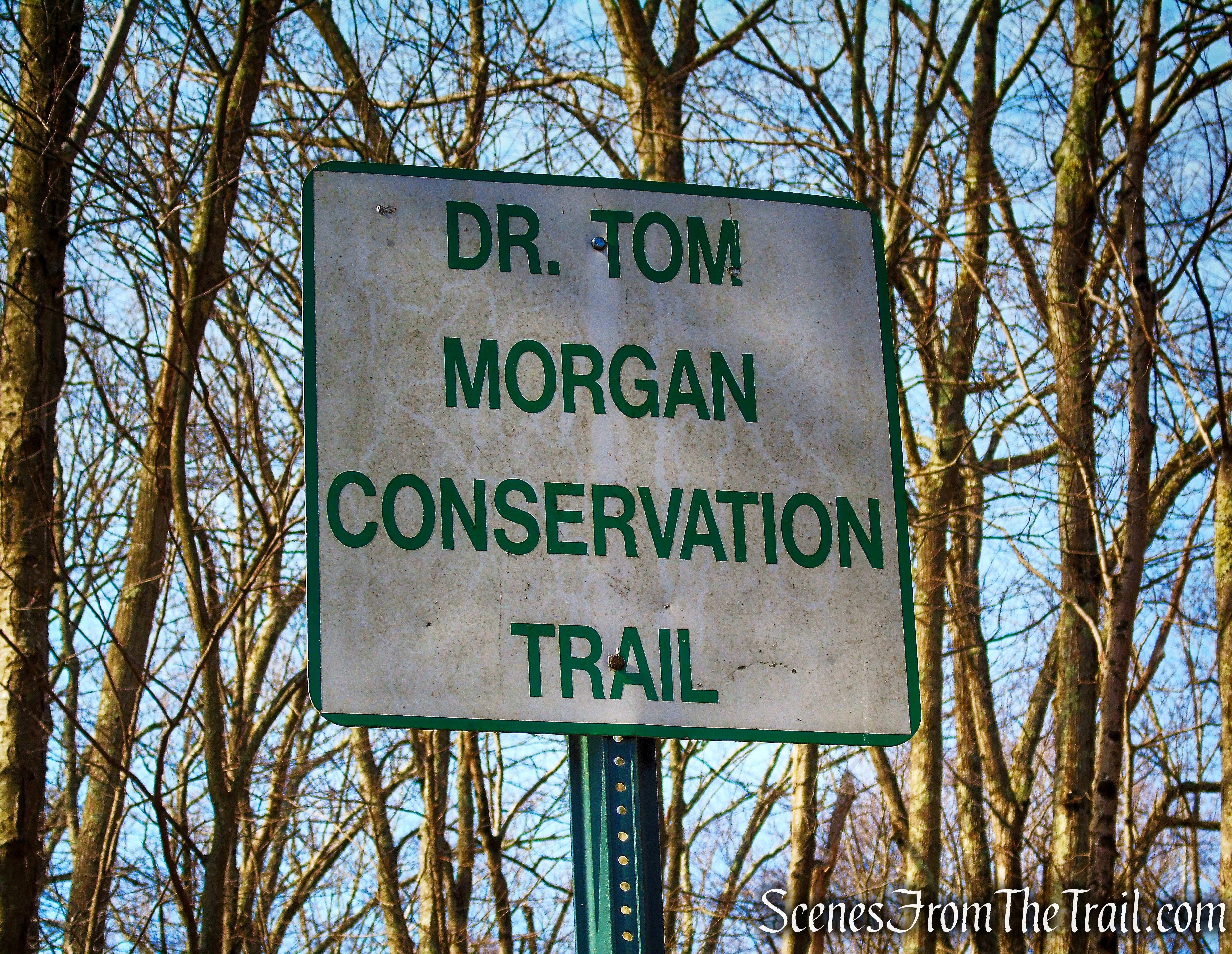
Dr. Morgan was a naturalist with the Kent Conservation Advisory Committee
Hawk Rock/Mead Farm Trails
Don’t forget to display your mirror hanger parking permit and carry your hiking permit.
Hawk Rock/Mead Farm Trails
Hawk Rock Trail
Hawk Rock Trail
Hawk Rock Trail
Hawk Rock Trail
Hawk Rock Trail
Hawk Rock Trail
In about a 1/2 mile from the start of the hike, the trail turns left onto another woods road bordered by stone walls. In about another 250 yards, the Hawk Rock Trail turns right, leaving the woods road and climbs another woods road.
Hawk Rock Trail
Hawk Rock Trail
Hawk Rock Trail
Hawk Rock Trail
Hawk Rock Trail
In another 0.6 mile, the trail reaches a Y-intersection with the blazes turning left. The trail now heads downhill and soon crosses a small stream on rocks. The trail soon passes between two stone structures alongside the trail.
Hawk Rock Trail
Hawk Rock Trail
Hawk Rock Trail
Hawk Rock Trail
Hawk Rock Trail
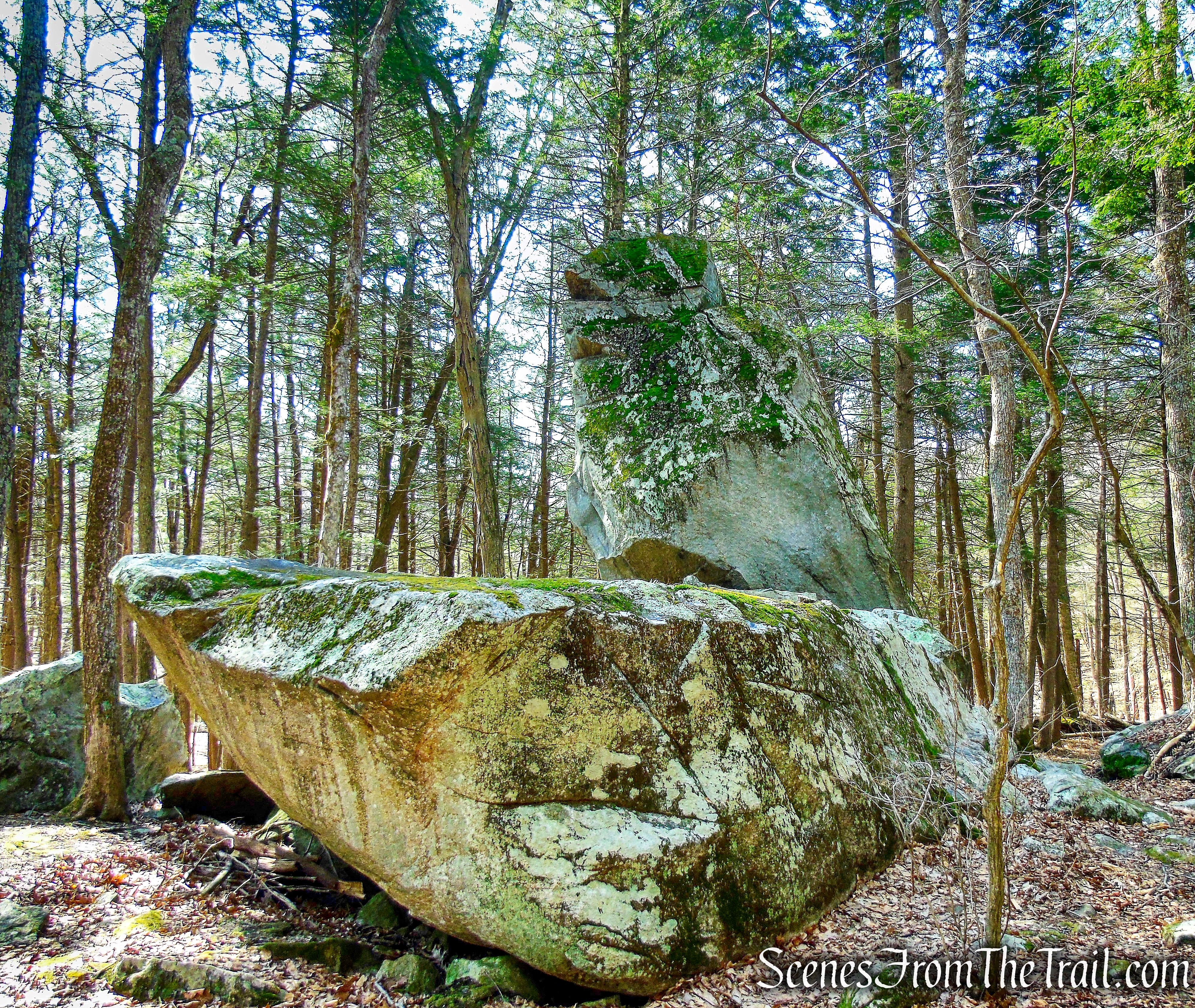
Soon the trail descends a little and reaches Balancing Rock, a huge glacial erratic that rests atop smaller boulders, forming a cave-like rock shelter.
Balancing Rock – Hawk Rock Trail
Balancing Rock – Hawk Rock Trail
A short distance from Balancing Rock, three red blazes on a tree, mark the end of the Hawk Rock Trail and just beyond is Hawk Rock.
terminus of Hawk Rock Trail
A flat table rock many yards in diameter lies before the hawk like an altar stone, and it may be hard to avoid wondering how many Indian fires and ceremonies had been once held on the site. This was once sacred ground for the local Wappinger tribe.
Hawk Rock
Hawk Rock, located a short distance from Horse Pound Brook, is a 25-ft high slab of granite, swept there by a glacier and set in a grove of towering hemlocks, nearly void of underbrush.
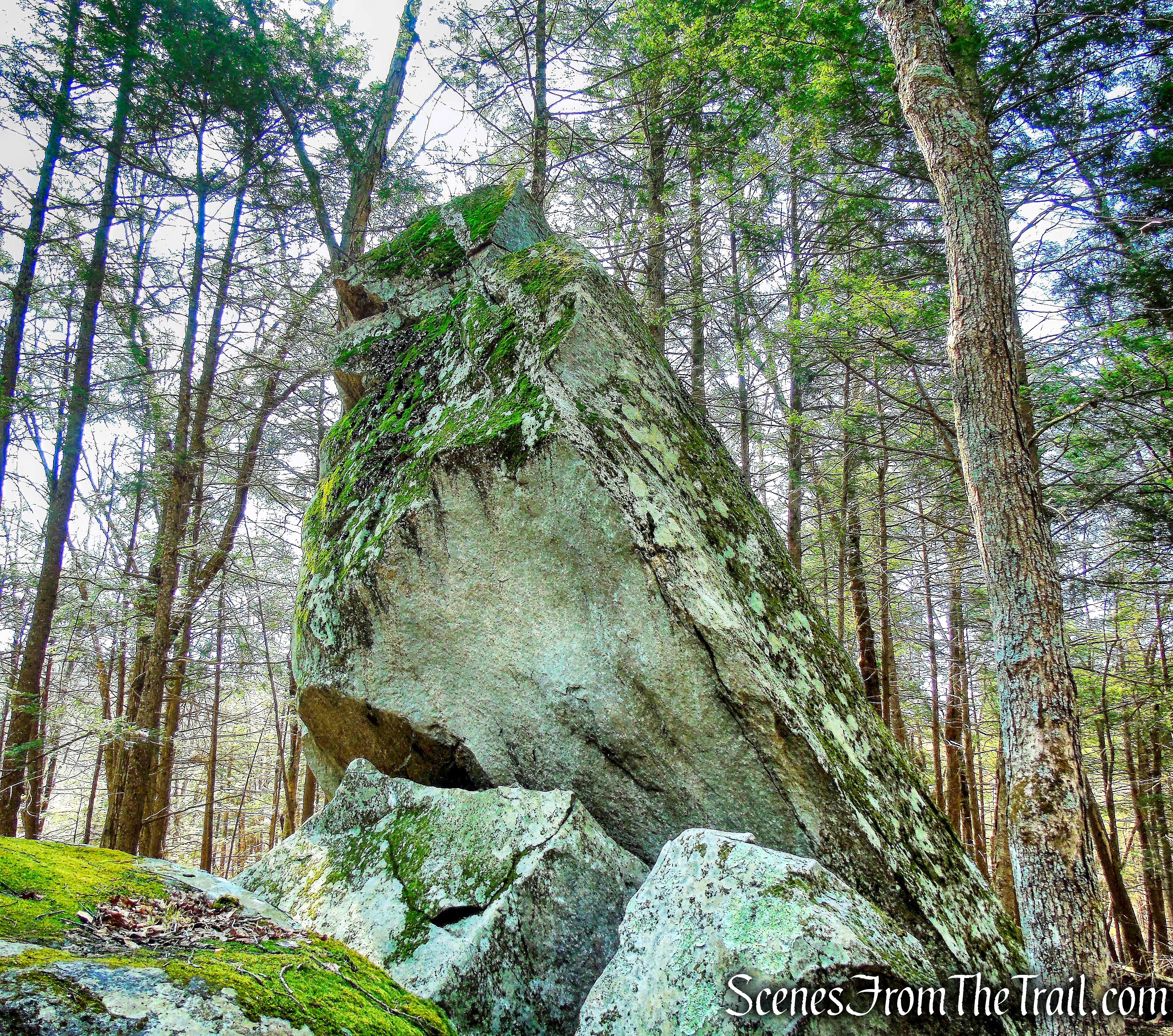
Hawk Rock
“In Native American legend, it was a place that marked an entrance from another world into ours. There’s just a change in the feeling. You walk in there, and even the trees change. The vegetation changes. The foliage changes.”
~ Philip Imbrogno
Hawk Rock
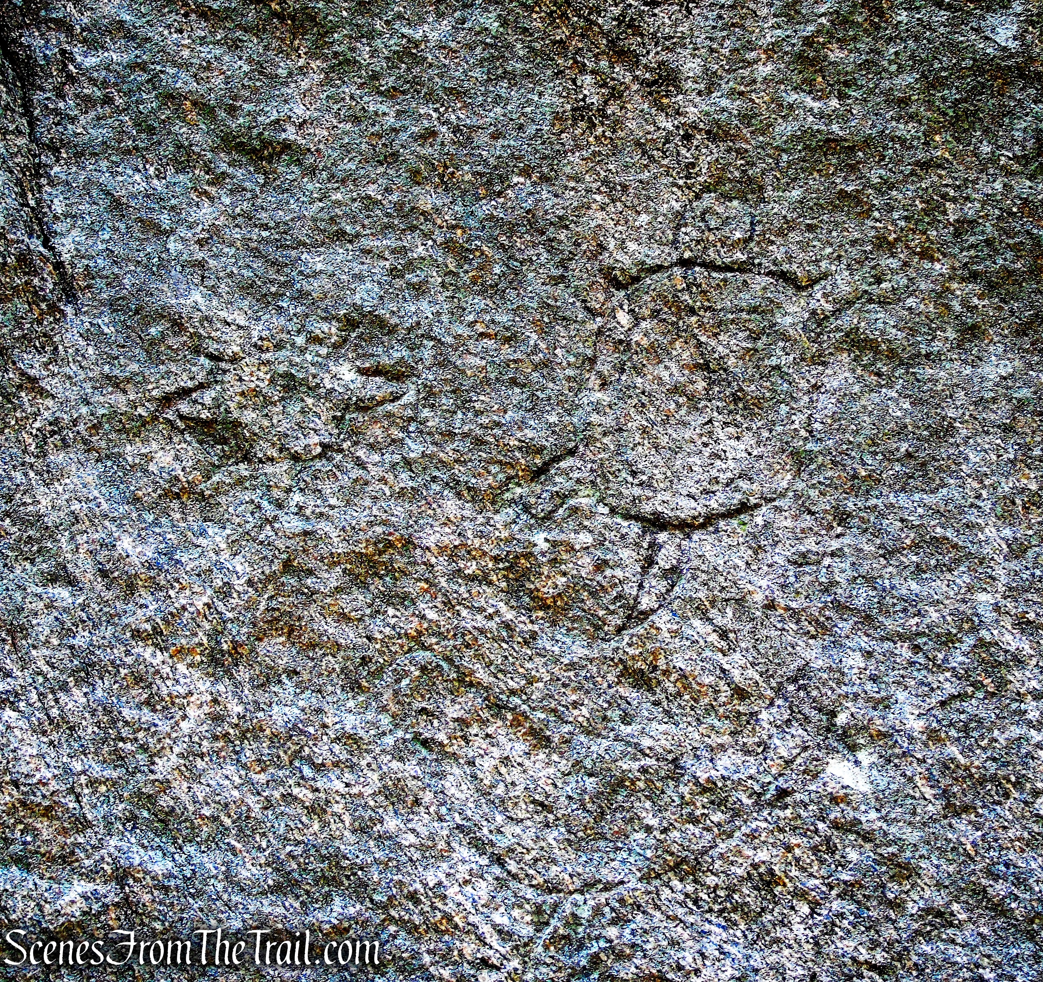
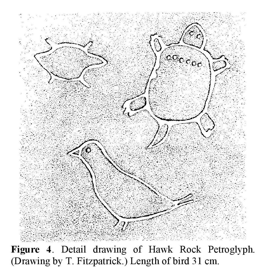
Three designs are carved into the vertical north face of Hawk Rock. They are interpreted as a turtle, a beaver, and a bird. The turtle carving is 12 inches in length from head to tail, and its body is 5.75 inches in width. The bird is 12 inches in length from its beak to its tail. The figure of the beaver is 6 inches in length and 3.2 inches in width. A scale drawing of the designs is shown below (Figure 4).
Hawk Rock
Hawk Rock
Retrace your steps back to Balancing Rock and look for 3 orange-blazes on a log laying on the ground, directly across from Balancing Rock. This is the start of the orange-blazed Mead Farm Trail. Turn right on the narrow footpath and a short distance in, the orange blazes begin to appear. The blazes are a mix of paint and round plastic discs (that appear more red than orange).
start of Mead Farm Trail
Mead Farm Trail
Mead Farm Trail
Mead Farm Trail
The Mead Farm Trail begins heading east, then soon curves to the left and continues northeast. Soon the trail nears Horse Pound Brook and runs along the shoreline. The trail eventually moves away from the brook and begins to head northwest.
Mead Farm Trail
Mead Farm Trail
The trail levels off and begins to follow a wide woods road. After about 1.2 miles from the start of the Mead Farm Trail, the Mead Farm Stone Chamber can be seen on the left.
Mead Farm Trail
The mortarless vault that is cut into the hillside, is lined with corbeled stones and topped with stone slabs more than four feet wide and eight feet long, each weighing many tons.
Mead Farm Stone Chamber
The origin of these structures is unclear; speculation about who built them includes Viking, Celts, Phoenicians, Colonial settlers, Indians, and witches. The more questions asked about these structures, the fewer answers there are. A true Hudson Valley mystery!
Mead Farm Stone Chamber
There are two other stone chambers nearby, but I did not find them. A short distance past the stone chamber, the trail passes by the Mead Farm Ruins.
Mead Farm Trail
Sometime in the 1860’s Moses F. Mead (1813-1868) purchased the eastern part of the farm where the ruins are today. This land was farmed as far back as the late 1600’s.
Mead Farm Ruins
The trail continues north on the woods road, then veers northwest. A short distance later, the trail arrives back at the parking area, where the hike began.
Mead Farm Trail
Mead Farm Trail
Mead Farm Trail
terminus of Mead Farm Trail
Review:
This was a really good hike through quiet woods with numerous points of interest, history and legend. On the day of our visit, we had the woods all to ourselves. A car pulled up as we returned to the trailhead, upon completion of the hike. A worthwhile hike that I would do again and hopefully find the other two stone chambers.
Pros: Hawk Rock, Mead Farm Stone Chamber, Balancing Rock, Mead Farm Ruins.
Cons: N/A
Take a hike!
Hawk Rock Loop
Sources:
