November 22, 2018 – Tarrytown, NY
Difficulty: Easy
Trails: Approximately 4 miles
Route type: Point to point (shuttle) Can be done as an out and back (doubling the mileage).
Maps: None available
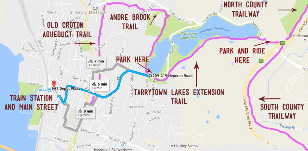
Trailhead parking:
- Eastview Park-n-Ride – 707 Old Saw Mill River Rd, Valhalla, NY 10595
- 209 Neperan Road, Tarrytown, NY 10591
At the northeast edge of the village of Tarrytown, New York, is the Tarrytown Lakes Park, a 72-acre scenic escape to walking and biking trails, kayaking in season, birding and, for local residents, fishing.
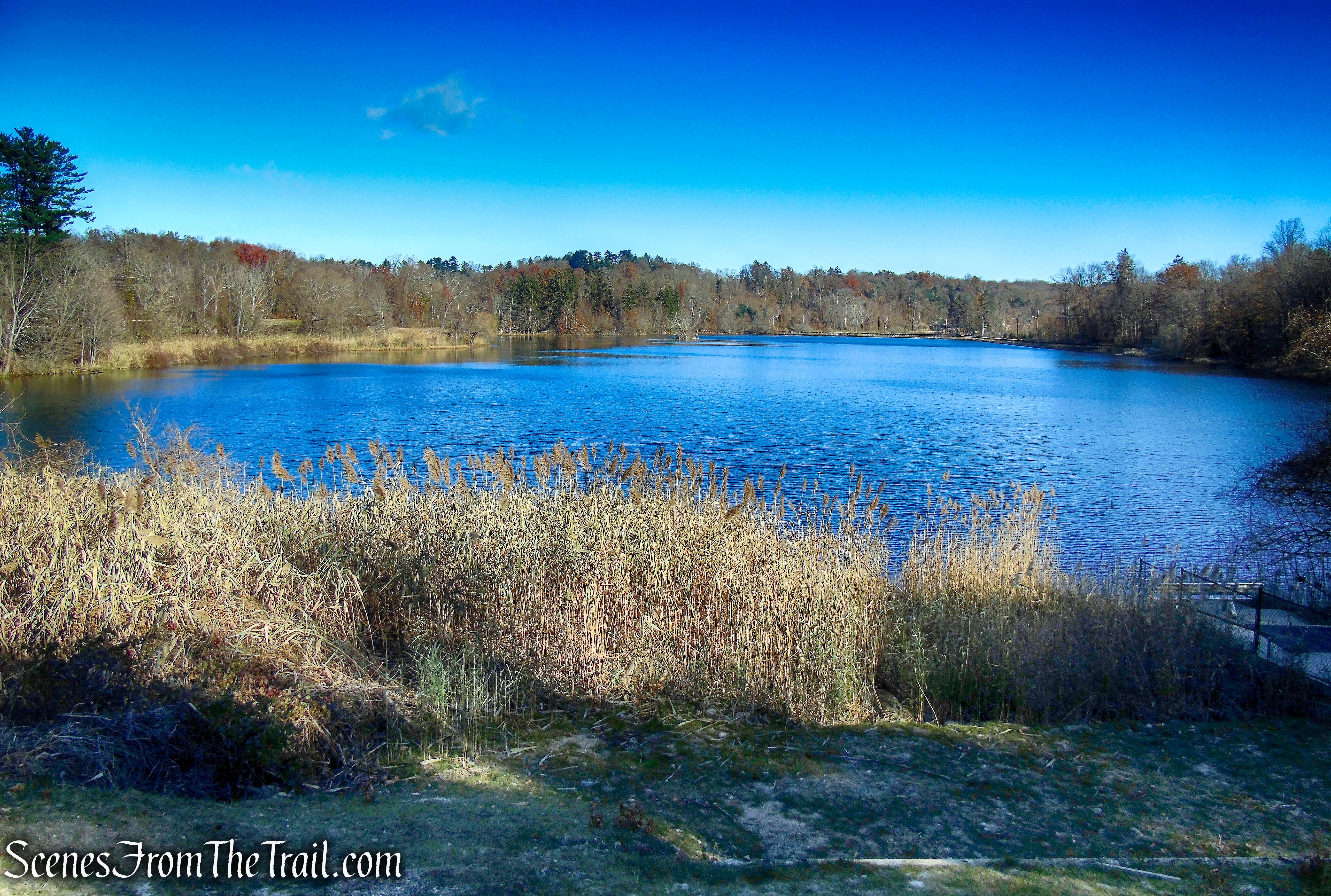
Upper Lake – Tarrytown Lakes
The park encompasses two man-made reservoirs, the large Lower Lake and smaller Upper Lake. They once provided water to the village, but the lakes are “retired” now, and serve as habitat for flora and fauna, and a place for accessible recreation.
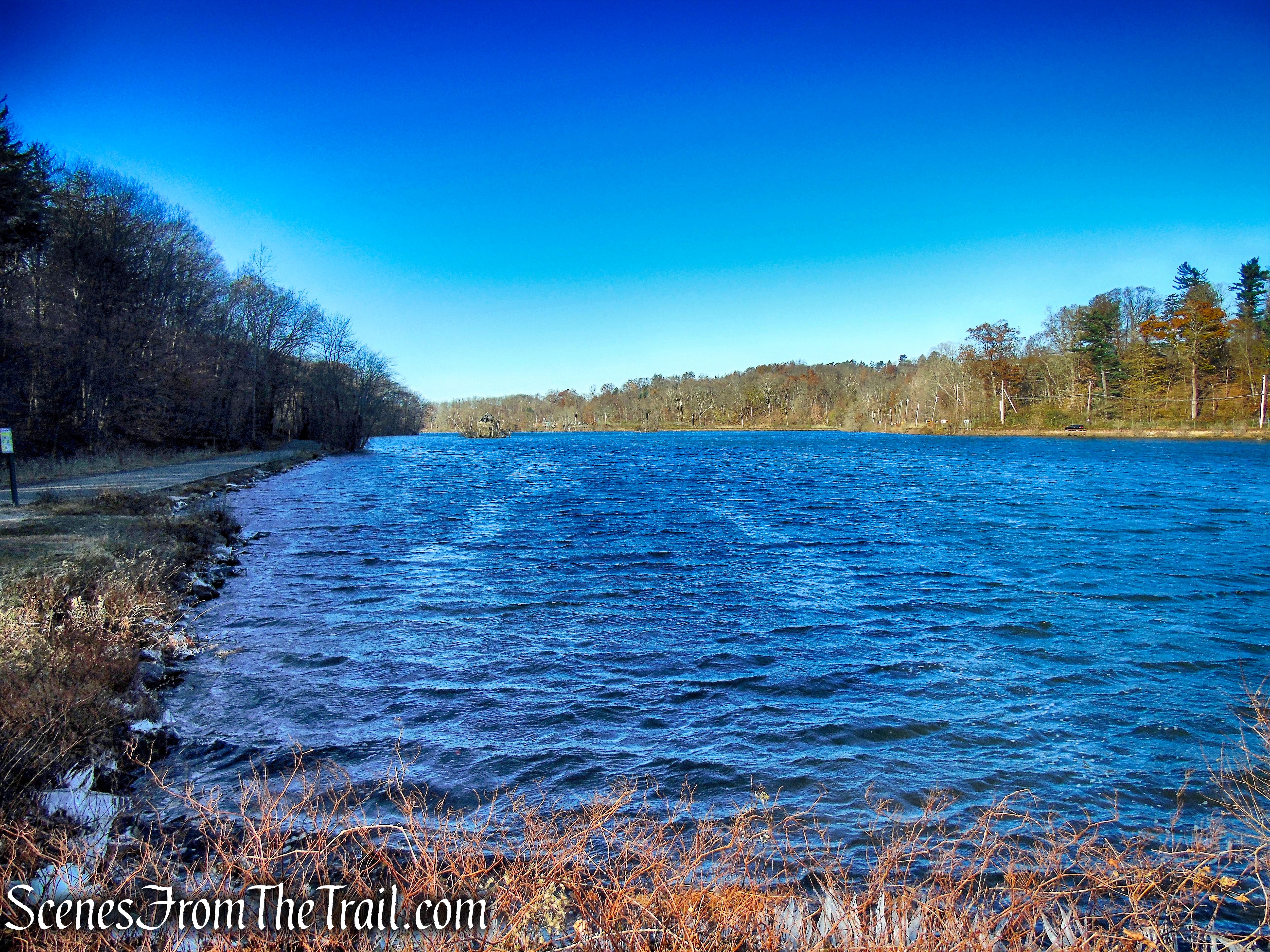
Lower Lake – Tarrytown Lakes
History of the Tarrytown Lakes area:
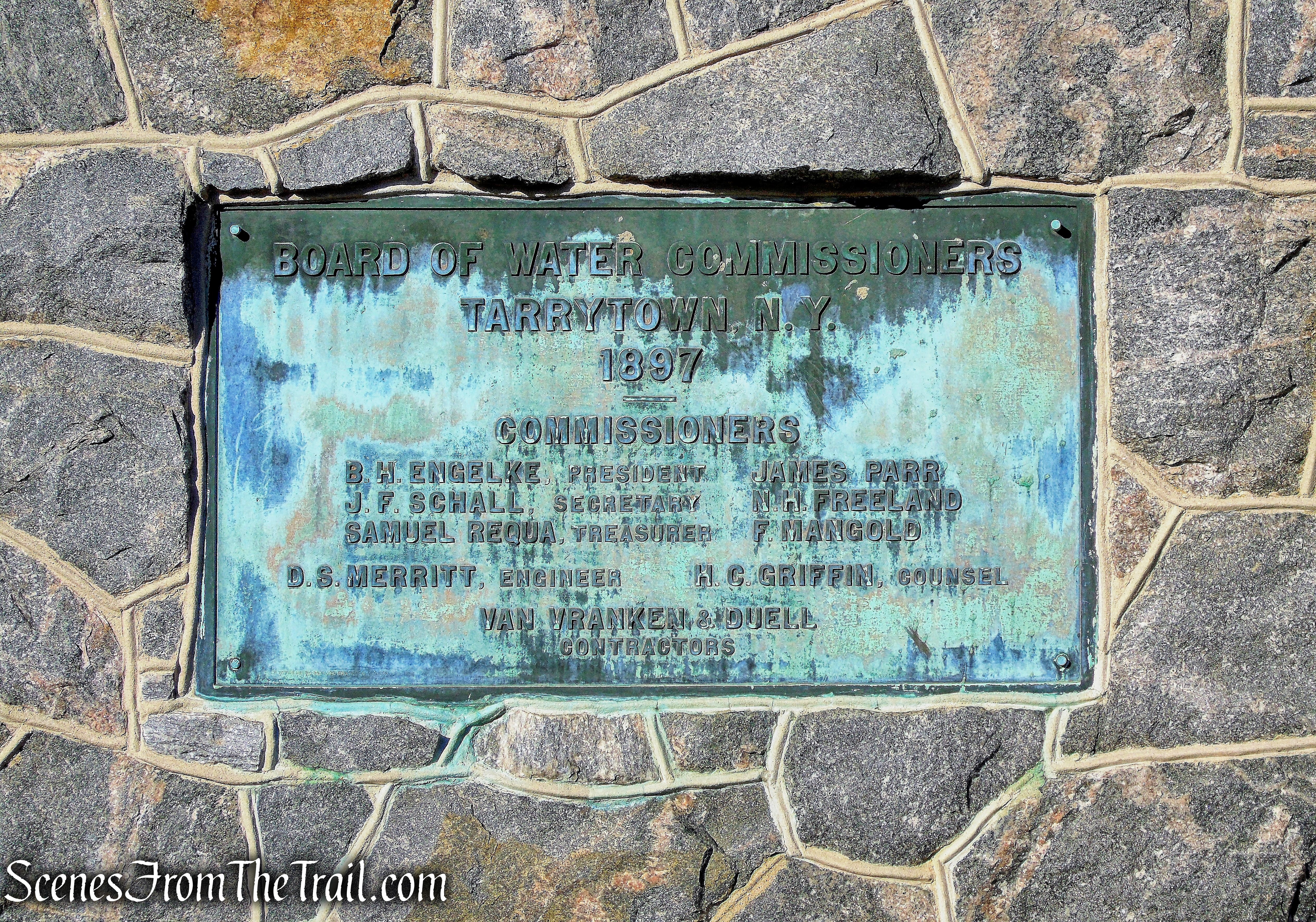
The village created the Tarrytown Lakes in 1897 as drinking water reservoirs for Tarrytown. As Tarrytown villagers required more water than the lakes provided, they were decommissioned as a drinking water source in 1993. Now this area, together with the 60 acres surrounding it, comprise the Tarrytown Lakes Park, almost 5% of the acreage of Tarrytown.
Tarrytown Lakes
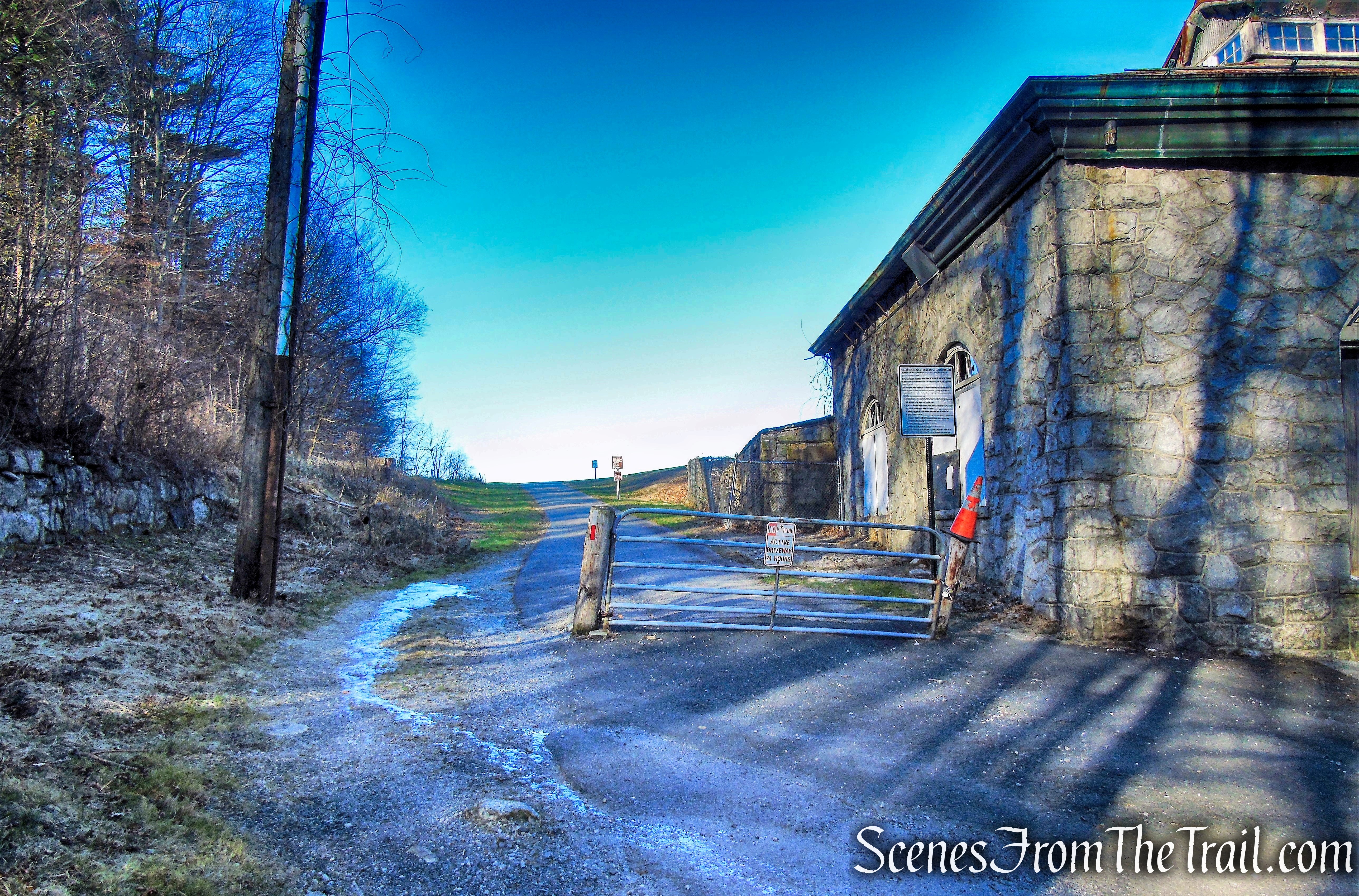
The Eastview Pumping Station, which was built around 1897, stands on the eastern-most point of Tarrytown. It was used until 1993 to clean and move the village’s drinking water. Today Tarrytown relies solely on the New York City Catskill and Croton Aqueducts for its drinking water.
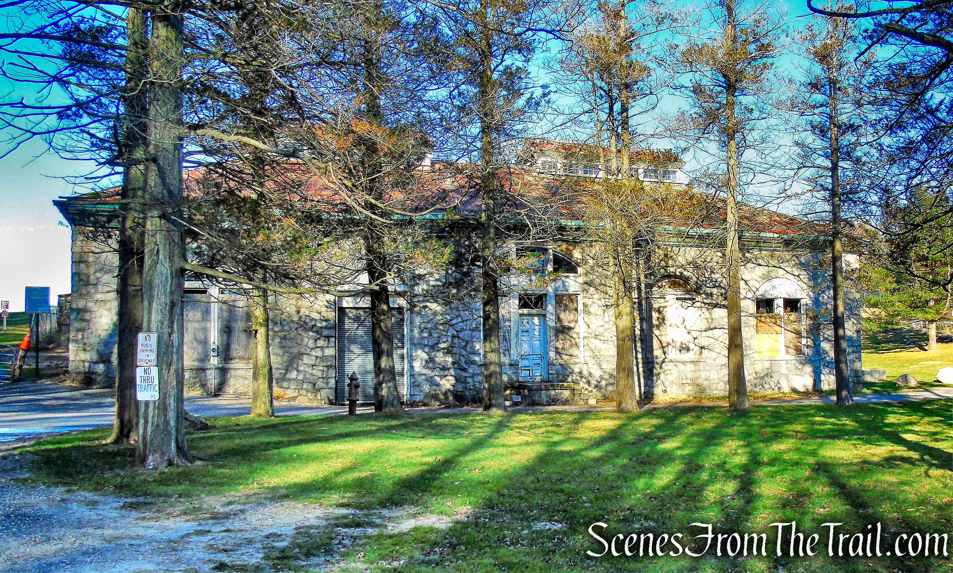
Eastview Pumping Station
The New York & Putnam Railroad had been established in 1880, with a single rail line that connected Brewster to the Bronx. During its lifetime the railroad had stops in White Plains, Elmsford, Pocantico Hills, Carmel and Brewster. Also along the route were stops at Tarrytown Heights, at the southernmost tip of the reservoir near the present-day intersection of Neperan Road and Sunnyside Avenue, and at East View.
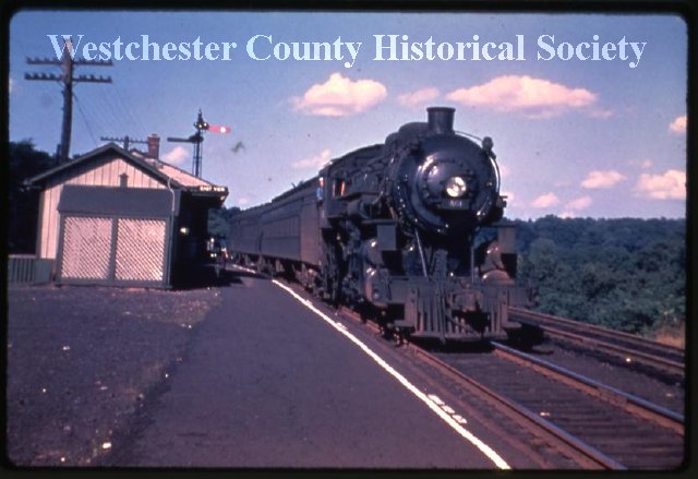
New York & Putnam Railroad – East View
The railroad’s initial path in the area, then known as Swampy Brook Valley, went over a wobbly 80-foot-high trestle bridge at East View, which so frightened passengers that a portion of the rail line was relocated closer to Rockefeller’s estate in Pocantico Hills. Because of the dangers of crossing the trestle, which often required that trains slow down to a crawl, the line was rerouted west around that valley in 1881. The trestle was torn down in 1883 and the valley became the Tarrytown Reservoir.
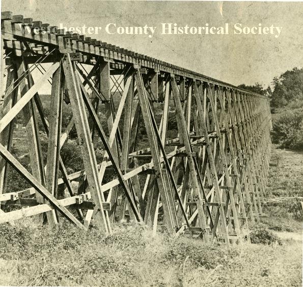
East View Trestle
John D. Rockefeller was annoyed by the railroad that ran through his family’s estate in Pocantico Hills. Rockefeller approached the railroad with a plan to move the line off his property. On April 15, 1930, a construction crew of 500 men began work on the railroad relocation. Three stations were closed: Tarrytown Heights, Tower Hill, and Pocantico Hills. The new route opened in 1931. It served fewer people and generated no freight traffic. The last trains ran on May 29, 1958 and the tracks between East View and Lake Mahopac were removed in 1962.
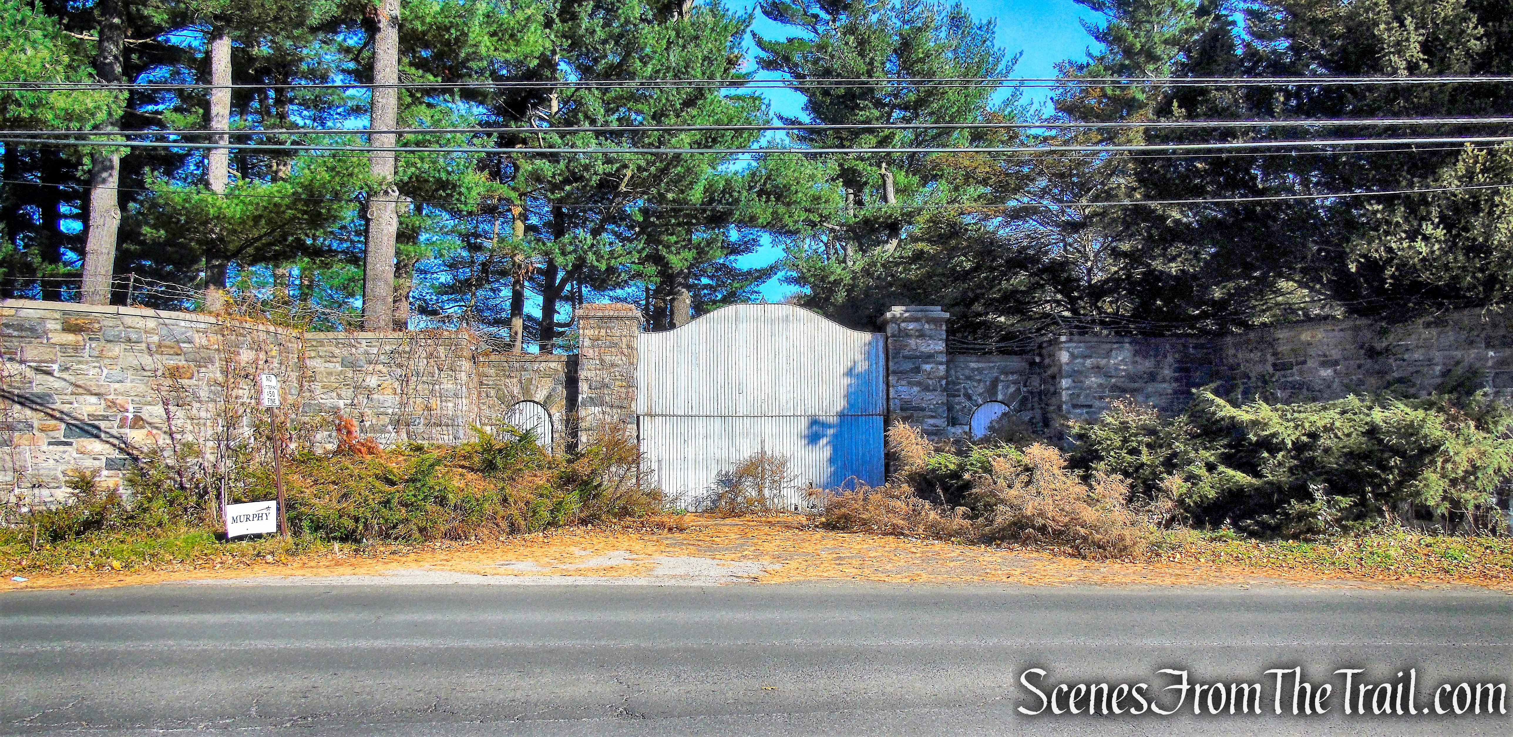
Rockefeller estate – County House Road
Today, the 72-acre preserve, just 35 miles north of New York City, serves as a recreation area for local residents and visitors. The park’s two lakes, two bike paths, walking trails, opportunities for kayaking, bird study, ice skating and cross-country skiing in winter, and connections to the county’s extensive network of hiking and bike paths are easily accessible.
Tarrytown Lakes Trails
The Trails: Total trail miles are about 4 miles including the Andre Brook Trail.
Opposite the Eastview Park-n-Ride is the entrance to a paved trail, owned by the County of Westchester, a “spur” trail of the North and South County Trailways. This trail is known as the Tarrytown Lakes Extension Trail and can also be accessed from the Neperan Road Tarrytown Lakes parking lot. Both the Tarrytown Lakes Extension Trail and the Tarrytown Lakes Trail are ideal for cycling and long walks, especially since they connect to other long distance multi-use trails.
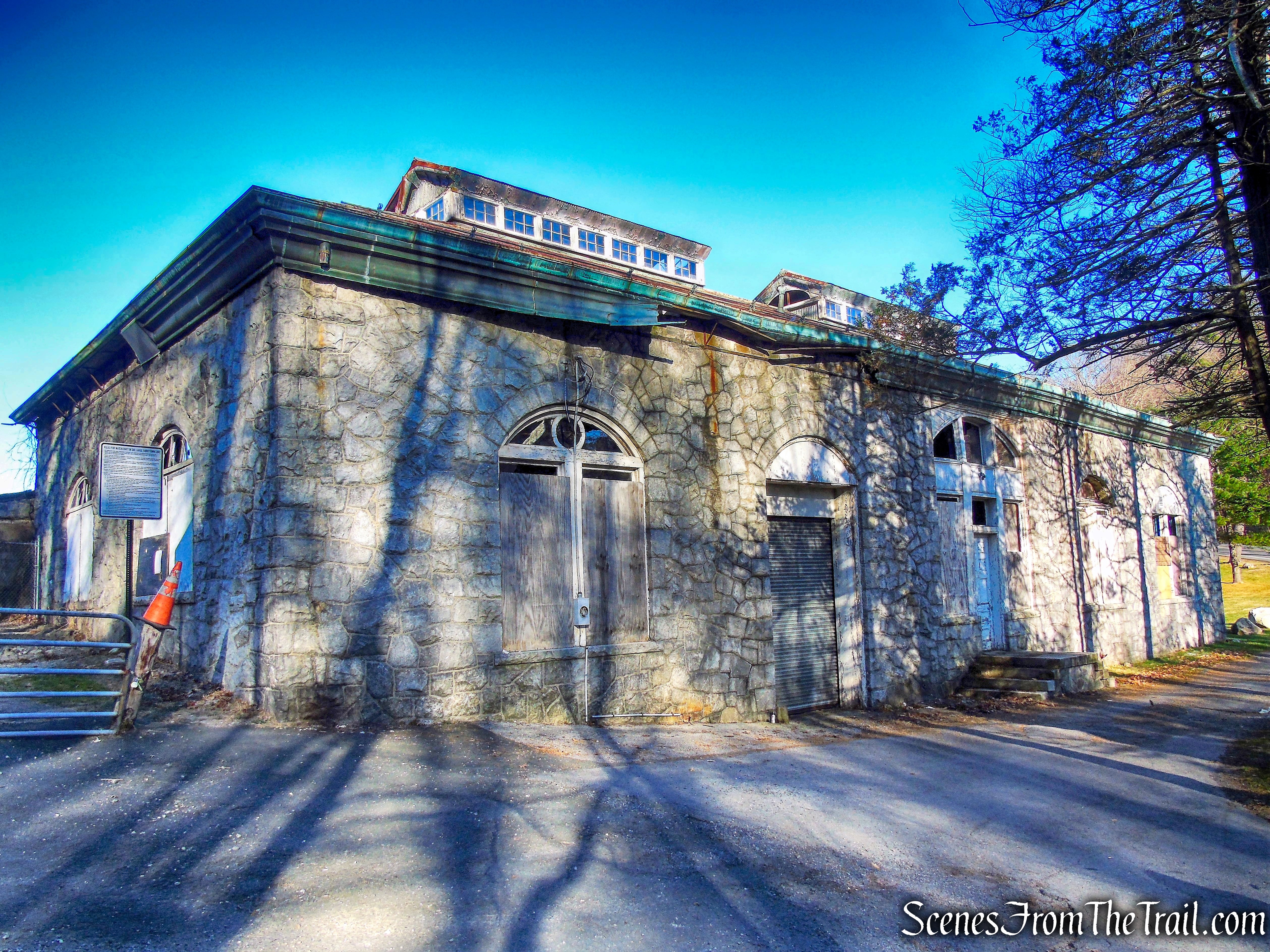
Eastview Pumping Station
The trail begins at the gate beside the old Eastview Pumping Station.
Tarrytown Lakes Extension Trail
A view of the Tarrytown Reservoir from the Tarrytown Waterworks Dam.

Tarrytown Lakes Extension Trail
The 18×16-ft. stone masonry gatehouse that sits atop the dam.
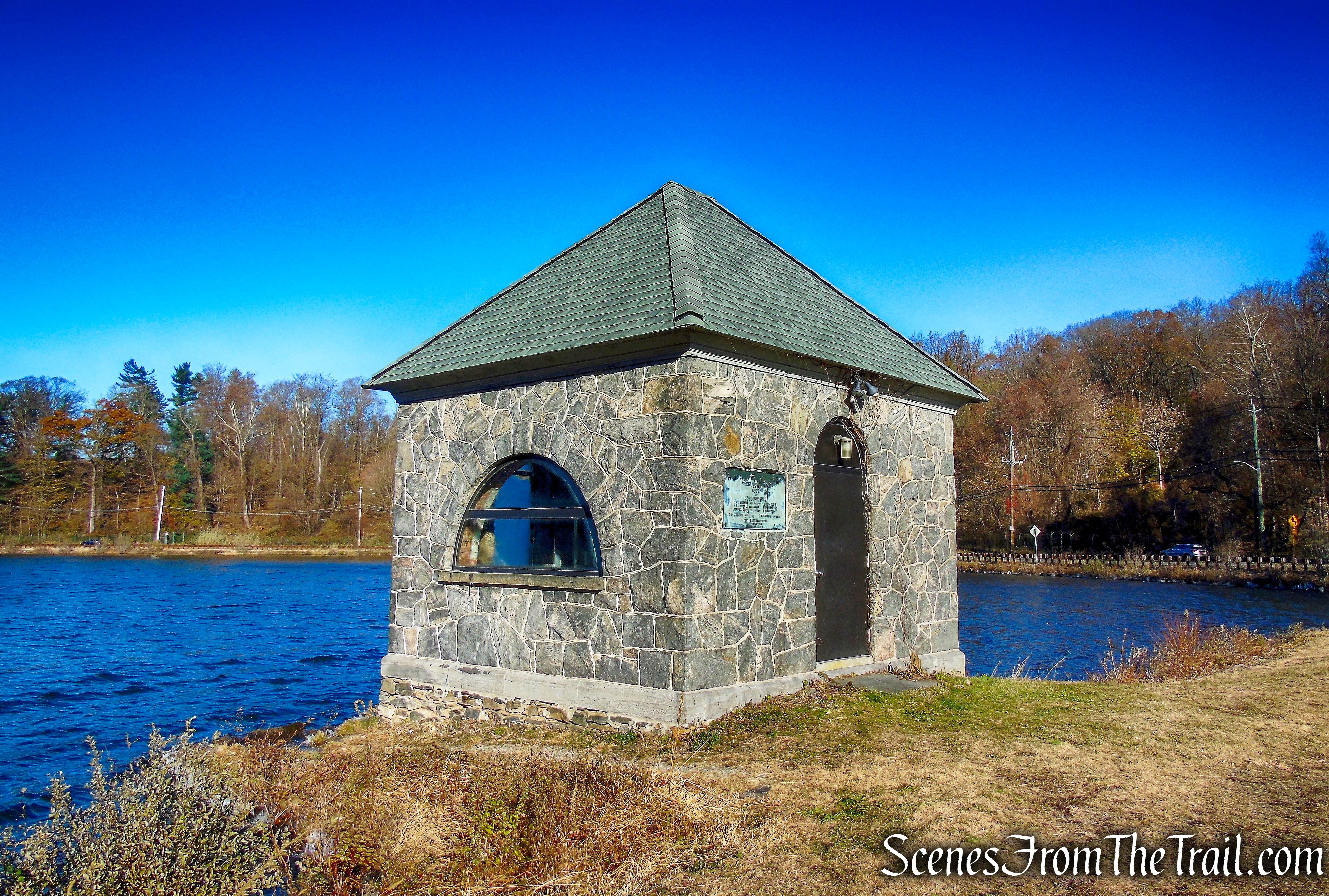
Tarrytown Lakes Extension Trail
Tarrytown Waterworks Dam Spillway.
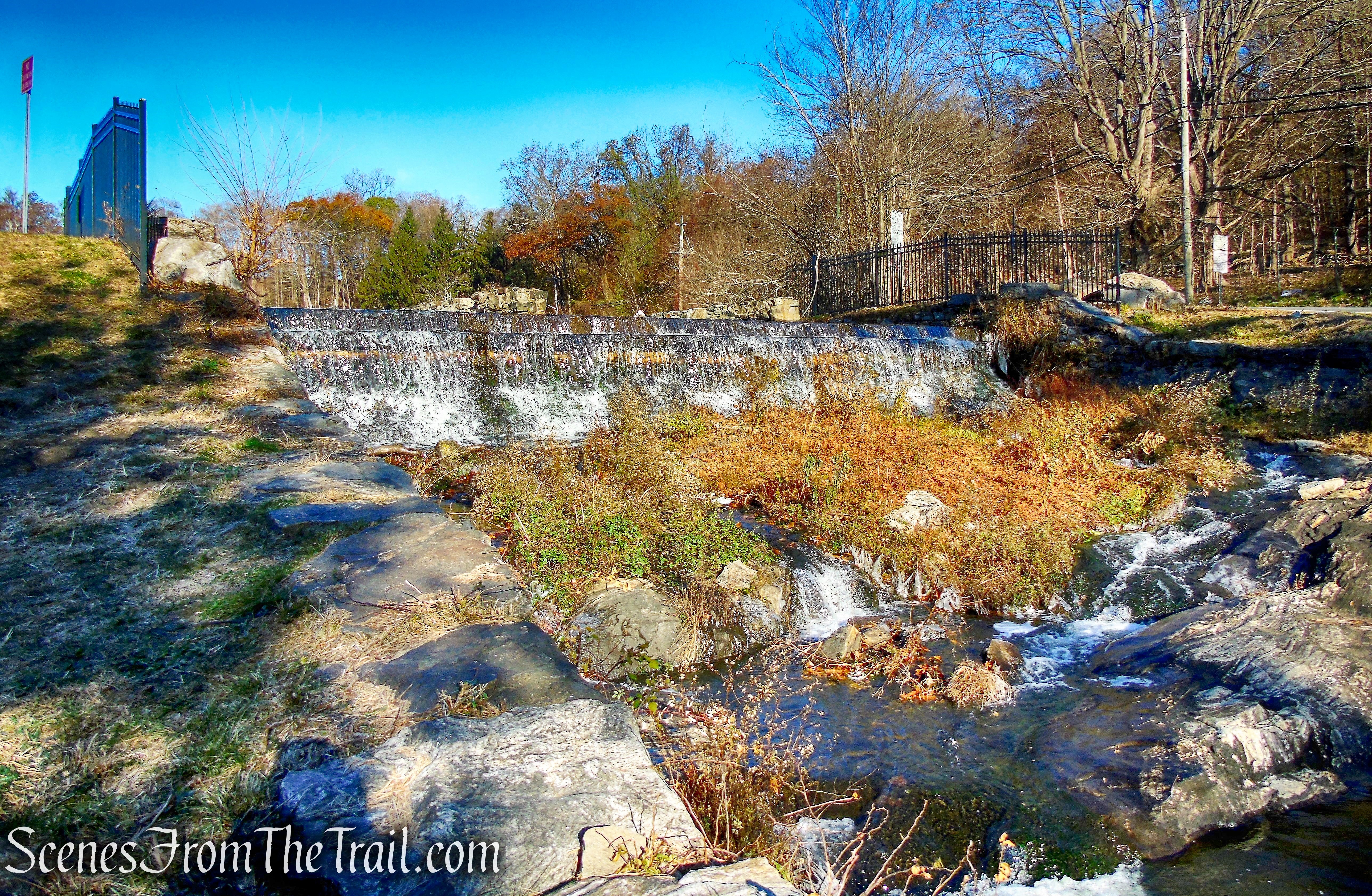
Tarrytown Lakes Extension Trail
The Tarrytown Lakes Extension Trail is on what was once the railroad bed of the Putnam Division of the New York Central Railroad. This pathway is level and wide, easy to navigate and perfect for a leisurely walk.
Tarrytown Lakes Extension Trail
Looking back at the Tarrytown Waterworks Dam and gatehouse. The Tarrytown Lakes Dam is of earthen construction and approximately 18 feet in height and 315 feet in length.
Tarrytown Lakes Extension Trail
This trail connects Eastview with Sunnyside Lane and Neperan Road.
Tarrytown Lakes Extension Trail
The Tarrytown Lakes Extension Trail extends for over a mile alongside the lake’s shore.
Tarrytown Lakes Extension Trail
The ruins of a well house.
Tarrytown Lakes Extension Trail
Tarrytown Lakes Extension Trail
A ruined structure along the trail.
Tarrytown Lakes Extension Trail
Approaching Neperan Road.
Tarrytown Lakes Extension Trail
The Tarrytown Lakes Extension Trail crosses Neperan Road and ends at the southern end of the smaller Upper Lake, which is also the location of the main parking area.
Tarrytown Lakes Park
The gravel covered trail known as the Tarrytown Lakes Trail is also on what was once the railroad bed of the Putnam Division of the New York Central Railroad. It is an approximately 0.6 mile long, wide multi-use trail and begins just west of the smaller Upper Lake.
Tarrytown Lakes Trail
The old railbed heads north, bordered by the lake on the right and private property on the left.
Tarrytown Lakes Trail
The trail crosses a railroad bridge that has been refurbished.
railroad bridge – Tarrytown Lakes Trail
railroad bridge – Tarrytown Lakes Trail
The Tarrytown Lakes Trail ends at County House Road, just across from Rockefeller property.
terminus of Tarrytown Lakes Trail at County House Road
Along its route, the Tarrytown Lakes Trail leads to several short footpaths, marked with metal blazes or paint, that meander through the woods, with frequent views of the lakes. These trails offer great bird-watching opportunities.
Blue Trail – Tarrytown Lakes
View northeast from the Blue Trail on the Upper Lake.
Blue Trail – Tarrytown Lakes
Yellow Trail – Tarrytown Lakes
Yellow Trail – Tarrytown Lakes
Just before its terminus at County House Road, on the left, is the start of the orange-blazed Andre Brook Trail. The 0.7 mile long Andre Brook Trail turns west, crosses Wilson Park Drive (near Tower Hill/County House Road) and leads down a ravine to the Sleepy Hollow High School parking lot, connecting with the Old Croton Aqueduct Trail, which traverses the parking lot.
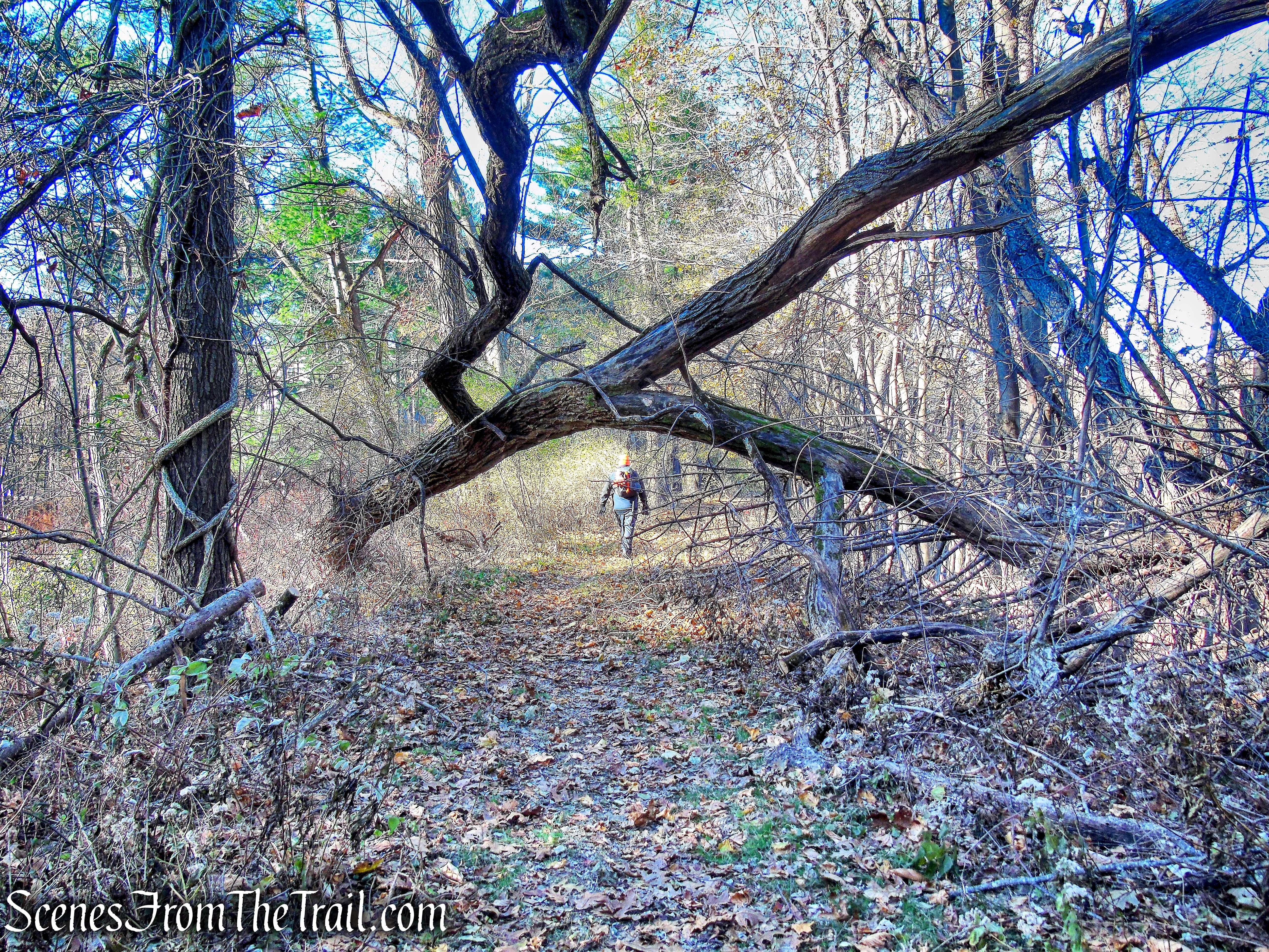
Andre Brook Trail
Andre Brook Trail
The Hudson River comes into view as the trail begins to descend.
Andre Brook Trail
The trail enters the woods and turns left as it reaches Andre Brook, behind the high school.
Andre Brook Trail
The trail then reaches the area behind and above the Sleepy Hollow High School football field.
Sleepy Hollow High School – Andre Brook Trail
Sleepy Hollow High School – Andre Brook Trail
Home of the Headless Horsemen, the coolest school mascot ever.
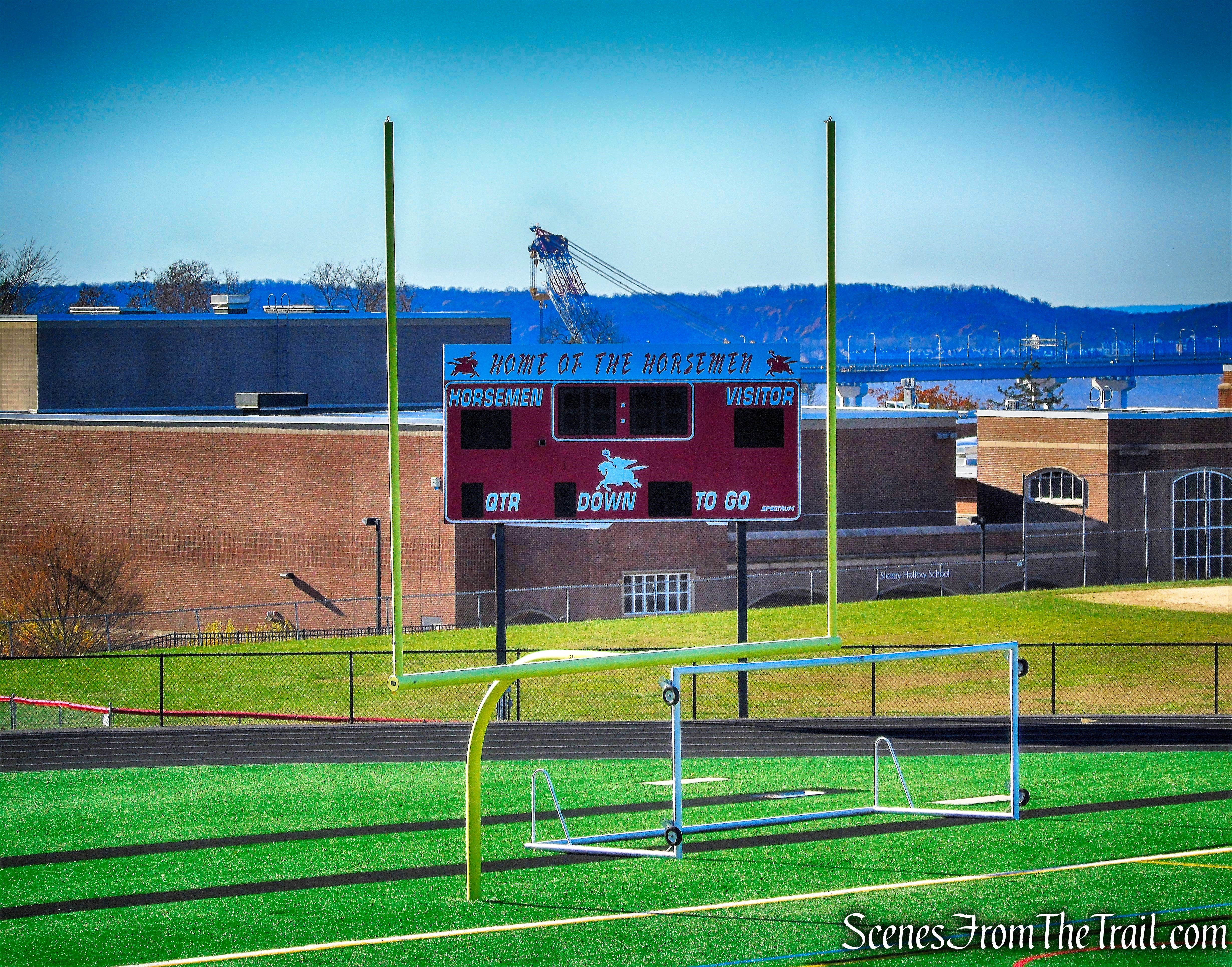
Sleepy Hollow High School – Andre Brook Trail
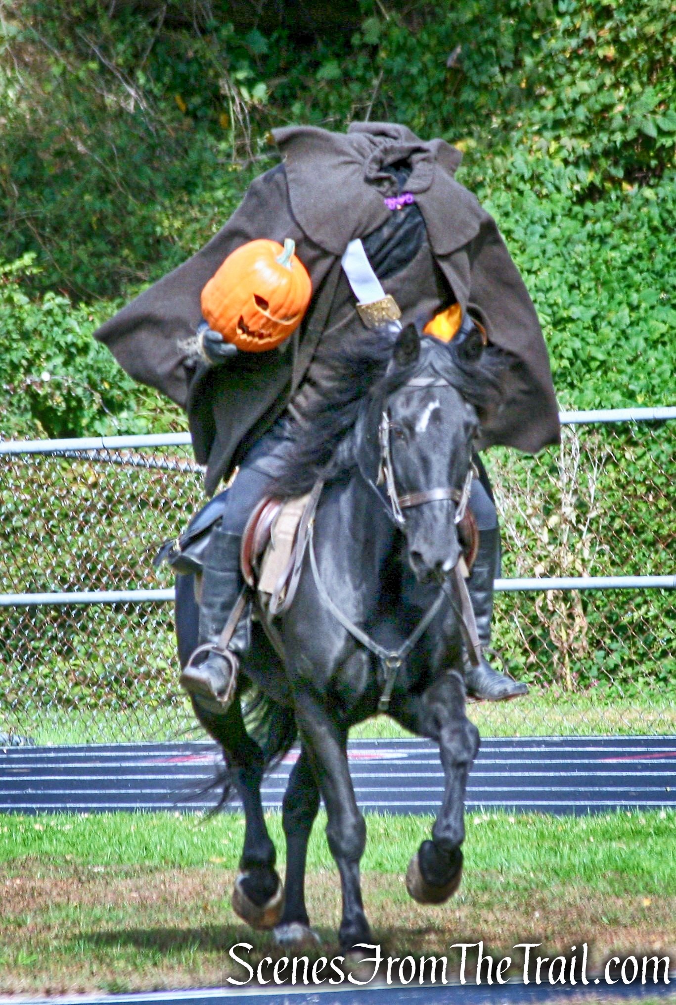
Headless Horsemen
At the end of the trail, the orange-blazed Andre Brook Trail connects with the Old Croton Aqueduct Trail and the village of Sleepy Hollow.
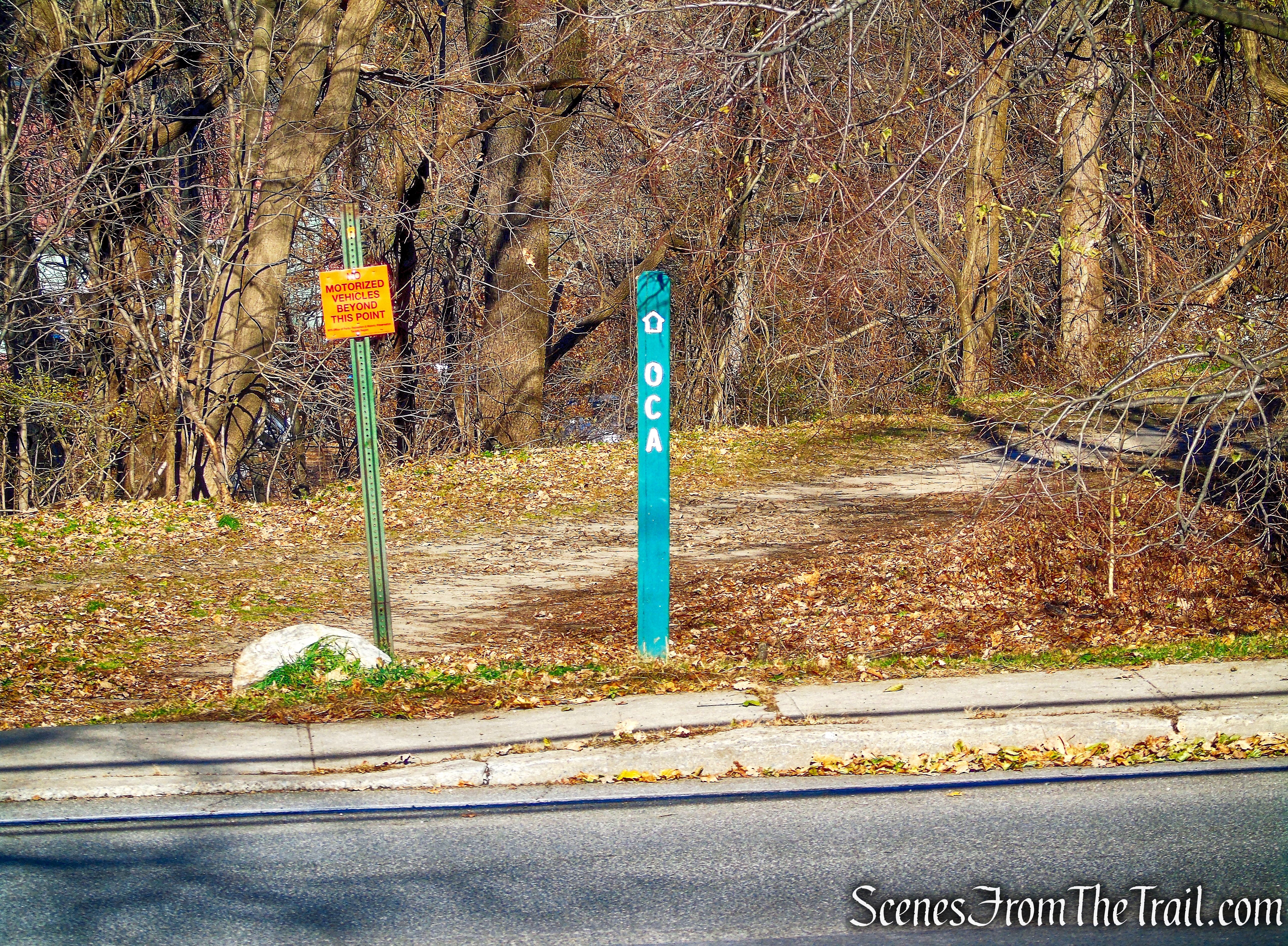
Old Croton Aqueduct Trail – Andre Brook Trail
This hike was done as a shuttle, meaning we used two cars. We parked one vehicle in the north lot of Sleepy Hollow H.S. (closest to Bedford Road/ NY-448) and one vehicle at the Eastview Park-n-Ride. This eliminated an uphill walk from the high school and made the hike even easier. There are numerous variations that can be done depending on where you park, including an out and back, which would double the mileage. For longer hikes, one can jump on the Old Croton Aqueduct Trail which runs through the high school parking lot or take the North/South County Trailways by Eastview. A truly lovely place that is so full of history and I am lucky to have grown up here.
Pros: Tarrytown Lakes, numerous access points, plenty of parking, scenic area, easy walking trails.
Cons: No trail map
Take a hike!
Tarrytown Lakes Trails
Sources:
- How The Tarrytown Lakes Came To Be
- History of the Tarrytown Lakes
- On the Water: Secret history of Tarrytown Lakes
- Stations Along The Trail On The Putnam Division Right-Of-Way
- What Happened to East View?
