August 20, 2017 – Cornwall, NY
Difficulty: Moderate – Strenuous (3 steep climbs and 1 steep descent)
Length: Approximately 5.3 miles
Max elevation: 1,391 ft.– total elevation gain approximately 1,247 ft.
Route type: Circuit
Map: West Hudson Trails Map – Black Rock Forest Consortium Web Map
Trailhead parking: Black Rock Forest Main Parking Lot – Reservoir Rd, Cornwall, NY 12518
Black Rock Forest is located in the western Hudson Highlands region in Orange County, NY, mostly in the town of Cornwall, with the southern fringe overlapping into the neighboring town of Highlands. At 3,870-acres, it is the largest area in the Highlands with a sustained elevation over 1,200 feet, providing the hiker with sweeping vistas and strongly contrasting habitats. There is a network of old logging and mining roads, and together with cut footpaths, provide over 30 miles of trails in Black Rock Forest.
I hiked the area a few years ago and decided to pay a return visit. We spent a good portion of the day there and only ran into a few people. One man and his dog at Black Rock summit, a woman walking her dog on a nearby trail and a couple walking in the opposite direction as we approached the parking area at the conclusion of our hike. It was a beautiful August day with temps in the low 80’s, sunny and slightly humid. We arrived at the parking area at approximately 9:15 am and there were only several cars in the lot. We did this hike clockwise from the parking area and only retraced our steps for less than 1/2 of a mile.
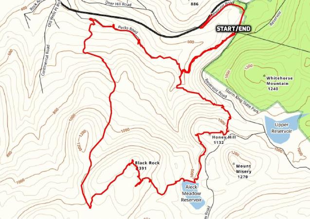
Black Rock Mountain Loop
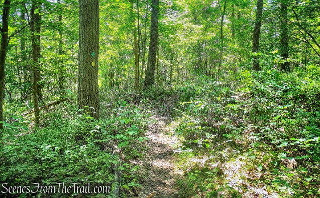
We began our hike at the southwest corner of the parking area, on the red-blazed Duggan Trail.
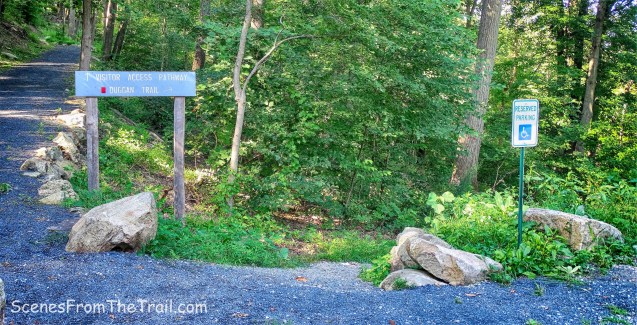
Start of Duggan Trail
The trail enters the woods on a footpath, heading southwest. Almost immediately, I re-injured my calf muscle which I thought was healed. I seriously thought about turning around and calling it a day, but I decided to stick it out and hobbled on.
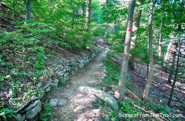
red-blazed Duggan Trail
In about 1/2 of a mile, the red trail ends at a junction with the blue-blazed Reservoir Trail. We continued straight ahead on the blue trail, which crosses Ben’s Bridge (a wooden footbridge).

Ben’s Bridge
The blue-blazed Reservoir Trail climbs steadily on a woods road. It parallels a stream that is known for its picturesque cascades. It was almost bone dry on this day. We climbed approximately 350 feet in about 1/2 of a mile.
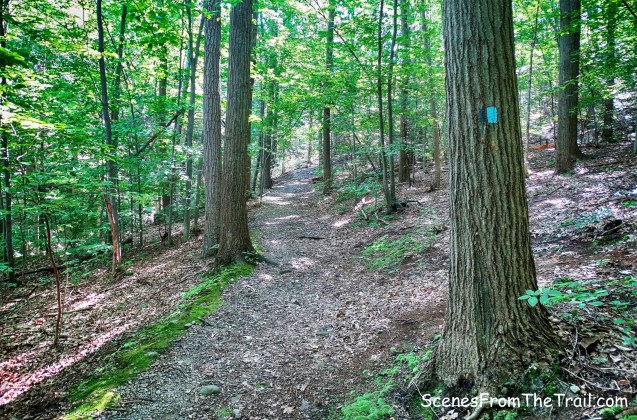
blue-blazed Reservoir Trail
We came to a junction where a sign marks the start of the Honey Hill Trail. We turned right here and proceeded to follow the white blazes uphill.

Honey Hill Trail
The Honey Hill Trail climbs approximately 200 feet in about 1/3 of a mile as it approaches the 1132 ft. summit.

Honey Hill Trail
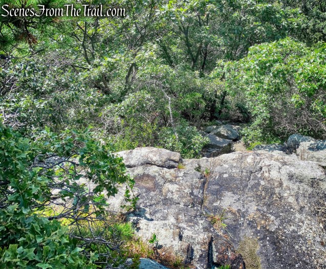
After arriving at the summit, the trail begins to descend and in a short distance, comes to a directional sign, where the white blazes turn left. Just ahead is a rock ledge with a limited viewpoint.

Honey Hill Trail
Straight ahead is Black Rock Mountain, which we would be climbing shortly. We took a nice long break here as we were a little tired from our climb. My calf was still hurting, but I was able to continue.
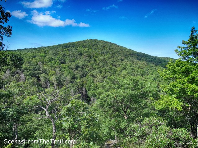
Black Rock Mountain
We got back on the Honey Hill Trail and continued to descend, now heading towards Aleck Meadow Reservoir.

Honey Hill Trail
The descent is steep in places, but it is quite scenic. It was so quiet and peaceful, that it felt as if we had the woods all to ourselves.
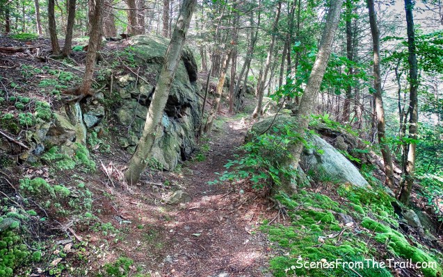
Honey Hill Trail
The white-blazed Honey Hill Trail ends at a junction with the joint Stillman (yellow) and Highlands (teal diamond) Trails at the base of the Aleck Meadow Reservoir dam.

terminus of Honey Hill Trail
We turned right onto the joint Stillman/Highlands Trail, but veered off it as we climbed the embankment up to the reservoir. According to Henry Tryon, Black Rock’s first director, the reservoir occupies what was once a small dairy farm.

Aleck Meadow Reservoir
We headed west along the earthen dam and entered the woods on the joint Stillman/Highlands Trail.
joint Stillman/Highlands Trail
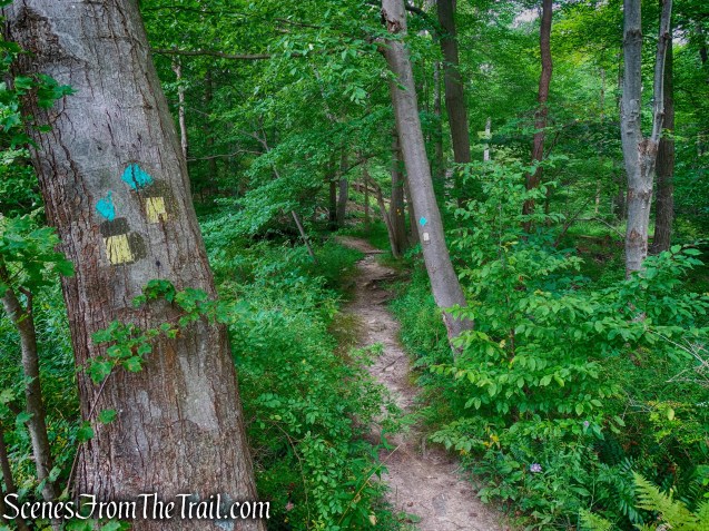
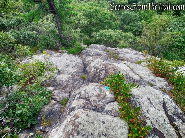
The joint Stillman/Highlands Trail is well blazed and easy to follow, but we missed a turn because the tree with the offset blazes, indicating the turn, was partially obscured by vegetation. The trees laying across the trail is another indicator as well, but we stepped over them and kept walking. When we saw no more blazes, we knew were off the trail and backtracked to the proper turn.

obscured blazes on the joint Stillman/Highlands Trail
From the Aleck Meadow Reservoir to the summit, we gained almost 400 feet of elevation in about 1/2 of a mile, but when we reached the summit, it was all worthwhile. We had hiked almost 2.5 miles.
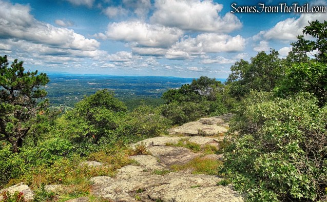
Black Rock Mountain summit
There was a man with his dog at the summit when we arrived, but he left shortly thereafter and we had this glorious view all to ourselves. To the west, the Black Rock Fire Tower is visible. The 80 ft. Black Rock Forest Fire Tower was erected in 1929 as a private lookout and is closed to the public.
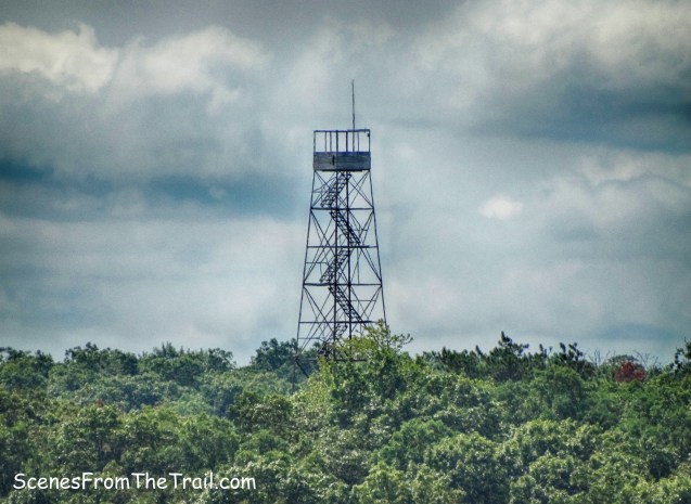
Black Rock Forest Fire Tower
To the northeast, the Hudson River and the Newburgh-Beacon Bridge are visible.

view northeast from Black Rock Mountain
To the west, Schunemunk Mountain stands waiting for me to hike it. We hung out at the summit for quite some time, enjoying the spectacular view while we had lunch. The breeze felt so good that I could have stayed there all day, but we had a hike to complete.

Schunemunk Mountain as viewed from Black Rock Mountain
We then proceeded to head southwest to continue following the joint Stillman/Highlands Trail as it begins to descend Black Rock Mountain. At first glance, the blazes appear to just drop off the cliff.
joint Stillman/Highlands Trail
The trail does descend steeply here and it required using both hands and feet, but it wasn’t that difficult.
joint Stillman/Highlands Trail
After the initial steep descent, the grade does moderate and we continued on the joint Stillman/Highlands Trail.
joint Stillman/Highlands Trail
In about a 1/2 of a mile from the summit, we came to a wide gravel road. We turned right on this road that is known as Hulse Road. We followed Hulse Road as it led us downhill. It climbs a little, then continues its descent, steeply in places.

Turn right on Hulse Road
We stayed on Hulse Road for over a mile until it ends at a junction with the white-blazed Black Rock Hollow Trail. Turning right, we now began heading southeast, following the white-blazed trail along another gravel road, with Black Rock Brook to our left.
Turn right on the white-blazed Black Rock Hollow Trail
Just feet off the trail, there is a ruined stone building along the brook. If I wasn’t so tired, I would have explored it. There was a lot of fallen branches blocking the way, perhaps by design.

ruined stone building
Right by the stone building are the remains of an old dam.

dam
In about 1/2 of a mile, we came to a water filtration plant. Here, the Black Rock Hollow Trail turns right and starts to climb more steeply, but we veered left, skirting the filtration plant, and continued on the blue-blazed Reservoir Trail.

veer left at the water filtration plant
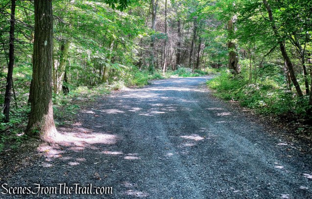
The blue-blazed Reservoir Trail travels on another mostly level gravel road. We were glad because we were pretty tired by this point.

blue-blazed Reservoir Trail
In a short distance, we came to a junction where the Reservoir Trail turns right to cross Ben’s Bridge. Here we made a sharp left onto the red-blazed Duggan Trail and followed it back to the parking area where the hike began. The whole way back on the Duggan Trail was mostly uphill. I didn’t remember walking that much downhill at the beginning of the hike. It was only 1/2 of a mile, but it felt longer, much longer. We were all exhausted by this time and my calf was screaming for mercy. A great hike, but we were glad it was over.
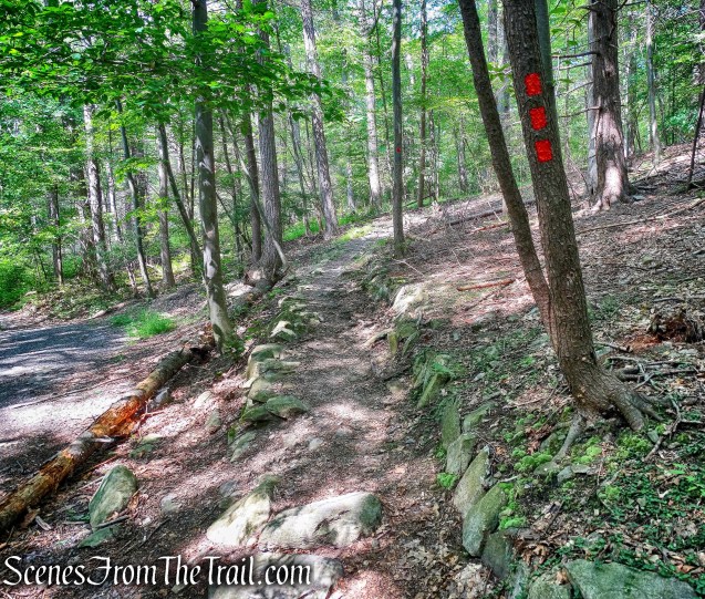
sharp left on red-blazed Duggan Trail
This hike was rigorous, but had a lot of different points of interest along the way. By the time we got back to the parking area, it was almost full, but we encountered very few people along the trails, which was a good thing. Black Rock Forest is great place to hike and I intend on going back to explore more of the trails. Now get out there and take a hike!
Pros: Woods roads, scenic views, reservoir, ruins, brooks and streams, less traveled.
Cons: Water level was low in the brooks and streams, lots of elevation, road noise can be heard from Black Rock Hollow Trail and the summit of Black Rock Mountain.

summit of Black Rock Mountain

I was always looking to save some elevation gain, so I preferred the somewhat obscure trailhead up ridiculously steep Mine Hill Road. The car I had at the time was definitely unhappy with this choice, but still struggled up without quitting.
The fire tower had no signs threatening draconian penalties for climbing, so it wasn’t too difficult to make it up the missing stairs to the fine view!
LikeLike