July 1, 2017 – Haverstraw, NY
Difficulty: Moderate
Length: Approximately 6.5 miles
Max elevation: 1,224 ft.– total elevation gain approximately 800 ft.
Route type: Circuit
Map: Harriman-Bear Mountain Trails Map 118
Trailhead parking: Call Hollow Rd, Haverstraw, NY
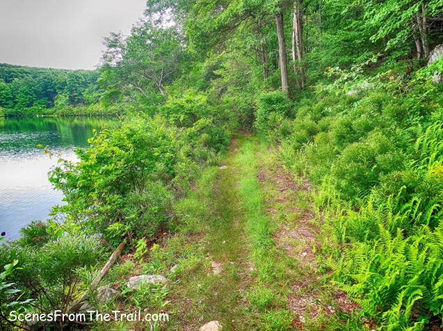
The first day of July called for high humidity and possible rain and thunderstorms. Not ideal hiking weather, but one must adapt to the conditions that are beyond our control. I mapped out a moderate hike that would take us on fairly level woods roads past bodies of water to try to stay as cool as possible. We did this loop clockwise beginning at Call Hollow Road on the right side of the map below.
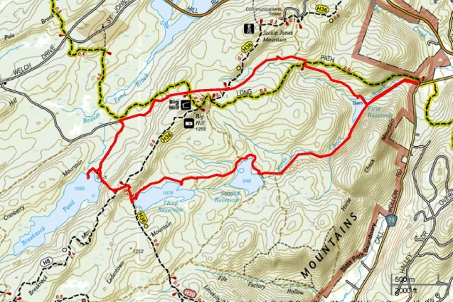
hike route
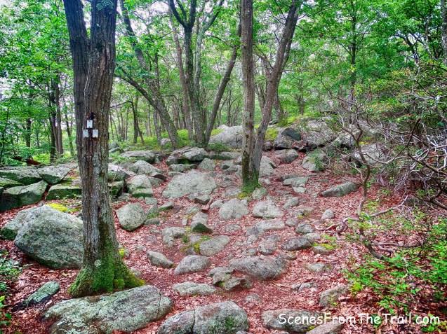
This hike is almost entirely on unmarked trails, but is quite easy to navigate. None of the woods roads/trails are overgrown and never having hiked this area before, we were able to find our way without any difficulties. The parking area on Call Hollow Road is also a trailhead for the Long Path, but our hike began on the paved road just to the left. The paved road beyond the gate leads to the Letchworth Village Reservoirs water treatment plant. Letchworth Village State Developmental Center was a New York State custodial institution on Willow Grove Road, just east of the Palisades Interstate Parkway. It was founded in 1908 by William Pryor Letchworth. Letchworth Village was closed in 1996.
Myles, William J.. Harriman Trails: A Guide and History (Kindle Locations 5516-5519). New York – New Jersey Trail Conference. Kindle Edition.
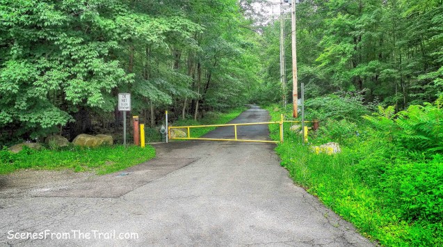
gate on Call Hollow Road
In 1908, the far-sighted planners bought 640 acres in the hills drained by Horse Chock Brook, a branch of Minisceongo Creek. This was to be used for water supply. At present, there are three Letchworth reservoirs. Harriman State Park has acquired the land and roads around the reservoirs, but the reservoirs themselves are off limits. The three reservoirs are named First, Second and Third Reservoirs.
The paved road leads gradually uphill on what Google maps shows as Camp Winaki Road. It is actually Woodtown Road as indicated on the NY/NJ Trail Conference map.
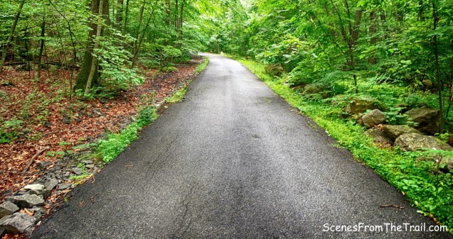
Woodtown Road
In about .3 miles, the road passes the Letchworth Village water treatment plant. Here the paving ends and the road bears left, past a gate.
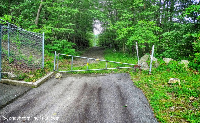
Woodtown Road
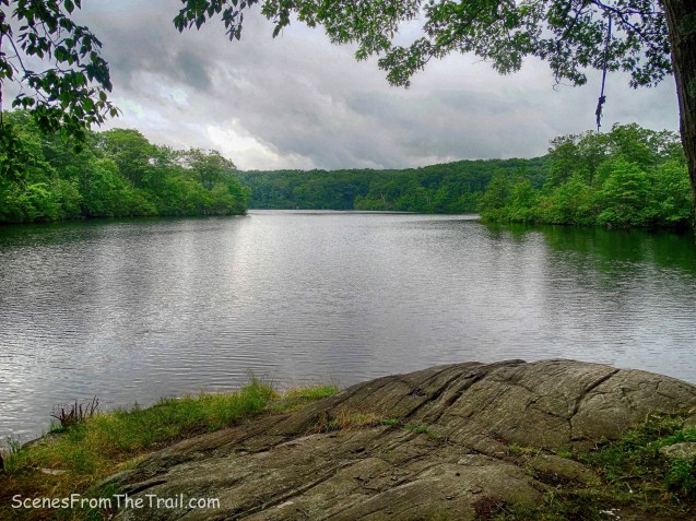
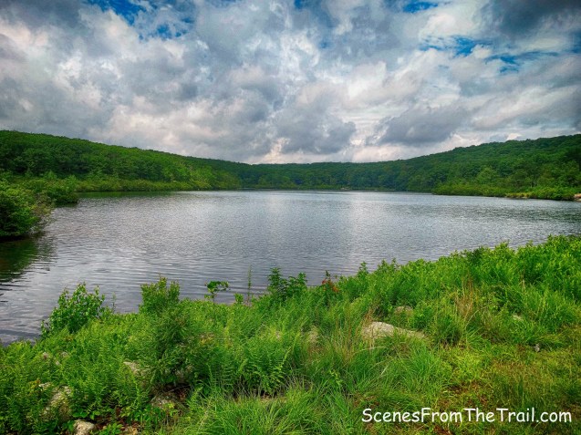
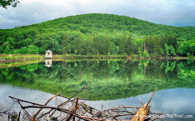
It then comes to the eastern end of the dam of First Reservoir, which was built in 1912.
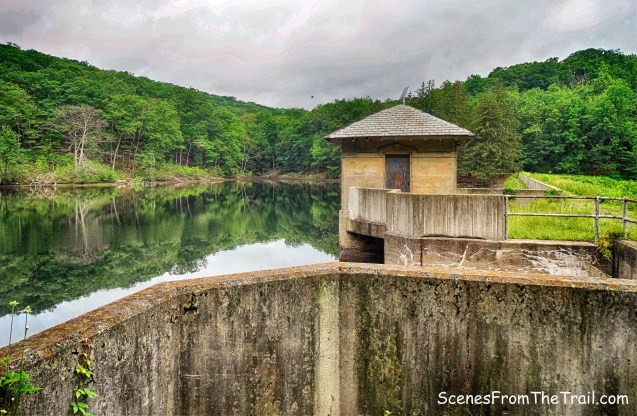
First Reservoir
We stopped here momentarily to reflect upon the meaning of life. Well, not exactly, we stopped mainly to catch our breath, wipe our brows and capture some images.
First Reservoir
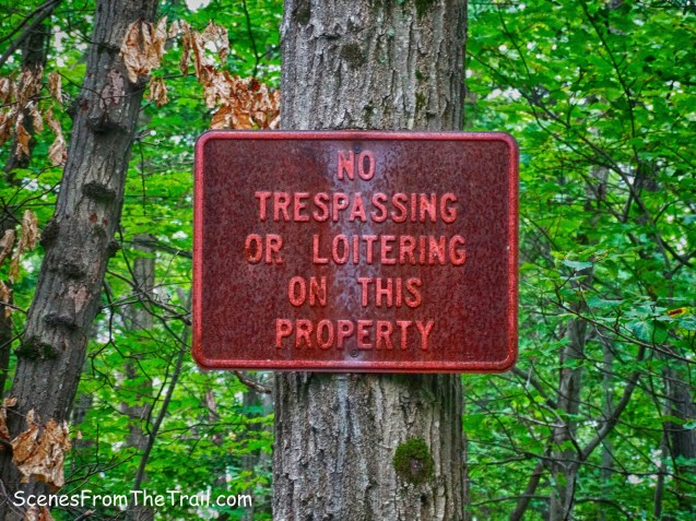
There are numerous signs posted throughout, but they pertain to the reservoirs and not the land around them, which is owned by Harriman State Park.

No Trespassing sign
We continued on Woodtown Road which climbs gently, with Horse Chock Brook to the right. Woodtown Road is named after a family of woodcutters who had several homes, a sawmill and a barkmill at the site of the Second Reservoir. Woodtown Road was used for hauling iron, charcoal and wood to Haverstraw.

Woodtown Road
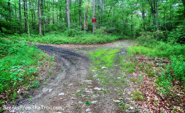
At about 1.35 miles, just below the dam of Second Reservoir, Woodtown Road turns left. We continued ahead on the more obvious route that continues straight ahead and then bears right. This is a service road which leads to Third Reservoir. We arrived at the Second Reservoir and took a short break here.

Second Reservoir
In 1910, the 50-acre Parcel #30, known as the Bedford Pond property (the old Wood millpond), was acquired by Letchworth Village for $538.84 (the pond was 14 acres). After two years of water shortage, the Second Reservoir was built in 1927-28, using the old mill pond.
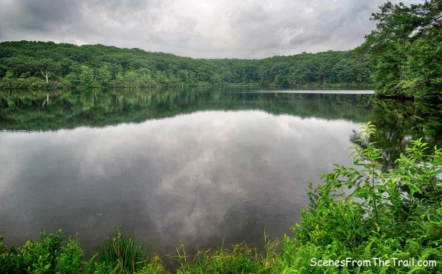
Second Reservoir
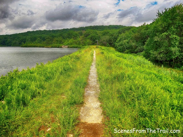
While relaxing here a group of about six loud talking women approached. They decided to take a break here as well, and that was our cue to proceed on our hike. Now on the service road, we began walking along the northwestern shore of the reservoir.
service road
We passed by some old rusty pipes then crossed the spillway and continued on the service road.

service road
We got one last look at Second Reservoir before the road starts to veer away from it.
Second Reservoir
We then arrived at a junction with another woods road that goes to the right. This is known as the Second Reservoir Trail. This woods road connects the Second Reservoir with the joint Suffern-Bear Mountain Trail/Long Path section and the Old Turnpike near the Big Hill Shelter. We stayed on the service road.
Second Reservoir Trail junction
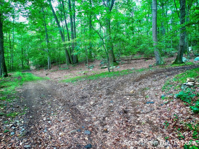
The service road begins to climb and then reaches a fork. We stopped here to figure out which way to go. After consulting my compass, we stayed right at the fork to continue heading west towards Third Reservoir.
fork in the road
The rusty sign on the tree at the fork was of no help.
rusty sign
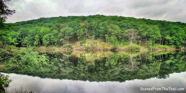
A little further up the road we came to Third Reservoir and the sun was shining.
Third Reservoir
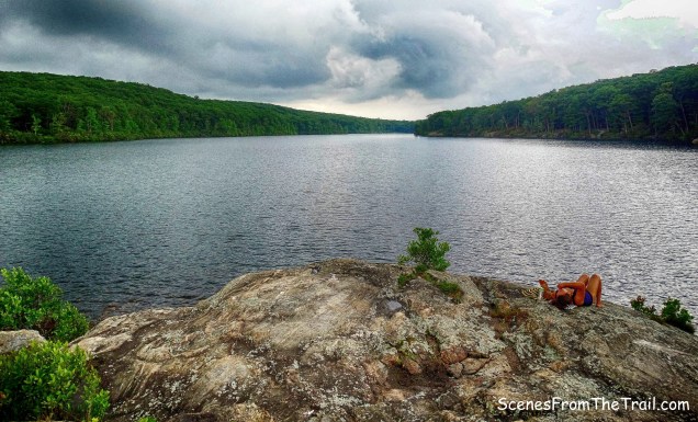
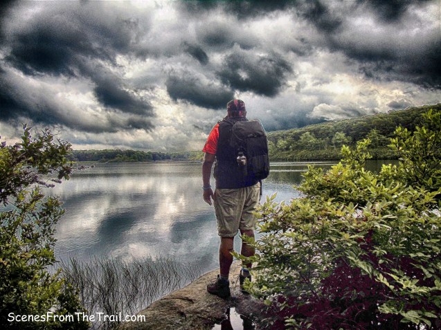
Third Reservoir, which was built in 1951-52 in the valley where the Suffern-Bear Mountain Trail comes down off Ladentown Mountain and starts up Big Hill. The trail was moved 400 feet to the west when the reservoir was filled. We found a nice flat rock at the edge of the reservoir to sit down and relax for a minute or two.
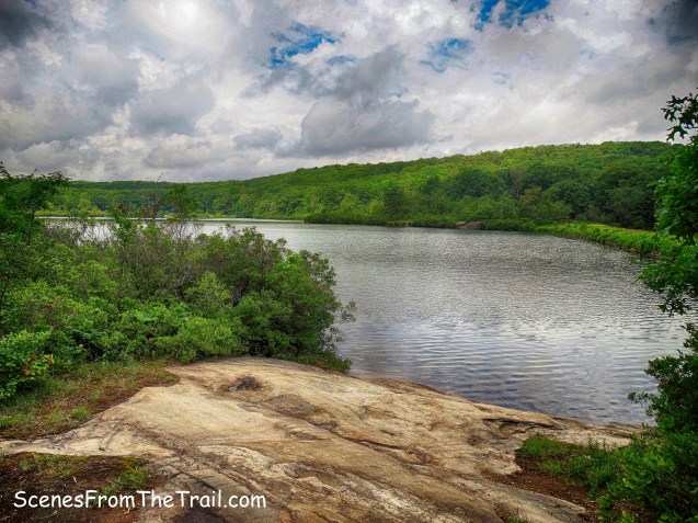
Third Reservoir
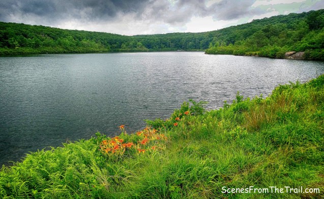
After working up a sweat, the sun was feeling kind of hot so we found a shadier spot. We then made our way over the earthen dam, still part of the service road as indicated on the map.
earthen dam
What a beautiful spot this place is. It was very quiet and quite picturesque as we soaked up some rays while we walked.
Third Reservoir
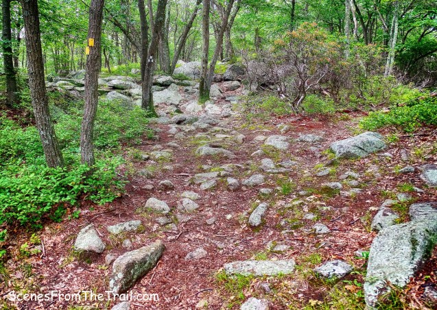
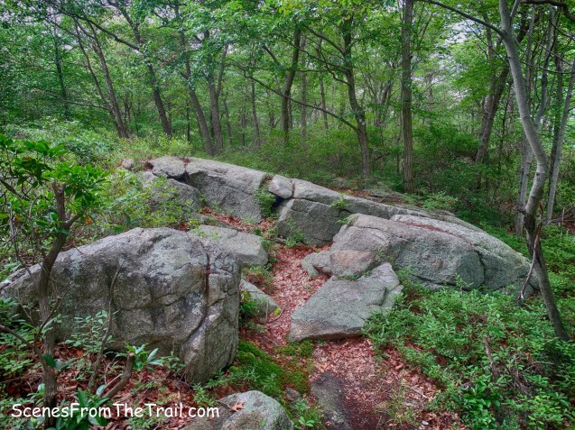
Just past the dam, the service road ends and an unmaintained trail begins, as indicated on the map. It looks more like a narrow woods road, although in places it does resemble a footpath.

unmaintained trail – Third Reservoir
It is easily passable and several other unmarked trails intersect it, but we stayed close to the water and ignored the other trails.
unmaintained trail – Third Reservoir
We then came to the junction with the yellow-blazed Suffern-Bear Mountain (S-BM) Trail. Knowing we were on the right track and having found our turnoff spot, we found a nice rock to sit on at the western edge of Third Reservoir and took another break.

Third Reservoir
We then proceeded northwest on the S-BM Trail, which heads up Breakneck Mountain. This was the steepest part of the hike, but only lasted for about .3 miles.
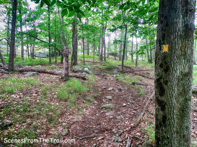
yellow-blazed Suffern-Bear Mountain (S-BM) Trail
This section of the S-BM Trail was scouted in 1924 by Archibald T. Shorey. He was a member of ADK, and a Brooklyn Boy Scout leader. Various routes were considered, but by January 1926 the route the trail presently follows had been worked out.
Suffern-Bear Mountain (S-BM) Trail
In about 1/3 of a mile, when the S-BM Trail makes a sharp right, there are 3 white blazes on a tree just to the left. This is the start of the white-blazed Breakneck Mountain Trail. We turned left here.
Suffern-Bear Mountain Trail/Breakneck Mountain Trail junction
The Breakneck Mountain Trail was first blazed in the fall and winter of 1927 at the suggestion of Major Welch, General Manager of the Park. It was built to connect the T-MI Trail with the S-BM Trail.
Breakneck Mountain Trail
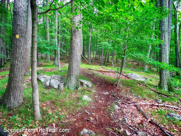
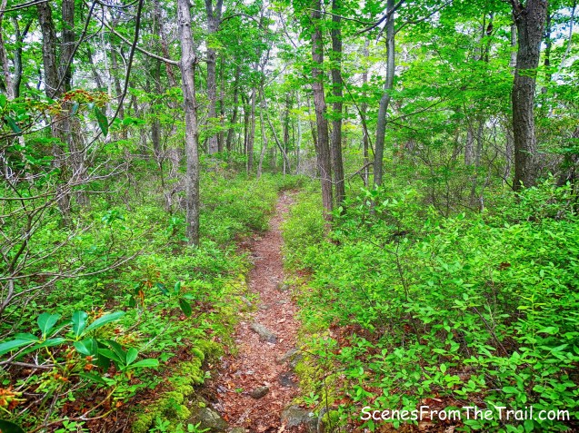
Now following the white blazes, we walked over open rock as the trail begins to descend.
Breakneck Mountain Trail
In just under 600 feet from the start of the Breakneck Mountain Trail, there is an unmarked trail that goes off to the right. We turned here and began walking this footpath in a westerly direction towards Breakneck Pond.
unmarked trail to Breakneck Pond
The trail starts off level then begins a steep descent and comes out by a cabin on Breakneck Pond. The cabin is part of the AMC Harriman Outdoor Center, which operates camping facilities here and opened exactly one year ago on July 1, 2016.
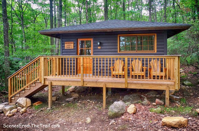
AMC Harriman Outdoor Center
Camp Winake of the Rockland County Council, Boy Scouts of America, was opened in 1930 at Breakneck Pond. Winake, which means “a pleasant place,” was the Algonquin name of the home of William P. Abbott, an active member of the Council’s camp committee in 1927. Later, the camp became known as Camp Lanowa, operated by Homes for Homeless Children.
Myles, William J.. Harriman Trails: A Guide and History (Kindle Locations 5410-5413). New York – New Jersey Trail Conference. Kindle Edition.
The camp had been abandoned for over a decade before the AMC took it over. We stopped here briefly and then we wandered around a bit. This place is really nice and I wouldn’t mind staying here sometime. We walked over to a large rock outcrop that looked out over the pond to get a better look. Breakneck Pond is a 64-acre natural lake that was enlarged by a dam in 1888.
Breakneck Pond
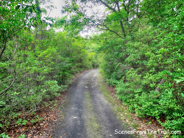
We then proceeded down the main road of the camp about a 1/2 of a mile and turned right onto the Old Turnpike which has an orange cable strung across it.
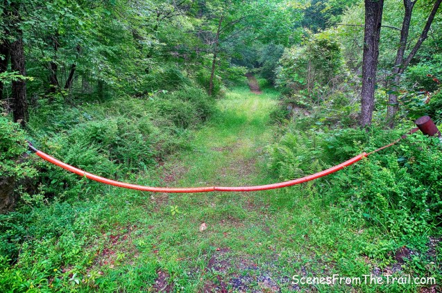
Old Turnpike
The Old Turnpike was rather overgrown until 1969, when AT&T widened it to 20 feet and buried a coaxial cable along one side.

Old Turnpike
The Old Turnpike was a road from Monroe (now known as Southfields) to Haverstraw. It is not known when it was first built, but it became the “old” turnpike in 1824, when a new turnpike (now Gate Hill Road/Route 106) was built.
The Old Turnpike crosses the Long Path, the S-BM Trail and then the Long Path again. It ends at the dam of First Reservoir. All day the skies were threatening with a little drizzle here and there. While on this road, the skies really opened up and we got soaked, hence no images. A good chunk of this road is badly eroded and becomes an ankle breaker, but at least it was downhill for its entirety. The rain let up as we approached First Reservoir and I pulled out my camera. I was able to capture an image of First Reservoir with Cheesecote Mountain in the background.
First Reservoir with Cheesecote Mountain in the background
We then crossed the dam to the eastern side of the reservoir towards Woodtown Road.
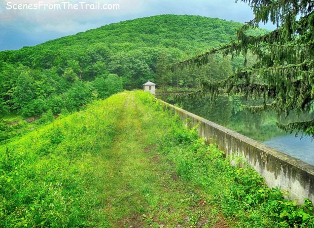
First Reservoir dam
We then turned left on Woodtown Road and retraced our steps back to Call Hollow Road where our hike began. On the way back down it started to rain heavily again, but we were already soaked. The rain did dash our hopes for a post hike BBQ, so we did some indoor cooking instead. I hope that you enjoyed the hike and please do not forget to follow my blog. Now get out there and take a hike!
Pros: Lesser traveled area of the park, water features, woods roads, unmarked trails, scenic views.
Cons: Unmarked trails (actually good for testing your map and compass skills), eroded woods roads become ankle breakers.
Take a hike!

I must say after receiving a summons for Trespassing while completing this hike the information contained on this page is misleading. These lakes are evidently still a public water supply operated by United Water and are not open to the public! There are signs posted throughout the hike and my advice would be to heed them!
LikeLike
As I stated in my post “There are numerous signs posted throughout, but they pertain to the reservoirs and not the land around them, which is owned by Harriman State Park.”
LikeLike
These are wonderful pictures. Would you mind if a road photo and a lake photo were included in an issue of the Genealogical Society of Rockland County newsletter? Thanks.
LikeLike
Be my guest, but please include photo credit please.
LikeLike
Absolutely. Thank you.
LikeLike
Thank you for this great article! Explains where my friends and I hiked today. We ended up at Third Reservoir via the yellow blazed Bear Mountain trail but coming from St John’s in the Wilderness church side via aqua trail, passing Big Hill. Sounds like we should try this hike to see the other reservoirs and Breakneck Pond.
LikeLiked by 1 person
Loved seeing pics from my old Camp Lanowa on Breakneack Pond. Actually it was owned & operated for many years by the Boys Athletic League of NYC from the 1920s to sometime in the 1980s I think, after which time it must have been sold for use as a camp for homeless kids. I was a camper there 1969-1971. BAL was a charity that provided 2-week camp vacations to underprivileged NYC kids. I was very sad to learn that they had ceased operations after so long a run.
LikeLike