June 17, 2017 – Irvington, NY
Difficulty: easy
Length: approximately 5.3 miles
Max elevation: 476 ft.– total elevation gain approximately 600 ft.
Route type: circuit
Map: Irvington Woods Trails Map
Trailhead parking: O’Hara Nature Center – 170 Mountain Rd
Irvington, NY 10533
Here is a more recent hike at Irvington Woods.
The forecast called for rain starting at noon so I figured I would try to get a hike in close to where I reside before the skies opened up. Irvington Woods at 400 Acres, is one of the largest forested areas in Southern Westchester. I had visited the preserve before several years ago, but only wandered around a little. Below is the route we took. We walked in circles a few times trying to find the points of interest.
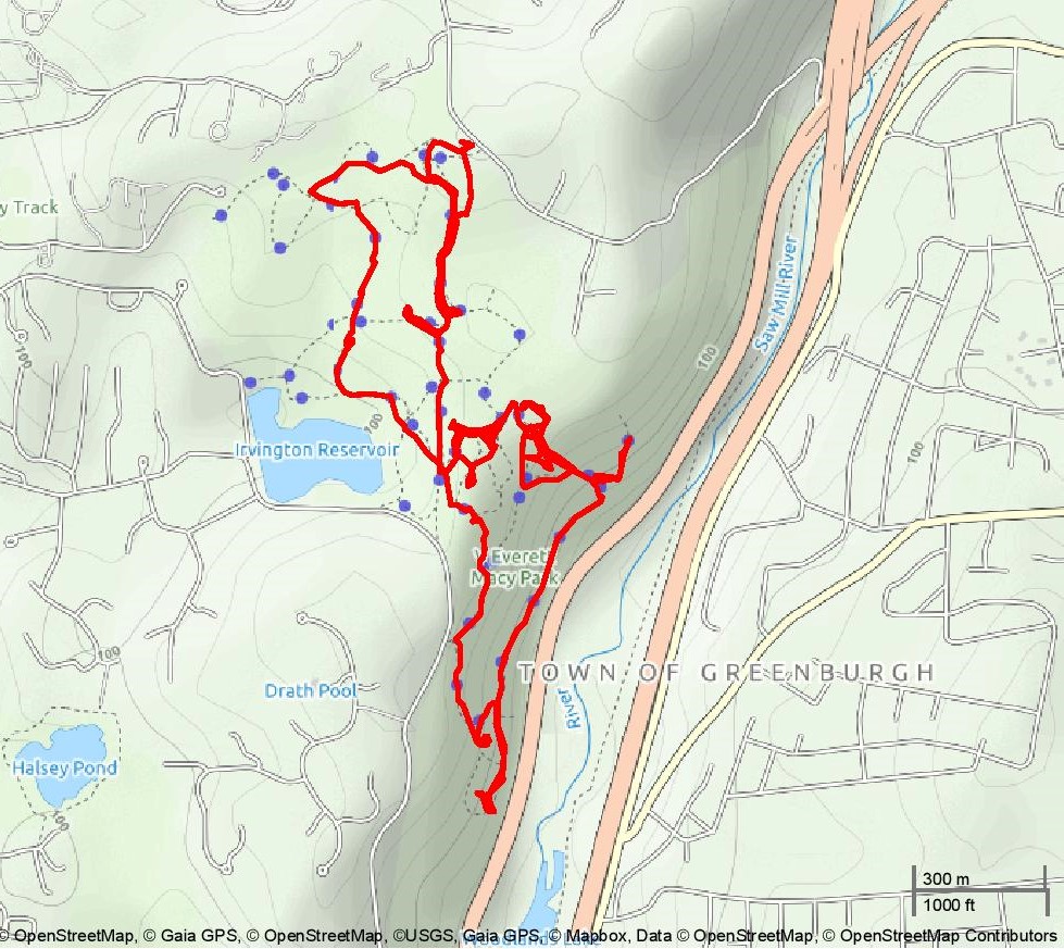
hike route
We arrived at the parking area of the O’Hara Nature Center slightly before 9:00 am on a Saturday morning. The only vehicle in the lot belonged to a groundskeeper who was doing some work out front.
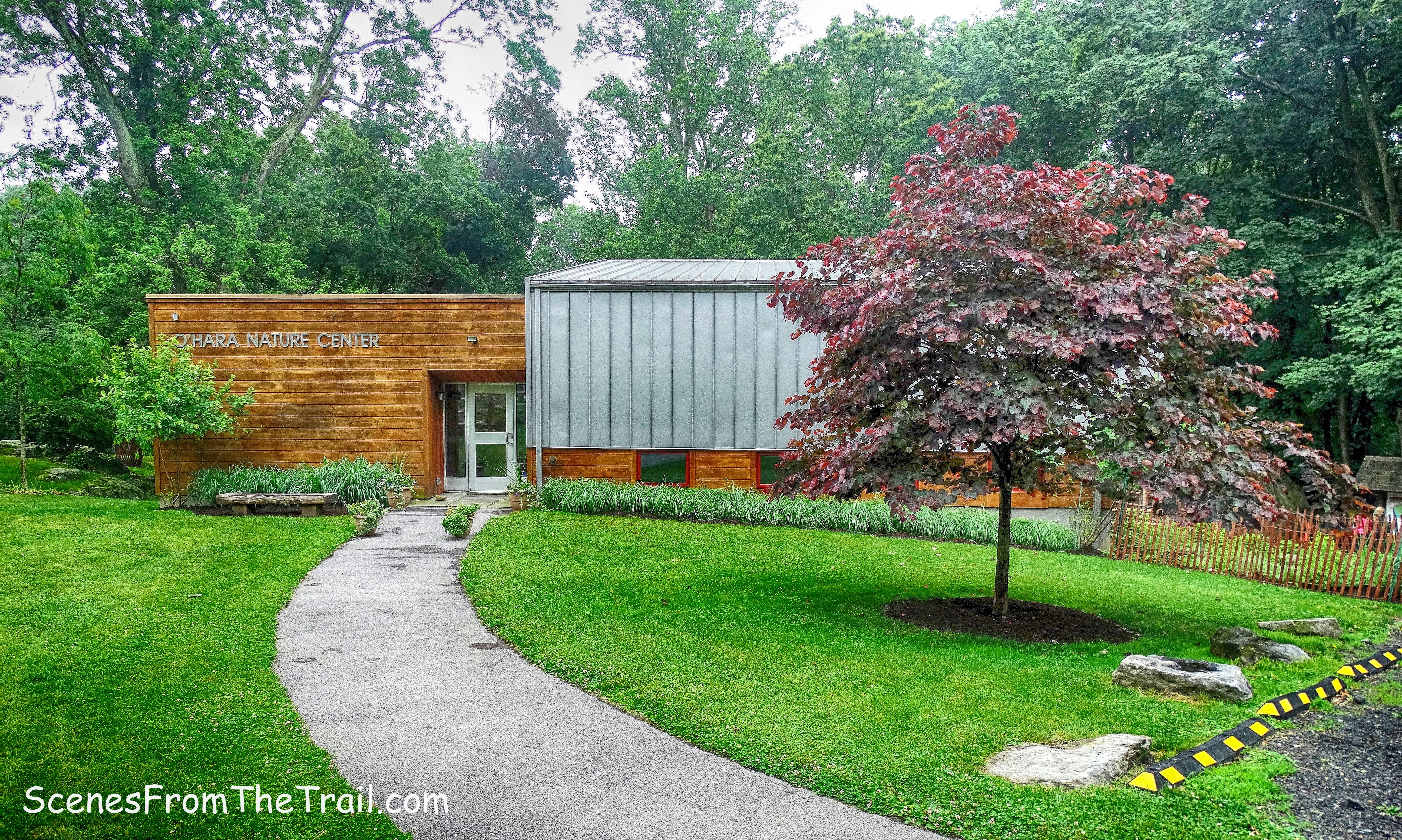
O’Hara Nature Center
We headed for the trailhead which is just to the right of the nature center, towards the rear.
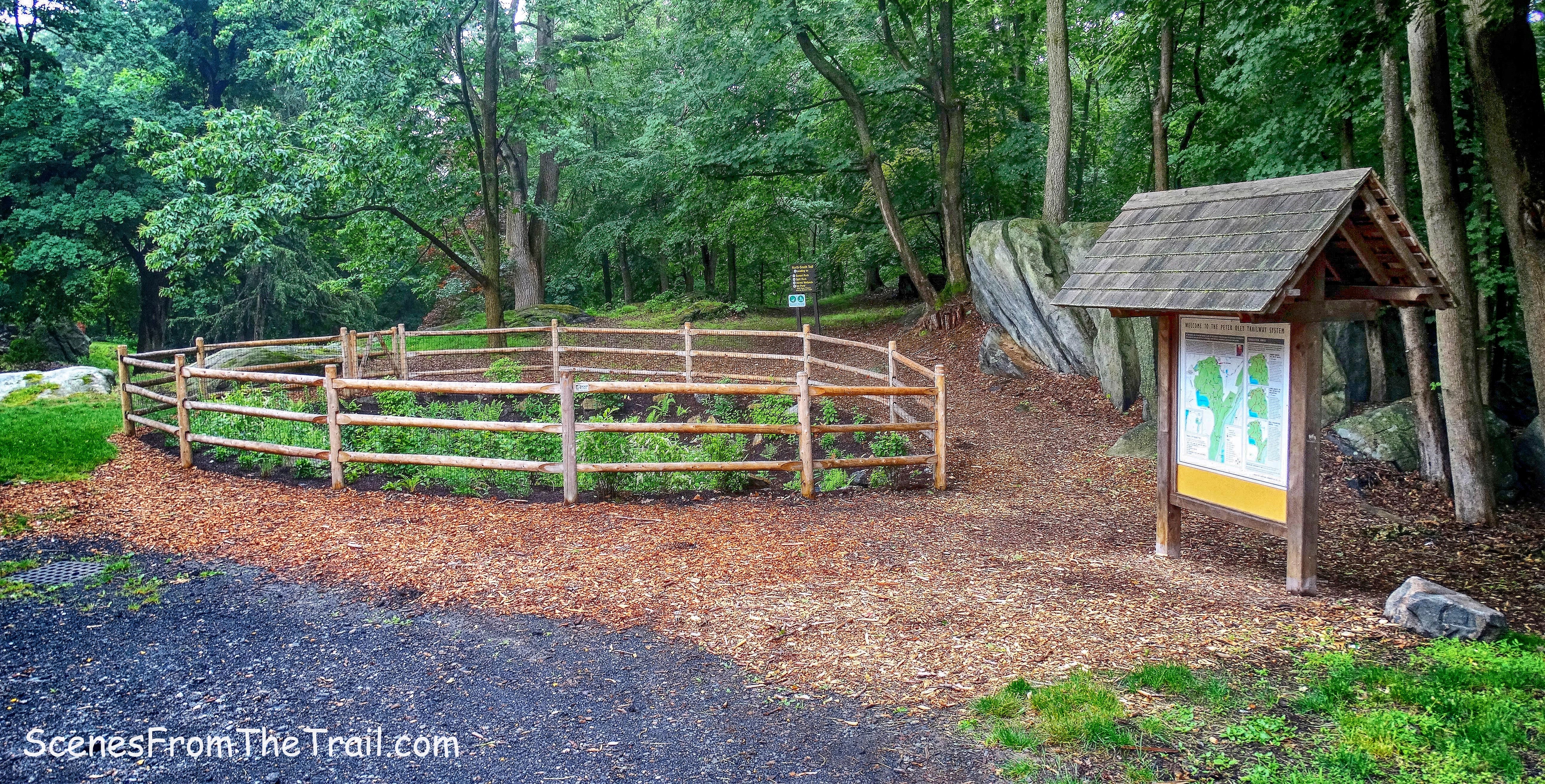
trailhead
Their website offers suggested hikes of various lengths which can be printed out. I chose the Full Perimeter Route which passes near all the points of interest. Our hike began by following the North-South (NS) Trail.
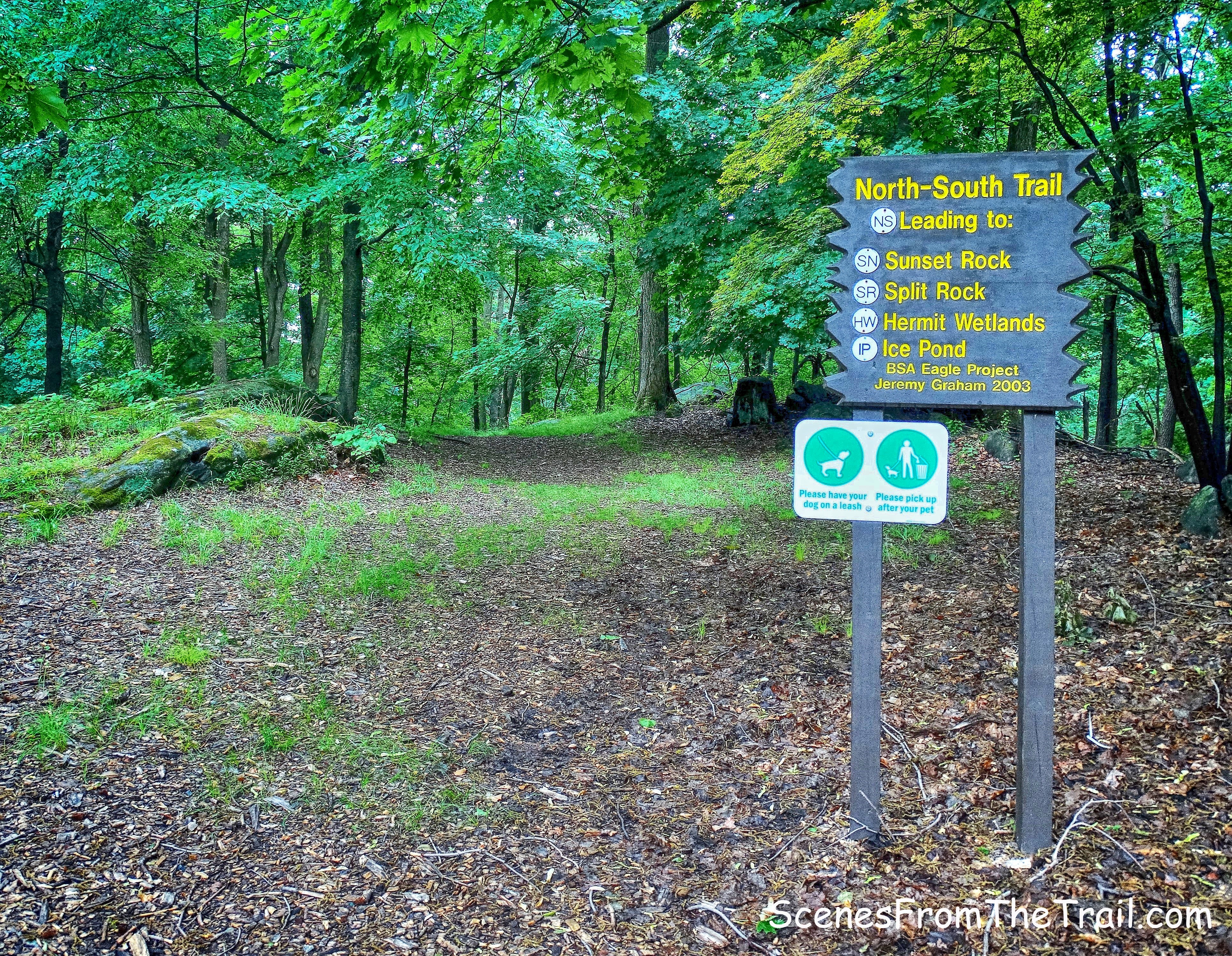
North-South Trail
The trails here are somewhat hard to follow as is evident from the hike route above. As the hike went on, I started to figure it out, but the intersections were a little confusing. Nevertheless, this place is not big enough to really get lost in. The woods were quiet except for the sound of squirrels scurrying about and birds chirping.
North-South Trail
The numbers on the posts at the junction pinpoint your location on the map. At number 10, we turned right onto the Split Rock (SR) Trail.
junction 10
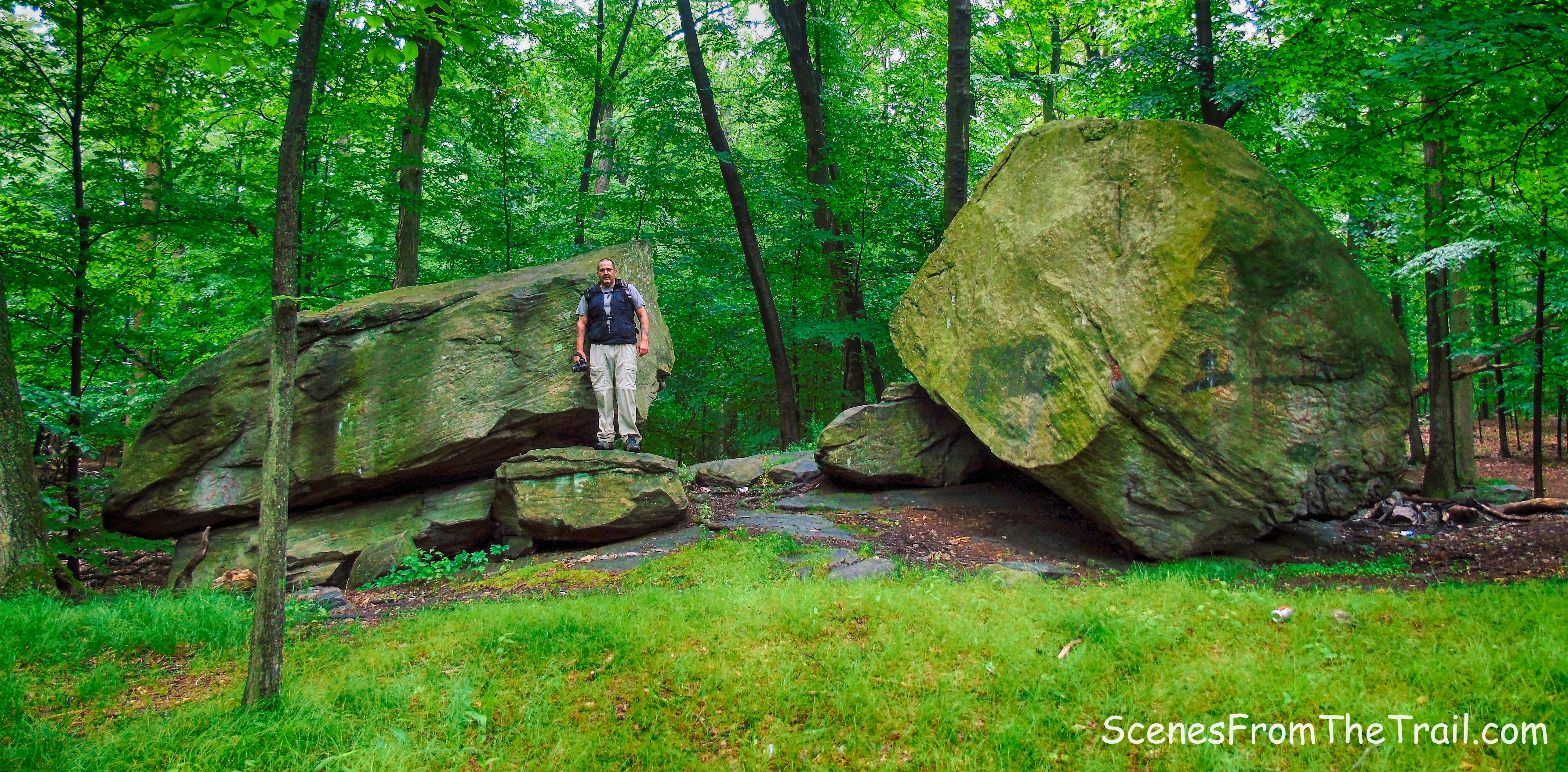
A short walk down the SR Trail and we arrived at Split Rock, a large glacial erratic.
Split Rock
This seems to be the hangout for local kids due to the numerous discarded beer bottles and cans that were strewn about the area. There is a garbage can here, but it must be invisible to those under 21. We then retraced our steps back to junction 10 and turned right. We were back on the NS Trail and then arriving at another intersection, I became confused. We were looking for the HW Trail, that according to the map, was in this direction. We ended up going on the joint HG/NS Trail, but I knew at this point we would just freestyle the rest of the hike.
junction
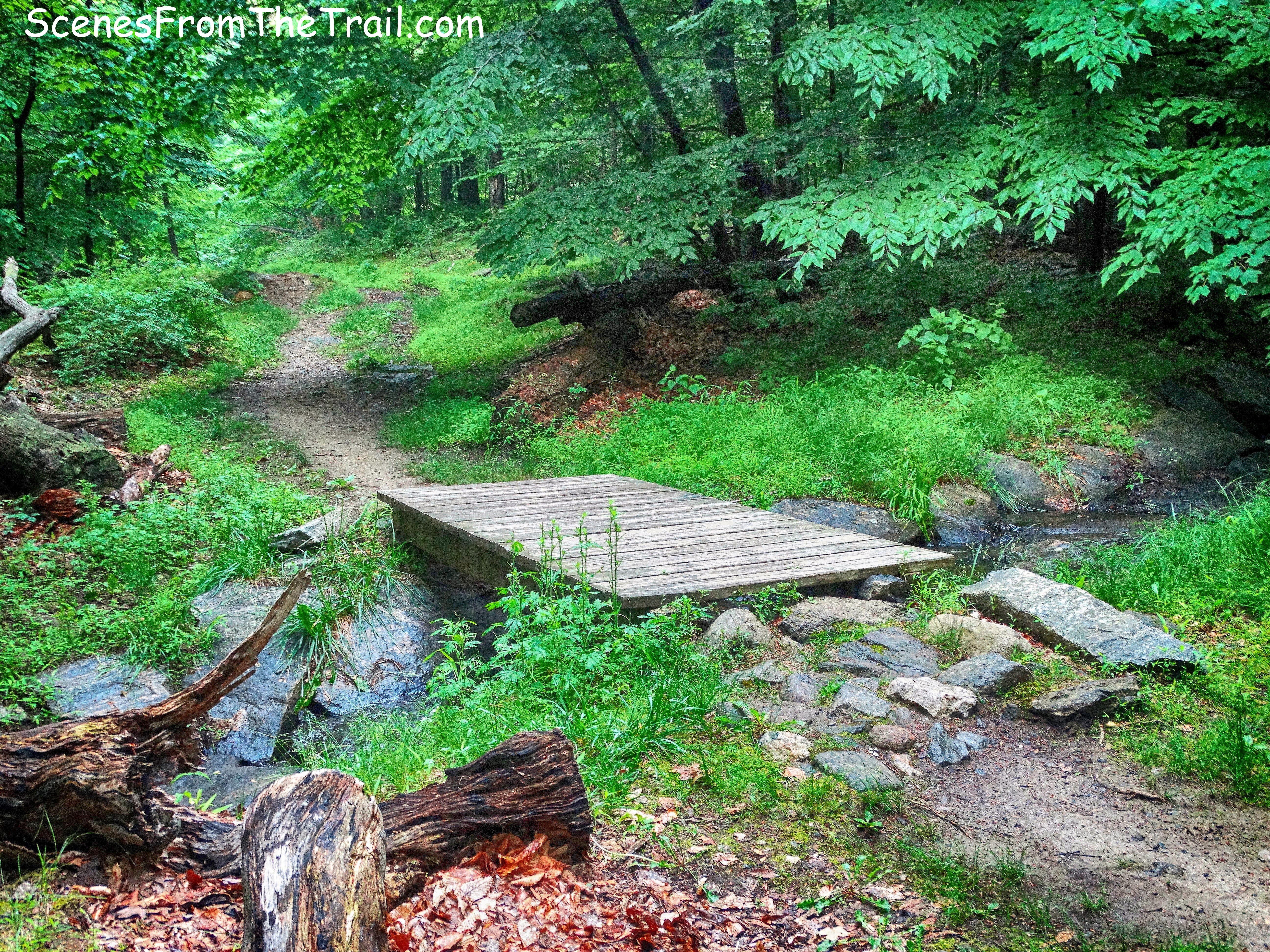
We then arrived at marker 15, where we crossed a wooden footbridge.
wooden footbridge
A short distance later, we came to a fork where the HG Trail goes right, but we stayed left and began walking on the unmarked woods road.
unmarked woods road
We were looking for Sunset Rock, which the website states has “striking sunset views of the Hudson River.” We came to another junction where the road splits and a trail takes a hard left. I happen to spot a sign on a tree that read “Sunset Rock” so we took the hard left.
junction
Although the sign is helpful, it would be a good idea to have a sign posted right by the actual spot. We ended up wandering around looking for those elusive Hudson River views. I climbed all the high ground to no avail. I spotted a man walking his dog and asked him where it was and he pointed the way. He told me that he comes here all the time and still manages to get lost. Sunset Rock wasn’t impressive at all. It was basically a clearing with no views at all. Possibly in Winter with no leaves on the trees, one can see the river, but not on this day.
Sunset Rock
We began heading northeast, now looking for the Hermit’s Grave. While looking for Sunset Rock, I spotted the sign on the tree that read “Hermit’s Grave” by marker 17. The sign points us in the right direction, but finding the grave was anything but easy.
Hermit’s Grave sign
Once again we wandered around, this time looking for the grave. I consulted the map numerous times and still nothing. We passed some nice rock formations as well as some woman with three very large unleashed dogs that wanted to jump on us. After literally walking in circles, we headed for higher ground to see if we could spot the Hermit’s Grave from above. We found a faint path and climbed to the top of a rock formation.
rock formation
After not being able to spot anything worthwhile from above, we took a break there. I plucked a couple of Ticks off my pants and then sprayed myself with bug repellent, which I had forgotten to do prior to beginning this hike. We descended the rock formation and jumped back on the HG Trail (short for Hermit’s Grave) and walked down what looked like an eroded woods road for the third time.
eroded woods road
I had a feeling that we were now going the right way, considering that we tried just about every other way. Heading southeast the trail turns left and passed marker 25 and then we came to marker 26, the site of the Hermit’s Grave.
marker 26
A short climb up the trail and we finally got to the Hermit’s Grave.
Hermit’s Grave
According to their website, In 1810 Johann Wilhelm Stolting was born in Heligoland (Germany) in the North Sea. He was well educated and spoke German, Greek, French and Hebrew. Although he was a teacher, linguist, scientist and landowner; at the end of his days he became a recluse, making buttons on a homemade lathe to support his few needs.
Hermit’s Grave
The eccentric Stolting roamed the streets and woods and bathed in the Saw Mill and Hudson Rivers. In a small shed on his land overlooking the Saw Mill River valley, he slept in his own coffin made of local chestnut wood. Stolting was a fascinating figure, and became known as the Hermit of Irvington. He died in Irvington on January 10, 1888. His is the only marked grave in the Village of Irvington.
Hermit’s Grave
After checking out the grave, we retraced our steps back to marker 25 and turned left. We were now walking on the Monument Loop (ML) Trail.
Monument Loop (ML) Trail
The ML Trail looks like it was once a road that led to one of the estates that once graced these woods. The stone embankments along its side is a telltale sign of its prominence.
ML Trail
We walked along the ML Trail, now searching for the Macy Monument, a granite rock with a plaque honoring V. Everit Macy. We got to marker 24 and veered left, off the trail on a footpath to find it. We walked until the trail seemed to peter out, but no monument. We did see a couple of stone benches though.
stone bench
When we got tired of looking, we backtracked to marker 24 and proceeded up the stone steps towards the overlook.
ML Trail
Climbing the stone steps, we arrived at a terrace. I read that it was the best view on this hike. We climbed the last few stone steps to the terrace……
stone steps to the terrace
and no view! Nothing but trees surrounded this terrace. It was a nice place to sit and relax, but no views! I could see the cars on the Saw Mill River Parkway zipping past down below through the trees, but that was it.
the terrace
After a brief rest, we returned to the ML Trail and headed up the hill. We passed through a clearing and re-entered the woods.
ML Trail
Besides the two dog walkers earlier in the hike, we did not encounter anyone else the rest of the way. The woods were scenic and quiet, just the way I like it.
ML Trail
Along the trail there is a massive tree that fell and ripped a boulder out of the ground.
tree and boulder
We crossed a wooden footbridge over a small stream along the way as a light drizzle began to fall.
wooden footbridge
That light drizzle turned into a steady rain so we decided to make a beeline back to the parking area instead of passing by the reservoir. We took a wrong turn or two along the way, but eventually made it back to the parking area, thoroughly drenched. I would visit this place again in better weather to check out the spots that I missed. I think I could find my way around a little better on my next trip there. Until next time folks, now get out there and take a hike!
Pros: Historic features, rock formations, glacial erratics, reservoir, secluded trails.
Cons: Trails are hard to follow at times, no views.
Take a hike!

Great park, one time I found shards of old china pottery after a storm there!
LikeLiked by 1 person
Did you find the trails difficult to follow? Maybe I am just used to traditional blazes, but I found the intersections confusing.
LikeLike
I absolutely felt the same way, but the park wasn’t too big so eventually I found familiar territory.
LikeLiked by 1 person
Thanks, that makes me feel better. Safe journeys to you.
LikeLiked by 1 person