May 7, 2017 – Bronx, NY
Difficulty: easy
Length: approximately 4.5 miles
Route type: circuit
Map: Pelham Bay Park
Trailhead parking: Orchard Beach Parking lot
For an updated and slightly different version of this hike, click HERE.
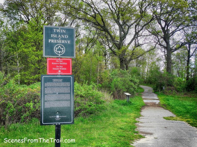
Located north of Orchard Beach, Hunter Island contains many noteworthy geological features including glacial erratics that were deposited during the last ice age nearly 15,000 years ago. The Siwanoy Indians, who originally occupied the island, called it Lap-Haa-Waach King, meaning “place of stringing beads,” after the shells they strung together and used for ceremony and currency. In 1654, they sold the land to Thomas Pell (c.1610-1669), for whom Pelham Bay Park is named, and it was called Pell’s Island, and then Pelican Island, until 1804 when John Hunter bought the island for $40,000. He cultivated the land, creating a magnificent garden and mansion.

Hunter Island
I first visited Hunter Island to search for owls a few years ago. In the process of trying to find those elusive owls, I discovered a hidden gem in the Bronx. I did eventually find those owls, but have been back numerous times to explore the myriad of trails that snake through this island. The only official trail here is the Kazimiroff Nature Trail, in honor of Dr. Theodore Kazimiroff (1914-1980). Kazimiroff dedicated much of his work to the exploration and preservation of Pelham Bay Park. There are numerous other unmarked trails that lead in all directions. With 138 acres to explore, there is enough ground to cover to keep you busy for a few hours. I decided that I would walk the “official” trail today and meander throughout the rest of the island. Although we did retrace our steps several times, it was mostly a loop.
Hunter Island
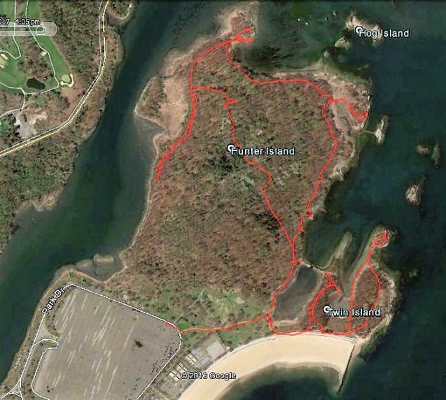
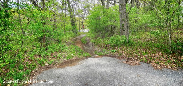
It was mostly cloudy, temps in the low 50’s with rain in the forecast on this Sunday in May. Not wanting to get caught in a downpour miles deep in the woods, this was a good spot for a leisurely hike before the rains fell. After parking in the Orchard Beach lot, we headed out on the unpaved park road towards the trailhead. It was a little swampy at the start of the trail as we began on the Kazimiroff Nature Trail.
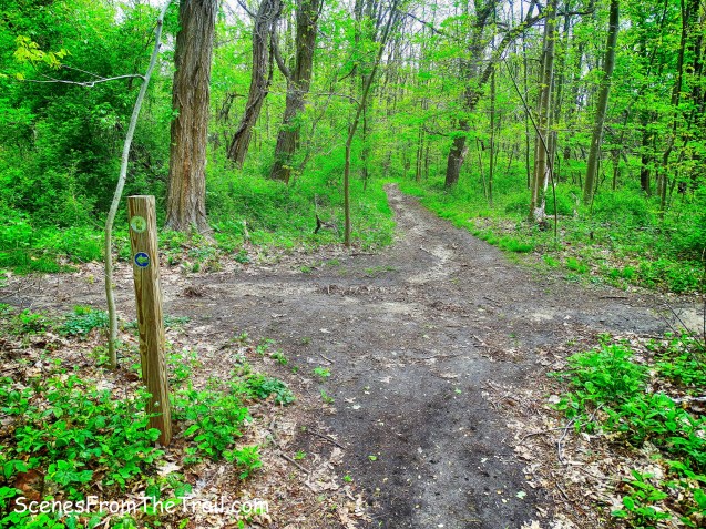
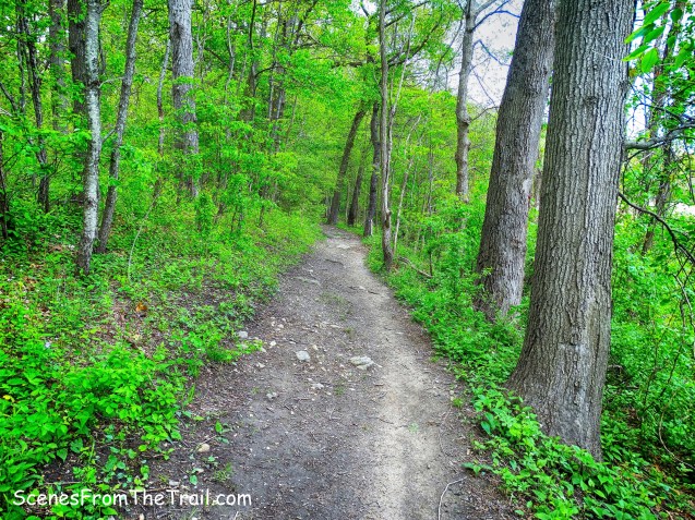
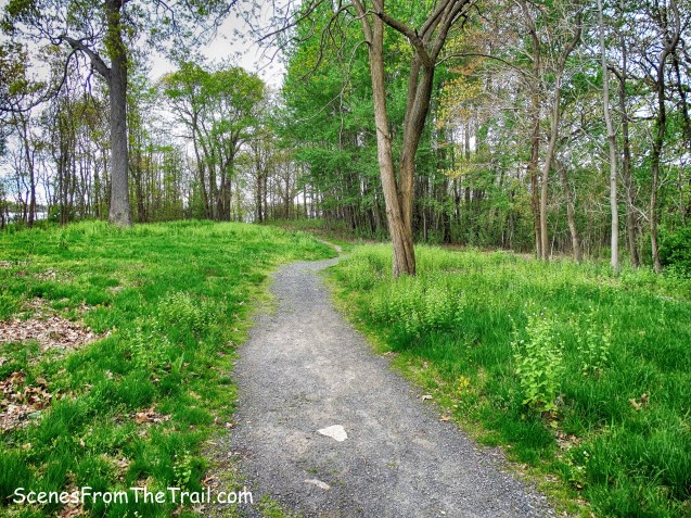
Kazimiroff Nature Trail
The flora along this trail so lush and green and a welcome sight, a contrast to the chilly air, which was not Spring like.
Kazimiroff Nature Trail
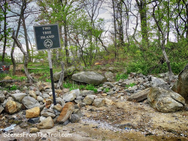
There are numerous spur trails that lead towards the water’s edge and we encountered one almost immediately. This spur trail left us standing directly across from Two Tree Island, named after Joe Two Trees, an Algonquin Indian that lived in Pelham Bay Park and befriended and inspired a then 10 year old Theodore Kazimiroff.

Two Tree Island
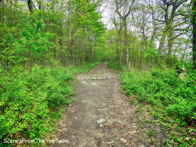
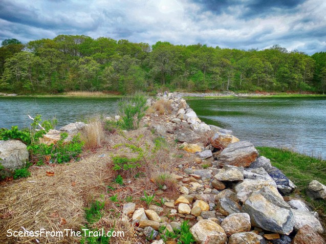
Hunter Island was at one time connected to West Twin Island via a man-made stone bridge that now lies in ruins in one of the city’s few remaining salt marshes.
stone bridge ruins
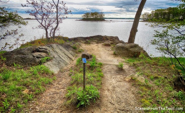
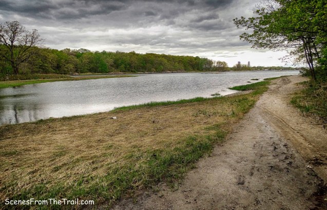
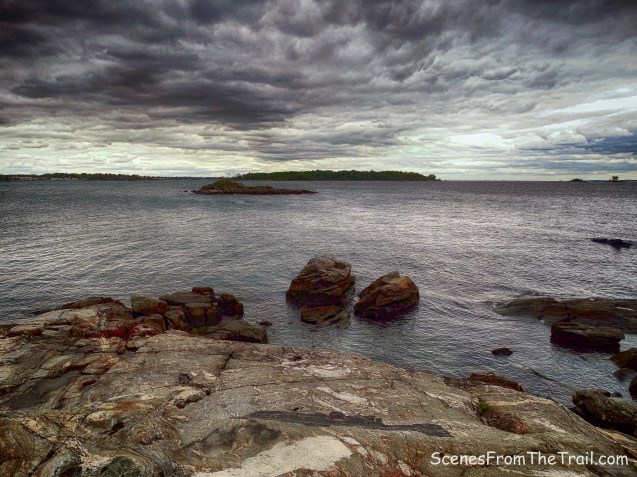
Looking north out onto the Long Island Sound, reminded me of why I love this place.

Hunter Island
After taking in the view, we walked back to the main trail, turned right and veered left at fork, following the blue arrows which lead into the forest. The right fork would be our return route.
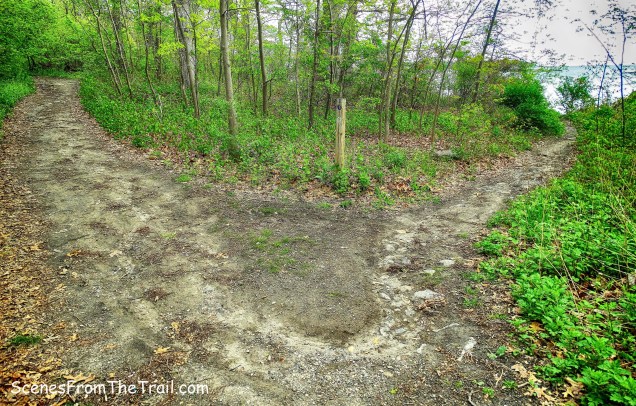
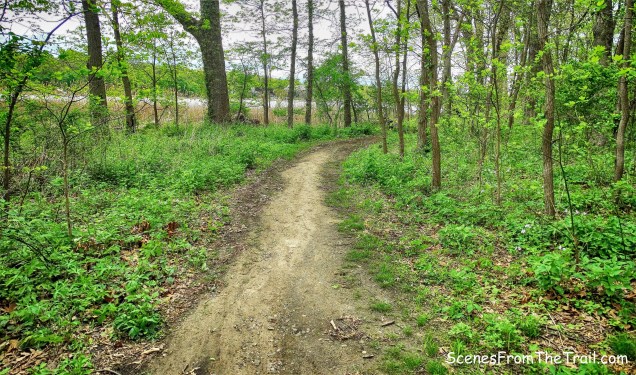
Kazimiroff Nature Trail
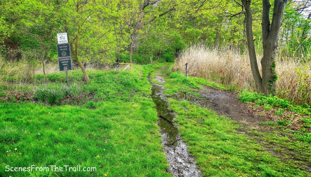
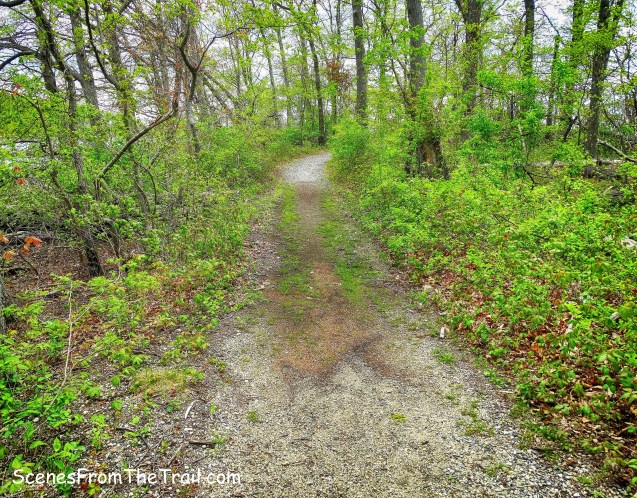
The first part of the trail is easy to follow and the posts with arrows indicate which direction to go in order to stay on the trail. Following the blue arrows takes you on the outer loop, which is the route we took.
Kazimiroff Nature Trail
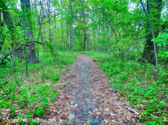
I always enjoy walking through these scenic woods, so close to the city yet it felt like we were upstate somewhere.

Kazimiroff Nature Trail
There are countless trails that criss-cross the island, some of which are wide woods roads that were part of John Hunter’s estate.
woods roads
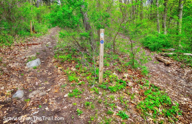
Still following the blue arrows, we turned right and began walking on what was once the road that connected Mr. Hunter’s estate to the mainland. At this point, the posts with the directional arrows are no longer visible. They have either been removed or perhaps fallen down. There are blue splotches on trees which I didn’t deem reliable at the time, but did lead the right way.
Kazimiroff Nature Trail
We came to a T-intersection where in the past I have always turned right. We decided to turn left and continue on the original road to the mainland, which now headed west along the water.
original road to the mainland
As we walked, I could see that we were headed towards the area of the parking lot and we turned around and retraced our steps back to the T-intersection and proceeded straight with the water to our left.
Kazimiroff Nature Trail
We got to a fork where the blue arrow appeared again and veered right, but we stayed left and came to a rock outcrop on the northwestern section of the island.

rock outcrop
We walked to the tip of the island and looking west, I saw a giant boulder. Doing research for this post, I discovered that it is called the Gray Mare. The Native Americans reportedly believed that their God or guardian intentionally placed the Grey Mare at that spot and it was a very important Siwanoy ritual site.

Gray Mare
We then retraced our steps back to the fork and veered left reconnecting with the main trail.

Kazimiroff Nature Trail
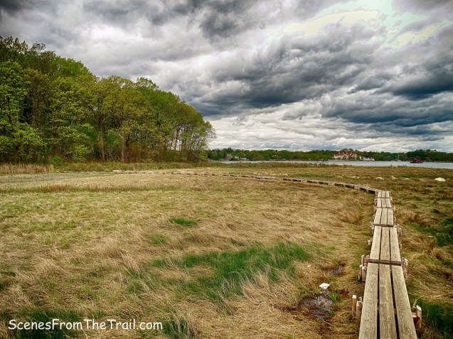
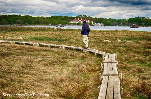
Just up on the left, a short spur trail leads to my favorite spot. The salt marsh with its wooden plank walkway that leads to a tiny rocky island.
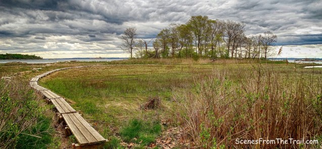
tiny rock island
I’ve been here numerous times and always enjoy walking the plank out to this joyous spot. We took a nice long break here just as the sun made its long awaited appearance. Sitting on a rock and enjoying the view, Glen Island is visible in the distance.

view from tiny rock island
A tinier rock island with glacial erratics, sits nearby. It is accessible via a sandbar during low tide.

glacial erratics
The sun was short lived and the wind picked up, a cue that it was time to get moving. We walked the plank back to the main trail and continued on our hike.
the plank
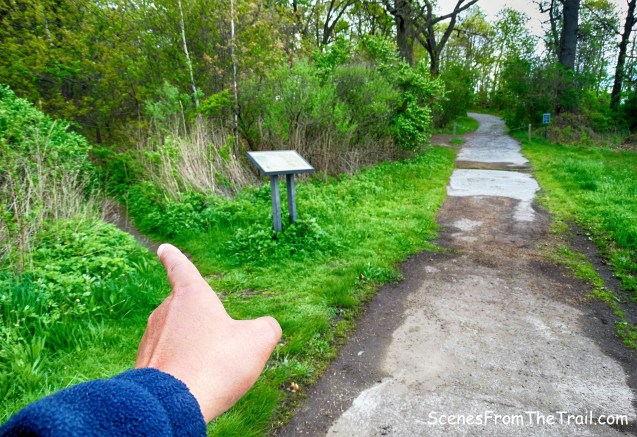
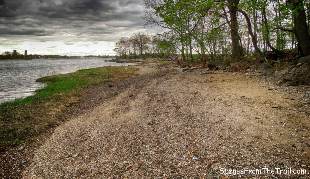
The trail markers appeared again, but it didn’t really matter as the trail paralleled the water. We stopped at a few of the many side trails that lead to views along the water. There is one spot along the trail that used to have an informational sign, but only a steel post remains. It sits across from Two Trees Island, but I have no clue what it was.
Kazimiroff Nature Trail
Then we arrived back at the trailhead, but our hike was not over.
Kazimiroff Nature Trail
We walked straight towards the ocean and Orchard Beach, but I spotted a Great Egret in the salt marsh and stopped to take a look.
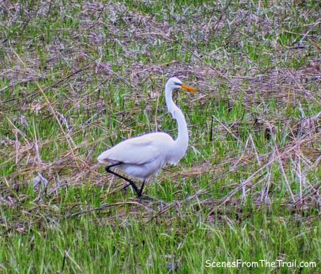
Great Egret
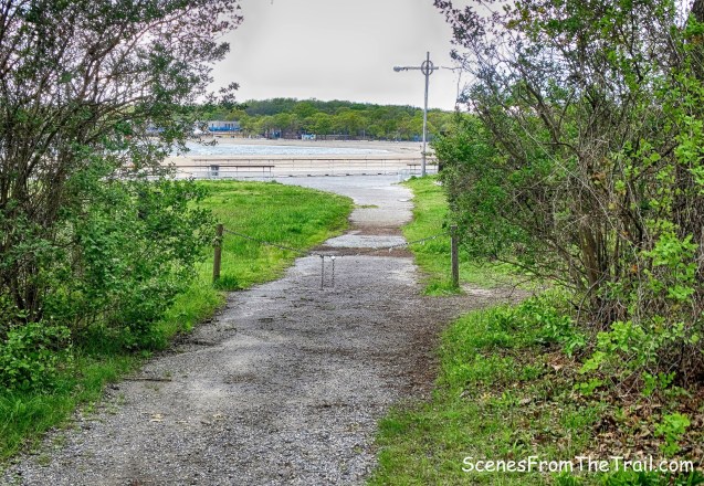
Walking towards the beach, we turned left onto the boardwalk. Technically it’s called a promenade because it is a paved walkway, but boardwalk sounds better to me.
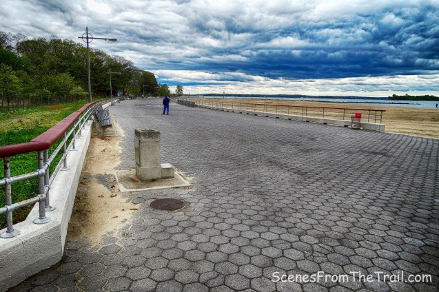
Orchard Beach hexagonal-block promenade
We turned left just before the nature center by the Orchard Beach kiosk and onto West Twin Island.
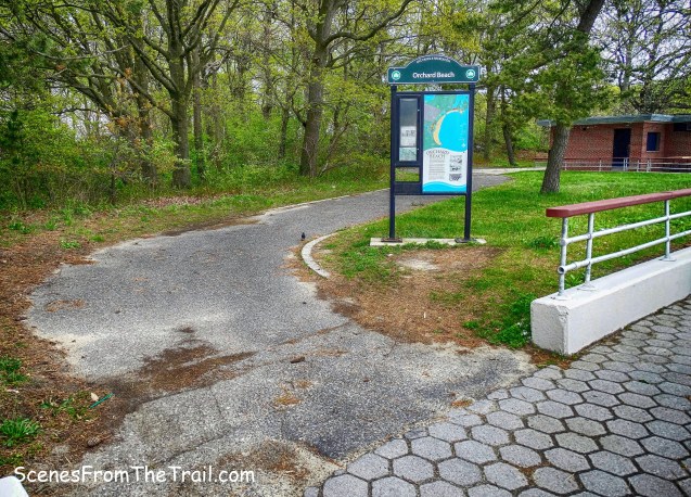
kiosk
We then turned left onto the first trail we saw and headed towards the salt marsh.
West Twin Island
We continued on the wide footpath that parallels the salt marsh, heading northeast.
West Twin Island
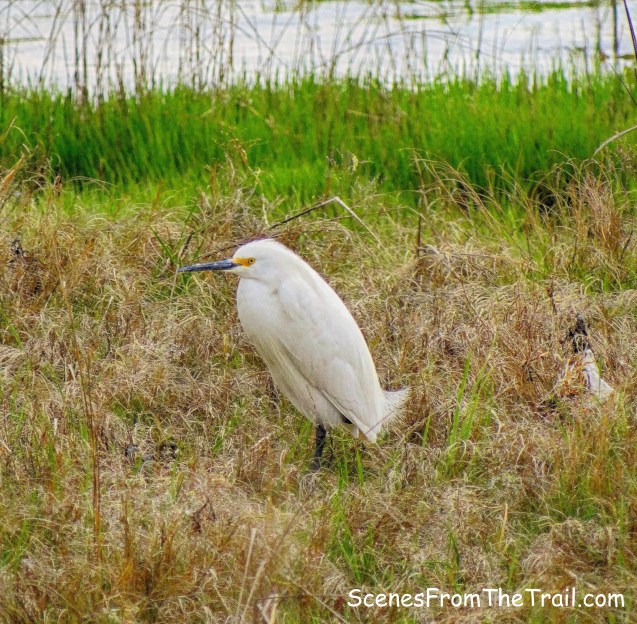
Along the way, a Snowy Egret was just sitting there with its long neck tucked in.
Snowy Egret
We walked over to the stone bridge that used to connect West Twin and Hunter Islands.
stone bridge
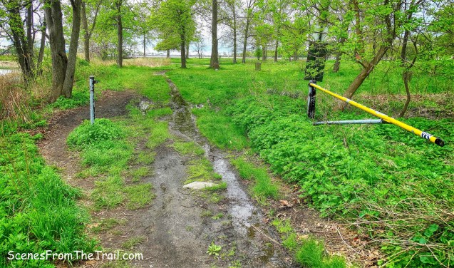
Heading east now towards East Twin Island, we encountered a slight problem. The trail that connects the “Twins” was flooded. The water was about calf high and it was a little too chilly to get our feet wet.

flooded trail
We headed back the way we came in and turned left after reaching the “boardwalk.” When we neared the end, we turned left.
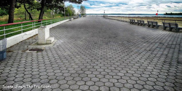
Orchard Beach hexagonal-block promenade
Now we were on East Twin Island and our feet were still dry.
Twin Island
Reaching a fork, we decided to stay left and walk along the water. The wide paved road would be our return route.
Twin Island
The clouds were getting a bit dark now as the wind increased.
Twin Island
It was a very pleasant walk along the rocky sand as we headed for Two Tree Island.
Twin Island
Twin Island and Two Tree Island connect via a thin mudflat landbridge which is submerged at high tide.
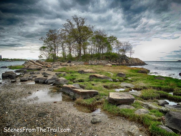
Two Tree Island
We ventured onto the tiny island to get a look around. I have been here a few times and have always enjoyed relaxing on the rocks. Today was no different.
Two Tree Island
Sitting here, looking out at the Long Island Sound, I felt a few drops. Since it was the tail end of the hike, we figured it was best to just start heading back.
Two Tree Island
Walking back from Two Tree Island, we had a good view of East Twin Island on the left, West Twin in the center and Hunter Island on the far right. The Islands were once true islands in Pelham Bay but are now connected to each other and to Orchard Beach by a landfill created in 1937.

East, West and Hunter Islands
We headed back towards Orchard Beach, passing through the center of East Twin Island.
East Twin Island
When we reached the “boardwalk,” we turned right and headed back to the parking lot where we began our hike.
East Twin Island
Even though I have hiked this area several times before, I always enjoy coming back and discovering new things about it. It does get crowded in the hotter months, but early mornings are usually less congested. On this day we crossed paths with several people and a large group of bird watchers. A great day of hiking in the Bronx, you can’t beat that with a baseball bat. Now get out there and take a hike!
Pros: Rock formations and glacial erratics, Long Island Sound, views, islands, shore birds, scenic trails.
Cons: poorly marked trails, entrance fee in summer months, tends to get crowded in warmer weather.
Take a hike!

Wow! Beautiful photography! I must get out and do this hike soon before it gets too warm
Great find!! Thank u 🌞
LikeLike
Thank you so much, a great place if you’re in the mood for an easy and scenic stroll along the Long Island Sound.
LikeLike
One of my favorite haunts! So many quiet little islandy spots and the rocks are crazy gorgeous.
LikeLike
That small island that is reached via the wooden plank walkway is called the Russian Island, at least by the locals who frequent the area. I practically grew up on Hunter’s Island and remember back in the 70’s when there was a wide paved trail up to a concession stand at the peak of the island (near where the original mansion once stood). There were many small encampments built by a variety of immigrants. Each group had their own little section which is probably where the Russian Island came from. In recent years, the Park Dept has destroyed all attempts by the regulars to make cosy little sitting areas. While I understand the policy, I regret the loss anyway.
LikeLiked by 1 person
We loved this hike. Lots to see geologically and ornithologically. Beautiful and thoughtful and thorough description.
Thank you so much.
LikeLiked by 1 person
All in all a great photo- docu-hike! I am so pleased that you took the time to preserve the place which was sacred to so many diverse groups over the thousands of years since the glacier receded.
On behalf of generations of residents, campers, hikers, Joe Two-Trees, my father, Dr. Theodore Kazimiroff, Joe’s friend, and myself,Dr. Ted L.Kazimiroff, I thank you . Best wishes, Ted K.
LikeLiked by 1 person
Thank you for the kind words.
LikeLike
Dear Outlaw Hiker, I thank you for having taken the time to walk and photograph this preserve, and then to post with detailed commentary/legends. I hugely enjoyed your hikes and am grateful that you went and did such a splendid job. It feels unsufficient to say thank you but I say it with verve and very strong conviction: THANK YOU – vii2024
LikeLiked by 1 person