April 16, 2017 – Woodbury, NY
Difficulty: moderate
Length: approximately 4.5 miles
Route type: circuit
Map: Harriman-Bear Mountain Trails Map 119
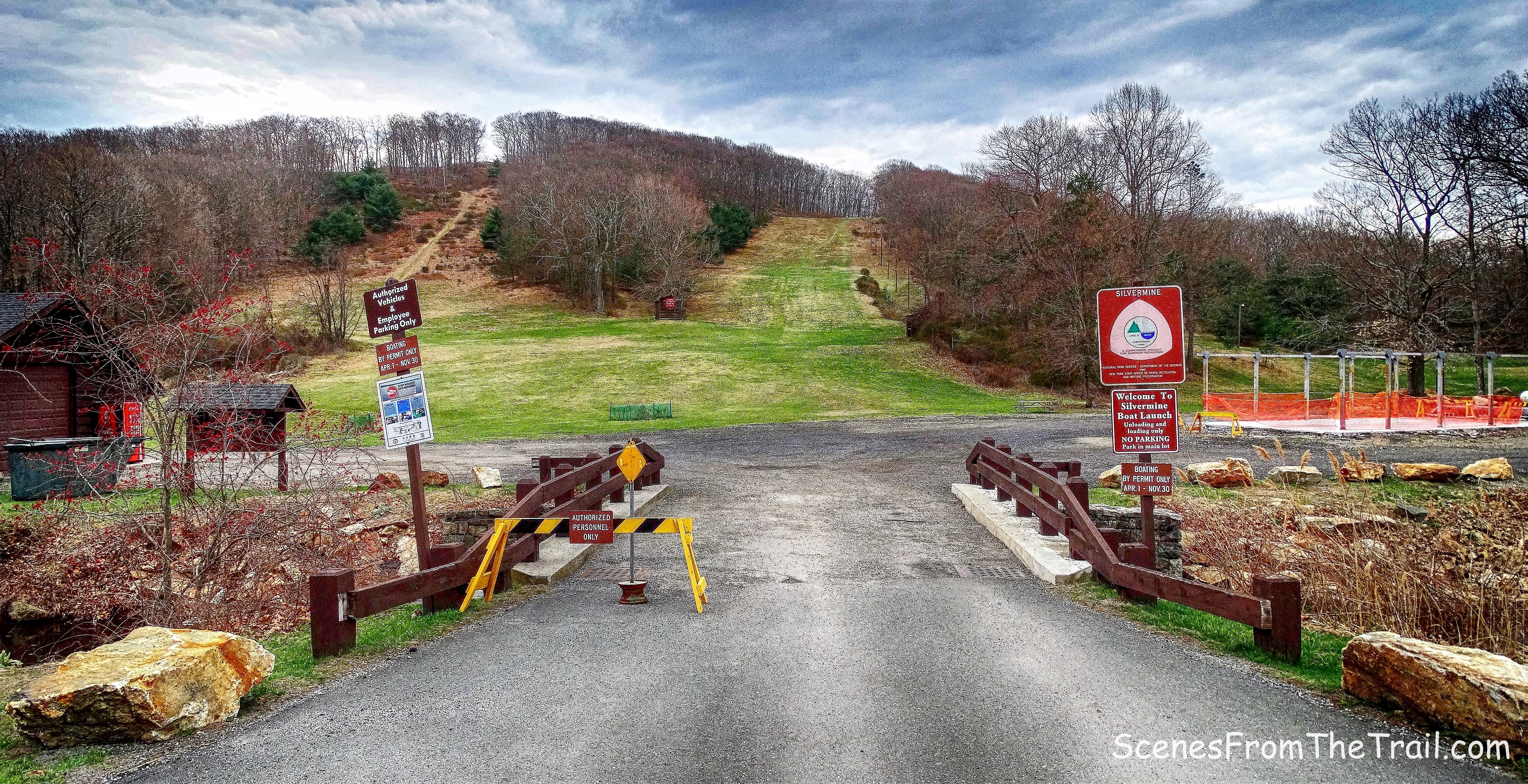
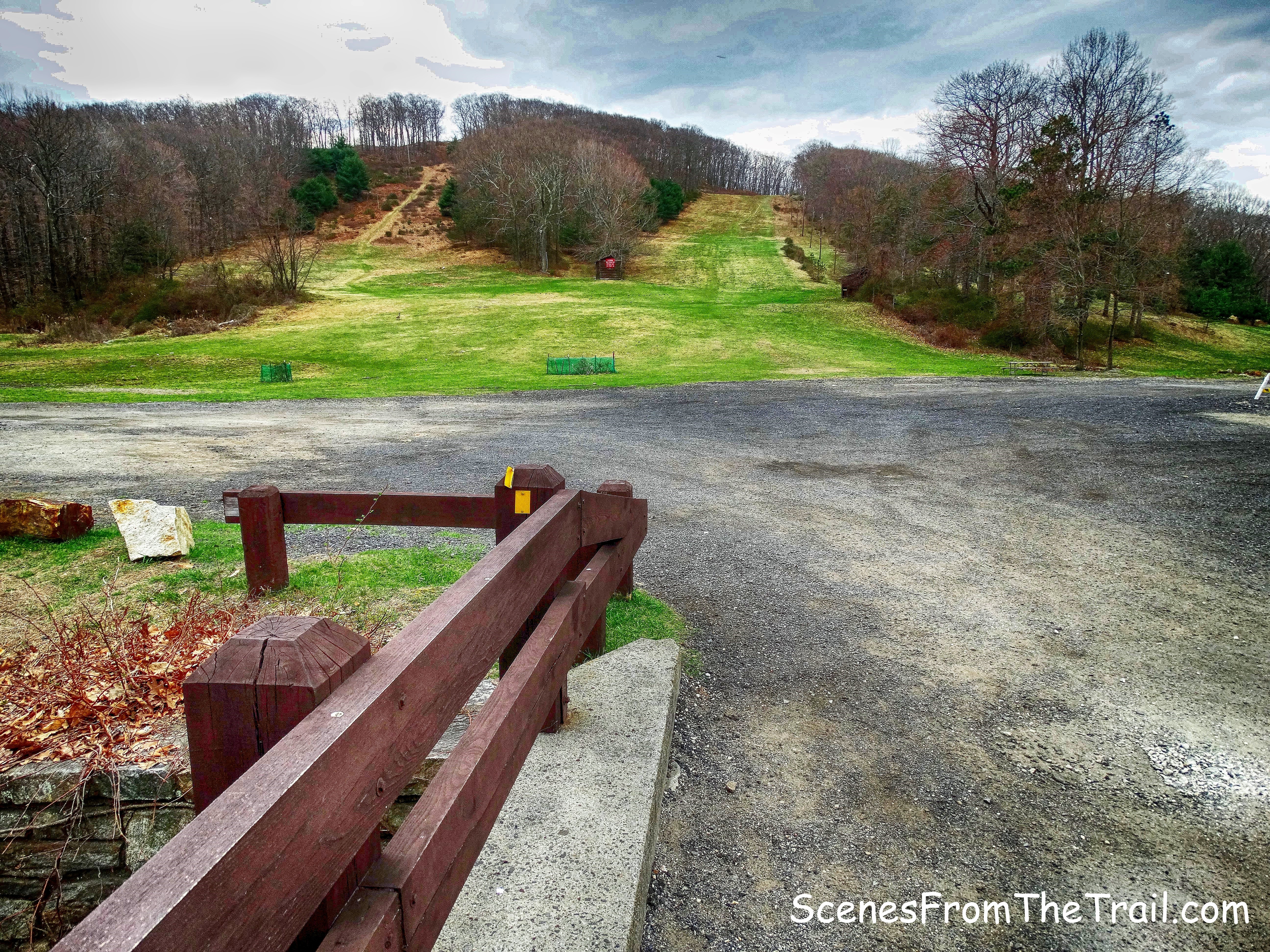
Trailhead parking: Old Silver Mine Ski Center
Silver Mine Ski Center was once a popular ski destination. It was shut down in the 1980’s due to inconsistent weather. The Silver Mine area now offers picnic grounds, fishing and hiking.
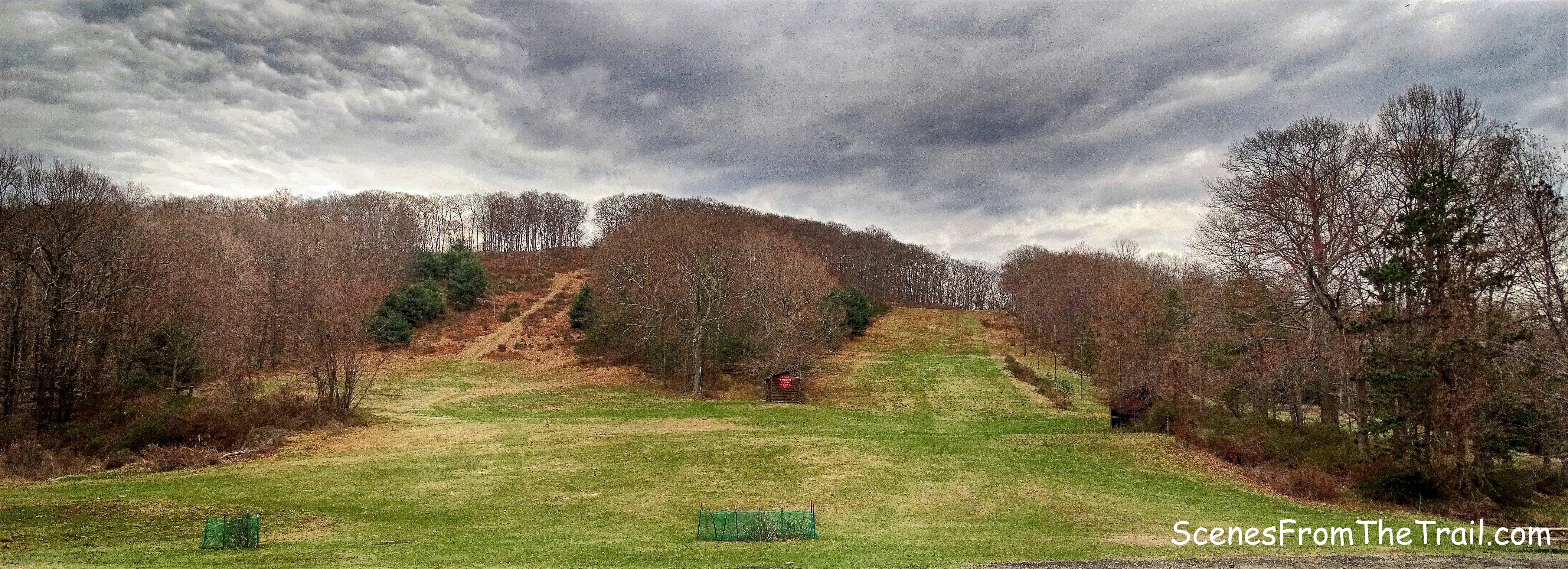
Old Silver Mine Ski Center
I have done several hikes from Silver Mine and have found them all enjoyable. I also like to check out the stone shelters that are scattered throughout the park and this hike provided that opportunity. We arrived at the parking area at about 9:30 am, a later start than I am used to, but better late than never. The weather for this Sunday reached the mid 80’s and windy. Although it was cloudy when we began our hike, it would turn out to be a bright sunny day. It was finally shorts weather and we were ready to get our hike on.
We did this loop hike counterclockwise.
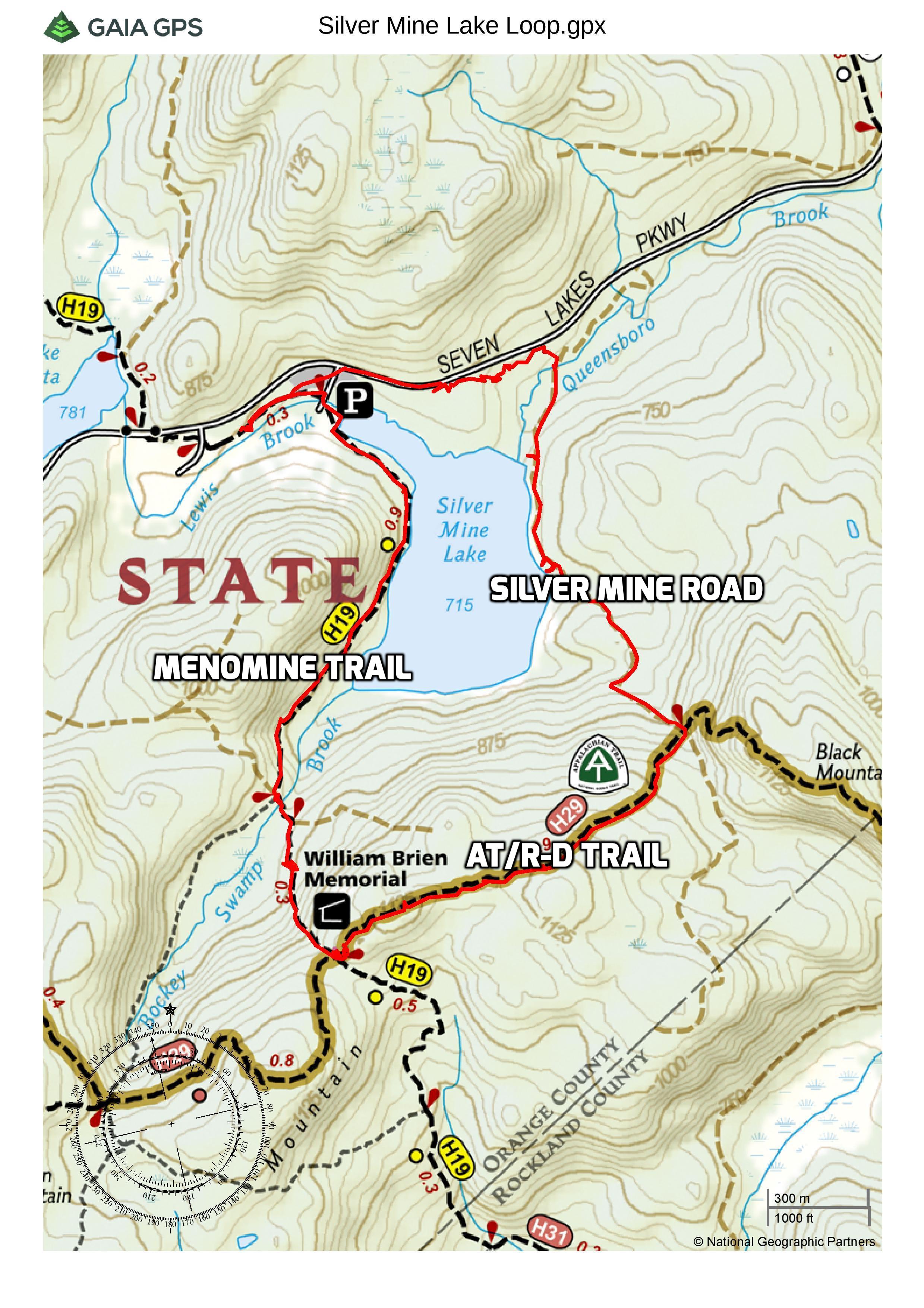
Silver Mine Lake Loop
A new feature that I have added is the Google Earth Fly-Through. It follows the path that we hiked and it gives you a good idea of the terrain, layout, amount of parking etc. Check it out, it’s pretty cool.
View the Google Earth Fly-Through video of the hike below.
We began our hike by crossing the bridge over Lewis Brook.
bridge over Lewis Brook
For the first part of the hike we would be following the yellow blazes of the Menomine Trail. The blazes are located along rocks, the bridge and on buildings in this area so they are hard to miss.
bridge over Lewis Brook
Turning left after crossing the bridge, we headed towards Silver Mine Lake.
Silver Mine Lake
After lingering along the shore momentarily, we then continued on our way along the right side of the lake. Following the yellow blazes which were abundant at the edge of the woods.
Menomine Trail
We turned left behind the shack and entered the woods on the southwest end of the lake.
Menomine Trail
On a rocky footpath we walked through the woods with the lake to our left.
Menomine Trail
We came to an open view of the lake with Black Mountain just beyond.
Silver Mine Lake
The trail turns right, skirts the lake then turns inland and begins a gradual climb.
Menomine Trail
It was swampy in this area and somewhat buggy. I would recommend adding bug spray in the warmer months. The trail wraps around the southern end of the lake where we crossed over a metal pipe, acting as a culvert.
Menomine Trail
We rested here briefly until the bugs started annoying me. Of course I was the only one that didn’t apply any bug spray. The Menomine Trail then begins to steepen as it snakes its way uphill. The sun began to come out at this point and and brightened up our day.
Menomine Trail
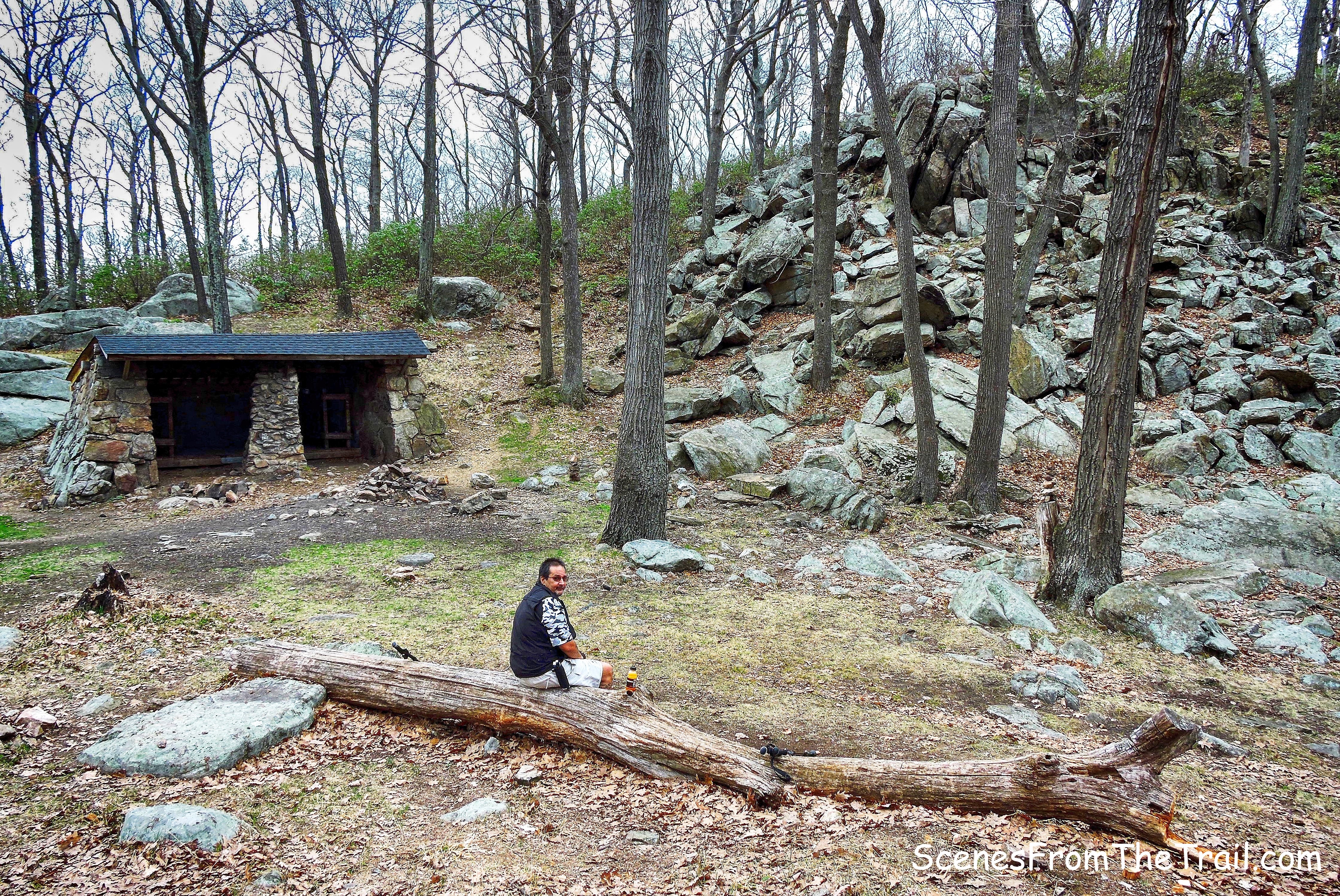
At the top of the rise, the William Brien Memorial Shelter came into view.
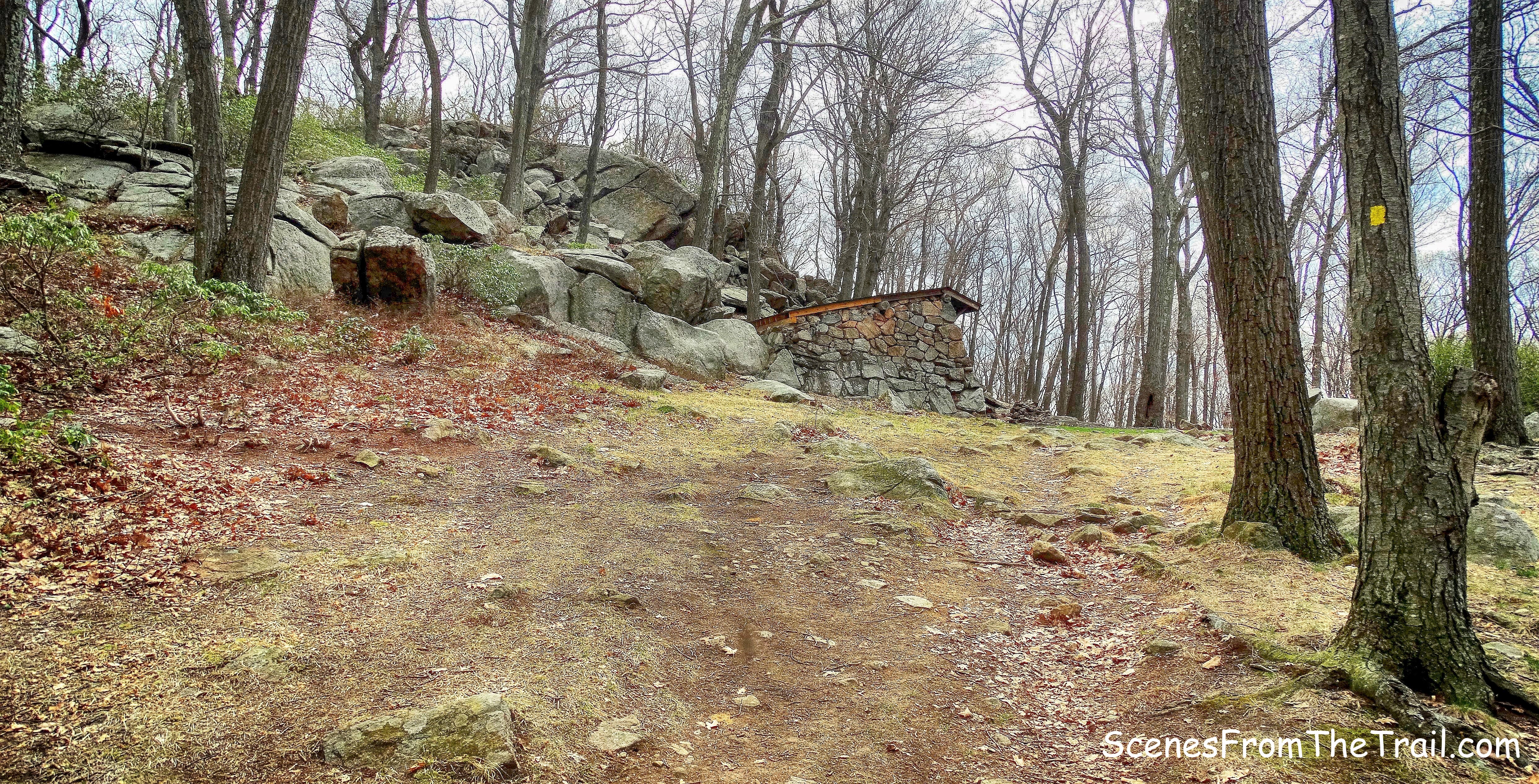
William Brien Memorial Shelter
This stone shelter was built in 1933 by the Civilian Conservation Corps and was originally named the Letterrock Shelter.
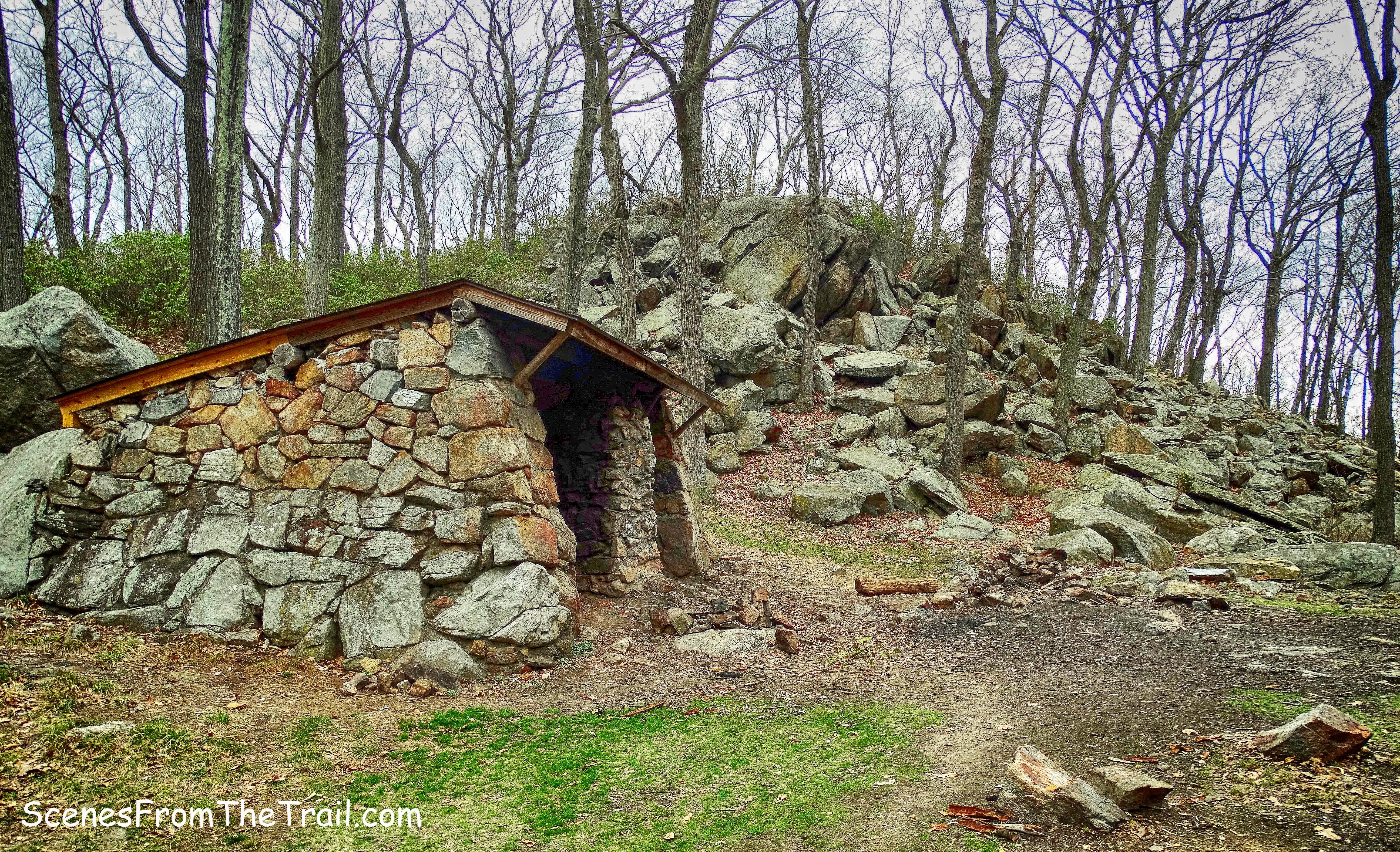
William Brien Memorial Shelter
In 1973 it was renamed in memory of the first president of the New York Ramblers Hiking Club.
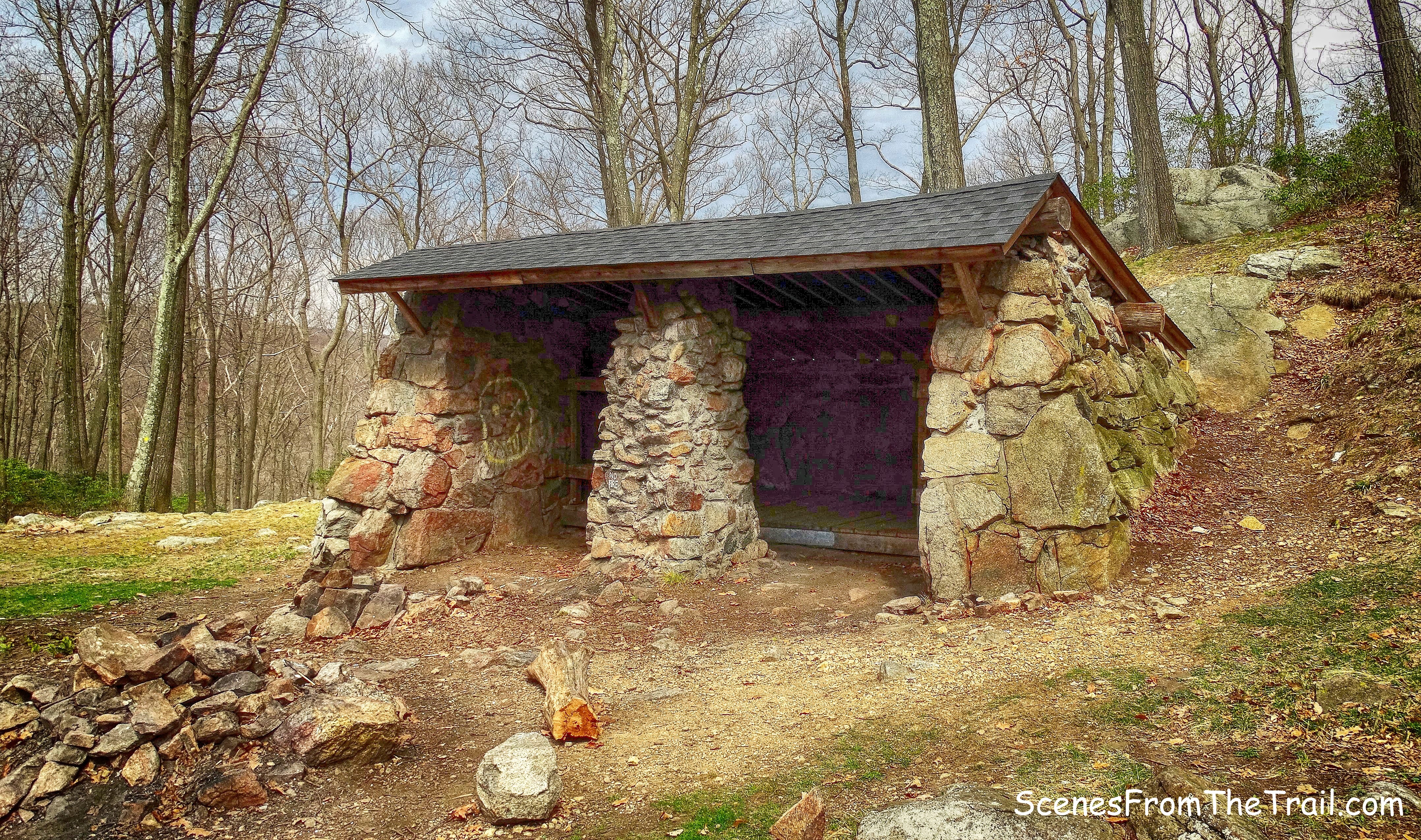
William Brien Memorial Shelter
It has two bunk beds and unlike most shelters in Harriman, it has no fireplace, but it does have two fire rings just outside.
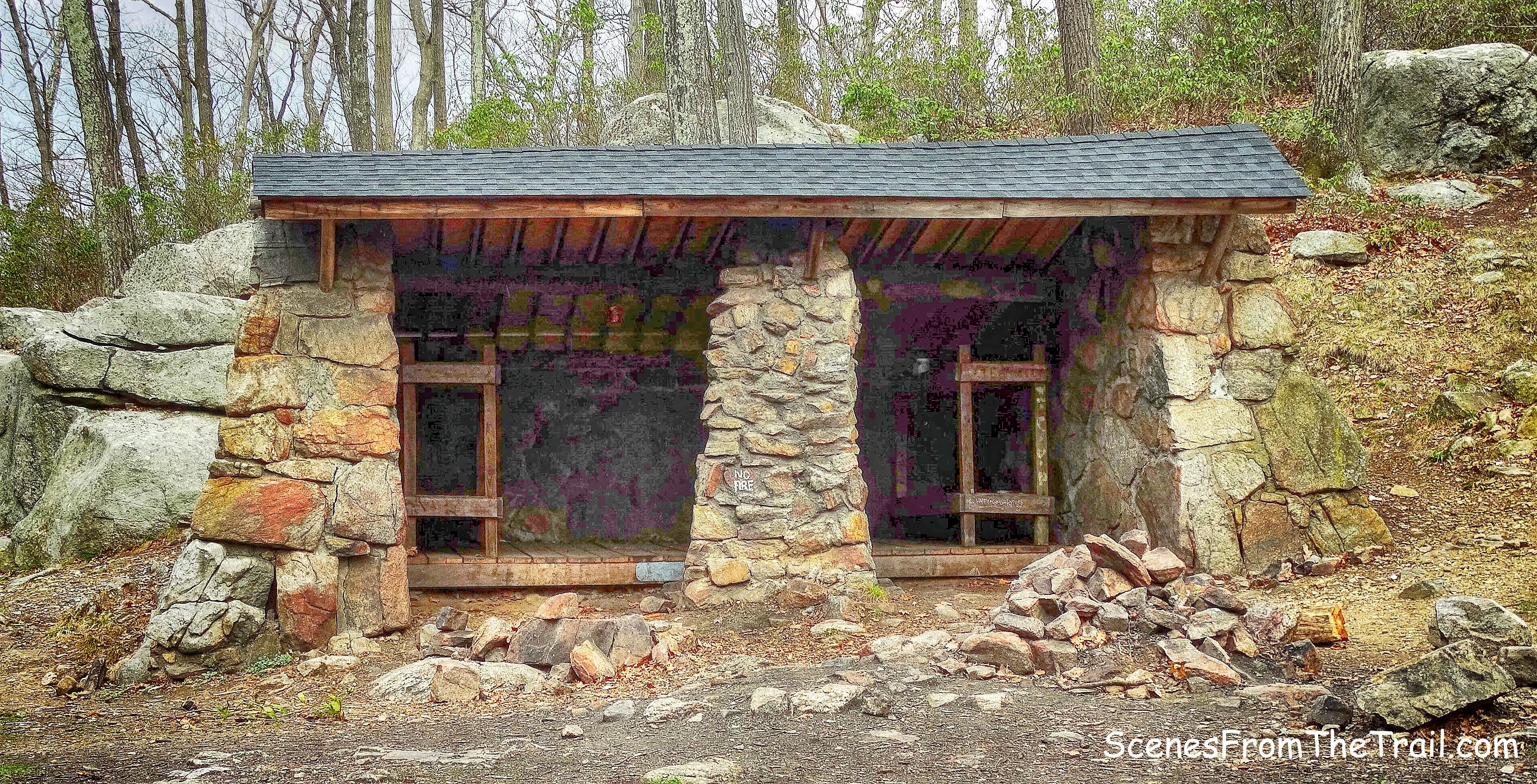
William Brien Memorial Shelter
Within feet of the shelter is a fallen tree that made a nice seat. We sat there and enjoyed a snack and a beverage. We felt a few drops and commented to each other that if the skies opened up at least we had some shelter from the rain. Luckily the sun shone bright for the rest of the day. Just past the shelter, to the right of the huge jumble of boulders, is where we jumped on the joint white-blazed Appalachian Trail (A.T.) and the red-dot-on-white-blazed Ramapo-Dunderberg Trail (R-D).
AT/R-D trail
Thanks to the trail volunteers, the stone steps made it easy to climb the hill.
AT/R-D trail
When we got to the top we stopped for a minute to look down at the shelter from above.
view from above
This section of trail was quiet and picturesque. We didn’t see anyone on the half mile stretch that we hiked.
AT/R-D trail
There were several ups and downs along the way, but nothing too drastic. I could feel the sun on my neck and it felt good.
AT/R-D trail
The trail then descends at the lowest point between Letterrock and Black Mountains. Here the joint AT/R-D trail continues up steeply to Black Mountain. We turned left onto the unmarked Silver Mine Road.
Silver Mine Road
This woods road was built in 1934 by workers of the Temporary Emergency Relief Administration, it is easily identified by the stone embankments along its sides.
Silver Mine Road
We followed Silver Mine Road downhill as it led us towards the northeast side of the lake.
Silver Mine Road
We came to the northern shore of Silver Mine Lake and sat for a bit and soaked up some rays as we enjoyed the view. Black Mountain is on the left and Letterrock Mountain is just to the right of center.
Silver Mine Lake
We continued walking on Silver Mine Road as it skirted the lake. We passed by a dam and then Silver Mine Road crosses Queensboro Brook on a wide wooden bridge.
wooden bridge
Queensboro Brook
When the Silver Mine Road curves to the right, Seven Lakes Drive is just up the embankment. A short unmarked trail leads to it and then turning left, in about 1/4 mile the parking area is on the left. Not wanting to do a road walk, we bushwacked through the woods keeping Seven Lakes Drive on our right.
bushwacking
We then arrived at the parking lot and returned to the vehicle. On a side note; When gearing up, I placed my phone on the roof of the car and forgot it there. Upon returning to the vehicle hours later, the phone was still sitting there. I lucked out that no one decided to “borrow” it. Don’t forget to follow my blog to stay up to date on all my journeys. Now get out there and take a hike!
Pros; Lake views, well marked trails, scenic woods, ample parking.
Cons: Swampy in a short section of the Menomine Trail which means bugs in warm weather, no summit views.
Take a hike!

I hiked “the loop” today. however I wish I had read your thorough post beforehand. The left turn at the William Brien Memorial Shelter is easy to miss. In fact I would say indiscernable. Thus I continued on what is shown on your map as H19 for miles, unwittingly heading southeast and away from the lake. after some time it was raw forest and eventually it got completely dark. While it was exhilerating to some extent it was also quite scary because eventually the tree markings were no longer visible, it was completely dark and it was deep forest. I feared I might have to sleep in the forest, which was concerning because the temperature drops rapidly after the sun descends below the horizon. No cell coverage and it was a near certainty that no one would come to get me. and I was alone which was stupid… but of course I had not anticipated hiking raw forest for 5 hours. Anyway, miraculously by the din of moonlight (and noise pollution) I eventually made it to the Palisades Parkway around exit 16. I knew I was far away from my car parked still in the silver mine lake parking lot… but at least I could walk with the benefit of headlights… and I knew walking north I would eventually hit seven lakes drive…. which is just 1.5 miles from silver mine lake. Great experience and a good lesson what not to do. I would like to volunteer the cost and the time to improve the signage along the trail. I think it would help.
LikeLike