September 27, 2018 – Newport, Rhode Island
Difficulty: Easy
Length: Approximately 3.5 miles
Max elevation: 57 ft.– total elevation gain approximately 47 ft.
Route type: Point to point
Trailhead parking: Easton’s Beach 175 Memorial Blvd, Newport, RI 02840
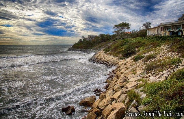
The Cliff Walk along the eastern shore of Newport, RI is world famous as a public access walk that combines the natural beauty of the Newport shoreline with the architectural history of Newport’s gilded age. Wildflowers, birds, geology, all add to this delightful walk.
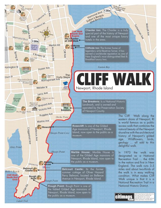
Newport Cliff Walk Map
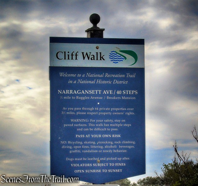
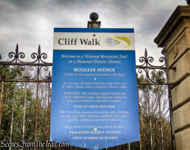
In 1975 the walk was designated as a National Recreation Trail, the 65th in the nation and first in New England. The walk runs 3.5 miles and about two-thirds of the walk is in easy walking condition. Parts of the southern half of the walk are a rough trail over the natural and rugged New England rocky shoreline.
Newport Cliff Walk
Newport’s Cliff Walk is a public right of way over private property owned by the waterfront property owners. The walk historically was really a path or trail with many rustic components, and in some spots has never changed.
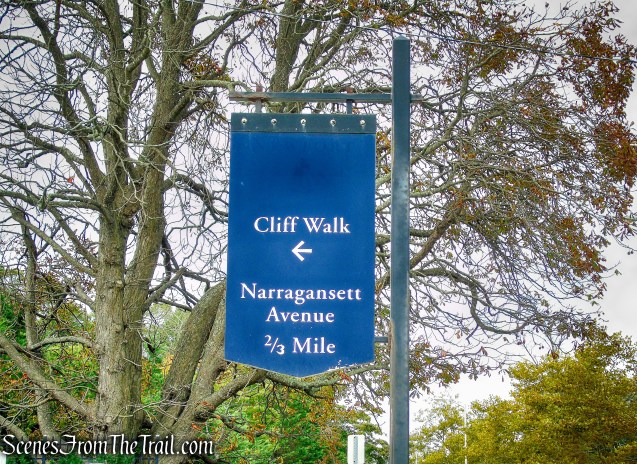
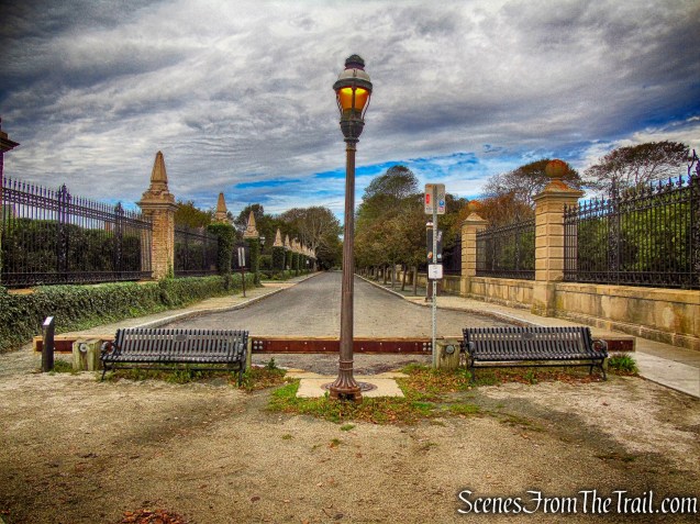
The walk starts at the western end of Easton’s or First Beach at Memorial Blvd. and runs south with major exits at Narragansett Ave., Webster St., Sheppard Ave., Ruggles Ave., Marine Ave., Ledge Rd., and ends at Bellevue Ave. at the east end of Bailey’s Beach locally referred to as Reject’s Beach.
Limited metered parking is available along the sidewalk on Memorial Blvd. between Easton’s Beach (also known as First Beach) and the entrance to the Cliff Walk. The meters accept credit cards and there is a 3-hour limit. There is also public parking in the Easton’s Beach parking lot. They charge a fee in season, but when we visited (September 27, 2018) there was no one in the booth collecting the parking fees.

Easton’s Beach Public Parking
It’s a short distance from the parking area to the official start of the Cliff Walk.
Memorial Boulevard
I happen to notice this bronze plaque embedded in the sidewalk on Memorial Boulevard. In Newport, Rhode Island, the WPA (Works Progress Administration) built sidewalks and most of the stone walls, grandstands, concession buildings and other facilities in Newport’s public parks during The Great Depression.
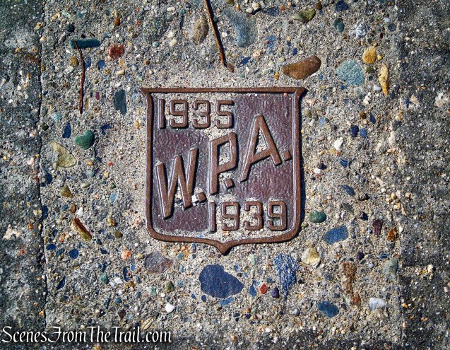
W.P.A. plaque

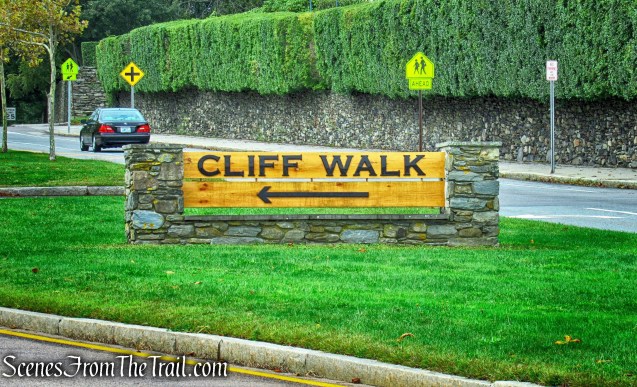
Cliff Walk entrance on Memorial Boulevard
near the Cliff Walk entrance on Memorial Boulevard
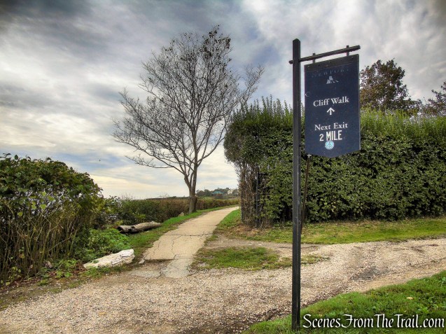
I will divide this hike into sections, as there are five unique segments to the Cliff Walk.
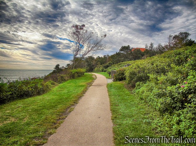
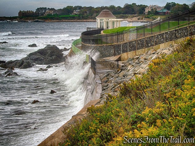
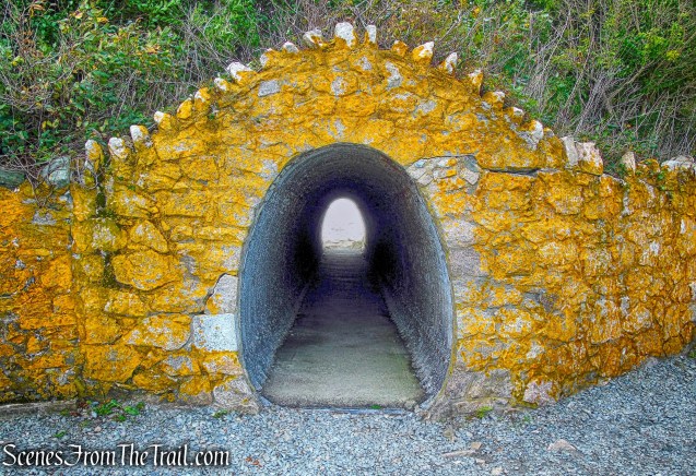
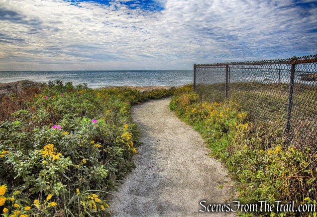
1. Memorial Blvd. to Forty Steps
Cliff Walk entrance on Memorial Boulevard
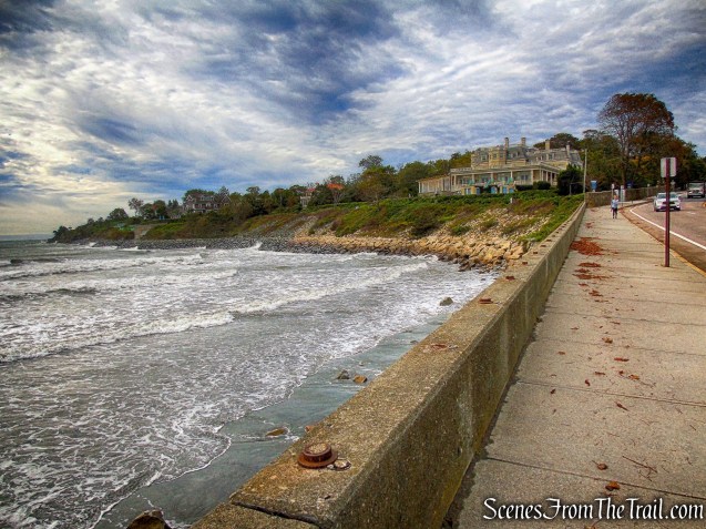
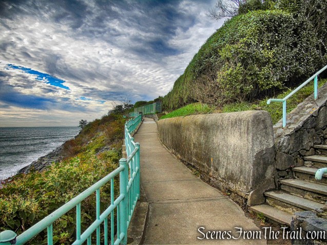
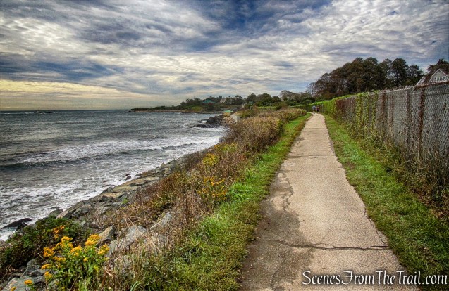
The beginning is the easiest section because it is paved and is the most recently renovated area.
1. Memorial Blvd. to Forty Steps
The paved walk is ideal for a casual stroll.
1. Memorial Blvd. to Forty Steps
1. Memorial Blvd. to Forty Steps
1. Memorial Blvd. to Forty Steps
The 40 Steps plunge 40 feet down the side of a cliff and onto a balcony that rests just above the ocean. Unfortunately they were cordoned off during our visit for maintenance.
1. Memorial Blvd. to Forty Steps
2. Forty Steps to Ruggles Ave.

2. Forty Steps to Ruggles Ave.
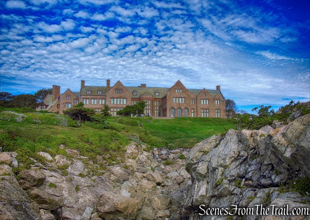
This section covers a close up of Mansions at Salve University campus. There are several sets of steps in this area.

2. Forty Steps to Ruggles Ave.
2. Forty Steps to Ruggles Ave.
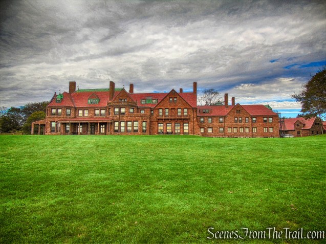
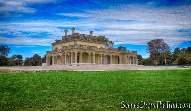
This section will allow you to see some beautiful coastal views, along with Ochre Court (part of Salve Regina University), The Breakers mansion and the Vinland Estate (below), a Romanesque Revival “summer cottage.” This Gilded Age house was completed in 1884 by the architecture firm Peabody & Stearns for wealthy tobacco heiress Catharine Lorillard Wolfe.
2. Forty Steps to Ruggles Ave.
The 80-acre grounds of Salve Regina University is arguably the most scenically situated campus in New England.
2. Forty Steps to Ruggles Ave.
The Breakers mansion. This 70-room palazzo was designed by Richard Morris Hunt for Commodore Cornelius Vanderbilt.

2. Forty Steps to Ruggles Ave.
2. Forty Steps to Ruggles Ave.
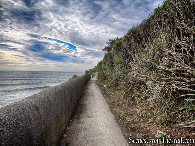
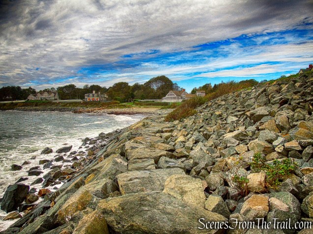
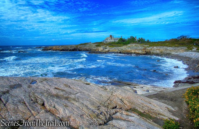
3. Ruggles Ave. to Belmont Beach
3. Ruggles Ave. to Belmont Beach
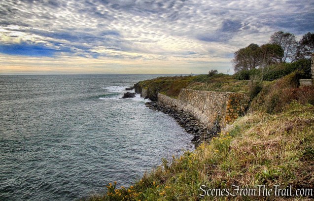
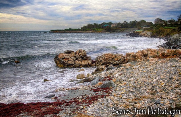
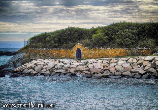
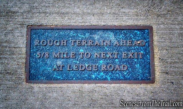
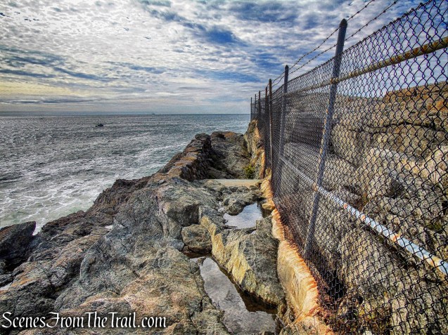
This section covers a touch of rough terrain and waves breaking near or on the walk at times.
3. Ruggles Ave. to Belmont Beach
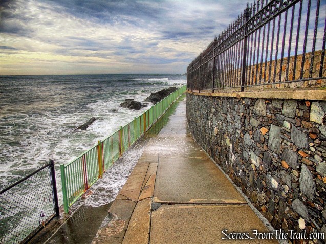
3. Ruggles Ave. to Belmont Beach
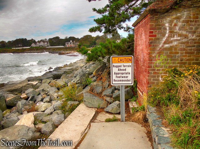
3. Ruggles Ave. to Belmont Beach
Not as rugged as the sign implies, but if wet, the rocks can be slick.
3. Ruggles Ave. to Belmont Beach
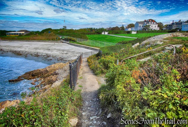
At Marine Ave. there is a small natural beach (Belmont) that is often used by surfers to launch their boards when surfing off the “Breakers” on those rare occasions when hurricanes are passing offshore.
3. Ruggles Ave. to Belmont Beach
3. Ruggles Ave. to Belmont Beach
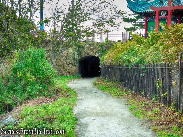
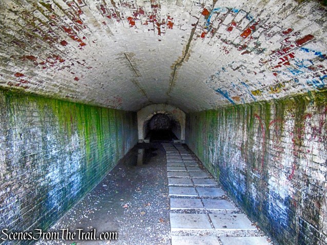
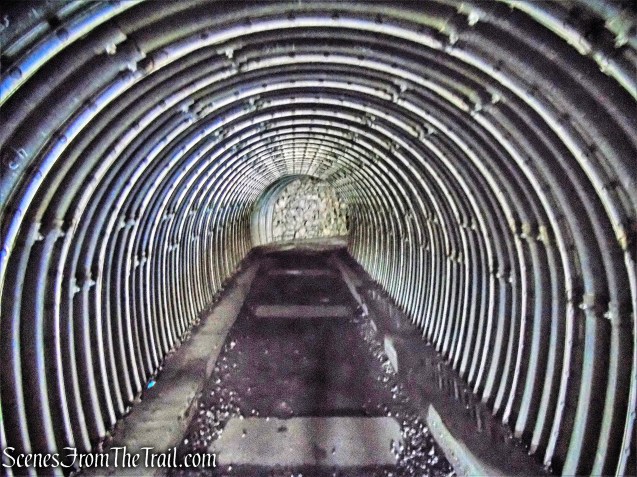
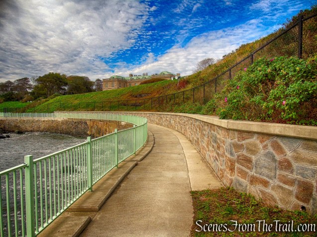
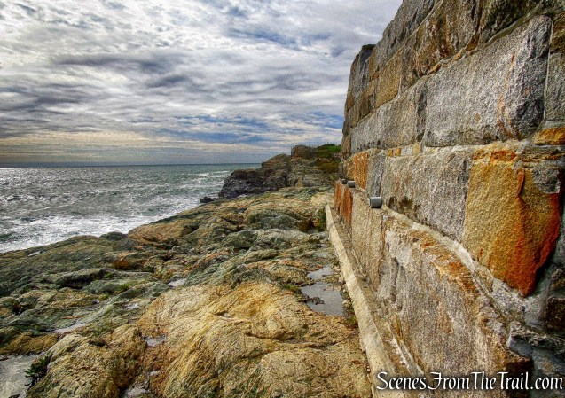
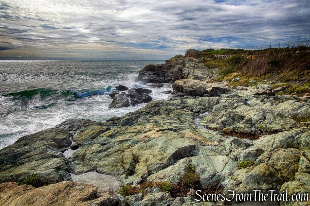
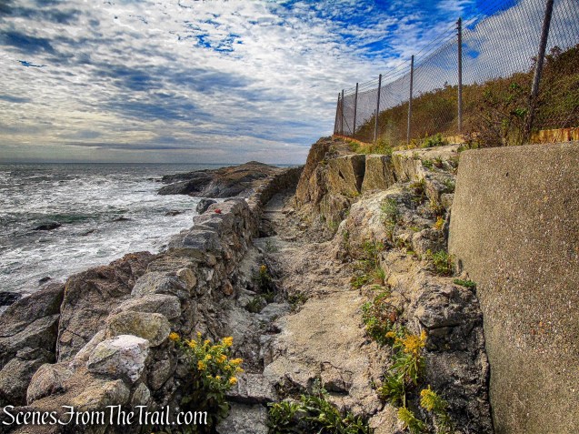
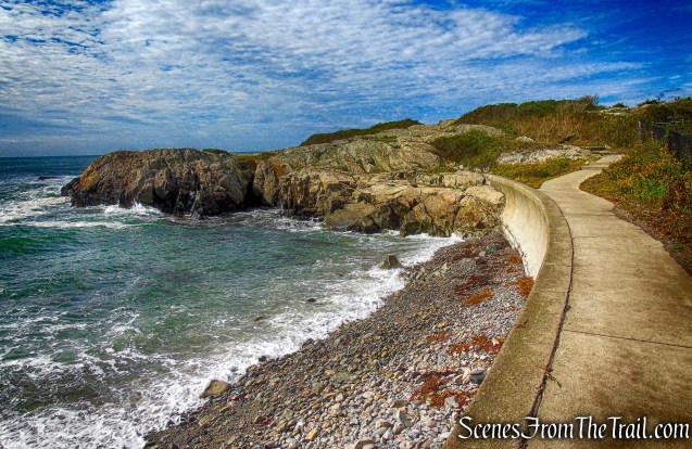
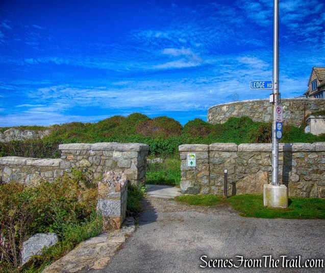
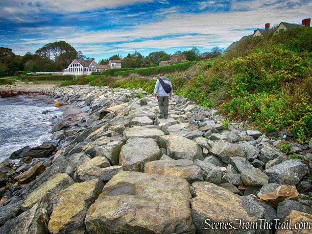
4. Belmont Beach to Ledge Rd. There are no public exits on this part of Cliff Walk from Marine Ave. to Ledge Rd.
4. Belmont Beach to Ledge Rd.
4. Belmont Beach to Ledge Rd.
Beechwood (Astor mansion)
4. Belmont Beach to Ledge Rd.
4. Belmont Beach to Ledge Rd.
4. Belmont Beach to Ledge Rd.
4. Belmont Beach to Ledge Rd.
4. Belmont Beach to Ledge Rd.
4. Belmont Beach to Ledge Rd.
4. Belmont Beach to Ledge Rd.
4. Belmont Beach to Ledge Rd.
4. Belmont Beach to Ledge Rd.
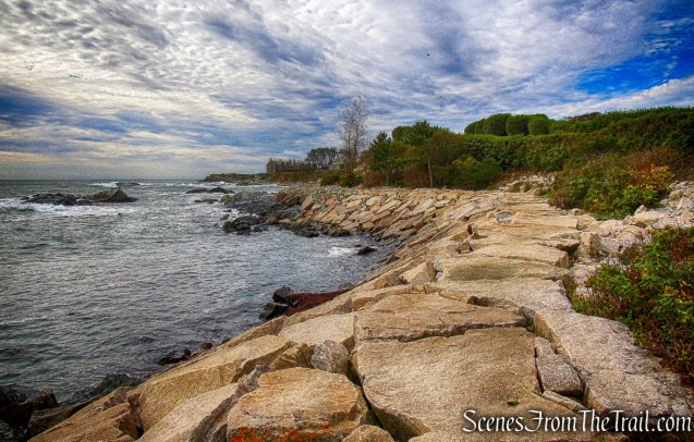
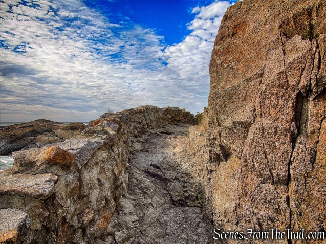
This was my favorite section.
4. Belmont Beach to Ledge Rd.
4. Belmont Beach to Ledge Rd.
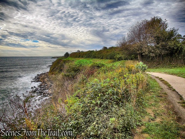
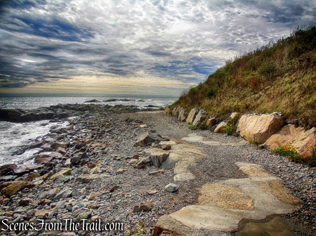
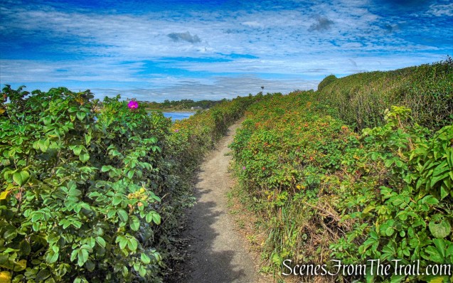
The Walk becomes a rocky trail meandering along the shoreline.
4. Belmont Beach to Ledge Rd.
4. Belmont Beach to Ledge Rd.
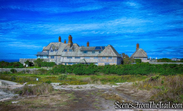
Doris Duke, the reclusive tobacco heiress and philanthropist, loved Newport and summered here for many years. Rough Point, the 39,000 square foot mansion with 105 rooms, was one of her many beautiful homes.
4. Belmont Beach to Ledge Rd.
4. Belmont Beach to Ledge Rd.
4. Belmont Beach to Ledge Rd.

4. Belmont Beach to Ledge Rd.
4. Belmont Beach to Ledge Rd.
4. Belmont Beach to Ledge Rd.
4. Belmont Beach to Ledge Rd.
The Waves mansion served as romantic backdrop for Grace Kelly and Frank Sinatra in the 1956 movie, “High Society.”
4. Belmont Beach to Ledge Rd.
4. Belmont Beach to Ledge Rd.
5. Ledge Road to Bellevue Ave.

5. Ledge Road to Bellevue Ave.

5. Ledge Road to Bellevue Ave.
5. Ledge Road to Bellevue Ave.
5. Ledge Road to Bellevue Ave.
5. Ledge Road to Bellevue Ave.
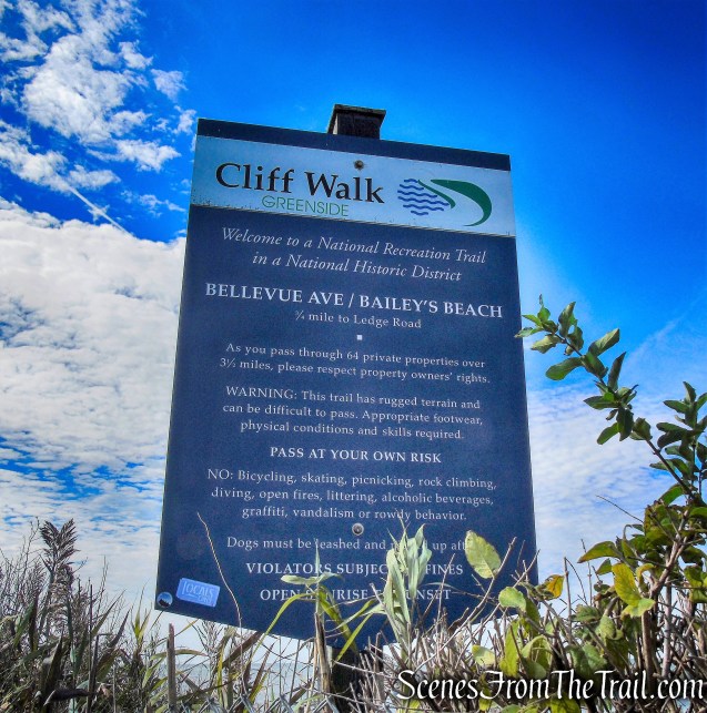
5. Ledge Road to Bellevue Ave.
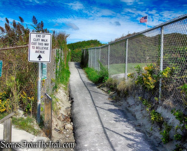
The path leads out to Bellevue Avenue where we walked 1-1/2 blocks to the bus stop.
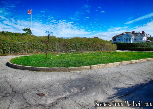
Bellevue Ave.
The bus stop is located on Bellevue Avenue, just past the intersection with Ledge Road. The 67 Bus stops here and will drop you off on Memorial Boulevard.
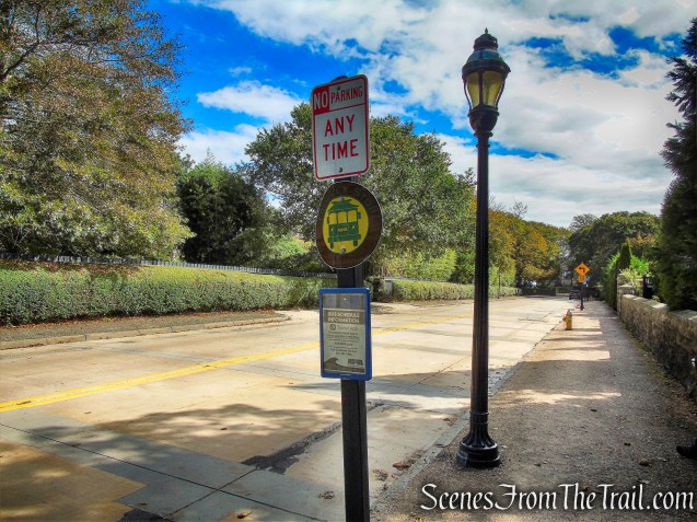
Route 67 Bus Stop – Bellevue Ave. & Ledge Rd.
This is one of those “must do it once” type of hikes. It’s extremely easy and quite enjoyable. The rough terrain sections are not rough at all unless the rocks are wet, then they can become a little trickier. The only drawback is waiting for the bus at the end of the hike and the walk back to the car. In season there is a bus every 20 minutes and every 30 minutes off season. In retrospect, I would have taken the bus to Bailey’s Beach and started from there. On the return trip, the bus dropped us off at the corner of Bellevue Ave and Memorial Blvd. We then walked about 1.3 miles along Memorial Blvd back to Easton’s Beach (First Beach), where we parked the vehicle. Other than that it was a beautiful stroll along the Newport shoreline.
Pros: Too many to list.
Cons: Waiting for the bus and the walk back to the parking lot, During summer months expect crowds.
Take a hike!
Newport Cliff Walk
Sources:

I believe that the Breakers was built for the Commodore’s grandson who was named after him.
LikeLike