August 5, 2018 – Greenwood Lake, NY
Difficulty: Moderate – strenuous
Length: approximately 3 miles
Max elevation: 1,299 ft. – total elevation gain: 705 ft.
Route type: Out and back
Map: North Jersey Trails Map #116 – Free Park Map
Trailhead parking: State Line Trailhead Parking Lakeside Rd, Greenwood Lake, NY 10925
The 2,000-acre Abram Hewitt State Forest encompasses a section of the Bearfort Ridge between Greenwood Lake and Upper Greenwood Lake, north of Warwick Turnpike. Bearfort Ridge, formed of the unusual Skunnemunk Conglomerate or “puddingstone,” is an anomaly in the midst of the Highlands. With its many overlooks, colorful bedrock, and stunted pitch pines, it is one of the most picturesque mountain ridges in all of New Jersey. The challenge: all of the trails “climb steeply” in places.
Bearfort Ridge
The forest is isolated and untouched, accessible only on foot. Marshes and wetlands are scattered throughout the forest with several brooks and streams crisscrossing the lower areas. Hemlock and oak are the dominant species of this relatively undisturbed forest. The glacially-smoothed ridge is studded with pitch pines. Rocky outcrops and upland swamps characterize Abram S. Hewitt State Forest. The glacially carved ridge offers spectacular views eastward along Greenwood Lake.

Ernest Walter Trail – Bearfort Ridge
While searching for a place to hike, Bearfort Ridge was cited numerous times as one of the most scenic areas in all of New Jersey. About an hour drive from where I reside, it was definitely worth the trip. I mapped out a loop hike using the various trails, but with extreme heat and poor air quality, the strenuous hike that I had mapped out would be made more difficult. I wanted to have options for a shorter out if it became necessary. As it turned out, the hike became an out and back once we got to Surprise Lake. We could have continued and completed the loop, but to be honest, the ruggedness of the trails made this three mile hike more than enough on this hot and humid day. We were satisfied with the hike and the effort that we put forth on this sweltering Sunday in August.
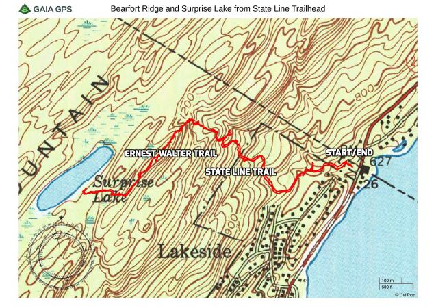
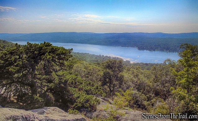
Bearfort Ridge and Surprise Lake from State Line Trailhead
A new feature that I have added is the Google Earth Fly-Through. It follows the path that we hiked and it gives you a good idea of the terrain, layout, amount of parking etc. Check it out, it’s pretty cool.
View the Google Earth Fly-Through video of the hike below.
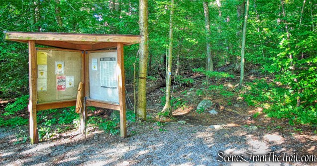
Since it was going to be a scorcher, we got an early start, arriving at the trailhead at approximately 8:00 am. The parking area has room for about 8 cars, but when we arrived there was only one car there. Upon returning to the parking area shortly after noon, the lot was at capacity with cars parked alongside the woods and cars filing in then turning around. The trailhead for the State Line Trail begins just below the hikers parking.
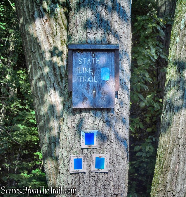
State Line Trail
The trail can also be accessed alongside the kiosk by the hikers parking as well. This is where we began the hike.
State Line Trail
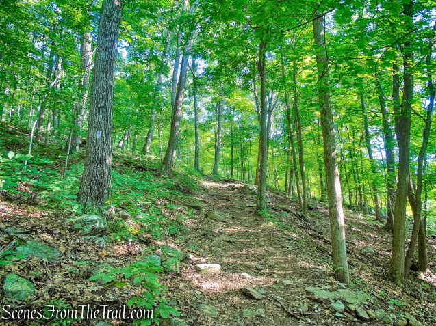
From the kiosk at the end of the parking area, we began following the blue-on-white-blazed State Line Trail, which follows a wide, rocky path up Bearfort Mountain.
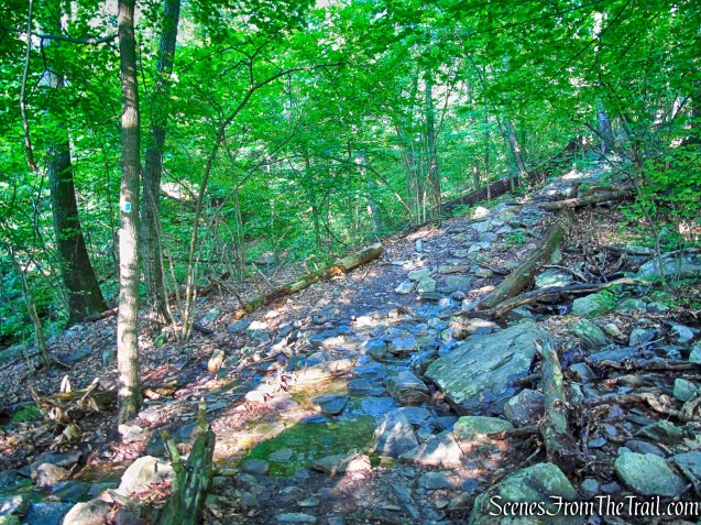
State Line Trail
The ascent is moderate at first, and the trail soon levels off.
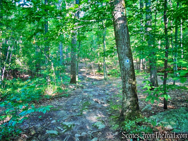
State Line Trail
The heavy rainfall the previous several days. turned the State Line Trail into a stream bed. On the level areas, there were numerous water crossings, some deeper and wider than others.
water crossing – State Line Trail
As the trail ascends, the water streamed over and around the rocks, making it slippery and a little slow going. At times we walked along the edge of the trail rather than walk through the flowing water or wet rocks.
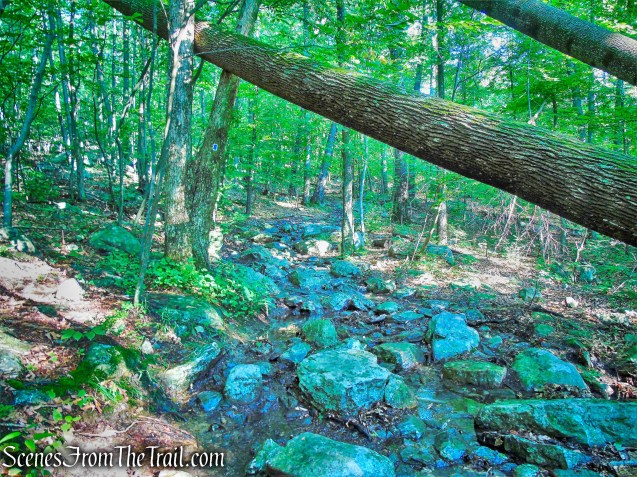
State Line Trail
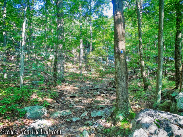
With a private home visible directly ahead, the trail turns right and begins to climb more steeply. Taking care to follow the blue-and-white blazes, as there are many side trails that branch from the main route.
State Line Trail
Although the trail is steep, it is nicely shaded on the section that we hiked. Even though it was still early morning, I had already worked up quite a sweat.
State Line Trail
In about 3/4 mile, we reached an intersection with the yellow-blazed Ernest Walter Trail. This turn can be easily missed as the blazes are not easily visible going uphill. I was on the lookout for them and spotted two yellow blazes on a tree as I was walking past the trail. I assume that one of the blazes is missing because this is either the start or end of the trail, depending on which direction one is traveling. We turned left and followed the yellow-blazed trail uphill.
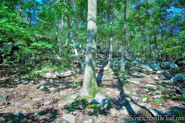
junction – Ernest Walter Trail
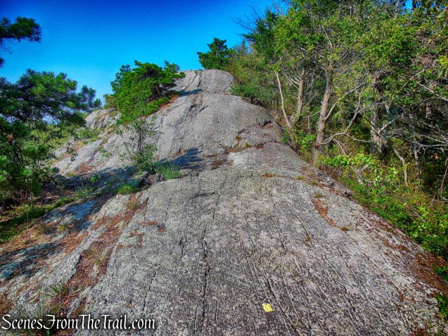
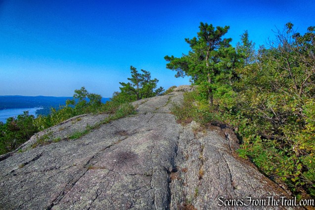
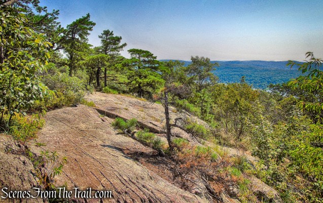
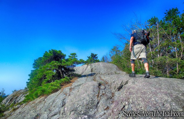
The trail climbs over rocks as it heads steeply uphill. In a short distance, we began to traverse a long, glacially-smoothed outcrop of Skunnemunk Conglomerate “puddingstone” rock. This unusual reddish-matrix conglomerate rock, studded with pebbles of pink sandstone and white quartz, is characteristic of Bearfort Ridge.
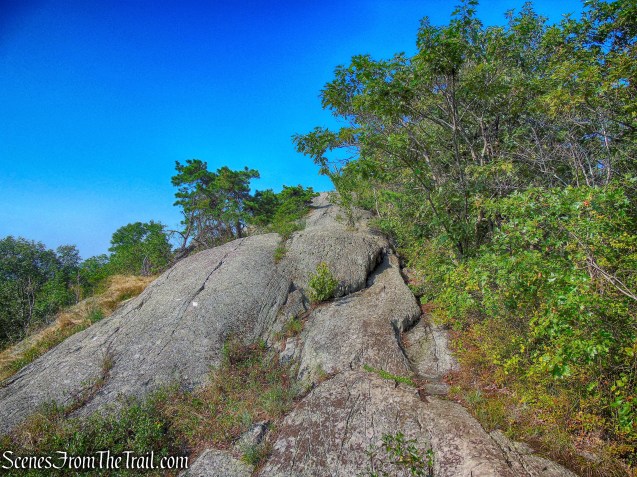
Bearfort Ridge – Ernest Walter Trail
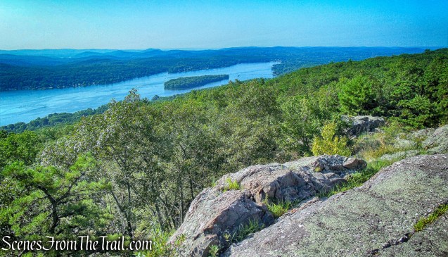
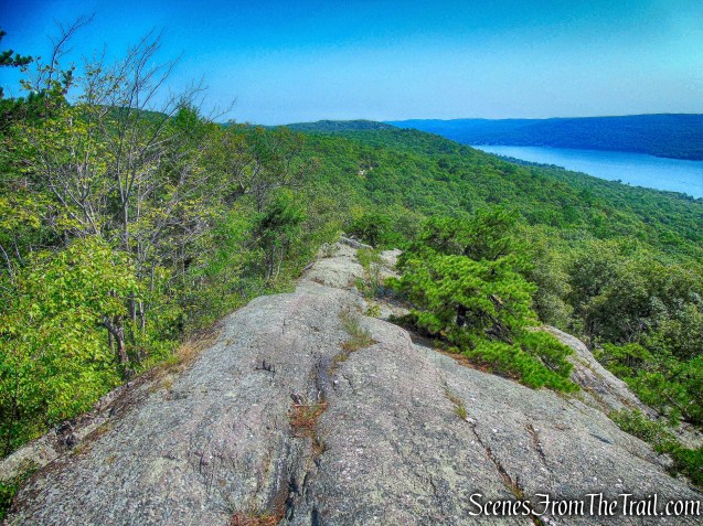
As the trail climbs along the ridge, views open up over Greenwood Lake to the east.
Greenwood Lake – Ernest Walter Trail
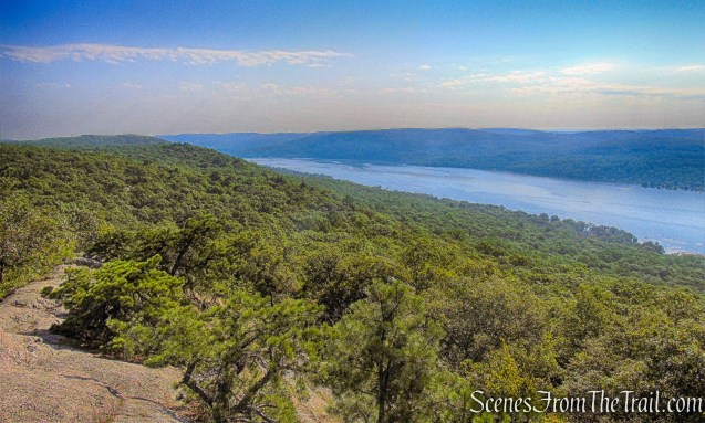
The trail continues to climb steeply over the bare rock of the ridge. The bottom of my boots were still wet from the State Line Trail and I slipped a little, several times. I wouldn’t recommend this section of the trail in times of rain or snow.

Bearfort Ridge – Ernest Walter Trail
It’s a nice walk, up the ridge, but without tree cover it is also very hot.
Bearfort Ridge – Ernest Walter Trail
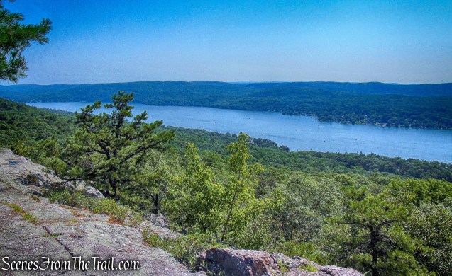
We continued to the top of the summit ridge, which offers a panoramic view over the six-mile-long Greenwood Lake, 600 vertical feet below. Although the air was thick and hazy, the view was still quite stunning.
Greenwood Lake – Ernest Walter Trail
We wanted to spend some time here, taking in the magnificent view and resting from the steep climb, but instead walked a little further and found a shady spot.
Greenwood Lake – Ernest Walter Trail
We continued along the Ernest Walter Trail, which briefly dips into the woods, but soon comes out again on another long conglomerate outcrop. After passing through an area studded with pitch pines…….
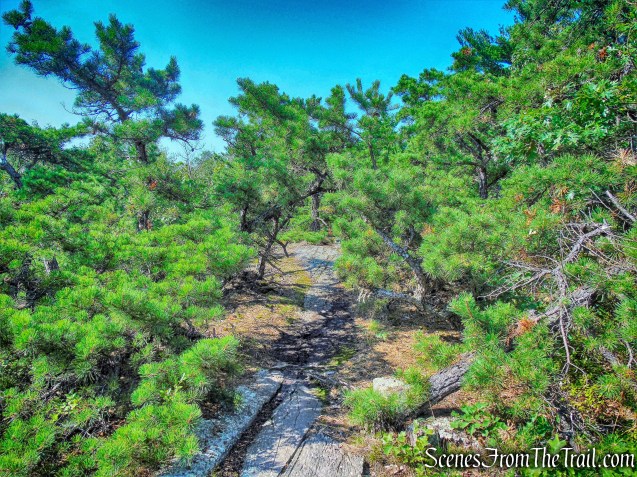
pitch pines – Ernest Walter Trail
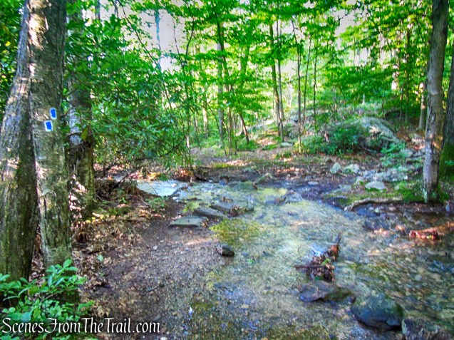
the trail bears right and descends to cross the outlet of a wetland to the right of the trail. The water here was about 12 inches deep and we walked across the fallen tree on the left, to cross over.
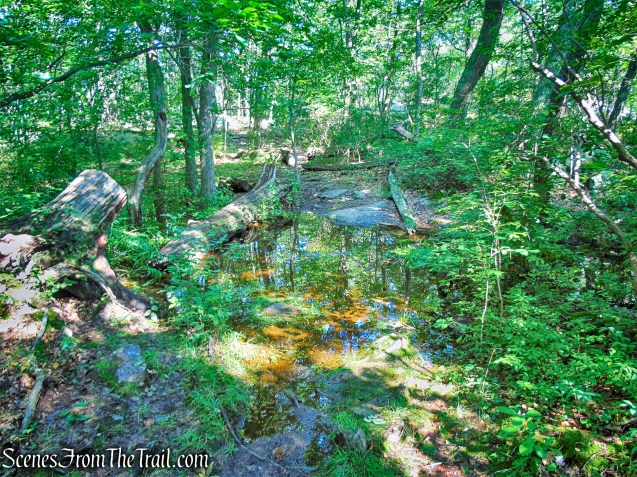
water crossing – Ernest Walter Trail
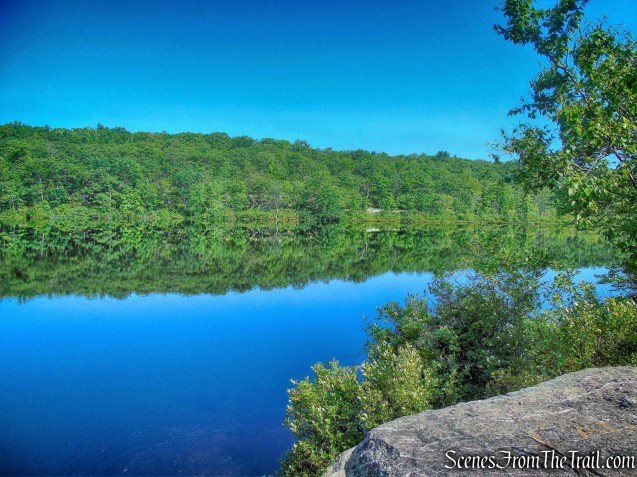
A short distance beyond, the yellow-blazed Ernest Walter Trail, reaches the eastern shore of pristine, spring-fed Surprise Lake.
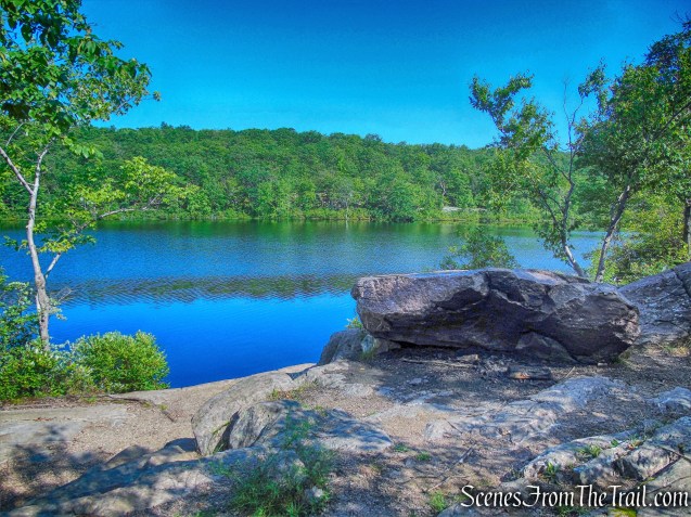
Surprise Lake
We sat here in the shade, and even though it was barely 10:00 am, we enjoyed our lunch. I had read, that this place attracts crowds, on this day, we had this beautiful spot to ourselves. We then began contemplating on our next move regarding the hike. I laid out the pros and cons of continuing on the loop and/or retracing our steps, which would shorten the hike by about a mile or so. We decided on retracing our steps and making this an out and back hike.
Surprise Lake
While relaxing here, three hikers and their dog came along. We struck up a conversation and as it turns out, one of them reads this blog. He told me that he recently followed one of my hikes. I was glad to hear that and offered to take their photograph. I didn’t catch their names, but the dog’s name is Roxie. They continued on to do the loop.
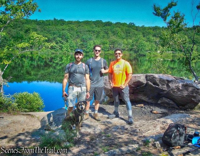
Roxie and her 3 friends
Now returning the way we came, we made our way through the woods and back out onto the scenic ridge.
Bearfort Ridge – Ernest Walter Trail
We didn’t mind revisiting these views, but we did mind the blazing sun.
Greenwood Lake – Ernest Walter Trail
This place is as beautiful as advertised.
Bearfort Ridge – Ernest Walter Trail
After making our way along the ridge, we reached the junction with the blue-on-white-blazed State Line Trail. There were about 25 hikers making their way up and stopped at the junction to wait for stragglers. We turned right and proceeded to navigate our way down the rocky trail. On two occasions, we bushwacked to the left, in order to view the cascades that tumbled down the mountain. We continued descending on the State Line Trail until we returned to the parking area, where the hike began. The best view of the cascades are right from the parking area.
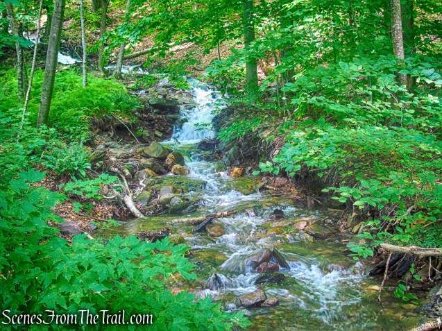
cascades – State Line Trail
This was an excellent hike and I plan to return, possibly in the fall, to complete the loop. The area is really beautiful and the views are amazing. This is a wonderful area to explore and there are connecting trails, including the AT, making long or short loop hikes possible. The State Line Trail is steep, but once up on the mountain, it does get easier, with some minor ups and downs.
Pros: Beautiful scenery, puddingstone, majestic views, Surprise Lake.
Cons: Can get crowded, State Line Trail is a stream after heavy rain.
Take a hike!
Bearfort Ridge and Surprise Lake from State Line Trailhead
Sources
