January 1, 2017 – Ossining, NY
Difficulty: moderate
Length: approximately 6 miles
Route type: circuit
Teatown Lake Reservation is a 1,000-acre nature preserve and education center located in the Lower Hudson Valley. There are almost 15 miles of trails that crisscross the property and connect to the Briarcliff Peekskill Trailway and the Croton Aqueduct Trail. The fourteen maintained trails span diverse terrain and habitats, including abundant fields, mixed hardwood forests, laurel groves, lakes, streams, swamps and farm land. The trails range from easy/novice to moderately difficult. Their website lists descriptions of specific hikes on their Hike Teatown page. The hike that I chose was the longest one that they listed, but any hike can be shortened or extended utilizing their detailed map and well blazed trails.
I wanted to start out the new year with a vigorous hike that was close to home. Teatown is a popular spot for hikers, runners and families, so I figured that New Year’s Day and an early arrival would help to avoid any crowds. We arrived at about 8:15 am and there were only a few cars in the lot. On our return later in the day both lots were full. The temps were in the mid to high 40’s and sunny. Another perfect day for a hike.
We decided to check out the rescued raptors that they have on exhibit before we began our hike, so we headed past the nature center and to the Raptor Loop Trail. It was a short detour that added minimal distance to our hike, but well worth it.
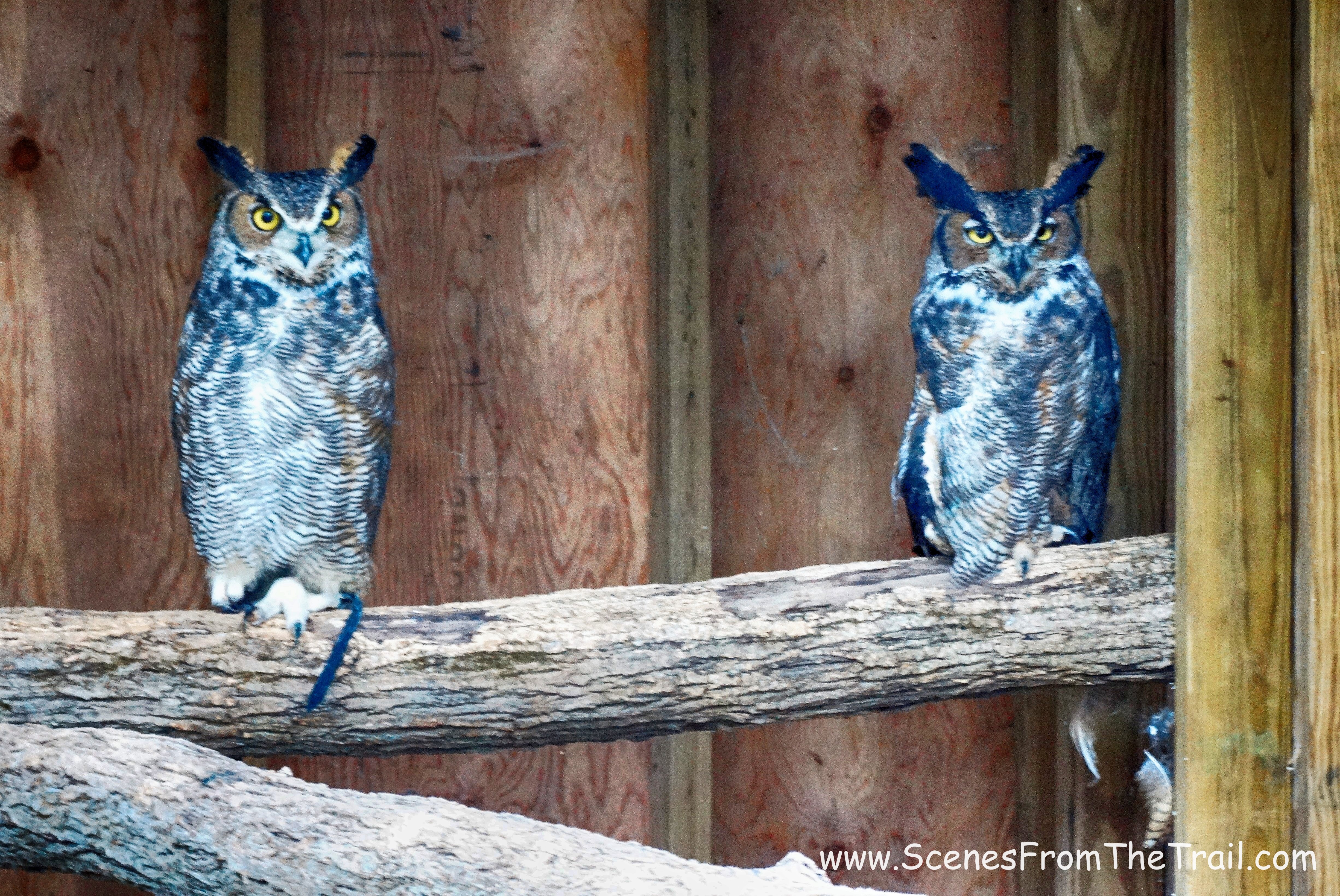
Great Horned Owls
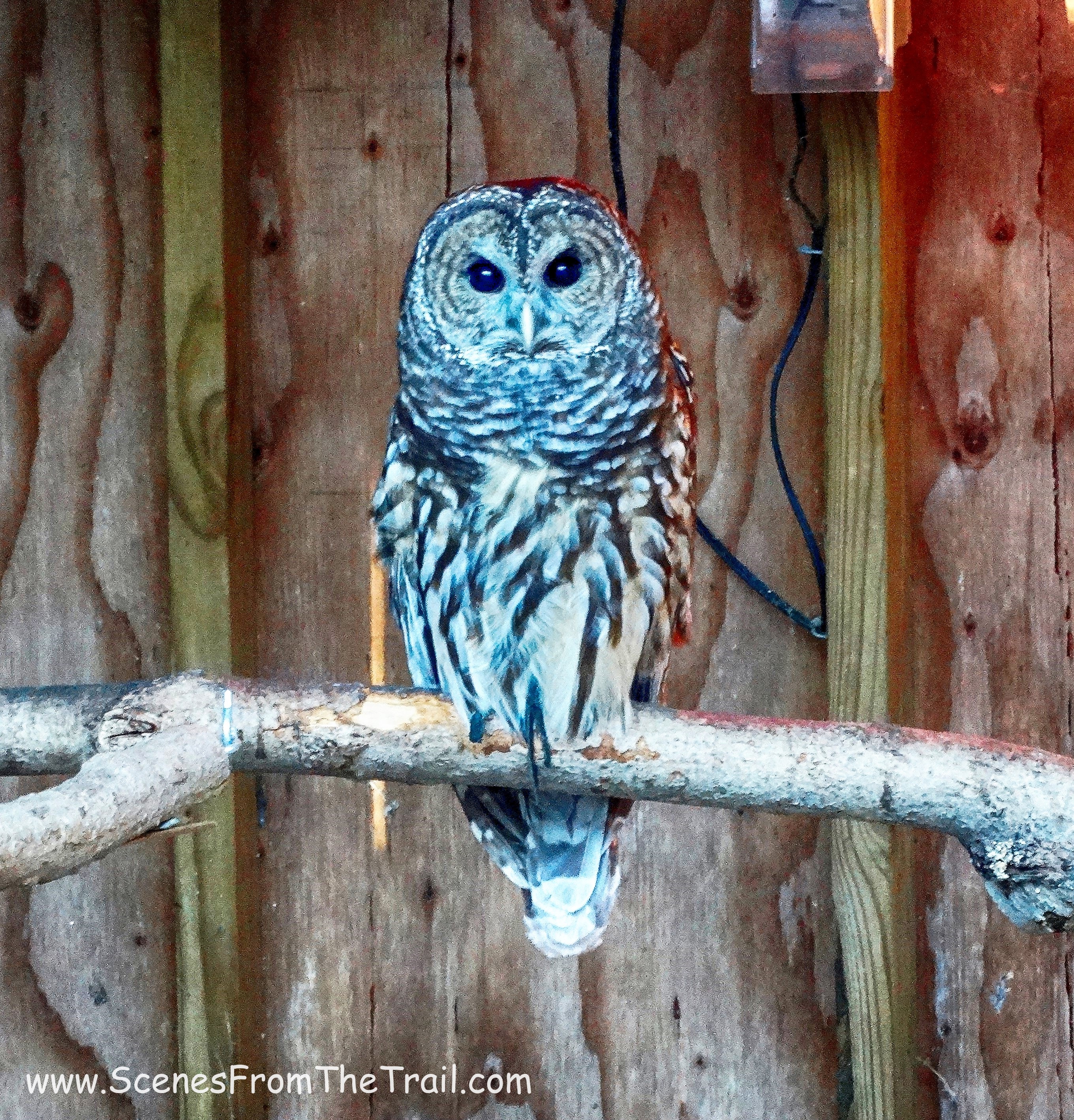
Barred Owl
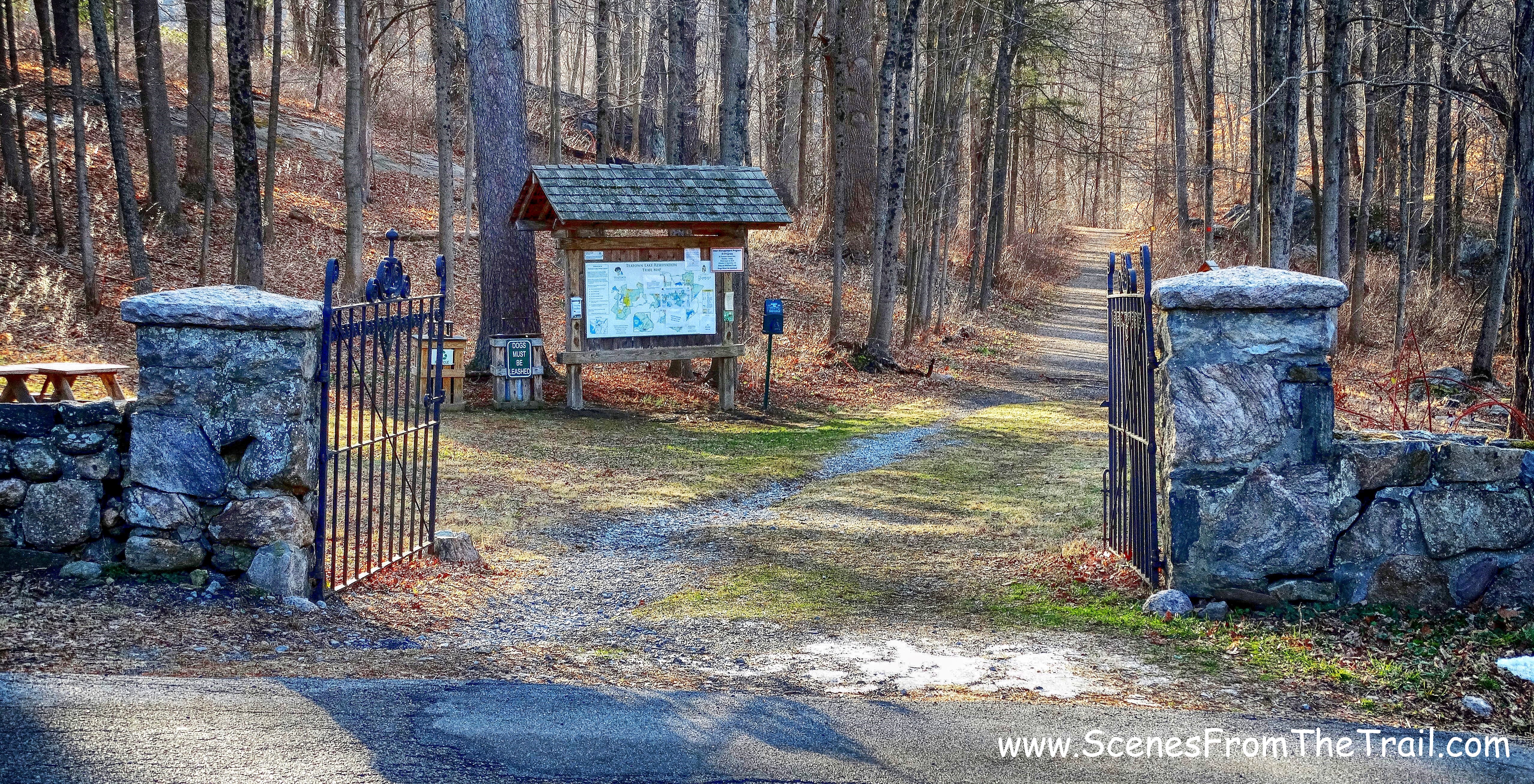
Once we were done viewing the birds of prey, we crossed Spring Valley Road and walked through the gate towards the kiosk. Here we would begin the following the orange blazes of the Twin Lakes Loop trail.
Twin Lakes Loop
We walked on the gravel road which led us to Vernay Lake. There we stopped for a moment to enjoy the view of the frozen lake.
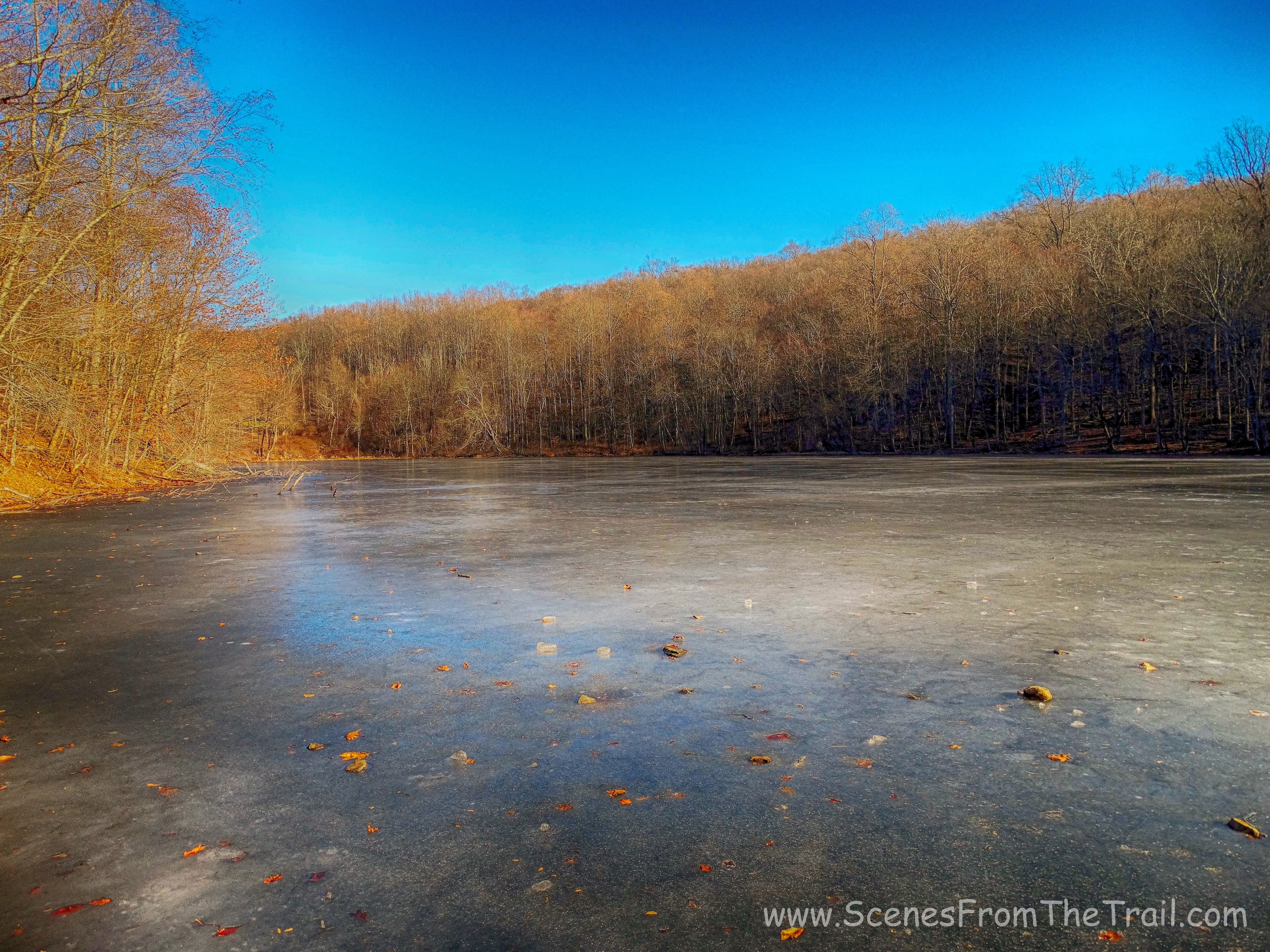
Vernay Lake
The orange-blazed Twin Lakes Loop trail is 2.3 miles long and loops around the lake, which means that you can go either left or right and if you follow the orange blazes, it will bring you right back here. We turned left and walked along the edge of the lake.
Twin Lakes Loop trail
While walking along the trail, I noticed a small stone building in the woods on the other side of the lake.
small stone building
The trail wrapped around the eastern end of the lake and began heading uphill on switchbacks once we were on the opposite side of Vernay Lake.
Twin Lakes Loop
The Twin Lakes Loop trail leads away from the lake as it heads uphill. The elevation is about 370 feet, so it’s doable for most. We arrived at the edge of Shadow Lake and took a brief rest while looking out towards the lake.
Shadow Lake
The trail led to the right of the lake (west), and we followed it and walked across the dam, which was covered with grass.
Shadow Lake dam
The trail began to rise and we arrived at the highest point which afforded views north, of the Hudson Highlands. Unfortunately, the view is marred by overhead power lines which run through the property. We stopped here briefly as the wind started picking up and caused our hasty departure.
view of the Hudson Highlands
The orange-blazed Twin Lakes Loop trail now began to descend gradually. The woods are very scenic, with interesting rock formations and stone walls all throughout the property. Up to this point, we had not encountered anyone else on the trail. It pays to get an early start. We came to a junction where the red-blazed Waterfall Trail began on the left and the orange-blazed Twin Lakes Loop trail veered right. We turned left onto the Waterfall Trail. There we walked alongside a stream and then crossed it on a small wooden footbridge.
footbridge – red-blazed Waterfall Trail
There were some lovely cascades along this trail as well as some well placed benches to relax and enjoy the scenery. As we sat on a bench in front of the cascade enjoying a snack, several groups of people passed by.
cascade – red-blazed Waterfall Trail
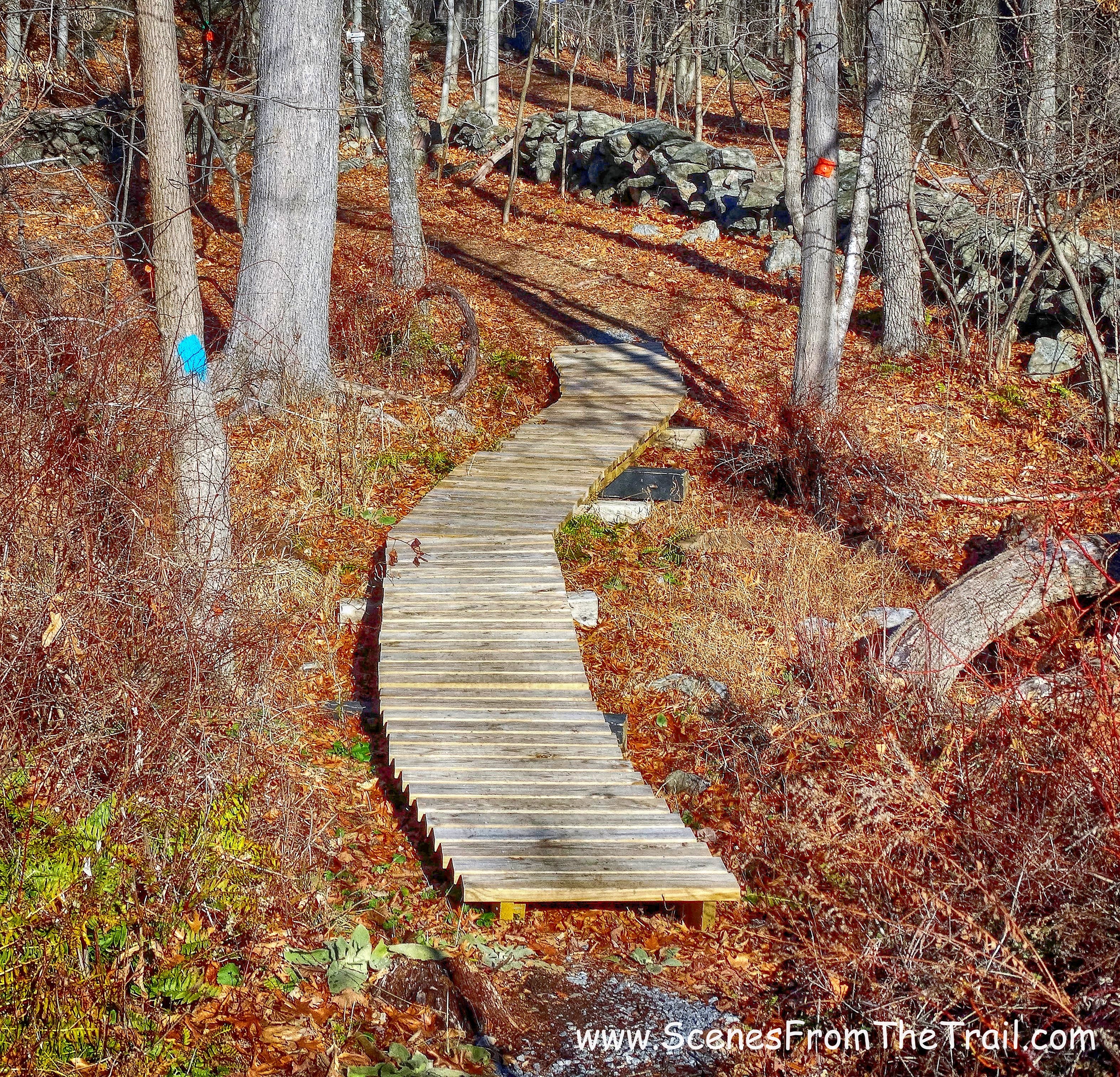
The Waterfall Trail is listed as .6 miles long, but it seemed a little longer. We then got to a junction where the red-blazed Waterfall Trail was joined by the green-blazed Briarcliff-Peekskill Trail (BPT). This area did not have any red blazes so I had to consult my map. It was easy enough to figure out and we followed the green blazes as we veered right and walked over some wooden puncheons.
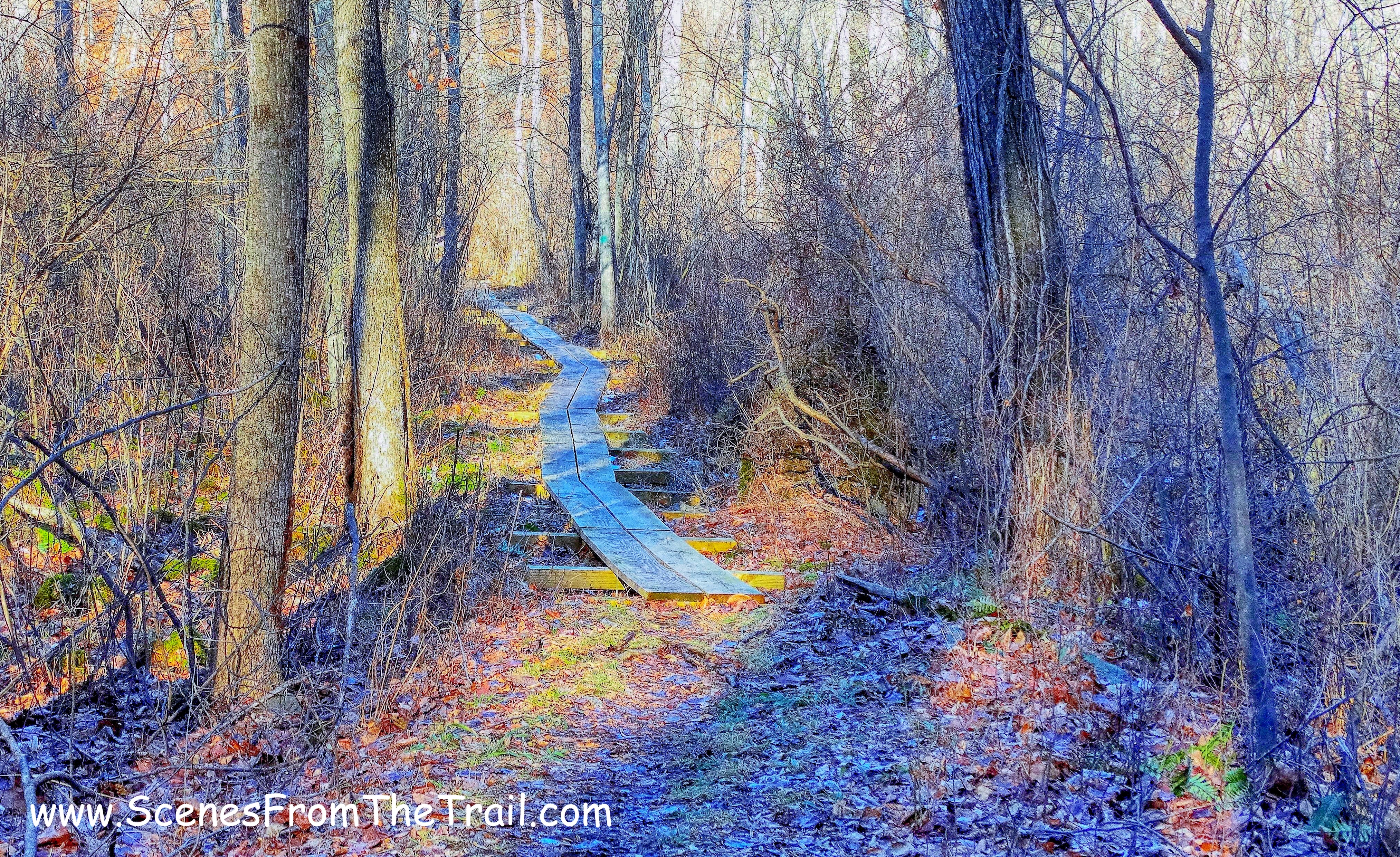
wooden puncheons – green-blazed Briarcliff-Peekskill Trail
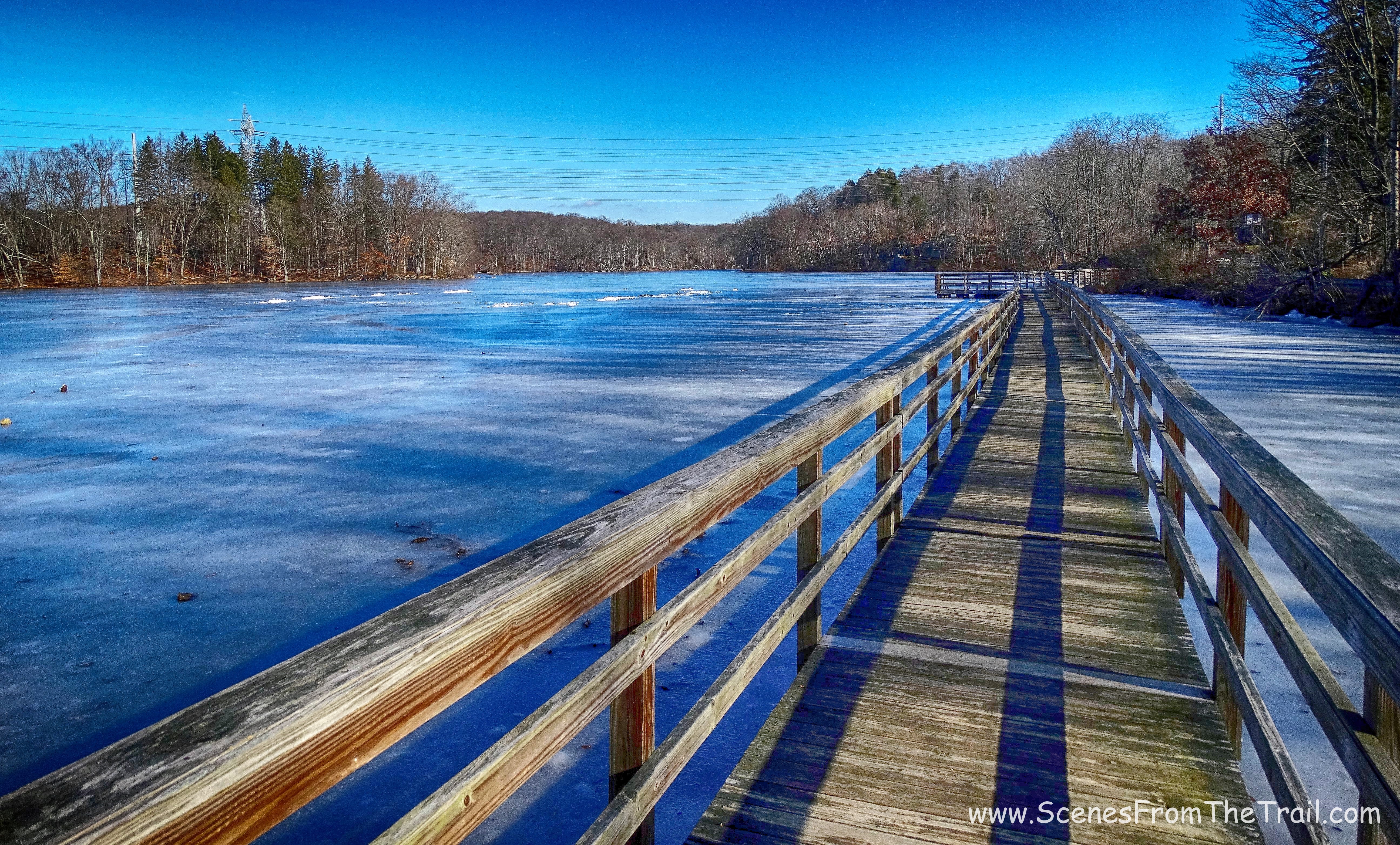
Shortly thereafter we arrived at Spring Valley Road where the Waterfall Trail ended. We crossed the road and joined the green-blazed Briarcliff-Peekskill Trail which ran jointly with the blue-blazed Lakeside Loop Trail on the other side of the street, alongside Teatown Lake. We turned right for a moment and walked onto the boardwalk (it’s part of the Lakeside Loop Trail) in order to get a good vantage point of Teatown Lake. We encountered hikers and families out for a walk in this area. With its close proximity to the nature center, I wasn’t surprised.
Teatown Lake – Lakeside Loop Trail
We retraced our steps back to the joint green-blazed Briarcliff-Peekskill Trail and blue-blazed Lakeside Loop Trail and continued on our way. We were following the green blazes which at times were joined by other trails, but our focus was on the green blazes.
green-blazed Briarcliff-Peekskill Trail
We passed through Griffin Swamp and arrived at a T-intersection with the Teatown-Kitchawan Trail which was blazed purple. Their hike directions said that it was blazed white, but I was able to figure it out. So now following the purple blazes through the woods, along a stream and across a wooden footbridge we arrived the northern end of Teatown Lake where it was dammed off.
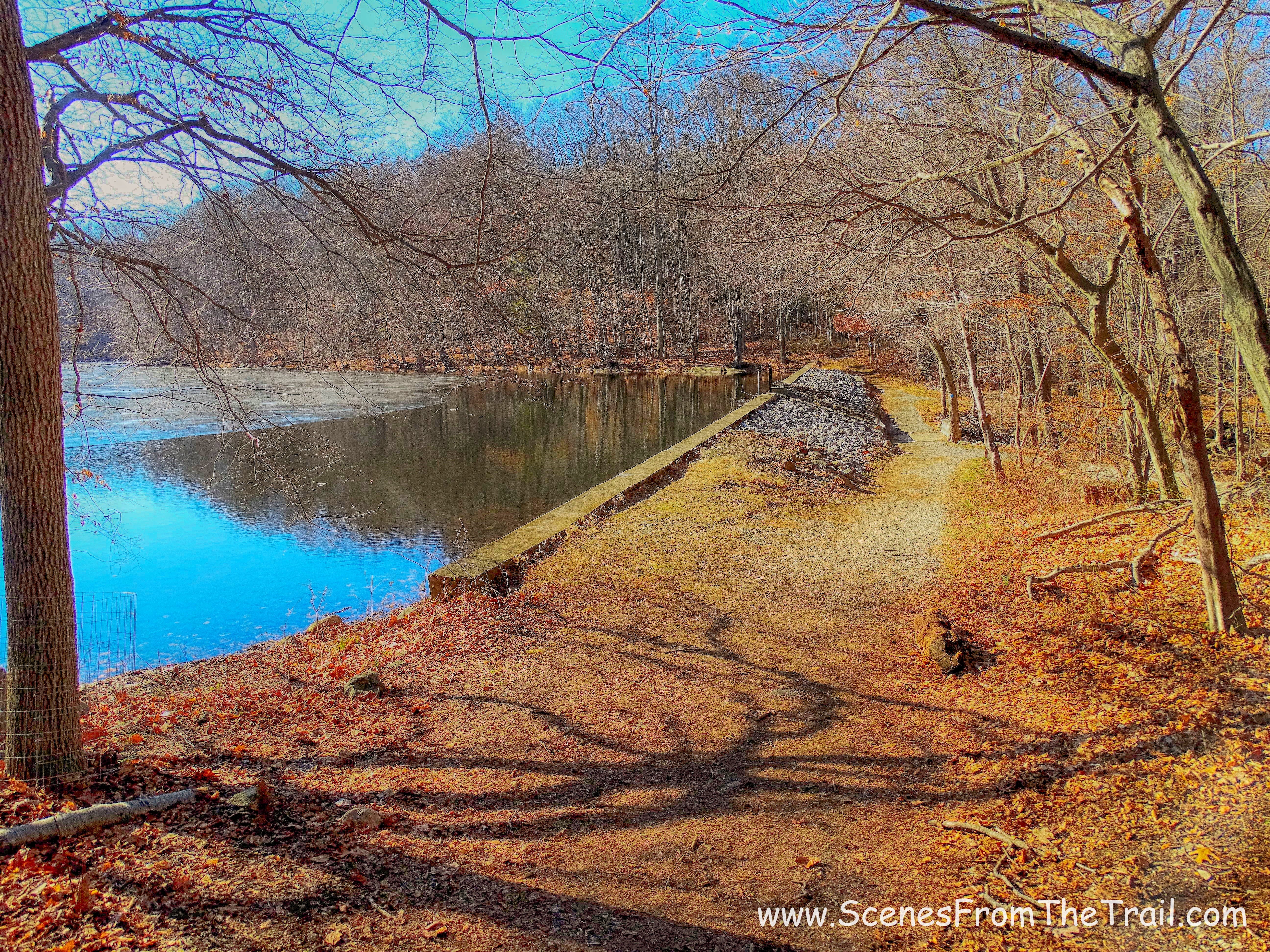
Teatown Lake dam
Arriving at the dam, facing the lake, we turned left and headed up the hill, hugging the woods. We were now on the Hilltop Trail which was blazed orange. We followed the orange blazes until we got to Blinn Road, where we took a sharp left onto the red-blazed Hidden Valley Loop trail. We crossed the road to continue following the red blazes as it led us up the hill through a field. Like the name implies, Hidden Valley Loop is actually a lollipop loop. If followed in its entirety, it will leave you back where you started. When the trail went both left and right, we turned left and followed it through the woods where after a short level stretch it began to descend into the valley.
Hidden Valley Loop
Just before we completed the loop, there was a junction with the white-blazed Twin Lakes connector where we turned left.
Twin Lakes connector trail
We followed the white blazes, crossing over Spring Valley Road until we reached the intersection of the orange-blazed Twin Lakes Loop trail. From there we retraced our steps along Vernay Lake, making a right by the concrete dock and back to the parking area where our hike began.
This was a pretty good hike that had mostly pros and few cons.
Pros: Scenic woods with varied terrain, well blazed trails, easy to follow map, stone walls galore, lovely streams and cascades, multiple lakes, convenient location and plenty of parking, no fee.
Cons: overhead power lines, crowded as you get closer to the nature center (in warm weather it’s probably extremely congested).
Well folks, I hope that you enjoyed my New Year’s Day hike, I surely did. Don’t forget to follow my blog and please feel free to leave any comments or suggestions. Now get out there and take a hike!
take a hike!
