April 7, 2026 – Montville, NJ
Difficulty: Moderate
Length: Approximately 5.3 miles
Max elevation: 934 ft.– total elevation gain approximately 600 ft.
Route type: Lollipop Loop
Map: Jersey Highlands Trails Map #125 – Morris County Park Commission Trail Map 2024
Trailhead parking: 472 Boonton Ave, Montville, NJ 07045
Gravel parking lot – porta-potties available on site
Overview:
Set within the rugged highlands of Montville, Pyramid Mountain Natural Historic Area offers a striking blend of wild terrain, geological wonders, and sweeping views. Its network of trails winds through dense hardwood forest, past glacial erratics, and over exposed ridgelines. With its mix of challenging climbs and rewarding vistas, this preserve delivers a distinctly rugged hiking experience just a short drive from the surrounding suburbs.
Orange Trail – Pyramid Mountain

Viewpoint – Blue Trail – Pyramid Mountain
Spanning more than 1,600 acres, the preserve features a diverse landscape of forests, fields, wetlands, and dramatic rock outcroppings. Scattered throughout are unusual glacial erratics left behind by the Wisconsin Glacier over 18,000 years ago, including Tripod Rock, Bear Rock, and Whale Head Rock. The park’s flat-topped ridges and narrow valleys are not only scenic, but also play an important ecological role—supporting local flora and fauna while helping regulate the water cycle by feeding reservoirs and replenishing aquifers.
Tripod Rock – Pyramid Mountain

Bear Rock – Pyramid Mountain Natural Historic Area
Whale Head Rock – Pyramid Mountain
Pyramid Mountain Natural Historic Area is managed by the Morris County Park Commission, overseeing its trails, facilities, and preservation efforts to protect both its natural and historical features.
History:
For thousands of years, this rugged landscape served as a seasonal home for the Lenape, who relied on its forests, streams, and rocky highlands for hunting, fishing, and gathering. Their presence here dates back well over 10,000 years, long before European arrival. In the 17th century, Dutch settlers were among the first Europeans to explore and establish homesteads in what was then part of old Pequannock. Traces of that early settlement still remain today, including weathered stone walls and survey markers that once defined farm fields and woodlots, quietly woven into the surrounding forest.
Pyramid Mountain Natural Historic Area was officially established in 1989 following a determined grassroots campaign to protect the land from development. The initial acquisition was made possible through funding support from the Mennen Company, helping to secure the foundation of what would become a preserved open space. Continued efforts throughout the late 20th century expanded the preserve, and in 1993 the Visitors Center was dedicated, marking a significant milestone in the area’s transition from threatened land to a permanently protected natural and historical resource.
Trails Overview:
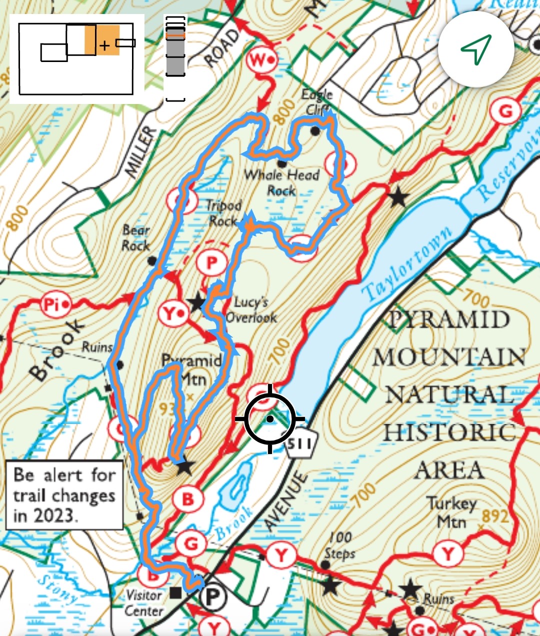
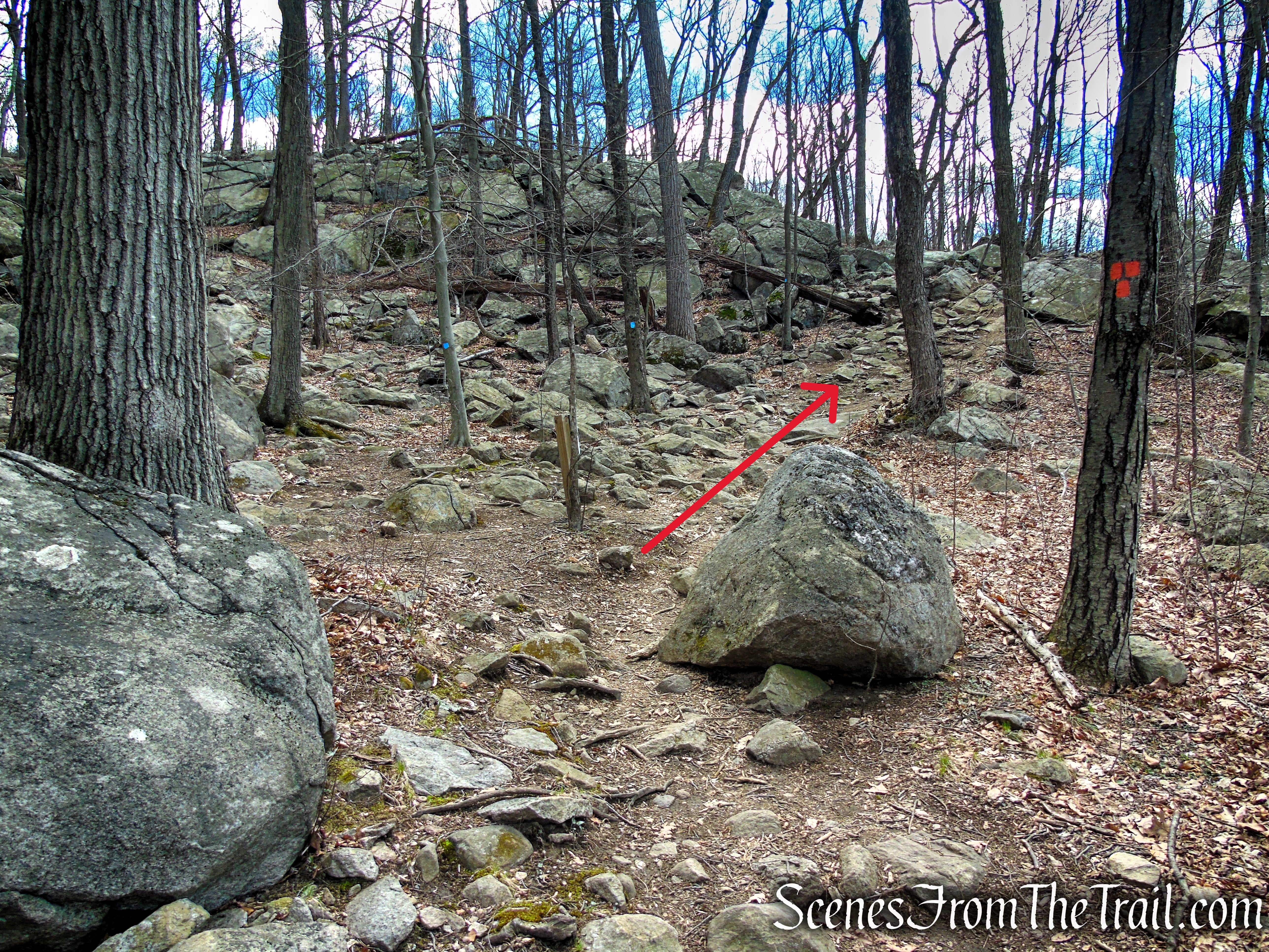
A park-wide reblazing was completed in 2021, resulting in several trail color changes, so it’s strongly recommended to use an up-to-date map when hiking here. In 2023, the Blue Trail was rerouted near its junction with the Orange Trail to the first overlook, slightly increasing the overall mileage. (See blue circle)
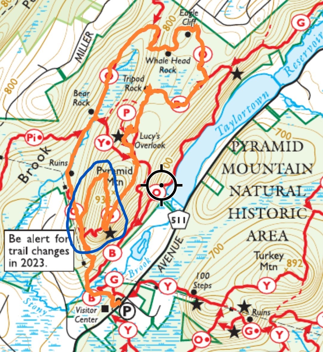
Blue Trail reroute
For the most accurate navigation, refer to the Morris County Park Commission’s trail map published in September 2024, which reflects these updates. The NY-NJ Trail Conference map (published in 2023) predates the Blue Trail reroute and may not show the current alignment—be sure to check the publication date in the bottom right corner of your map.
Morris County Park Commission Trail Map 2024
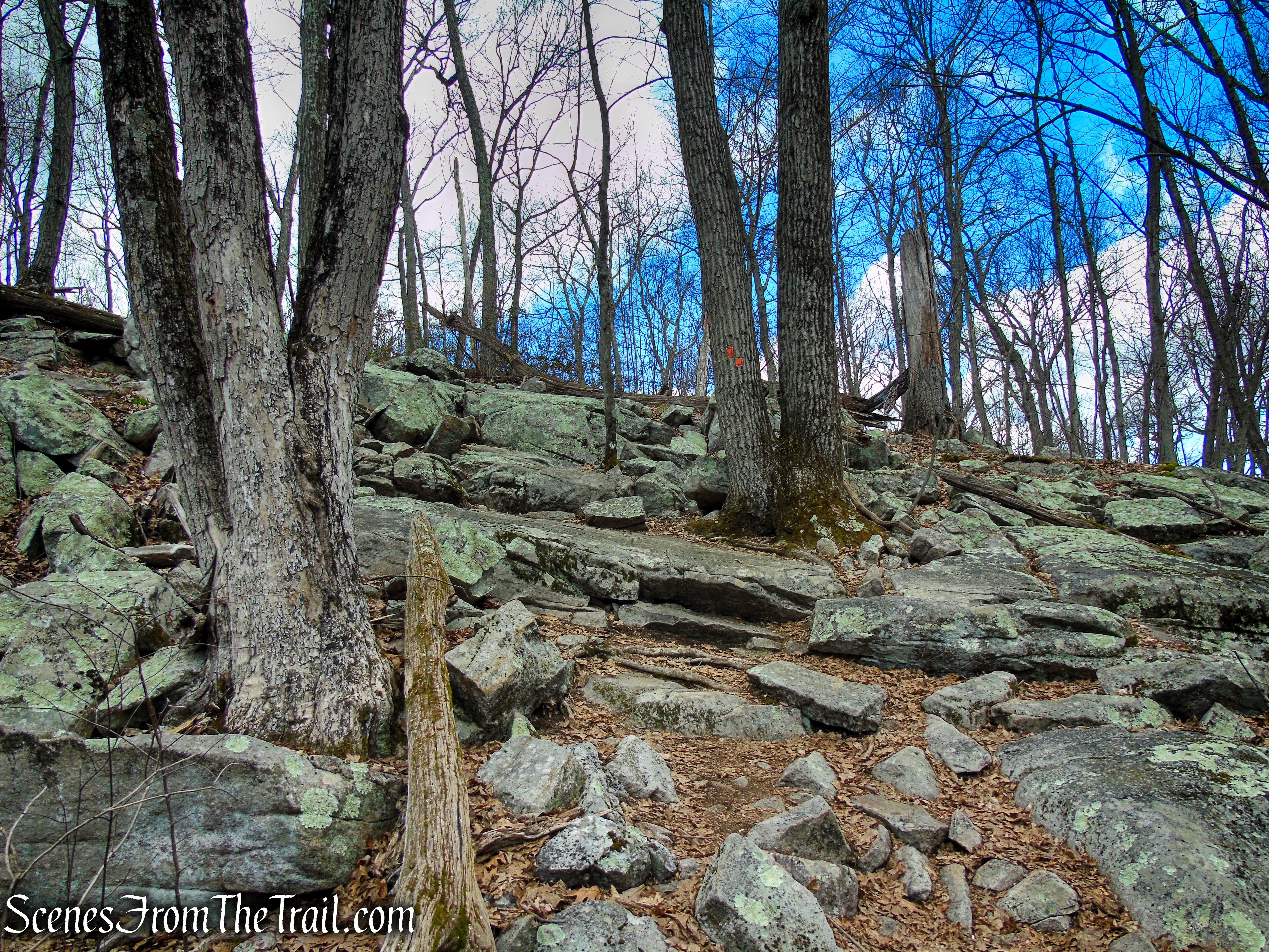
Rocks, rocks, and more rocks—if you enjoy rugged, ankle-testing terrain, this hike delivers. Jokes aside, much of the route traverses uneven, rocky ground that can be challenging at times. The climb on the Blue Trail leading to the first viewpoint winds over rocks of all sizes, but remains manageable with careful footing.
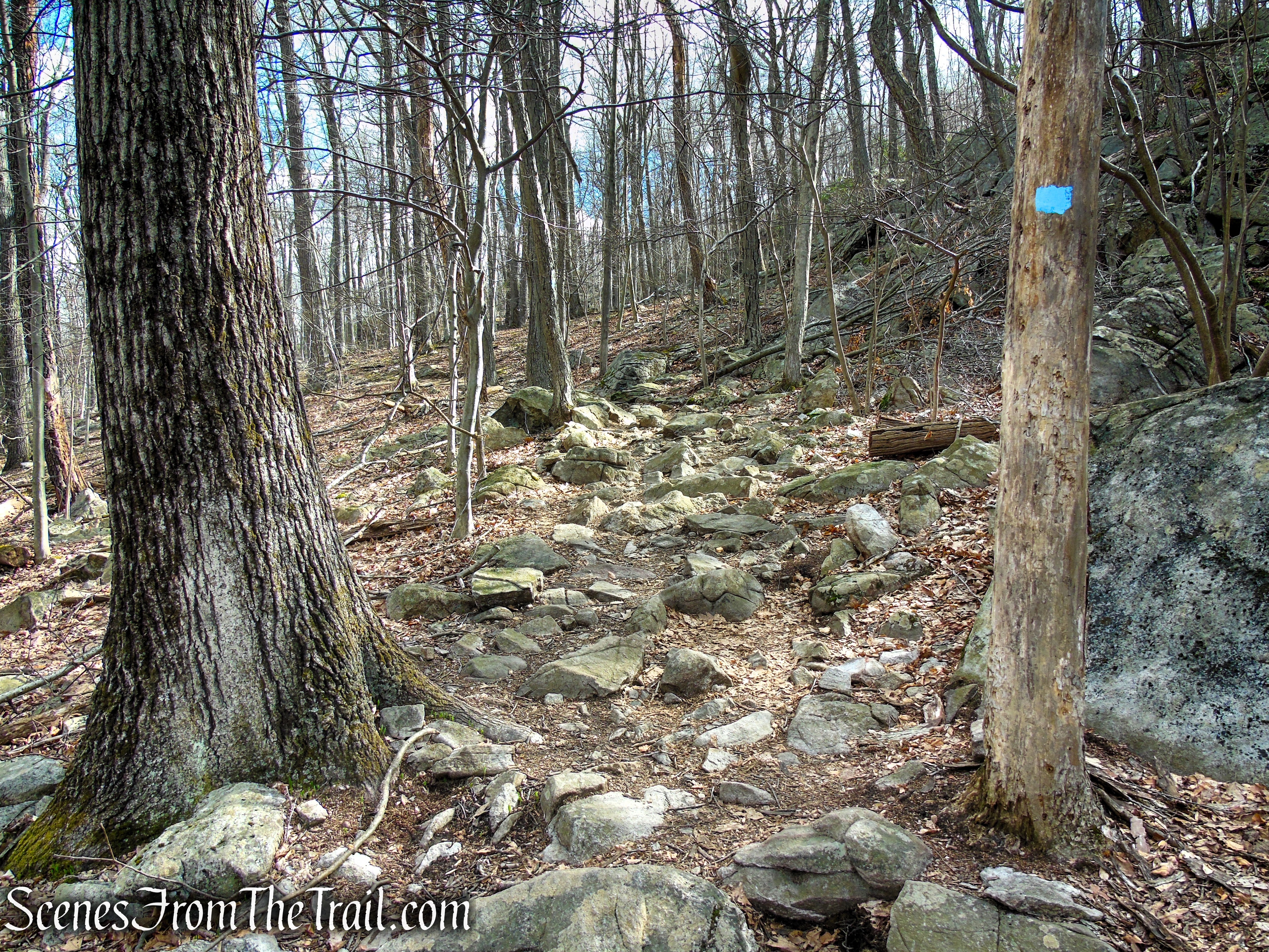
Blue Trail – Pyramid Mountain
The Orange Trail, however, is a different story. After passing Whale Head Rock, it drops steeply down a slope covered almost entirely in loose and uneven rocks. This section can be tricky to navigate, as there’s no clearly worn path—just a field of boulders guided by orange blazes on nearby trees.
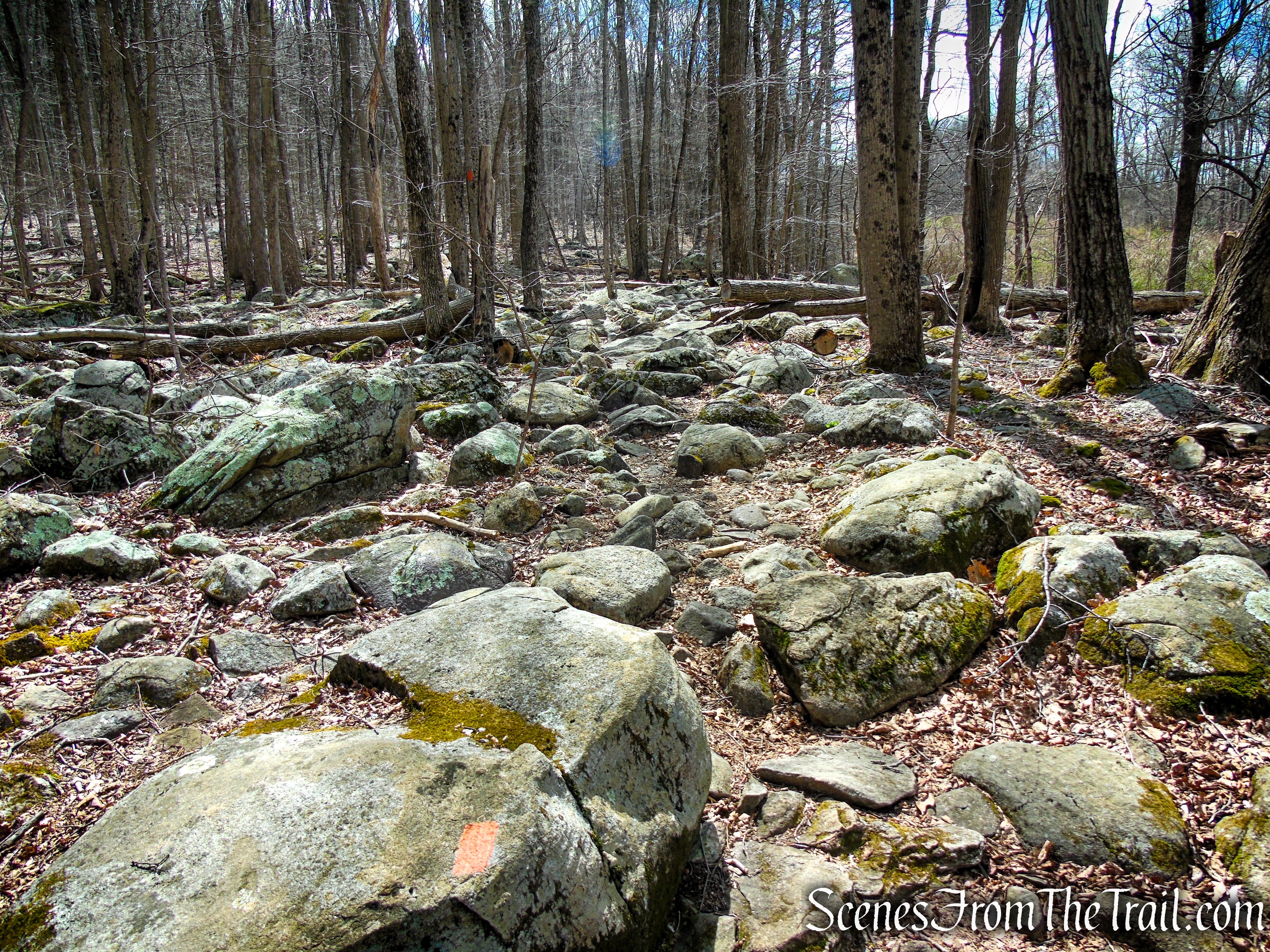
Orange Trail – Pyramid Mountain
The trails are generally well-marked, though some junctions still lack clear signage. The Lucy’s Overlook Trail, in particular, can be challenging to follow, as it winds over rocky terrain. At one point, we lost the trail and had to bushwhack a short distance back to the Blue Dot Trail.
The trails at Pyramid Mountain Natural Historic Area are maintained by a combination of the Morris County Park Commission and volunteers from the New York-New Jersey Trail Conference, who help with blazes, clearing, and general upkeep to keep the trails safe and navigable.
Hike Overview:
I did a similar hike in 2020 before the park-wide reblazing and have been eager to return to update the route. When I initially mapped out the hike, I didn’t realize the Blue Trail had been rerouted, so my planned route ended up shorter than the actual distance. The Orange Trail, descending steeply from Whale Head Rock, is particularly challenging on an “ankle breaker” type trail. From Bear Rock up to the junction with the Blue Trail, remains strewn with rocks, requiring careful footing throughout.
Even with the rocky trails, this remains a fantastic hike. The landscape is dotted with an impressive number of glacial erratics, making each turn and ridge a discovery. These rock formations not only create a challenging and rewarding experience for hikers who enjoy rugged terrain, but they also offer a fascinating glimpse into the region’s geological history and the dramatic forces of glacial activity that shaped it.
This moderate loop covers approximately 5.3 miles with a total elevation gain of around 600 feet, though the rocky terrain can make it feel more strenuous.
Pyramid Mountain Natural Historic Area
The elevation graph below illustrates the steady series of climbs and descents you’ll experience along this hike, highlighting the rolling, rugged nature of the terrain.
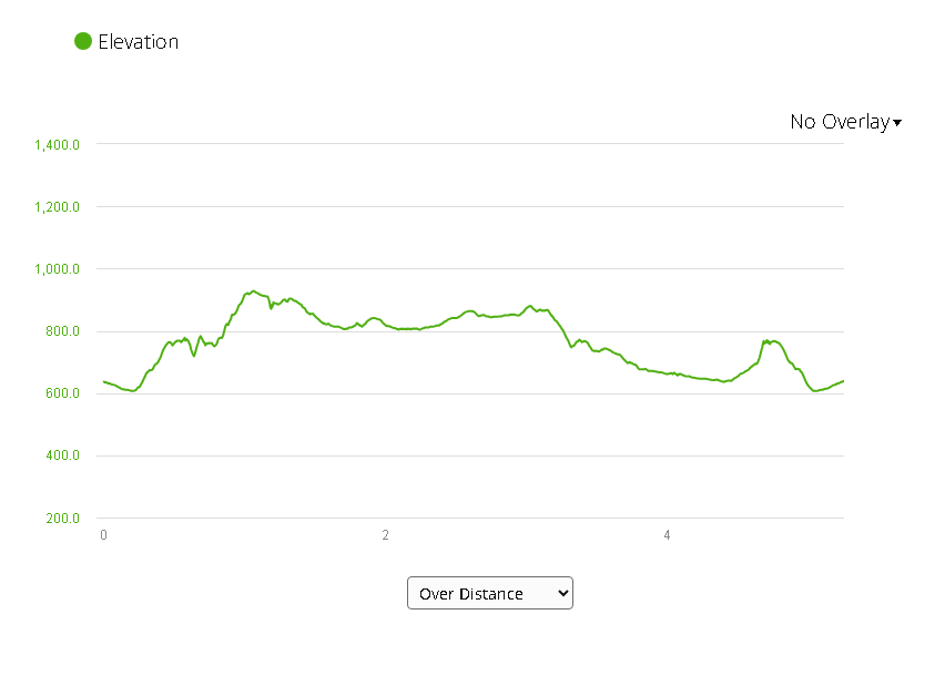
elevation profile – Pyramid Mountain
This loop hike covers most of the points of interest in the Pyramid Mountain section of the park. This is a good hike to do if it’s your first time visiting.
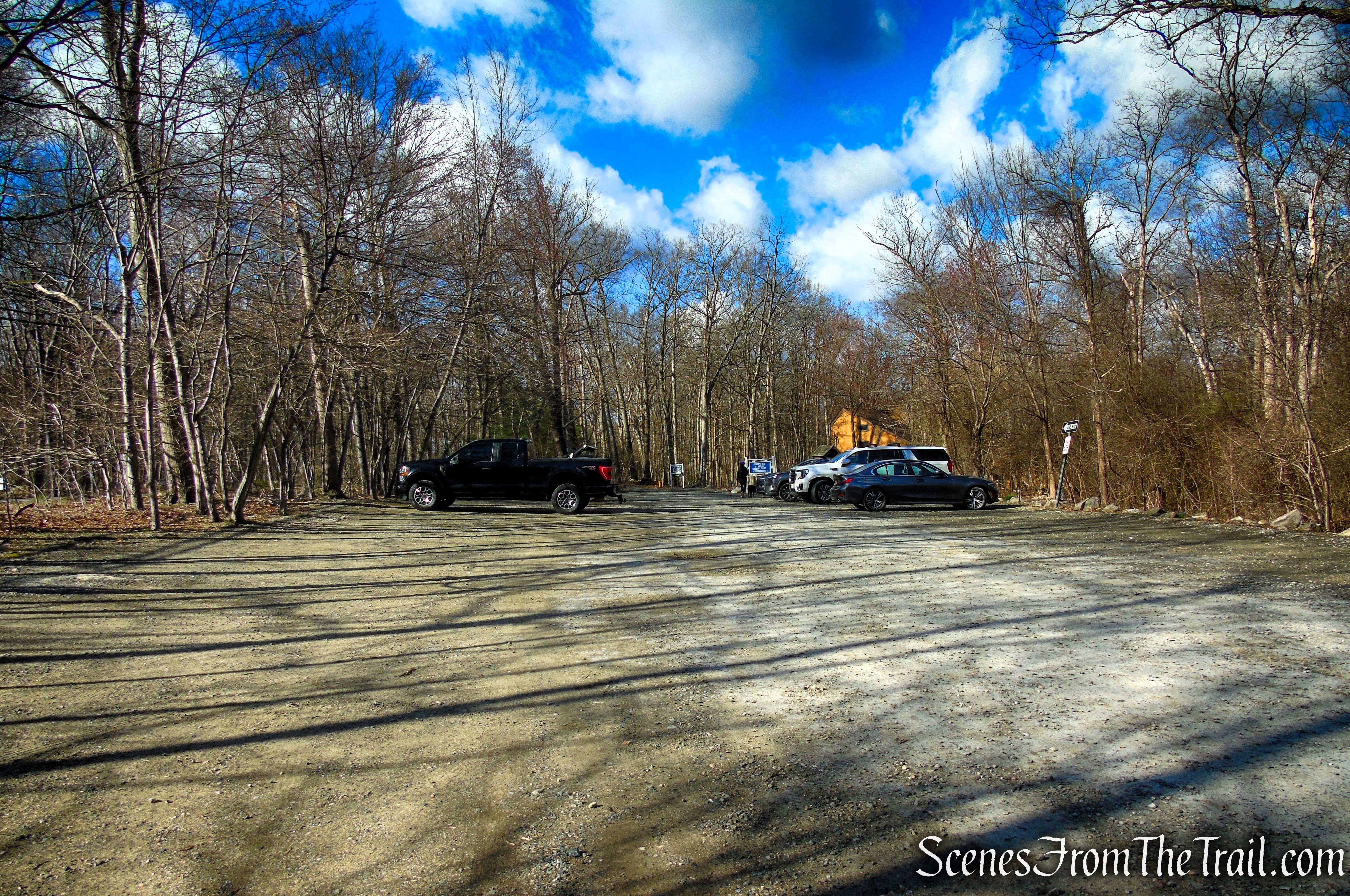
Parking:
The main parking area at Pyramid Mountain Natural Historic Area is a gravel lot that accommodates approximately 20–25 vehicles. The park is open daily from dawn to dusk, providing access to the trails and viewpoints during daylight hours.
Pyramid Mountain Natural Historic Area
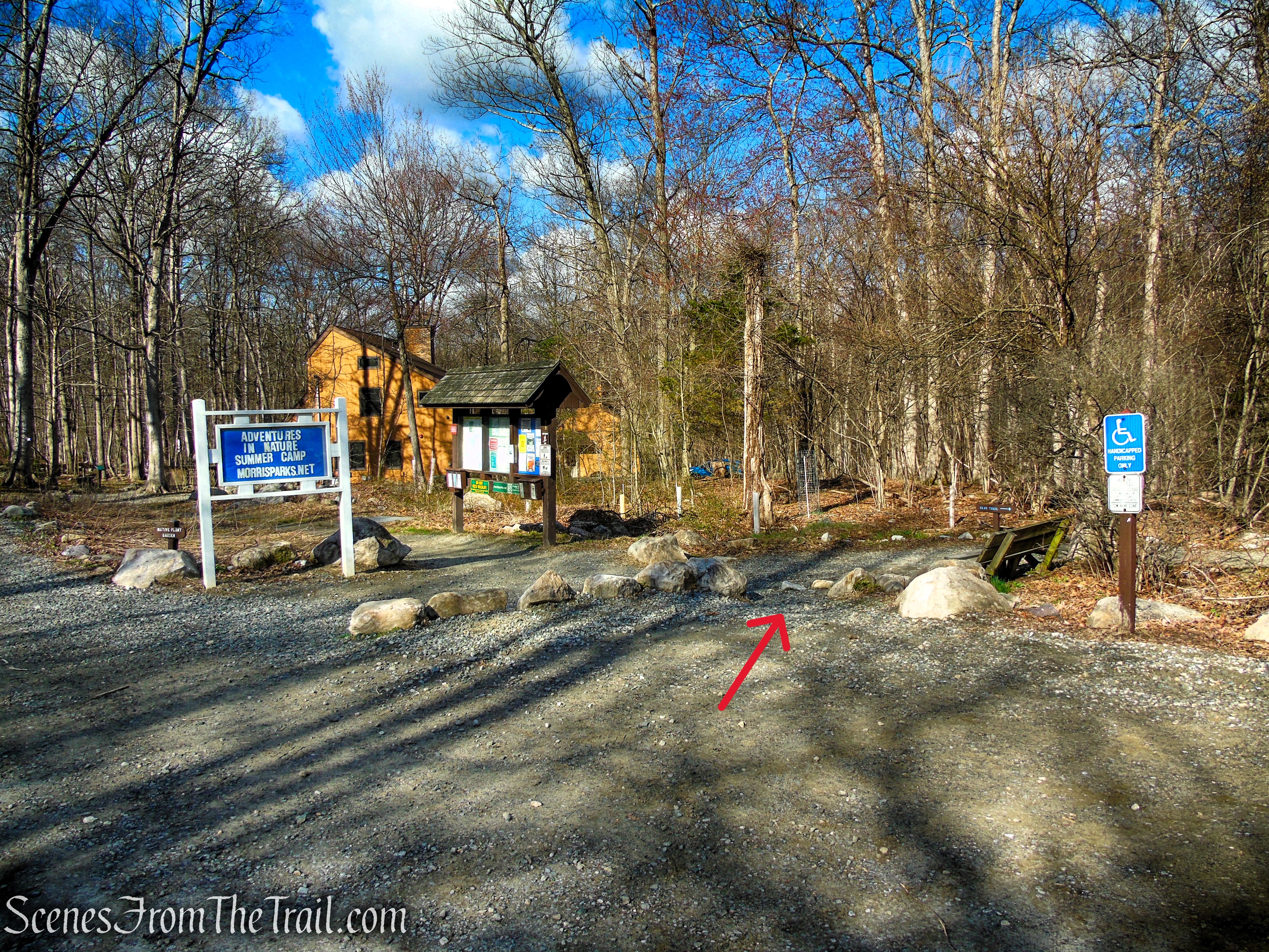
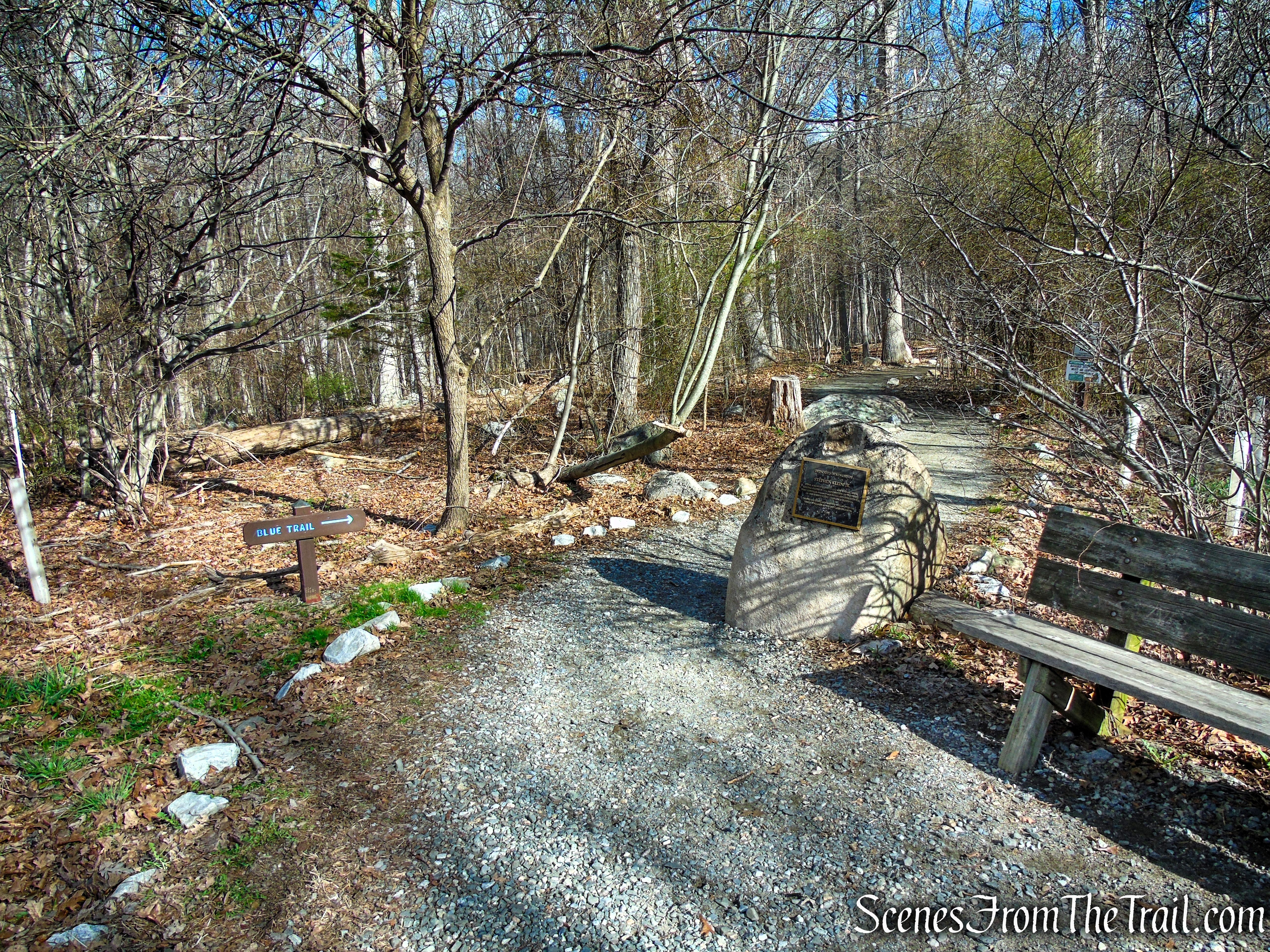
The Hike:
From the southern end of the parking area, follow the Blue Trail, which starts just north of a kiosk and immediately passes a memorial plaque for Stephen Klein Jr. The first part of this trail follows a wide gravel path bordered by small stones. In a short distance, you’ll reach a junction where a branch of the Blue Trail goes off to the right. Continue ahead on the main route of the Blue Trail, which passes a junction on the right with the green-blazed Toddler Trail.
Pyramid Mountain Natural Historic Area
Blue Trail – Pyramid Mountain
Blue Trail – Pyramid Mountain
After bearing right, the Blue Trail crosses Stony Brook on a wide fiberglass bridge. Just beyond, you’ll reach a fork marked by a large cairn, where the Blue Trail loop begins. Bear left here to follow the western leg, which gradually climbs through a landscape dotted with scattered boulders.
Blue Trail – Pyramid Mountain
Blue Trail – Pyramid Mountain
Blue Trail – Pyramid Mountain
Blue Trail – Pyramid Mountain
Blue Trail – Pyramid Mountain
Blue Trail – Pyramid Mountain
The climb soon becomes steeper as the trail passes a powerline clearing on the left. Shortly after, the trail descends to a junction with the Orange Trail on the left—this will serve as your return route, but for now, continue following the blue blazes.
Blue Trail – Pyramid Mountain
Blue Trail – Pyramid Mountain
Blue Trail – Pyramid Mountain
Blue Trail – Pyramid Mountain
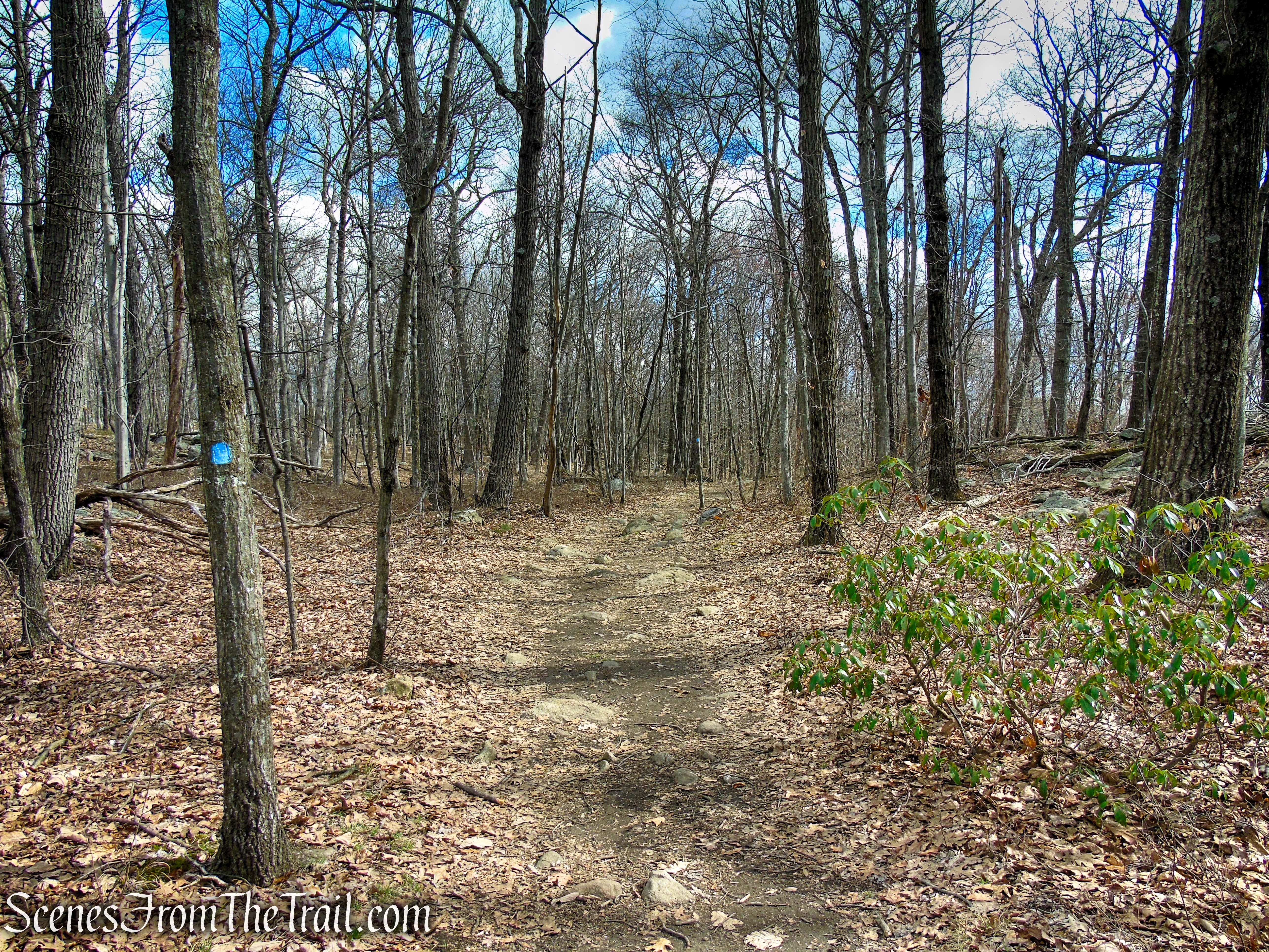
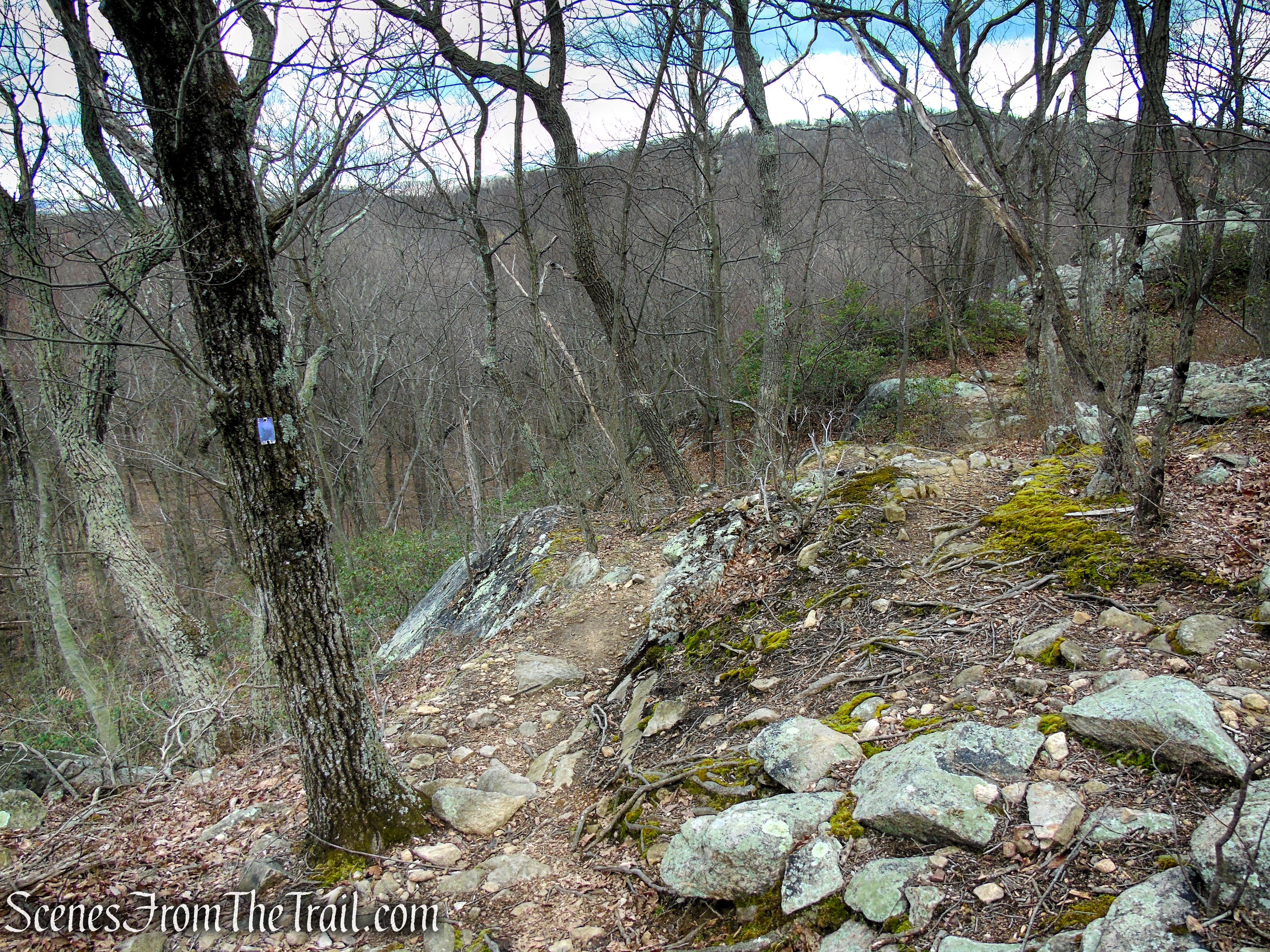
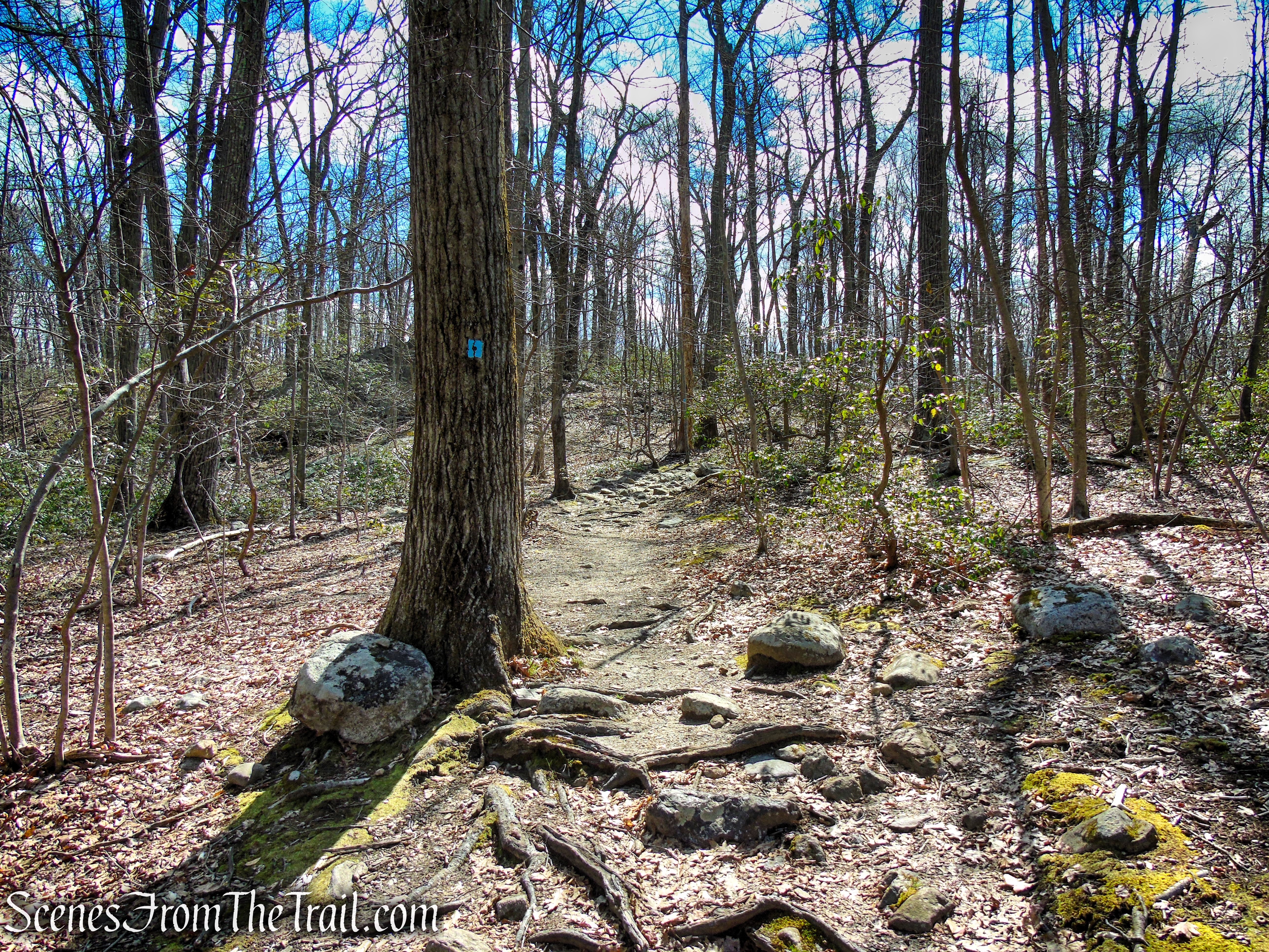
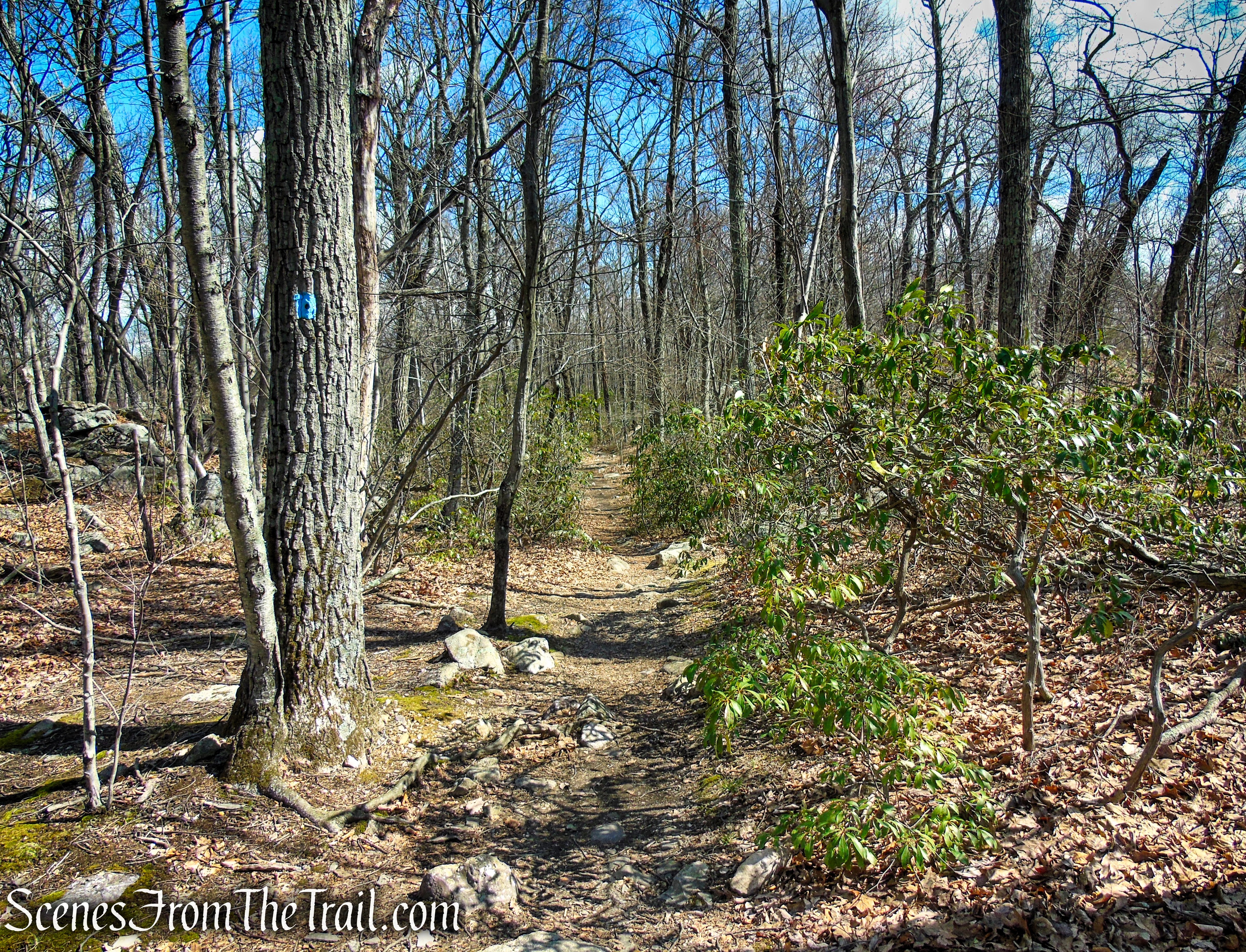
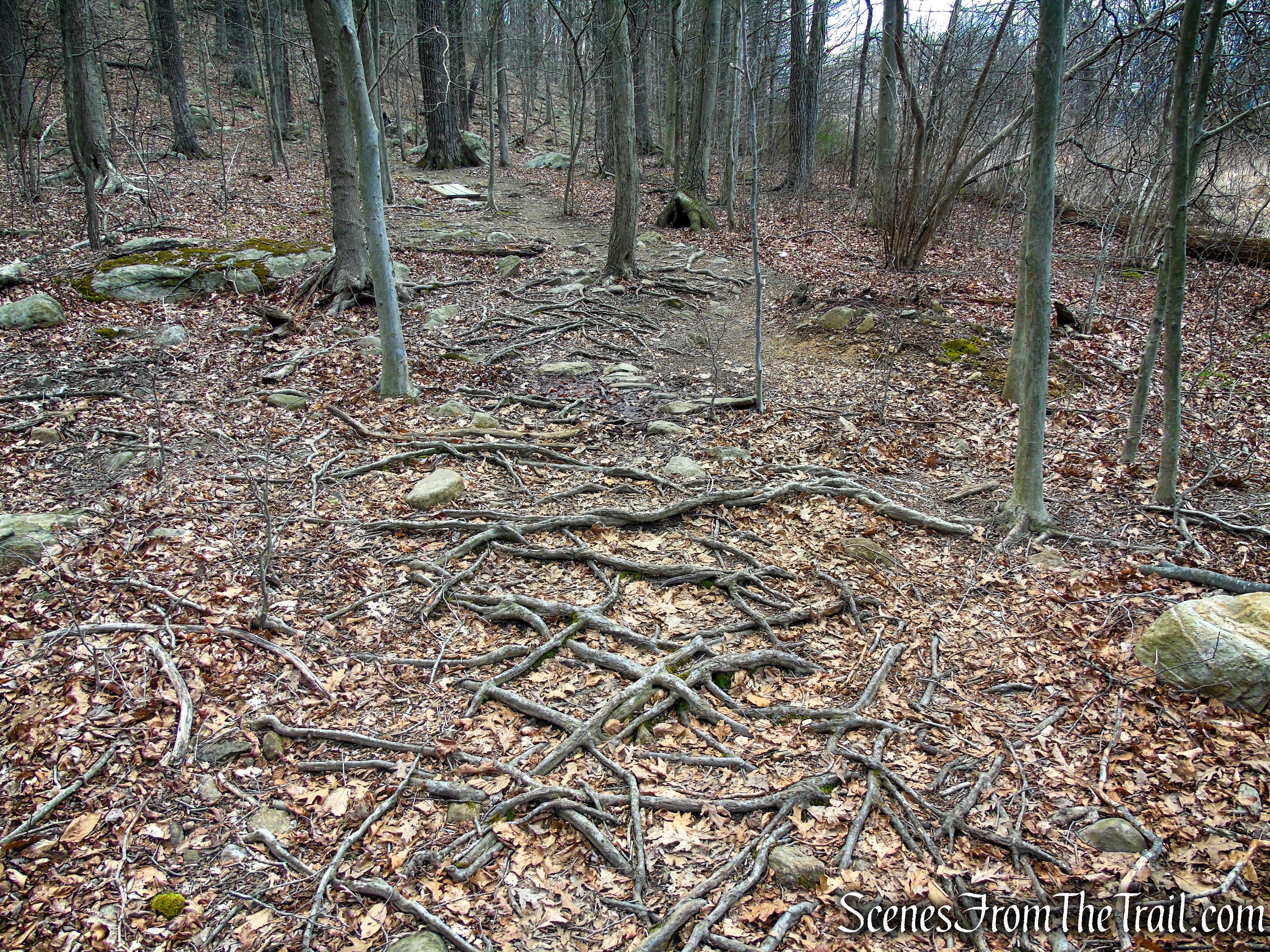
After passing the junction with the Orange Trail, the trail levels out briefly before the Blue Trail resumes a steady climb through a hardwood forest. The ascent takes hikers over a mix of packed earth, roots, and scattered rocks, with the terrain gradually becoming more rugged. Short, steeper sections lead to exposed bedrock, adding both challenge and variety to the hike.
Blue Trail – Pyramid Mountain

Blue Trail – Pyramid Mountain
Blue Trail – Pyramid Mountain
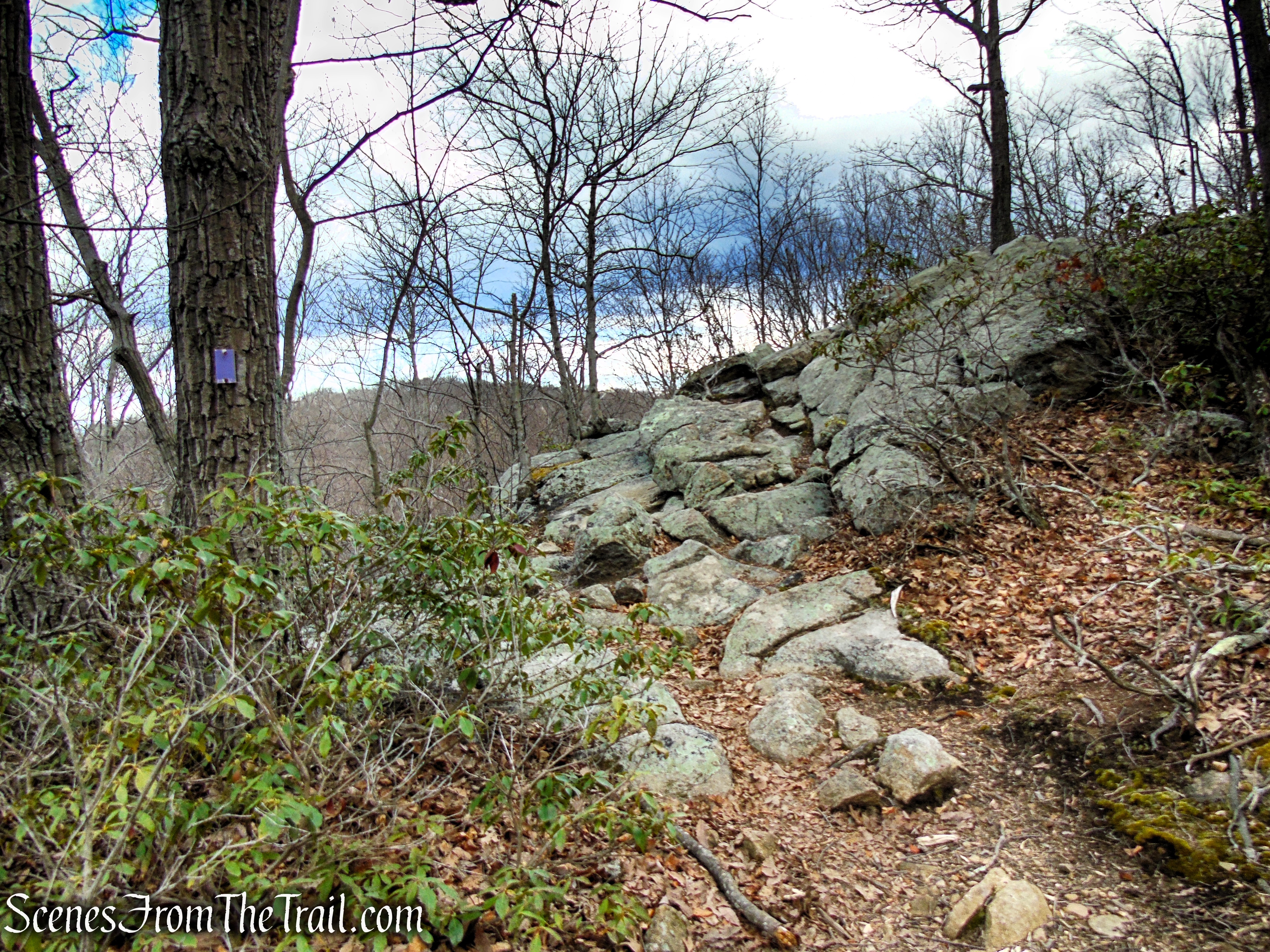
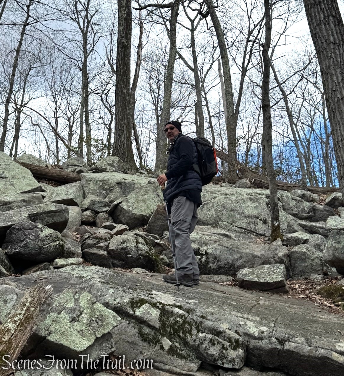
The Blue Trail ascends Pyramid Mountain via a series of short switchbacks, with stone steps strategically placed in steeper sections to assist hikers on the climb.
Blue Trail – Pyramid Mountain
Blue Trail – Pyramid Mountain
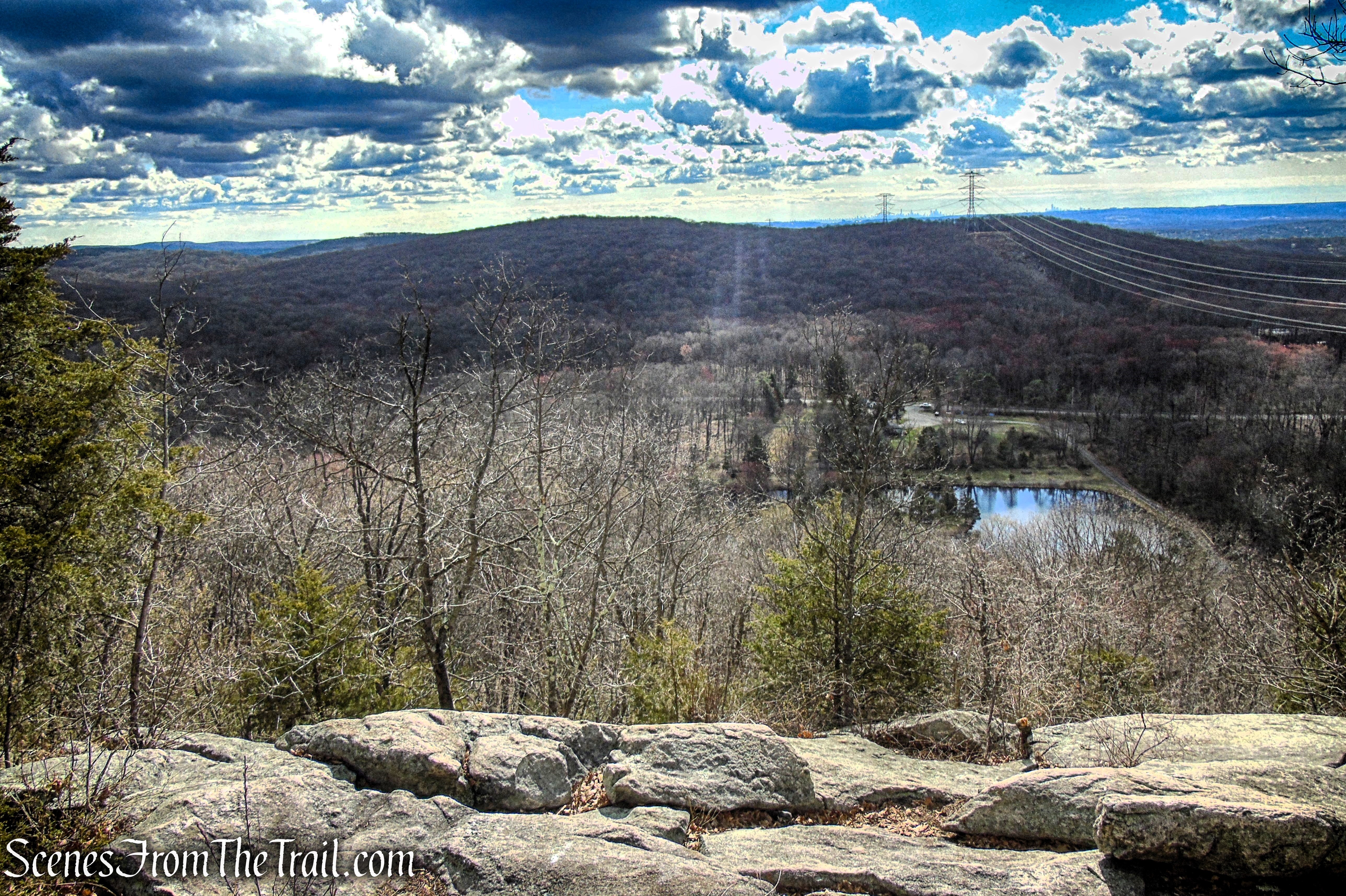
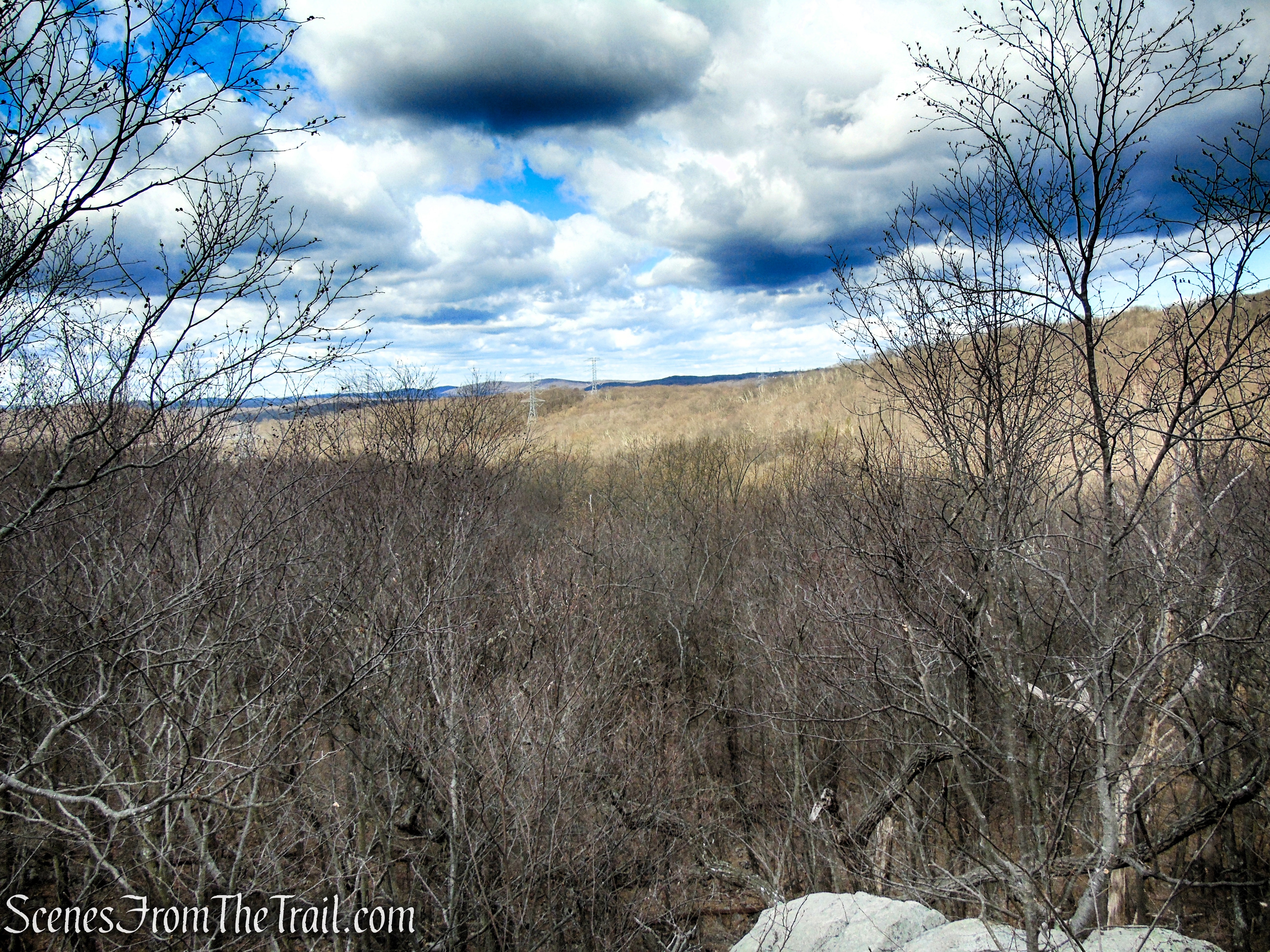
As the trail approaches the viewpoint, the forest begins to open and the terrain becomes less rocky, revealing a rocky outcrop that provides sweeping views of the surrounding highlands and distant ridgelines—a well-earned reward for the steady climb.
Blue Trail – Pyramid Mountain
By the time you reach this overlook, you will have covered approximately 1.2 miles and gained about 400 feet in elevation, making it a perfect spot to pause and take in the views.
Blue Trail – Pyramid Mountain
The view southeast from the summit of Pyramid Mountain stretches across rolling highlands and distant ridgelines, offering a panoramic glimpse of the surrounding landscape.
Viewpoint – Blue Trail – Pyramid Mountain
The distant Manhattan skyline emerges on the horizon, a faint but unmistakable silhouette rising beyond the rolling ridges of northern New Jersey. On especially clear days, the cluster of skyscrapers appears etched against the sky, offering a striking contrast between the wild, rocky foreground and the dense urban landscape far in the distance—a reminder of just how close this rugged preserve sits to the heart of New York City.
Viewpoint – Blue Trail – Pyramid Mountain
From the viewpoint, the trail levels out moderately, meandering over a mix of rocky terrain and forested sections. Just off the path, hidden among the foliage in warmer months, are interesting rock formations and scattered boulders that reward careful eyes.
Blue Trail – Pyramid Mountain
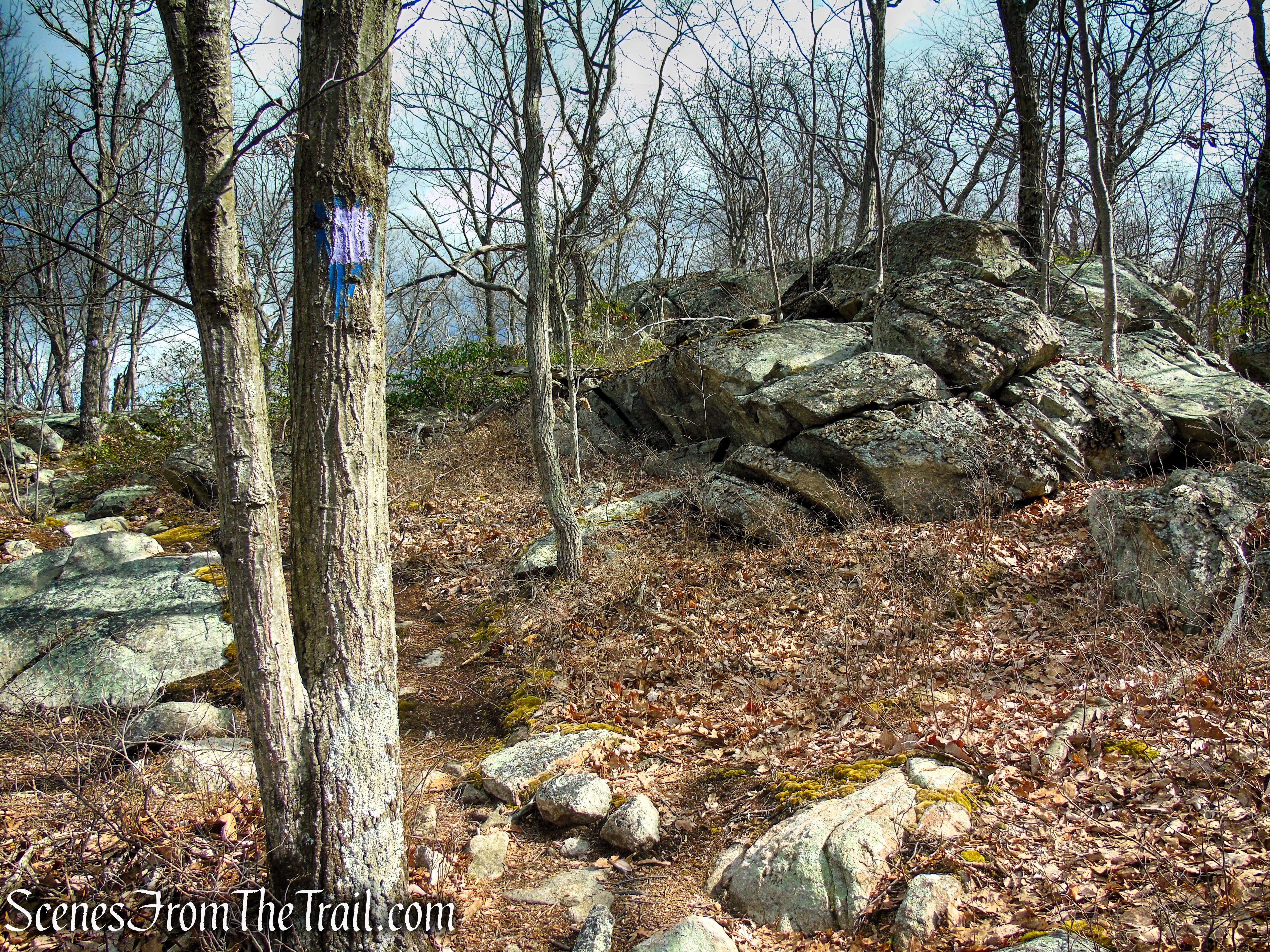
After another 0.4 mile, the Blue Trail reaches a junction with the Blue Dot Trail, marked by a large cairn. Here, the Blue Trail turns right, but you’ll want to bear left to leave the Blue Trail and continue on the Blue Dot Trail.
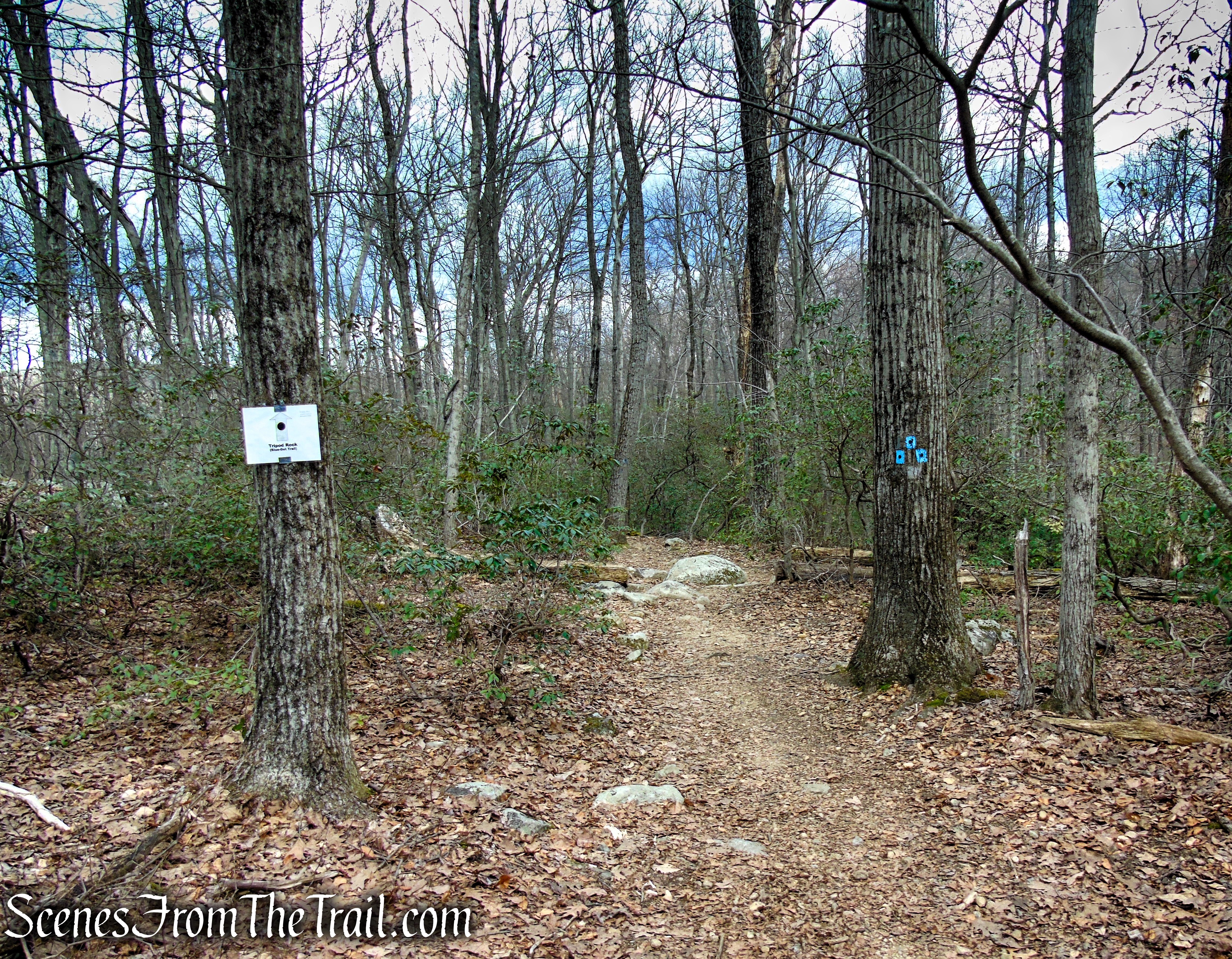
Blue Dot Trail – Pyramid Mountain
Blue Dot Trail – Pyramid Mountain
Blue Dot Trail – Pyramid Mountain
Shortly, the Blue Dot Trail reaches a junction with the Yellow Trail branching off to the left; continue straight ahead to stay on the Blue Dot Trail.
Blue Dot Trail – Pyramid Mountain
Blue Dot Trail – Pyramid Mountain
Shortly after, the Blue Dot Trail reaches a junction with the Purple Trail on the left. This rugged trail leads in a short distance to Lucy’s Overlook, named for Lucy Meyer, who led the crusade to save the area from development. Unfortunately, the panoramic west-facing views have grown in (although there still is a limited south-facing view). If you wish, you can follow the Purple Trail, which loops around for 0.2 mile until it ends at a second junction with the Blue Dot Trail (where you turn left to continue along the route of the hike). Otherwise, continue ahead on the Blue Dot Trail.
Purple Trail – Pyramid Mountain
The Purple Trail is less traveled, and it is moderately challenging, with uneven footing, roots, and scattered boulders, making it a quick side excursion for hikers who want to explore a quieter section of the preserve while enjoying both the history and geology of the area.
Purple Trail – Pyramid Mountain
Purple Trail – Pyramid Mountain
Lucy’s Overlook.
Lucy’s Overlook – Purple Trail – Pyramid Mountain
Purple Trail – Pyramid Mountain
Purple Trail – Pyramid Mountain
Purple Trail – Pyramid Mountain
After leaving the Purple Trail, turn left to continue on the Blue-Dot Trail. As you near Tripod Rock, the terrain grows more rugged, with larger exposed stones hinting that one of the preserve’s most iconic glacial erratics is close. This section builds anticipation, culminating in the striking sight of the famous balanced boulder.
Blue Dot Trail – Pyramid Mountain
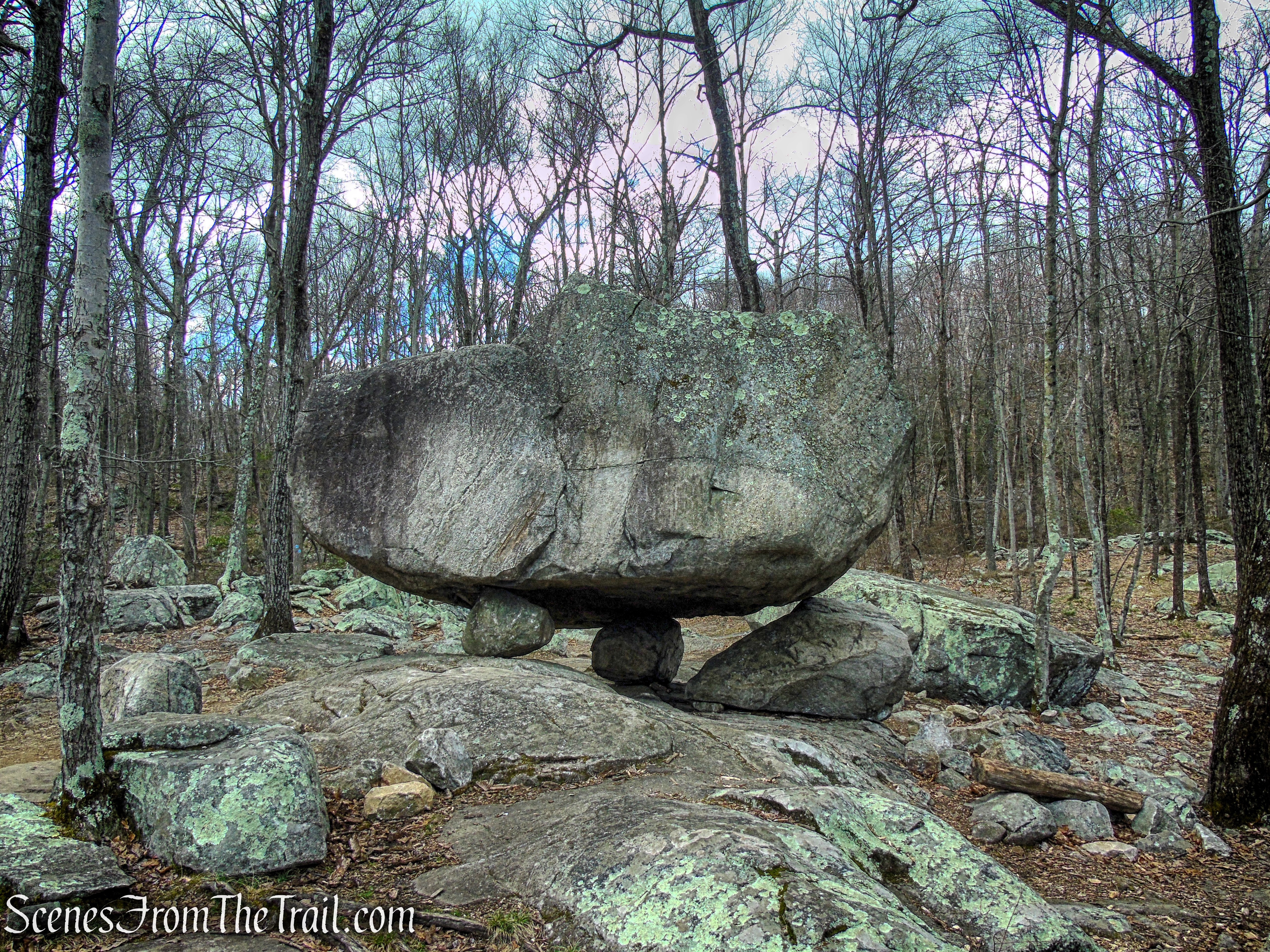
This massive boulder, estimated at 160 tons, was left behind by the Wisconsin Glacier more than 18,000 years ago. Uniquely balanced on three smaller stones, Tripod Rock is thought to have held spiritual significance for the Lenape people.
Tripod Rock – Pyramid Mountain
Framed by forested ridges and scattered boulders, Tripod Rock dominates its surroundings, a striking landmark in the rugged terrain of Pyramid Mountain.
Tripod Rock – Pyramid Mountain
The supporting stones cradle the massive boulder with an almost architectural precision, revealing the subtle angles and natural engineering of this geological wonder.
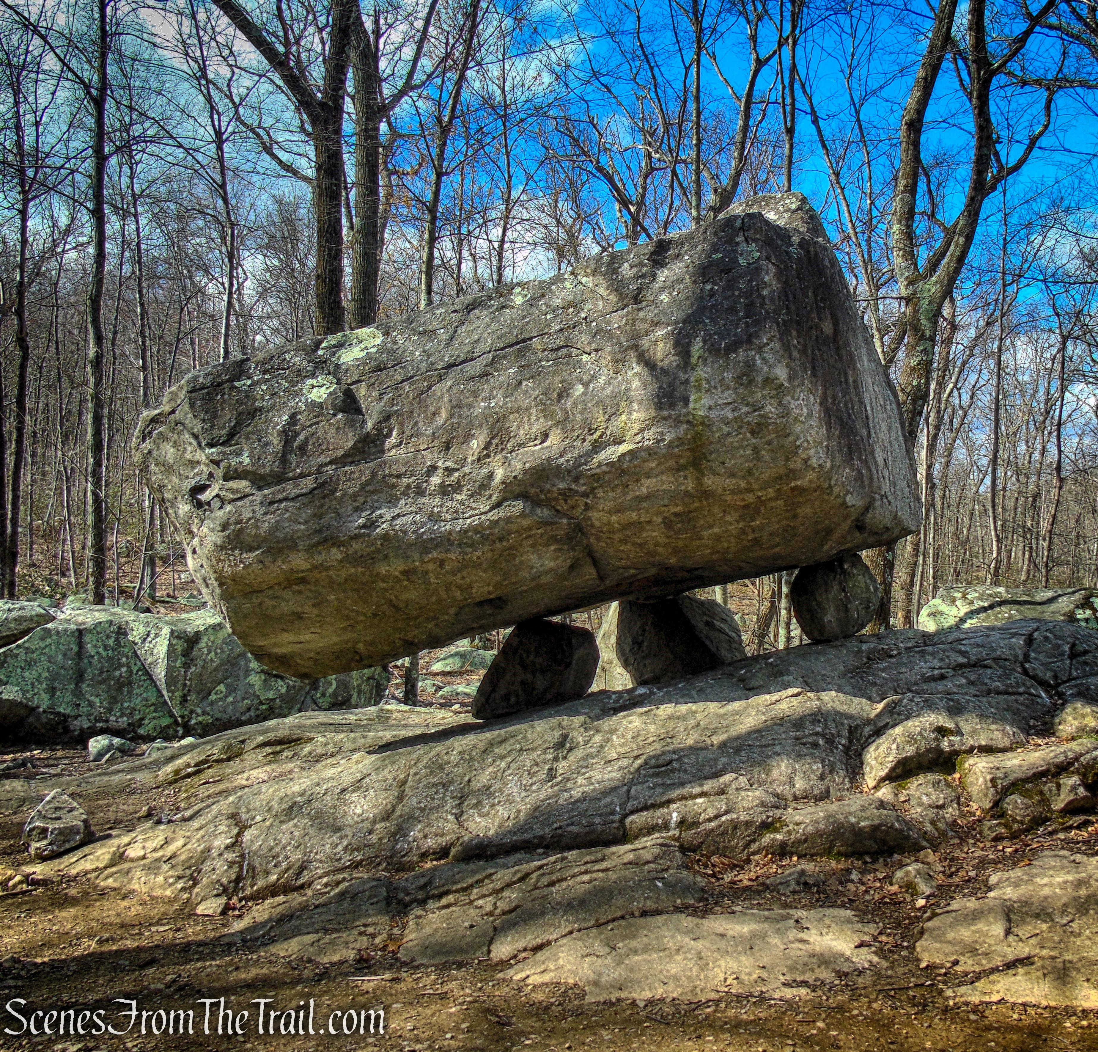
Tripod Rock – Pyramid Mountain
Tripod Rock perches delicately atop three smaller stones, a remarkable example of natural balance sculpted by glacial forces thousands of years ago.
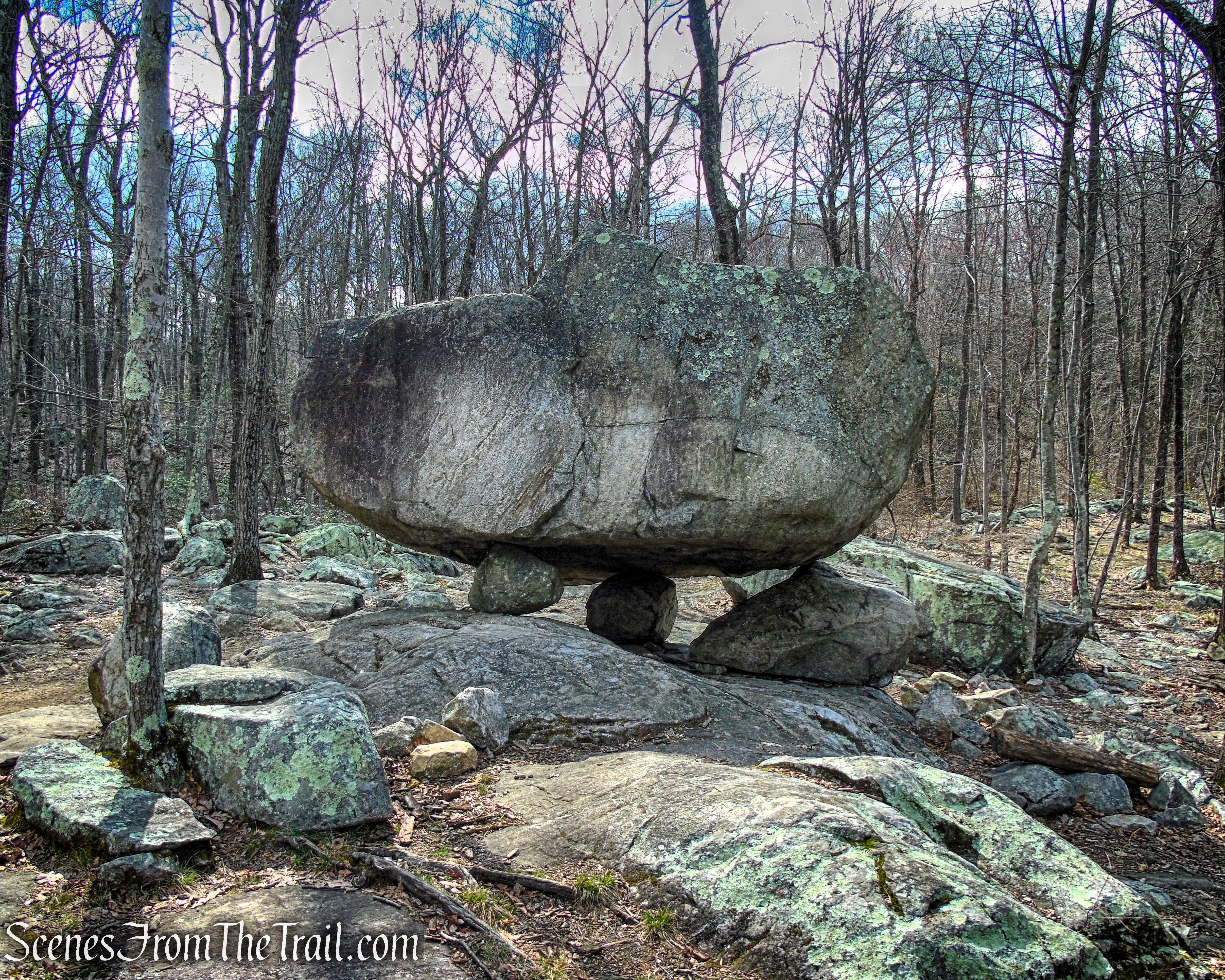
Tripod Rock – Pyramid Mountain
After exploring the area around Tripod Rock, return to the Blue-Dot Trail and turn left. Heading east, the trail winds through a landscape dotted with mountain laurel, scattered boulders, and intriguing rock formations. About 0.4 miles from Tripod Rock, the Blue-Dot Trail reaches its end at a junction with the Orange Trail.
Blue Dot Trail – Pyramid Mountain
Blue Dot Trail – Pyramid Mountain
Blue Dot Trail – Pyramid Mountain
Terminus of Blue Dot Trail – Pyramid Mountain
Turn left onto the Orange Trail, heading northwest. From the junction with the Blue Dot Trail, the trail winds through shaded hardwood forest and stretches of exposed rock. After a series of gentle rises and dips, it begins a climb toward Eagle Cliff, crossing open bedrock and leading hikers onto more rugged, elevated terrain.

Orange Trail – Pyramid Mountain
Orange Trail – Pyramid Mountain
The Orange Trail around Eagle Cliff becomes increasingly rugged as it climbs, passing over exposed bedrock and scattered boulders that demand careful footing. Along this stretch, hikers are rewarded with elevated vantage points overlooking the surrounding landscape, making it one of the most striking sections of the preserve.
Orange Trail – Pyramid Mountai
Orange Trail – Pyramid Mountain
Orange Trail – Pyramid Mountain
Along the trail, you’ll come across a boulder marked by multiple fractures, its cracked surface revealing the slow but relentless forces of weathering and pressure. The jagged lines and exposed interior offer a fascinating glimpse into the geological processes that have shaped Pyramid Mountain.

Orange Trail – Pyramid Mountain
Orange Trail – Pyramid Mountain
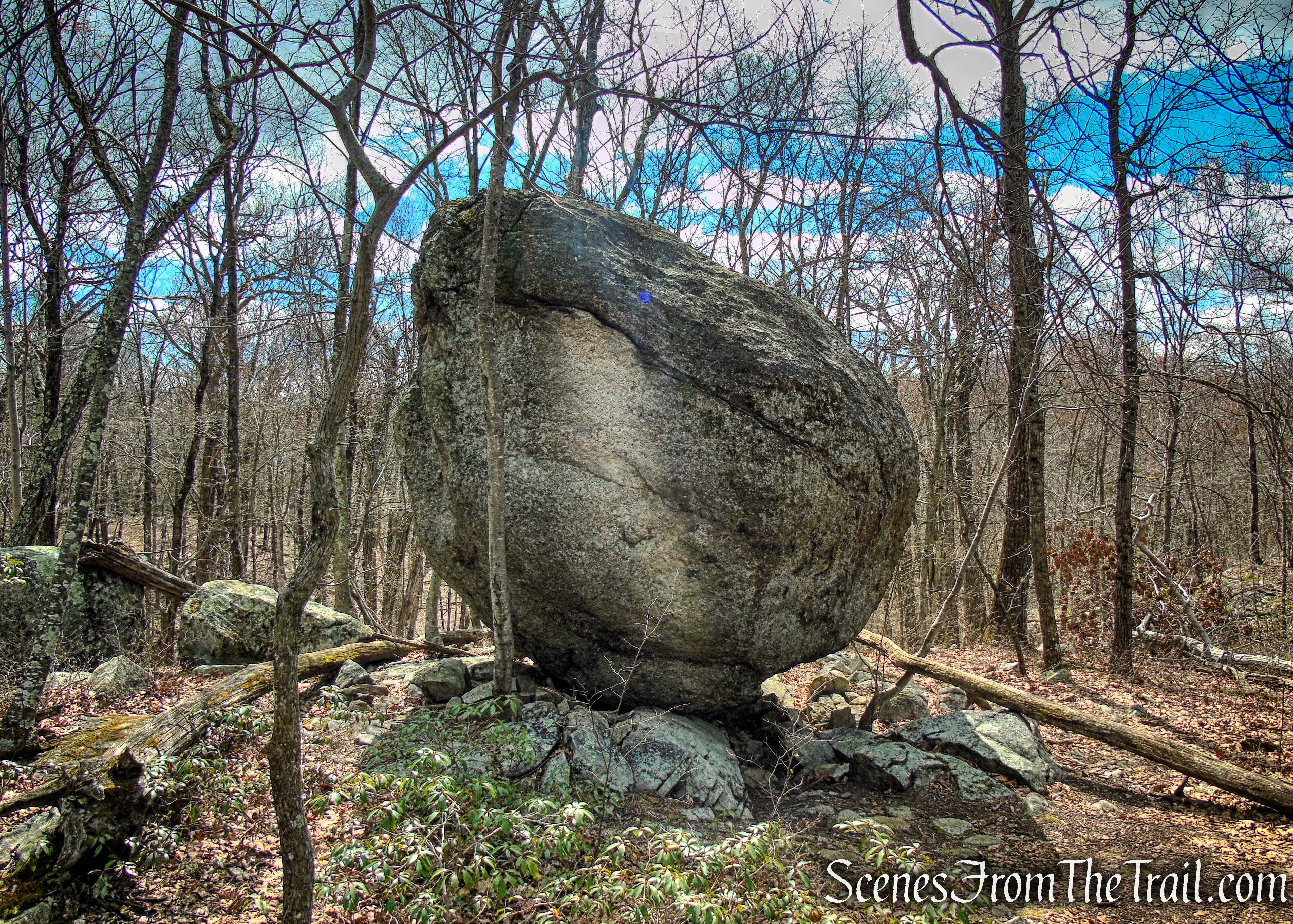
Whale Head Rock is named for its distinctive curved shape, standing out among the scattered boulders with a smooth surface shaped by glacial transport and natural weathering. It is framed by trees and smaller rocks, blending naturally into the rugged landscape. From the trail, Whale Head Rock serves as both a landmark and a point of interest, signaling a change in terrain as the path begins its steep descent. As a glacial erratic, it illustrates the power of the Wisconsin Glacier, carried and deposited far from its origin, offering a tangible glimpse into the region’s ancient geological history.
Whale Head Rock – Pyramid Mountain
After Whale Head Rock, the Orange Trail slopes downward gradually at first, then steepens, winding over an uneven mix of small, medium, and large rocks that require careful footing. Even at the base of the descent, the trail continues across rocky terrain, maintaining a rugged, hands-on hiking experience.
Orange Trail – Pyramid Mountain
The trail turns right and heads north for about 0.2 mile. It then bears left, crosses a branch of Bear House Brook and reaches a junction with the White Trail. Turn left onto the Orange Trail and cross Bear House Brook on a wooden footbridge. The Orange Trail continues south, paralleling Bear House Brook, which runs through the valley below on the left and eventually widens to form Bear Swamp.
Orange Trail – Pyramid Mountain
Orange Trail – Pyramid Mountain
Orange Trail – Pyramid Mountain
Puddingstone, also known as purple conglomerate, is found throughout Morris County, particularly in areas like Boonton and Mountain Lakes. The name is believed to have been given by English settlers, who thought the rock’s mix of rounded pebbles embedded in a darker matrix resembled a traditional pudding filled with fruit.
Puddingstone – Orange Trail – Pyramid Mountain
Orange Trail – Pyramid Mountain
In another half mile, directly ahead stands Bear Rock, a massive glacial erratic and the largest of its kind in New Jersey. Said to resemble a giant bear, it has served as a local landmark for centuries and was likely used as shelter by Native Americans. Today, it marks the boundary between Kinnelon Borough and Montville Township. Take a moment to explore this impressive geological feature up close.
Orange Trail – Pyramid Mountain
Bear Rock – Orange Trail – Pyramid Mountain
Bear Rock – Pyramid Mountain Natural Historic Area
After exploring Bear Rock, continue on the Orange Trail along an old woods road, with a rock wall lining the right side. Shortly ahead, the Pink Dot Trail (black dot on pink) branches off to the right, but stay straight on the Orange Trail. Just beyond, the trail curves left and crosses Bear House Brook via a wooden bridge.
Orange Trail – Pyramid Mountain
Orange Trail – Pyramid Mountain
Orange Trail – Pyramid Mountain
Orange Trail – Pyramid Mountain
The Orange Trail continues along a rocky footpath, running alongside power lines on the right. About a third of a mile past the brook crossing, it reaches a junction with the Blue Trail coming in from the left. Turn right to follow the Blue Trail, which climbs steeply before leveling out over rolling terrain. Soon, the trail begins a steady descent and turns right to pass under the power lines. You are now retracing your steps from the beginning of the hike.
Terminus of Orange Trail
Continue ahead on the Blue Trail, bearing right at the next junction (where the loop of the Blue Trail begins). After crossing the bridge over Stony Brook, follow the Blue Trail back to the parking area where the hike began.
Review:
This is a truly rewarding hike, with rocky terrain that feels more challenging than the mileage or elevation gain might suggest. The highlight isn’t necessarily the views, but the striking, rock-strewn landscape that unfolds along the trails, offering constant interest and variety. The geological features—glacial erratics, boulder fields, and unique formations—make this hike especially compelling for anyone curious about the natural history of the area.
Pyramid Mountain Natural Historic Area is the most popular hiking destination in the Morris County park system, and it can get crowded on weekends when the weather is nice. For a quieter experience, visiting on a weekday is highly recommended.
Pros:
Rocky and varied terrain, striking geological features, glacial erratics like Tripod and Bear Rock, scenic forested trails, moderate challenge suitable for experienced hikers, well-marked trails, rewarding hiking experience throughout.
Cons:
Can be crowded on weekends, rocky terrain may be challenging for some hikers, steep sections and uneven footing, limited parking, some trails less clearly marked at junctions, views partially obscured by regrowth in certain areas.
Take a hike!
Pyramid Mountain Natural Historic Area
Sources:
