August 31, 2025 – Gardiner, NY
Difficulty: Moderate
Length: Approximately 3 miles
Max elevation: 1,224 ft.– total elevation gain approximately 610 ft.
Route type: Lollipop-Loop
Map: Shawangunk Trails Map #105
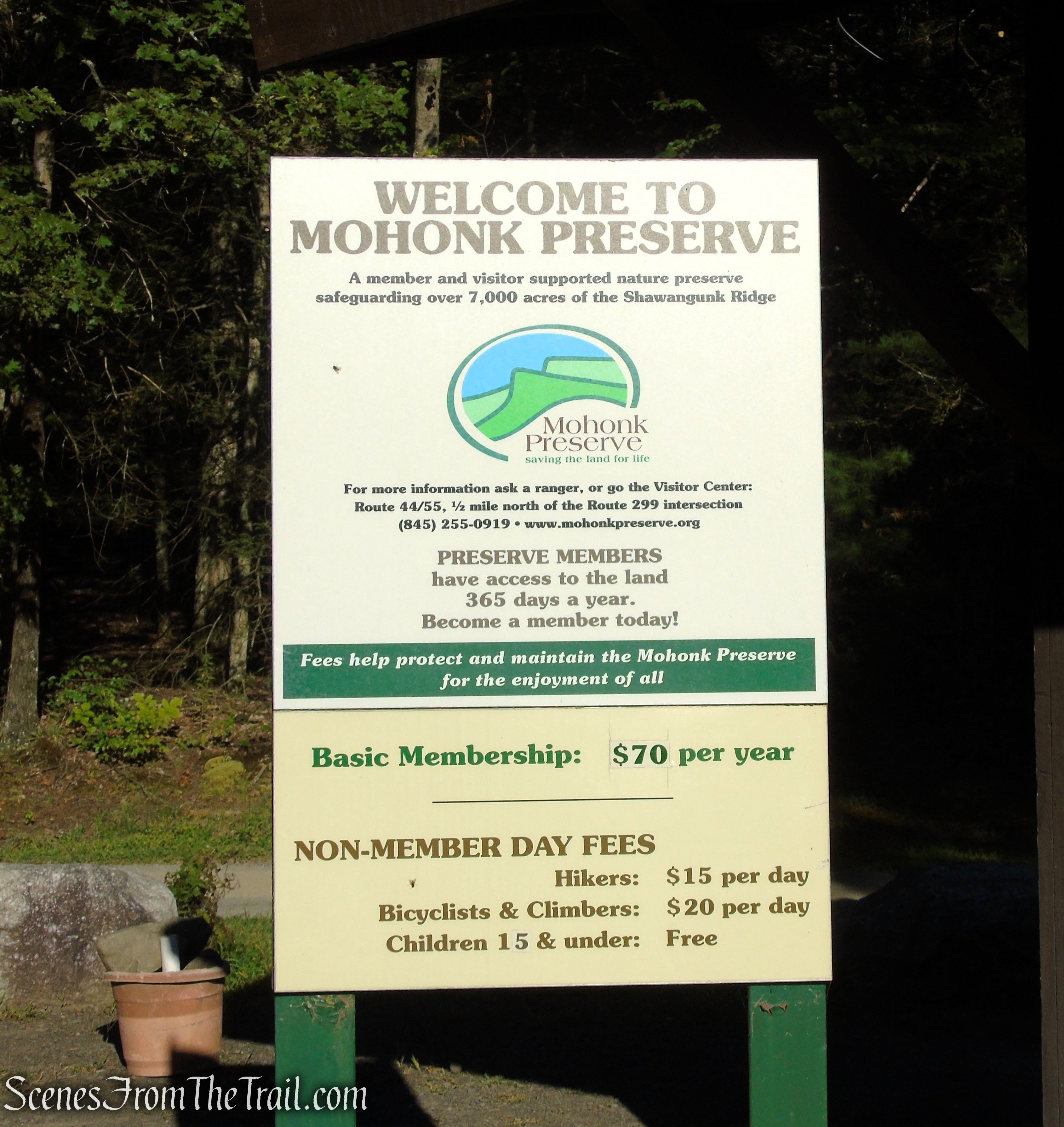
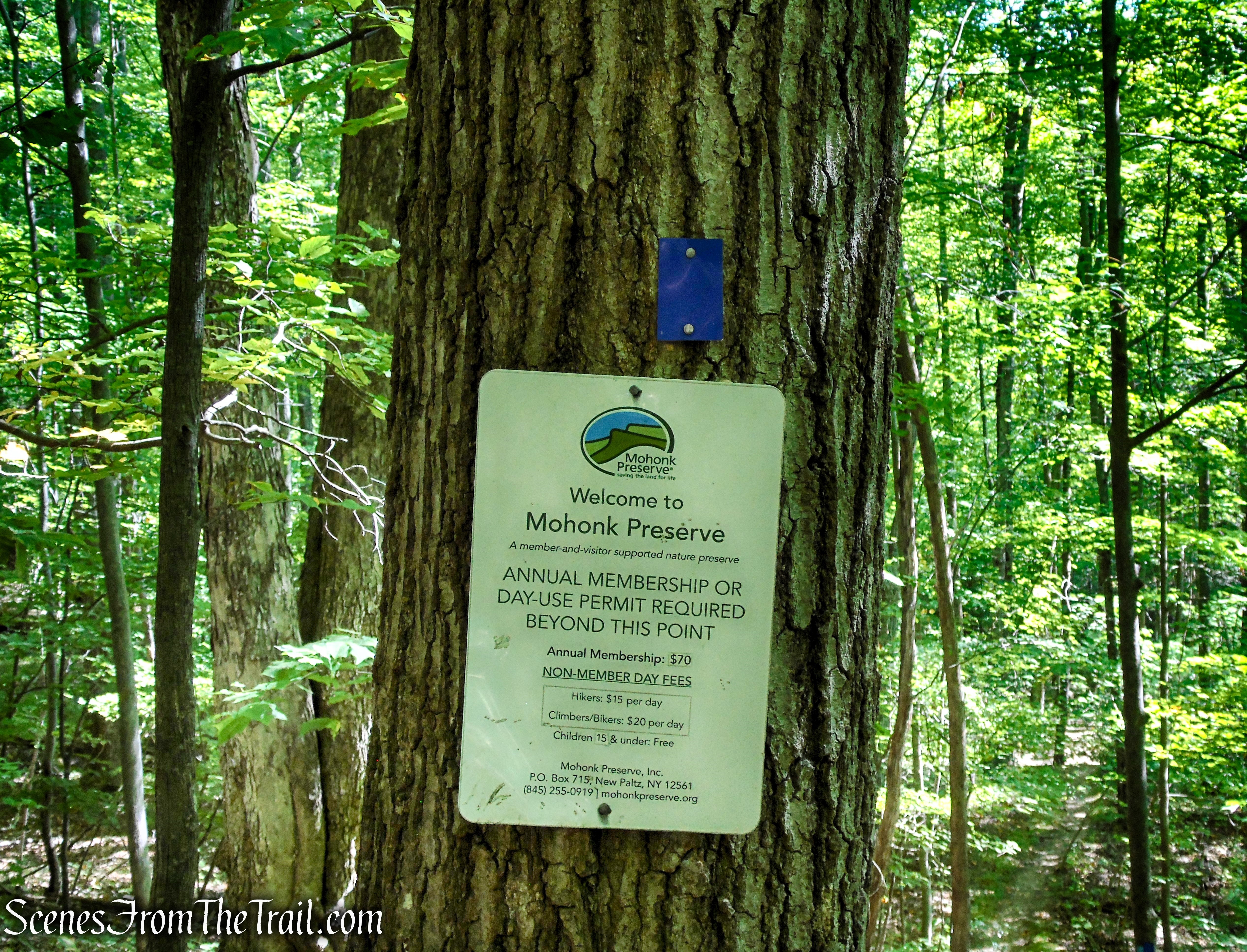
Fee: $15.00 day hiking fee (Non-Member) – Purchase Membership
Trailhead parking: Mohonk Preserve Coxing Trailhead – Gardiner, NY 12525
Please note: The Coxing Trailhead is Mohonk Preserve’s smallest parking lot and fills VERY early on peak weekends. On summer and fall weekends, arrive early to ensure a parking space.
Overview:
Mohonk Preserve is the largest private nature preserve in New York State, encompassing over 8,000 acres of protected land in the scenic Shawangunk Ridge near New Paltz, about 90 miles north of New York City. Mohonk Preserve offers more than 70 miles of trails and carriage roads used for hiking, trail running, biking, horseback riding, and cross-country skiing.
Lost City Escarpment Trail – Mohonk Preserve
It is also a world-renowned destination for rock climbing. “The Gunks” (Shawangunk Mountains), is one of the oldest climbing areas in the U.S.
Shawangunk Conglomerate is a tough, silica-cemented rock made of quartz pebbles and sand, formed over 400 million years ago. Its durability shapes the dramatic cliffs of the Shawangunk Ridge and provides a unique landscape for hikers, nature lovers, and climbers alike. Visually, the rock appears as a light gray or white matrix embedded with rounded quartz pebbles.
Lost City Escarpment Trail – Minnewaska State Park Preserve
The “Gunks,” as they are affectionately known, are part of a 245 mile long ridge that runs from New York to Pennsylvania, forming a spectacular and rare landscape. Miles of Victorian-era carriageways and backwoods trails allow nearly limitless exploration of places of extraordinary scenic beauty.
Lost City Escarpment Trail – Minnewaska State Park Preserve
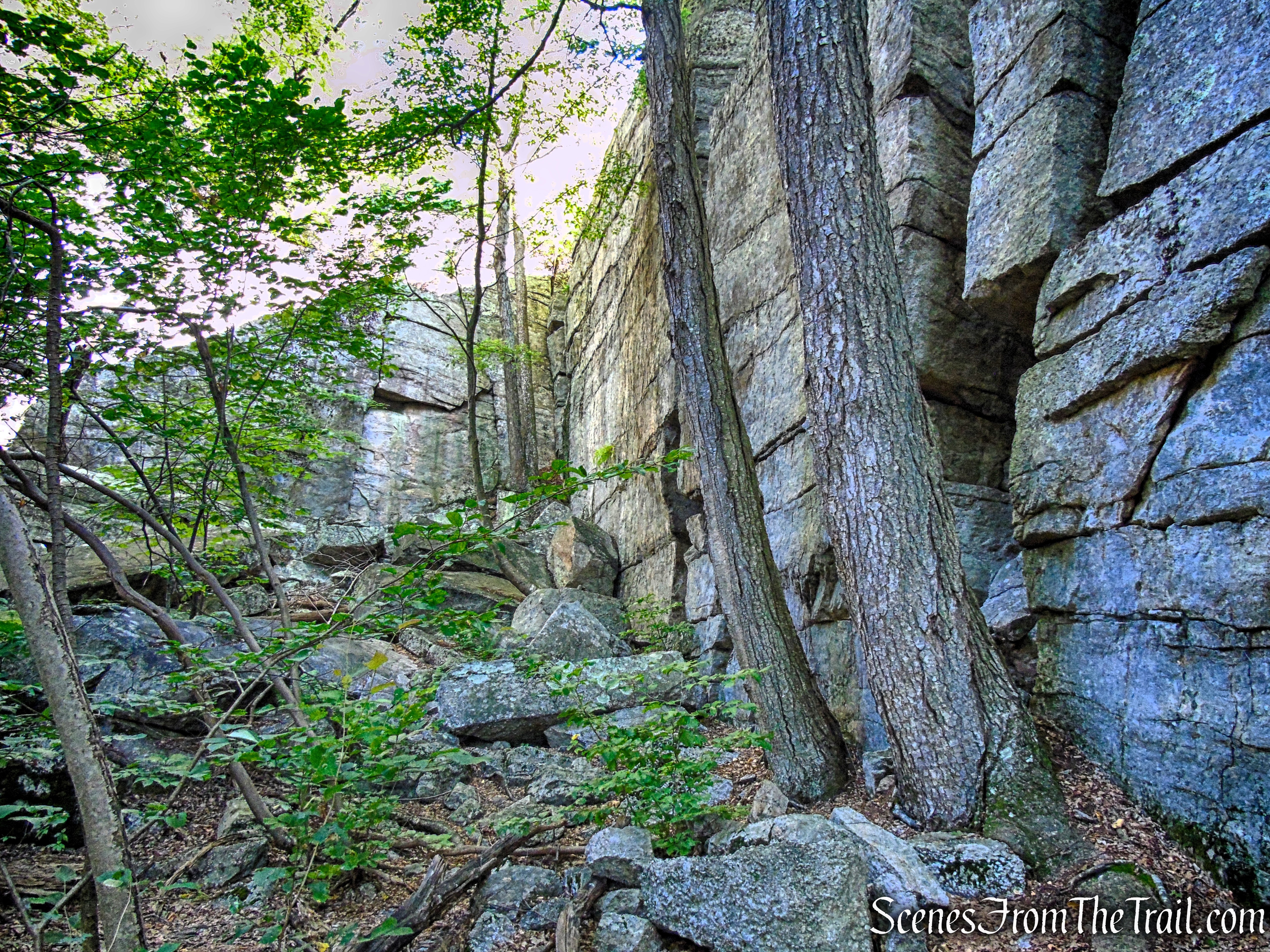
The Lost City Escarpment Trail is the highlight of this hike. It is a relatively newly blazed trail which was constructed sometime between 2018 and 2020. It travels through varied terrain along the Dickie Barre cliffs, with almost constant views of both the Lost City below and the surrounding countryside.
Lost City Escarpment Trail – Mohonk Preserve
History:
The area’s human history traces back to early 19th-century settlers like the Enderly family. They homesteaded along Coxing Kill, operating a water-powered sawmill beginning in 1801, leaving behind stone walls and a family graveyard near the Coxing Trailhead.
Established in 1869 by the Smiley brothers, the Mohonk Mountain House resort laid the foundation for a legacy of conservation in the region. To protect the surrounding natural landscape, the Mohonk Trust was created in 1963, eventually evolving into Mohonk Preserve Inc. in 1978. In recognition of their historical and environmental significance, both the Mohonk Preserve and the Mohonk Mountain House were designated a National Historic Landmark in 1986.
Trails Overview:
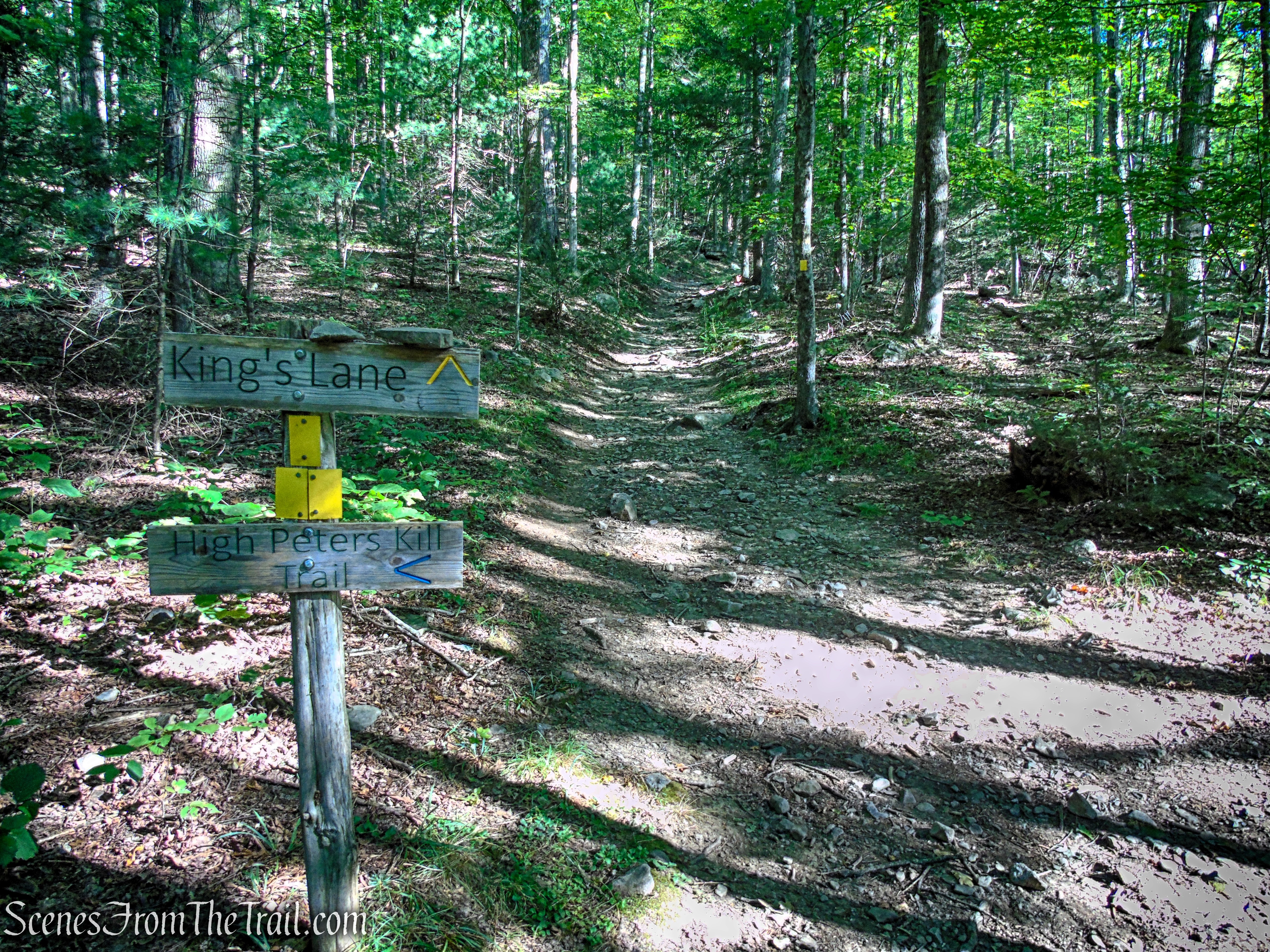
- High Peters Kill Trail ~
This blue-blazed footpath connects Mohonk Preserve (via Coxing Trailhead) with Minnewaska State Park. The trail features a mix of terrain: forested sections, rocky ledges, narrow cliffside paths, water crossings, and ridgeline traverses. The High Peters Kill Trail serves as a connector within the broader network of trails spanning Mohonk Preserve and Minnewaska State Park Preserve. Whether you’re looking for a short loop or an extended hike across the Gunks, this trail offers a solid starting point.
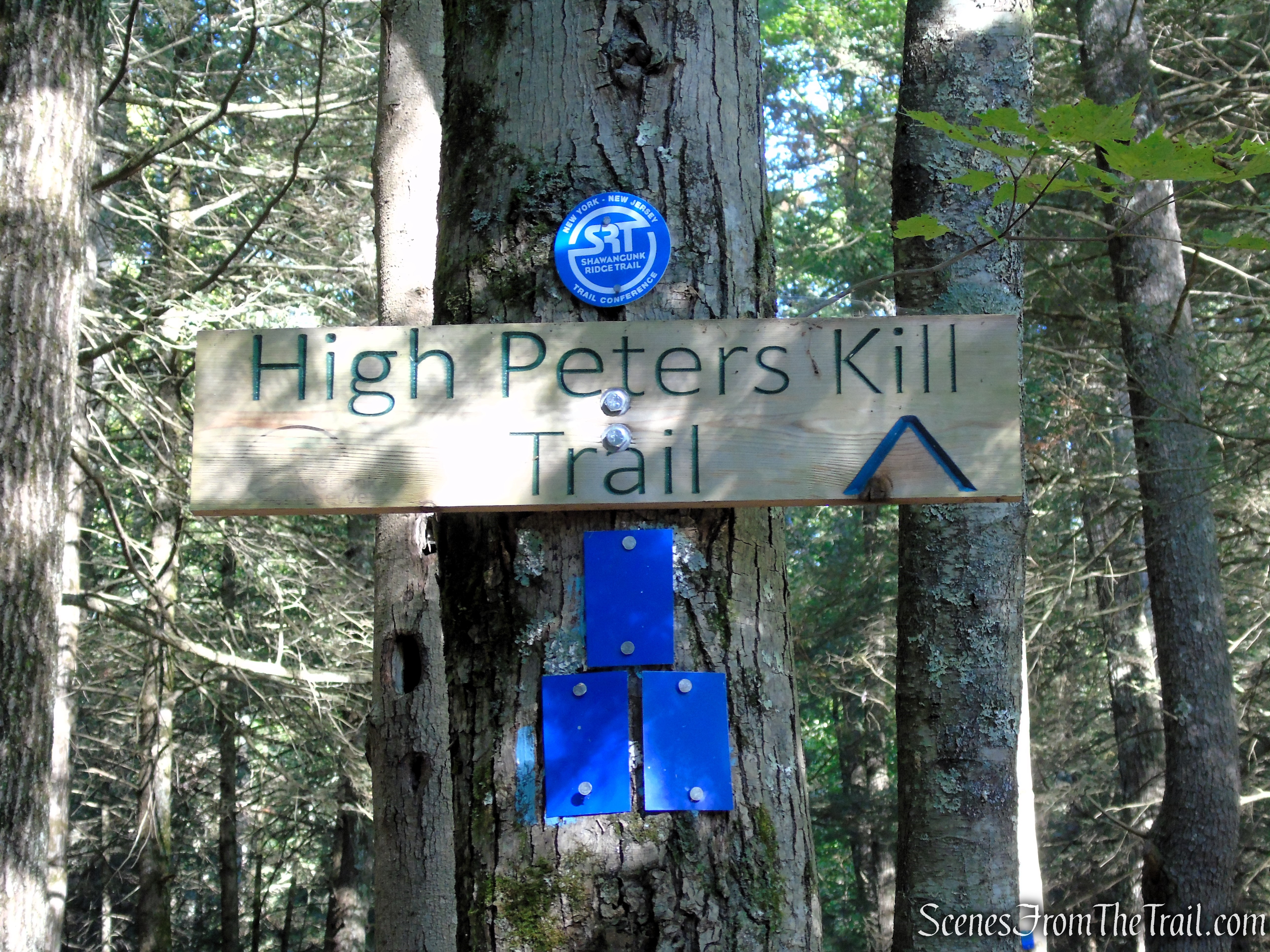
High Peters Kill Trail – Coxing Trailhead
- Kings Lane ~
This yellow blazed trail is a historic and scenic hiking route that offers a glimpse into the region’s past. Originally an old woods road used for transporting materials like conglomerate to be made into grindstones, the trail now serves as a path for hikers and rock climbers. It begins at a junction with the High Peterskill Trail and continues uphill through a forested area. The trail leads to the Lost City, a notable rock climbing area featuring dramatic cliffs and panoramic views.
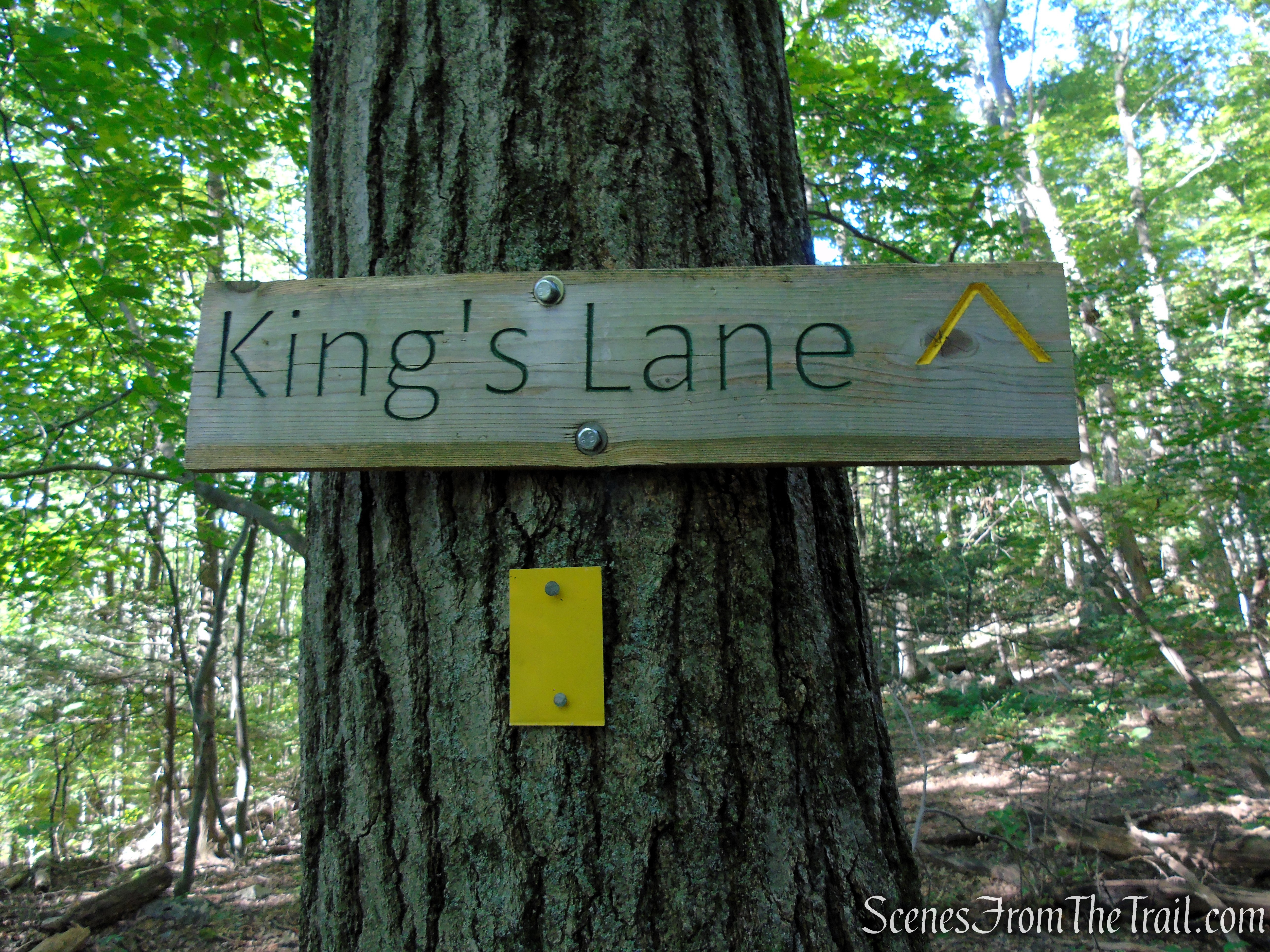
King’s Lane – Mohonk Preserve
- Lost City Escarpment Trail ~
The Lost City Escarpment Trail is a relatively newly marked footpath known for its dramatic cliffs, lush forests, and panoramic views. It features unique rock formations and offers a mix of moderate to challenging terrain. The impressive glacially-formed cliffs and crevices resemble a “Lost City” skyline, offering a unique and visually striking landscape. Hikers can navigate through boulder-strewn areas, ascending to panoramic views of the Catskill Mountains and the Hudson Valley, especially breathtaking during the fall foliage season.
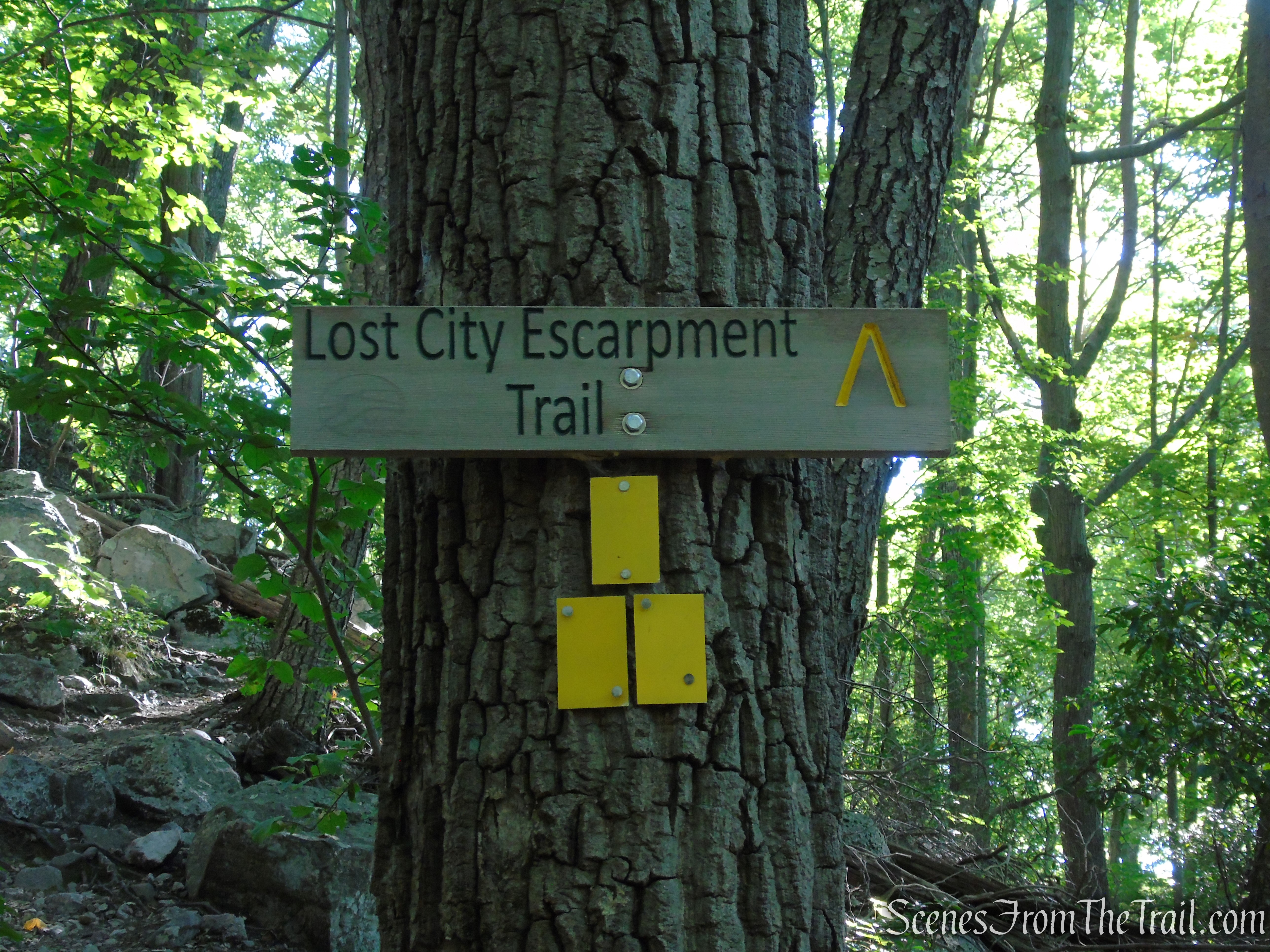
Lost City Escarpment Trail – Mohonk Preserve
These three trails make up the Lost City Loop. All three trails are well marked and easy to follow.
Hike Overview:
This scenic hike through the Lost City and Dickie Barre area features well-marked, rocky trails that wind through rugged terrain. The route offers wide-ranging views of the valley below and the surrounding hills, making it a rewarding journey for hikers. The trail through the Lost City, with its unique rock formations, add a sense of adventure and discovery to the experience.
King’s Lane – Mohonk Preserve
The Coxing Trailhead is Mohonk Preserve’s smallest parking lot and fills to capacity VERY early on peak weekends. On summer and fall weekends, arrive early to ensure a parking space.
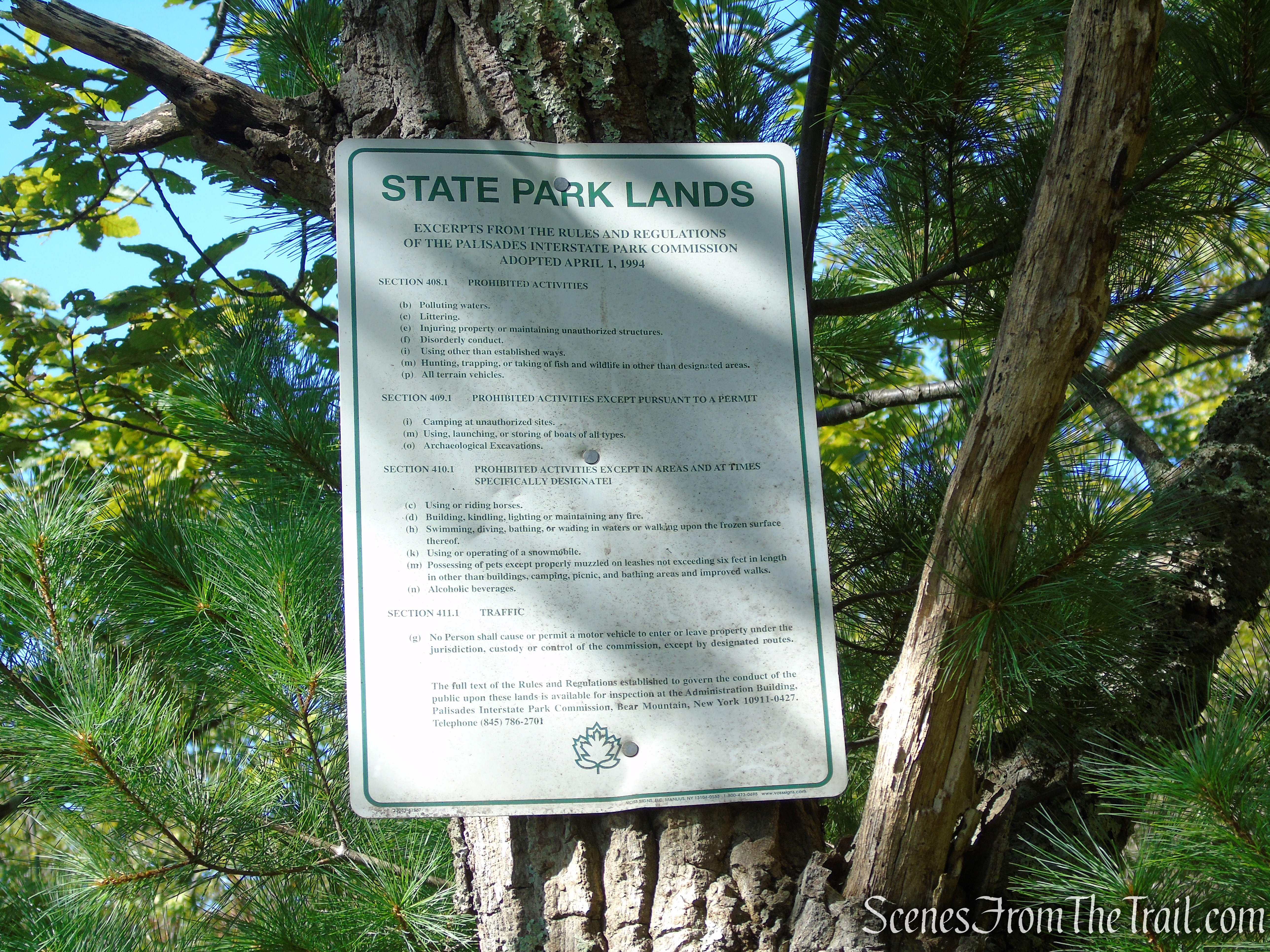
To access the land you need to have a current membership or pay a day use fee.
Coxing Trailhead – Mohonk Preserve
The last time that I hiked this area was in 2018. At the time, the Lost City Escarpment Trail was not marked. I decided to pay it a return visit to check it out. We explored the crevices on our last visit, but this time we just hiked the trails in order to document the Lost City Escarpment Trail as a loop. If you wish to explore the crevices of the Lost City, you may do so at your own risk.
This moderate loop on well marked trails was done counterclockwise, starting at the Coxing Trailhead.
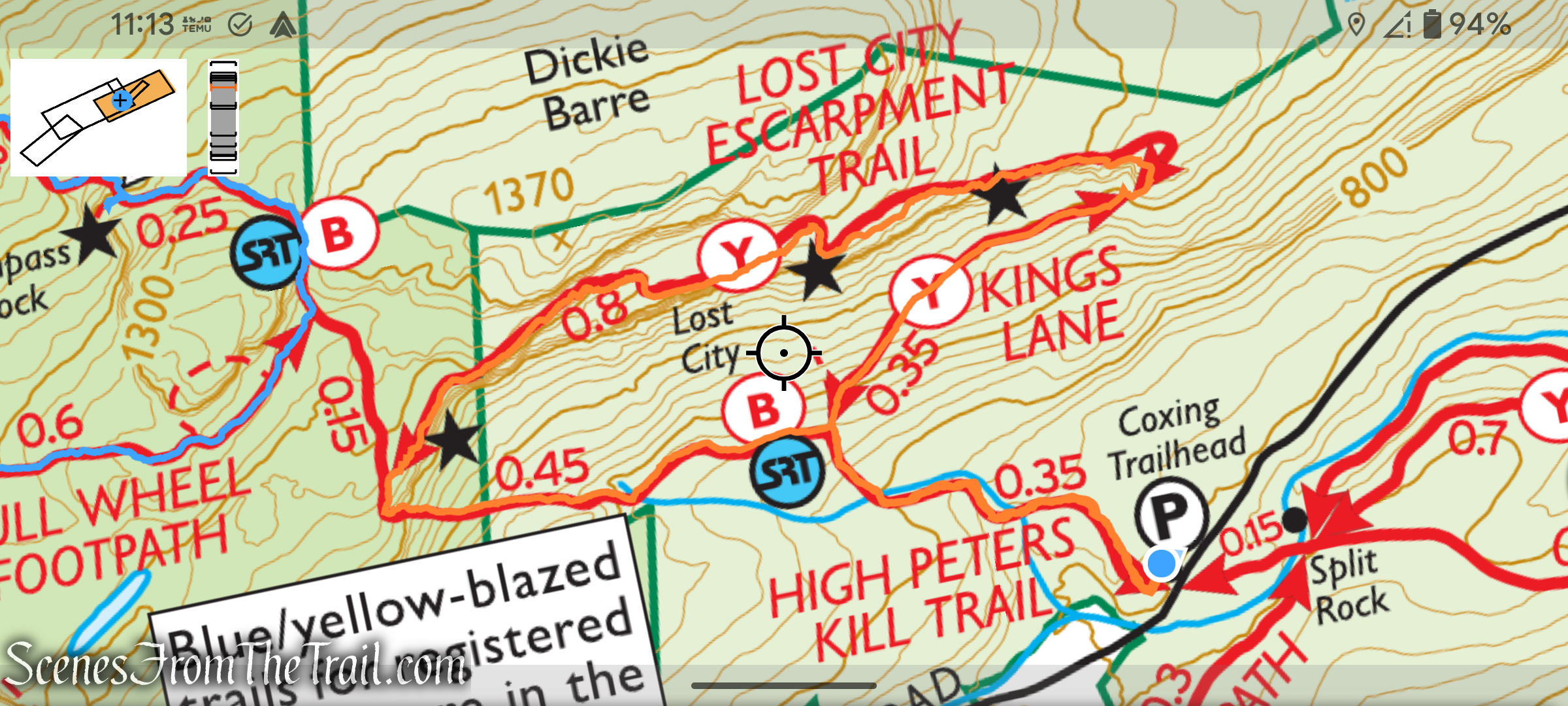
Lost City Loop
Although this is a moderate hike, it does have numerous ups and downs, and there is one spot where you will have to crawl through.
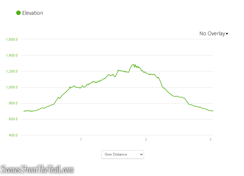
elevation profile – Lost City Loop
Remember to wear sturdy footwear, as the terrain can be uneven and challenging in spots.
The Hike:
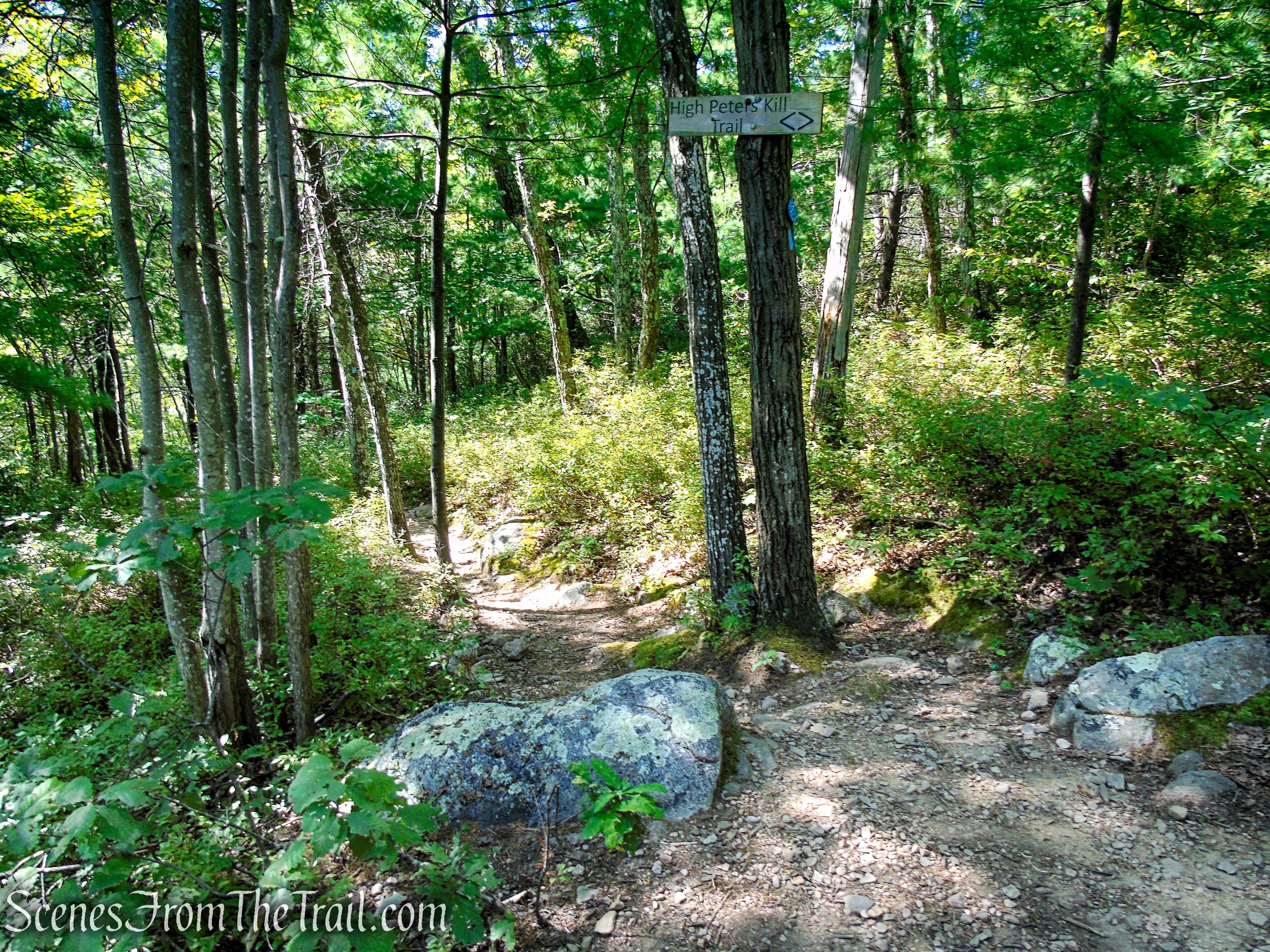
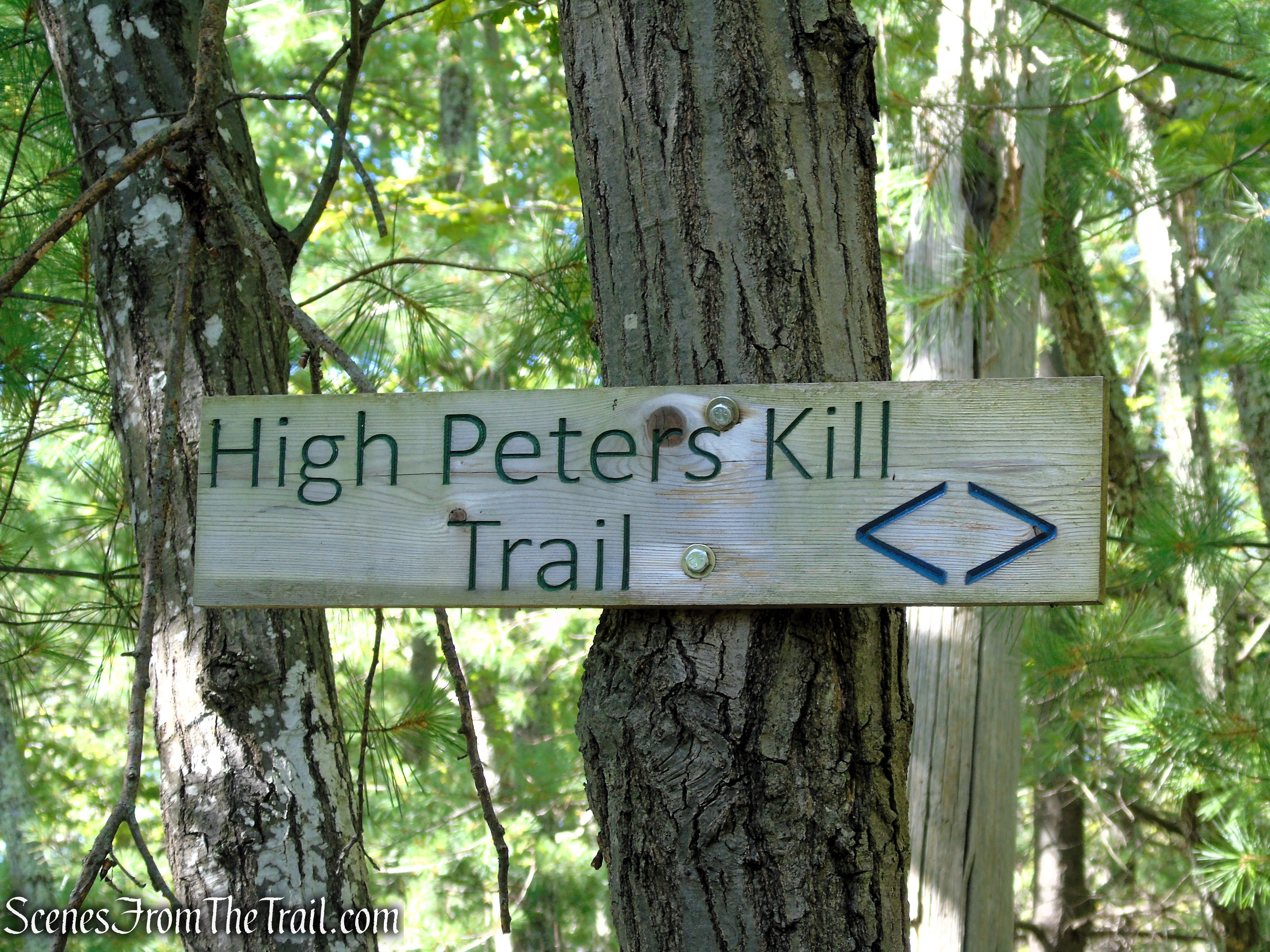
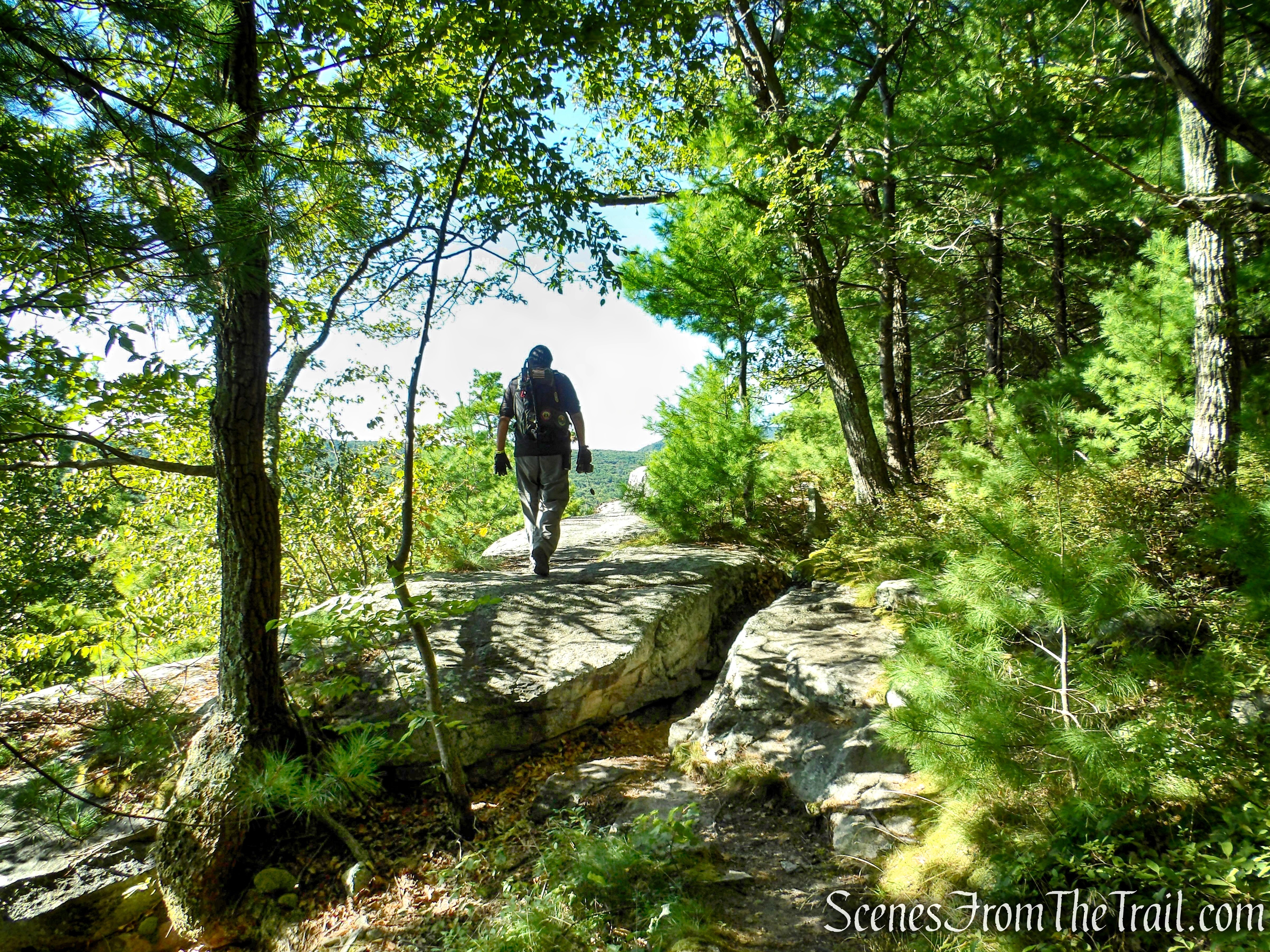
This hike begins at the southern end of the Coxing parking area by a kiosk, where three blue blazes mark the start of the High Peters Kill Trail. You’ll be following the High Peters Kill Trail for about .35 mile (this trail is also the route of the Shawangunk Ridge Trail, with its logo markers appearing at junctions and other locations along the way).
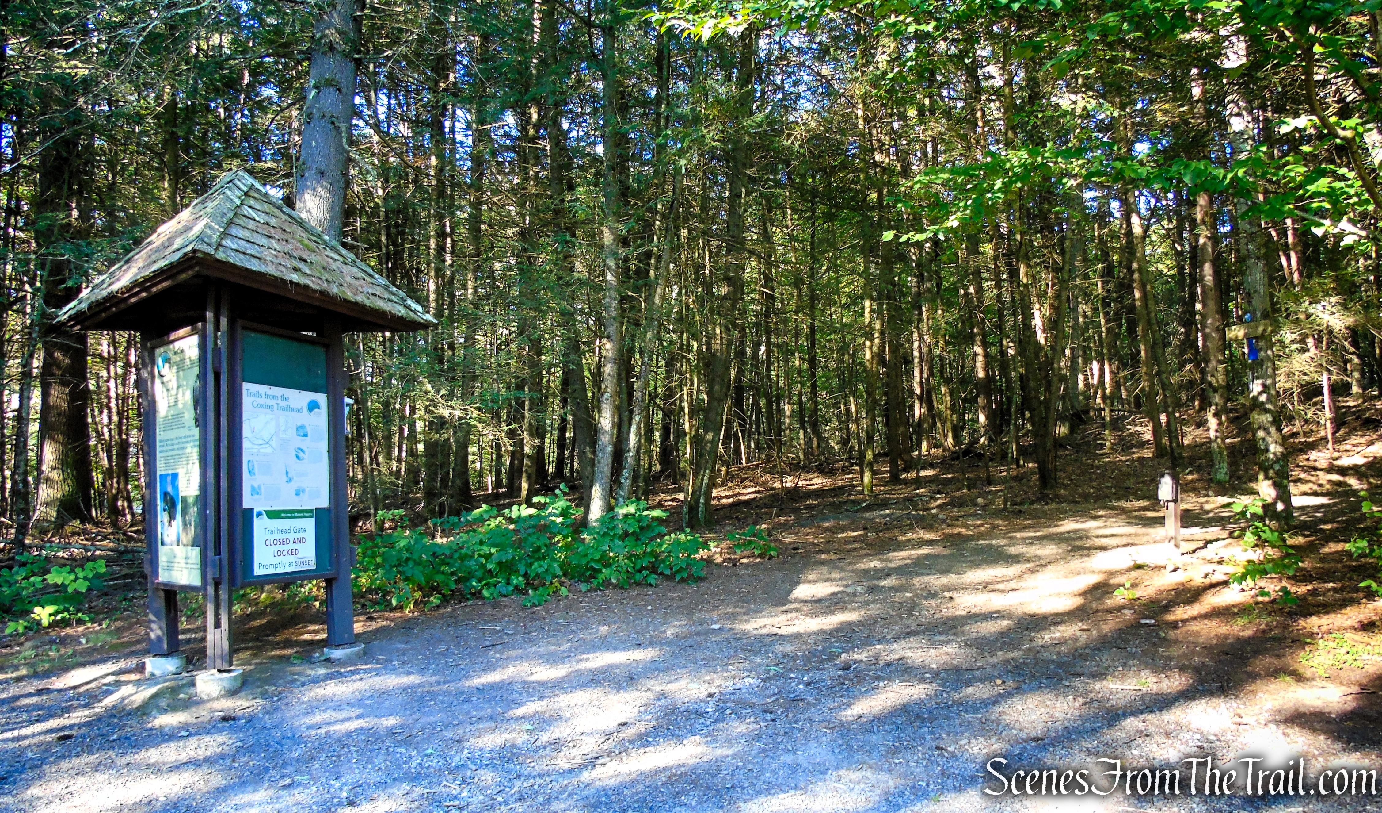
High Peters Kill Trail – Coxing Trailhead
High Peters Kill Trail – Coxing Trailhead
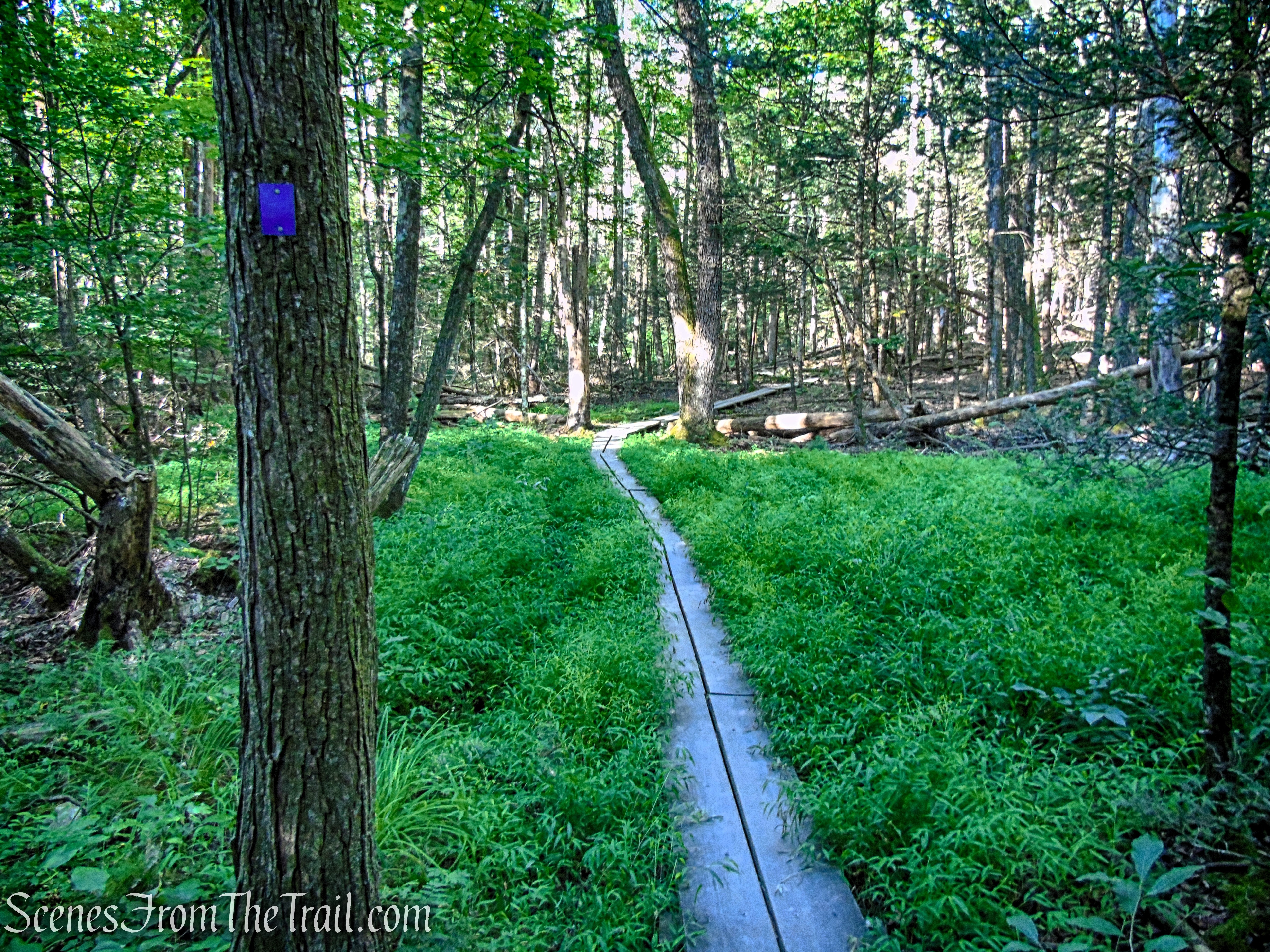
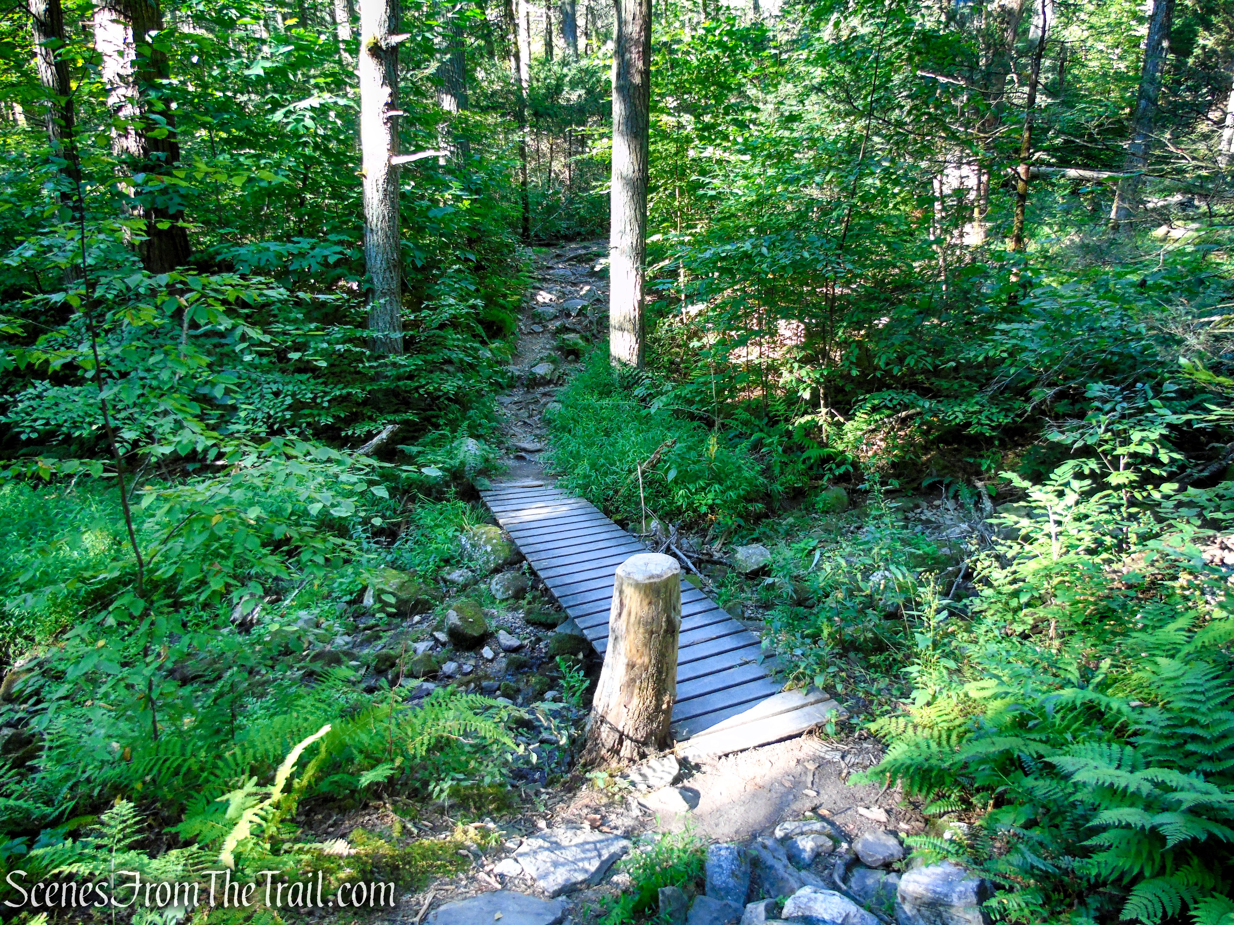
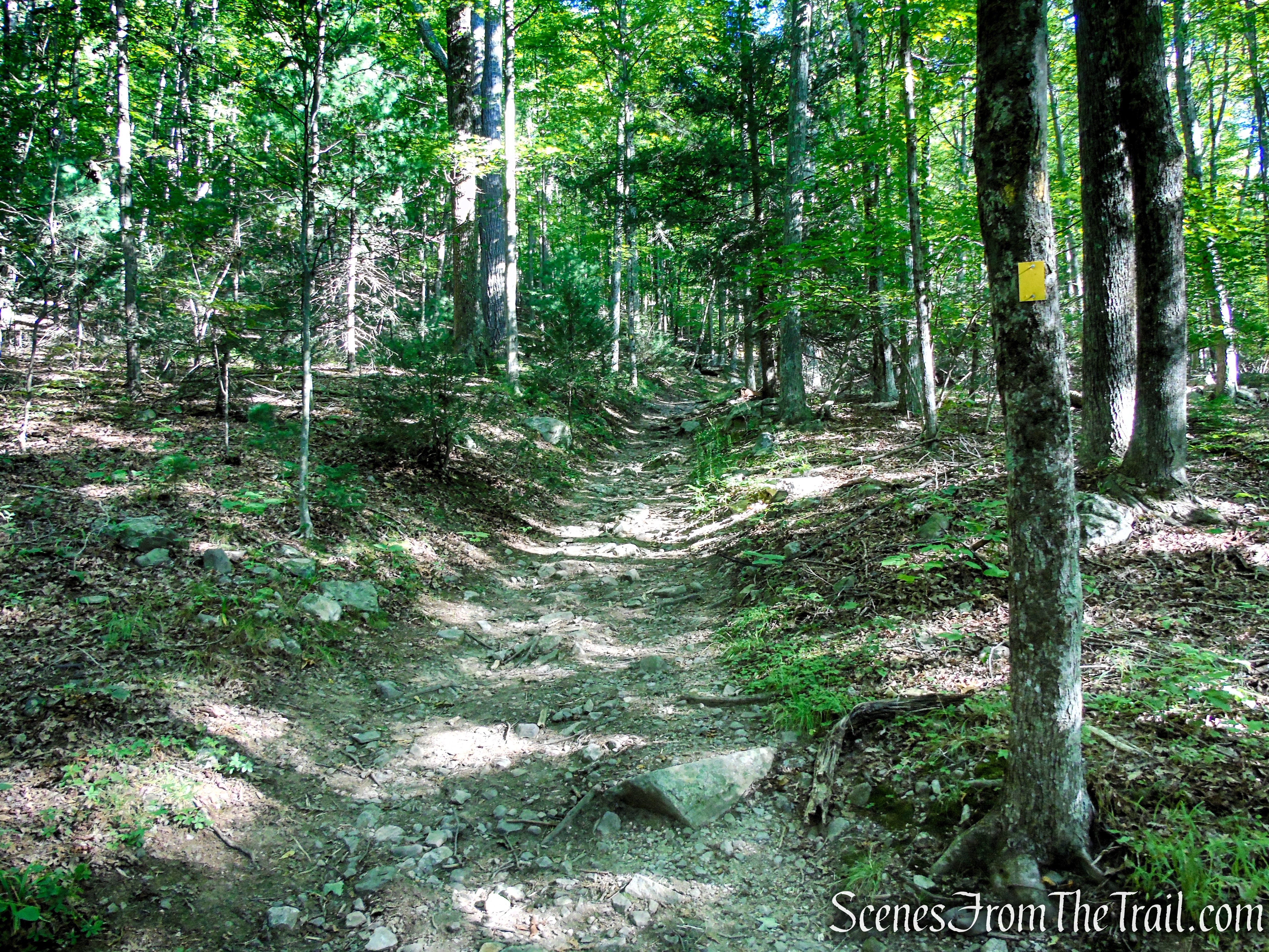
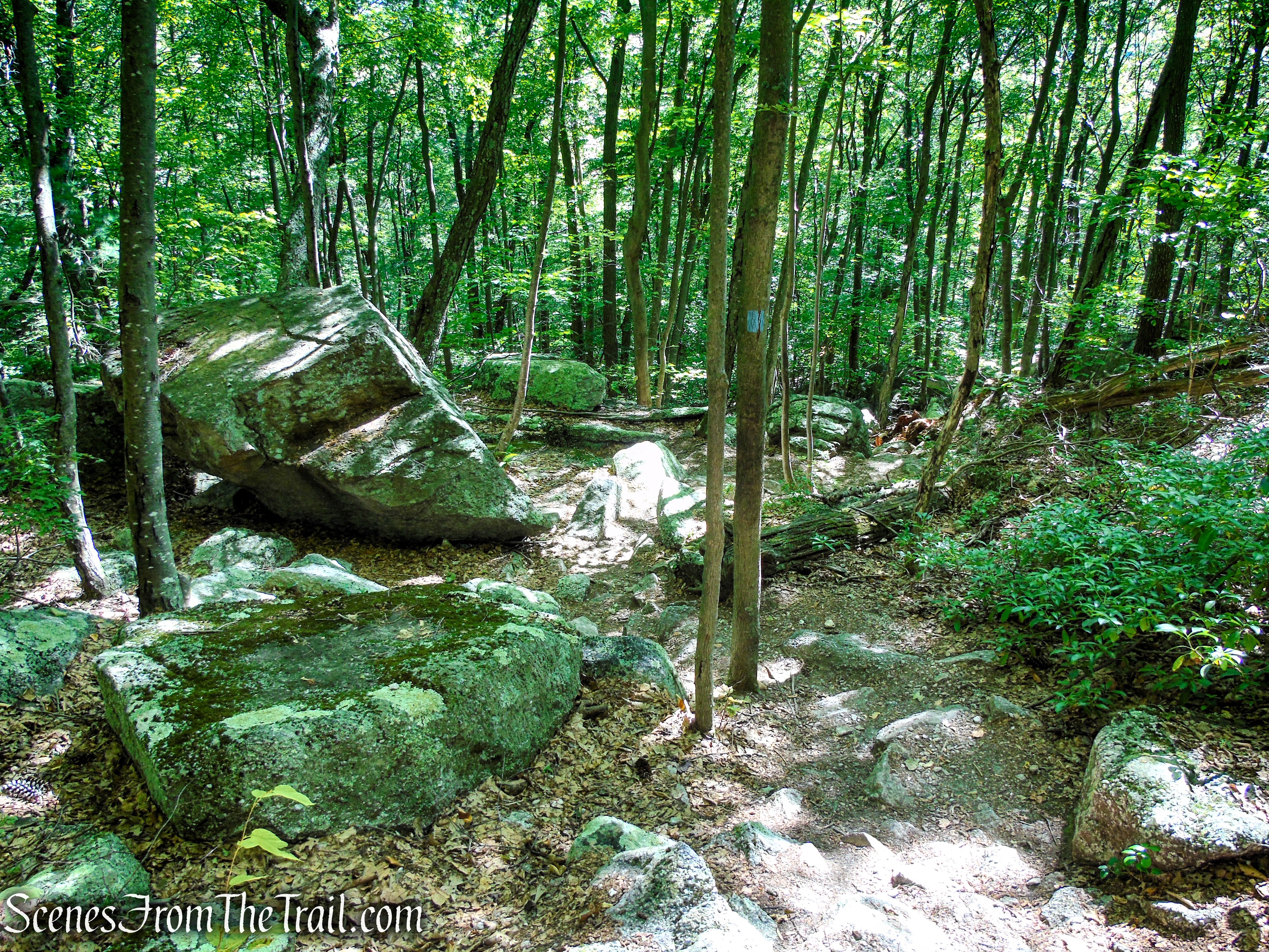
The High Peters Kill Trail follows a woods road, passing the Enderly Burial Ground on the right. It then crosses a wet area on a boardwalk and continues through a Hemlock forest. After crossing a stream on a wooden bridge, the trail begins a gentle climb, paralleling the stream for a short distance. It then crosses the stream on rocks and bears right, away from the stream.
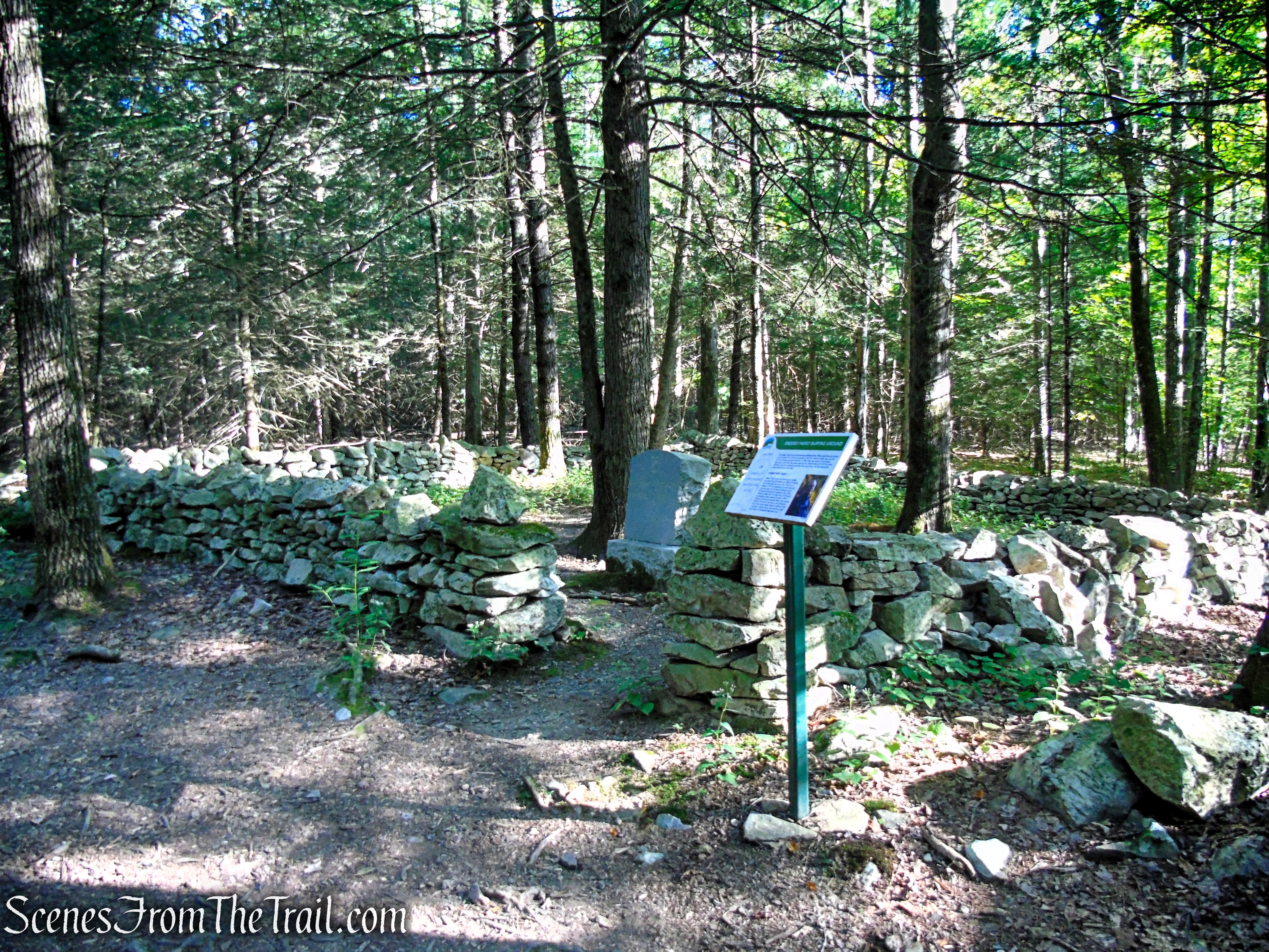
Enderly Burial Ground – Mohonk Preserve
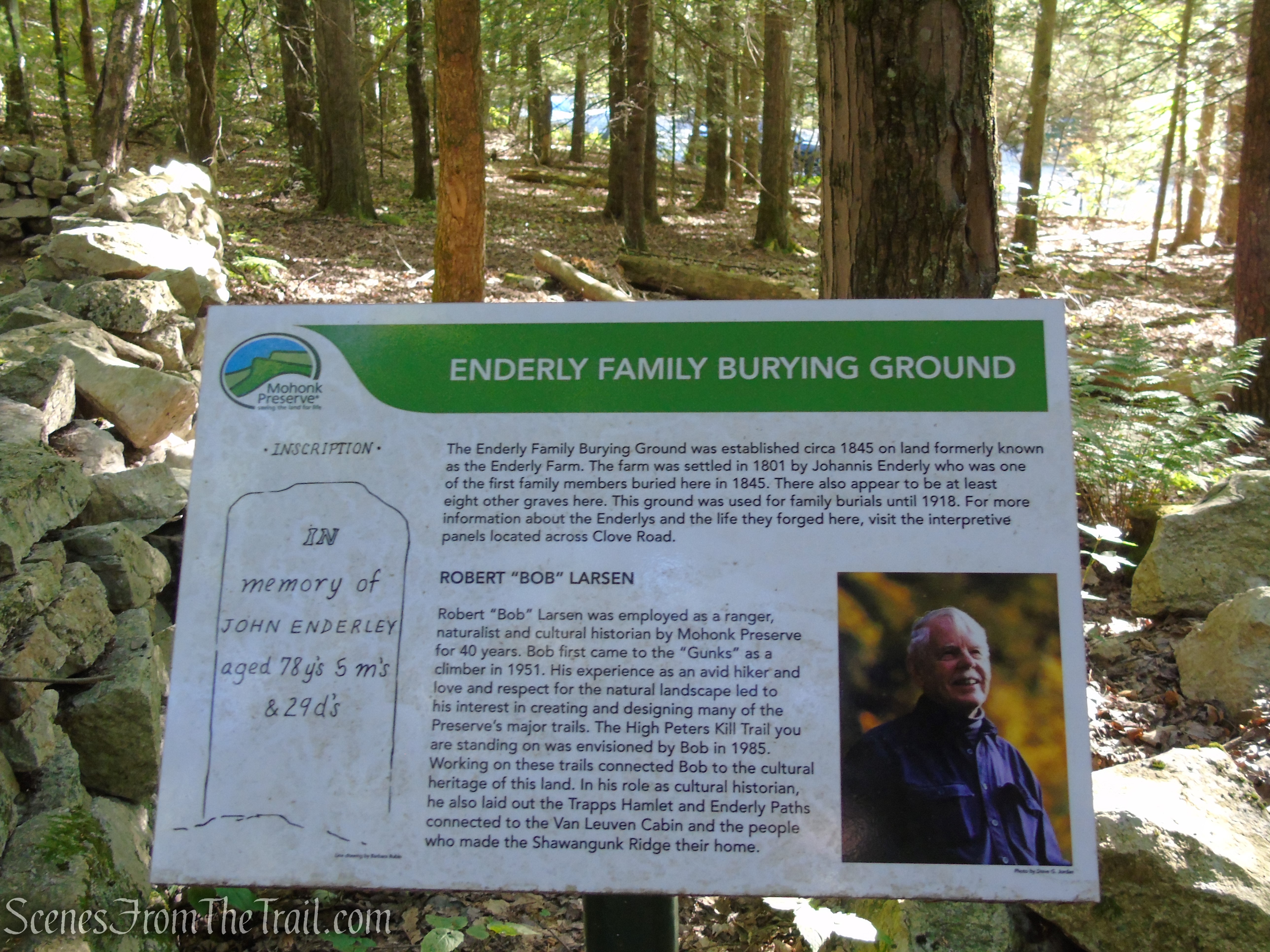
Enderly Burial Ground – Mohonk Preserve
High Peters Kill Trail – Mohonk Preserve
High Peters Kill Trail – Mohonk Preserve
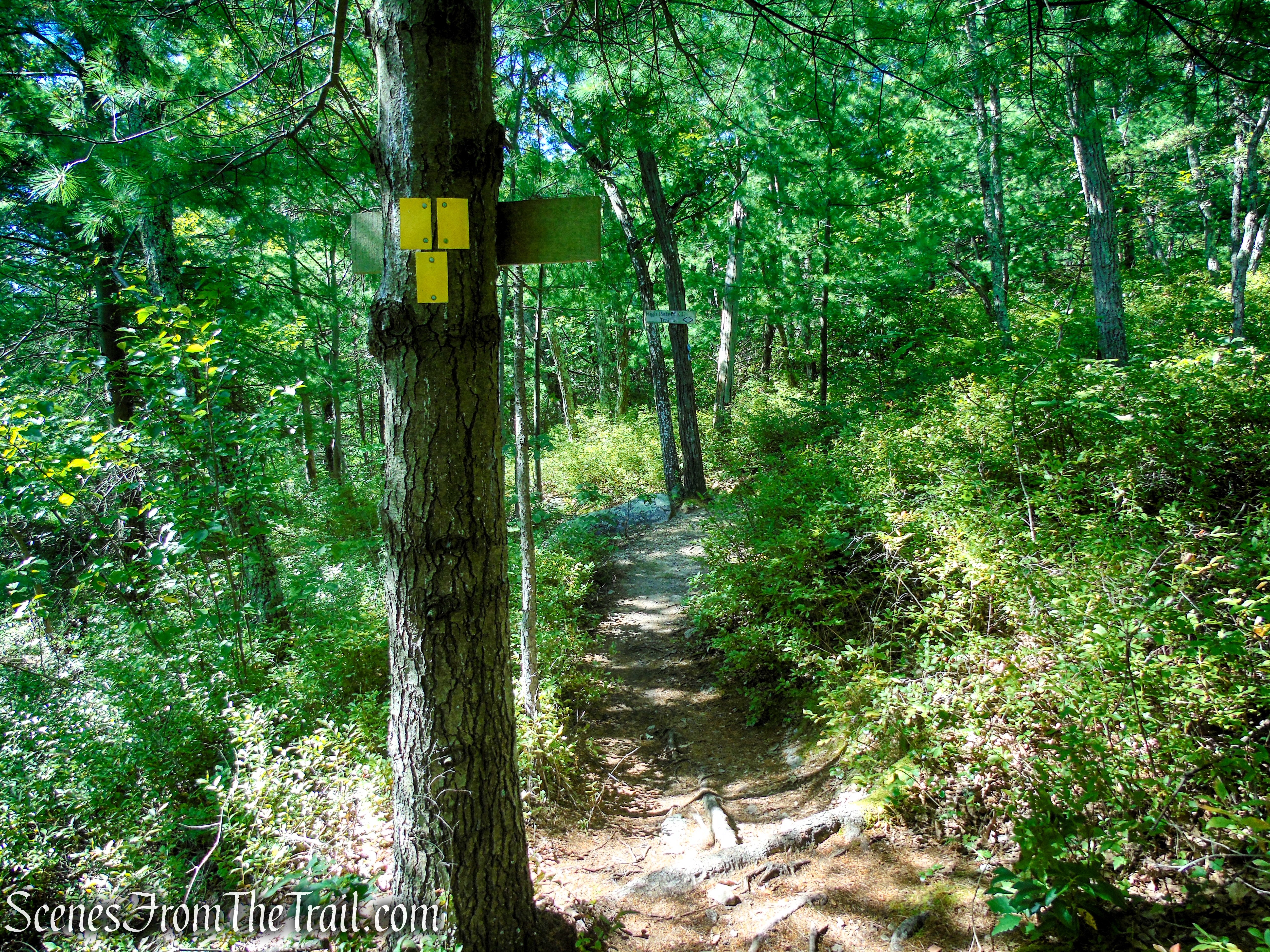
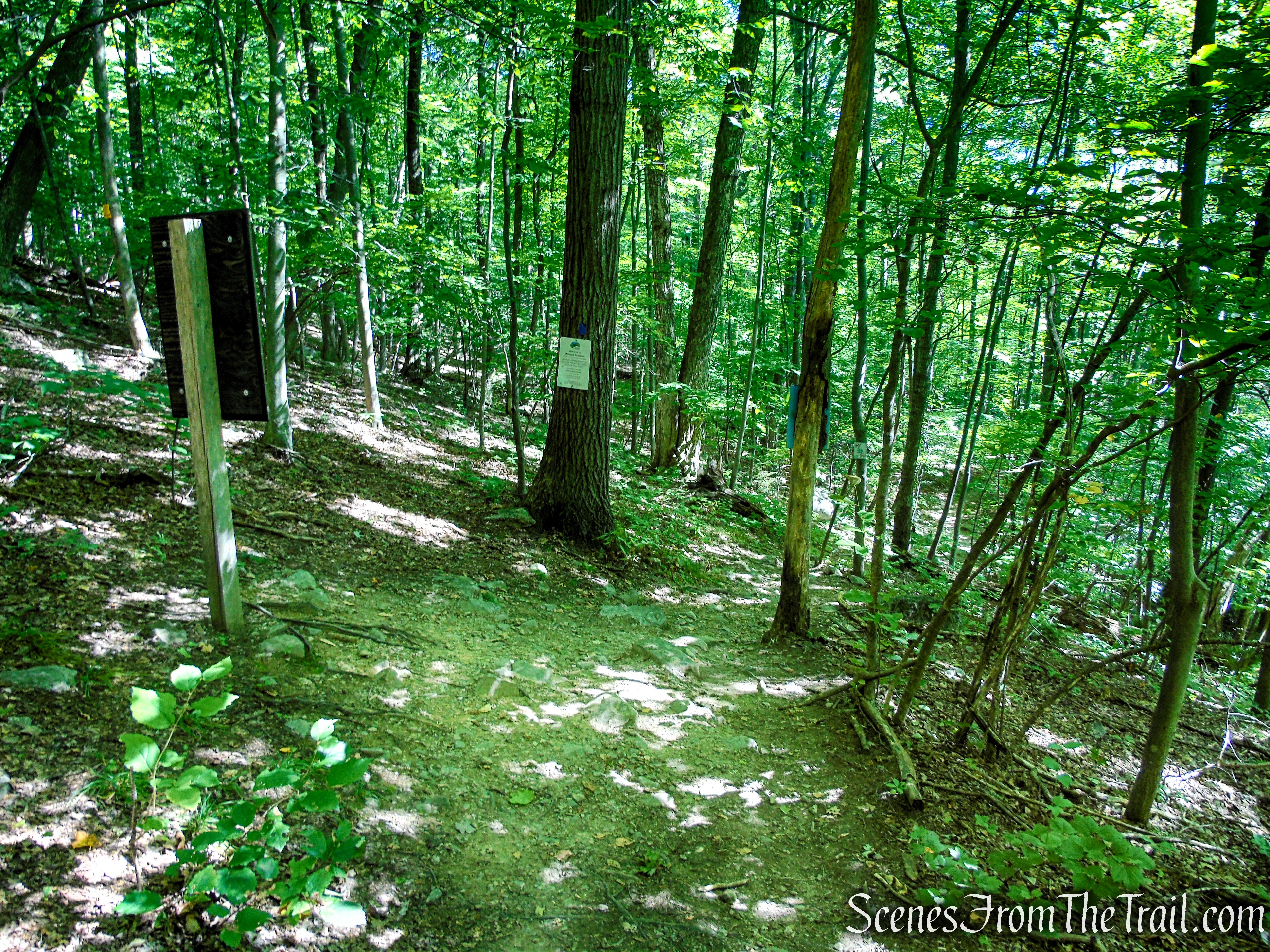
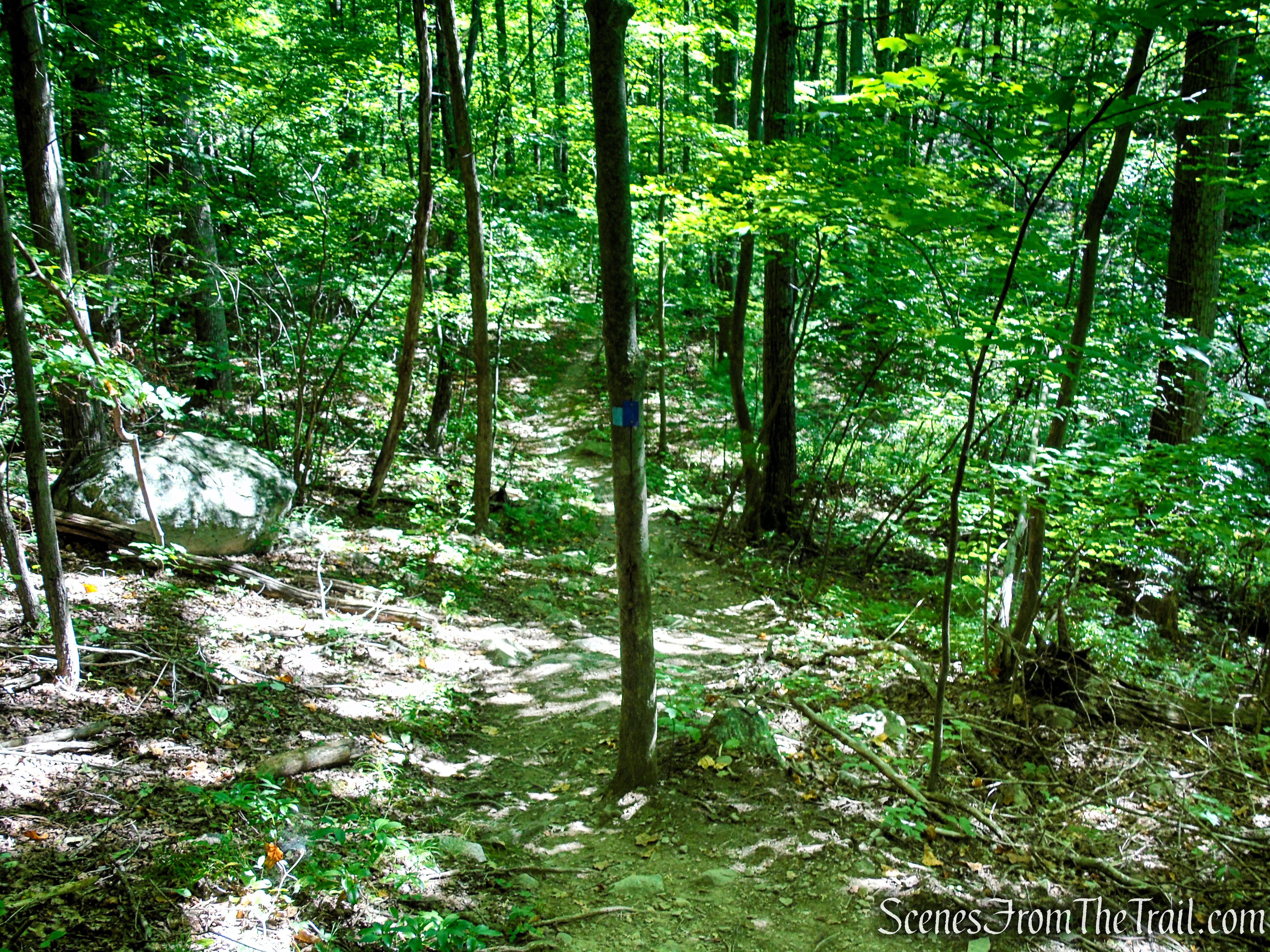
Soon, you’ll come to a junction with the yellow-blazed King’s Lane Trail, which continues straight ahead. Leave the blue blazed trail and follow the yellow blazes. This is the start of the loop. You will return to this spot on the blue trail.
King’s Lane – Mohonk Preserve
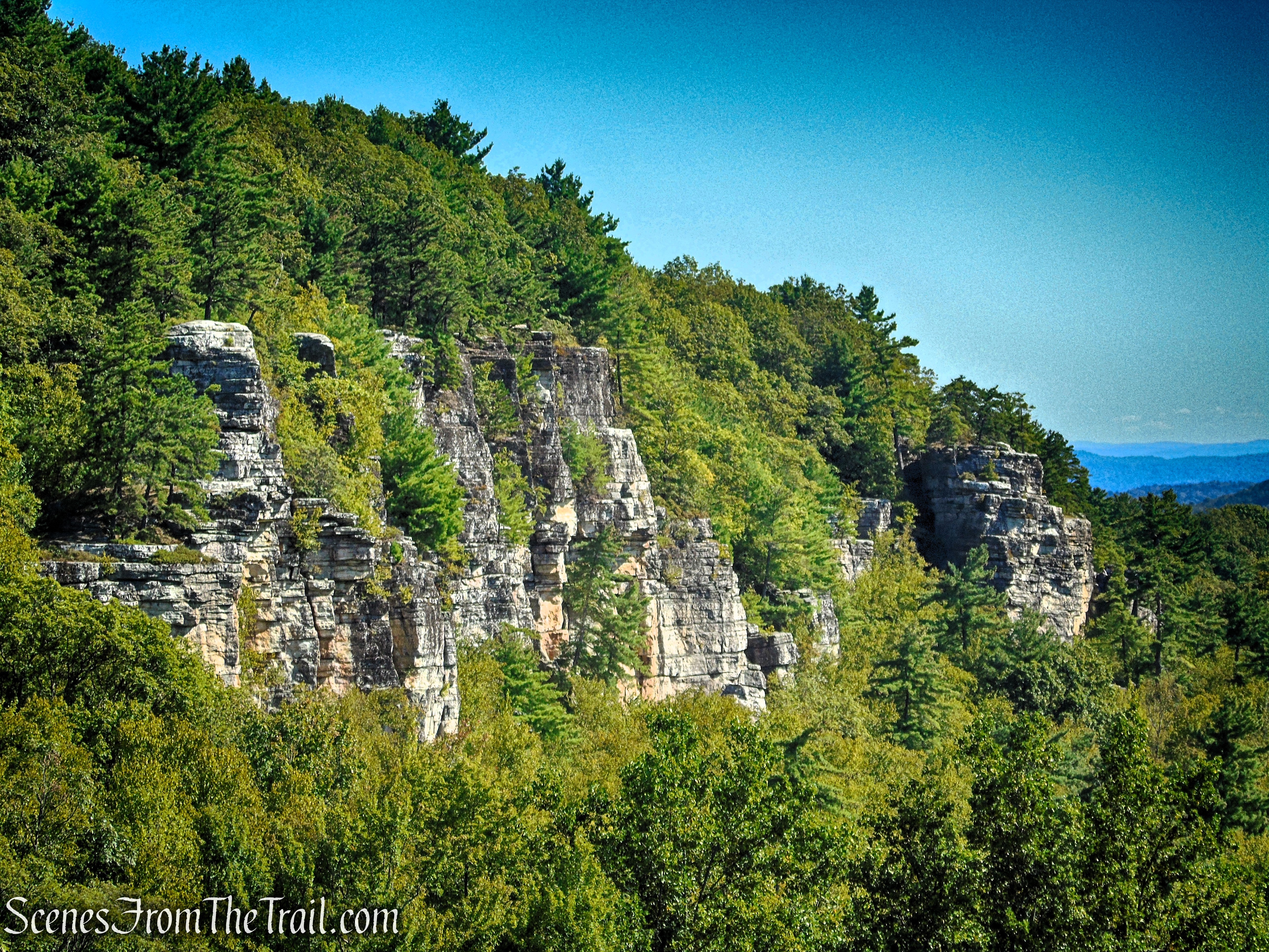
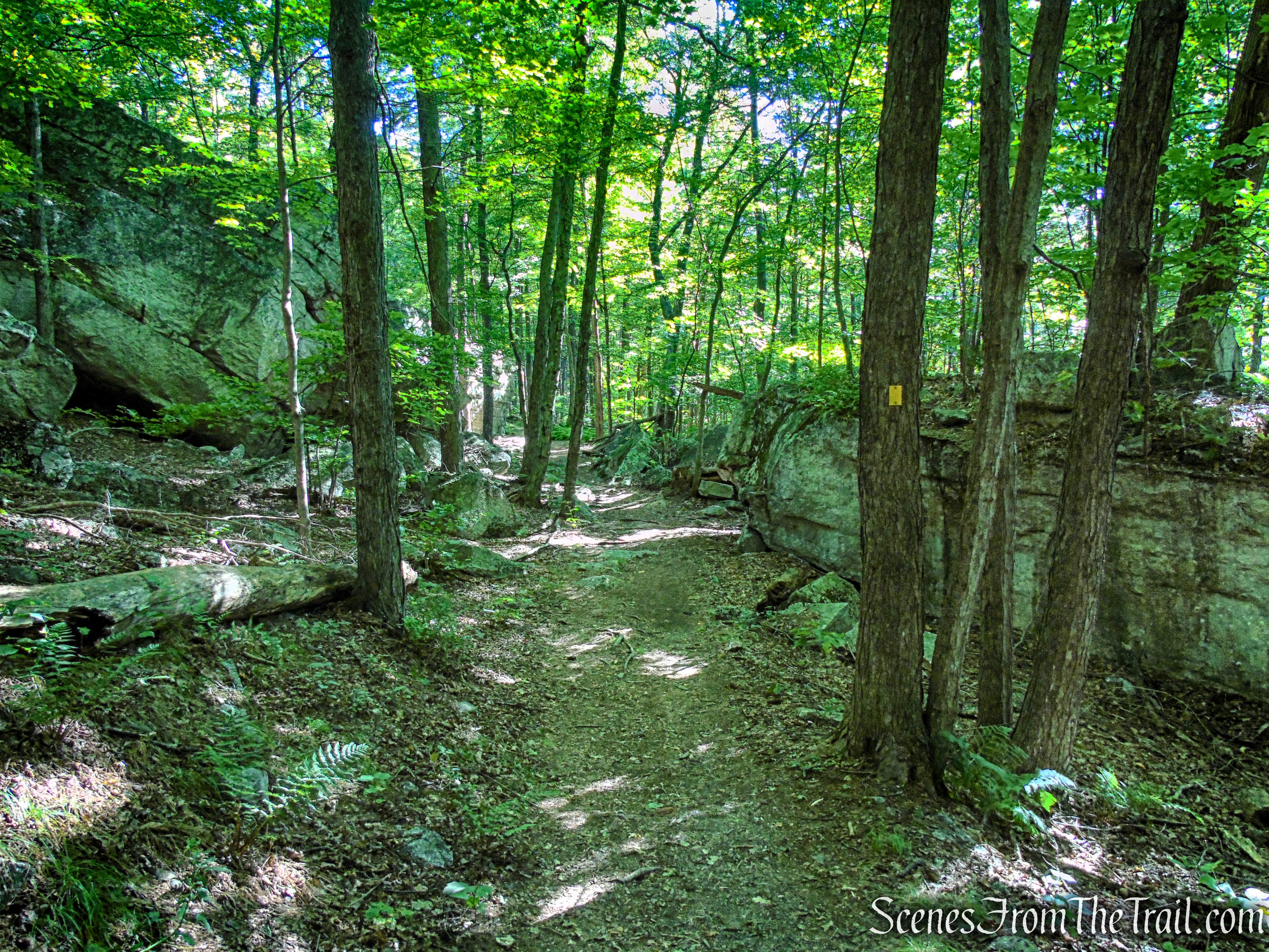
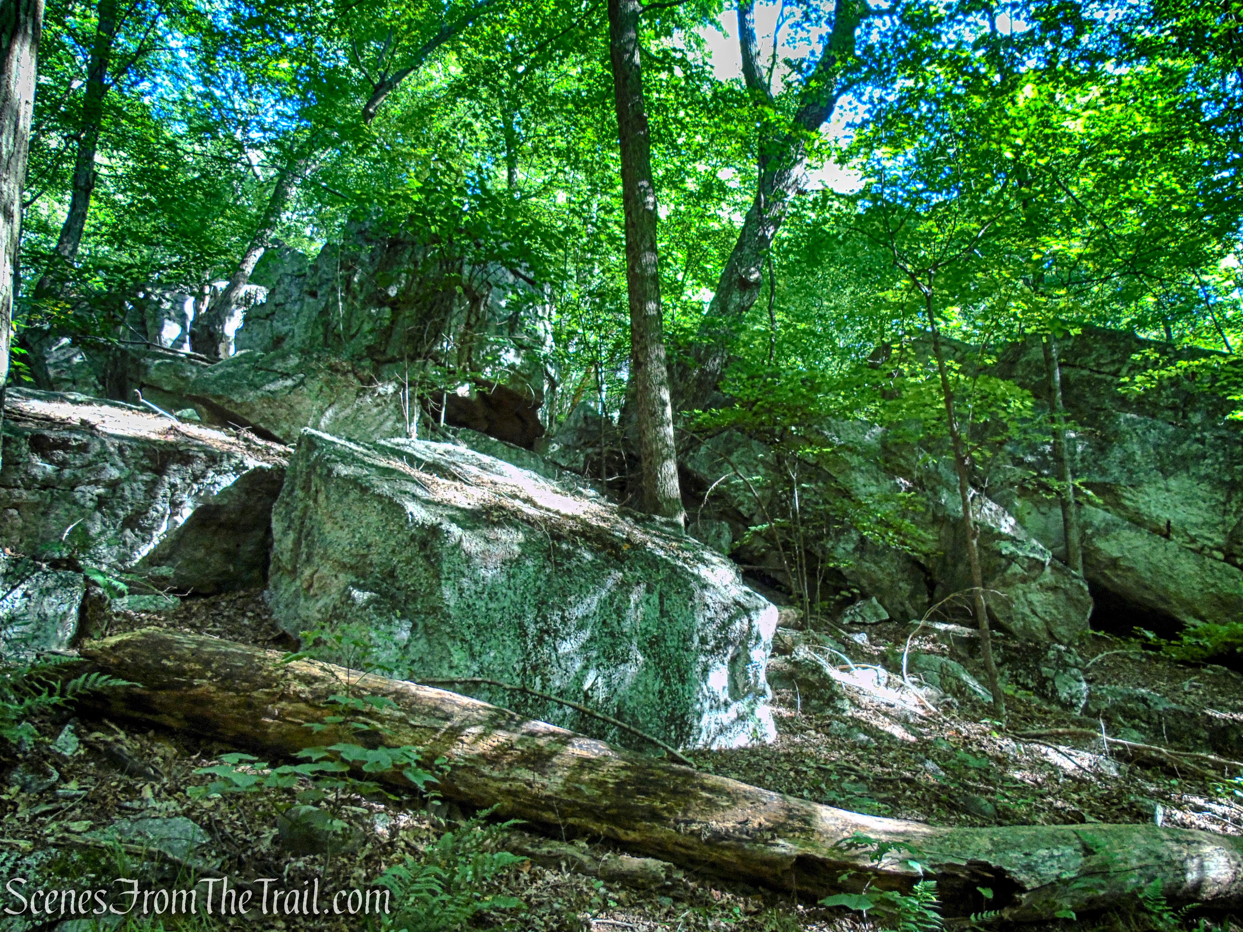
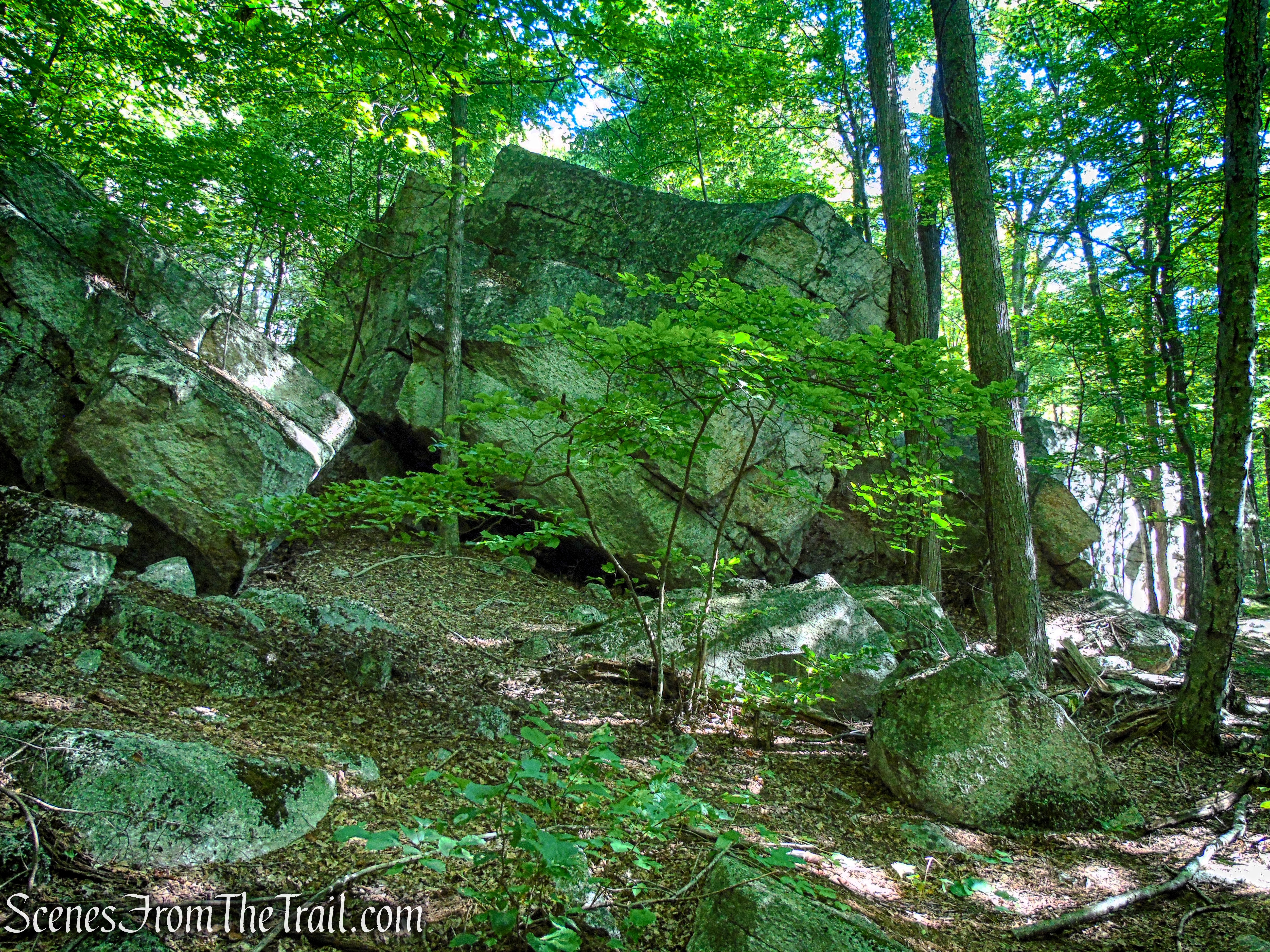
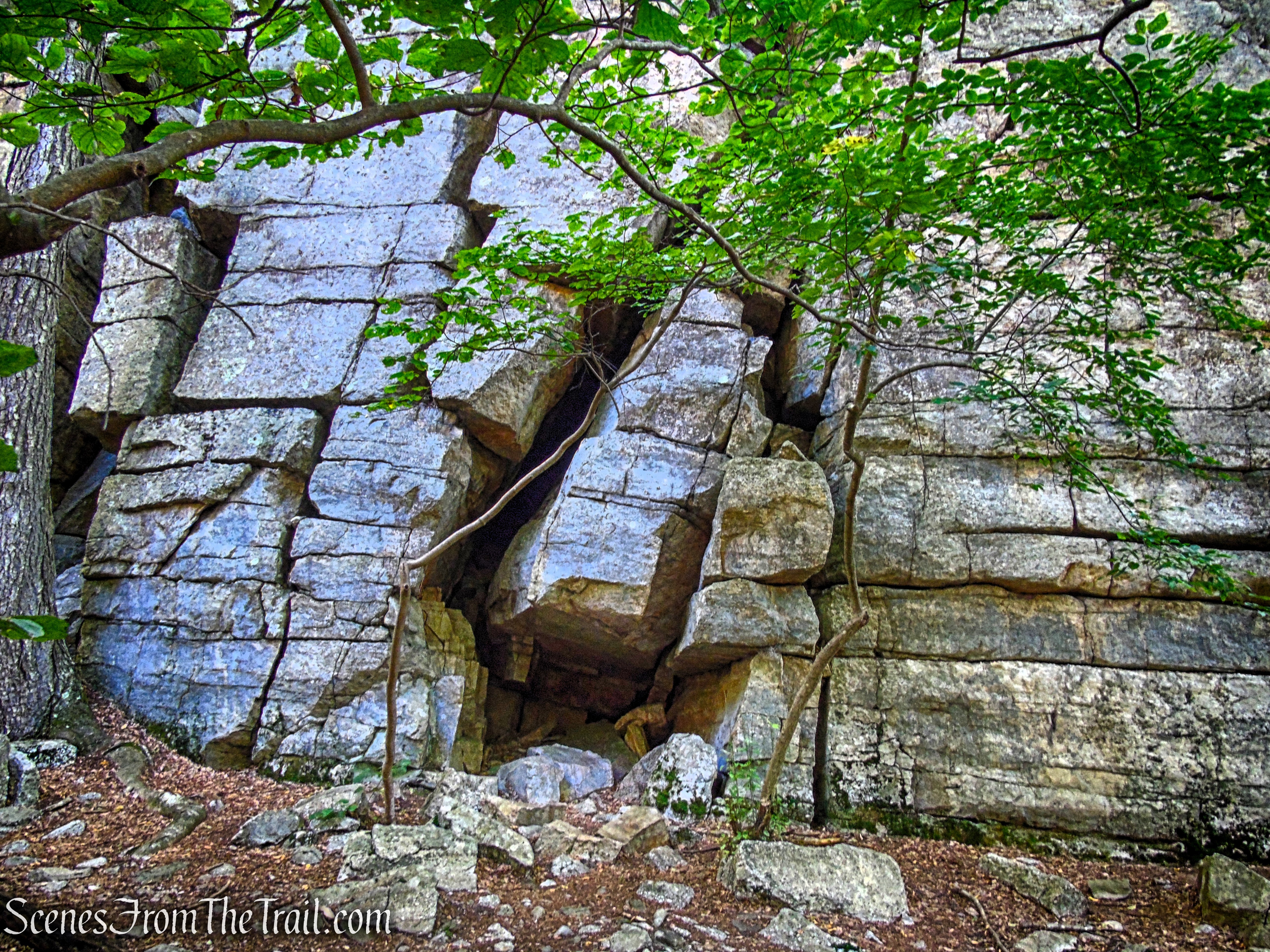
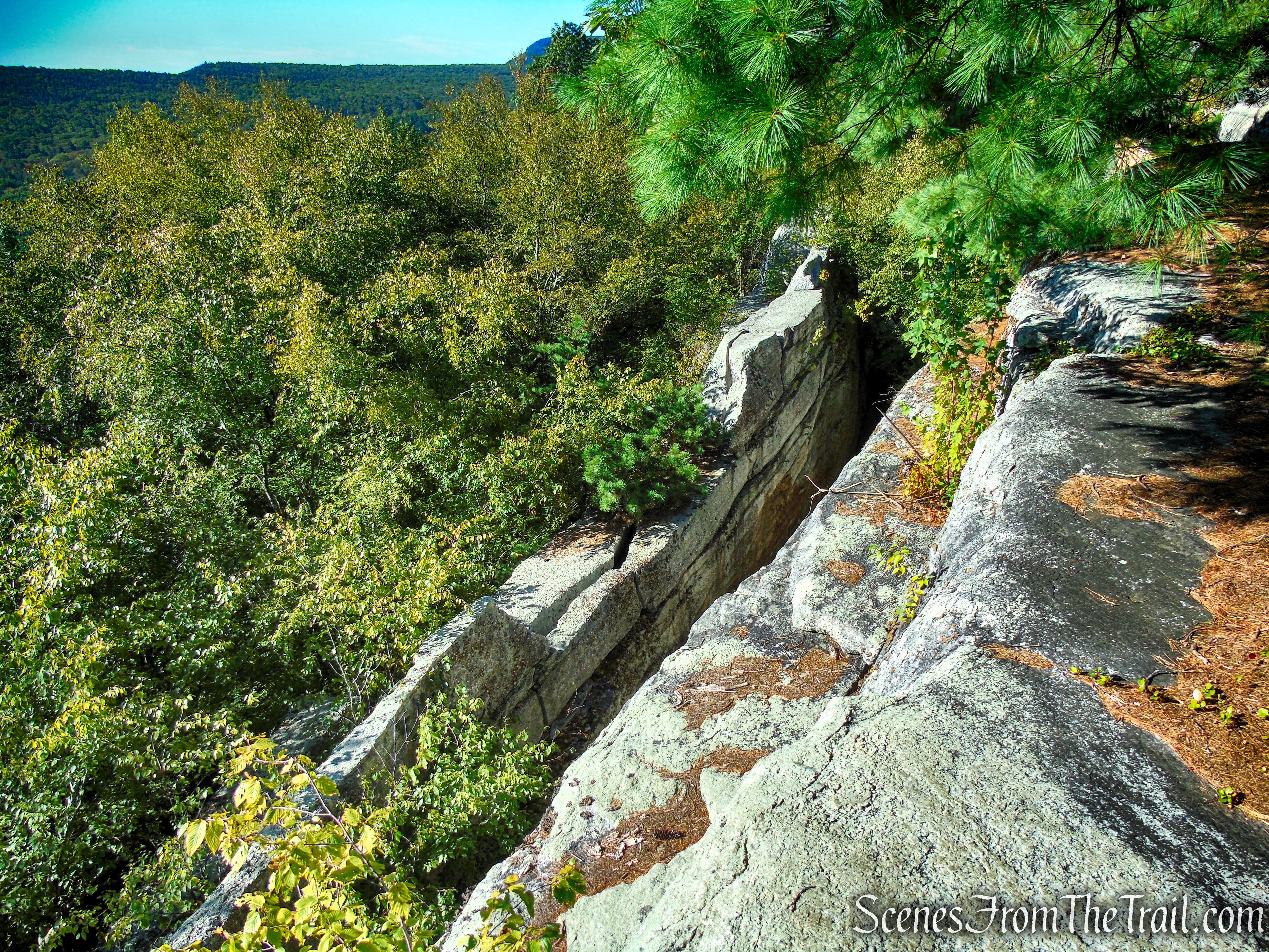
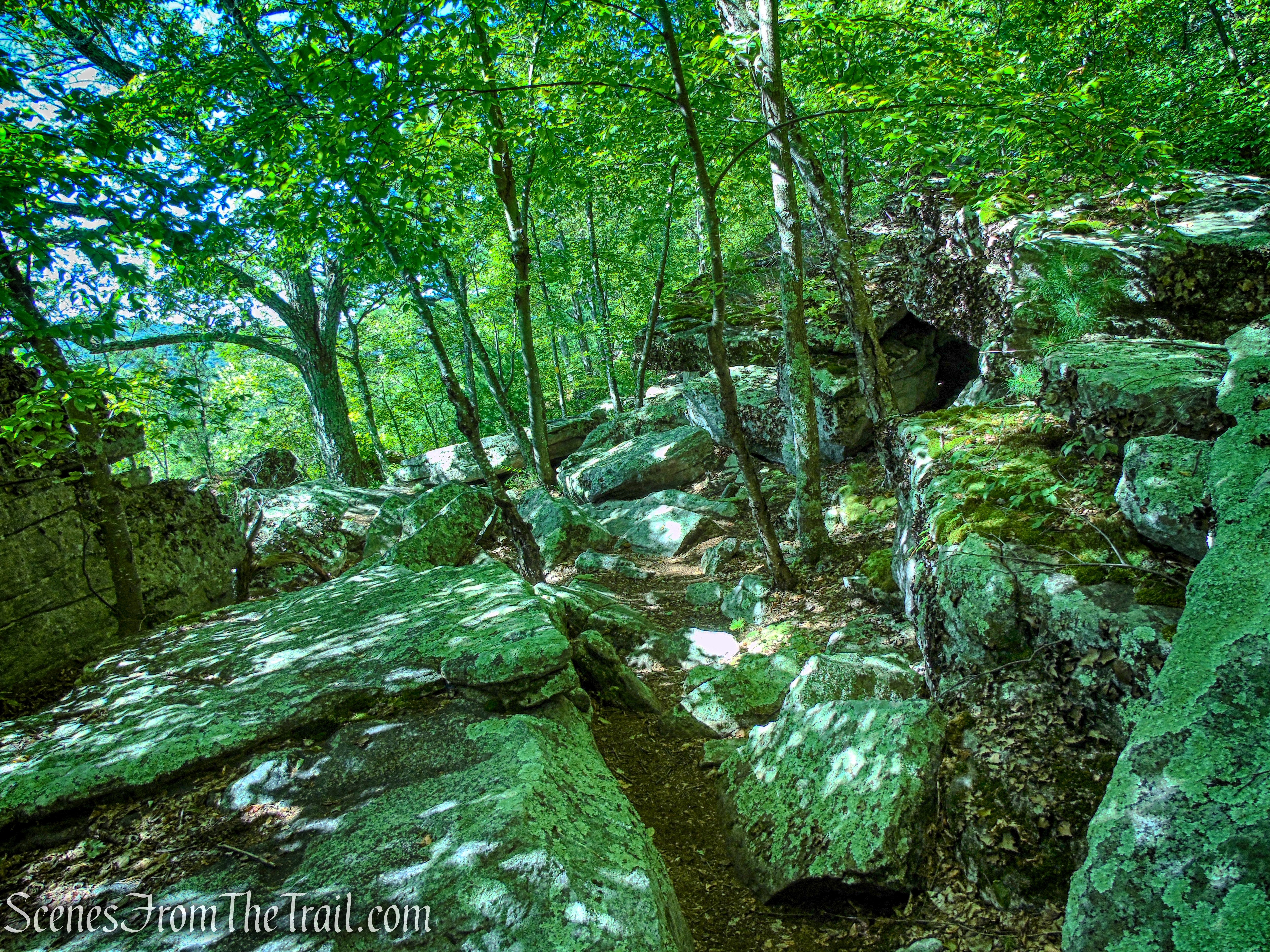
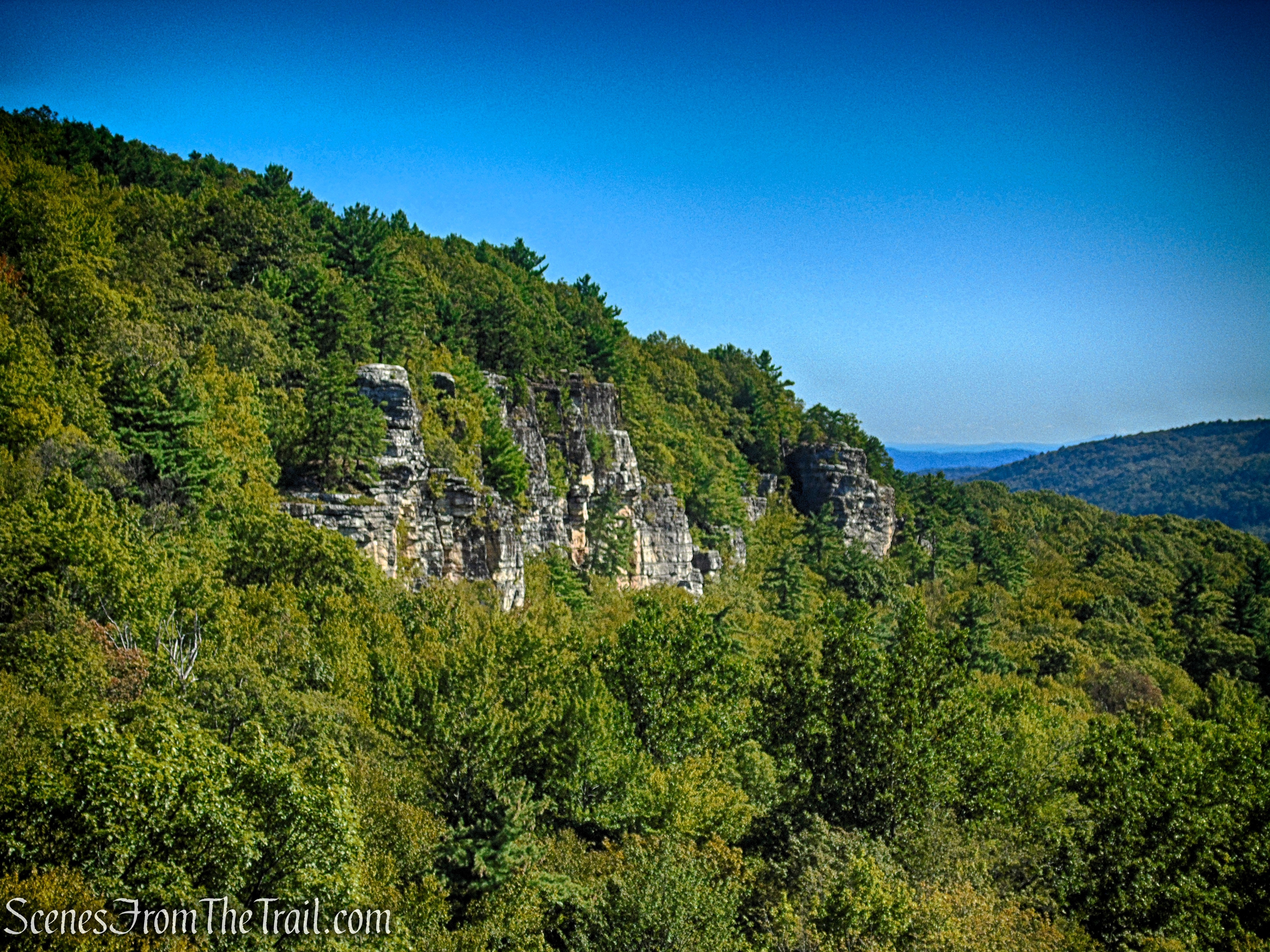
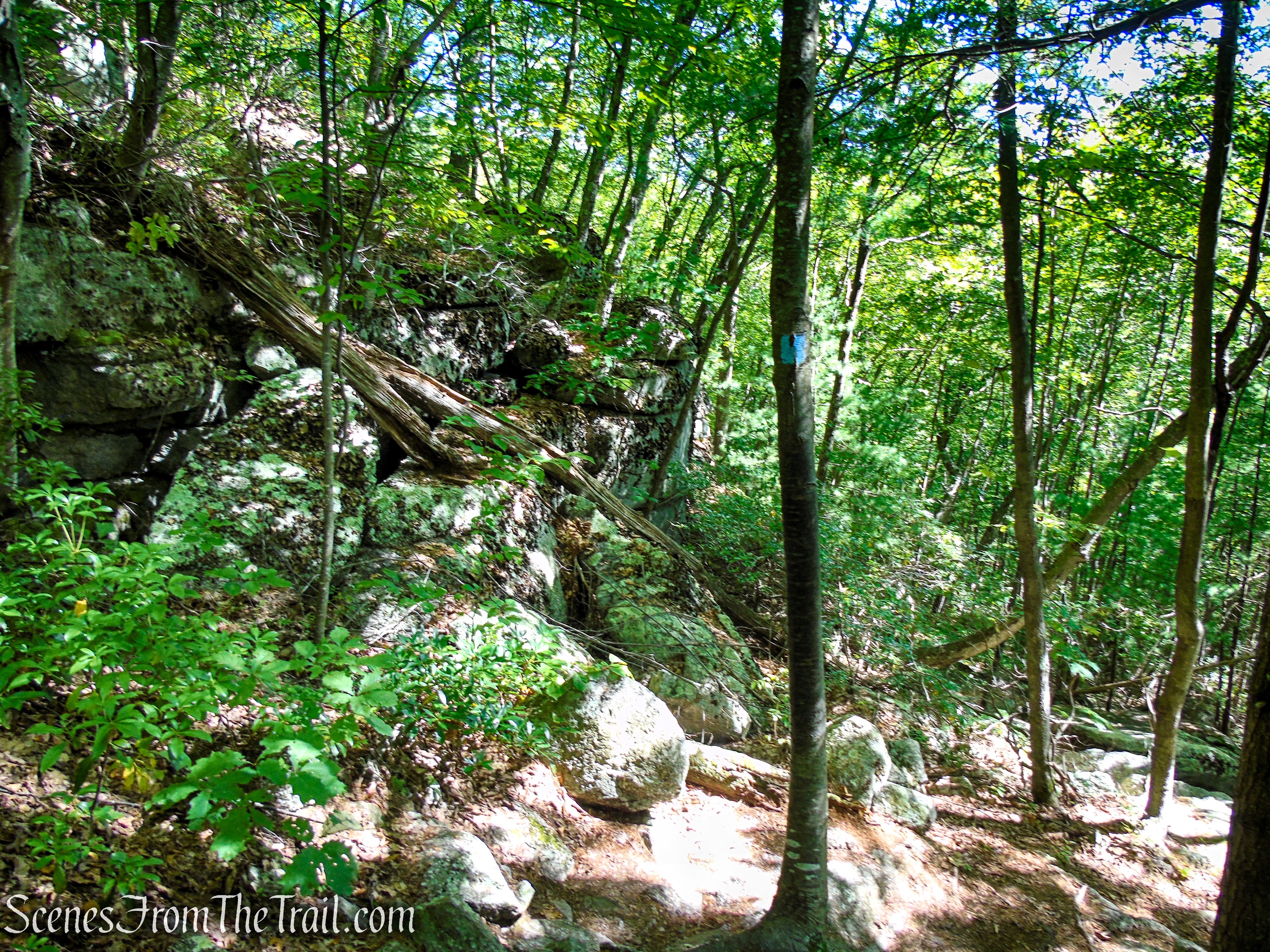
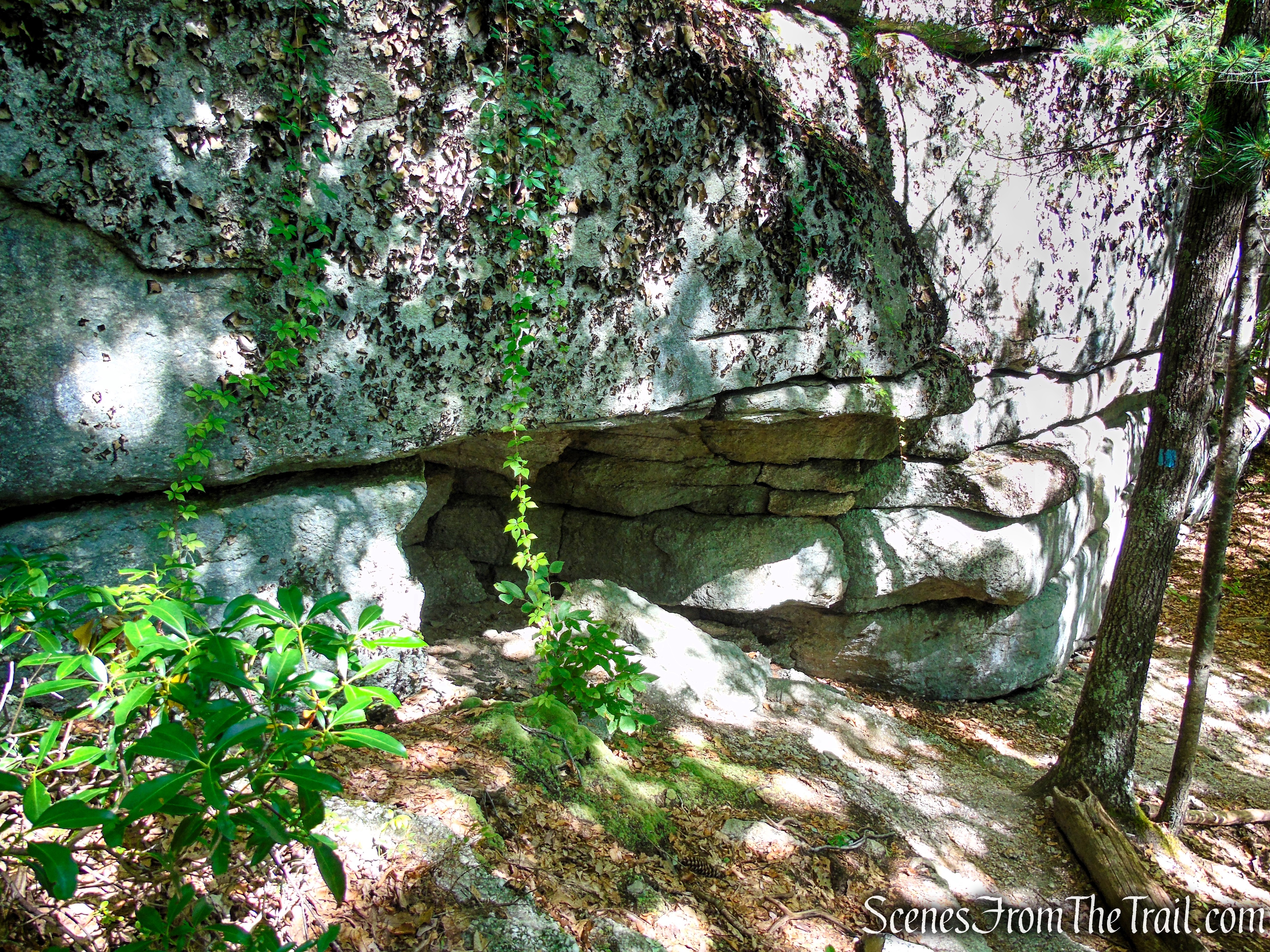
If you plan to explore the crevices, look for side trails on the left that lead to the base of the cliffs. Otherwise, continue following the old road as it climbs the hillside, first somewhat steeply, then the grade moderates as it passes an impressive line of cliffs used by rock climbers. This is the “Lost City,” a faulted section of Coxing Clove, which has canyon like fissures in the towering rock outcrops.
King’s Lane – Mohonk Preserve
Originally, this road was used to haul conglomerate stone to create grindstones. Today, it’s been repurposed as a hiking trail that passes by the cliffs of the Lost City.
King’s Lane – Mohonk Preserve
King’s Lane – Mohonk Preserve
King’s Lane – Mohonk Preserve
King’s Lane – Mohonk Preserve
King’s Lane – Mohonk Preserve
The towering cliffs of the Lost City can be seen through the trees.
King’s Lane – Mohonk Preserve
King’s Lane – Mohonk Preserve
King’s Lane – Mohonk Preserve
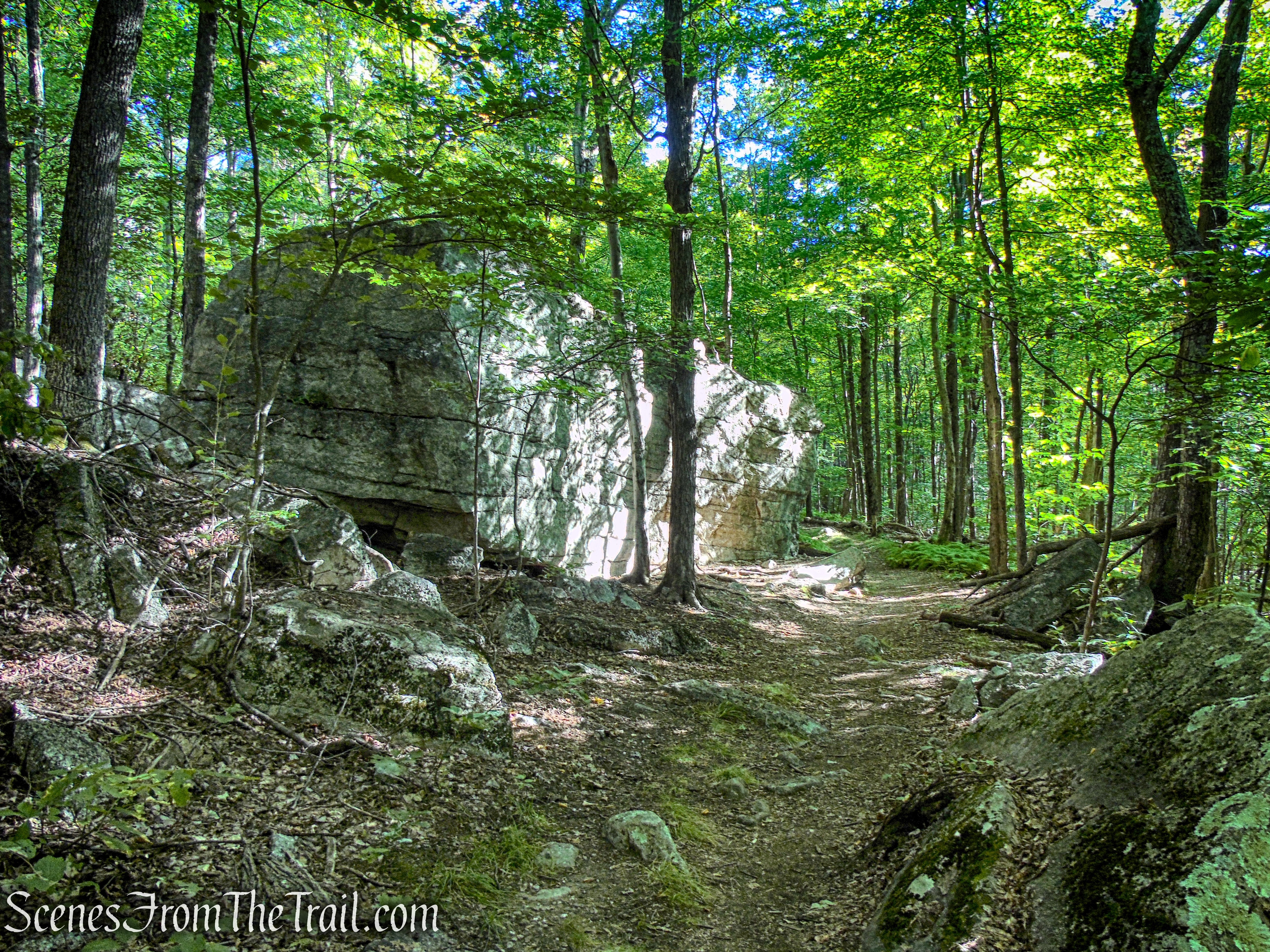
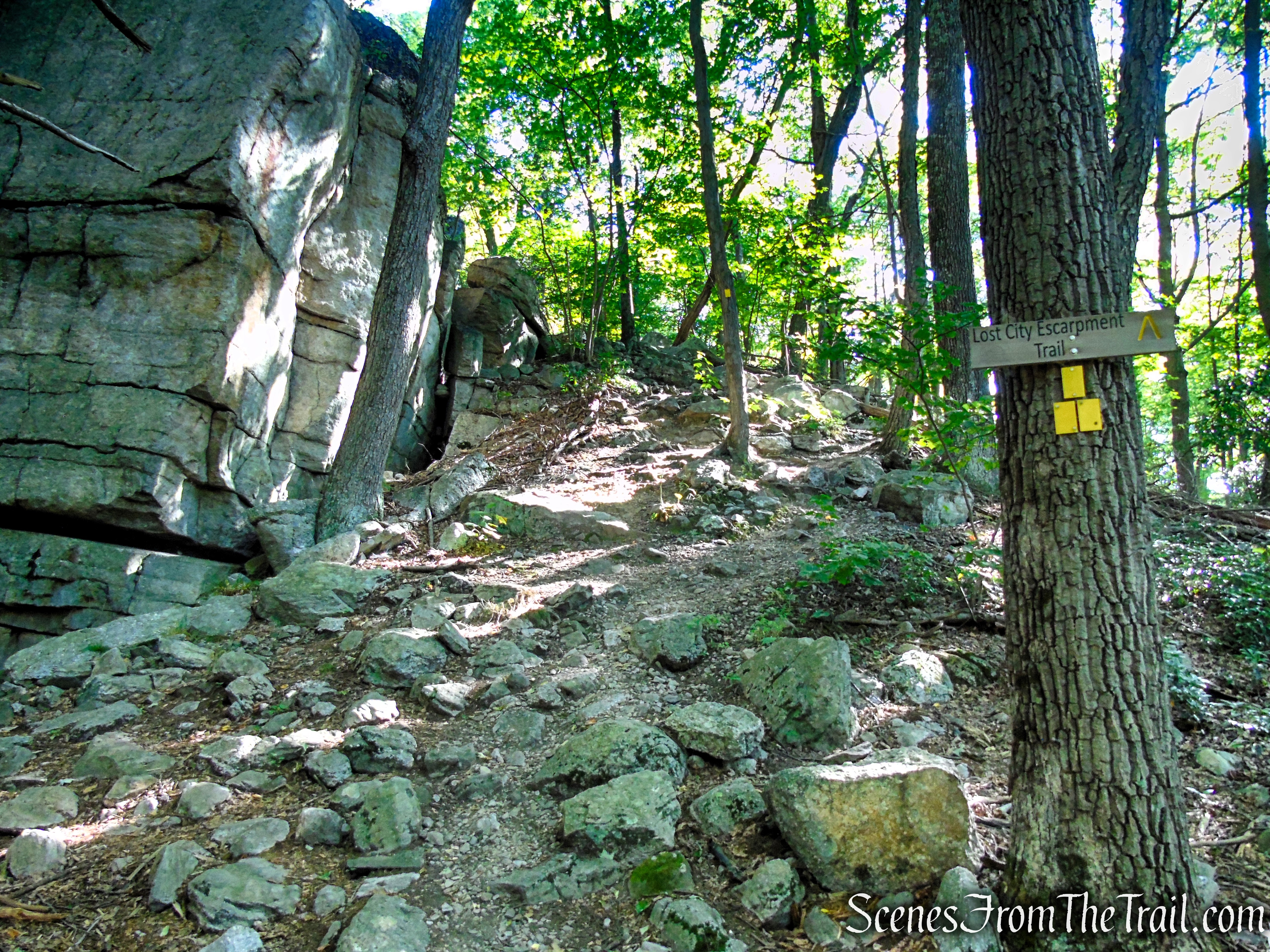
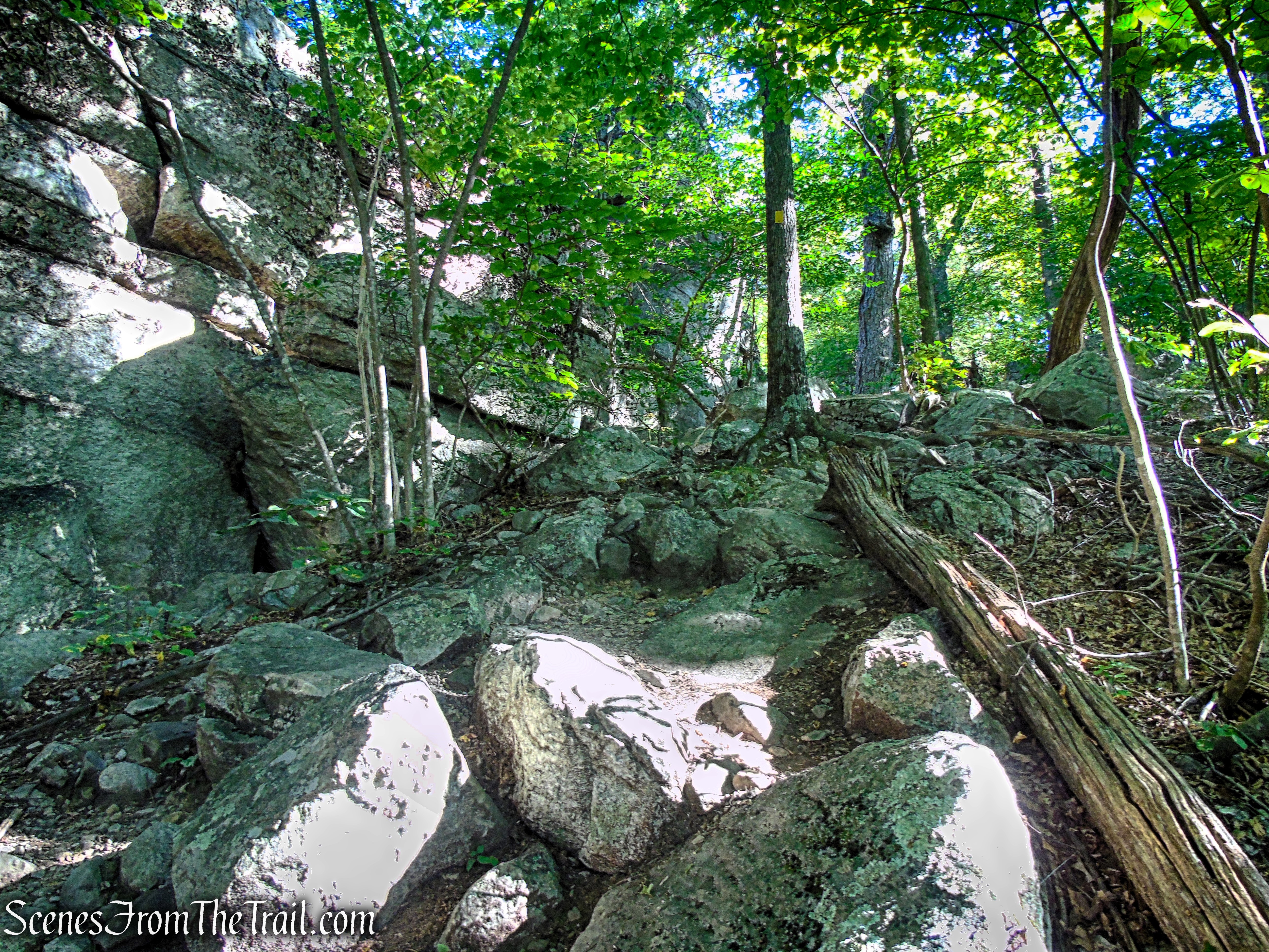
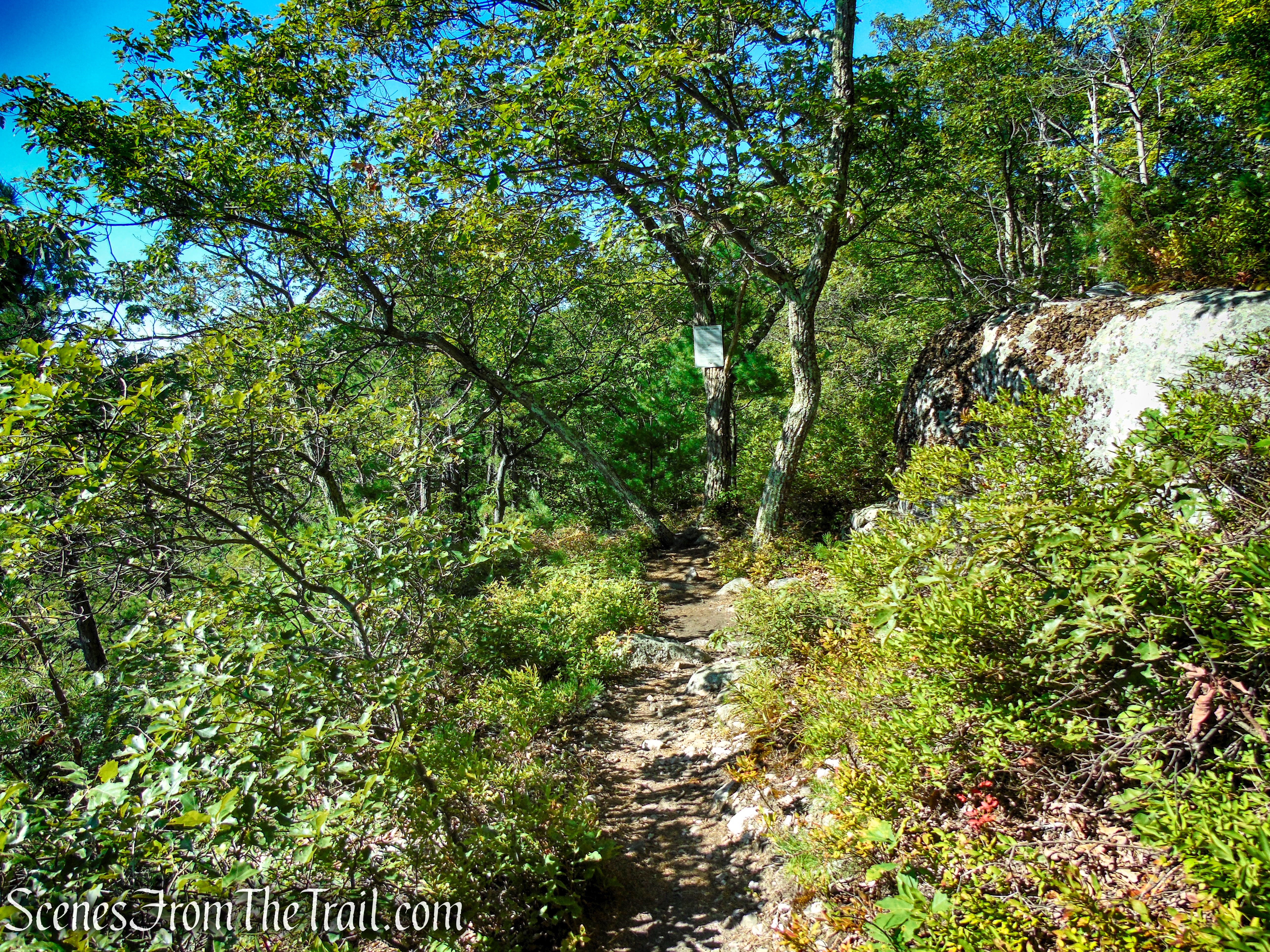
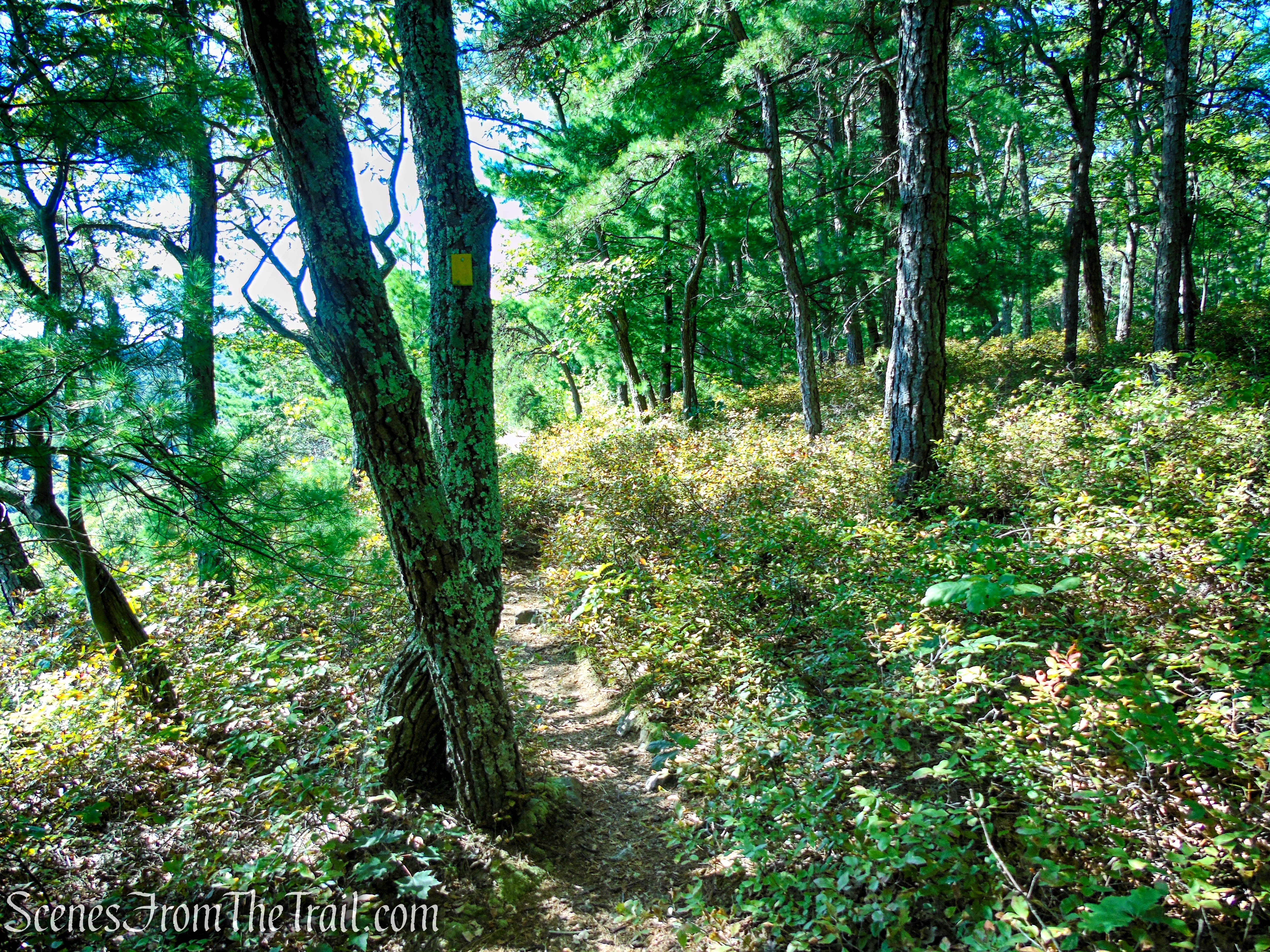
Soon, King’s Lane ends where the Lost City Escarpment Trail begins. You will have to navigate through a boulder-strewn area to gain the ridge. Follow the yellow blazes as they climb the hill and turns left to reach the ridge.
Lost City Escarpment Trail – Mohonk Preserve
Lost City Escarpment Trail – Mohonk Preserve
Lost City Escarpment Trail – Mohonk Preserve
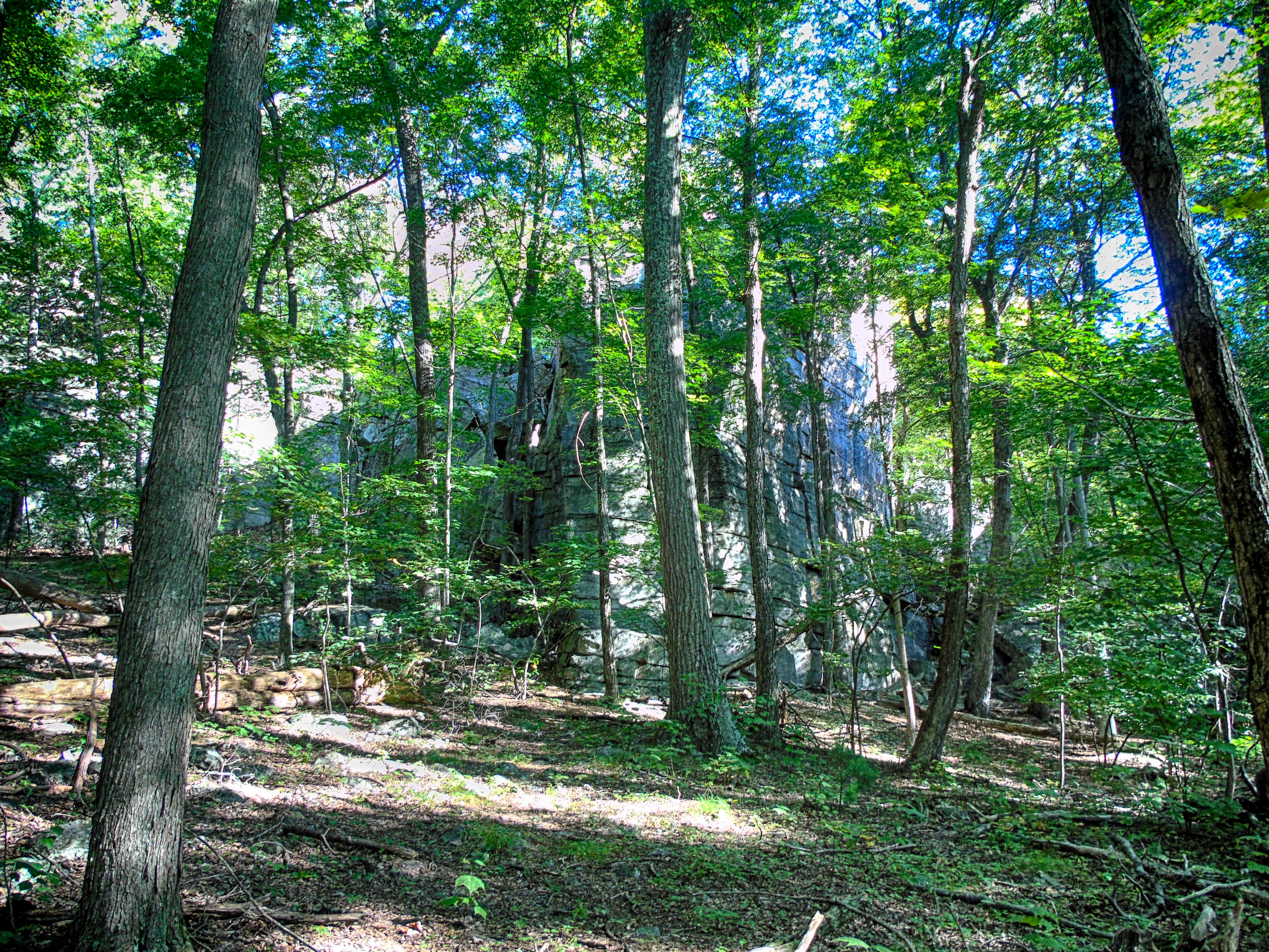
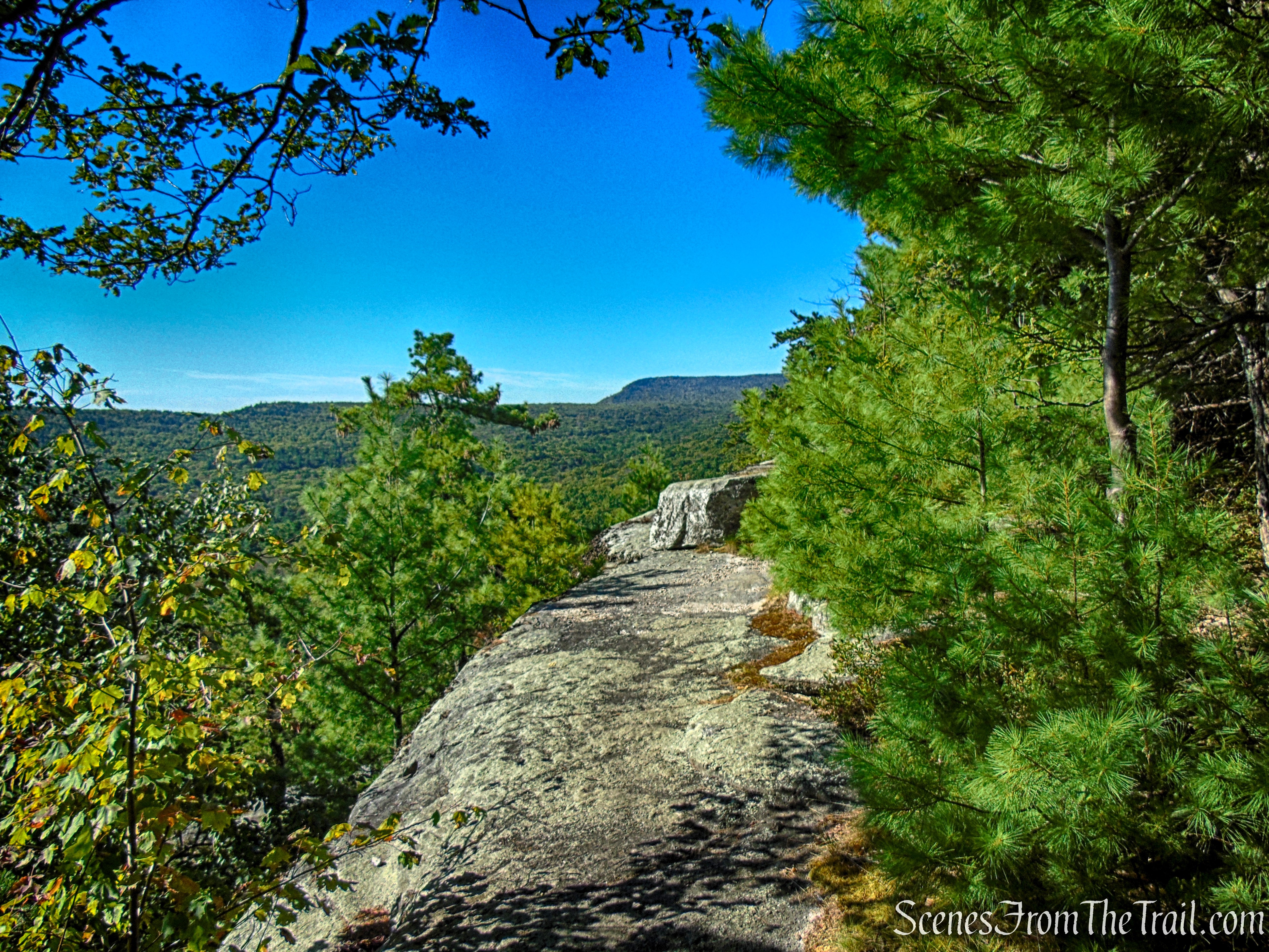
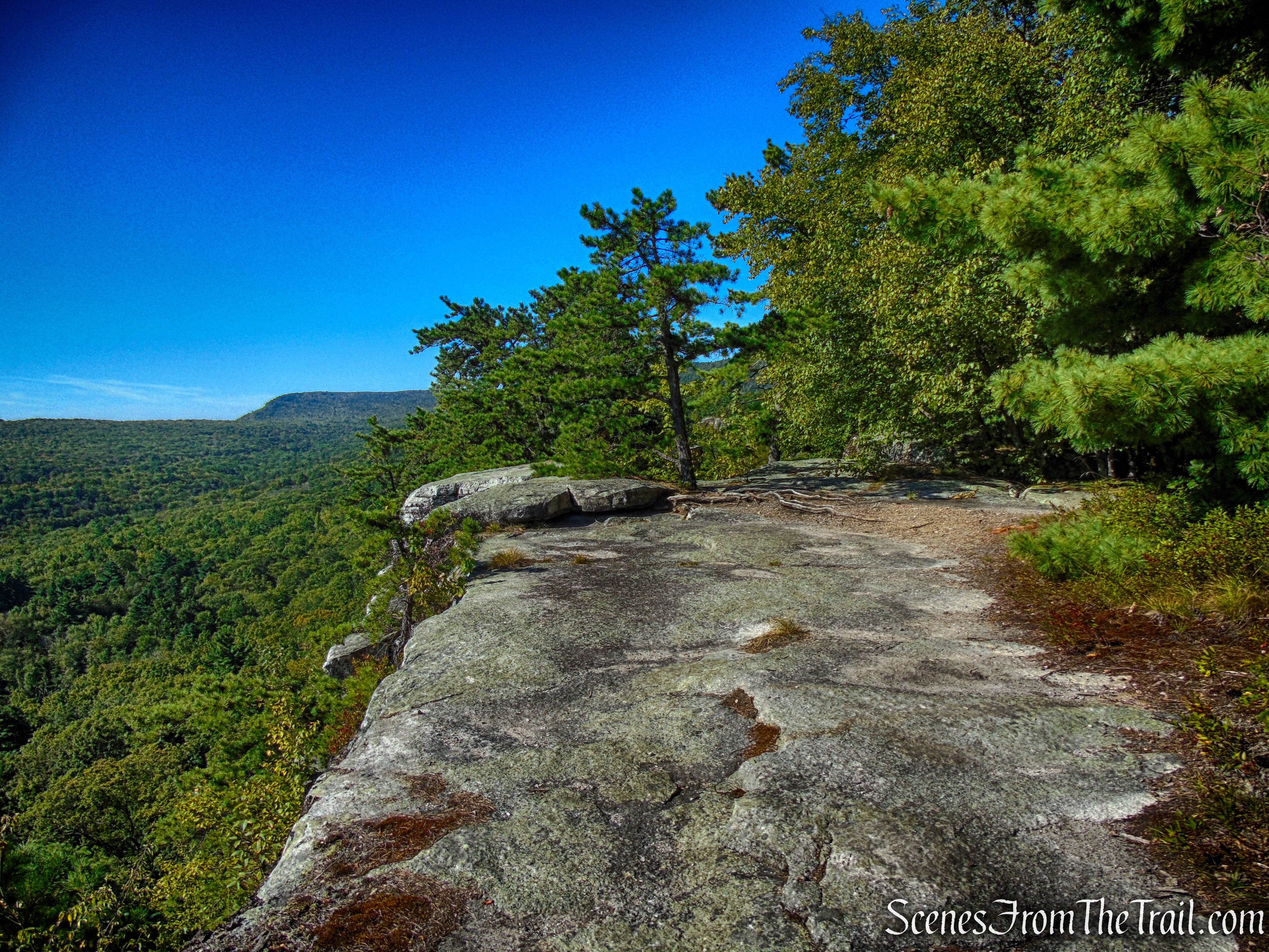
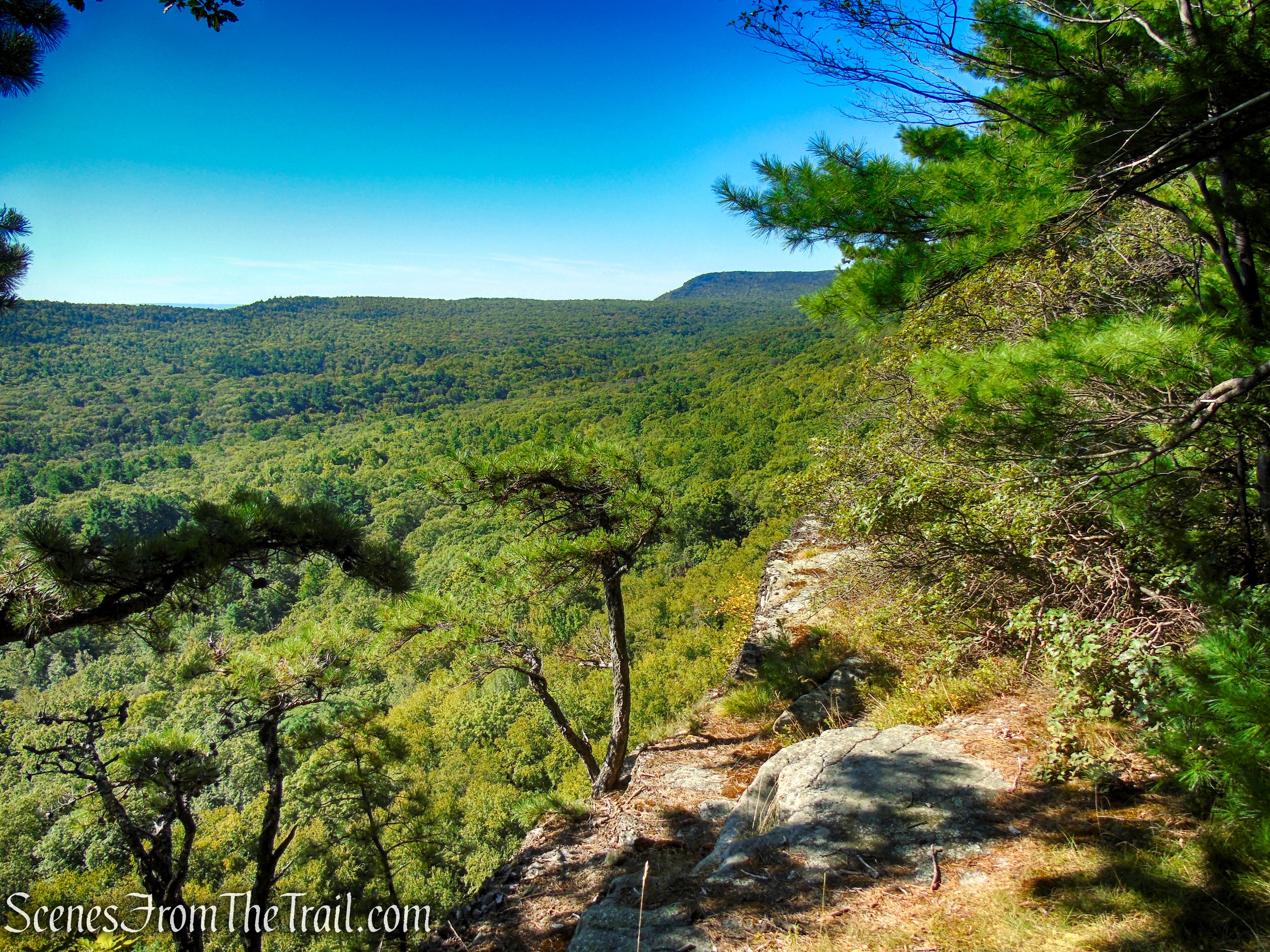
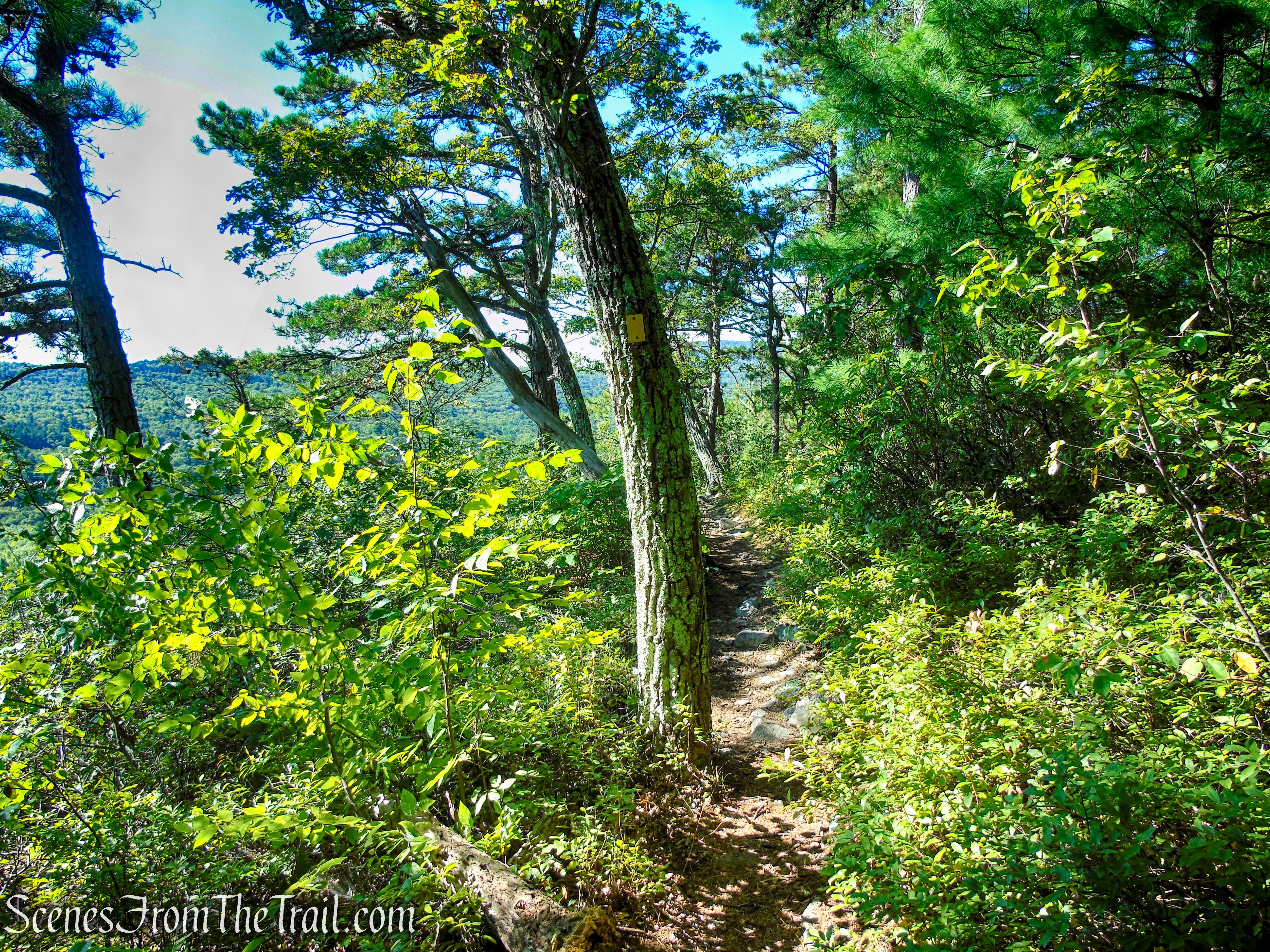
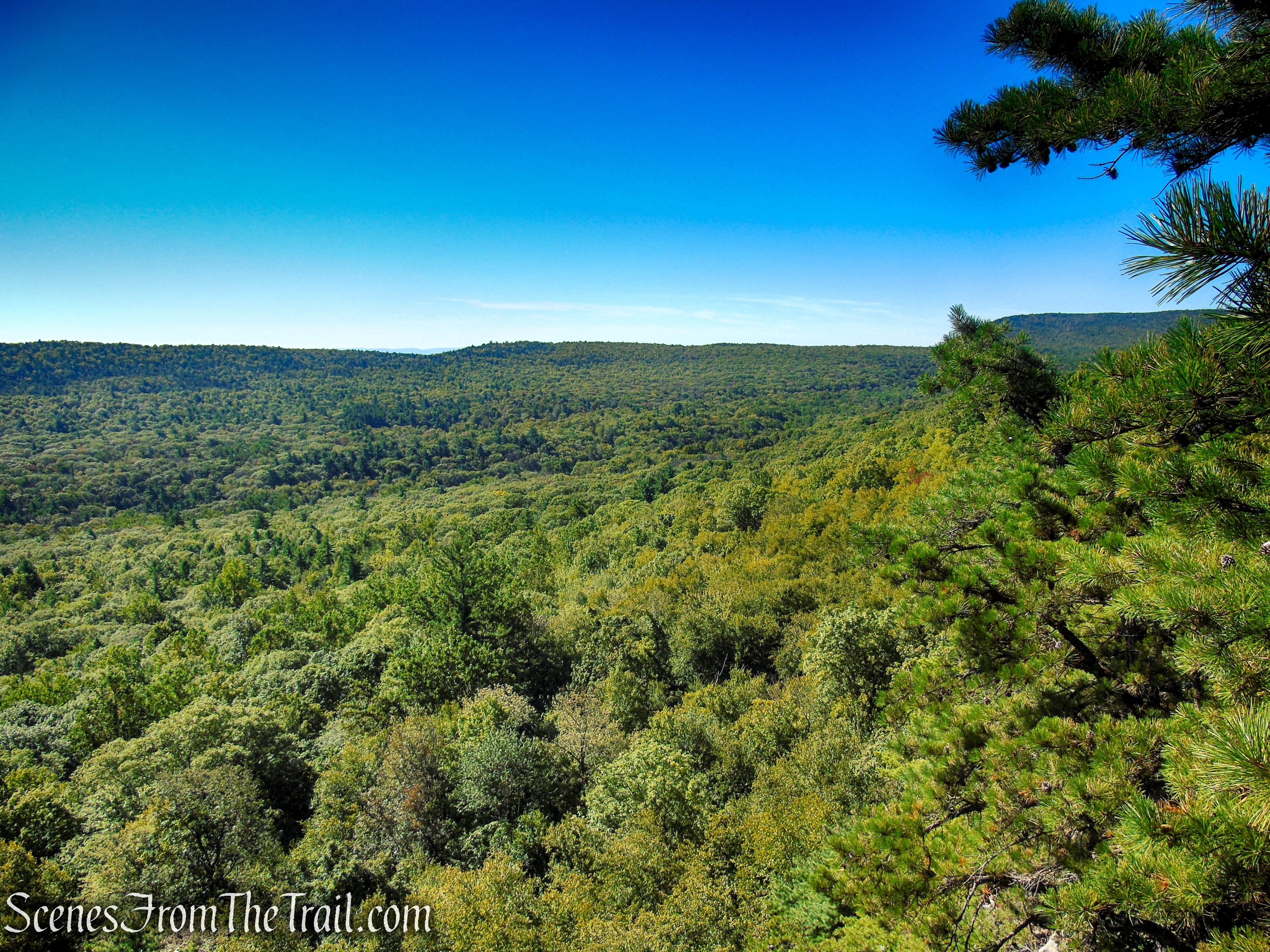
Once on the ridge, the trail follows the edge of the Dickie Barre cliffs and views open up of the surrounding area.
Lost City Escarpment Trail – Mohonk Preserve
Lost City Escarpment Trail – Mohonk Preserve
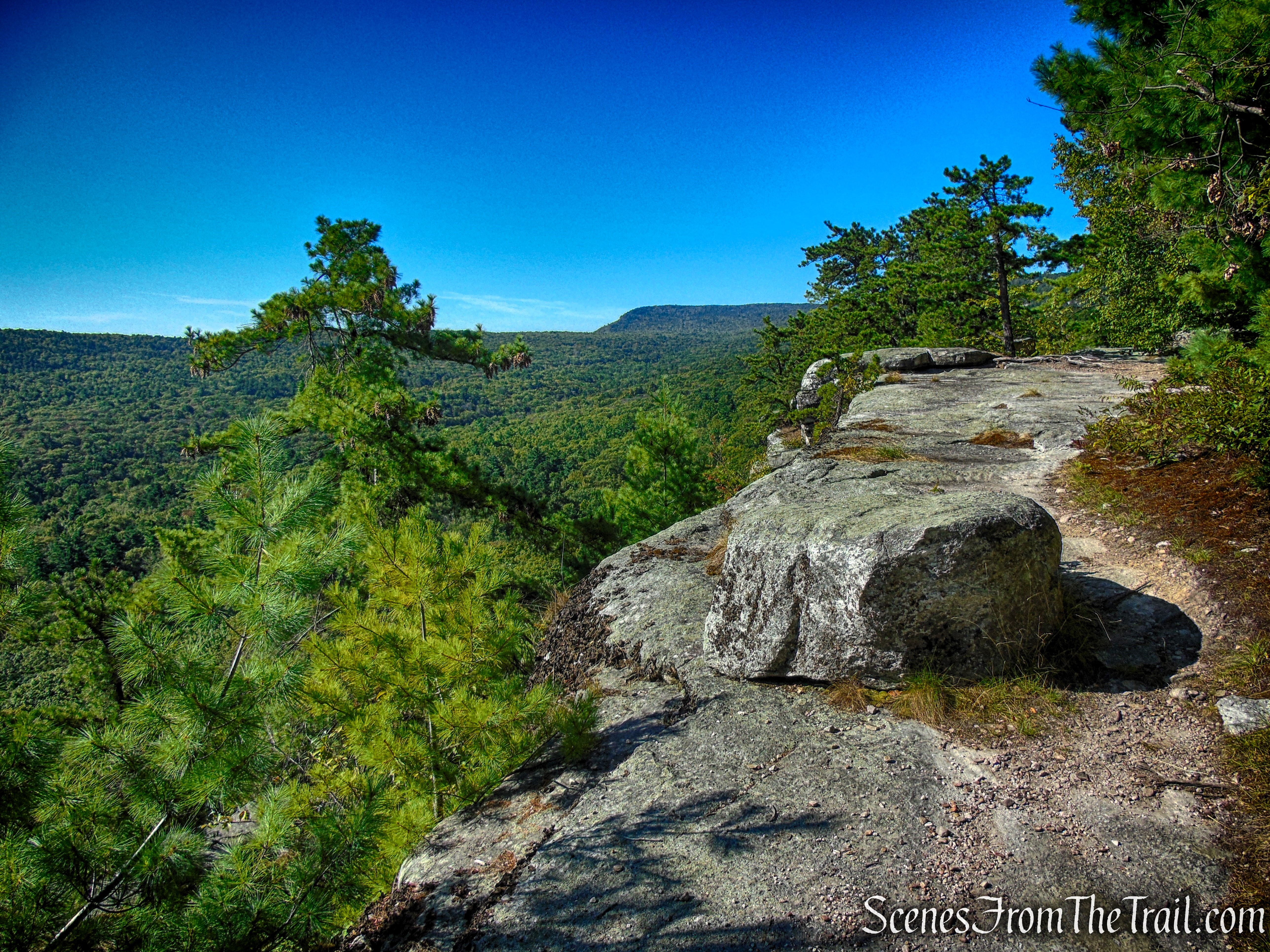
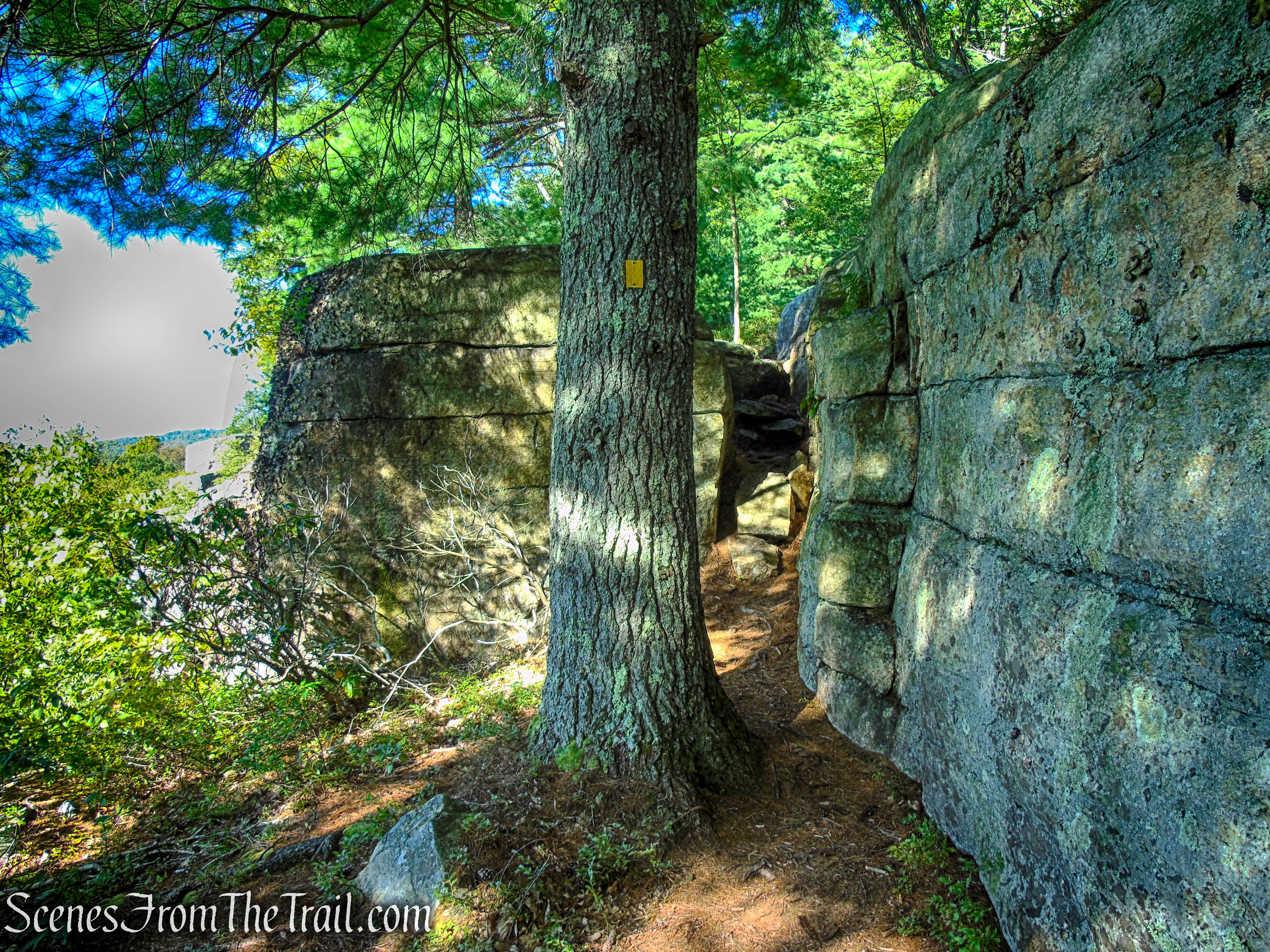
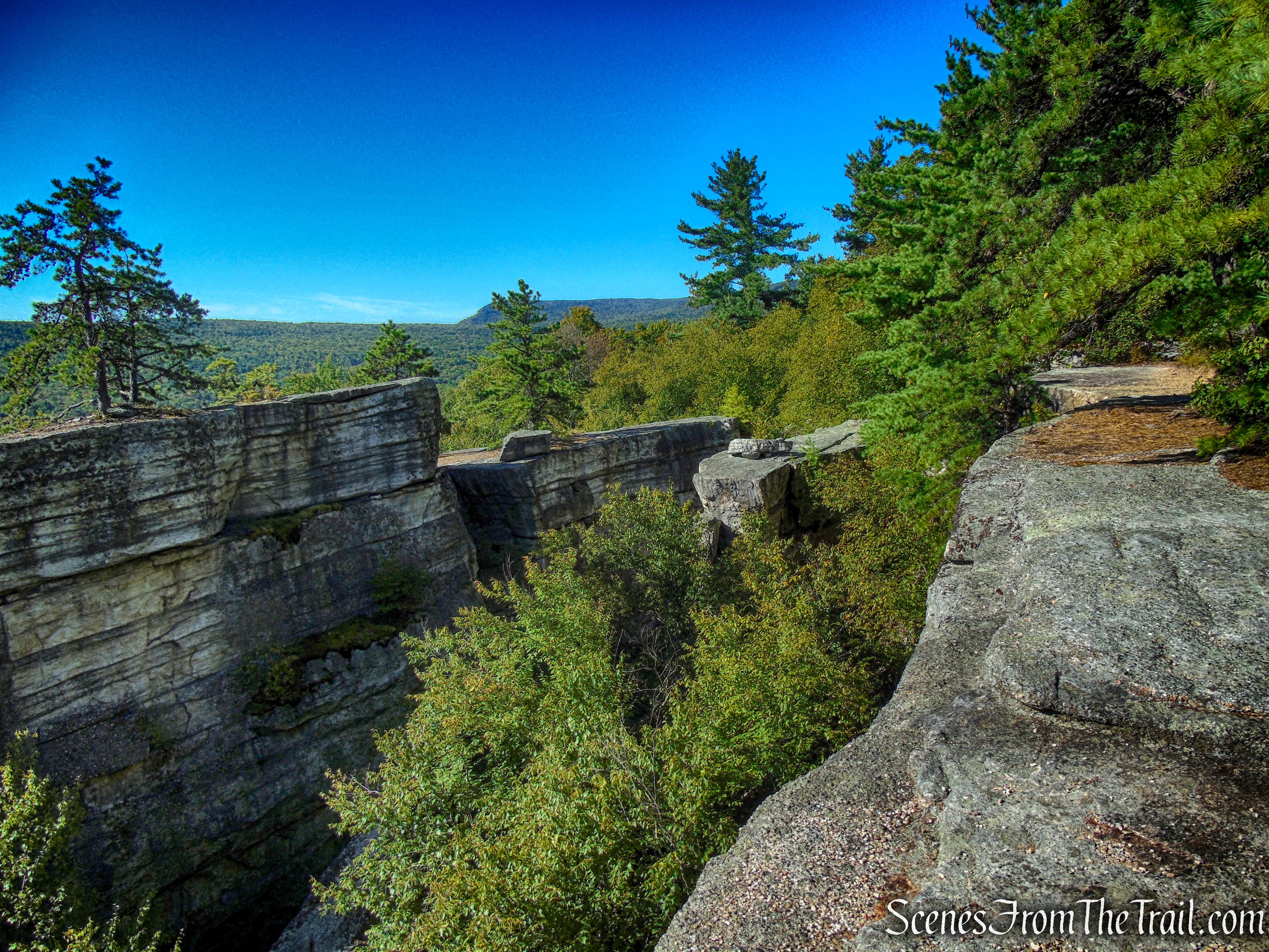
As the trail heads in a westerly direction, it comes extremely close to the edge of the cliffs. Extreme caution should be excercised. You will have a good vantage point of the Lost City below as you walk the trail.
Lost City Escarpment Trail – Mohonk Preserve
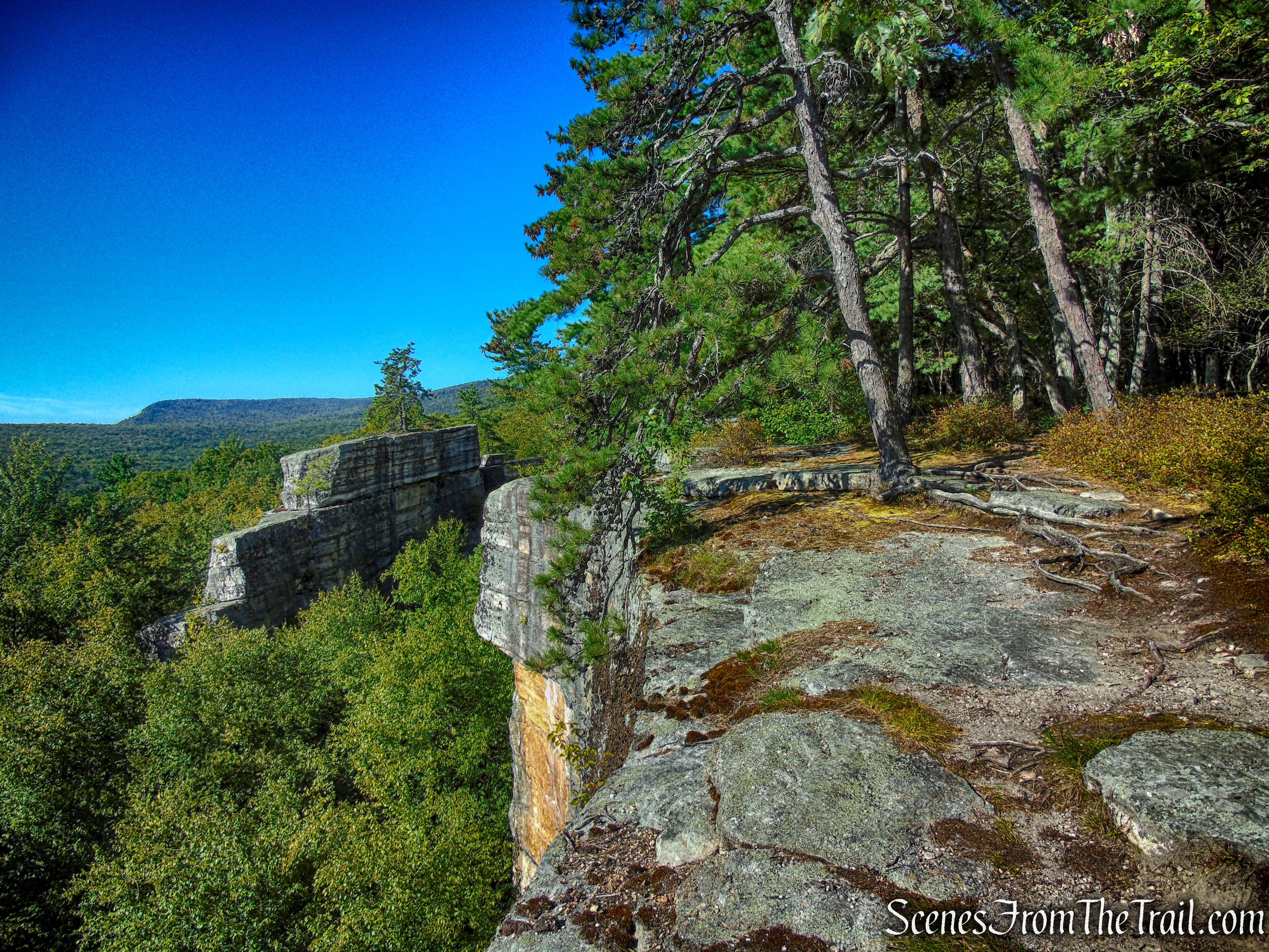
Lost City Escarpment Trail – Mohonk Preserve
Lost City Escarpment Trail – Mohonk Preserve
Lost City Escarpment Trail – Mohonk Preserve
Lost City Escarpment Trail – Mohonk Preserve
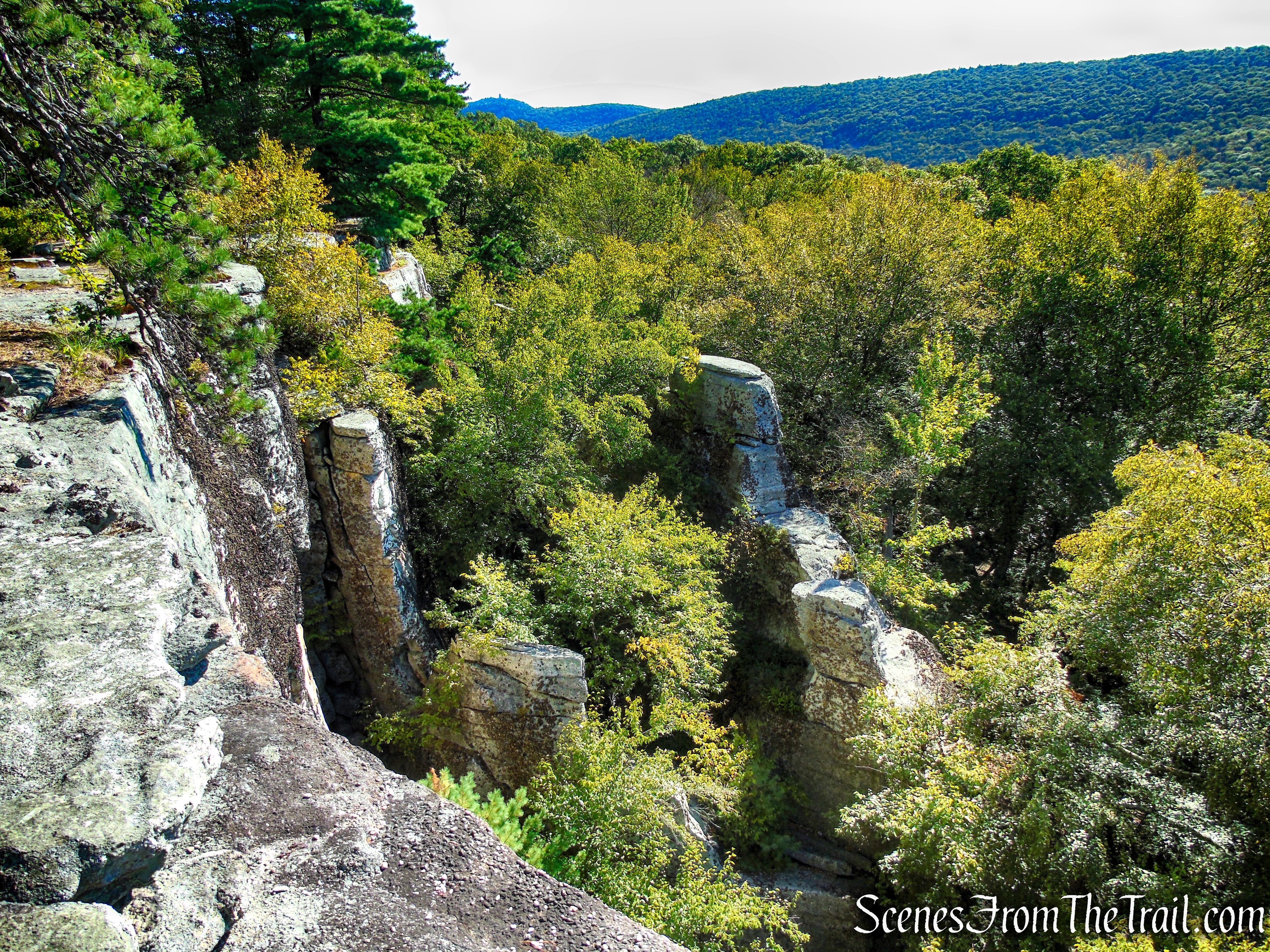
The trail alternately veers away from and returns to the cliff line, offering nearly continuous views.
Lost City Escarpment Trail – Mohonk Preserve
Lost City Escarpment Trail – Mohonk Preserve
Lost City Escarpment Trail – Mohonk Preserve
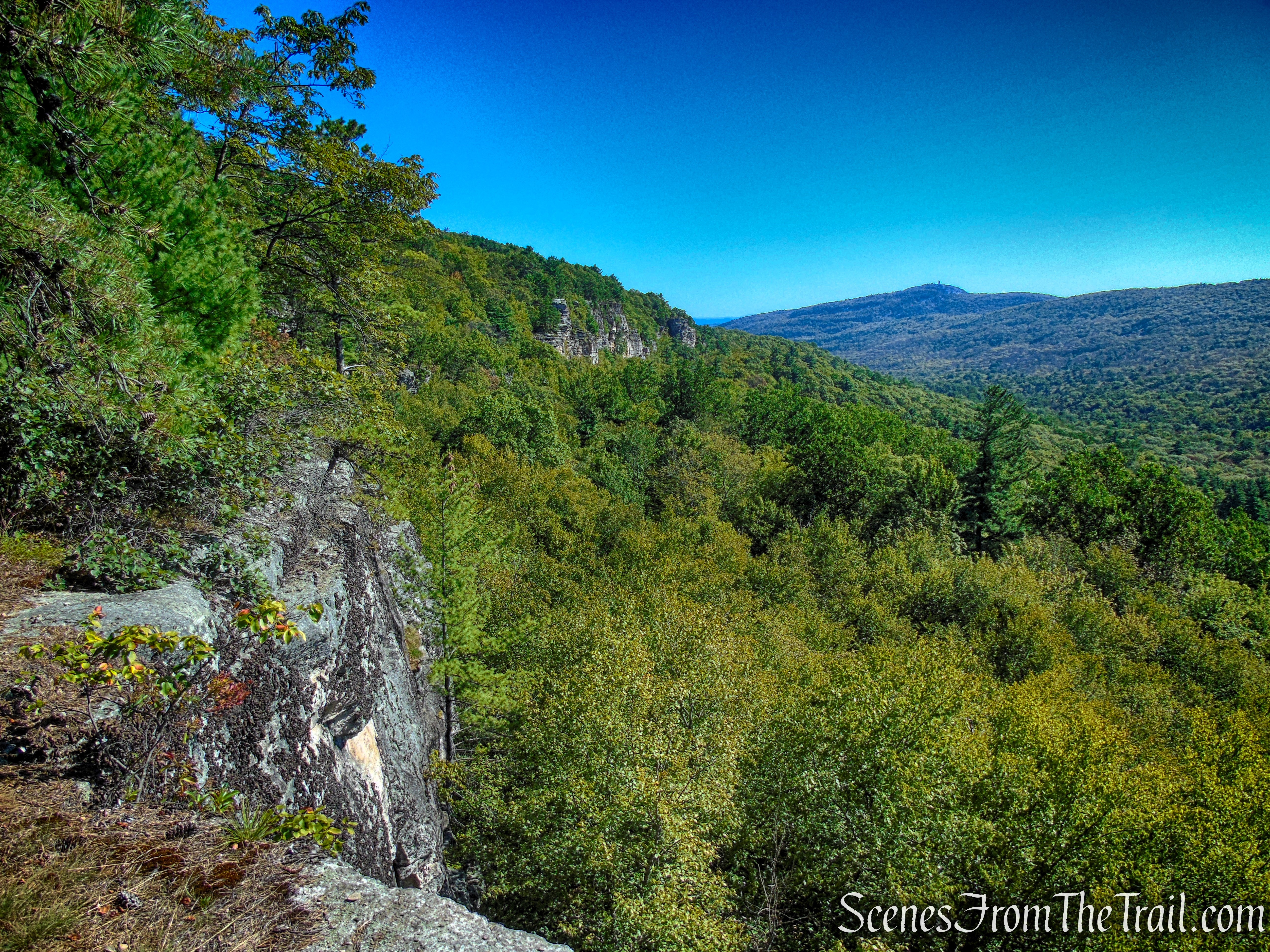
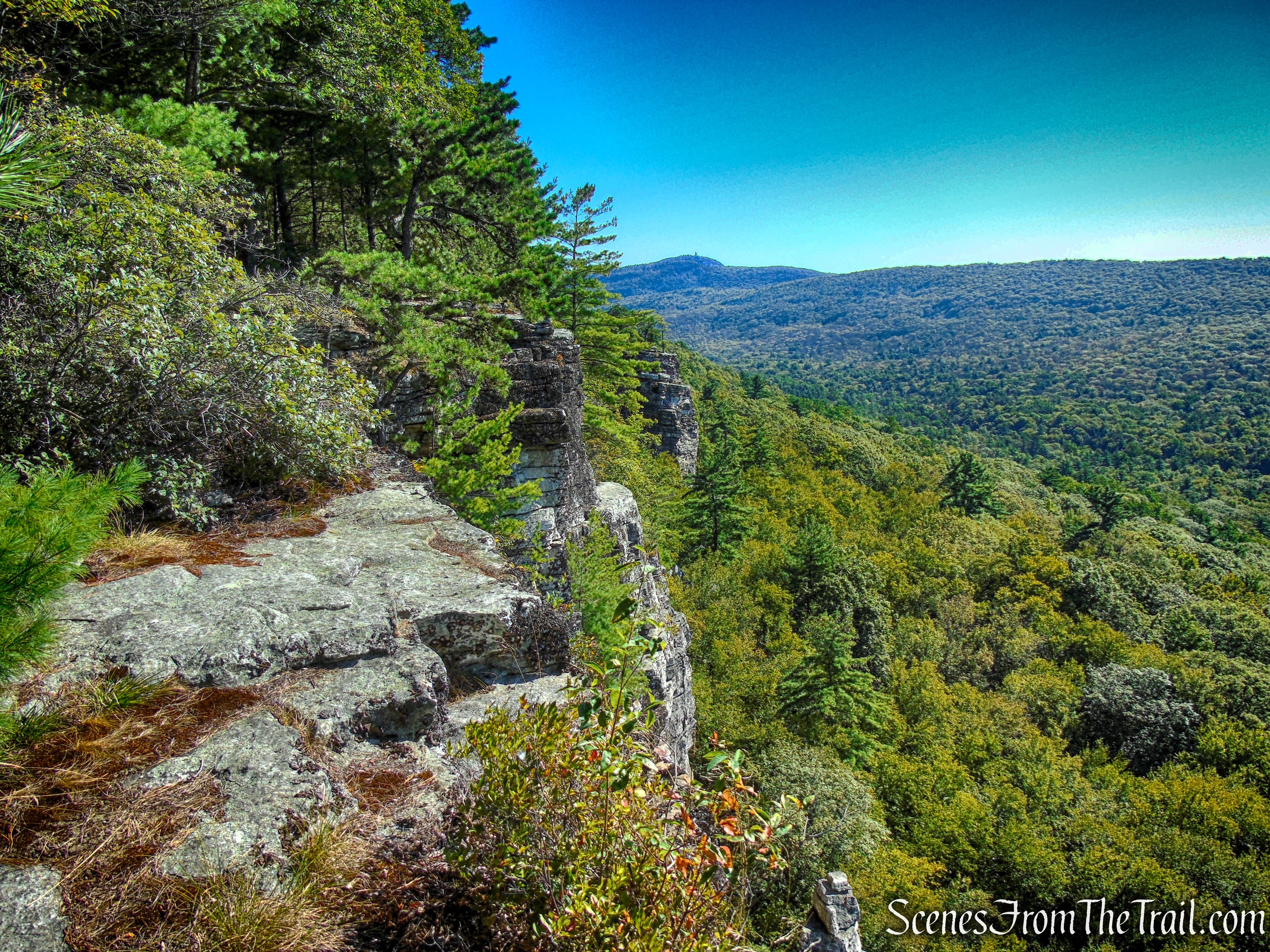
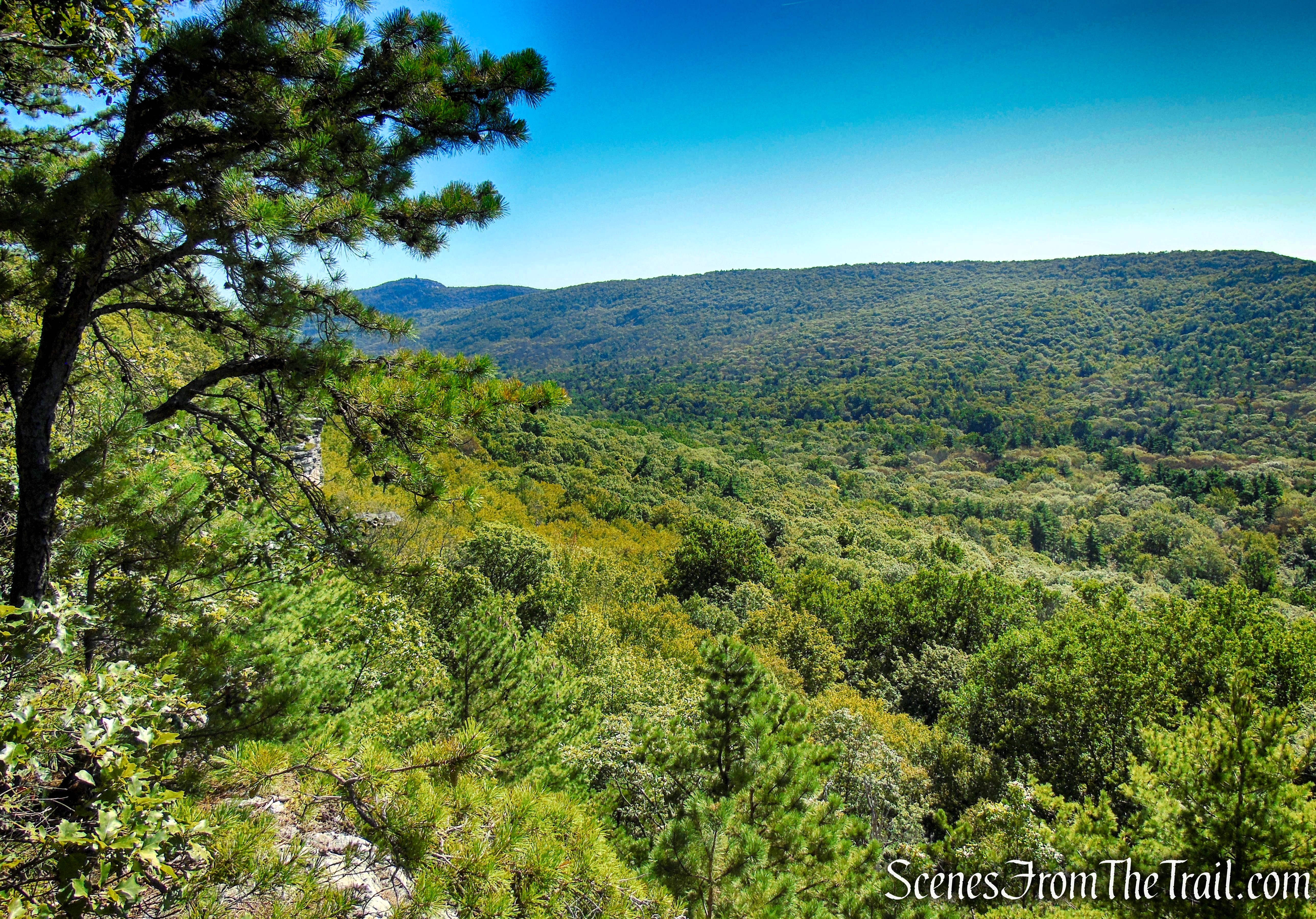
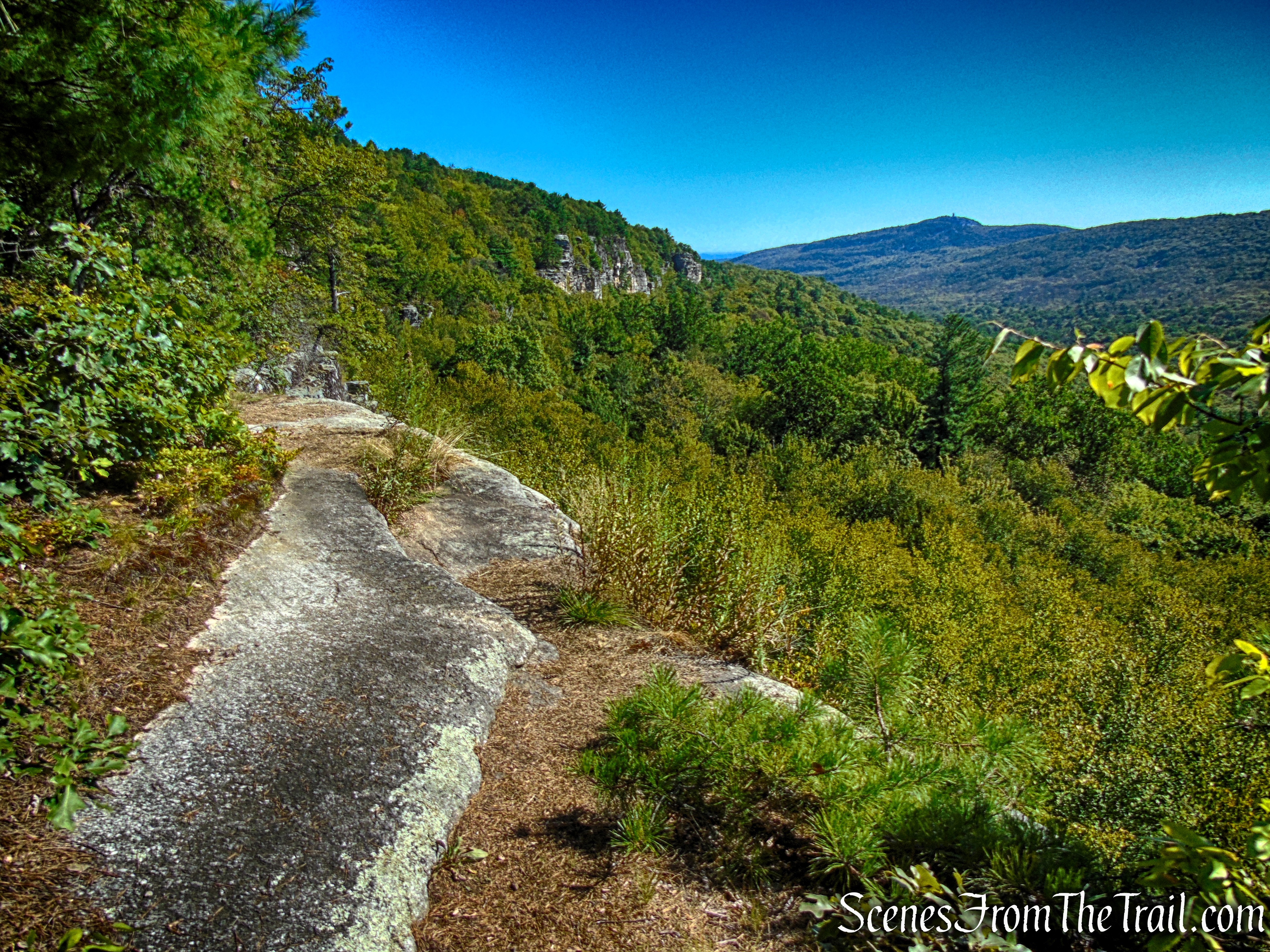
Looking south, to the left of the narrow notch is The Trapps and Millbrook Mountain is on the right. Through the notch, across the Walkill Valley, the Catskill Mountains are visible on a clear day.
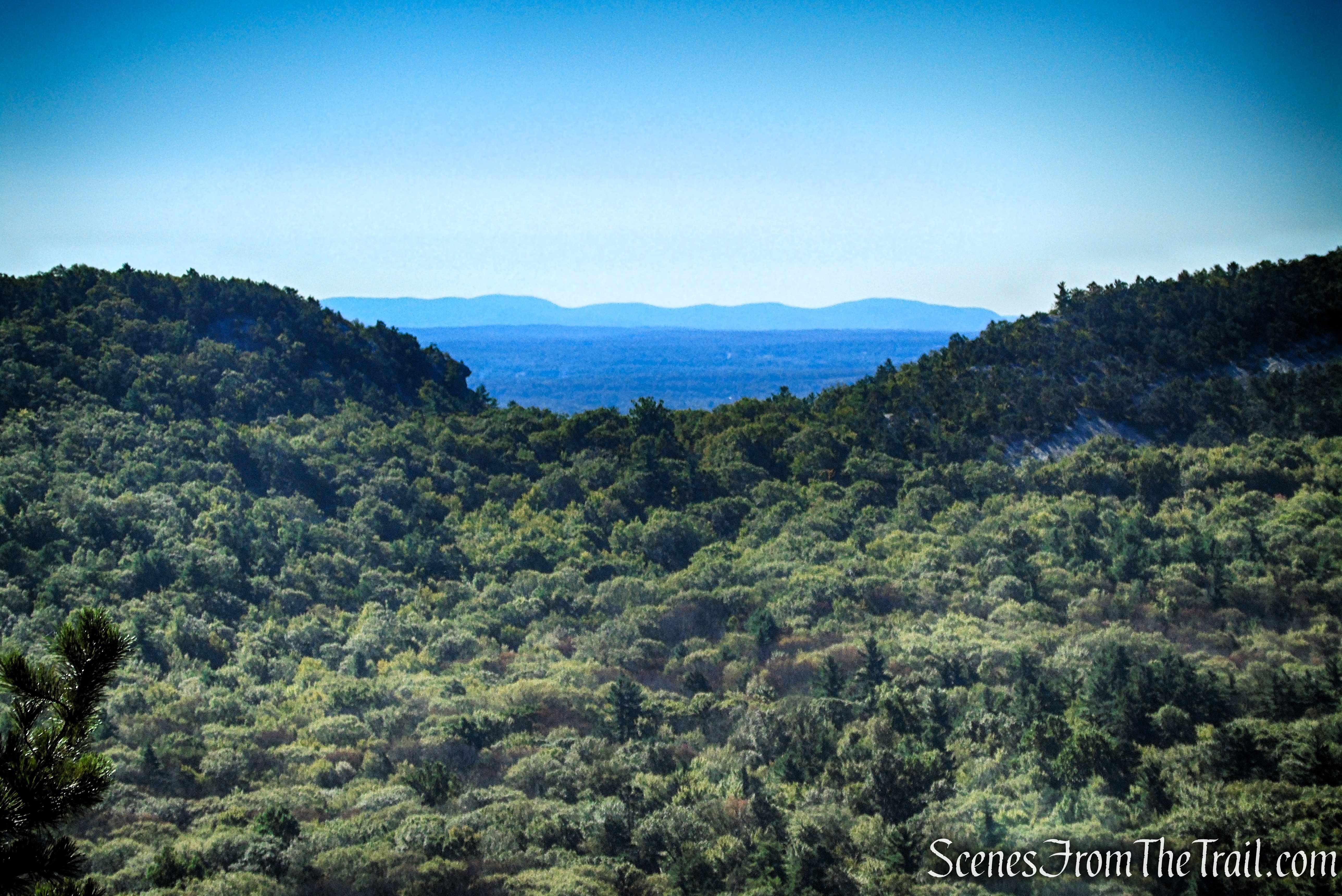
Lost City Escarpment Trail – Mohonk Preserve
Lost City Escarpment Trail – Mohonk Preserve
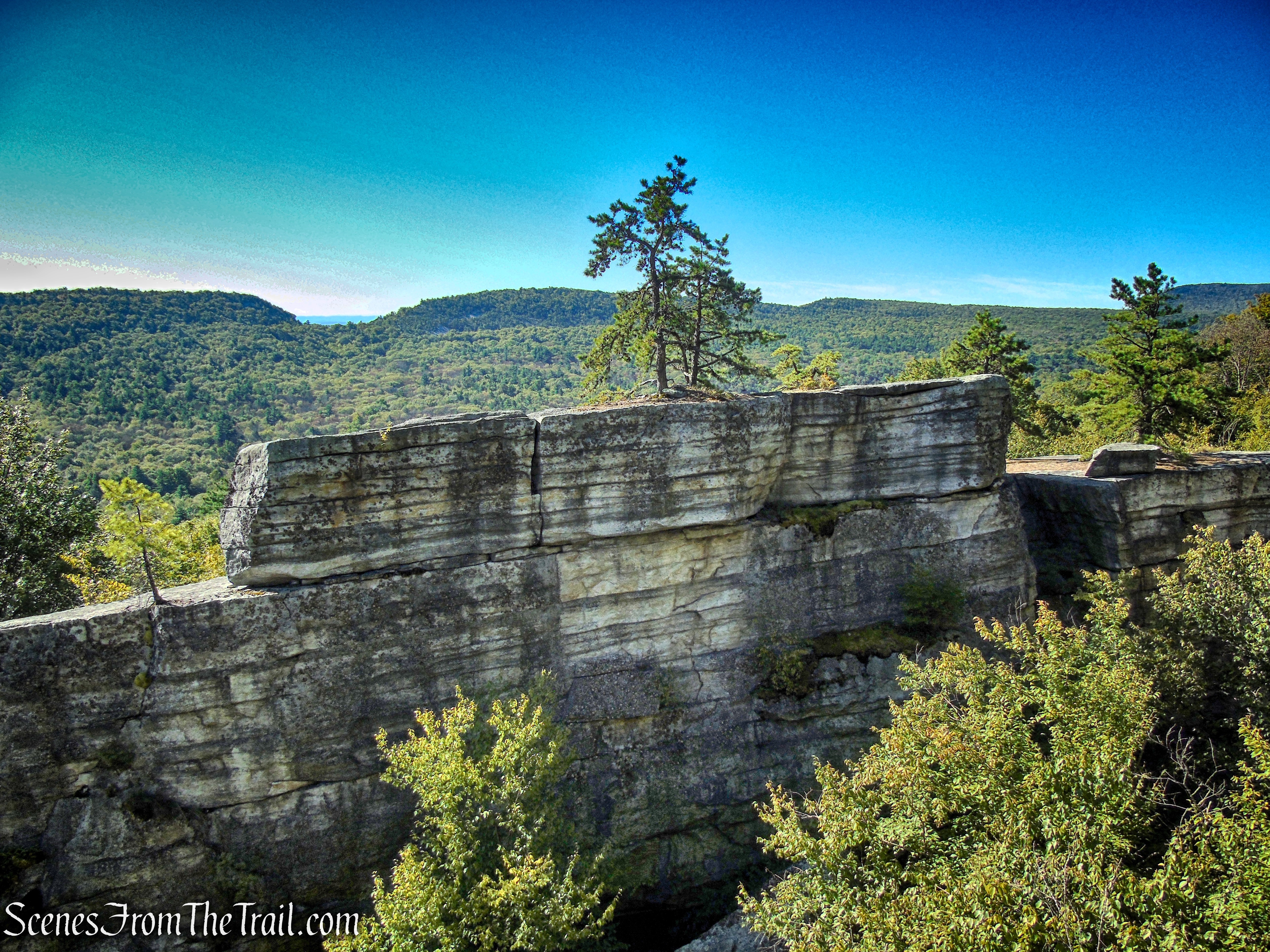
To the east, Skytop Tower sits at 1,253 feet above sea level, atop Mohonk Mountain.
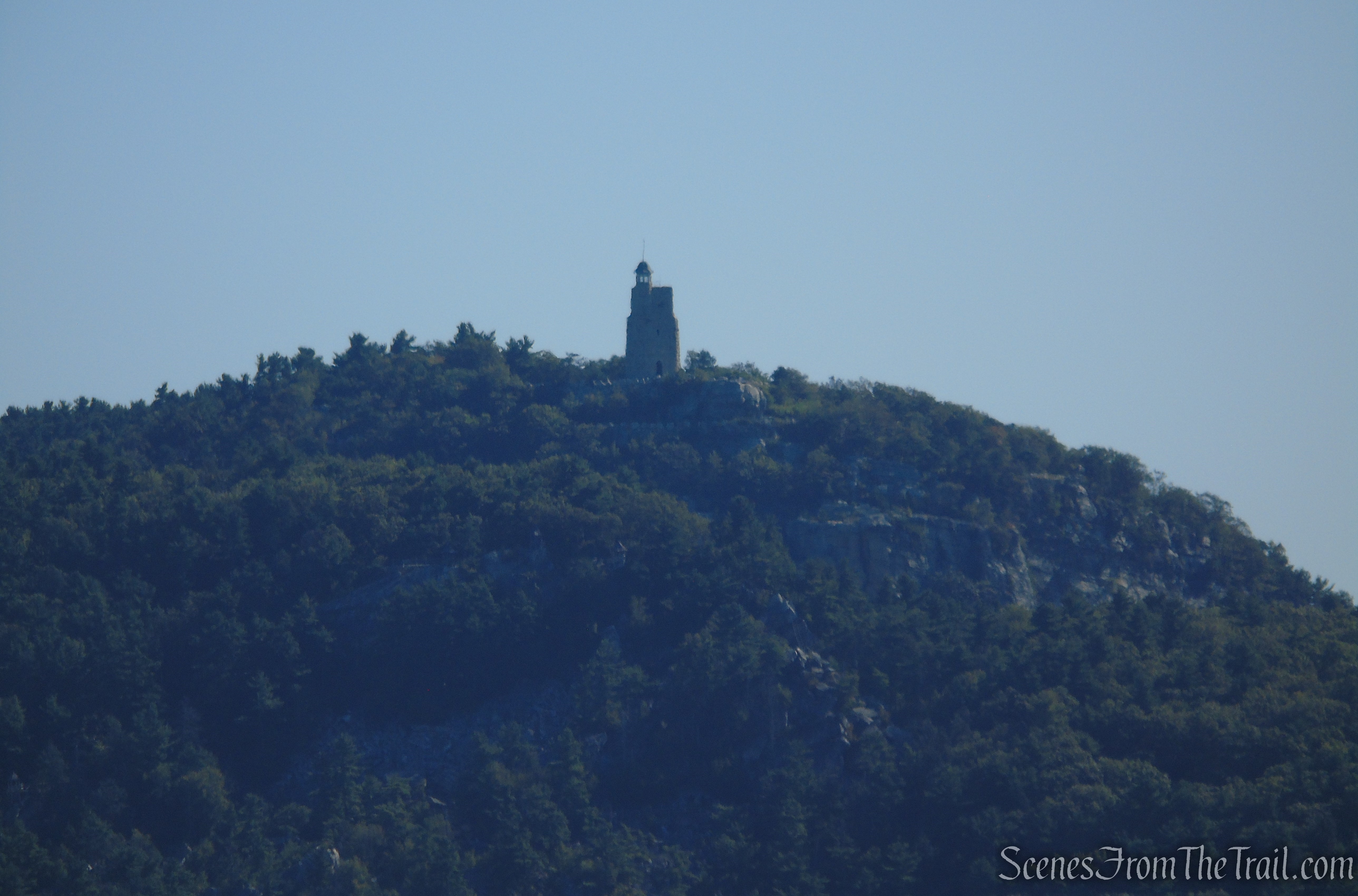
View of Skytop Tower atop Mohonk Mountain from Lost City Escarpment Trail
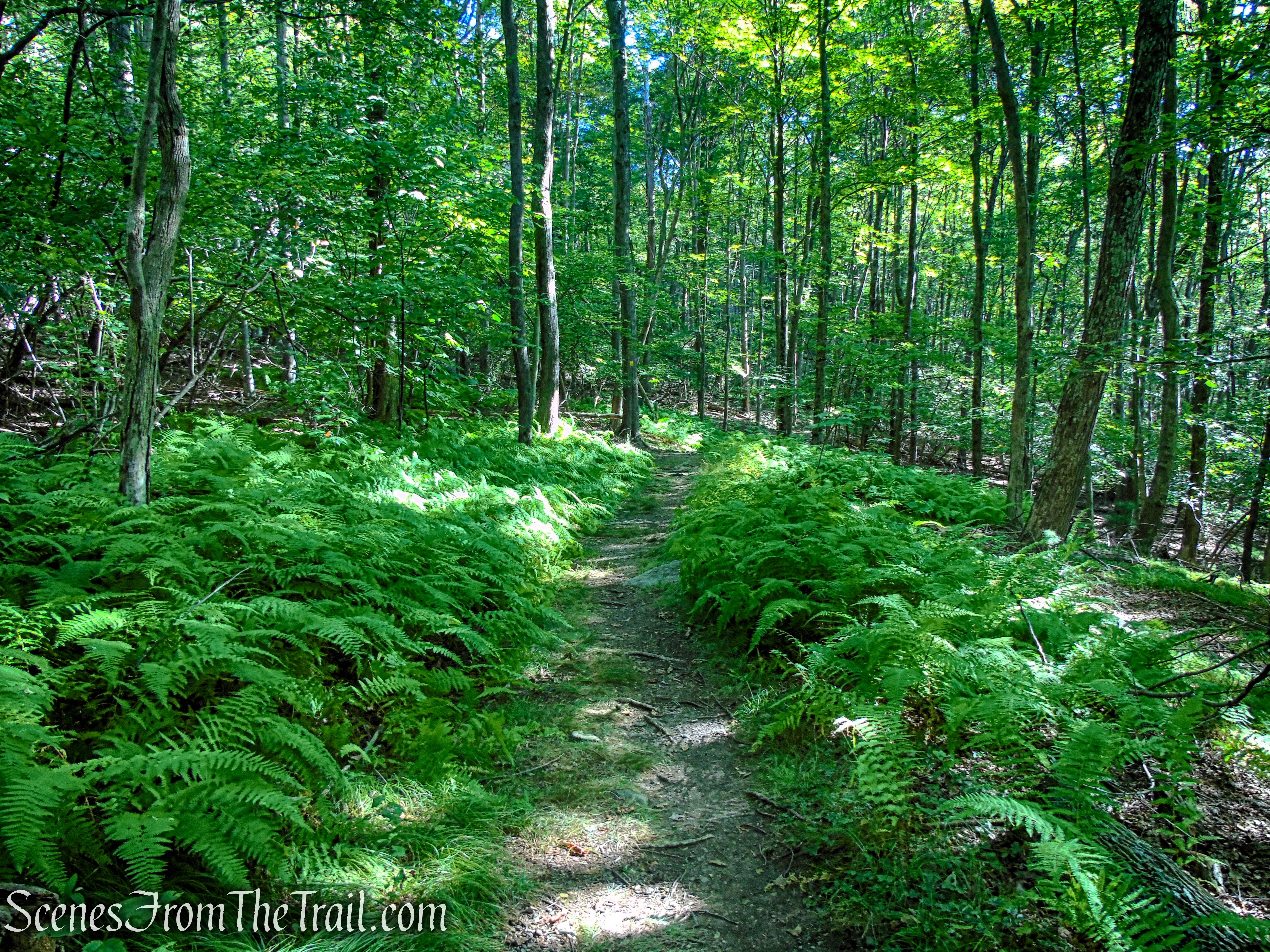
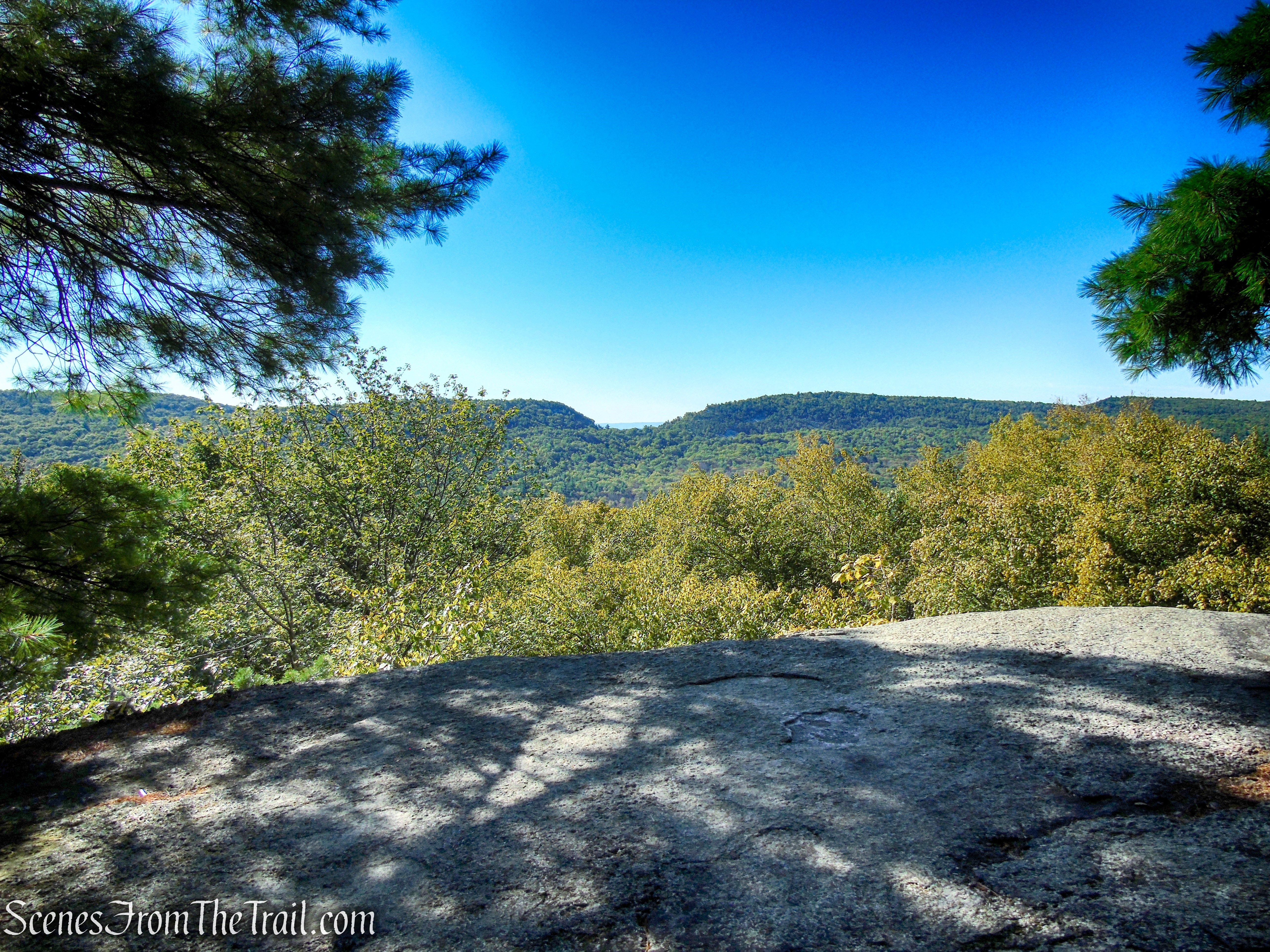
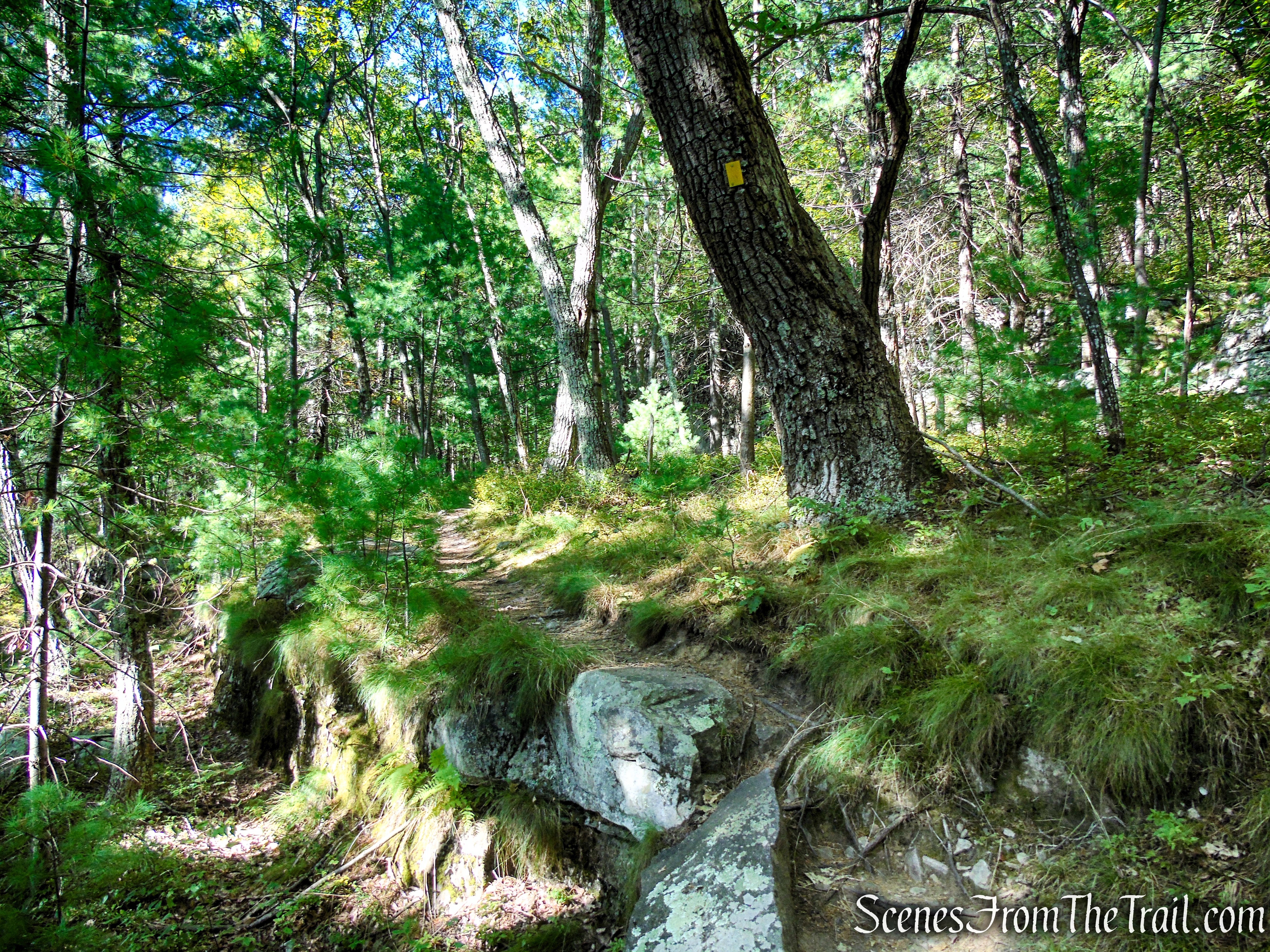
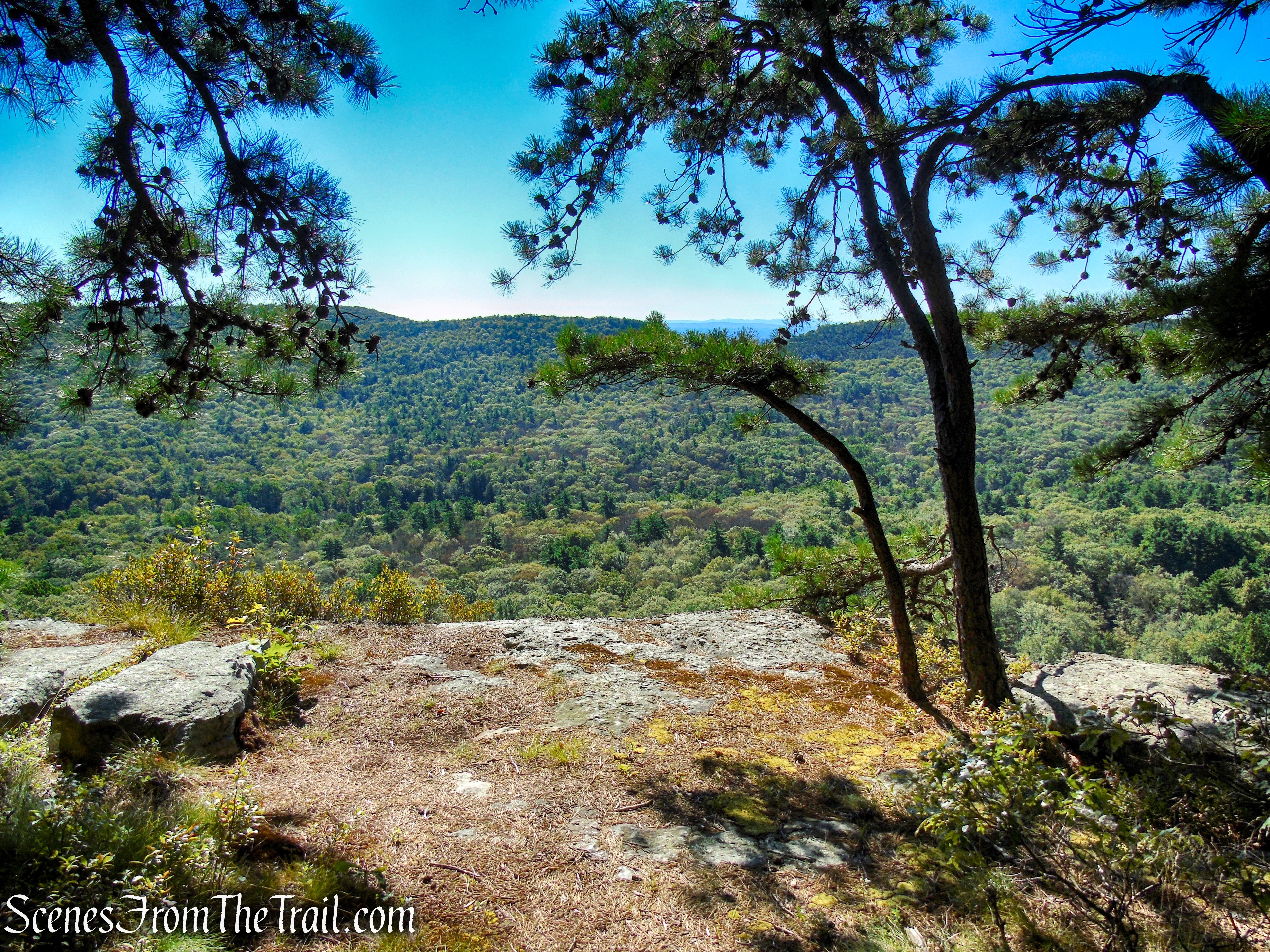
Continue heading west on the Lost City Escarpment Trail, enjoying the scenic ridge walk. At times you will encounter short spur paths that lead to views.
Lost City Escarpment Trail – Mohonk Preserve
Lost City Escarpment Trail – Mohonk Preserve
Lost City Escarpment Trail – Mohonk Preserve
Lost City Escarpment Trail – Mohonk Preserve
Lost City Escarpment Trail – Mohonk Preserve
Lost City Escarpment Trail – Mohonk Preserve
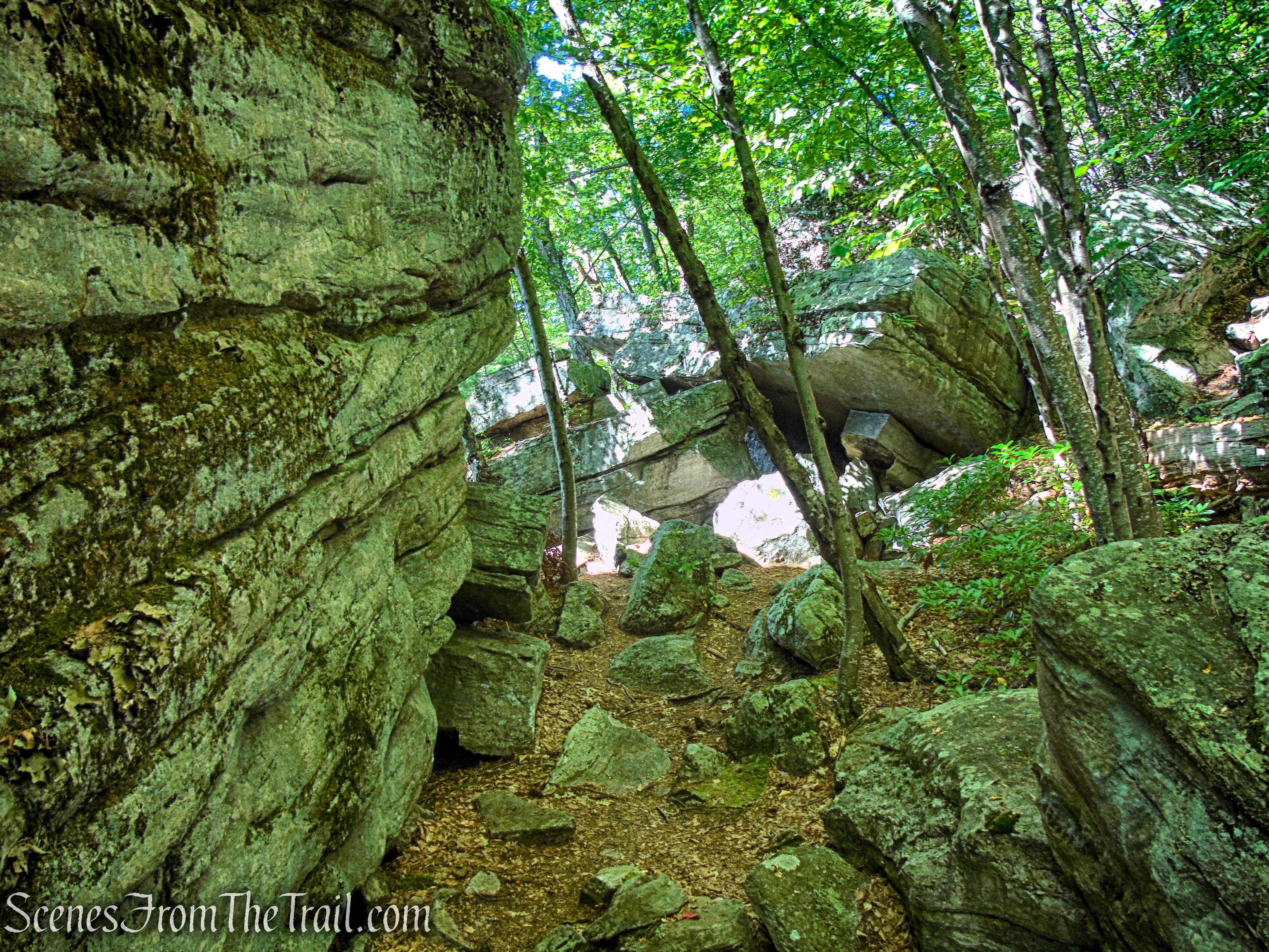
Here, you will have to crawl through. It is larger than it appears.
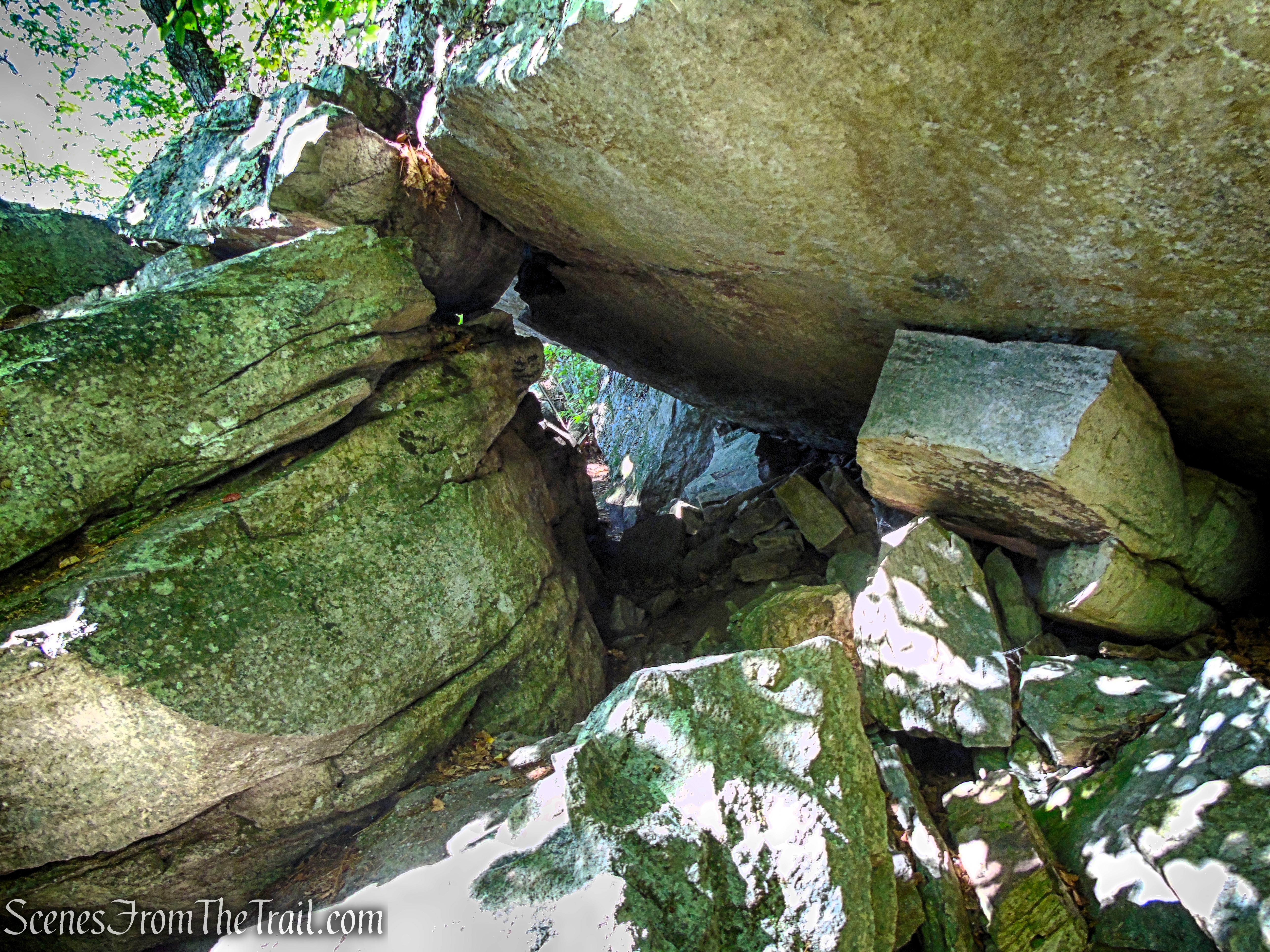
Lost City Escarpment Trail – Mohonk Preserve
Lost City Escarpment Trail – Mohonk Preserve
Lost City Escarpment Trail – Mohonk Preserve
Lost City Escarpment Trail – Mohonk Preserve
Lost City Escarpment Trail – Mohonk Preserve
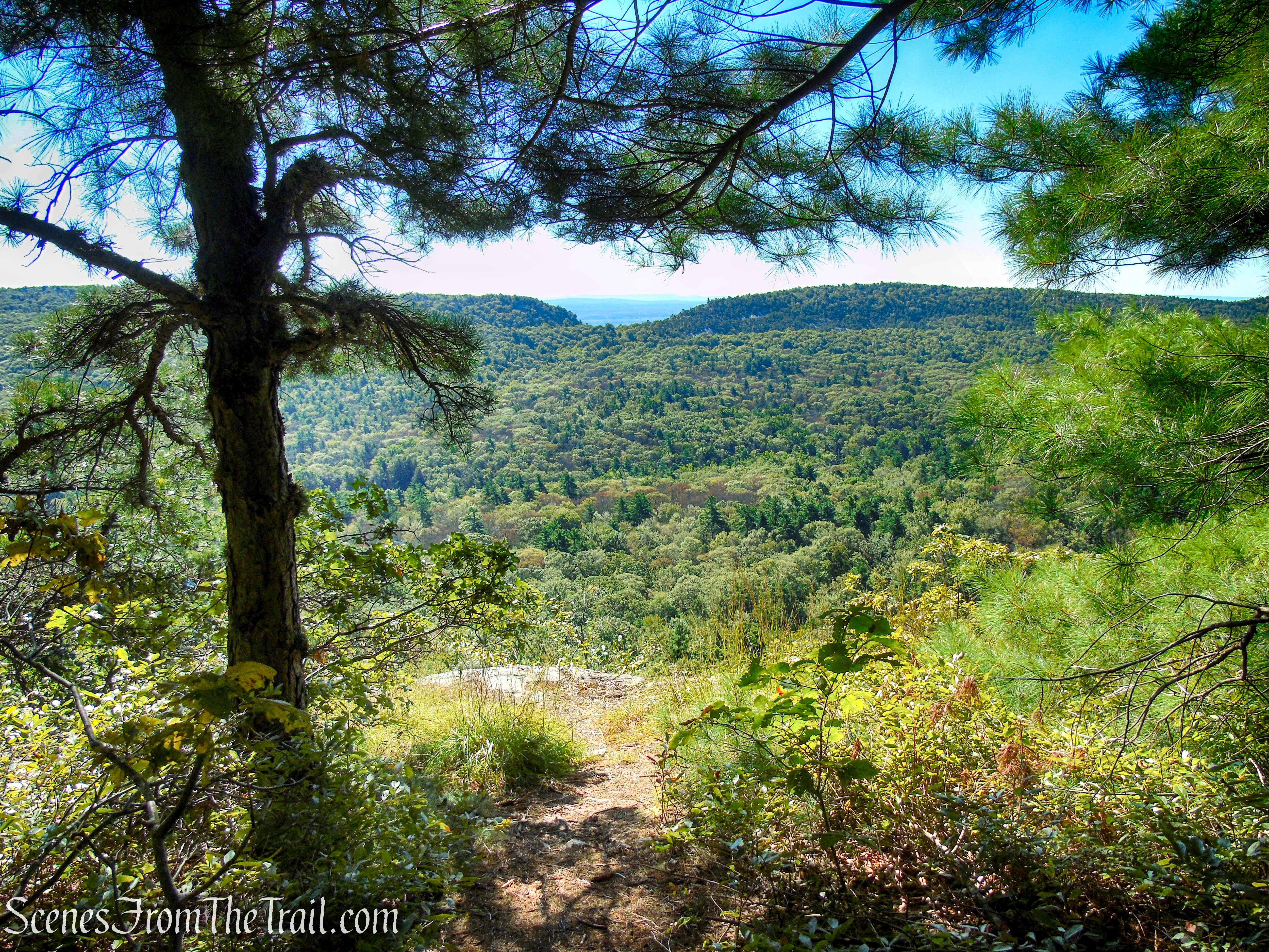
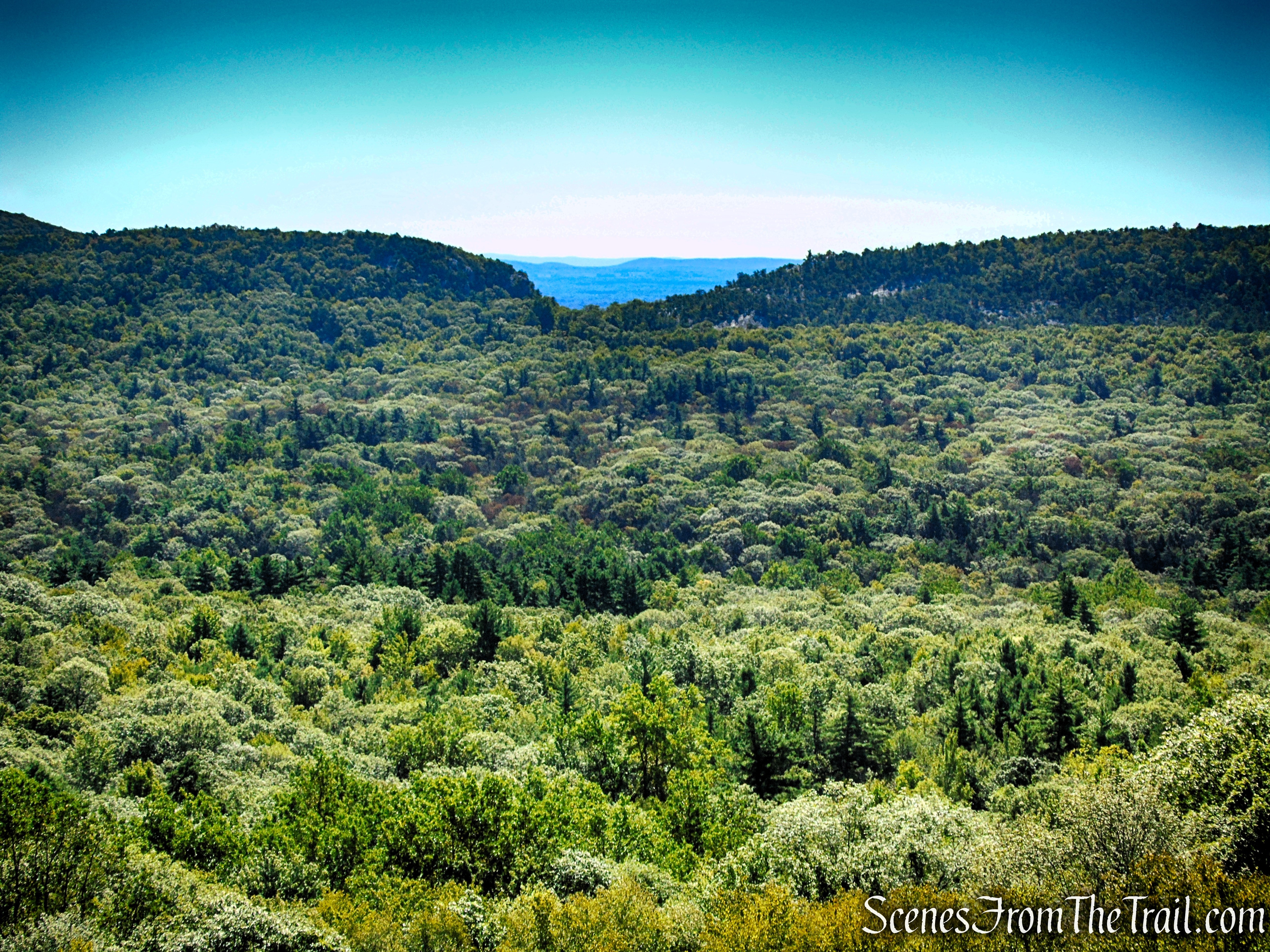
After about 3/4 of a mile of ridge walking, the Lost City Escarpment Trail enters Minnewaska State Park. Continue following the yellow blazes along the edge of the cliffs. A short distance later, the trail comes to a wide ranging viewpoint which makes a nice spot to take a break. You have now traveled about 1.4 miles.
Lost City Escarpment Trail – Mohonk Preserve
Lost City Escarpment Trail – Minnewaska State Park Preserve
Lost City Escarpment Trail – Minnewaska State Park Preserve
Lost City Escarpment Trail – Minnewaska State Park Preserve
The steep, vertical rock face of the Dickie Barre cliffs.
Lost City Escarpment Trail – Minnewaska State Park Preserve
Lost City Escarpment Trail – Minnewaska State Park Preserve
Lost City Escarpment Trail – Minnewaska State Park Preserve
Looking east. The highpoint, just right of center, is Mohonk Mountain with Skytop Tower at its summit.
Lost City Escarpment Trail – Minnewaska State Park Preserve
The Lost City Escarpment Trail ends at a T-intersection with the blue-blazed High Peters Kill Trail.
Lost City Escarpment Trail – Minnewaska State Park Preserve
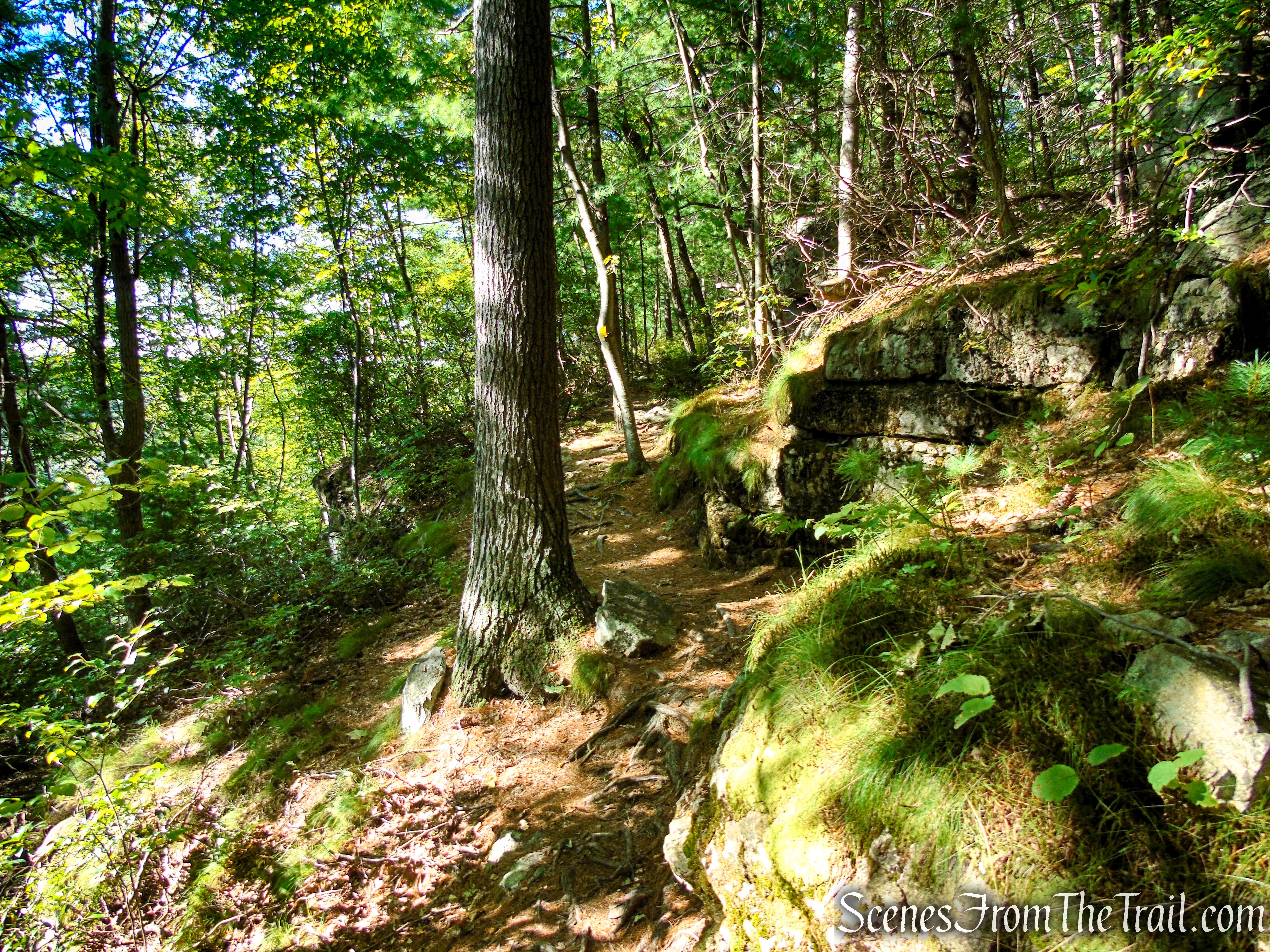
Turn left at the junction and follow the blue blazes as the trail descends steeply, passing large rock formations along the way.
High Peters Kill Trail – Minnewaska State Park Preserve
High Peters Kill Trail – Minnewaska State Park Preserve
High Peters Kill Trail – Minnewaska State Park Preserve
High Peters Kill Trail – Minnewaska State Park Preserve
High Peters Kill Trail – Minnewaska State Park Preserve
Soon, the High Peters Kill Trail re-enters Mohonk Preserve. Continue following the blue blazes as the trail continues to descend.
High Peters Kill Trail – Minnewaska State Park Preserve
High Peters Kill Trail – Mohonk Preserve
High Peters Kill Trail – Mohonk Preserve
After almost a 1/2 mile from where you began on the blue trail, you will pass the junction with King’s Lane. Bear right to continue on blue, now retracing your steps from the beginning of the hike, and returning back to the parking lot, where the hike began.
Review:
This is a really great hike in The Gunks. It’s one of the shorter loop hikes that can be done at Mohonk Preserve, but if you’re feeling ambitious, you can take anyone of the connesting trails to lengthen the hike. On most nice weekends, Mohonk is swarming with people, but we only saw a few hikers during our visit.
Pros:
Lost City, Dickie Barre cliffs, well marked trails, scenic landscape, scenic views.
Cons:
Parking lot fills up early.
Take a hike!
Lost City Loop – Mohonk Preserve
Sources:
