March 30, 2025 – Woodland Park, New Jersey
Difficulty: Easy
Length: Approximately 3.4 miles
Max elevation: 520 ft.– total elevation gain approximately 350 ft.
Route type: Circuit
Map: Garret Mountain Reservation Map
Trailhead parking: Barbour’s Pond Picnic Area, Woodland Park, NJ 07424
No fees for parking or hiking, just admission to Lambert Castle.
Overview:
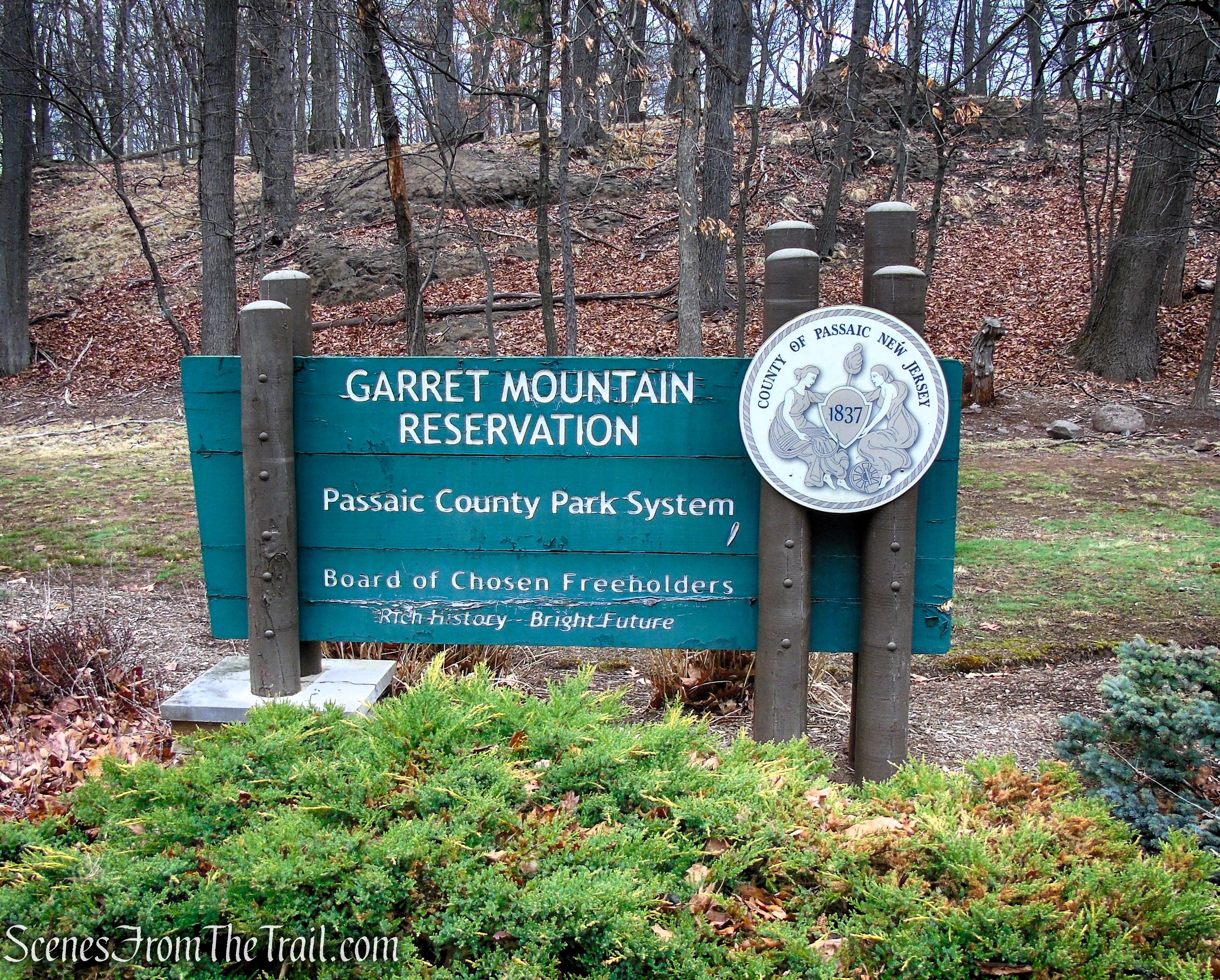
Garret Mountain Reservation is a 568-acre park located on First Watchung Mountain in Paterson and Woodland Park and extending into Clifton. Situated more than 500 feet above sea level, it provides sweeping views of northern New Jersey and the New York City skyline. Garret Mountain Reservation is easily one of Passaic County’s most frequented parks. The original landscape was designed by the famed Olmsted Brothers Firm.
Garret Mountain Reservation
This beautiful park, operated by the Passaic County Parks Department, the park includes an equestrian center, athletic fields, fishing, picnic grounds, jogging paths, and trails for cross country skiing, hiking and running.
Lambert Castle and Lambert Tower, two of Passaic County’s historic sites, are also located within Garret Mountain Reservation.

Lambert Castle

Lambert Tower – Garret Mountain Reservation
History:
The rocks themselves are over 190 million years old, part of lava flows that created the Watchung Mountains that run roughly north-south in northeastern New Jersey. You can see exposed basalt in many places with the marks of a glacier’s passing over the basalt, both smoothing it but also cutting grooves (striations) into the stone.

Yellow Trail – Garret Mountain Reservation
Before contact with Europeans, the native populations used the mountain (also known as Garret Rock) and traces of their lives can be found in artifacts and even drawings made on some rocky surfaces.
The Watchung Mountains were an important observation post for the Continental Army during the Revolutionary War. After the Civil War, two of Paterson’s mill owners purchased land atop the Mountain. Catholina Lambert purchased land on the northeast corner of the mountain and built Belle Vista as his showplace home, now known as Lambert Castle. Lambert Tower was also constructed atop the mountain. Southwest of the land owned by Lambert, the Barbour Flax Mill purchased a stream fed pond, and this pond was used for suppressing fires at its mills on Grand and Spruce Streets. This pond became a place to cut ice as well as a swimming pond for locals.

Barbour’s Pond
By the mid 1920’s Lambert’s property passed to Passaic County and plans were made for a park. By the 1930’s, Barbour’s Pond was also taken over by Passaic County. The combined properties became Garret Mountain Reservation and the land became the location for relief projects for Works Progress Administration (WPA).

Historical Marker – Garret Mountain Reservation
Garret Mountain Reservation was designed by the Olmsted Brothers, the landscape architecture firm carried on the work of Frederick Law Olmsted who designed Central Park in New York.
Garret Mountain Reservation opened to the public in 1931.
In 1967, Garret Mountain was designated a National Natural Landmark.
Parking and restrooms:
There are at least a half dozen parking areas from you to choose from. All the parking areas provide access to the Yellow Trail. For this particular hike, we parked at the Pat Di Ianni Boathouse aka Barbour’s Pond Picnic Area.

Barbour’s Pond Picnic Area
The parking lot is sizable and can fit a number of vehicles.

Barbour’s Pond Picnic Area
There are comfort stations throughout the park that are open in season. Portable toilets are provided in the parking areas for use during the off season.
Trails Overview:
The Yellow Trail circles around the outer perimeter of Garret Mountain Reservation, and offers several panoramic overlooks. The New York City skyline can be seen from several overlooks along the Yellow Trail on a clear day. This trail is very well marked with yellow blazes.
The White Trail traverses the center of the park and connects at both ends with the Yellow Trail, making additional loop hikes possible. With the exception of the short sections where it overlaps the Yellow Trail, I did not hike this trail.
The Teal section of the paved Park Road is designated for joggers and walkers and loops around the park.

Garret Mountain Reservation Trail Map
Hike Overview:
I did this hike in 2018 and decided it was time for a return visit. Unfortunately, it was quite foggy and overcast on the day of this hike, so the views were very limited. Things have changed within the park, with significant improvements added since I was last here.
This hike was done counterclockwise from the Barbour’s Pond Picnic Area. With the exception of a slight detour at the “Auto Overlook,” the entirety of this hike takes place on the Yellow Trail. This trail is well marked and easy to follow.

Yellow Trail Loop – Garret Mountain Reservation
There are numerous ups and downs on this hike, but all relatively short.

Elevation profile – Yellow Trail Loop
The Hike:
From the parking area, follow the paved path downhill towards the southern end of Barbour’s Pond and turn left onto another wide paved path. Continue south along the paved path, passing to the left of the Pat Di Ianni Boathouse. Once behind the boathouse, turn left on the gravel path which is the route of the Yellow Trail, which comes in from the right.

Barbour’s Pond Picnic Area

Pat Di Ianni Boathouse

Yellow Trail – Garret Mountain Reservation

Yellow Trail – Garret Mountain Reservation
After paralleling a stream on the right, the trail turns left, away from the stream and begins to climb, passing some cliffs on the right. As the trail nears private homes, it climbs slightly, turns left and crosses a small field. The trail then turns sharply to the right, descends the hill, turns left and crosses Park Road.

Yellow Trail – Garret Mountain Reservation

Yellow Trail – Garret Mountain Reservation

Yellow Trail – Garret Mountain Reservation

Yellow Trail – Garret Mountain Reservation

Yellow Trail – Garret Mountain Reservation

Yellow Trail – Garret Mountain Reservation

Yellow Trail – Garret Mountain Reservation
The trail now runs along a wide gravel road, and in a short distance, the Yellow Trail reaches a junction with the start of the White Trail, which begins straight ahead. TURN RIGHT on the wide gravel road and continue following the yellow blazes.

Yellow Trail – Garret Mountain Reservation

Yellow Trail – Garret Mountain Reservation
In about 250 feet, the gravel road bears left as the Yellow Trail continues straight ahead, climbing an embankment and crossing the paved Park Road again. The Yellow Trail turns right at the entrance to the Garret Mountain Equestrian Center and runs along the road near the edge of the woods.

Yellow Trail – Garret Mountain Reservation

Yellow Trail – Garret Mountain Reservation

Yellow Trail – Garret Mountain Reservation

Yellow Trail – Garret Mountain Reservation
Just before reaching the park boundary, the yellow blazes turn left, away from the road and ascend into the woods on a footpath. With the access road to the stables visible ahead, the trail bears right and passes between abandoned concrete tank supports.

Yellow Trail – Garret Mountain Reservation

Yellow Trail – Garret Mountain Reservation

Yellow Trail – Garret Mountain Reservation
The Yellow Trail climbs slightly, then descends and turns left and enters the parking area for the Passaic County Mounted Patrol Squad. Here, the trail turns right and begins to run along the ridge of Garret Mountain, with the stables to the left. At the end of the stables, the trail bears left then turns right, continuing along the ridge.

Yellow Trail – Garret Mountain Reservation

Yellow Trail – Garret Mountain Reservation

Yellow Trail – Garret Mountain Reservation

Yellow Trail – Garret Mountain Reservation

Yellow Trail – Garret Mountain Reservation

Yellow Trail – Garret Mountain Reservation

Yellow Trail – Garret Mountain Reservation

Yellow Trail – Garret Mountain Reservation

Yellow Trail – Garret Mountain Reservation

Yellow Trail – Garret Mountain Reservation
A Deer carcass near the edge of the cliffs alongside the Yellow Trail.

Deer carcass – Garret Mountain Reservation
A short distance beyond the stables, the Yellow Trail reaches a viewpoint to the east from the edge of the ridge. Clifton, as well as the southern part of Paterson, may be seen directly below, with much of southern Bergen County beyond and the Manhattan skyline visible (on a clear day) in the distance.

Yellow Trail – Garret Mountain Reservation

Yellow Trail – Garret Mountain Reservation
The trail continues north along the ridge, passing several more viewpoints.

Yellow Trail – Garret Mountain Reservation

Yellow Trail – Garret Mountain Reservation

Yellow Trail – Garret Mountain Reservation

Yellow Trail – Garret Mountain Reservation
A short distance later, Lambert Tower comes into view.

Lambert Tower – Garret Mountain Reservation
Lambert Tower, a 70 foot stone observation tower, was constructed in 1896 by Catholina Lambert. The tower was built on the crest of the cliffs above Lambert Castle, which is visible through the trees below.

Lambert Tower – Garret Mountain Reservation
The grounds around the tower and along the 150-foot sheer cliffs are open to visitors of the Garret Mountain Reservation. Lambert Tower was undergoing renovations and not accessible at the time of this hike.

Lambert Tower – Garret Mountain Reservation

Lambert Tower – Garret Mountain Reservation
The tower was not open on the day we visited, but the Passaic County Parks website states: It offers stunning views of the area from Bear Mountain NY, to Northern New Jersey, the George Washington Bridge and the New York City skyline all the way to the Verrazano Narrows Bridge and beyond to Sandy Hook, NJ.
Lambert Tower – Garret Mountain Reservation
The Yellow Trail passes to the right of the tower along a stone wall, but on this day we had to walk around the fenced off construction site and walk between the fence and the wall. Just past the tower, the Morris Canal Greenway Trail (marked with canal-boat-logo-on-yellow blazes) joins. Continue to follow both the yellow and the Greenway logo blazes. The crushed stone path at a break in the stone wall leads downhill to Lambert Castle.

Yellow Trail – Garret Mountain Reservation

Yellow Trail – Garret Mountain Reservation

Yellow Trail – Garret Mountain Reservation
After curving to the right, the trail descends on a rocky path and stone steps, and it briefly parallels the paved park road. About 0.2 mile from the tower, a side trail to the right leads to another expansive viewpoint to the east from the edge of a cliff (we bypassed this since there were no views on this day).

Yellow Trail – Garret Mountain Reservation

Yellow Trail – Garret Mountain Reservation
The trail soon passes a small gravel parking area on the left, follows a footpath into the woods, then emerges onto a grassy field and follows along its right side. A new playground and gazebo are just to the left.

Yellow Trail – Garret Mountain Reservation

Yellow Trail – Garret Mountain Reservation
At the end of the field, the Yellow Trail, together with the Greenway Trail, descend on a footpath to the entrance of the Auto Overlook.

Yellow Trail – Garret Mountain Reservation
Here, the White Trail and the Greenway Trail leave to the right, as the Yellow Trail continues ahead. Turn right, leaving the Yellow Trail briefly towards the overlook. The overlook affords a panoramic view over downtown Paterson (directly below) and High Mountain to the north.

Yellow Trail – Garret Mountain Reservation

Auto Overlook – Garret Mountain Reservation

Auto Overlook – Garret Mountain Reservation

Auto Overlook – Garret Mountain Reservation

Auto Overlook – Garret Mountain Reservation
Follow the paved path as it curvers to the left towards Park Road and turn right, rejoining the Yellow Trail, which climbs along the road that leads to Veterans Memorial Point, the site of a communications tower.

Auto Overlook – Garret Mountain Reservation

Yellow Trail – Garret Mountain Reservation
Just to the left of the trail is a round stone platform called the “Crow’s Nest.”

Yellow Trail – Garret Mountain Reservation

Crow’s Nest – Garret Mountain Reservation
The Yellow Trail continues past the guard rail and turns left, but you may want to take a moment to check out the view from Crow’s Nest.

Yellow Trail – Garret Mountain Reservation

Crow’s Nest – Garret Mountain Reservation

Crow’s Nest – Garret Mountain Reservation

Crow’s Nest – Garret Mountain Reservation

Crow’s Nest – Garret Mountain Reservation
Lambert Tower in the distance.

Crow’s Nest – Garret Mountain Reservation
When you are ready to continue, retrace your steps to the guardrail barrier and turn left, rejoining the Yellow Trail as it descends into the woods. In about a quarter of a mile, after the White Trail comes in from the right and quickly leaves to the left, the Yellow Trail climbs over a small rise.

Yellow Trail – Garret Mountain Reservation

Yellow Trail – Garret Mountain Reservation

Yellow Trail – Garret Mountain Reservation

Yellow Trail – Garret Mountain Reservation

Yellow Trail – Garret Mountain Reservation

Yellow Trail – Garret Mountain Reservation
The trail then descends, first gradually, then more steeply on switchbacks. At the base of the descent, the trail turns right onto a path, then bears left and crosses the park entrance road. The Yellow Trail then bears right and runs between Mountain Park Road and the treeline.

Yellow Trail – Garret Mountain Reservation

Yellow Trail – Garret Mountain Reservation

Yellow Trail – Garret Mountain Reservation

Yellow Trail – Garret Mountain Reservation

Yellow Trail – Garret Mountain Reservation
The Yellow Trail soon crosses a footbridge and views of Barbour’s Pond begin to appear on the left. The trail continues along the west side of the pond, soon passing over the small cliffs overlooking the pond.

Yellow Trail – Garret Mountain Reservation

Yellow Trail – Garret Mountain Reservation

Yellow Trail – Garret Mountain Reservation

Yellow Trail – Garret Mountain Reservation

Barbour’s Pond – Garret Mountain Reservation

Barbour’s Pond – Garret Mountain Reservation

Barbour’s Pond – Garret Mountain Reservation

Yellow Trail – Garret Mountain Reservation

Barbour’s Pond – Garret Mountain Reservation
Yellow Trail – Garret Mountain Reservation

Yellow Trail – Garret Mountain Reservation

Barbour’s Pond – Garret Mountain Reservation

Barbour’s Pond – Garret Mountain Reservation
The Yellow Trail then joins a gravel road along a short stone wall, and a short distance later, reaches the south end of the pond.

Yellow Trail – Garret Mountain Reservation

Yellow Trail – Garret Mountain Reservation

Yellow Trail – Garret Mountain Reservation
After crossing another footbridge, the Yellow Trail bears right on a paved path towards the Pat Di Ianni Boathouse. Here, TURN LEFT and follow another paved path across the dam of the pond alongside a black fence, past another gazebo, then climb the stone steps, back to the parking lot, where the hike began.

Yellow Trail – Garret Mountain Reservation

Yellow Trail – Garret Mountain Reservation

Barbour’s Pond Picnic Area

Barbour’s Pond – Garret Mountain Reservation

Barbour’s Pond Picnic Area
While you are in the area, Lambert Castle is worth a visit. You can take the path down from Lambert Tower to the castle during the hike or you can stop by afterwards. The images below are from 2018.
Lambert Castle
“The Castle,” a well-known landmark in Northern New Jersey, is located on Garret Mountain overlooking the City of Paterson. Once a private residence, the building is fashioned after an English castle. Catholina Lambert, an English immigrant who made his fortune in the silk industry, built the Castle in 1892-93. He named it “Belle Vista.” Many prominent individuals of that era, including President McKinley, visited the Lambert family in their luxurious residence.

Lambert Castle
Lambert’s son, Walter, sold the Castle to the City of Paterson in 1925. The city used the building as a Tuberculosis Hospital for several years. In 1928, the title was transferred to the Passaic County Park Commission as part of Garret Mountain Reservation.

Lambert Castle
The New Jersey and National Registers of Historical Places awarded the Castle Landmark Designation in 1976.

Lambert Castle
Review:
A really nice hike even though there were no views due to the fog. The park’s scenic landscape provides a respite from urban life within a historic and well-maintained park. If you are looking for a backwoods experience, this is not the place. The trails are not far removed from civilization and the park can get crowded on warm days. There are plenty of other activities to enjoy in the park if hiking is not your thing. Garret Mountain Reservation is worth a visit to see and enjoy all it has to offer.
Pros:
Lambert Castle, stone observation tower, scenic views, lots of birds, pond. The trails were well maintained and easy to follow on the day of my visit.
Cons:
Lambert Tower was not open, can get crowded.
Take a hike!

Yellow Trail Loop – Garret Mountain Reservation
Sources:
