December 29, 2018 – Woodbury, NY
Difficulty: Moderate
Length: approximately 6 miles
Max elevation: 1,338 ft.– total elevation gain 872 ft.
Route type: Circuit
Map: Harriman-Bear Mountain Trails Map #118
Trailhead parking: Kanawauke Picnic Area, Woodbury, NY 11797
Overview:
Besides the marked hiking trails, Harriman-Bear Mountain State Parks feature an extensive network of woods roads. There are over 50 miles of woods roads, some are maintained by the Park as fire roads, while others are not formally maintained. Except for the Horn Hill Bike Trail (and several other roads which are used for part of their length by marked hiking trails), these woods roads are not blazed. They can, however, be readily followed by hikers equipped with a map, and they may be combined with the marked trails to form interesting and varied loop hikes.
The Lichen Trail is just under a half mile long, but it is a very scenic and enjoyable stretch of trail. It was built in 1933 by Frank Place of the Tramp and Trail Club as a shortcut from the Arden-Surebridge Trail to the Ramapo-Dunderberg Trail. Frank Place called it the Surebridge Shortcut. R.H. Torrey had found the new trail to be rich in common and unusual lichens and decided to name the new trail the Lichen Trail.

Lichen Trail Loop from Lake Kanawauke
The Hike:
This hike travels on woods roads and footpaths past several points of interest. It begins and ends with a road walk. Kanawauke Road/CR 106 from Kanawauke Circle to Rt 17 is closed in winter. The road barrier at Kanawauke is just west of the Kanawauke Lake parking lot entrance. This provides public access to the lot.

Lake Kanawauke Picnic Area
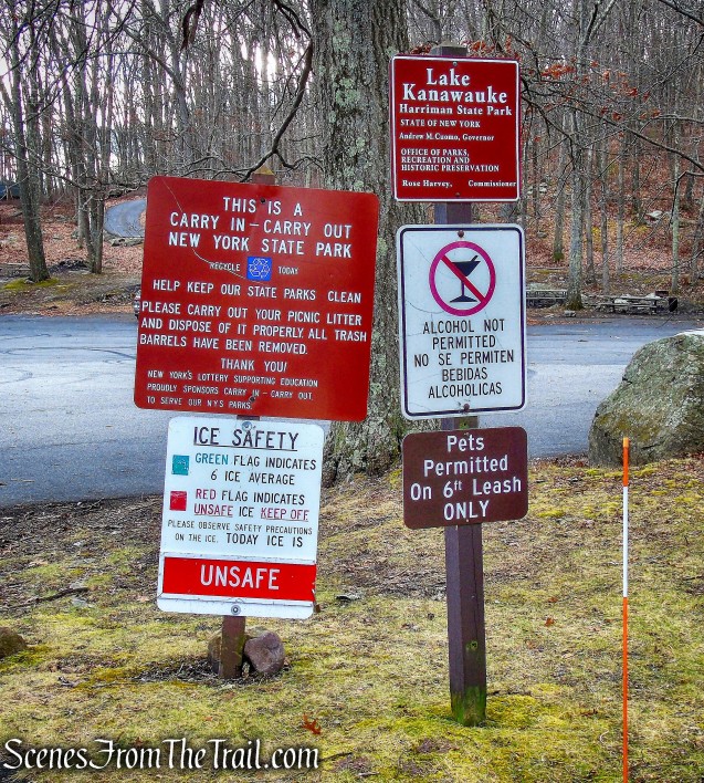
Lake Kanawauke Picnic Area
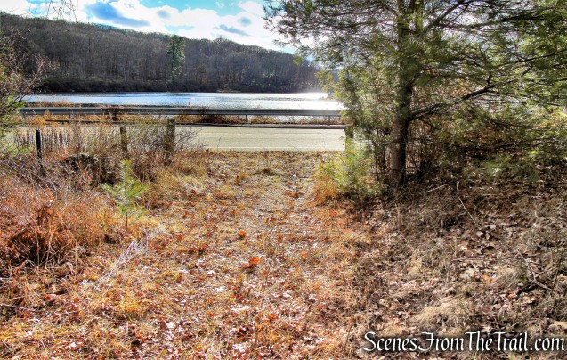
From the Lake Kanawauke Picnic Area, we turned left and began walking west along the road. It is a pleasant walk along the road when it is closed, although care should be taken as a car ignored the road closure and sped by us. The scenic Lake Kanawauke is to the right with Good Spring Mountain on the left. As the road curves to the right, it passes between Lake Kanawauke (on the right) and Little Long Pond (on the left).

Kanawauke Road/CR 106

Kanawauke Road/CR 106

Lake Kanawauke

Little Long Pond
Once past Lake Kanawauke, there is a woods road with a steel barrier to the right. This is the return route. About 420 feet farther, is another woods road with a cable across it, about 0.5 mile from the parking area. Here we left Kanawauke Road/CR 106 and began walking uphill on what once known as the “Crooked Road,” as it follows many curves around the hills in an attempt to keep the road as level as possible.
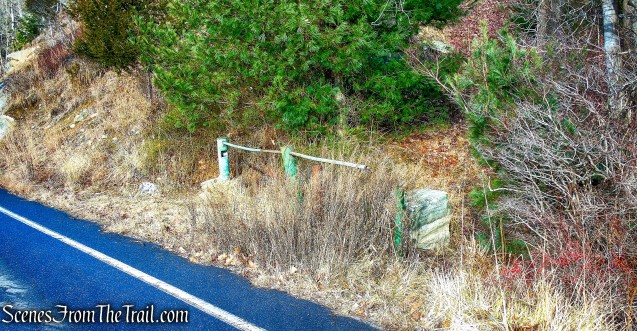
return route – woods road

Crooked Road

Crooked Road

Crooked Road
On the hillside above Little Long Pond, the Park, in 1919, built Camp Matinecock for the Boy Scouts. In the winter of 1920-21, when the new Trail Conference was building the R-D Trail, the volunteers were accommodated with bed and board at Camp Matinecock. In 1930, the Queens Council Girl Scouts took over the camp, calling it Camp Quid Nunc (Latin = What Now?). The Girl Scouts vacated the camp in 1969, and the camp was demolished in 1976.

foundation – Crooked Road
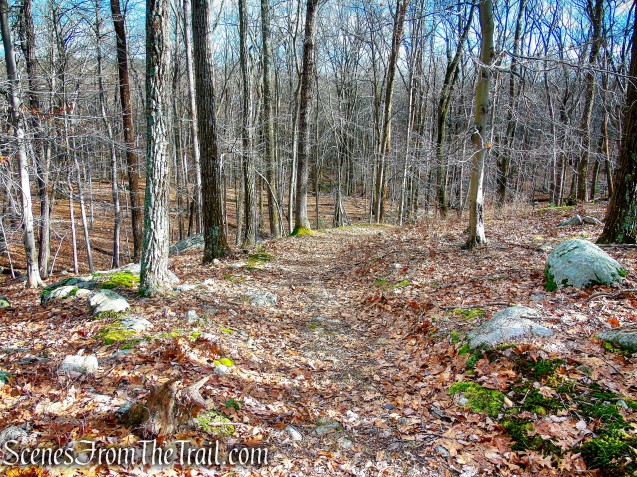
Crooked Road continues northeast past the old camp, curves to the south, then curves northeast. It climbs steadily on a moderate grade as it snakes its way up the hillside, and in just over one mile from the start of the hike, reaches the yellow-blazed Dunning Trail, where we turned left.

Crooked Road

Crooked Road

Crooked Road
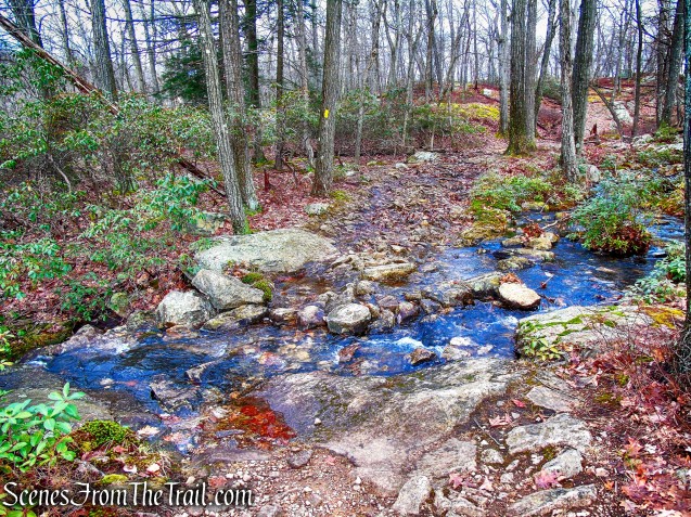
Crooked Road now follows the route of the Dunning Trail which continues climbing. To the left of the trail there is an unmarked footpath that leads to a view over Little Long Pond. After crossing a stream on rocks, the Dunning Trail goes through a large bare, rocky area, known as “Bowling Rocks” for the boulders that dot the bare rock. The trail continues through a rather open area, with views to the left over the ridge to the south.

Dunning Trail

view of Little Long Pond from Dunning Trail
Dunning Trail

Dunning Trail

Bowling Rocks – Dunning Trail

Bowling Rocks – Dunning Trail

Dunning Trail
About 0.4 mile from Bowling Rocks, after a short climb, the Dunning Trail reaches a junction with the red-dot-on-white-blazed Ramapo-Dunderberg (R-D) Trail. (This junction, which is on the crest of a ridge, is easily missed. If you find yourself beginning a long, steady descent, you’ve gone too far and should return to the highest point, where the junction is located.) Here we turned right and followed the red-dot-on-white blazes northward.

Dunning Trail
Dunning Trail

Dunning Trail

turn right on R-D Trail

Ramapo Dunderberg Trail
A short distance ahead, the R-D Trail crosses a huge open rock surface, known as the Whaleback. Just beyond, look for a plaque on a boulder to the right of the trail (I missed it both times that I hiked this area). It was placed in memory of George E. Goldthwaite, a member of the Fresh Air Club of New York, who was reputed to have hiked the entire 21-mile R-D Trail in less than five hours

Ramapo Dunderberg Trail
The trail now steeply descends a rock face to cross a stream on a log bridge.

Ramapo Dunderberg Trail

Ramapo Dunderberg Trail
The R-D Trail then climbs to a junction with the blue-L-on white-blazed Lichen Trail (which begins on the left).

Ramapo Dunderberg Trail

Ramapo Dunderberg Trail

Ramapo Dunderberg Trail
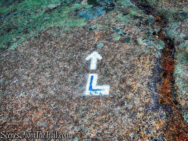
turn left on Lichen Trail
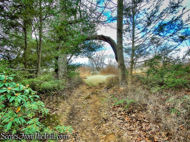
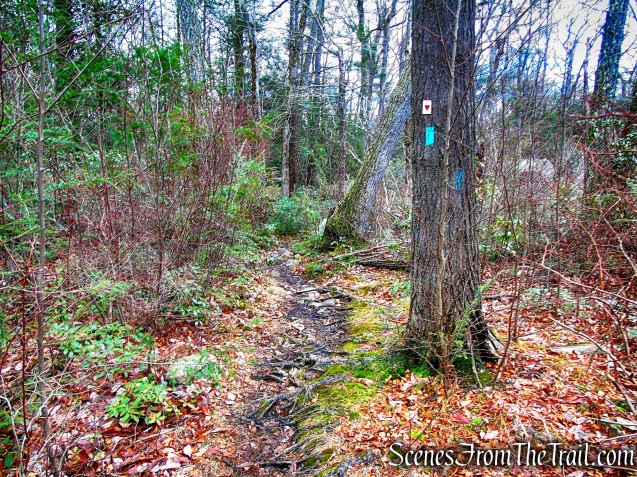
The Lichen Trail travels in a northerly direction over bare rock along the ridge of Surebridge Mountain. This is an extremely scenic section of trail and with its numerous ups and downs, makes it enjoyable as well. There are views of the surrounding hills throughout and at one point views over Island Pond to the northwest. After 0.45 mile, the Lichen Trail ends at a T-intersection with the joint Long Path/Arden-Surebridge Trail.

Lichen Trail

Lichen Trail

Lichen Trail

Lichen Trail

Lichen Trail

Lichen Trail

Lichen Trail

Lichen Trail

Lichen Trail

Lichen Trail

Lichen Trail

Lichen Trail

terminus of Lichen Trail
We turned left on the Joint Long Path/A-SB Trail, but after a short distance I remembered that the A-SB Trail is flooded out near Island Pond so we turned around. For the purpose of this hike description, we turned right on the Joint Long Path/A-SB Trail from the Lichen Trail. The trail climbs a little at first, then begins a steady descent. At the base of the descent, the joint trails reach “Times Square,” marked by a fireplace next to a huge boulder. It was so named because it is located at the junction of three trails and serves as a popular meeting place for hikers.
joint A-SB Trail/Long Path

Times Square
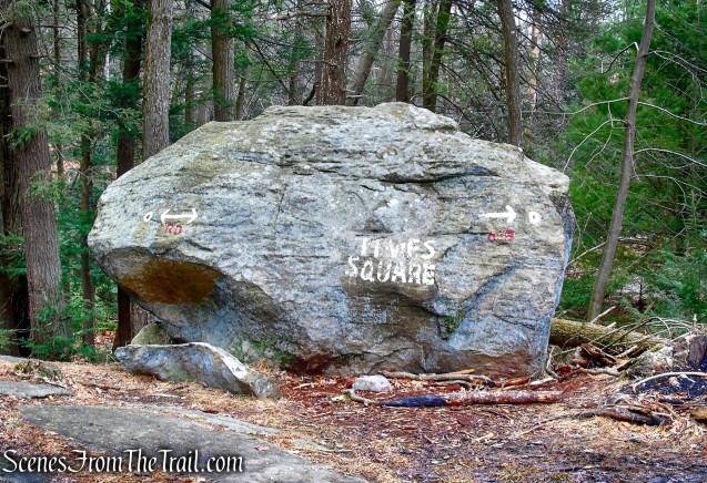
Times Square
The joint A-SB Trail/Long Path continue to the right of Times Square then split, with the A-SB Trail going left and the Long Path to the right. We veered right to remain on the Long Path.

veer right onto Long Path
veer right onto Long Path
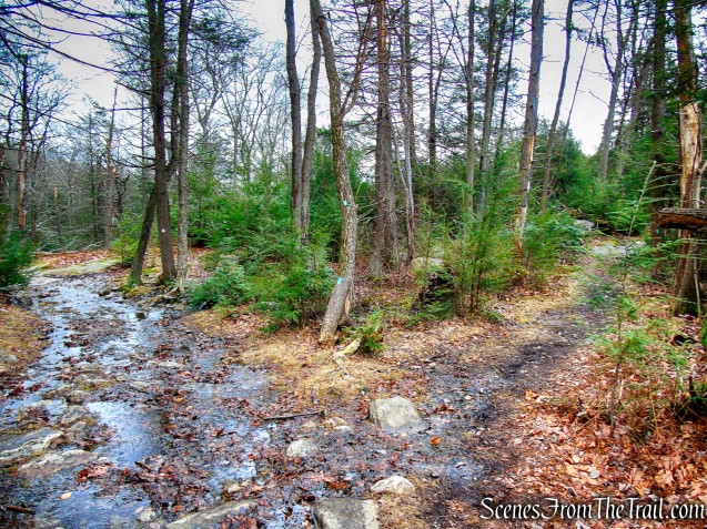
The Long Path climbs at first, then levels off as it runs along the shoulder of Hogencamp Mountain. It then begins a steady descent as it travels though a valley.

Long Path

Long Path

Long Path

Long Path
The Long Path then passes a large boulder to the left with a triangular shaped tunnel I have seen referred to as Cat’s Eye. Just past the boulder, to the left of the trail is a massive rock formation known as Cape Horn. A short distance later, the Long Path comes to a junction with the yellow-blazed Dunning Trail where we turned right.

Long Path

Cat’s Eye – Long Path

Cape Horn – Long Path
The Dunning Trail descends through laurel along a wide woods road. At the base of the descent there are stone foundations on both sides of the trail. These are remnants of the village built in the late 1800’s to house workers at the adjacent Hogencamp Mine, which was active from 1870 to 1885. According to historian James M. Ransom, there were once 20 houses, several barns, a school and a store in this location. After crossing a brook, there is a stone platform to the left. A short distance beyond there is a vertical mine shaft, about 25 feet in diameter, on the right side of the trail. A cast-iron pipe protrudes from the shaft, which is filled with water. There are many other interesting remnants of mining activity in the area. Those who wish to explore the area more extensively should consult Iron Mine Trails by Edward Lenik (now available from the Trail Conference as an e-book).

Dunning Trail

Hogencamp Mine – Dunning Trail
The Dunning Trail then reaches Crooked Road where we turned left. We began retracing our steps until we came to another unmarked woods road on the left. We followed this second woods road downhill for about 460 yards until we reached Kanawauke Road/CR 106 and turned left.

Crooked Road
woods road

woods road
woods road
We then retraced our steps along Kanawauke Road/CR 106 for about 0.5 mile, back to the parking area, where the hike began.

Kanawauke Road/CR 106
Review:
This was a great hike through a very scenic section of the park. The Lichen Trail is the highlight of this hike and worth checking out. All the points of interest and nice views, makes this a worthwhile day in Harriman State Park. This hike is better done in the winter months when Kanawauke Road/CR 106 is closed. We encountered very few people on this hike, most at or near Times Square. The R-D and Lichen Trails travel over a lot of bare rock with little or no trees. Therefore, many of the blazes are painted on the rock slabs and may be difficult to see with snow or ice on the ground.
Pros: Lesser traveled area, historical features, well marked trails, scenic views, rock formations.
Cons: Begins and ends with a road walk.

Lichen Trail Loop from Lake Kanawauke
Sources:
- New York-New Jersey Trail Conference
- Lenik, Edward J.. Iron Mine Trails (Kindle Locations 1645-1651). New York – New Jersey Trail Conference. Kindle Edition.

Great blog, great photos!
LikeLiked by 1 person
Thanks.
LikeLike
Fabulous pictures! I’m inspired to get out there a fee more time this summer!
LikeLiked by 1 person
Is there any place to hammock camp along these trails? If not, does anyone know of a hammock camping spot in the park that has a good water view? Thanks in advance!
LikeLike
Do you yourself organize hikers or do you know of any hiking groups that are coordinated by people familiar and experienced with trails in Harriman region? Ps: Great blog!
LikeLike
Sorry, I do not organize hikes.
LikeLike