June 25, 2017 – Sloatsburg, NY
Difficulty: Moderate to Strenuous
Length: Approximately 5.2 miles
Max elevation: 1,047 ft.– total elevation gain approximately 800 ft.
Route type: Circuit
Map: Harriman-Bear Mountain Trails Map 118
Trailhead parking: Johnsontown Road Trail Parking, Sloatsburg, NY 10974

Almost Perpendicular, Claudius Smith Rock and Dutch Doctor Shelter Loop
Check out the Google Earth Fly-Through video of the hike below.
Almost Perpendicular, a name given to a cliff on Dater Mountain in Harriman State Park by the Fresh Air Club in in 1936. It offers the hiker panoramic views of the Ramapo Mountains.
Claudius Smith Rock is a large rock formation that provides spectacular views from the top. The base of the rock formation has caves that were the former hideout of the gang of marauders, known as the Cowboys of the Ramapos, led by Claudius Smith. They operated during the Revolutionary War era. On January 22, 1779, Claudius Smith was hanged in Goshen, NY.
The Dutch Doctor Shelter, built in 1935 is a three-sided stone structure on the White Bar Trail used by hikers for overnight camping. It is named for John Frederick Helms, the “Old Dutch Doctor,” who lived nearby from 1874 to about 1892. He made a living by raising medicinal herbs, such as ginseng.
It was a beautiful Sunday morning in June. Low humidity and most importantly, no rain! We arrived at the parking circle on Johnsontown Road just before 9:00 am and there were quite a few cars already there. We geared up and headed down Johnsontown Road, the way we drove in, for about 100 feet, crossing a small bridge over a stream.
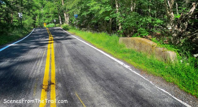
Johnsontown Road
A short distance after crossing the bridge, there are three blue-on-white blazes on a tree, which indicate the start of the Blue Disc Trail. We turned right and began walking up the hill on the paved road, crossing the route of a gas pipeline.

Start of the Blue Disc Trail
After passing a pumping station for the pipeline, the Blue Disc Trail bends left onto a footpath and begins to climb Dater Mountain. It then turns left onto a woods road.
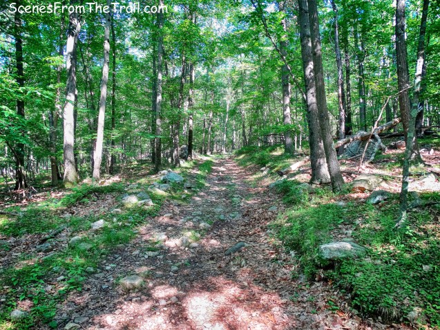
Blue Disc Trail
The white-blazed Kakiat Trail joins the Blue Disc Trail briefly, but when the two trails split, we continued to follow the blue-on-white blazes which begins a steep climb.

Blue Disc Trail
The Blue Disc Trail crosses a mostly dry stream and climbs a bit steeper over large rocks. At times we had to use our hands, but it was more enjoyable than difficult.

Blue Disc Trail
Once past the mini-scramble, we continued up the rocky slope to our destination.

Blue Disc Trail
After almost a mile from the start of the hike, we arrived at Almost Perpendicular. What a great view and we totally earned it. We took a load off and enjoyed the peacefulness of this glorious spot.

Almost Perpendicular
We found a shady spot to sit while looking out towards the Ramapo Mountains and enjoying the breeze which helped cool us off.
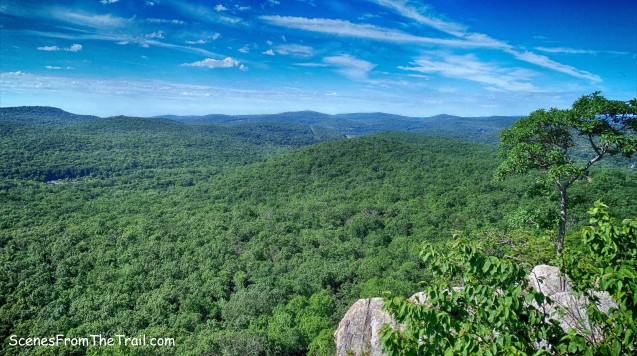
View from Almost Perpendicular
When we were well rested and hydrated, we headed for the highest point and found the Blue Disc Trail which now heads north into the woods.

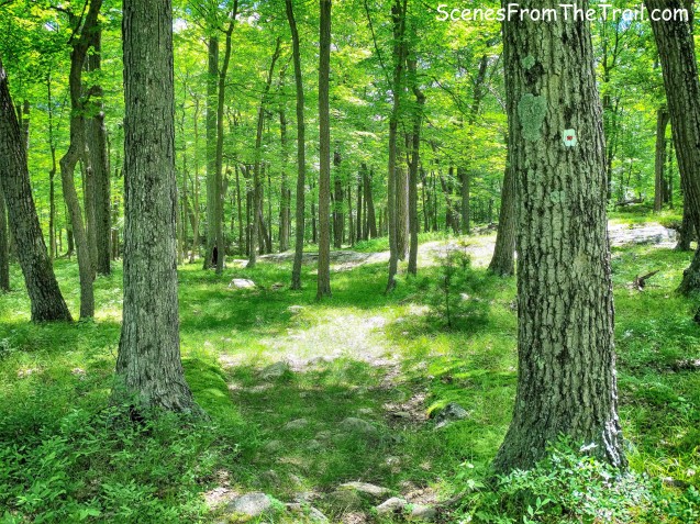
Blue Disc Trail
After entering the woods, the Blue Disc Trail begins to descend. The sun was hot by this time and the mostly shaded trail kept us from getting overheated.

Blue Disc Trail
After a modest descent, the trail now begins to climb Pound Mountain.

Blue Disc Trail approach to Pound Mountain
The trail is steep in spots, but nothing major and we just kept on trekking.
Blue Disc Trail – Pound Mountain

Blue Disc Trail – Pound Mountain
The trail then continues along the summit ridge and begins to descend again. At the base of the descent, the Blue Disc Trail begins to climb and runs alongside a rock ledge.

Blue Disc Trail
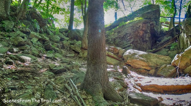
The trail gets interesting at this point. It makes you squeeze between the the rock ledge and a boulder……

Blue Disc Trail
and lets you experience the enchanting geology of Harriman State Park.

Blue Disc Trail
Then we arrived at “Elbow Brush,” a short tight squeeze through a rock crevice. This is easily bypassed if you so choose, but we passed through it.

Elbow Brush – Blue Disc Trail
I had to duck and twist in order to make it through without taking my backpack off, but it was kind of fun.

Elbow Brush – Blue Disc Trail
We took a breather and then continued the gradual climb on the Blue Disc Trail. Along the way we ran into a couple of Trail Maintainers hard at work keeping the trail free and clear for us.

Trail Maintainers – Blue Disc Trail
We then began the approach to Claudius Smith Rock. It is just past the junction with the red-dash-on-white-blazed Tuxedo-Mt. Ivy Trail.

approach to Claudius Smith Rock
At this point, we lost sight of the blue-on-white blazes, but did see the junction for the Tuxedo-Mt. Ivy Trail. The huge rock formation in front of us had to be Claudius Smith Rock.

Tuxedo-Mt. Ivy Trail junction
I happened to see a blue-on-white blaze painted high up on Claudius Smith Rock and we climbed up to check it out. The view was pretty grand, I must say.

View from Claudius Smith Rock
There were several people up there already, but we walked around capturing images of the scenic landscape. The rock itself reminds me of the Gunks with its whitish appearance. We found a shady spot and enjoyed our lunch.

Claudius Smith Rock
While sitting there relaxing, a large group of people came from the opposite direction so we decided to find a less populated spot. When we were ready to resume our hike, we walked back down the Blue Disc Trail and turned right on the Tuxedo-Mt. Ivy Trail and made our way to the base of Claudius Smith Rock. There is the location of his hideout. On the way we could see the upper chamber where they slept, it’s about 8-10 feet high, 30 feet long, and 10 feet deep.

Claudius Smith Den – upper chamber
I had seen images online, but seeing this massive rock formation up close is mind blowing.

Claudius Smith’s Den
Claudius Smith’s Den was formed as slabs weathered out of the cliff. Blocks of rock were pried out of the cliff by thaw-freeze and could possibly date back approximately 12,000 years. The image below show the lower chamber that was used for their horse stable. On January 22, 1779, Claudius Smith was hanged in Goshen, NY.

Claudius Smith’s Den – lower chamber
We then retraced our steps back to junction of the Blue Disc and Tuxedo-Mt. Ivy Trails and began heading east on the TMI Trail. It was an easy walk and extremely peaceful on the TMI Trail. We did not encounter any other hikers and the only sound was the chirping of birds.

Tuxedo-Mt. Ivy Trail
The Tuxedo-Mt. Ivy Trail was a favorite project of Major William A. Welch, the Park’s first General Manager. It was he who persuaded the Tuxedo Park Association to let the Trail Conference blaze the trail in the spring of 1923.
Myles, William J.. Harriman Trails: A Guide and History (Kindle Locations 2872-2874). New York – New Jersey Trail Conference. Kindle Edition.
Tuxedo-Mt. Ivy Trail
The TMI Trail crosses Spring Brook and reaches a junction with the White Bar Trail. At the junction is a cellar hole, all that remains from the homestead of John Frederick Helms, the “Old Dutch Doctor,” who lived here from 1874 to about 1892.

cellar hole
We turned left on the White Bar Trail and just a few feet up on the right side of the trail is the Dutch Doctor Shelter.

Dutch Doctor Shelter
We rested here briefly while listening to a couple arguing on the phone while they were standing about 30 feet from each other. So much for peace and quiet on the trail. It made for a humorous moment. We then began heading south on the White Bar Trail. The White Bar Trail was first marked in 1921-22 by the Boy Scouts from the 17 camps on Kanawauke Lakes, using mostly old roads. In January 1995, the White Bar Trail was extended south for 1.55 miles from the Dutch Doctor Shelter to the Johnsontown Circle. This extension facilitated access to the park trails from the end of Johnsontown Road, where parking is available. It was a nice easy walk the rest of the way.

White Bar Trail
We took care to follow the horizontal white blazes because the White Bar Trail briefly joins several woods roads. The White Bar Trail nears Seven Lakes Drive, bears right and joins the abandoned section of Johnsontown Road. Johnsontown Road once was a main Park drive. On November 10, 1962, after the new Seven Lakes Drive had been opened, the road was closed beyond the circle.

abandoned section of Johnsontown Road
We then arrived back at the circle, where our hike began. A very enjoyable hike that had a lot to see and the trails kept us on our toes. I saw my first Harriman Black Bear after our hike. While driving down Seven Lakes Drive, the bear ran across the road and into the woods. We stopped on the road where it went into the woods, but it was gone. Not a bad hike to do in hot weather, thanks to the canopy of trees that shade the trails. I hope that you enjoyed the hike and please don’t forget to follow my blog. Now get out there and take a hike!
Pros: Great views, massive rock formations, Almost Perpendicular, Claudius Smith Rock, Dutch Doctor Shelter, Elbow Brush, shaded trails, woods roads.
Cons: Claudius Smith Rock attracts crowds.

Take a hike!

You are exactly right about everything! Did an overnight there. GREAT!
LikeLiked by 1 person
Thanks, glad that I could help.
LikeLike