April 9, 2017 – Congers, NY
Difficulty: moderate
Length: approximately 6 miles
Max elevation: 556 ft. – total elevation gain: 1413 ft.
Route type: circuit
Map: Hudson Palisades Trails Map
Trailhead parking: Landing Rd, Clarkstown, NY
To early Dutch settlers, Hook Mountain was known as “Verdrietlg Hock,” which means “Tedious Point.” Hook Mountain State Park is a 676-acre undeveloped park, part of the Palisades Interstate Park system, just north of Nyack. It extends along almost seven miles of continuous waterfront and cliff slopes. The Long Path runs along the escarpment above while a bike path follows the river’s edge from Haverstraw Beach State Park to Nyack Beach State Park in Upper Nyack.
Throughout the years, I have visited Hook Mountain many times. I have never explored the northern section so I decided it was time to check it out. The Long Path segment of this hike has quite a few ups and downs, with some of the ups being pretty steep. It is also less traveled than the southern section of Hook Mountain, on the other side of Landing Road. Below is a Google Earth image of the hike route with Rockland Lake just to the left of the red x.
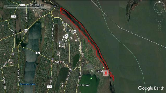
Hike route
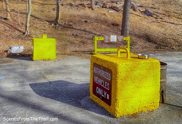
We arrived at the parking area shortly before 9am on a gorgeous Sunday morning. Temps reached the mid 60’s and practically no wind. A perfect day for a hike. We began by crossing the road and heading north past the barricades and up the hill on the Long Path.
trailhead
Just up the hill on the right is the Wells Family Burial Ground. There are 21 graves here with the earliest date being 1831 and the latest 1874. Benedict Wells was the former owner of a large portion of Rockland Lake. He donated land for the hamlet’s church and school. His brother, Thomas Wells, owned property on the north side of the lake.

Wells Family Burial Ground
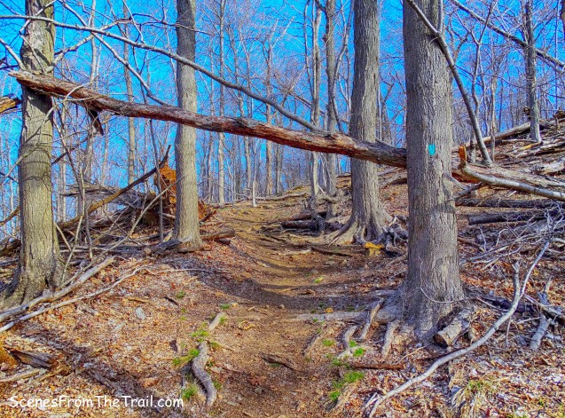
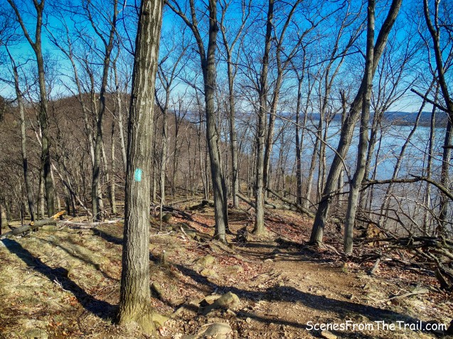
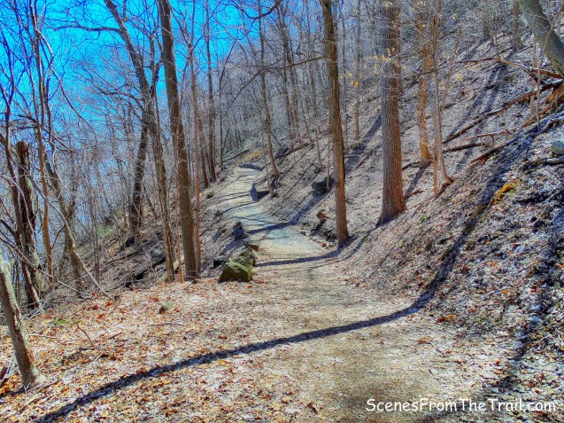
The first half of this hike, we would be following the Aqua blazes of the Long Path which would take us along the ridge. Just past the cemetery, the trail begins to climb.
the Long Path
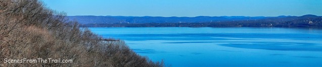
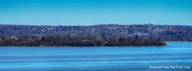
As the trail levels off there is an unobstructed viewpoint over the Hudson River to the right of the trail.

the Long Path
From this viewpoint, Croton Point Park is visible across the Hudson River.

view from Long Path
Looking northeast, the East Hudson Highlands and beyond is discernible in the distance.
view from Long Path
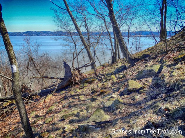
As I stated previously, the Long Path portion of this hike has numerous ups and downs. I have hiked the Long Path atop most of the Palisades and this appears to involve the most climbing along the ridge. At times the trail runs along the edge of the cliff with partial views through the leafless trees.
the Long Path

partial view
It was very peaceful throughout this hike. No road noise, no dogs barking and barely any other people around. In fact we only encountered a few hikers along the first half of the hike. Wildlife was plentiful, but with the exception of a pair of curious deer, they were too quick for my lens.

curious deer
We saw a couple of Bald Eagles, a hawk and plenty of Turkey Vultures soaring just above the treeline. Plenty of smaller birds serenaded us as we trudged along the cliffs. I also spotted a Wild Turkey when I ventured off the trail. Chipmunks and Squirrels were abundant throughout the hike as well. After all the numerous elevation changes on the Long Path, we came to a junction with the start of the White-blazed Treason Trail.

White-blazed Treason Trail
According to Daniel Chazin of the NY/NJ Trail Conference, The “treason” after which the trail is named was the famous treasonous act of Benedict Arnold during the Revolutionary War, when he handed over the plans to West Point to the British Major, John Andre. Supposedly, Benedict met Andre at a large rock along the Hudson River a the base of Hook Mountain known today as “Treason Rock.” The Treason Trail, which leads down to this rock, was named after this event. Since the top of the cliffs are in such close proximity to the river, this trail is quite steep as it descends on switchbacks.
White-blazed Treason Trail
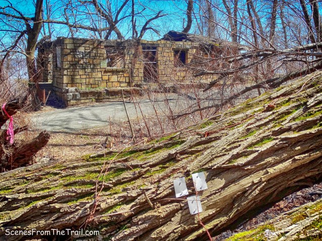
The White-blazed Treason Trail ends at the Hook Mountain Bike Path, which is paved at this point. An abandoned stone park building is across from the intersection.
White-blazed Treason Trail ends
We then took a few minutes to check out the stone building which had seen better days.

abandoned stone park building

abandoned stone park building

abandoned stone park building
We then began heading south with the river on our left and the cliffs to our right.

Hook Mountain Bike Path
Hook Mountain Bike Path
The bike path is easy walking and usually quite busy with walkers, runners and bikers, but not on this day. Although we saw people doing all those things I just mentioned, they were few and far between.

Hook Mountain Bike Path
Just off the trail to the right stands a stone building, built into the hill with a concrete roof. My only guess is that it could have been used to store explosives when the quarries were operational.

stone building with a concrete roof
For the most part it was a nice quiet walk along the shore of the Hudson River. The scenery wasn’t bad either.

Hook Mountain Bike Path
We came to a clearing with a view towards the river and we stopped briefly. Visible directly across is Croton Point Park with the Village of Croton on Hudson just beyond.

view from Hook Mountain Bike Path
view from Hook Mountain Bike Path
As we continued walking on the bike path, we came to the ruins of a small shack that was sitting on the embankment.

ruins of a small shack
We came across several spots that afforded us enjoyable views of the Hudson River.

view of the Hudson River
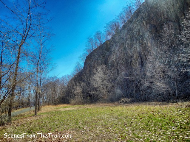
There are a few ups and downs along this bike path, but nothing like earlier in the hike. At times the path is as high as 80 feet above the river with a steep drop off.
Hook Mountain Bike Path
Another stone building stands right alongside the bike path.

stone building
I don’t know the origin of this building, but if I had to guess, I would say that this may have had something to do with the park. It has similar characteristics as some of the other park buildings.

stone building
Looking up we could see where we were hiking earlier in the day.

Hook Mountain
Then we passed another stone shack.

stone shack
This hike was chock full of ruins. I was pleasantly surprised at all the ruined buildings we saw. Most are either right alongside the path or within feet of it. As we continued on the bike path, you guessed it, another ruined building right beside the path.

ruined building
This building could have been a restroom due to the multiple sinks that are laying around.

ruined building
Although the history of these buildings may have faded with time, I am glad that they haven’t been demolished.

ruined building
Across from the building is another pleasant view of Westchester County. We stopped here and enjoyed it.

pleasant view
We continued walking on the bike path until we came to a junction with another park road. Here we made a sharp right and began walking up the hill.

junction
Just past a stone building, now used as a private residence, are two more old buildings. The first one resembles a stockade, although I have no idea what its purpose was.

stockade?
A little further into the woods, a bigger stone structure is visible from the park road.

bigger stone structure
After checking out these two interesting buildings, we resumed walking up the park road, back to the parking area where our hike began. It was about 2:30pm and every available parking spot was taken with cars parked along both sides of the road.

park road
This hike although exhausting, had many points of interest and was quite enjoyable. I hope that you enjoyed the hike and please don’t forget to follow my blog. Until next time, now get out there and take a hike!
Pros: Mostly secluded, cliffs, wildlife, views, ruins galore, scenic trails, Hudson River.
Cons: numerous steep ups and downs.

Take a hike!

Thank you for a very new hike!!! Seeing as I’m an avid seeker of any type of ruin – this one looks perfect!!! Love the river aspect too!
Super – cannot wait to do this one
Take care – looking forward to your next post
LikeLike
Thank you for the kind words. If you like ruins, this is a great hike to do. Better get out there before the vegetation obscures them from view. Enjoy.
LikeLike
Thanks so much for sharing. This was such a fun hike when I went there a couple of months ago.
LikeLike
You’re welcome, there is lots to see along the trail.
LikeLike
Thank you so much for your information! You make us want to get out and explore!
LikeLike
Thanks for reading, glad you are inspired.
LikeLike
I enjoy the hike and pictures. I rember hiking those trails back in the 70s, those stone buildings were in better shape back then , some had fireplaces in them.
LikeLike
My understanding is that at least some of those old ruins, buildings, were part of the ice industry that operated at Rockland Lake until the early 1900s. The Knickerbocker Ice Company built an incline railway to bring the cut ice down to the river(alongside what is now (Slaughter) Landing road) to load on barges for travel to NYC and beyond. The area also had a resort and people living along the river as well as summer homes for NYCs wealthy.
LikeLike